Tag Archives: mountains

Big Bend National Park Outer Mountain Loop Ultra, 5/17/25

Chisos Mountains in Big Bend National Park.

WAY down on the US/Mexico border, Big Bend is probably one of the most remote National Parks in the Lower 48; 5h from El Paso, 6h from Lubbock and 6.5h from San Antonio with a whole lot of nothing in between (stock up on food and gas before heading down). Big Bend gets it name from the large bend in the Rio Grande River that forms the Southern border of the park, but the River is only a very small portion of the diverse ecosystems that make up Big Bend National Park. The lush green banks of the Rio Grande, to the vast Chihuahuan desert, to the high summits of the Chisos Mountains.

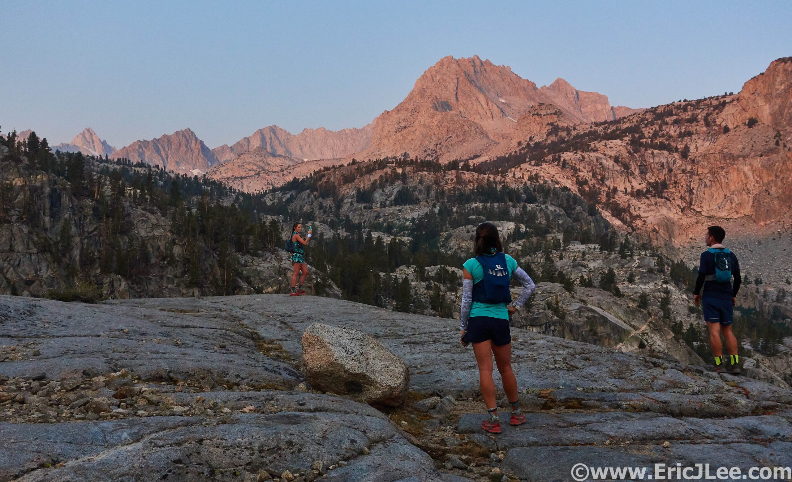
Timing wasn’t perfect, but with a free weekend in mid-May, I was able to convince Maddie to join me for the long road trip down to Southern Texas. It’s a LONG way from Boulder to Southern Texas, with a whole lot of nothing after leaving Northern New Mexico, other than oil fields and the extraterrestrial vibes of Roswell. Our intended goal was a popular backpacking loop known as the Outer Mountain Loop that spanned the low Chihuahuan Desert to the top of the highest point in the Chisos Mountains, Emory Peak. We were able to secure a campsite along Grapevine Rd, and after setting up camp, headed up into the Chisos Mountains to poke around a bit and drop some water for the following day’s run. After dropping almost 2gallons of water we headed back to camp to eat and get some rest before our early morning start.

Early morning glow along the Dodson trail in the lower Chihuahuan desert.

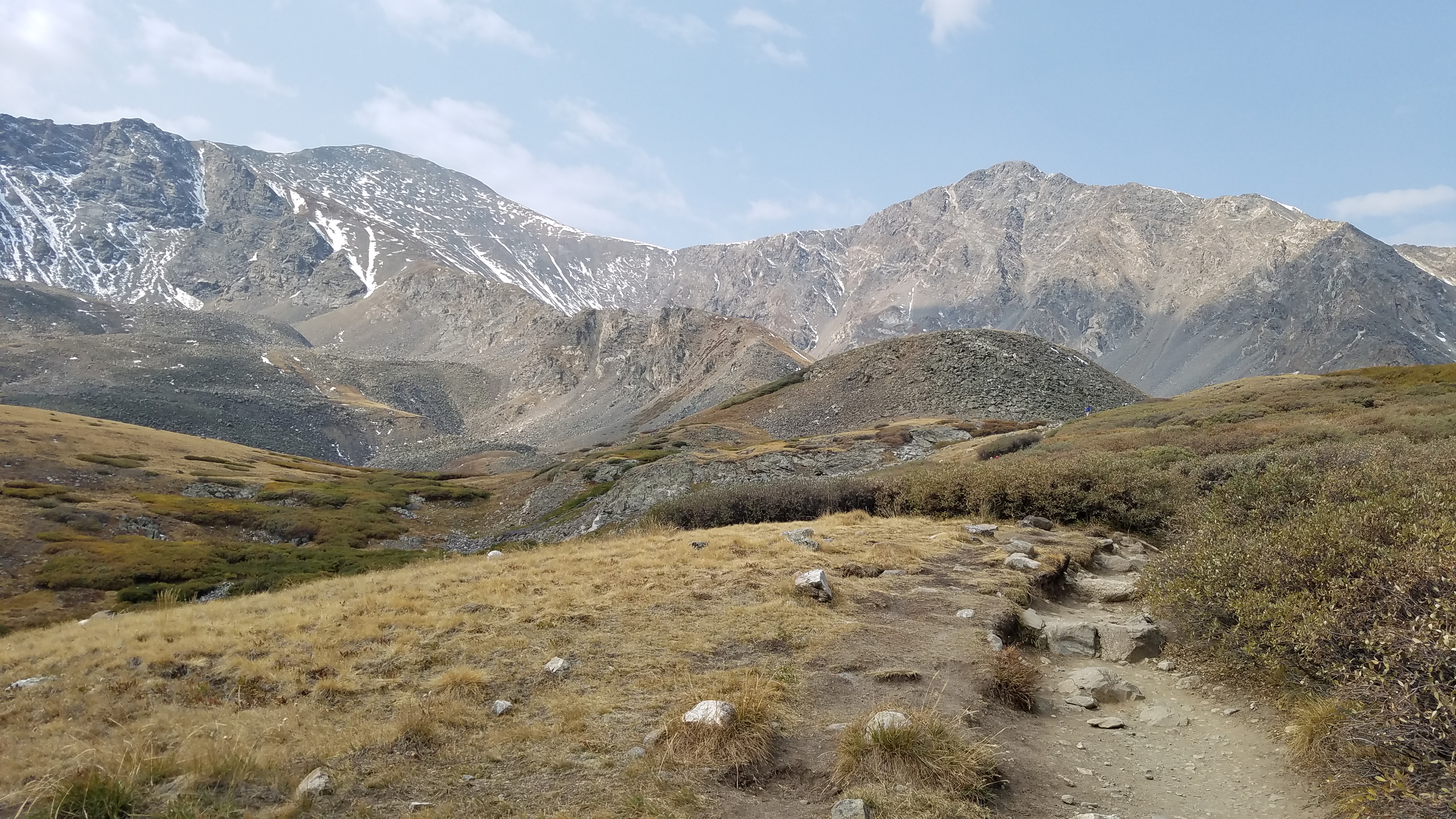
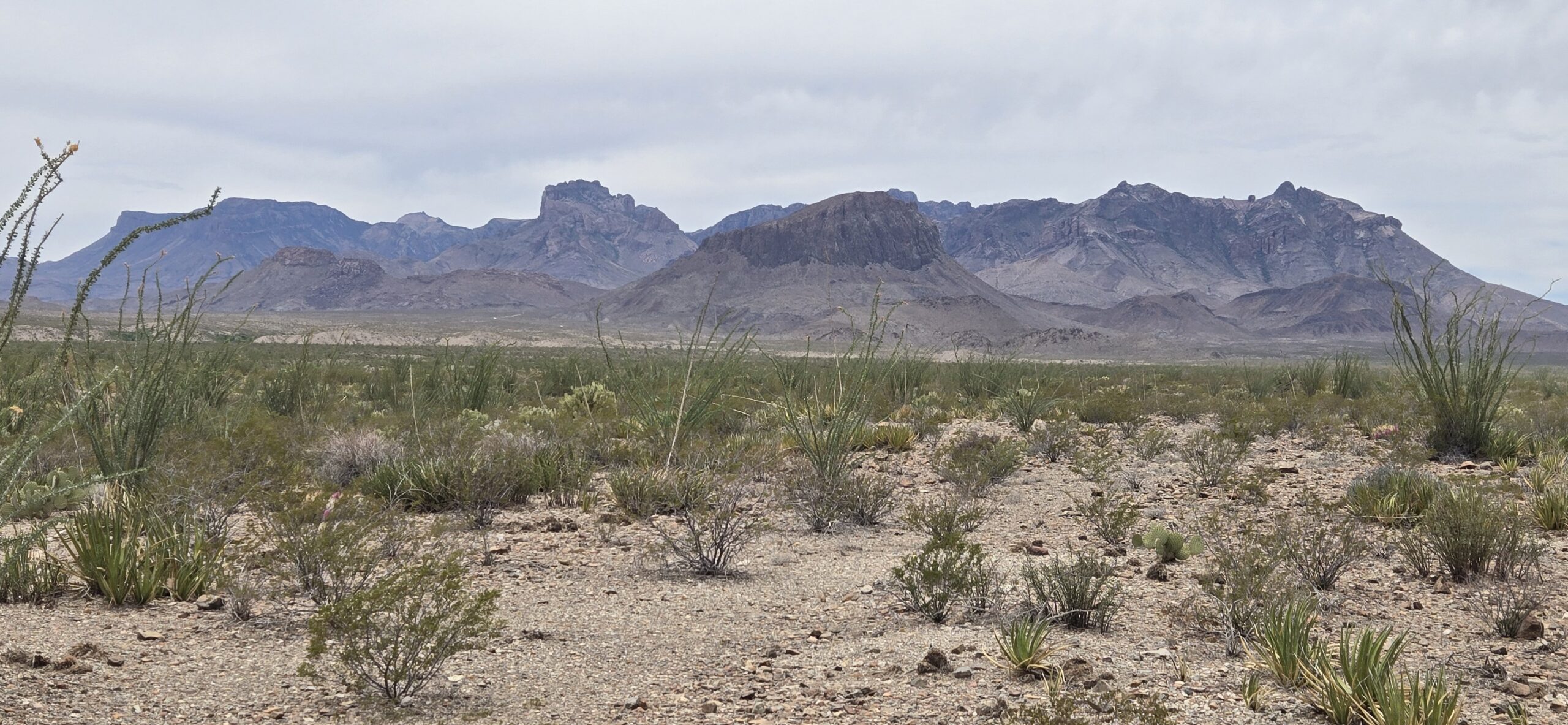
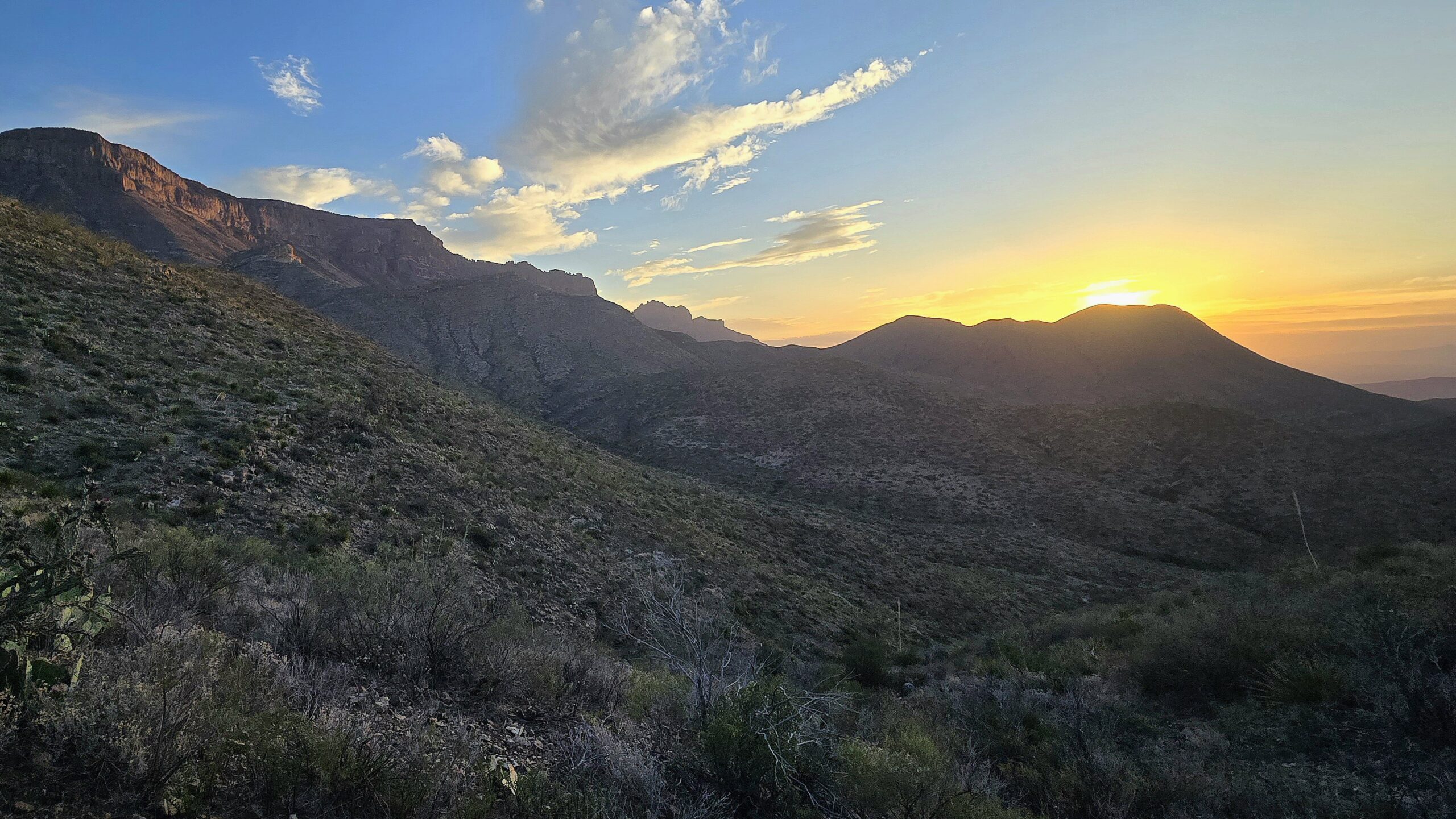
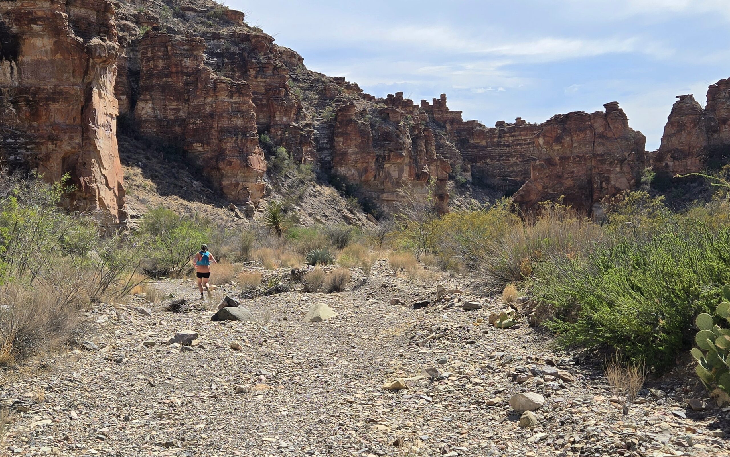
Our alarms went off at 430a and we rolled down to the Blue Creek Trailhead, the lower trailhead for the Outer Mountain Loop, with the goal of getting through the low elevation portion of the route before the 90F heat set in. We headed out just after 5am by headlamp into the cool pre-sunrise desert. The trail started out fairly smooth and easy to follow as we climbed and descended through the lower foothills of the Chisos Mountains. As we neared the top of our first major climb the trail dropped into a wash and started to become overgrown and scratchy, Maddie was NOT a fan of the catclaw and agave. As the sun began to warm the morning sky, we were treated to exquisite views of the towering Chisos mountains to our North and the expansive Chihuahuan Desert in every other direction. The trails were dotted with succulents, cacti, blooming prickly pear and claret cup and razor-sharp ocotillo.

Sunrise over the Chihuahuan desert.

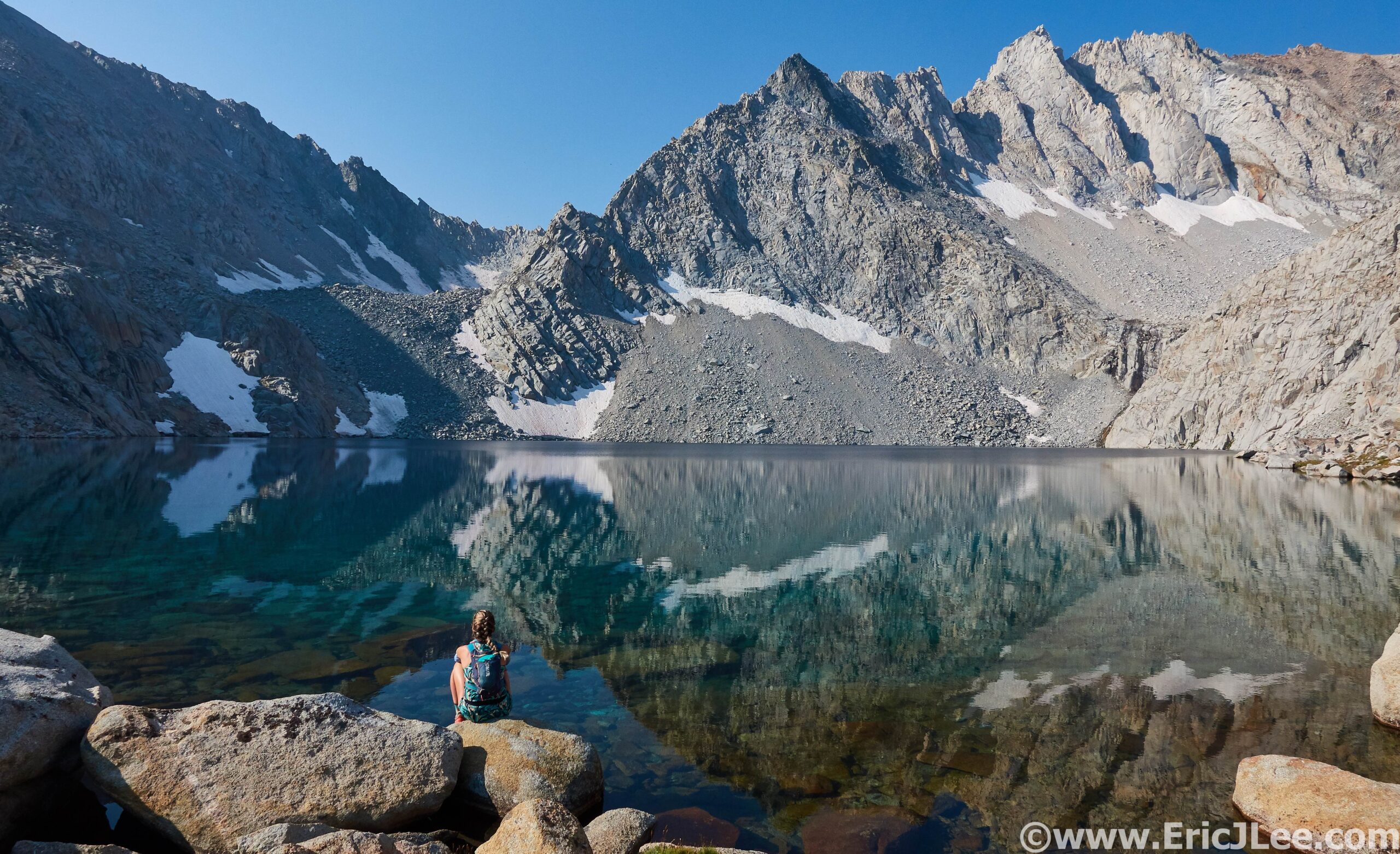
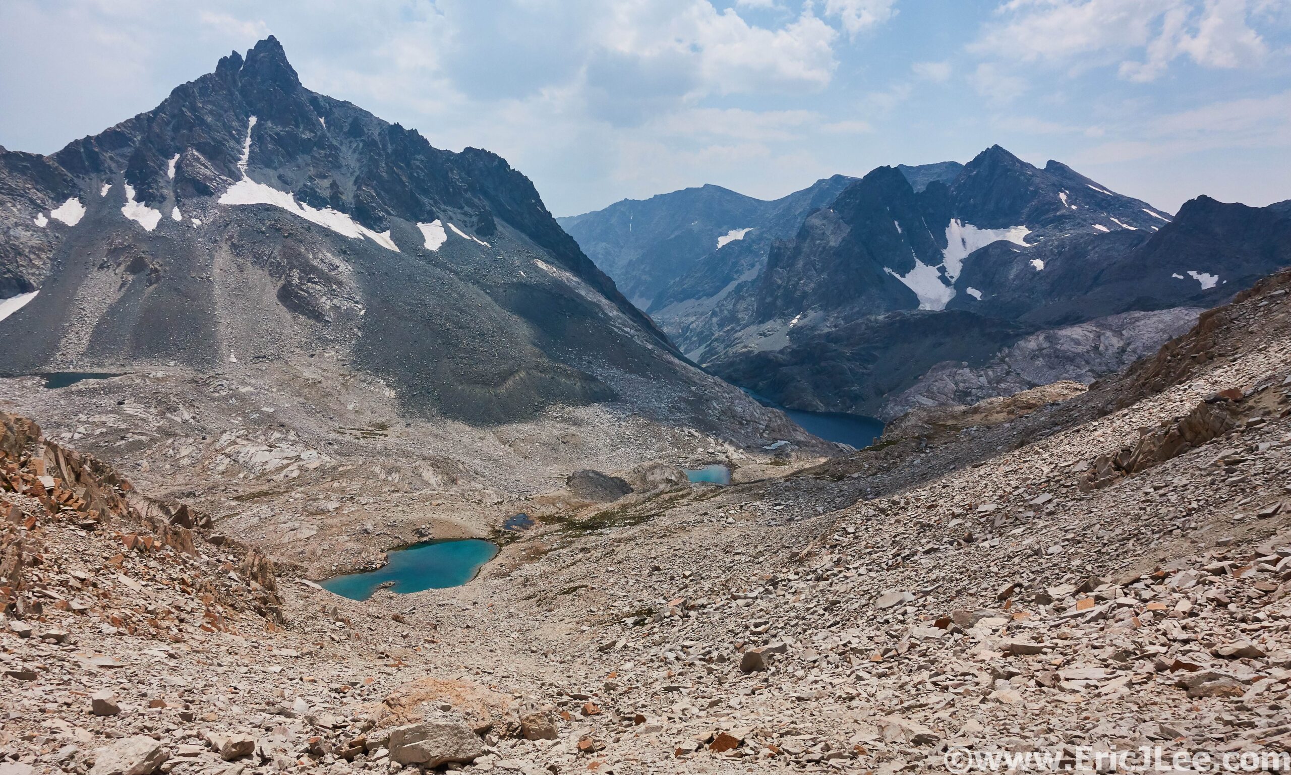
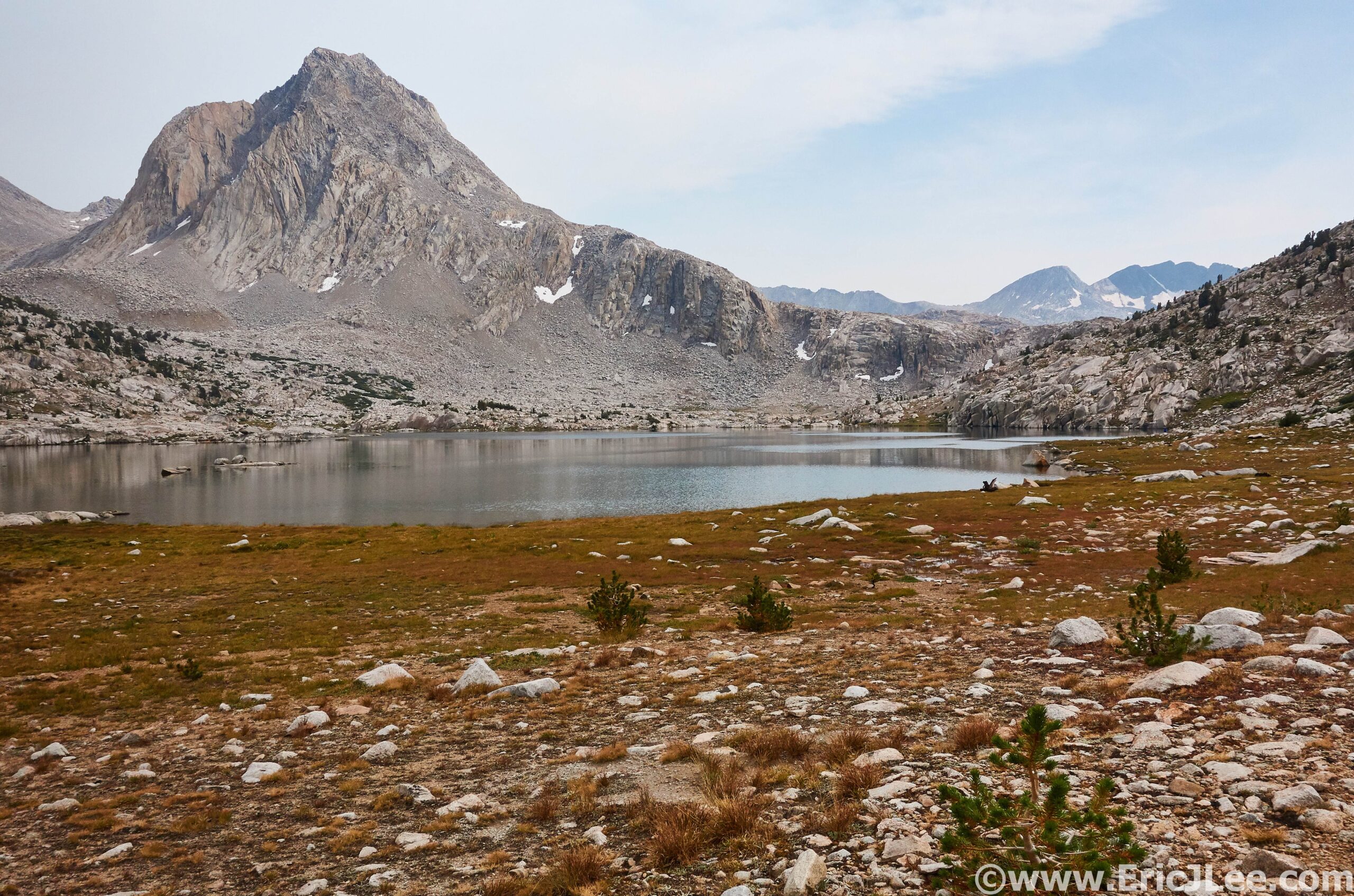
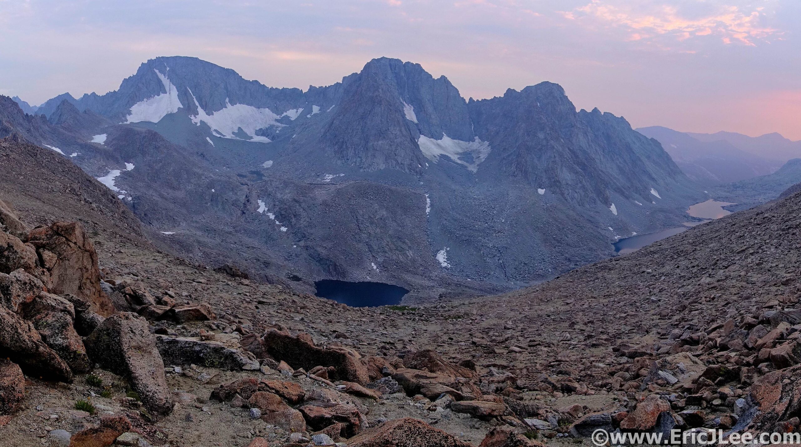
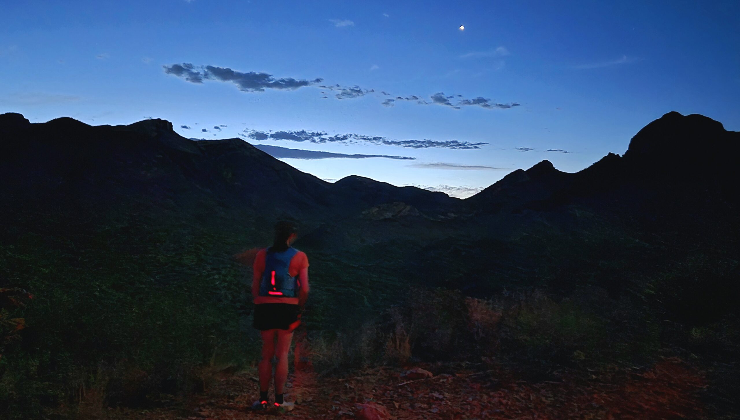
We made quick work of our pre-sunrise section, reaching the junction with the Juniper Canyon Trail (mm11.6) in the early morning hours, beating the heat of the day. From here we started our 4000ft climb to the top of the Chisos Mountains, Emory Peak. As the day warmed I felt pretty decent, but Maddie was feeling the heat, and her stomach started to turn (it might have been the maple syrup drink). We trudged our way upwards into the mountains, longing for a little shade and a cool breeze. Around 5000ft we finally turned our way into the woodland forests of the Chisos Mountains and a little shady reprieve from the cloud filtered sun. After what felt like endless switchbacks we finally hit the saddle to Emory Peak, the high point of the day.

Headed up the Juniper Canyon trail to the Chisos Mountains.
Looking down from the summit of Emory Peak into the Chisos Mountains.

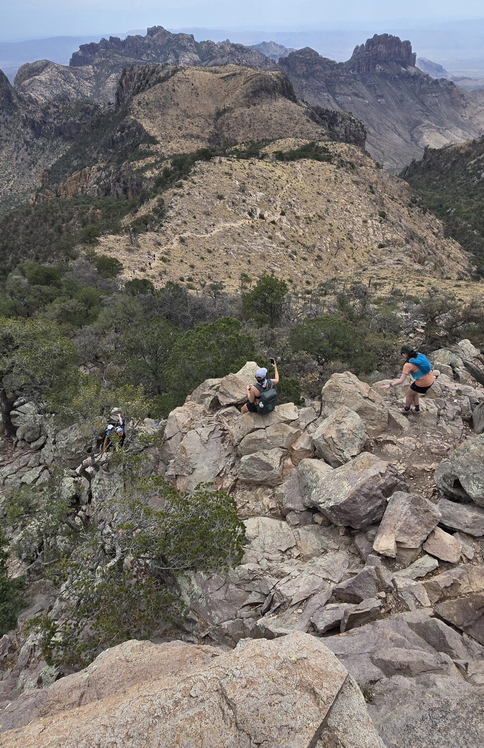
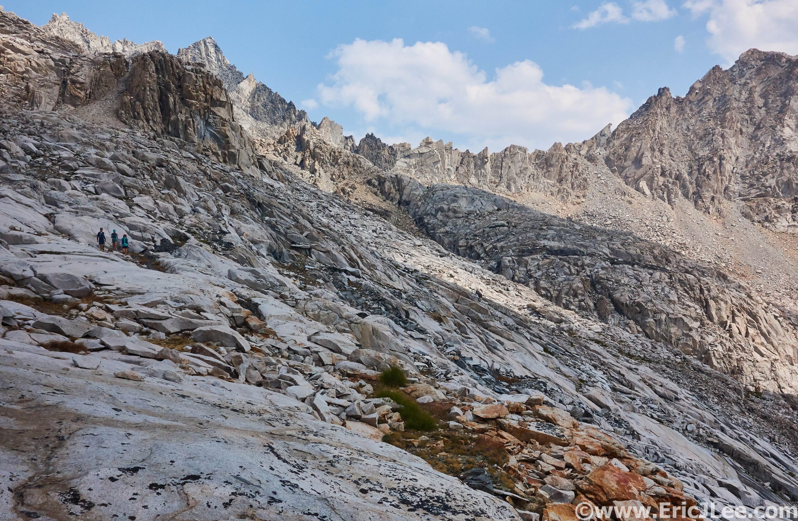
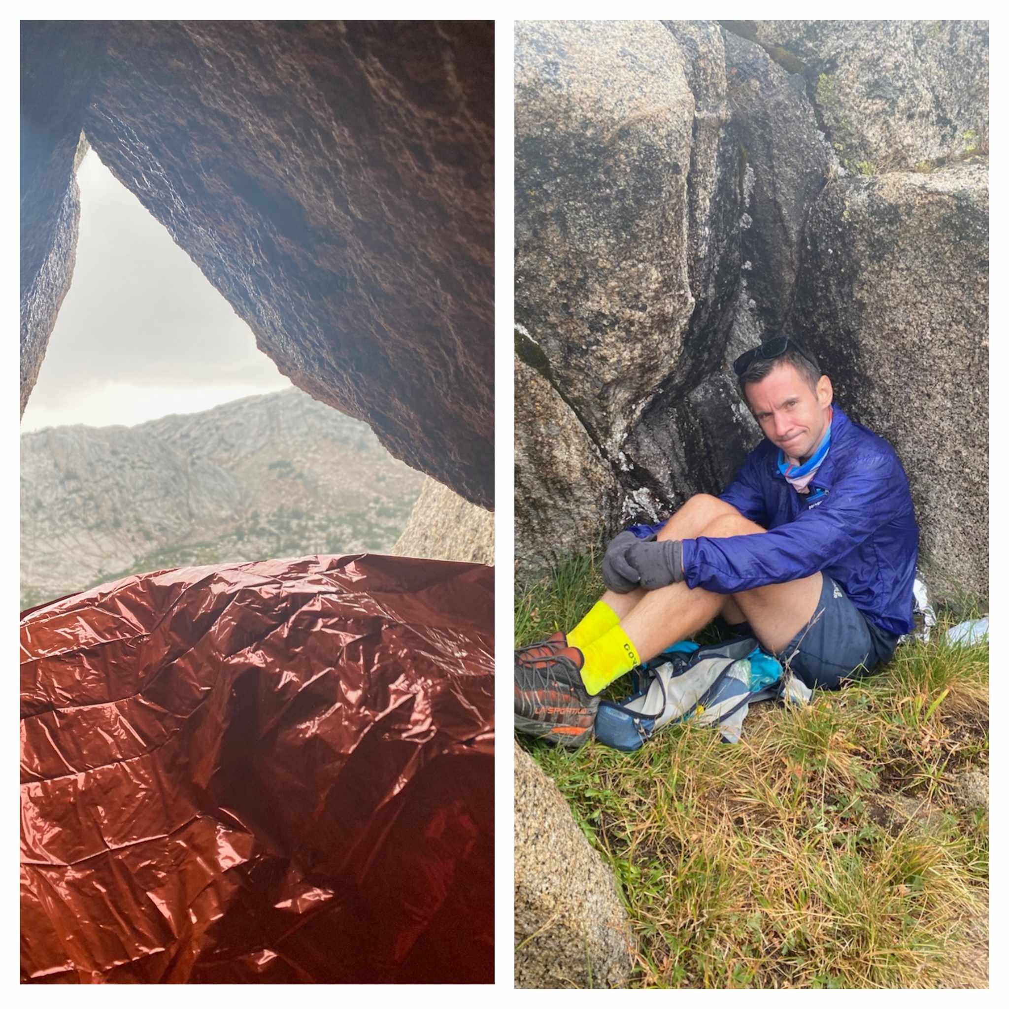
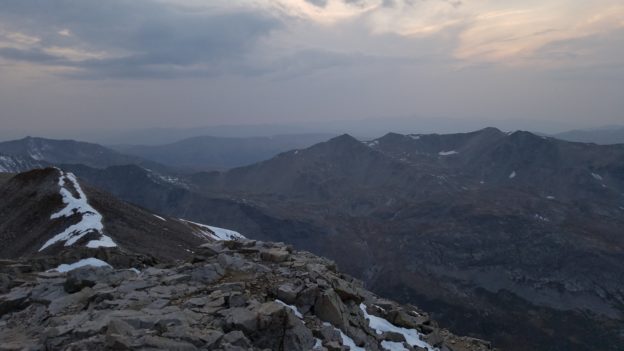
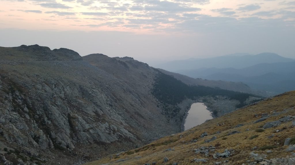
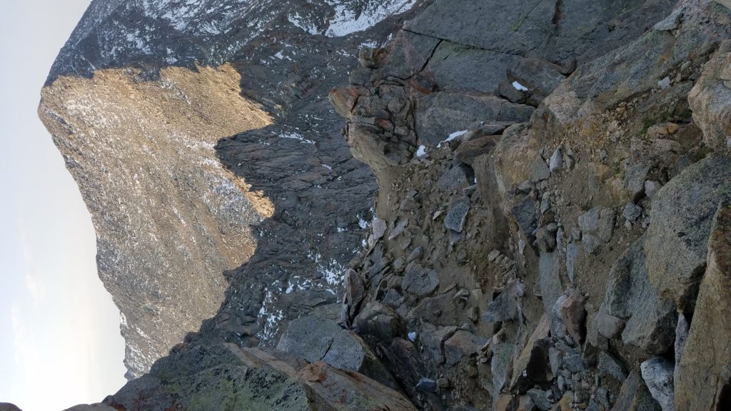
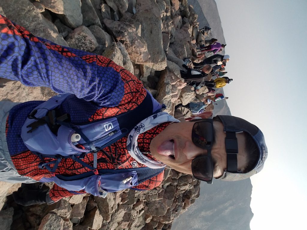
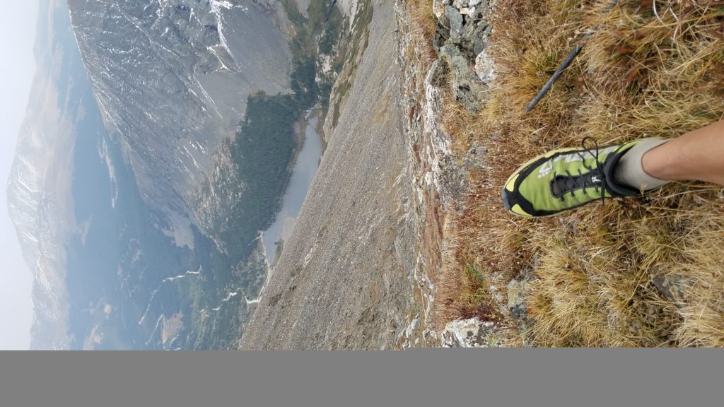
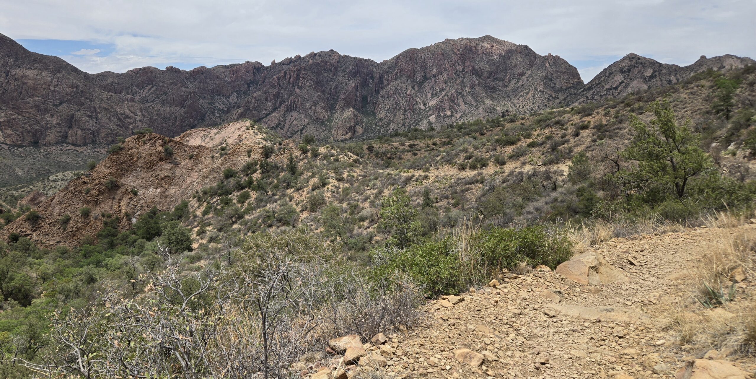
The final class 3 scramble to the summit was a pleasant change of pace, leading to expansive views and a great spot for a snack (mm21.1). This was the first time all day we’d encountered large groups of people. The clouds were burning off and the midday heat was starting to set in as we jogged downhill into Chisos Basin. After refilling our bottles and chugging a bunch of water from our water cache in Chisos Basin, we set off back up the trail to the Laguna Meadow saddle (mm25). This was my roughest section, as the hot sun baked our core and shade came at a premium. When we finally reached the Laguna Meadow saddle and jct with South Rim trail I sat down to have a little pity party (mm28.9).

Ascending our way out of Chisos Basin.
Pity Party time at the Laguna Meadow saddle.

I told Maddie to continue on without me, and that I’d slowly trudge my way in, but she wasn’t having any of it. “We started this together, we’re going to finish this together”. In an attempt to revive myself, I popped two salt tablets, chugged some water, and we started the LONG 2600ft downhill back to the Blue Creek trailhead. We both found a little more bounce heading downhill in the 90F+ heat, both bent on getting back to the car for cold beverages and to escape the heat. The canyon slowly mellowed out and the rocky switchbacks gave way to gravelly wash. We spent the last few miles slowly cruising through the wash, chatting about the highs and lows of the day and commiserating about how ready both of us were to get out of the sun. Finally, the Homer Wilson Ranch came back into site and we knew the car was CLOSE! One last little hill and we plopped ourselves down in the shade of the car, cracked open a cold soda and relished the day’s accomplishments.

Lower Blue Creek Canyon, almost back to our car.

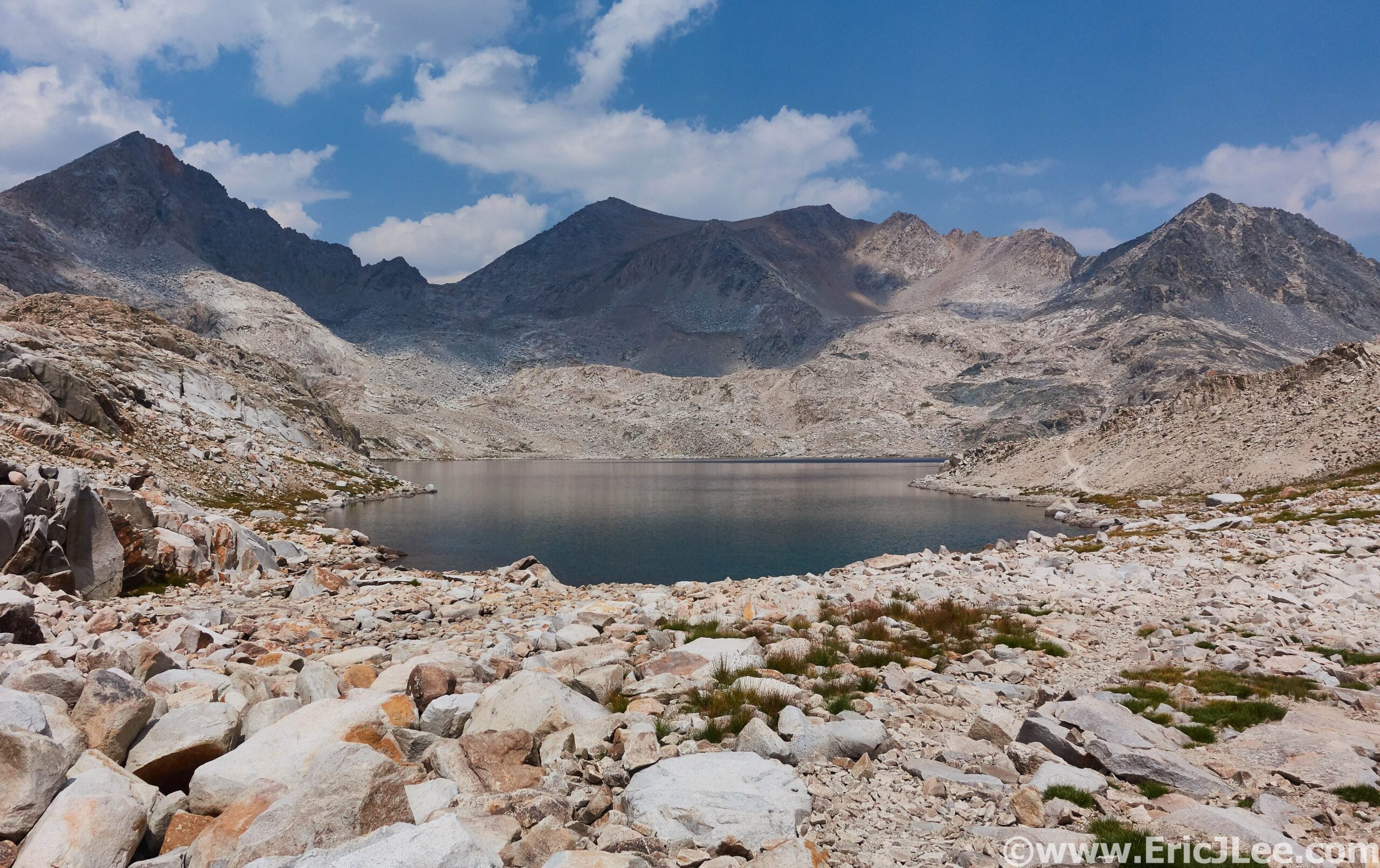
In total we’d completed the 34.6mi/8000ft Outer Mountain Loop (+Emory Peak) in just over 12hours car to car in temperatures ranging from 70F to 97F! Our journey covered the high desert, deep canyons, woodland forests and summit of the highest peaks. For most of the year there are no natural water sources along the route, so planning water resupplies is key. The three access points are Chisos Basin (will be closed for construction through 2026), Blue Creek TH near Homer Wilson Ranch, and Juniper Canyon 4×4 Rd TH. On the day we each carried about 1.5-2gal of water, but could have used even more. Outside of Emory Peak and Chisos Basin we mostly had the trail to ourselves, so got to truly experience the solitude the desert can offer. Big Bend National Park is a wonderfully diverse array of ecosystems, tucked a long way from anything along the US/Mexico border. For anyone looking to visit I’d highly recommend late November through March, unless you really like it HOT.

Big Bend National Park Hot Springs along the Rio Grande River.

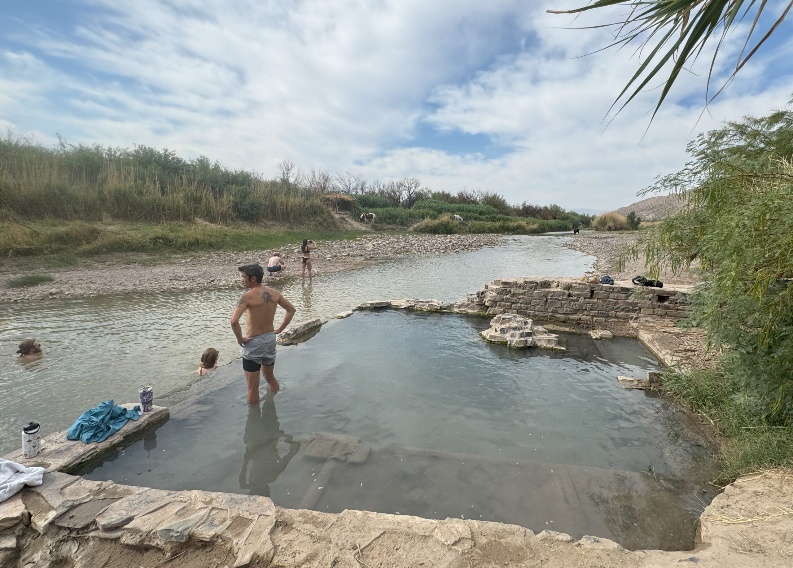
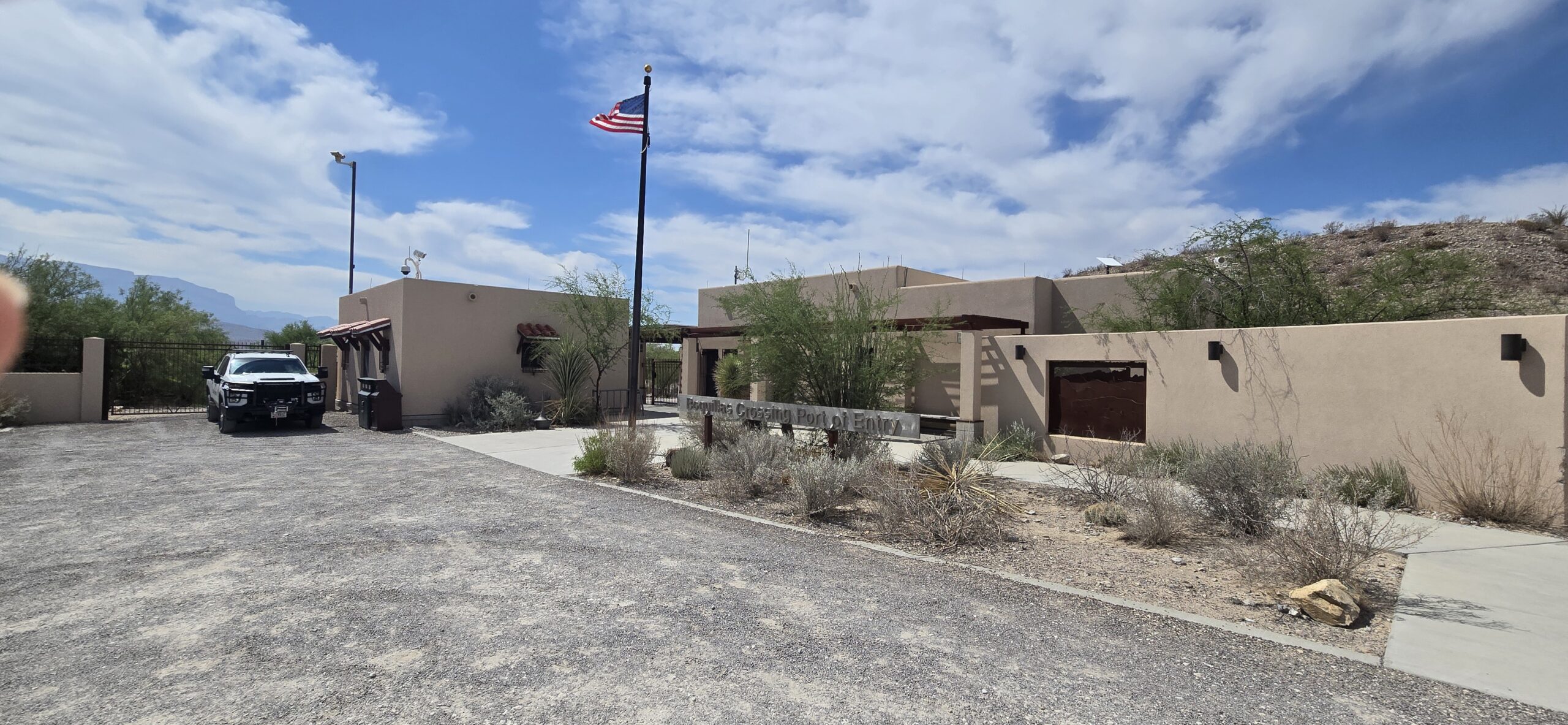
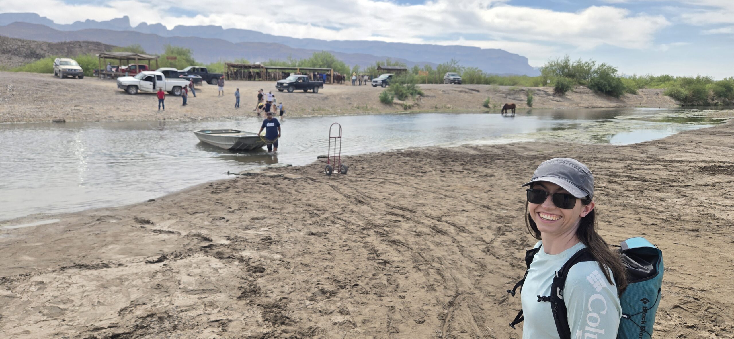
The following day we took a little road trip to the far SE side of the park, first for a soak in the Rio Grande Hot Springs. The old bathhouses were built in the early 1900s right along the border and all that remains are the old pools along the river, frequented by the wild horses that live in the area.  After a nice soak, alternating between the warm spring and the cool Rio Grande river, we headed off for the Boquillas Port of Entry into Mexico. Because, how often do you get to wade through a river into another country? After a short visit with the single US Border Patrol Officer in the small office, we popped off our shoes and waded our way across the Rio Grande (you can also take a boat for $5). Once in Boquillas we checked in with the Mexican authorities, paid the small tourist fee and went for a stroll. The town of Boquillas is more of a small hamlet with a few restaurants, a couple of shops and a LONG drive to anywhere else. We grabbed lunch, took a quick stroll across town, then headed back to the US. Other sites within the park worth visiting are Boquillas Canyon, Santa Elena Canyon, 4wd River Rd, Chisos Mt South Rim trail, Dog Canyon/Devil’s Den.

US Border Patrol Station at Boquillas Crossing in Big Bend National Park.
Maddie getting ready to walk across the Rio Grande into Mexico during low water (May).

Kings Canyon National Park Ultra, 8/23/2020

Erika, Adler and Flan crossing the river on the way to Echo Lake from Lake Sabrina.

I grew up backpacking the deep canyons and rivers of Kings Canyon National Park, then later in life honed my mountaineering skills and scrambling head on the high peaks of the Range of Light. The remove alpine meadows, rugged peaks, crystal blue lakes and abundance of lonely places are all reasons that Kings Canyon National Park holds a special place in my heart. From the John Muir Trail to Mt Whitney, there are numerous well known landmarks that draw outdoor enthusiasts to the area, and rightfully so. In all of my exploring, one area that had eluded me was the infamous but remote valley of Ionian Basin. A high alpine granite playground, guarded by the hulking figures of the Black Giant, Charybdis, the Three Sirens, Scylla and Mt Gottard, containing numerous crystal blue alpine lakes and seen only by a handful of eyes each year, it’s a destination only for the most dedicated, hardy and adventurous. A place I’d only seen from the summit of Mt Solomon in 2004 while hiking the John Muir Trail.

Early morning light on Lake Sabrina.
Sierras we have arrived. Taking in the early morning light enroute to Kings Canyon NP.

With the Covid pandemic raging throughout the US, Flannery, Adler, Erika and I decided to plan a trip to the California mountains to explore a little not too far from home nature. The wheels went in motion to do some trail running, hot spring exploring, Whoa Nellie chowing, capped by two epic runs in Kings Canyon NP and the Yosemite NP High Country, ticking off two of my National Park Ultra Marathon project runs. I was excited to share a little of my former backyard and old stomping grounds with several of my best friends and craving a little new adventure. After quickly getting settled in to our Eastern Sierras campground outside of Bishop the night before our Kings Canyon adventure, we began to pour over maps for the proposed route.
Flan and Adler: “So how much of this route is off trail?”
Me: “Maybe 50%? It’s all fine.”
Flan: “Wait, what?”
Woops, I guess I had underplayed the amount of off trail navigation, talus and challenging terrain the run would entail, a lesson we’d all be learning the next day.

The beautiful reflection of Echo Lake with the SE ridge of Mt Wallace in the background.

We started out at sunrise from our car at the North Lake Trailhead, jogging the road across to Lake Sabrina, then on up the trail towards Echo Lake. The early morning light was hazy with all the smoke hanging in the air, but the scenery was stunning, and our spirits were running incredibly high. Our trail started to thin out as we neared Echo Lake, one of the most stunning turquoise blue granite lined lakes I’ve ever seen. From Echo Lake the fun began, with a loose talus scramble up to the elusive Echo Col, we missed the correct notch on our first try, getting cliffed out, but found easier passage through the cliff bands and down towards the JMT. Our route from Echo Col down to the JMT was some of the loosest and most heinous talus I’ve encountered, and the group was not too pleased (understandably so). Finally we stepped off the alpine tundra and back on to the well constructed trail of the JMT, now deep within the heart of Kings Canyon…. But our adventure was only beginning.

Navigating the complex landscape below Echo Col (back Right) on our way to the JMT.

With a realization that the day was already quickly passing by, the travel had been tough and slow, the other three opted to follow the JMT directly over to Evolution Basin and Darwin Canyon, while I made a mad dash from the JMT southward up and over the divide and into Ionian Basin. We bid our farewells for the moment, and I powered up the hill as the others took a dip in the icy water of Helen Lake. As I crested the western saddle of the Black Giant and descended the talus into Ionian Basin I was greeted by a dozen beautiful shimmering alpine lakes and the imposing North face of Charybdis. I rocked hopped across the talus West through the basin towards the low point on the Goddard Divide that would drop me back to Wanda Lake. As I climbed away from Lake 11592 towards the saddle, taking in the expansively stunning views, dark clouds began to roll over head…. then a clap of thunder…. all of it way to close for comfort.

Looking back at Helen Lake as I climb towards Ionian Basin.
Ionian Basin in all it’s glory with Charybdis and The Three Sisters guarding it’s entrance.

I put my head down and began to power up towards the saddle, cresting just in time to see the sky explode behind me as bolts of lightning hit the peaks directly across Ionian Basin, oh shit, must go faster, must go faster. The rain began to fall, thunder rolled overhead, and I was still miles from any significant amount of tree cover and safety. My heart raced and all the hairs on my arm stood on end as I raced down the now rain-soaked talus towards Wanda Lake. When I reached the lake shore at 11400ft, a bolt of lightning struck the ridge behind me and pea sized hail began to fall. I ducked under the nearest large boulder, which only provided marginal protection from the elements in the mostly barren landscape surrounding Muir Pass. Outside of my attempt on the Colorado 14ers in 2015, it was the most terrified I’ve been in the outdoors in my entire life. I donned all my clothing, rain jacket, rain pants and beanie, then crouched down under the small overhang, praying that it would provide me enough protection from the massive storm raging directly overhead.

I sat wondering if this was going to be the day where my hubris got the better of me, how long was I going to be stuck under this rock, praying that my friends (who were ahead of me down valley) were faring better than I was, and that I’d get to see them again later that day. Finally, after what seemed like hours (probably was 40-50min) the storm passed on down Evolution Basin, and dissipated North as it cleared Mt Darwin. In it’s wake it had left everything coated in two inches of hail, my teeth chattering but an immense amount of gratitude that I had survived the ordeal. I jogged down the hail and rain soaked trail into Evolution Basin, one of the crown jewels of the John Muir Trail. At last I reached the climbers trail turn off into Darwin Basin that would take me to Lamarck Col, and eventually back to the car.

Flan’s view and Adler’s “Unhappy with Eric” face as they ride out the storm.
I was stuck in this landscape for almost an hour as the storm raged. It’s aftermath, clear skies and hail strewn boulder fields.

The challenging terrain, emotional distress of the storm and the long day were already wearing on me, but I soldiered onward with a single purpose, to get it done. As I rounded the first lake in Darwin Canyon I saw three figures on the far side of the lake: it was Adler, Flannery and Erika and we all let out cries of joy at seeing each other and being reunited after so many hours and the harrowing ordeal we’d all endured. They too had gotten ravaged by the storm and had been forced to hide under a few boulders for an hour as it passed directly overhead. We slogged our way up canyon, finally hitting the final 1300ft climb to Lamarck Col. By this point we were all pretty toasted, and it took all of our strength to navigate our way through the boulders upward to the pass. We crested the pass just as the sun’s final rays were illuminating the Western sky, and took that moment to express a little gratitude for the beauty of where we were and what we had experienced, despite the hardships of the day.

Sapphire Lake along the JMT in the heart of Evolution Basin.
Sunset from the top of Lamarck Col looking back into Darwin Basin. What an epic day, and what an epic journey.

We descended down the endless gravel and sand towards North Lake, finally collapsing at our car, 16hours after we had started. We were all exhausted, starving but ecstatic to be done running for the day. The day had been anything by smooth, but we had all come out of it, learning more about ourselves, our friends and with a profound respect for the unforgiving power of Mother Nature. Because along with her beauty, comes a sometimes uncontrollable fury that reminds us all, we are not in control and we are but guests in her amazing landscape. Kings Canyon still holds an incredibly special place in my heart, a place filled with so many wonderful memories, stunning vistas and unforgettable experiences at all levels. Being able to share it with my friends meant a lot, though I think we all could have done with a little less death talus and without the violent thunderstorm that soaked and shook us all. Kings Canyon National Park Ultra Run, 33mi, 8600ft vertical gain, 15h17min. From Lake Sabrina, over Echo Col, over Muir Pass, into Ionian Basin, through Evolution Basin, into Darwin Basin over Lamarck Col and back down.
Strava Segment #1
Strava Segment #2

24hours of 14ers; Revisiting the Past

Seven years ago a crazy idea was hatched out of an online discussion on 14ers.com, how many 14,000ft peaks was it possible to climb in 24hours, and what would be the optimal linkup? I love 14ers, and I love logistical challenges, so I set out working some variations and timing, scouted a few lines and put some wheels in motion. I made my first go at the linkup in July 2013 as a training run leading up to UTMB, ultimately bowing out after tagging Sherman in 18h37min, for a total of 9 summits. At the time it was a good first effort, but I felt that I had a left a lot more potential out there and that 12 was feasible on a good day. Since 2013 several others have improved upon my original 9 summits, pushing the number to 11 summits in 22h, though still no one had crossed the 12 peak threshold.

Smokey views from the Mt Evans Rd, 9/18/20.

After a summer of running around the mountains, I was searching for a little inspiration, something to cap the summer and add a little extra motivation to the weird race-less Covid year it’s been. The opportunity presented itself, so I worked the schedules, lined up a driver and was set to go. Friday morning at 430a my friend Misti picked me up and we headed out for the Mt Evans Rd, the starting point for the journey. At 6:11am on 9/18/20 I clicked the watch and started jogging up the Rd to Mt Evans. It was cool and breezy, smoke hanging in the air from all the wildfires, but on I ran. I hit summit lake at 1:10 and busted up the NE slope to the summit (1:43). For some reason I thought I was behind schedule so I cranked my way across the Sawtooth, gasping as I scampered around the snow on Bierstadt, hitting the summit in 2:38. Even though it was a Friday it was a bit of a cluster, so I wasted no time and hammered down the trail, passing dozens upon dozens of onlookers, not even registering their comments or questions, reaching the Guanella Pass Rd, and eventually 11000ft at 3:25 (10min ahead of schedule).

Headed across the Sawtooth to Mt Bierstadt.
Finally a bit of downhill after dodging the crowds atop Mt Bierstadt.

I jumped in the car, and Misti promptly took off for Stevens Gulch as I packed my water, food and gear for the next leg of the journey. The word of the day was ‘efficient’. We pulled up to the Stevens Gulch TH, I jumped out, poles in hand and headed straight onto the trail for Torreys Peak. I dug into the trail, and found a steady rhythm up and over Torreys (5:31) and over to Grays (5:55). Thankfully the trail wasn’t too busy and CFI has done some great work, allowing me to cruise at a quick pace back down to the car where Misti had a cup o’noodle waiting and off we bounced down the Stevens Gulch Rd, next stop Quandary!

Headed up Torreys and Grays Peak.

We had a good rhythm going, I’d stuff my pack with food, water and gear, eat something solid and do some recovery work on my legs while we drove. After a short nap we navigated our way onto the Blue Lakes Rd on the South side of Quandary Peak, where I again hopped out of the car at 11200ft, intent on making quick work out of the dirt road section. I soon crested the dam at Blue Lake, and struck off on the climbers trail headed for Cristo Couloir. My semi-secret shortcut and little known fact that it’s only 2mi from 11200ft to the summit of Quandary via Cristo (1mi gaining 2300ft!). I’ve always been good at digging my poles in and just grinding out slow vert, so that’s what I did. Reaching the summit of Quandary Peak at 9:06 (1:24 from the car) to cloudy cool skies with only one other person in site. I made quick work of the steep loose descent, getting back to the car in 37min (9:43)! Then began the frantic recovery and repacking effort before we hit the Kite Lake Rd, this would be the shortest turn around, and with a long loop of the DeCaLiBron to come.

Looking down Cristo Couloir on my way up Quandary.

Misti dropped me at 11100ft on the Kite Lake Rd at 10:07 (4:45pm) and I began the long slog up to Kite Lake and Mt Democrat. After 10hours I wasn’t feeling as spry but I just kept grinding away, for the first time starting to struggle a bit on the uphills, reaching the summit of Mt Democrat at 11:52 (1:45 from the car), slower than I’d hoped for, but still on pace overall. I made decent time over to Mt Lincoln (12:48), spurred on by a bitter cold wind that froze my fingertips. Soon after I crested Mt Bross as the evening light faded into blackness, I paused long enough to take in the fact that I’d had the entire DeCaLiBron to myself, a rare occurrence. The darkness made the rocky descent far tougher than I’d expected, and I rolled back to the car at 14:13. For the first time all day I was a bit beat up, and was looking forward to the long drive over to Missouri Gulch, a chance to rest and recharge before the long night ahead. I refueled and napped as Misti drove, and before I knew it we were bumping down the Winfield Rd, screeching to a halt because we’d flow right by the trailhead!

Cold and windy sunset run up Mt Lincoln, all by my lonesome.

After a quick double check of my gear and food stores I bid Misti farewell and set off into the darkness. I put on some music and just focused on strong and solid movement upwards. I was hitting my splits as I neared treeline, but I could feel the strain in my breathing. As I began to climb the endless switchbacks to Mt Belford I knew I was in for a challenging night. My lungs felt congested and I couldn’t seem to get a full breath, forcing me to take breaks far more often that I wanted just to catch my breath. The switchbacks seemed to drag on forever, made worse by the lingering snow and ice that further slowed progress. At this point I was feeling very demoralized, moving as fast as I could muster, reaching the summit of Belford in 2:31 from the trailhead (18:16). It was dark, cold and I was struggling mentally to stay motivated.

Final bit of light fading away on the Rocky Mountains.

I pushed on to Oxford, once again forced to dodge a bunch of awkward snow and ice blocking the trail, reaching Oxford in 0:47 (19:03), far slower than what I know I’m capable of. On the summit of Oxford I did some fuzzy math, realizing that at my current pace it was gonna be tough to break the current FKT of 11 summits in 22h. When I’d started up from the trailhead 11 summits seemed almost a certainty and 12 seemed very reasonable, but now I was struggling to fathom climbing 11 in the allotted time. As I descended back to Elkhead Pass I was able to talk myself out of the funk….you know these routes, there’s still time on the clock, so keep pushing forward until you run out of time, nothing is certain.

The grind up Missouri felt like death, but I pushed on as hard as I could. 13000ft…..13200ft….13500ft….. dodging a few more snow patches, and not happy to see that my scree shortcuts down the SW face of Missouri was blocked by drifted snow from the prior week’s storm, so I’d have to go around the long way. At last I crested the summit of Missouri Mt, summit #11 at 21:00, giving me an hour to traverse the ridge and drop 3000ft to Clohesy Lake, a task that felt nearly impossible at the moment, but still off I went.

The glory of sleep deprivation and the excitement of endurance events…nap time.

I pushed across Missouri’s NW ridge as fast as I could move in the dark, the whole things is a blur in my memory. I finally turned West and began to drop, astonished to find that the popularity of Nolans had hacked a real trail into the ridge (when I began scouting 13 years ago, no trail existed). This gave me a fighting chance, because descending 2800ft on a steep rough trail in 40min was definitely within the realm of possibility! I charged downhill as fast as my legs and lungs would allow, sliding out now and again, but losing elevation in a hurry. At last I dropped out of the upper basin and began descending to Clohesy Lake. The final mile of trail seemed to take forever, but as I neared 11200ft I turned my path straight down the tundra to the lake, collapsing on the edge of Clohesy Lake at 10991ft at 4:01am on 9/19/20, 21hours and 50min after starting my journey on the Mt Evans Rd the previous day. There had been so much doubt and uncertainty the previous 4hours that I’d actually make it to this point that I was relieved, excited, exhausted and beat to shit. The only thing left to do was trudge my way out of the mountains and back down to the Winfield Rd.

Since I don’t own a jeep this meant walking/yogging a slow 3mi back down the jeep road in the coldest part of the night. After wading through the river (twice) I walked up to Lana (my Rav4) and woke Misti to give her the good news… I’d done it, though barely. I’d set out the ultimate goal to climb 12 14ers in 24hours, and while I’d fallen short of that goal, I’d still managed to climb 11 summits and just squeeze in under the previous FKT by 10min, covering 22,300ft of gain and 48.7mi. It may not have been a perfect day; with all the physical struggles and the additional challenges added by the smoke and snow, but it had been one hell of a journey through the mountains. I’d over come the persevered despite the mental struggles and uncertainty, trusting in the process rather than giving in to the doubts. Though that 12th summit still lingers….Mt Huron, I’m coming for you.