Olympic National Park was founded in 1938, connecting the coastline to the temperate rainforest to the glacier lined high peaks of the Olympic peninsula. With over 900,000 acres of land and 600miles of trails, selecting a single day’s worth to visit as part of my National Parks project was a tall task. After combing through maps, talking to people with more experience in the park, I settled on connecting the sweeping alpine views of Hurricane Ridge to the deep forest of the Sol Duc valley. After a year of dealing with a chronic injury and rehabbing my way back to mostly functional, I decided to give the 39mi route a go, even though I was greatly undertrained, so the wheels started turning…
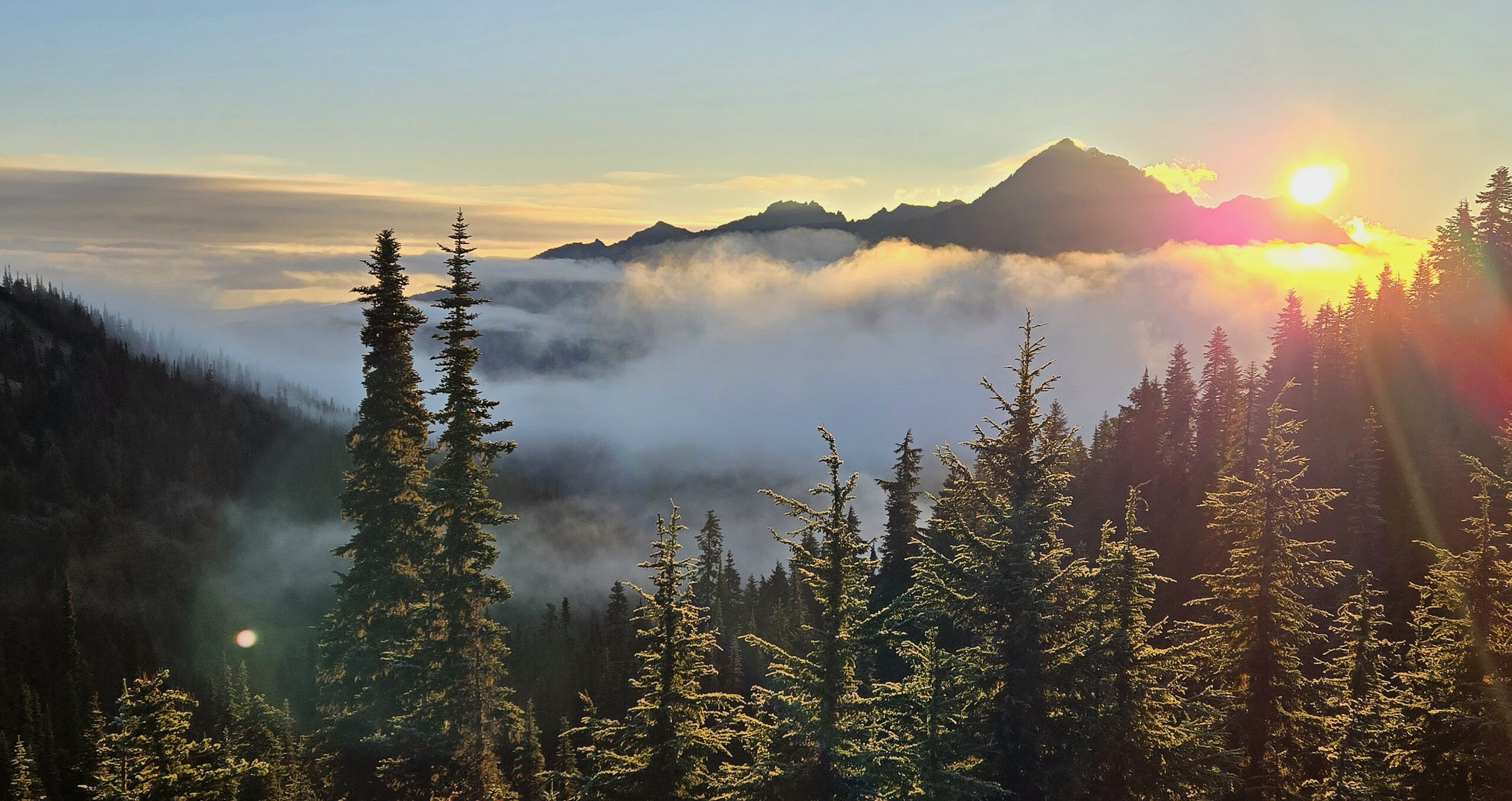
After landing in Seattle, I stocked up on supplies, grabbed my rental car, and headed straight to the Olympic Peninsula to meet up with my friend Jason, who had graciously (and excitedly) agreed to join for the long day ahead. We dropped a car shuttle at the bustling Sol Duc trailhead and headed back to Port Angeles to pack our gear and rest up for the long run. Sunday morning (8/25/24) we followed the Hurricane Ridge Rd to it’s end, parked our car, shouldered our packs and off we went. The clouds were swirling in the valleys below as the sun’s early morning glow illuminated the mountains, the whole scene felt very apt for a PNW adventure. We chatted as we cruised along the paved path to it’s end near Hurricane Hill, where our 5000ft descent to the Elwha River began.
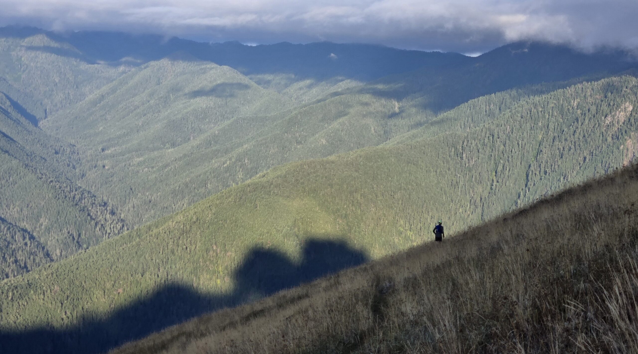
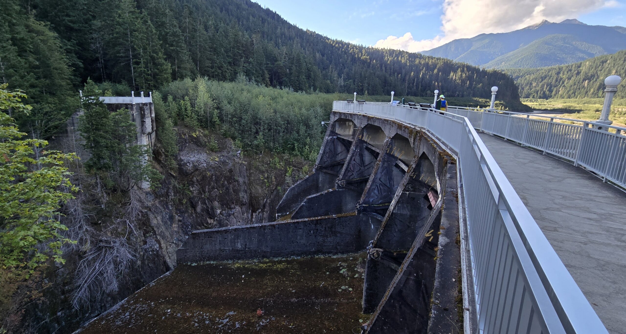
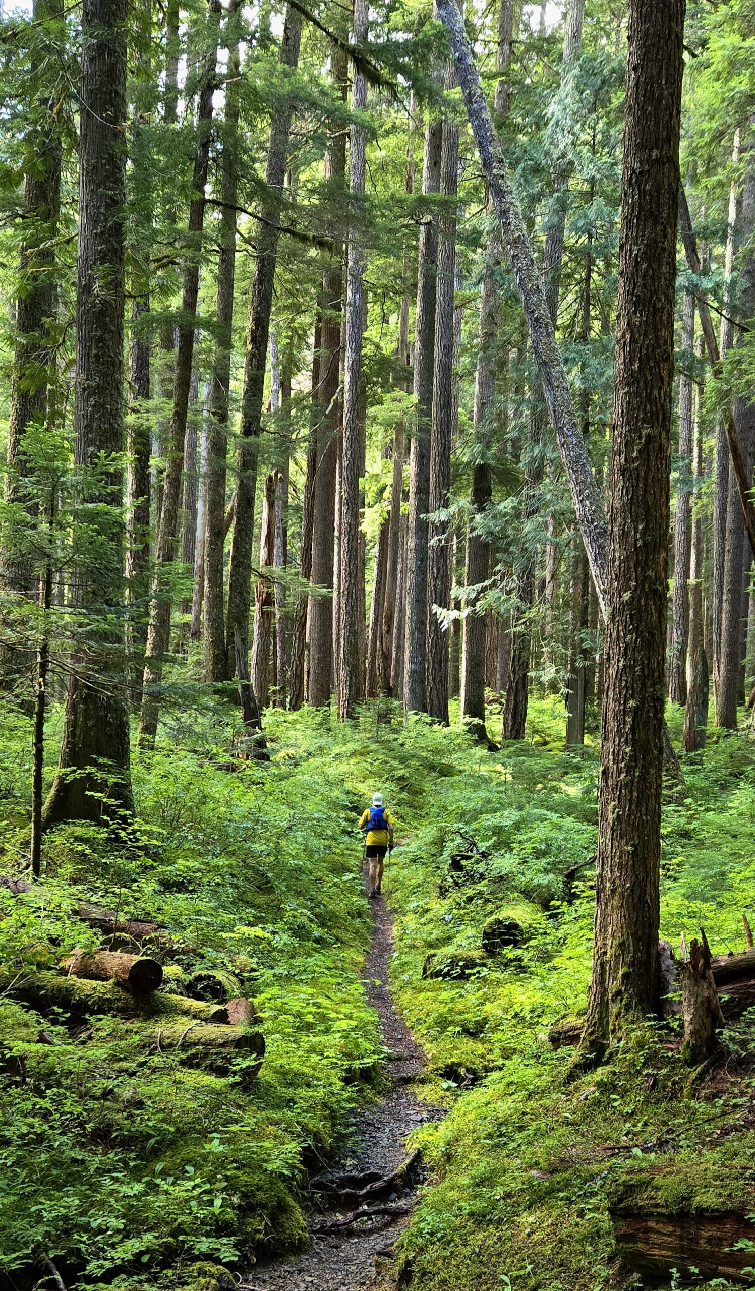
The first several miles of alpine tundra cruised by as we descended down the endless switchbacks into the dense forest below. Soft forest dirt, swooping switchbacks, calm and quiet trails, about as serene as we could have imagined. After about 1:45 we reached the decommissioned Elwha River Rd. In 2012 the Elwha River project began, removing the two dams along the river, returning the river back to its original channel, allowing the salmon to swim upstream, the silt to flow downstream and the valley to heal. With only foot traffic and bike traffic allowed, the 6.5mi on the road was incredibly quiet and pleasant as we quickly made our way to our next destination, Olympic Hot Springs.
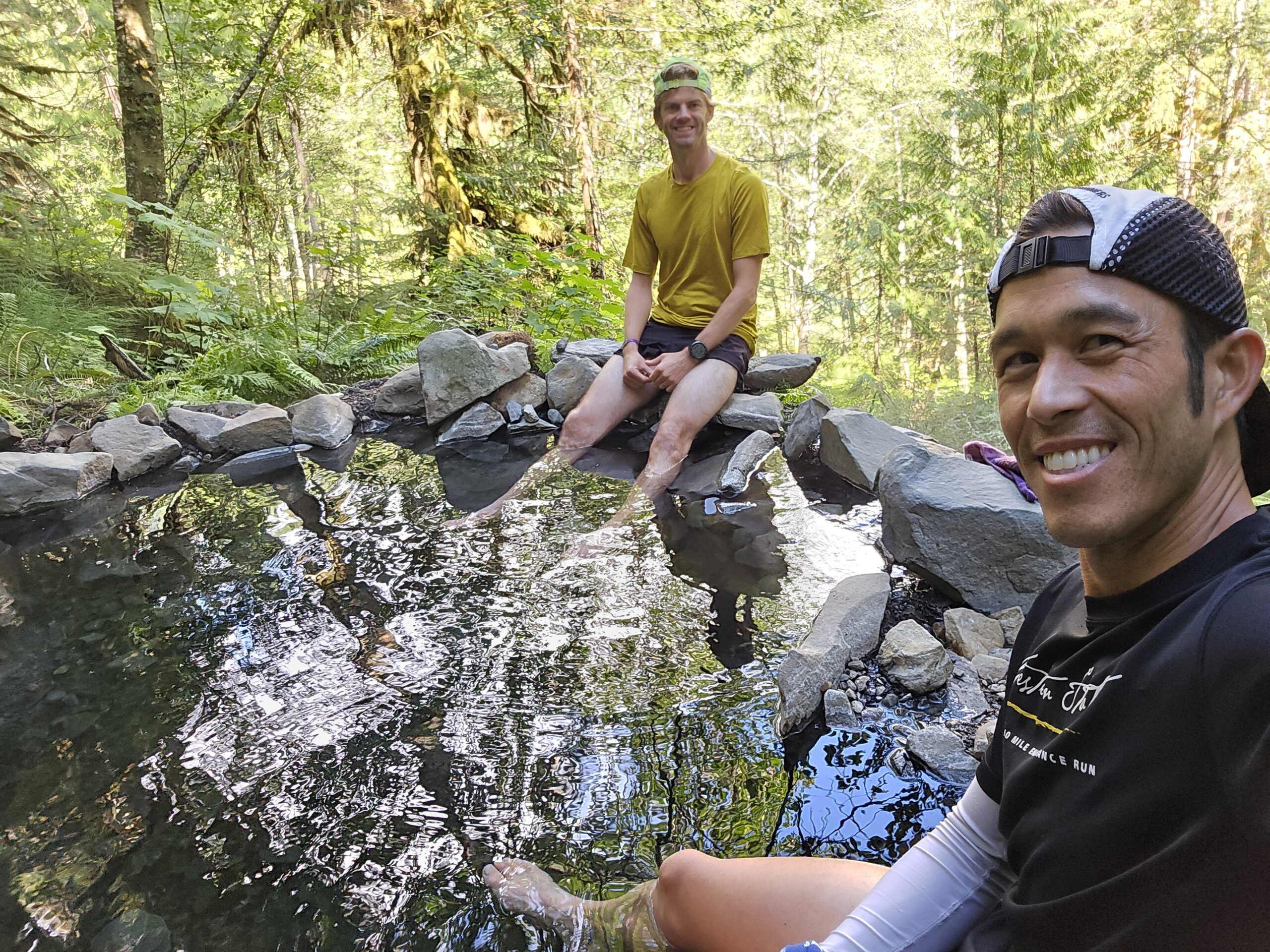
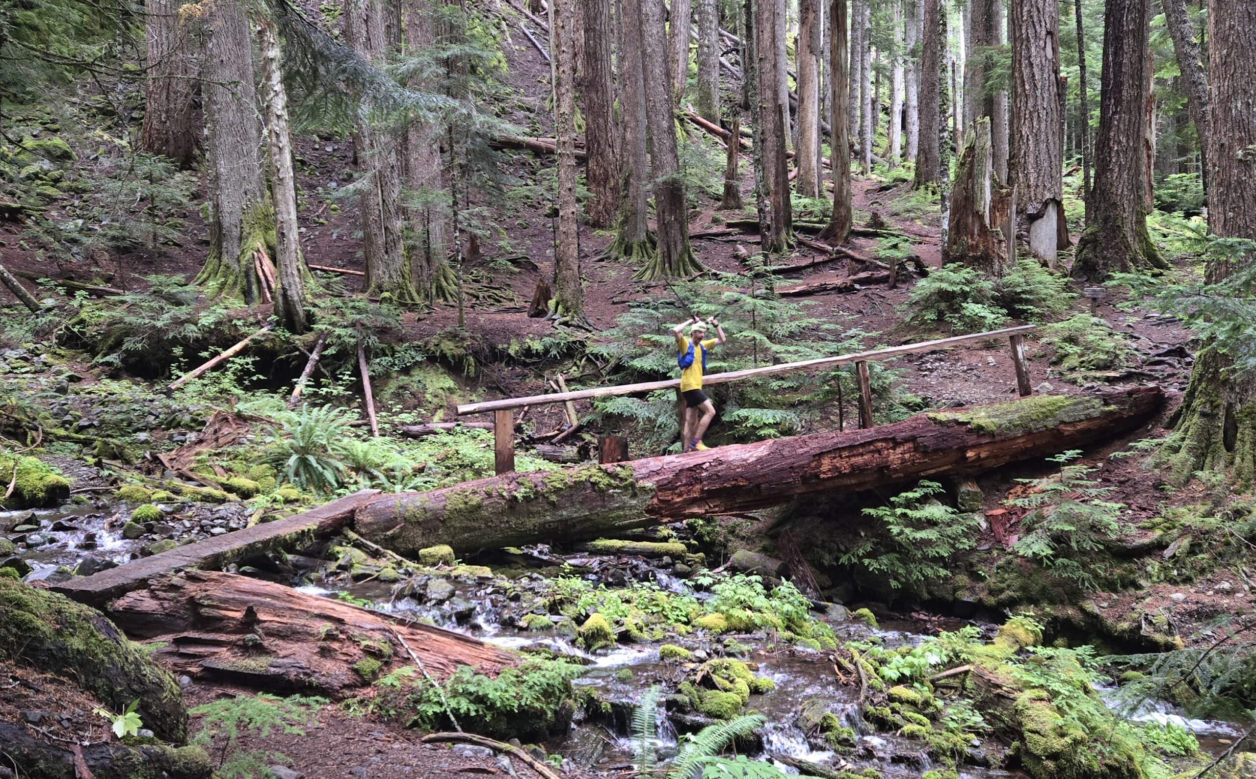
Olympic Hot Springs was long used by the Klallam Tribe, who introduced the first Europeans to the springs in 1907. A resort was then built to service the growing number of tourists visiting the area but was finally closed in 1966. This formerly busy hiking destination has now become quiet since the Elwha River project began in 2012, which turned the 1.5mi approach, into an 11mi haul. We stopped for quick soak in one of the toasty hot springs before continuing our 4500ft climb to Appleton Pass, it felt really nice to get our shoes off for a bit. Several miles after leaving the Hot Springs the trail finally kicked up as we pushed towards the pass. As we climbed over the pass, the trail changed from open grassland and tundra to deep dark forest as we descended into the fog that enshrouded the Western peninsula temperate rainforest.
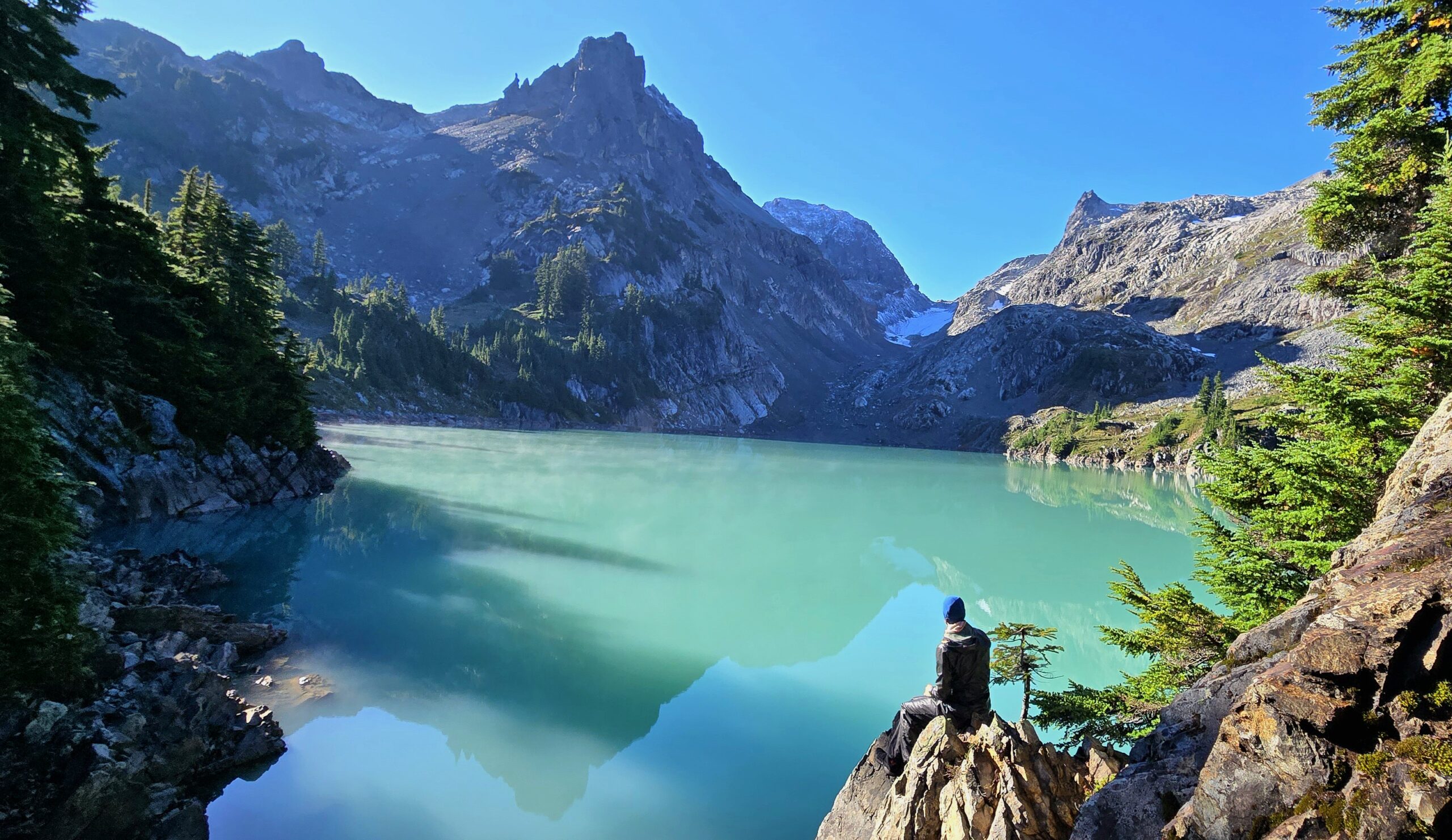
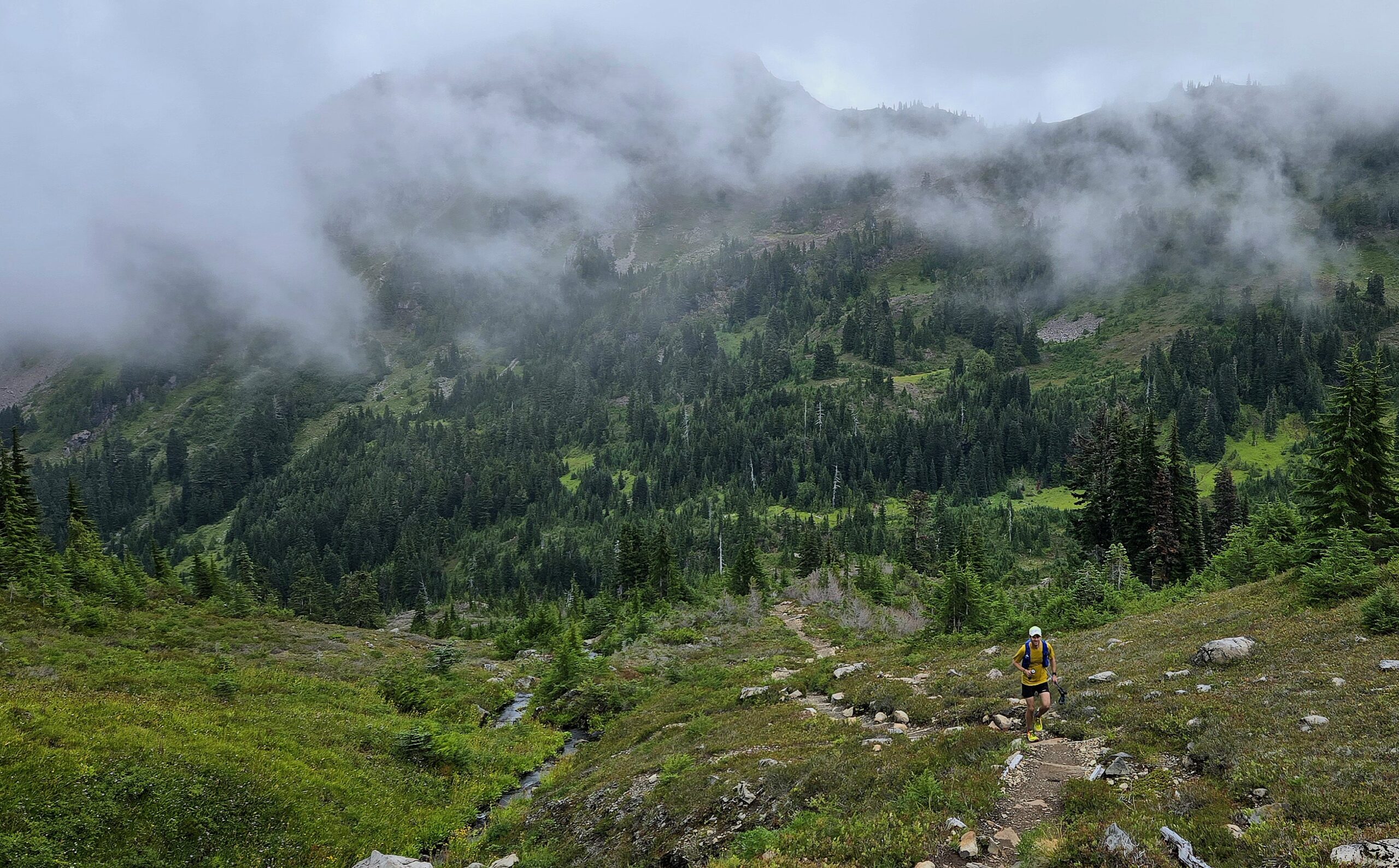
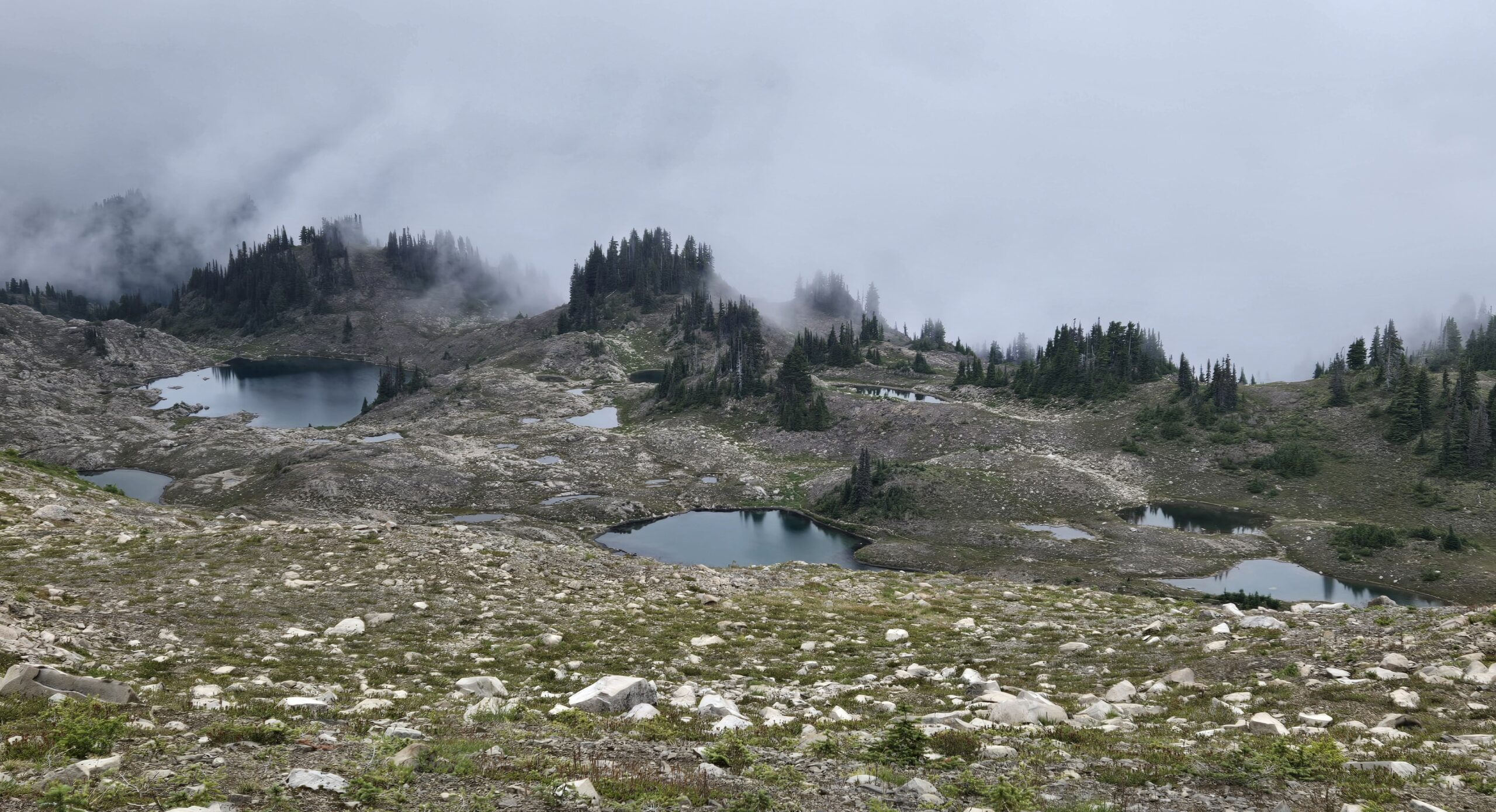
Back down we went to the Sol Duc river 2000ft below. Rain and dew dripped off the trees and bushes, while the spongy duff underfoot sunk with each footstep. From the Sol Duc river we climbed steadily back to Heart Lake, which marked the transition back into the alpine. It also marked the furthest I’d run in over a year (>29mi), since Cascade Crest 2023. Low clouds danced around the ridgelines, enveloping the surroundings mountains and lakes, only to just as suddenly part and reveal their secrets. Most of our run along the High Divide trail was in the clouds, a bit of a bummer as we were hoping for views, but enjoyable in its own right.
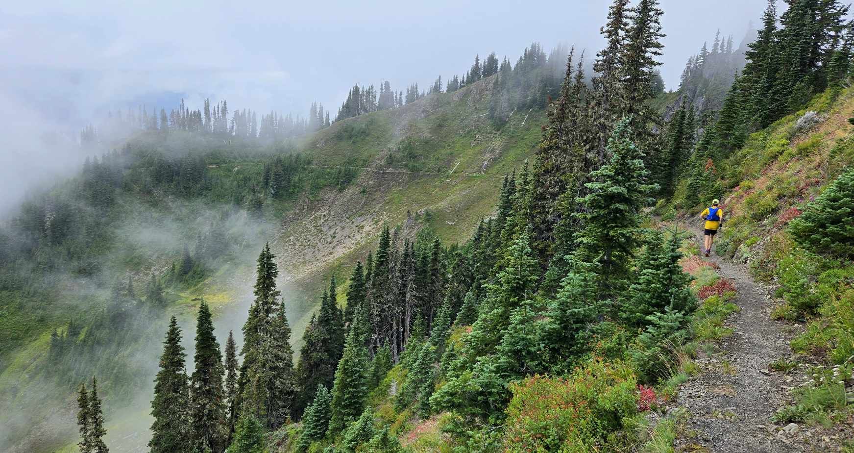
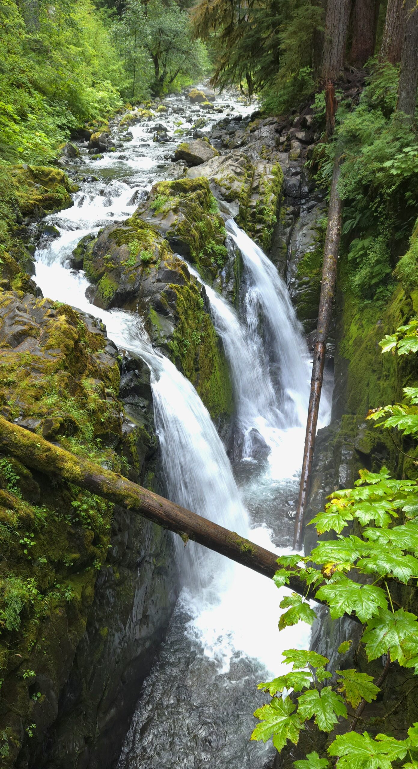
After a short wrong turn near Bogachiel Peak, we started our descent towards Deer Lake. As we descended the clouds began to part, and we got one final glimpse of the surrounding mountains before dropping back into the dense forest below. Now 32mi and 10:30 in to our day, my lack of training was starting to show. My legs were shelled, I was totally exhausted and it took all my remaining strength to just stay upright as we descended the rocky trail back to the Sol Duc River. We kept plodding along down, down, down, finally reaching the bridge across Sol Duc Falls. It was this spot 20 years ago, in a rainstorm, where I first fell in love with Olympic National Park. The calming thundering of the water, the beautiful contrast of the water, greenery and black rocks and the liveliness of the surrounding rain forest.
We jogged the last 1/2mi back to the trailhead, soaking in the soft smooth trail through the rain forest, finally reaching the Sol Duc trailhead 39.9mi and 12h30min after we’d left the cars at Hurricane Ridge. I was elated to have been able to complete the adventure after such a challenging year, but at the same time utterly shelled after pushing my body further than it was trained for. The traverse had provided everything I could have hoped for from the day, even though we’d barely scratched the surface of what Olympic National Park has to offer. Olympic doesn’t have the hype of it’s more well known brothers and sisters (it’s 10th on the visitation list), but it has all the majesty, beauty and diversity to inspire endless wonder.