Wind Cave National Park was founded in 1903, the seventh National Park within the system. Even though it was one of the first National Parks, it ranks far down the list of visitations (<700,000), and many have never heard of Wind Cave. Tucked away on the edge of the Black Hills in South Dakota, Wind Cave is the 7th longest cave system in the world (over 150 miles) and new cave is still being discovered every year. Though what makes Wind Cave National Park so special is the intricate boxwork that adorns the cave (found almost no where else in the world) and the wildlife that roams the above ground portions of the park.
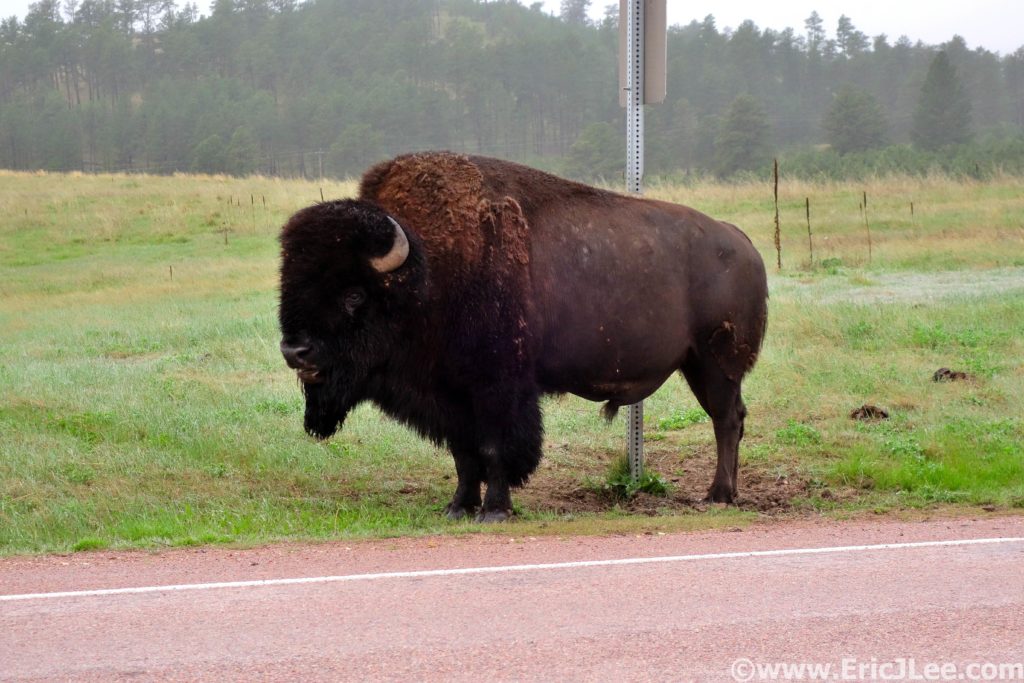
Bison are quite large and intimidating animals, keep your distance.
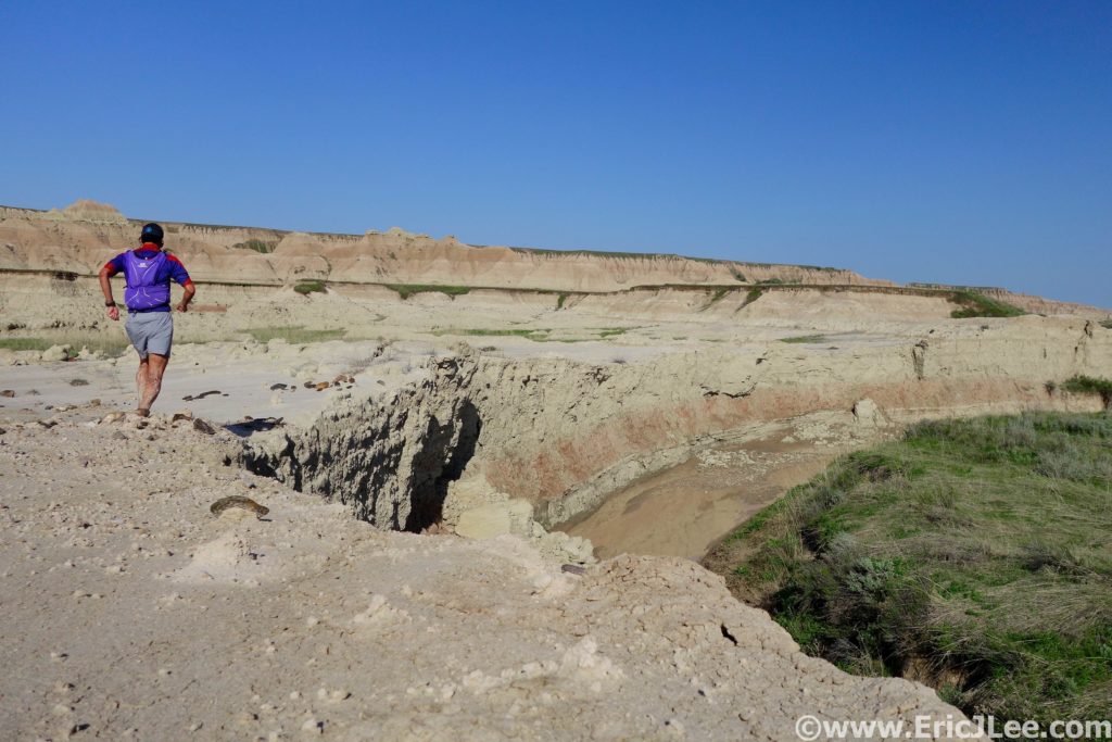
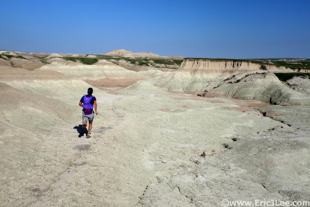
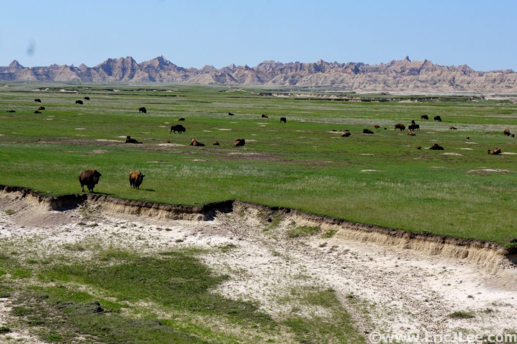
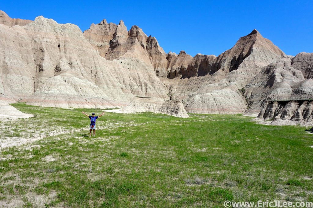
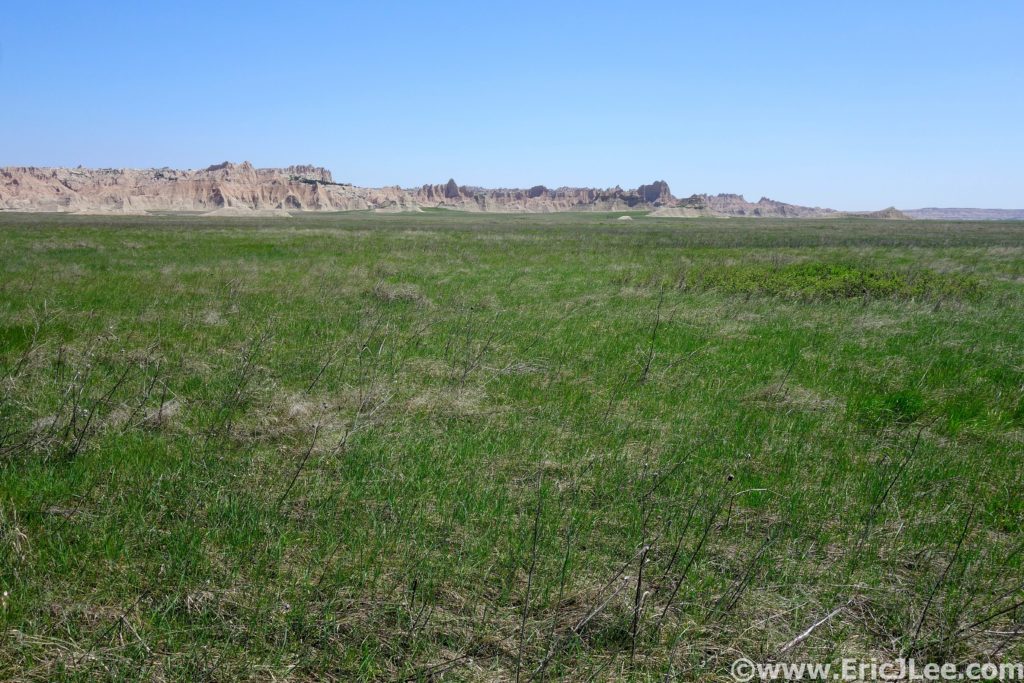
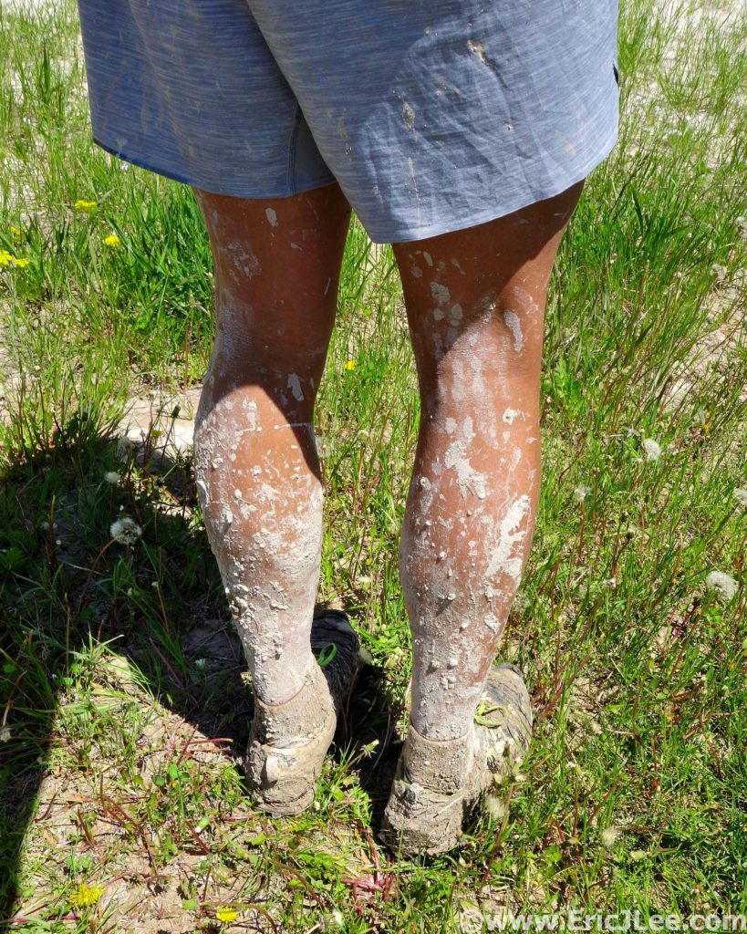
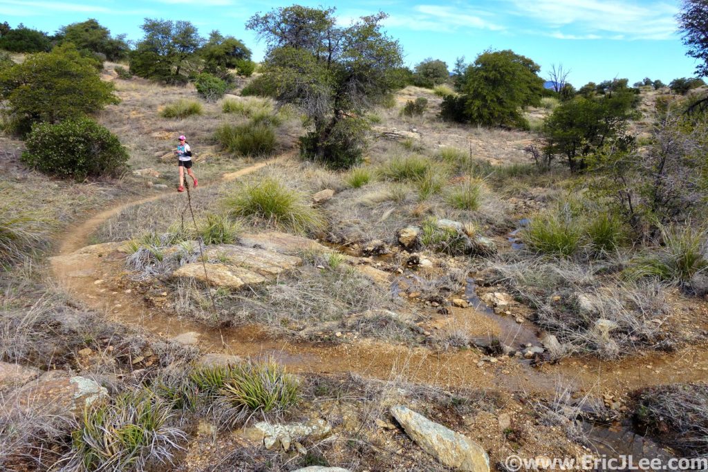
Fresh off my 6h sloppy mud run in Badlands National Park, and with bad weather looming the following day, I opted for a nice back to back National Park ultra combo. I had tickets for a 3pm cave tour along side my friends Ben, Amanda and Kedar, so at first light on 5/26/19 I hit the Wind Cave Canyon trail, jogging along the gravel road into the plains of Wind Cave NP. I soon turned north onto the Highland Creek Trail (3.5mi), traversing across the high plains, past endless herds of bison, several groups of elk and even a few pronghorn. Large sections of the trail were little more than a faint path cairned through the grasslands, and quite a few times I found myself glancing around looking for the path, but overall it was pretty smooth running.
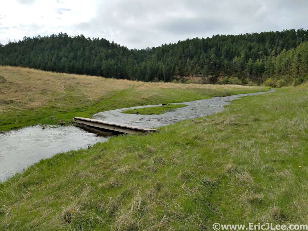
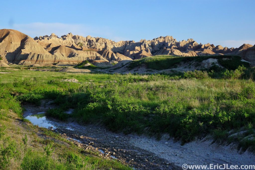
Cruising through plains and along the rivers of Wind Cave National Park.
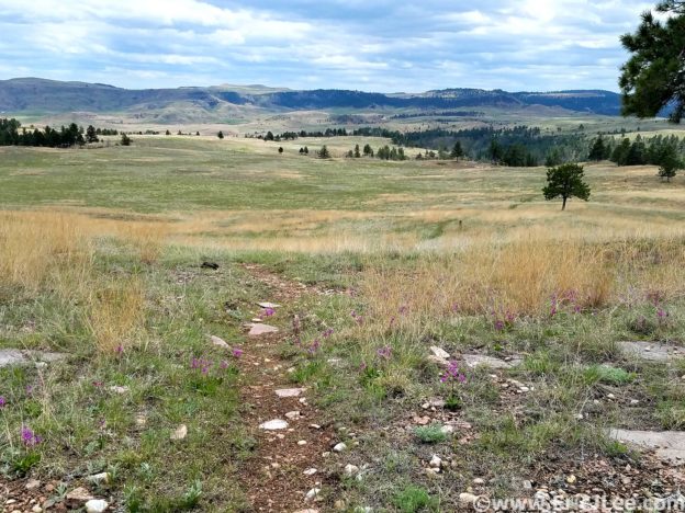
Smooth cruiser open plains single track in Wind Cave National Park.
Things were going smoothly and I soon found myself at County Road 5 (10.7mi), my lone 1.5mi stretch of road running for the day (dirt). I hit the Centennial trailhead , turned South and headed back into the park. The running continued to be smooth, as I rolled across the never ending plains, finally dropping into Beaver Creek canyon (16.5mi). I cruised up the creek through the narrow but shallow canyon alongside the creek, a nice change of pace to the expansive plains. I hadn’t passed a single person (or car) the entire morning, though I finally started to pass a steady trickle of people as I neared the Lookout Pt trailhead. I exited the canyon, passed through the trailhead and onto the Lookout Pt trail, headed back across the plains again.
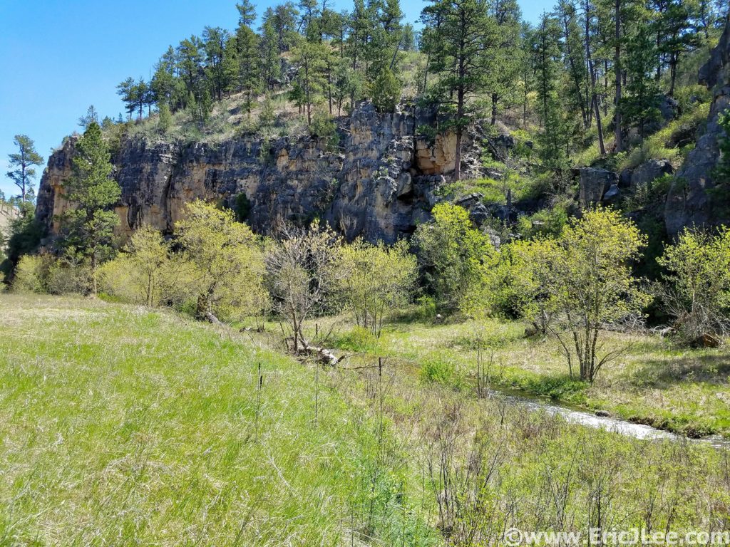
Cruising along Beaver Creek in Wind Cave National Park.
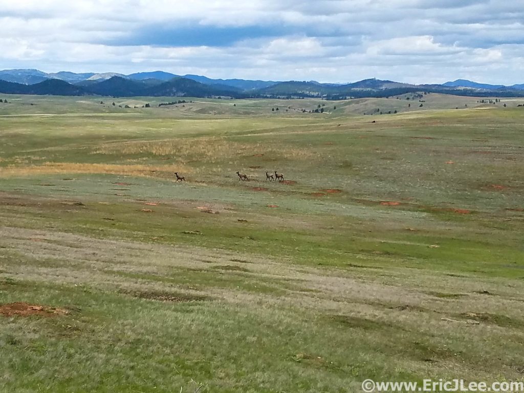
Some elk scampering across the plains of Wind Cave National Park.
As I connected back onto the Highland Creek Trail I could feel the fatigue building in my legs from the past two days of running. When I got back onto the Wind Cave trail, I made a quick turn south onto the final leg of my run, an out and back of the East Bison Flats trail (23.3mi). As I slowly climbed my way back up to the high plateau the sun began to beat down on me, and I quickly realized I was running out of water. Onward I slogged, steeply back down into the river canyon, only to immediately climb right back up to Gobbler Pass (26.6mi). I was definitely feeling beat up now, but as I turned around with just under 4miles to go I had really no other choice than to finish up the run. The fatigue and dehydration were taking their toll, so the final miles seemed to drag on in a blur. At last I descended back to Wind Cave Canyon and slowly shuffled my way to the car. I still managed to finish the 30.4mi lollipop in under 6h, not too shabby for a back to back weekend, and in time for the 3pm cave tour!
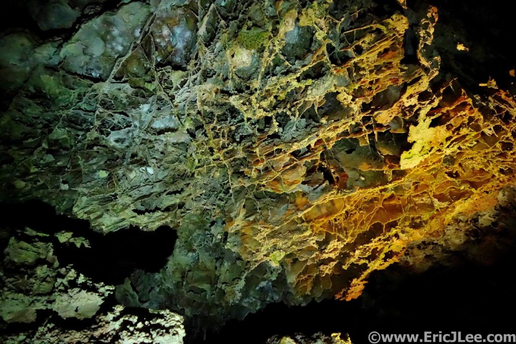
Boxwork in Wind Cave.
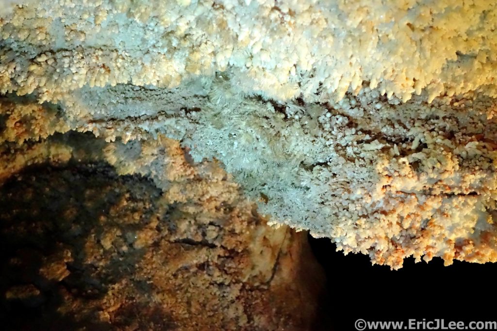
Frost work crystals in Wind Cave.
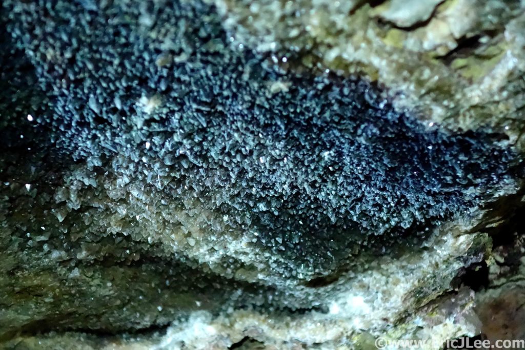
After chugging a cold soda, tasted so good, I dragged myself over to the Wind Cave visitor center to meet my friends and to catch the 3pm cave tour. I felt a little pathetic, slowly hobbling my way at the back of the tour group (legs were getting stiff), but it gave me an extra chance to photograph some of the cave formations and to take in the smaller intricacies of the cave. Wind Cave is most famous for it’s boxwork formations, a lattice of spiderweb like crosshatching that is found almost no where else in the world. We admired some frostwork (tiny white crystals), spar and a few stalagmites and stalactites. While Wind Cave may not be the most ornately decorated cave, it’s combination of unique features and above ground wildlife make it a special place to visit. For the runners out there the trails are beautifully runnable and very unpopulated (other than the herds of wildlife). So next time you’re in the area (Custer, SD), stop on in to Wind Cave NP and it’s sister Jewel Cave NM right next door, for a little tour of the above and below ground wonders.
It rained 5” last week, oh boy…not what I wanted to hear the
day before I was supposed to run a big loop around Badlands National Park, a
place everyone told me not to go when it rained. As I drove through the park
along the Rim road the early May sunlight began to illuminate the buttes, so I
stopped at the first view point to take in the views of Sage Creek far below. I
was greeted by a couple of grazing bighorn sheep, and a herd of bison. My first
trip to Badlands was off to a pretty good start.
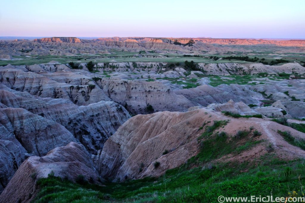
Sunrise over the Sage Creek area of Badlands National Park.
Badlands National Park has very few official trails, so to create a long distance route I pulled from a 22mile off trail backpacking loop with some planned detours and exploration, because that’s what Badlands is really about, a chance to explore, unencumbered. I rolled into the Conata Picnic area just after sunrise on 5/25/19, geared up and strolled off into the meadows. It was immediately apparent I was in for a bit of adversity as the packed dirt meadow turned damp and then into full on swamp. Well, dry feet weren’t going to be an option today. I slopped my way across the valley for 1.5mi, then turned sharply right (North) for the Deer Haven saddle.
Headed up towards Deer Haven, just to the right up the valley.
Looking down the upper reaches of the Sage Creek wash.
As I climbed away from the low grasslands up onto the butte,
I passed through dense stands of juniper, eventually weaving my way up the
steep hillside, around the cliff bands, and onto the summit of the Deer Haven
plateau. Now for the long winding downhill along the North Fork of Sage Creek.
The route started out pretty pleasant, running through the tall grass, occasionally
hopping the creek, but the footing was pretty good. After a short side trip up
one of the canyons draining The Pinnacles, I continued my descent, things
slowly got muddier and muddier and the creek got deeper and deeper. By the time
I hit the confluence of the North and Middle forks of Sage Creek the muddy misery
had escalated.
Running the plateaus along the North Fork of Sage Creek.
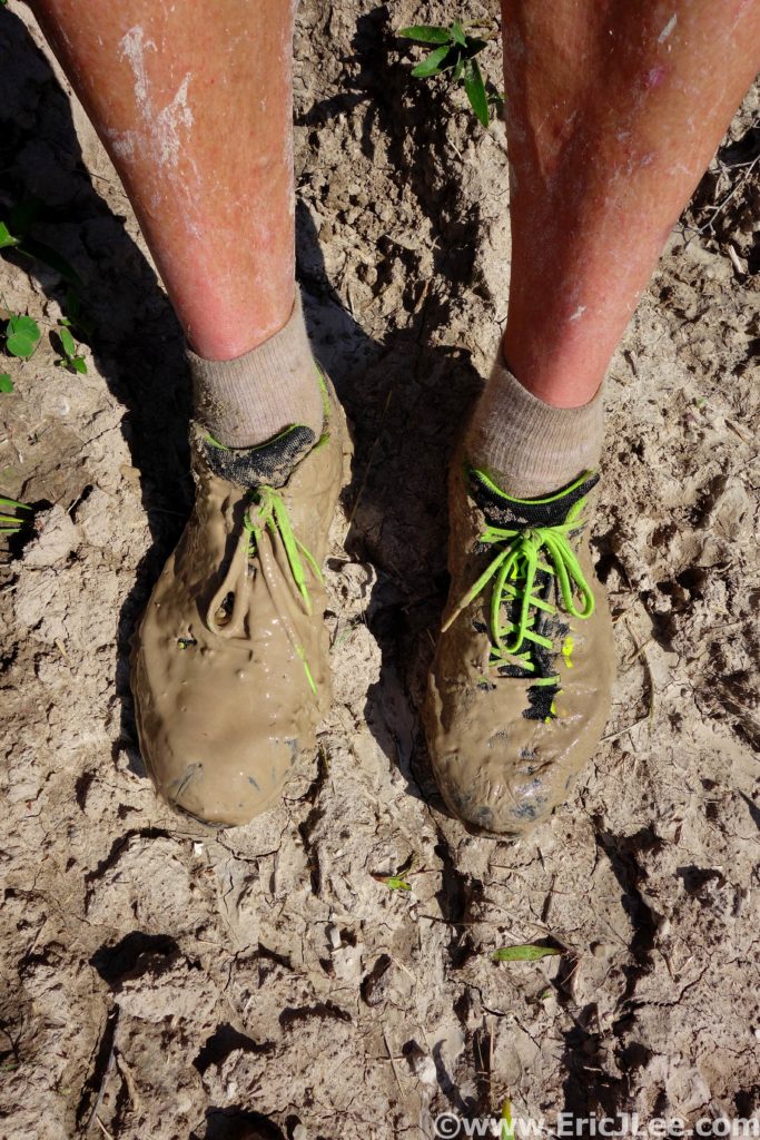
It was like running in peanut butter, yuck.
I cut over the high plateau above the creeks hoping that the
mud would dissipate, but no luck. As I rounded the bluff I dropped onto the
high plateau above the Middle Fork of Sage Creek, a small herd of bison dotted
the plains. Their muddy hoof prints had torn up the grasslands, and it was a
total mud pit. Despite the slipping and sliding, the terrain was fairly easy
and it was really nice to be jogging through the open grasslands and jagged mud
buttes with no one else around. I slow jogged and fast hiked my way up the
Middle Fork, headed towards Sage Creek Pass. As I made my way into the upper
basin the herd of bison had grown into the hundreds, dotting the plains as far
as the eye could see.
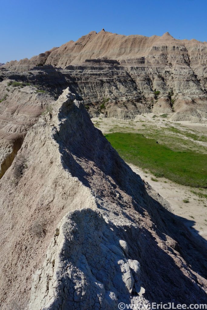
Just before reaching Sage Creek Pass I took a detour
slightly NE into some really interesting buttes, hoping to climb one. I
scrambled up the hard mud slope, onto the crumbling ridgeline. As I neared the
summit the slope pitched up to near vertical and the mud stone showed no signs
of solidifying, well that wasn’t going to happen. From my vantage on the
ridgeline I could see down into several of the nearby canyons, watched the
bison trotting around the grasslands and very much enjoyed my isolation deep in
the backcountry of Badlands. I spent anther half hour scrambling around the
canyons of the butte, finding coyote tracks, bighorn droppings and lots of bison
paths. Each canyon was a new adventure, would it be passable, where did it go?
I finally popped out back on the South side of the butte not far from Sage
Creek Pass.
Finding some semi-packed mud to run on!
Bison dotting the Badlands.
Trying to climb some of the mudstone ridges and buttes, not so solid.
The route down from the pass was an enjoyable jog down the
water course right alongside one of the mud stone buttes, alternating between
lovely packed dirt and greasy wet mud. At last I hit the park boundary fence,
hung a left and headed back towards the car across the flat plains that abutted
the mud stone buttes of Badlands. The grasslands seemed to stretch as far as
the eye could see, and as I soon discovered, were completely flooded with an
inch of muddy water. I tried to jog sections, but soon gave in and was relegated
to hiking. After what seemed like an endless slog I got back on the trail near
Deer Haven and jogged back to the car. Tired, covered in mud, and excited to be
back on hard pavement.
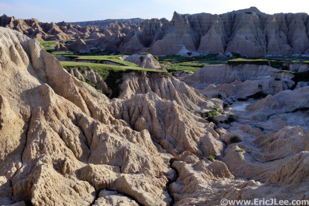
Playing in the canyons and plains.
The wide open plains surrounding the Badlands mud buttes and canyons. Endless grasslands (filled with mud this day).
My first trip to the Badlands had been an overall success. Despite the crazy mud and insanely wet conditions, I got to wander through the backcountry all my by lonesome, explore the maze of mudstone buttes and towers, watch the massive herds of bison take over the planes and just be out in an undeveloped part of one of America’s more obscure National Parks. Badlands may not look as dramatic as some of the mountainous national parks, but once you’re lost wandering the backcountry you get to better understand what the park is all about. I look forward to returning to Badlands again, when it’s less muddy and I get more time to just explore all the random canyons (but beware of the rattlesnakes!).
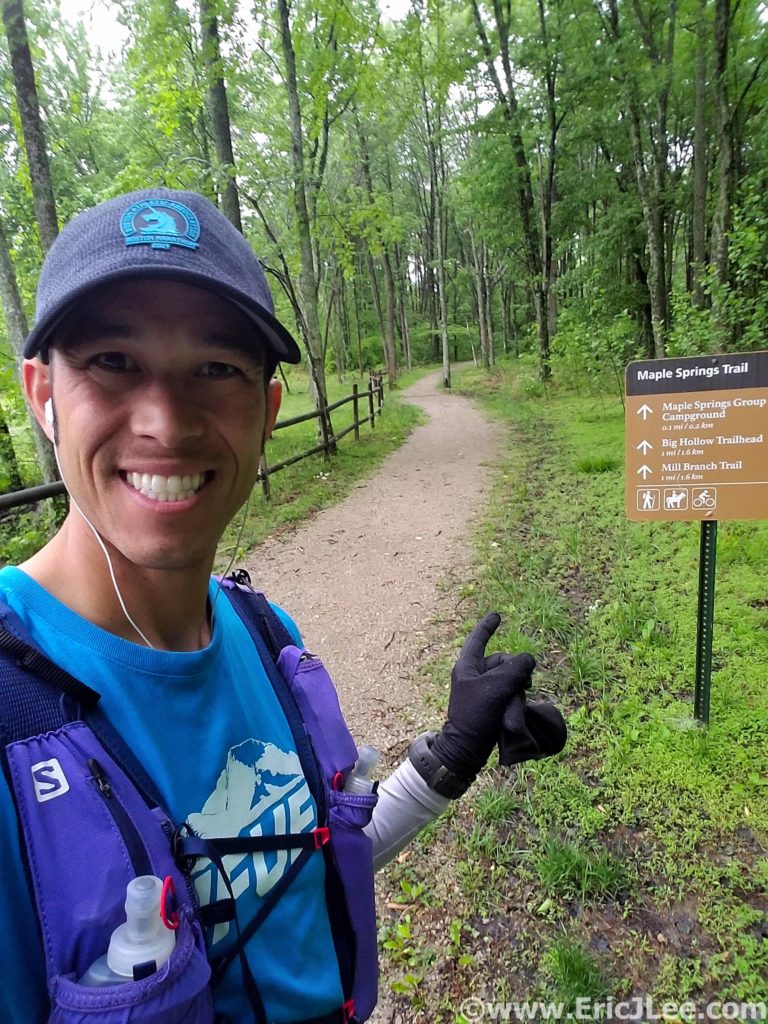
Squish, splash, splosh….what had started out as such a beautifully promising trail had quickly descended into a horse trodden mud bog….would the whole run be this way? The Maple Springs Trail had started out as beautifully cruiser crushed gravel meandering through the lush green forest, but as soon as I turned onto the Mill Branch Trail I found out what the ranger had warned me about, the horse trails were muddy….
Lush green forests and muddy trails of Kentucky along the Mill Branch trail in Mammoth Cave NP.
Mammoth Cave National Park is best known because its currently (May 2019) the world’s longest cave system at over 406miles of passageway with more still being discovered. The cave system has a long history of human exploration and exploitation along with a hugely diverse ecosystem inside and out. While the cave itself may be the best known feature of the park, the park also has a beautiful trail system, covering over 70miles, exposing one to the surface geology and weather that makes the formation of the cave possible (more on the caves at the end).
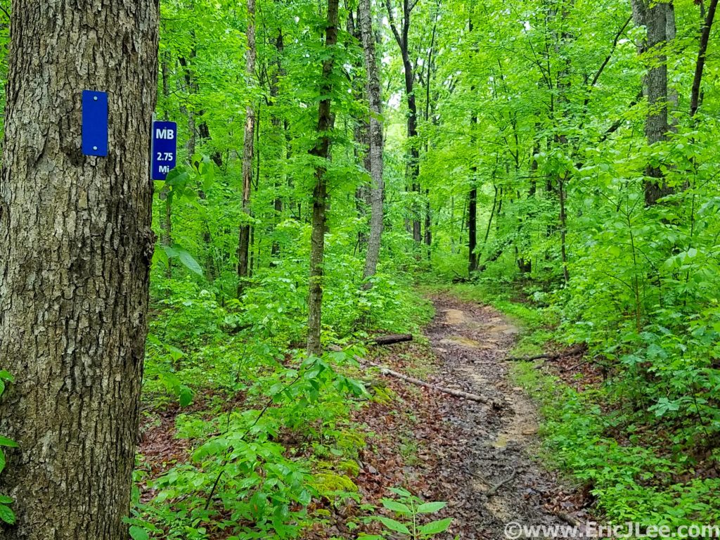
My run set off from the Maple Springs Trailhead cruising the beautiful crushed gravel paths through some of the greenest forest I’ve ever run through. Several days of rain had really brought everything to life…. including the mud. As I transitioned onto the duel use horse trails, the smooth path turned into a chopped up muddy mess. I sloshed my way around the North edge of the park on the Mill Branch and Blair Springs trails, both of which consisted largely of ankle deep mud…bleh. I got a short reprieve as I passed the First Creek TH (7.6mi, 1:30) and climbed the ridgeline high above Second Creek. The foliage briefly transitioned to pines and hemlock, before returning back to the dense hardwood forest.
My starting point at the Maple Springs TH in Mammoth Cave NP.
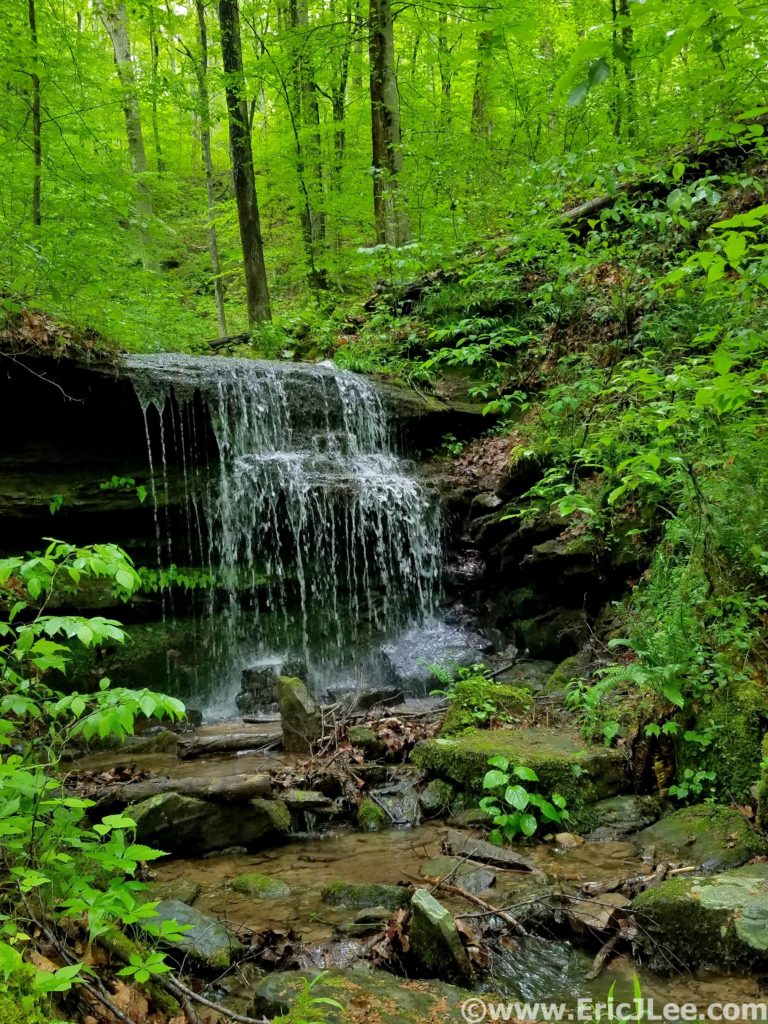
One of many cascades along the trail in Mammoth Cave NP.
When the trails weren’t a mud bog they really were beautiful…rolling
single track, swooping through the neon green forest and limestone rock
formations randomly jutting out of the hillside. As I made a turn to parallel the
Nolin River the trail transitioned back to the horrid mud bog, and I splashed
my way passed First Creek Lake (nice campsites) and then up the steep hill to
Temple Hill (14.3mi, 3:00).
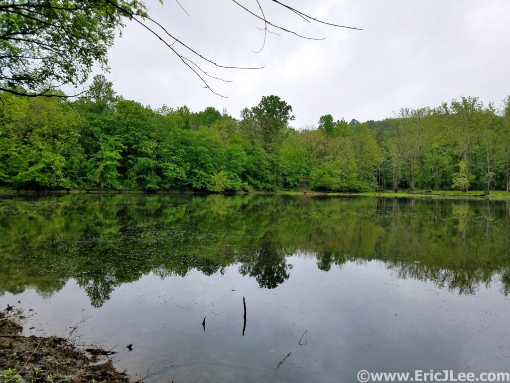
First Creek Lake, several lovely campsites.
Most of the terrain had been incredibly runnable to this point, so it was nice to have some hiking grade to break up the pace. I passed a few hikers on this stretch, the first people I’d seen all day! After a short but abrupt descent down the McCoy Hollow trail, the grade mellowed and the trail weaved in and out of various river drainages before descending to the Wet Prong of Buffalo Creek (20.4mi, 4:20). Another short steep ascent up to Collie Ridge before the trail plummeted straight down to the Dry Prong of Buffalo Creek. When I finally turned onto the Sal Hollow Trail (24.4mi, 5:25, final trail of the day) I was pretty ecstatic to see find it was a non-horse trail, meaning it was the most beautiful section of trail I’d been on all day.
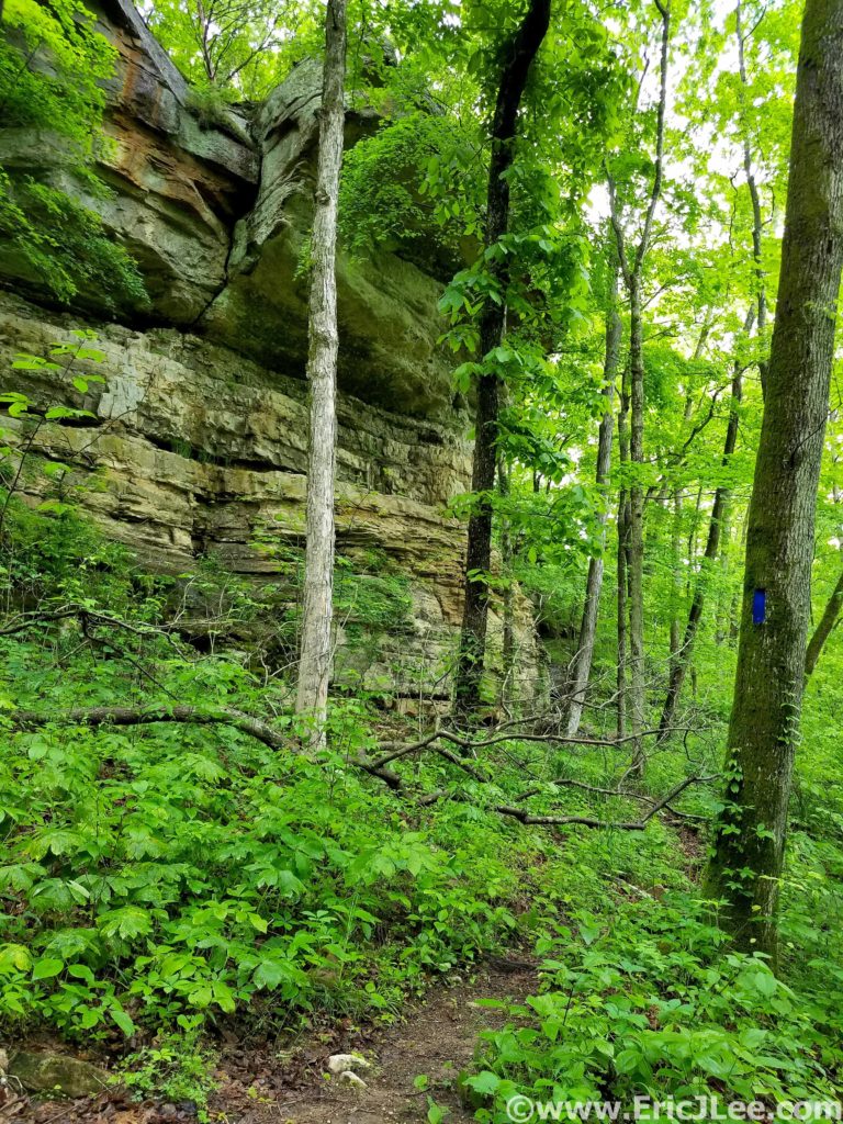
Limestone formations and lots of greenery await you on the trails of Mammoth Cave NP.
Soaking my legs in Sal Hollow to wash off a little mud and cool the feet.
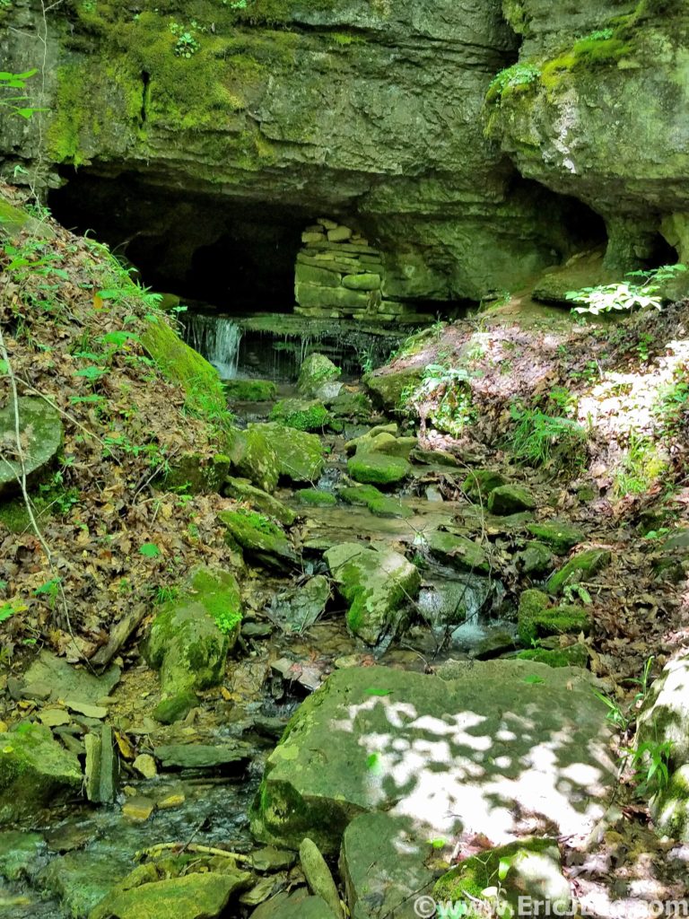
The damp single track weaved around trees and rocky limestone outcroppings, passing springs flowing out of caves and sink holes where the water was most likely draining into the cave system below. I even took a short break to crawl into one of the cave springs for 20-30ft, opting not to delve too deep on my own though. I splashed through a puddle now and again, but overall the footing was stellar, and my tired legs were glad for the reprieve from the mud bogs of earlier. This was the trail I’d been hoping to find all day, and despite being a tired and a little grumpy I was thoroughly enjoying the cruise through the forest, listen to the birds singing and the water cascading out of every hollow. It was on this stretch that the clouds finally broke and the first rays of sun shown through the foliage, dotting the green underbrush with its yellow glow. If only all of the trail system had been this lovely….After 33.1mi and 7:17 I popped out of the forest and back onto the Maple Springs Rd, what a day it had been. National Park Ultramarathon #15 complete.
One of several cave springs along the trail in Mammoth Cave…where did the water come from?
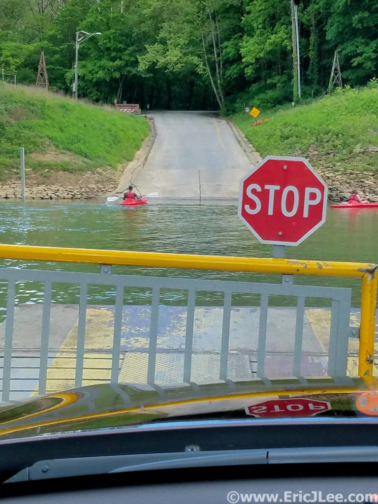
Riding the Green River vehicle ferry across, and me without my floaties.
This trip had been my first real exploration of Kentucky, and it further confirmed my belief that every single state has something beautiful and unique to offer. The rolling green hardwood forests are so unlike anything we have in the West it was a nice change of pace. While I could have done with a little less mud, I’ve never minded getting a little dirty on the run, sometimes you don’t get the perfect conditions, but that doesn’t mean you can’t have an amazing experience. The forests of Kentucky may not have the altitude or expansive views of some of the Western parks, but the beauty lies in much more subtle things. The millipedes crossing the trail, a heron flying across First Lake, unexpected caves dotting the hillsides or simply the ability to get lost in the forest for hours and only see a handful of people.
Sunlight trickling through the leaves of Mammoth Cave NP.
Now on to what brings most people to central Kentucky, the underground labyrinth that is Mammoth Cave….and it sure is mammoth! With a history dating back 1000s of years (to early Native Americans), Mammoth Cave was a known entity long before the Europeans arrived to exploit it. It wasn’t until the mid 1800s that people really began to explore the cave (Stephen Bishop) and cave tourism began to form. Mammoth Cave became a National Park in 1941, and now to visit the caves most people must participate in one of many organized cave tours. While I was not fortunate enough to get on one of the ‘Wild Cave tours’ (reserve early!, includes crawling and scrambling) I did get onto three different tours into very different parts of the cave. In the following paragraph I’ll describe the three tours I took and what I liked/disliked about them. Cave tour reservations can be made here.
The first tour I got on was the ‘Domes and Dripstones tour’ that enters through the New Entrance, which is essentially a dynamite blasted hole into the cave. From this entrance one descends straight into the heart of the cave down a very steep narrow set of stairs. You get a sense of the size of the size of the massive domes where water seeps into the cave and underground rivers. The tour then winds through a variety of passages ending at the Frozen Niagara formation, one of the few formations in this section of the cave. While interesting and beautiful, it was my least favorite tour as it’s a very large group and moves pretty fast, giving one less time to enjoy sections of the cave.
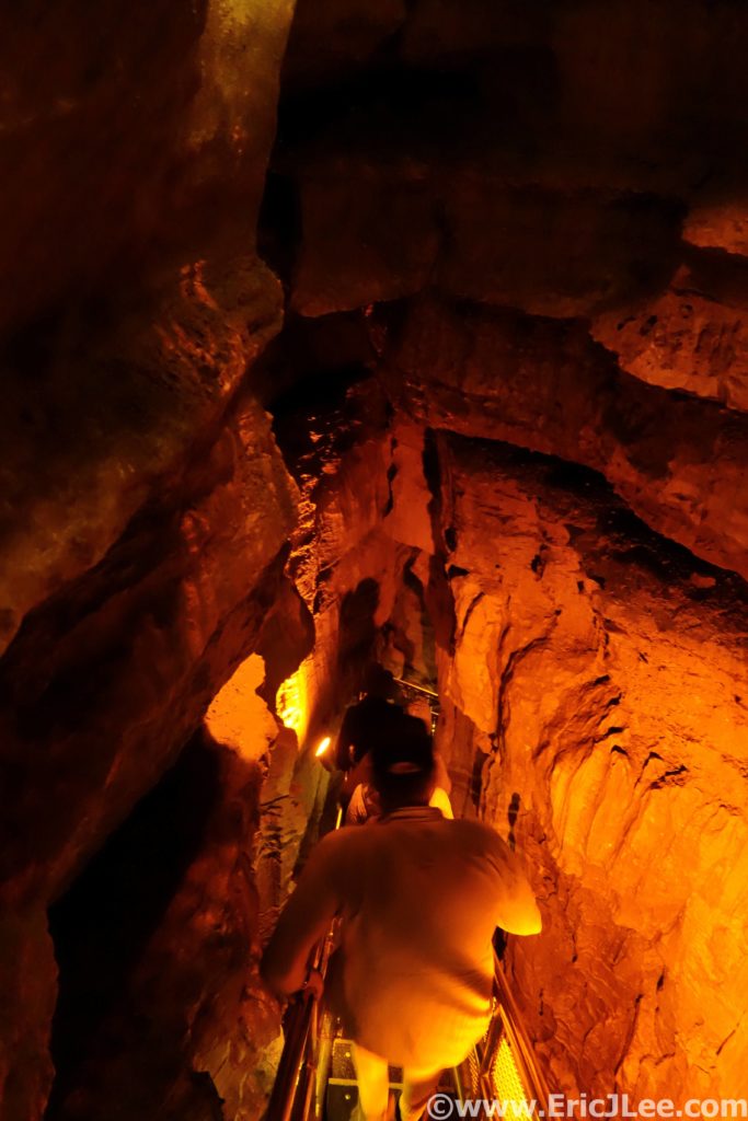
Descending the steep stairs down from the New Entrance deep into Mammoth Cave.
The Frozen Niagara formation in Mammoth Cave.
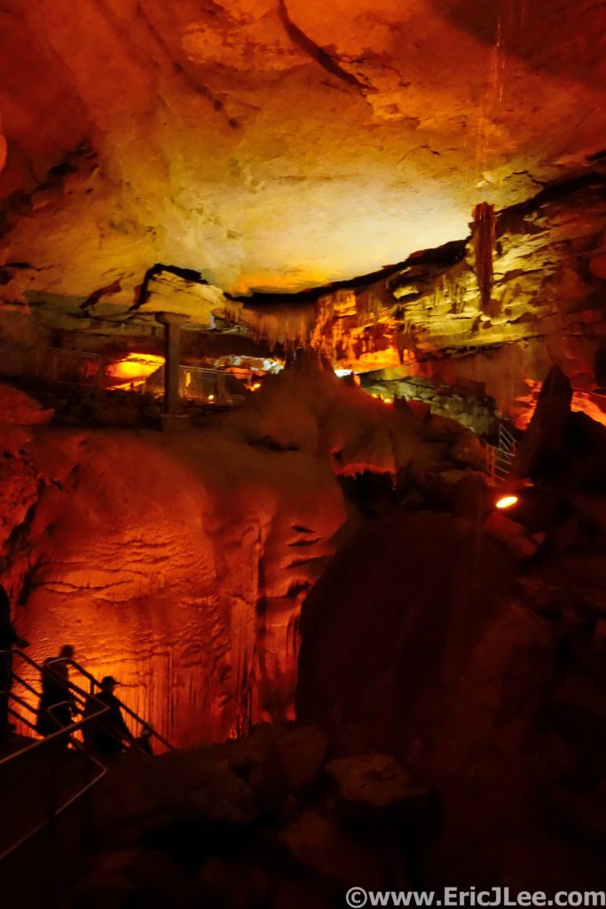
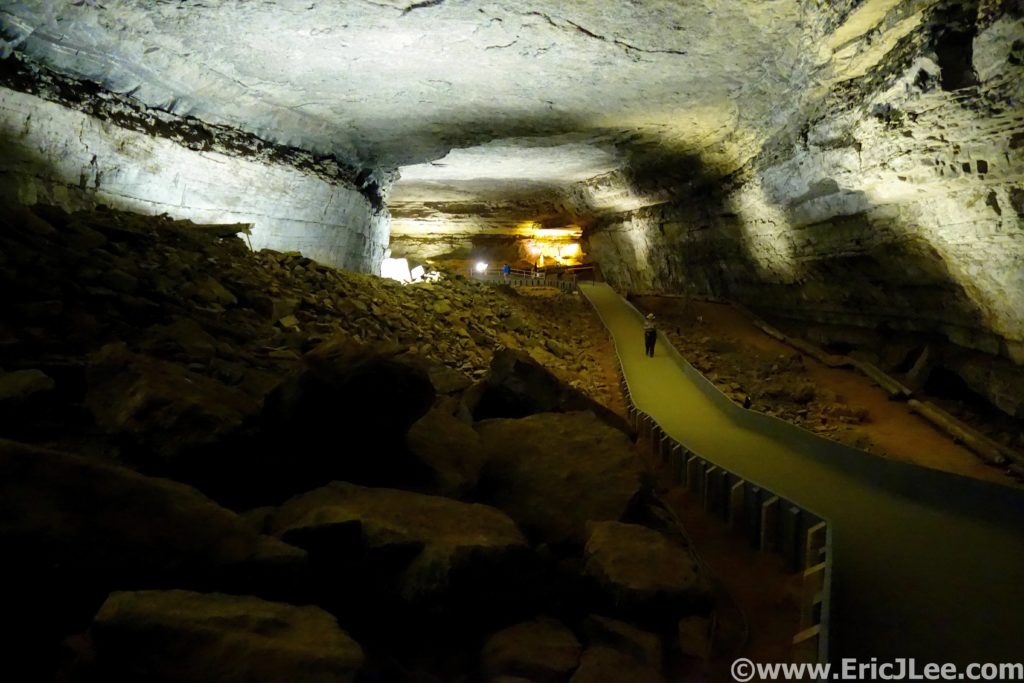
The second cave tour I took was the ‘Historic Tour’, this one enters through the original historic entrance in the center of the park. The initial passageways are massive, quickly letting one understand why people call it ‘Mammoth’. You then learn a good bit about the history of the cave, from early Native Americans to the salt peter mining and tourism of the 1800s. The walking tour then crosses the Bottomless Pit and into Fat Man’s Misery, a narrow section of passageway (all walkable, with a slight crouch). I found the Historic Tour more interesting than the Domes and Dripstones, partially because of the history, but also because you got a much better sense of the size and variety the cave offers.
The main hallway in Mammoth Cave is pretty darn big.
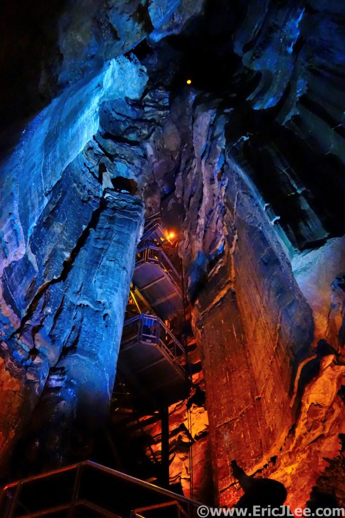
Looking up one of the giant silos in Mammoth Cave.
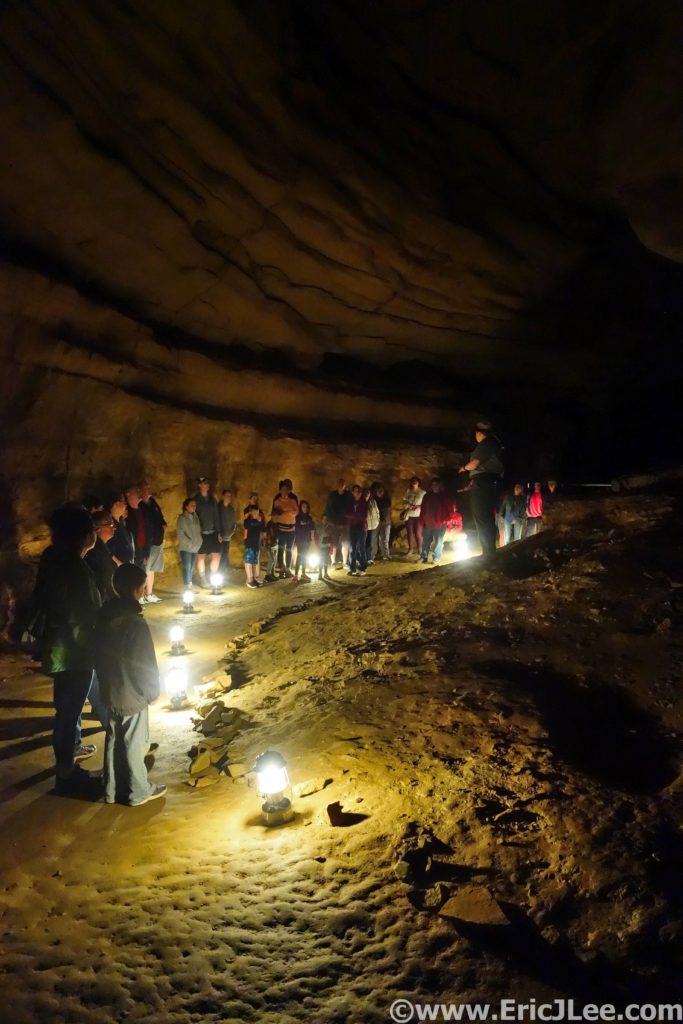
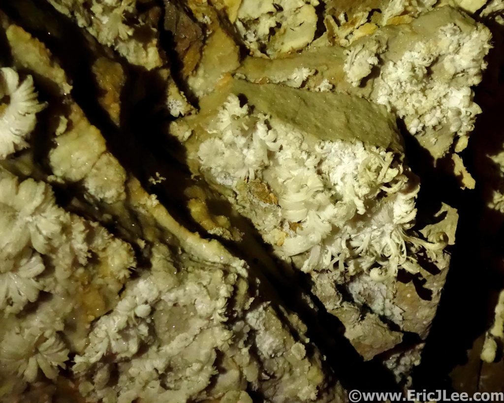
The last tour I took was the ‘Great Onyx Cave’ tour, part of the Flint Ridge cave system that as of this writing does not connect with the rest of Mammoth Cave (but is believed to). As we passed through the damp entrance, careful not to step on the cave salamanders (cool!) we quickly emerged into a room adorned with cave formations (drapes, columns, stalagmites/stalagtites, flow stone). As our small group of 20 slowly made our way deeper into the cave by lantern light the cave slowly dried out and the formation disappeared. Replacing the flow stone formations were delicate gypsum crystals, some of them assembled into the most beautiful gypsum flowers I’ve ever seen. While we didn’t cover as much cave passage on this tour I found that the time allotted allowed us to better appreciate the cave and the formations, as did the smaller group size. This was by far my favorite tour of the day.
Wandering Great Onyx Cave by lantern light.
Delicate gypsum flower formations in Great Onyx Cave.
It may be becoming cliché, but my National Parks project is taking me to areas of the country I otherwise may have never visited and explored. The rolling green hills of Kentucky and the always fascinating underground world of the cave truly exceeded my expectations. The US National Park system is not just a collection of big mountain landscapes or desert canyons, though those get most of the attention. Mammoth Cave is definitely worth exploring, both above ground and below. Because it’s the world above (the rain, the rocks, the ecosystem) that make the caves what they are. As always, special thanks to Vfuel for powering all my crazy ideas and adventures and to our National Park System for preserving such amazing places for all to see and experience in a responsible manner. Next up….Badlands National Park and Wind Cave National Park!
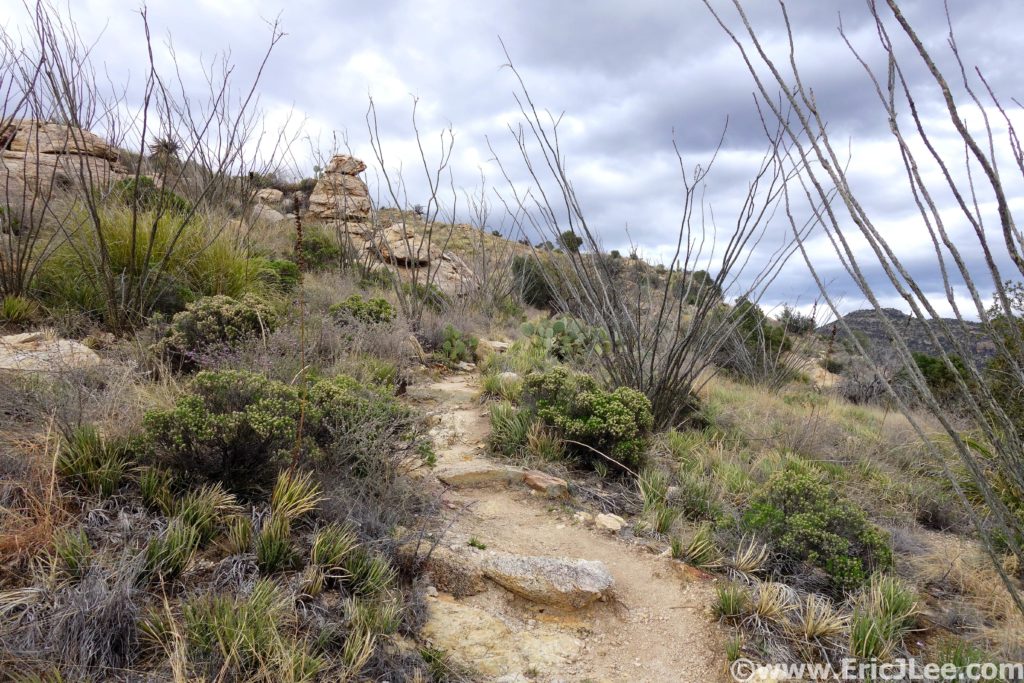
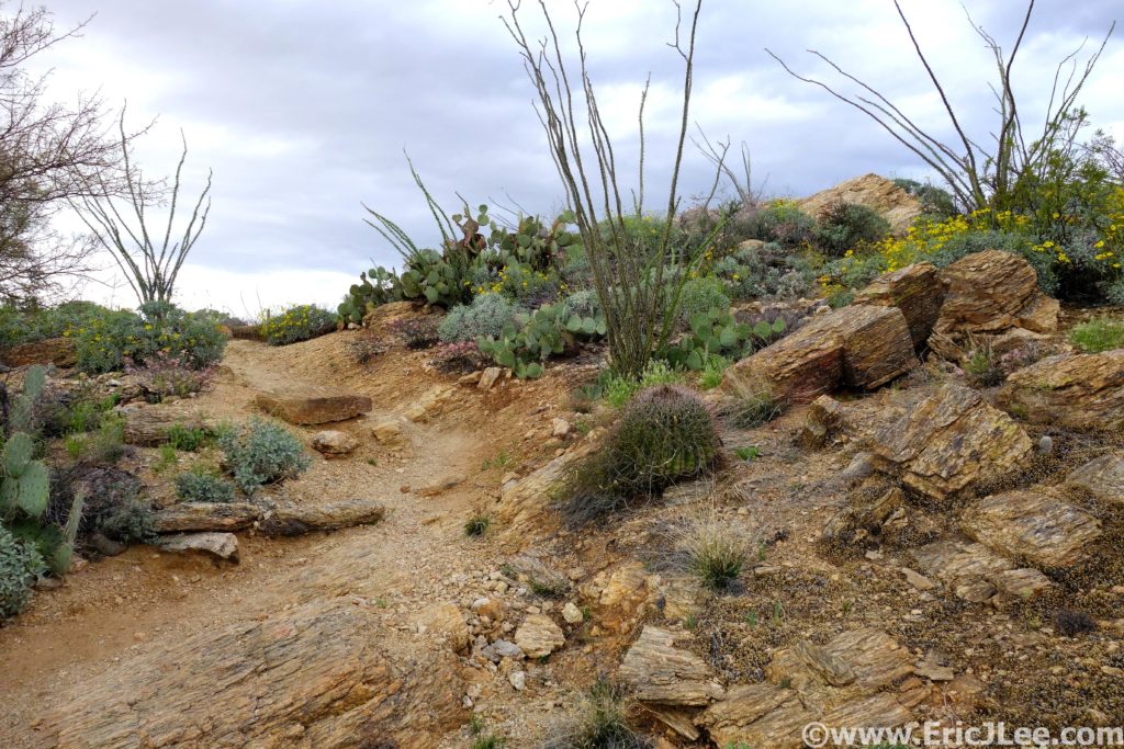
Saguaro cacti, cholla, barrel cacti, prickly pear cacti, ocotillo, catclaw, yucca….there are a long list of things in the desert that are just looking to stab, scratch and tear at you. Our lesson learned, just don’t touch anything and you should be good.
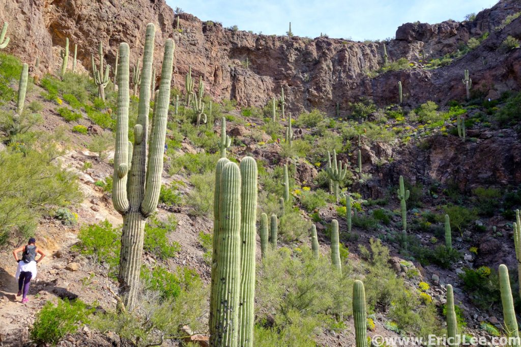
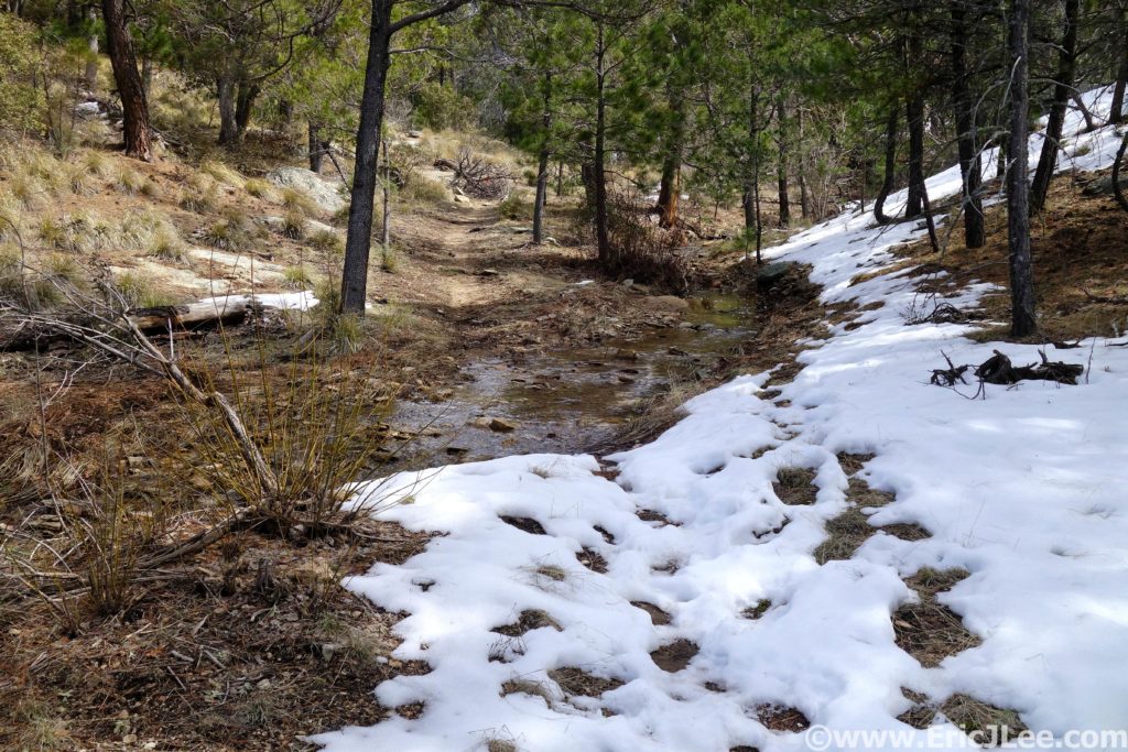
The winter of 2018/2019 has been great for skiing, but it’s also seen most of the trails in my home town of Boulder covered with snow/ice and temperatures just cold enough that things have never quite thawed out (which they normally do). In need of a little desert therapy I booked a quick weekend get away to Phoenix/Tucson. This would also give me a chance to knock out another one of my National Park ultra marathons, Saguaro National Park, which borders right up to the city of Tucson. As I started researching routes in the park I was astounded to realize that the park covered a huge diversity of ecosystems; from the desert lowlands covered in its namesake Saguaro cacti, through pinyon and juniper forests to the summit of 8666ft tall Mica Mountain complete with snow and ponderosa pines. Thanks to a little local insight from trail guru Benedict Dugger and the Tucson Trail Runners group I mapped out what looked to be a spectacular 38mile Figure-8 loop that covered a large portion of Saguaro East. A last minute surprise found me able to convince fellow Colorado runner Helen Cospolich to join me for the adventure.
Hiking our way up Picacho Peak, there are a few cabled scramble sections, but the conditions were phenomenal.
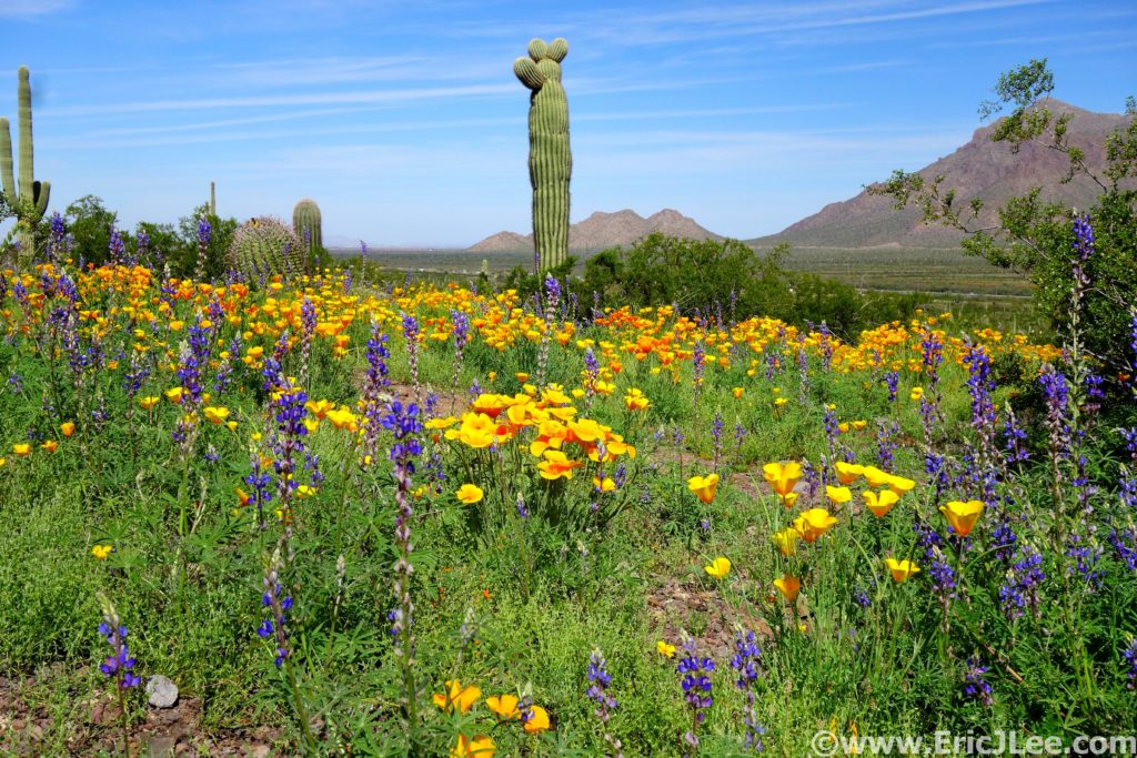
I flew out to Phoenix first thing Saturday morning and hit the ground running…literally. I grabbed Helen from her hotel and we headed straight for Picacho Peak State Park for a little warmup jog. The park was crowded, but we were in for a very special treat, as the winter’s unusually high precipitation had turned the park into a carpet of golden poppies and lavender lupine. We spent almost as much time taking photos as hiking and running. When the desert blooms it’s a truly spectacular sight, as the entirety of the landscape turns a vibrant green and wildflowers mingle with spiny succulents. After our morning tour I couldn’t help but head out for an afternoon run up Wasson Peak in West Saguaro National Park. It felt soooo good to simply run on trails again. The colors in the park weren’t peaking to the same level as Picacho Peak, but beautiful displays of wildflowers and smooth flowing single track made for a wonderful loop. Then it was back to the hotel to plot and scheme for the big adventure the following morning.
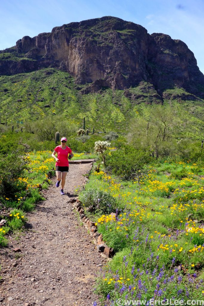
Desert bursting with life, lupine and poppies carpeting Picacho Peak State Park, 3/19/19.
Helen cruising around the Nature Trail in Picacho Peak SP, how can you not be giddy with trails like this, 3/9/19.
Trail running along the Sendero Esperanza in Saguaro National Park West, 3/9/19.
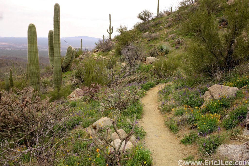
Sunday morning (3/10/19) Helen and I set out from the Broadway trailhead in the NW corner of the park, cruising our way through a network of trails, surrounded by giant Saguaro, crossing flowing washes (water!) and just ambling our way up to the Carillo and Three Tanks trails (3.2mi). Then the climbing started, up into the foothills of Saguaro we went. The trails were beautifully runnable, lined with an assortment of desert succulents and fields of greenery surrounding the babbling creek that was filling the desert with life. As we made our way up the Three Tanks trail and onto Douglas Springs the cacti gave way to rolling grasslands dotted with pinyon and juniper, slowly transitioning to ponderosa pine forest as we passed the Douglas Springs campground (10.2mi +1mi of detours).
Helen running up the Carillo trail in Saguaro National Park, 3/20/19.
Water flowing in the desert making everything super green this year, 3/10/19.
The Douglas Springs trail, out of the Saguaro zone and into the grasslands, juniper and pinyon, 3/10/19.
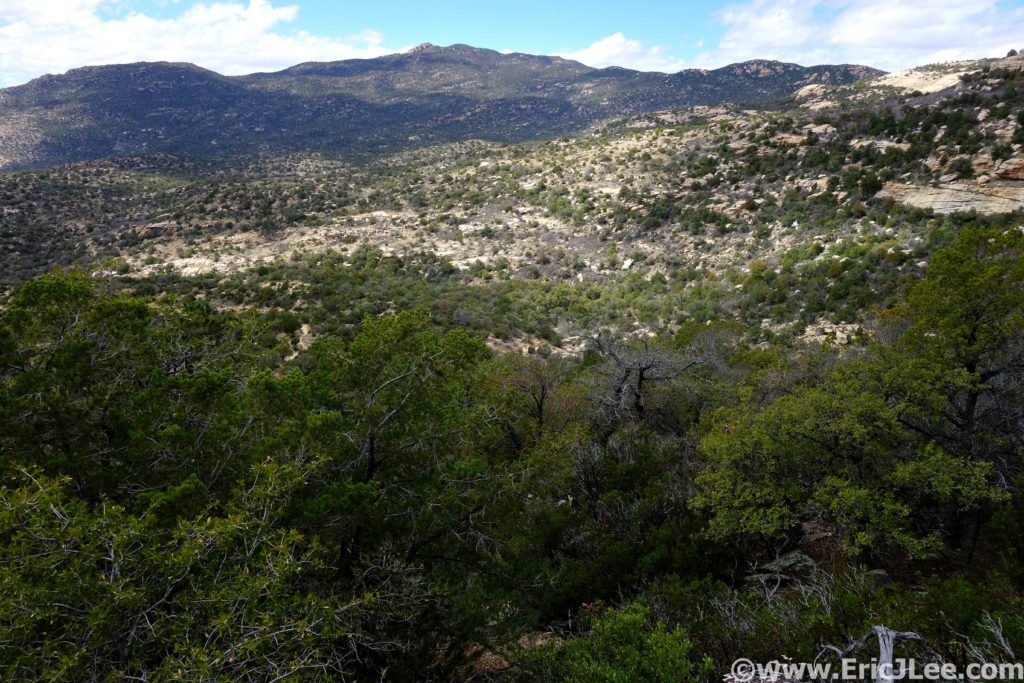
Here’s where the real climb began, 1400ft over the next few miles on a somewhat overgrown trail covered in manzanita and catclaw (ouch!) to the 6100ft Cowhead Saddle. This would be the middle of the Figure-8, and the next section was all business. The trail grinds its way up through ponderosa pine forest, passing jagged rock out croppings, and expansive views of the Sonora desert surrounding the mountains on all sides. The wind was really starting to whip through the trees, and boy was it chilly. Helen, opted to turn back and cut it a bit shorter (the trip was promising to run longer than the mapped 38miles). Around 7500ft the snow began, just a few small patches at first, but as I neared the summit of Mica Mountain I found myself more often on snow than not. Thankfully the tracks were easy to follow and the snow held my weight, soon I found myself atop 8666ft Mica Mountain (17.3mi +1.9mi of detours). There weren’t any views to speak of unfortunately as the summit was densely wooded, so I jogged on down the Mica Mountain trail toward Manning Camp.
Ponderosa forests high on Mica Mt, and a little bit of snow, 3/10/19.
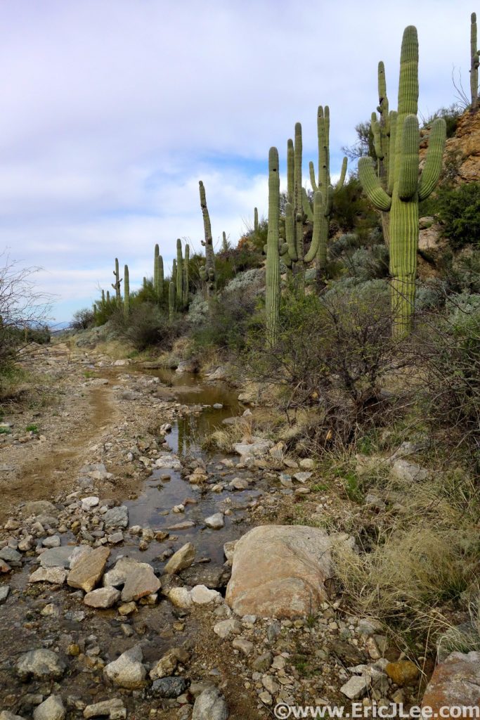
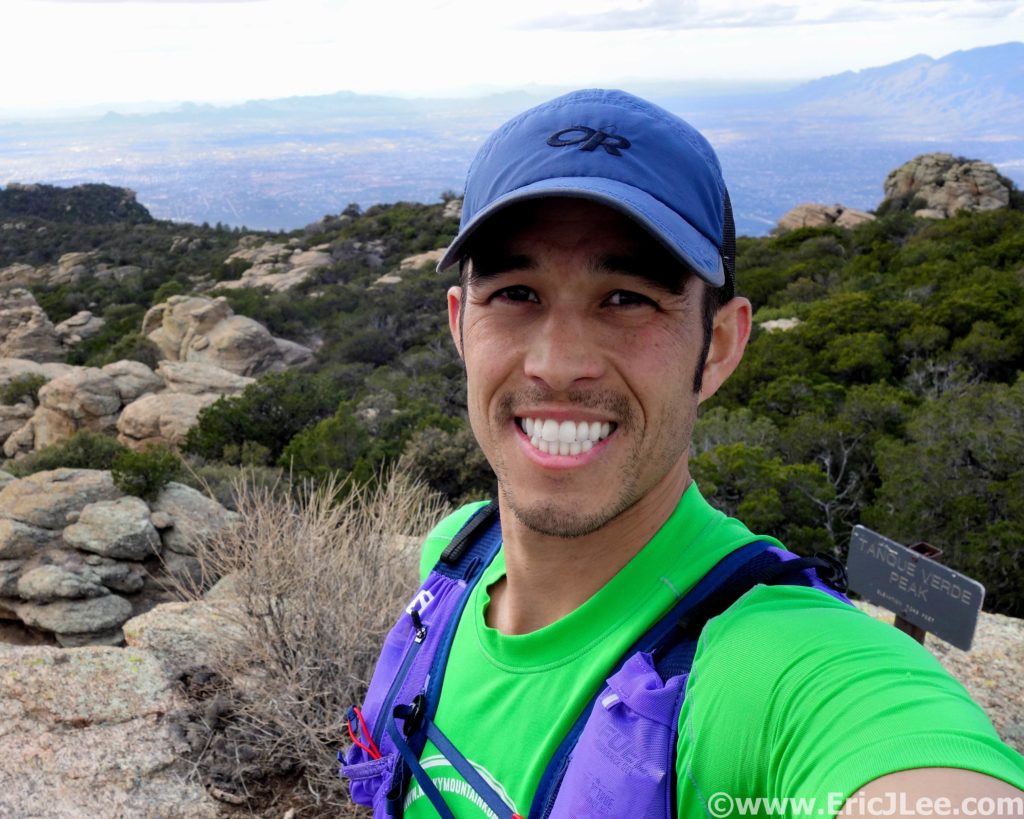
I followed the beautifully clear Chimenea creek down the mountain (refilled water) through now slushy snow to the cabin at Manning Camp, then on down down down the Manning Camp trail to Grass Shack Camp (23.6mi +1.9mi of detours). Trail was fun and technical as it zig zagged its way down the steep hillside back into more arid desert terrain. I washed off in the creek at Grass Shack camp and started the climb back up to Cowhead Saddle and Tanque Verde Peak. The temps were cool and the trail pleasant, but the miles and elevation were starting to take their toll, my poor road legs definitely weren’t in shape for this. The first stage of the climb to Cowhead Saddle went by quickly, but the rolling climb up to the summit of the Tanque Verde ridge was a grind. I felt like I was moving in slow motion but, finally I hit Tanque Verde peak (28.1mi +1.9mi of detours), a bit exhausted, but excited that I was done with most of the uphill, downhill running has always been my thing.
Looking over at Tanque Verde Peak from the Manning trail, oy that’s far away, 3/10/19.
Summit of Tanque Verde Peak, happy to finally be going downhill, 3/10/19.
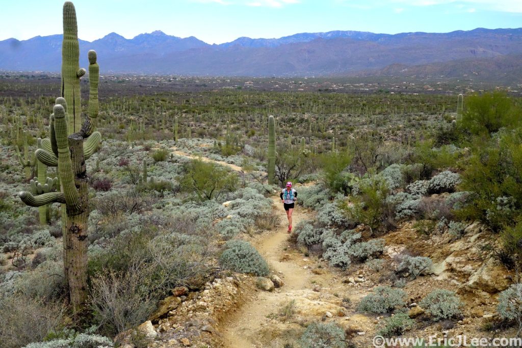
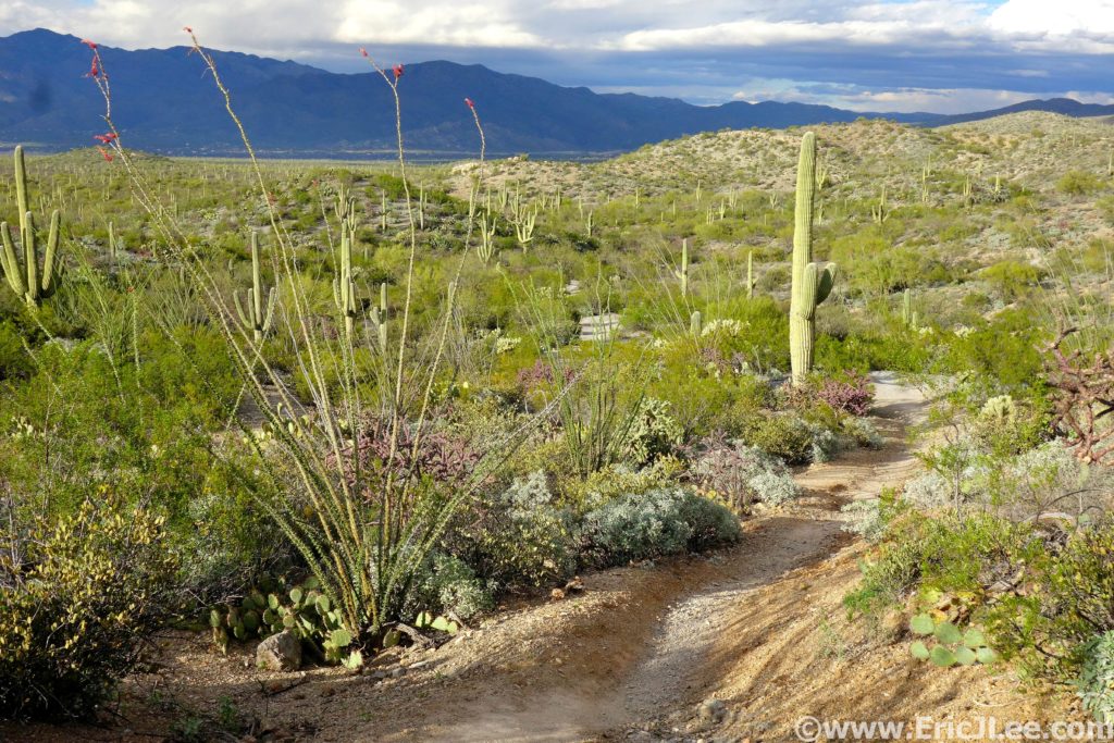
The descent down Tanque Verde peak was long and far more technical than I’d expected, rocky enough to slow the pace, many sharp turns that took one out of any rhythm, and the ever present sharp pointy desert flora threatening to impale one if you happened to stray from the trail even just a little bit. The miles were starting to drag on, but Tucson was slowly getting closer. Past Juniper Camp, and back into the desert, which was bursting with greenery and life, at last I saw the parking lot marking the 5mile to go point of the run (36.7mi +1.9mi of detours). Back down in the desert the afternoon sunlight cast beautiful shadows across the landscape, ocotillo were blooming and the massive Saguaro towered all around. I set out to run every step of that final 5miles across the Cactus Forest trail. Even though I was moving pretty well, the miles seemed to move by sooo slowly. When I finally hit the 2mi to go road crossing I pushed my legs a bit, crushing some 8:30 miles (ha!), and collapsing back at the trailhead 10h59min after we’d set out that morning. Total stats were 43.75mi (1.9m of detours), 9300ft of elevation gain, high point 8666ft, low point 2713ft, lots of cacti seen and my 14th National Park Ultramarathon completed.
The gauntlet of sharp pointy things on the way down the Tanque Verde ridge, 3/10/19.
The desert was bursting with life this spring after some heavier than normal winter rains, 3/10/19.
Back in the Sonoran desert, blooming ocotillo and Saguaro cacti everywhere, 3/10/19.
My run through Saguaro National park perfectly encapsulates why I started my National Park Ultra Project. It was a park I knew very little about other than it had giant Saguaro cacti and was a desert. I never expected to be climbing to the summit of a snow capped mountain, crossing numerous streams and rivers, get startled by white tale deer crashing through the brush, or taking photos of blooming poppies, lupine, prairie clover, evening primrose and globemallow. Our National Park system as a whole covers a huge array of beautiful places with unique ecosystems, but within a single park there is often so much more than its name sake implies for those willing to take their adventure beyond the visitor centers and paved nature trails. I can’t believe it’s taken me this long to explore the trails of Tucson and Phoenix, but I will definitely be back. It’s a perfect escape for those of us living in snowy winter climates, because who doesn’t need a little desert therapy once and a while (and good Mexican food!). Special thanks to Helen Cospolich for enduring my slightly longer than advertised run and keeping me company for many miles, Benedict and the Tucson Trail Runners for all the advice. To Vfuel for keeping me energized through all these long unsupported adventures, Adam Engel at Waldron’s Peak for helping fix my arm (still a work in progress) and Myriam Desrosiers massage for taking care of my aching muscles. Next up the Boston Marathon in April and Mammoth Caves National Park in early May! The adventure continues….
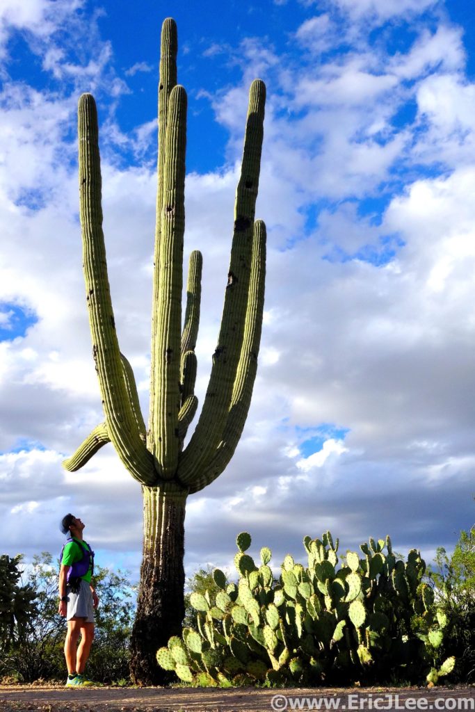
The Saguaro are very big, and I am very small. Approx 100year old cacti.