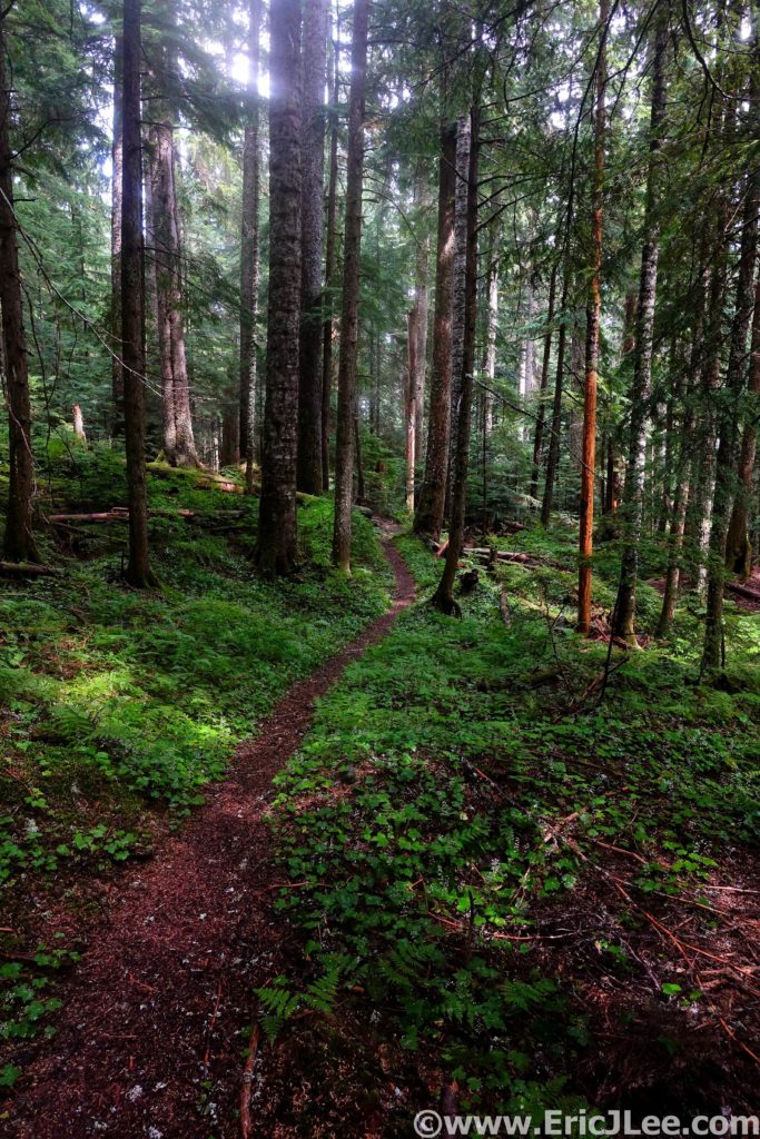
A collection of my reports documenting my project to map out and run an ultra distance route in every single US National Park that highlights the best of what that park is.
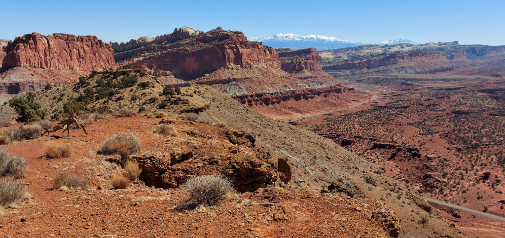
Capitol Reef from near Torrey with the Henry Mts in the background.
Utah has 5 National Parks, each encompassing a unique and amazing landscape. Of those 5, Capitol Reef definitely gets the least attention, and so many people are missing out. Take the slot canyons and washes of Zion, throw in a few arches and the cherry on top is the amazing geology of the 100mi long Waterpocket fold and you’ve got a slickrock wonderland, full of hidden passages and deep and narrow canyons. Capitol Reef National Park may not have just one thing that wows people or that draws tourist from around the world, but spend a little time there and you’ll start to unravel the mystery and magic that makes this National Park so spectacular.
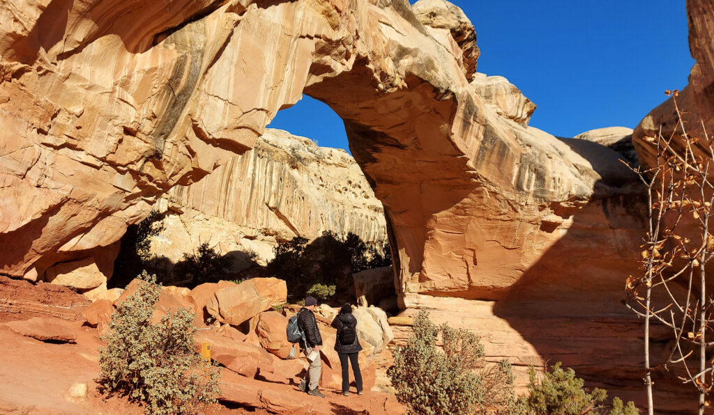
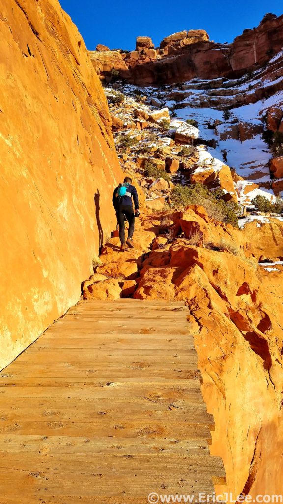
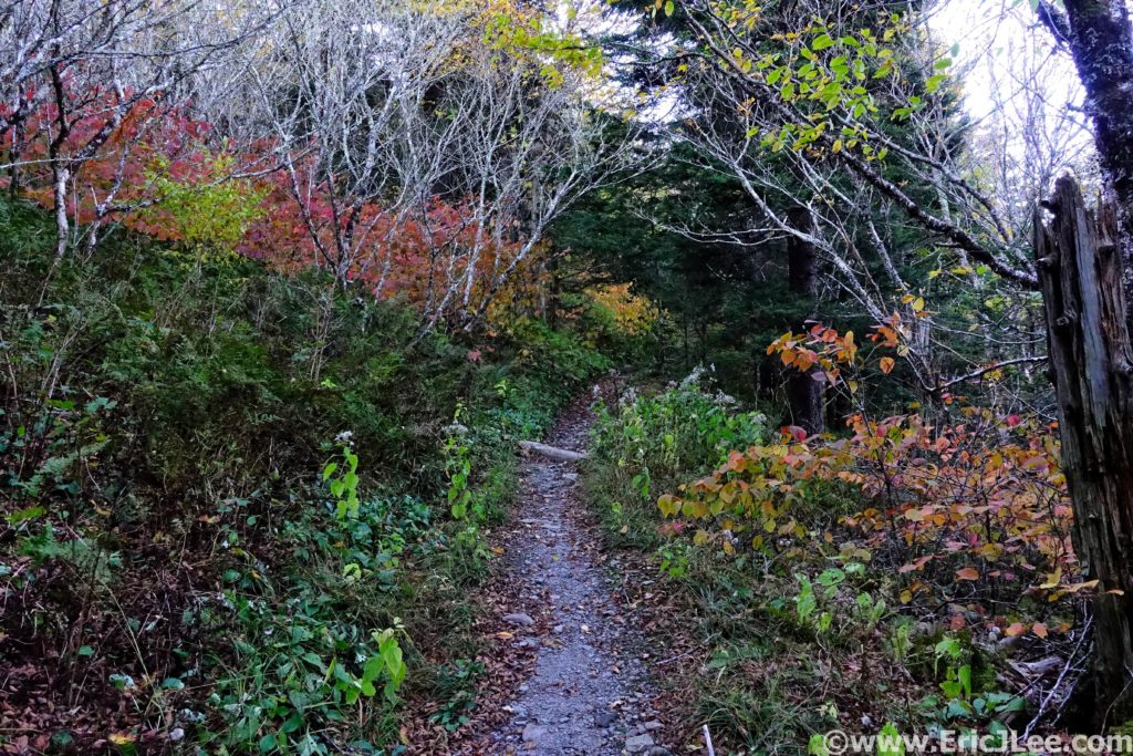
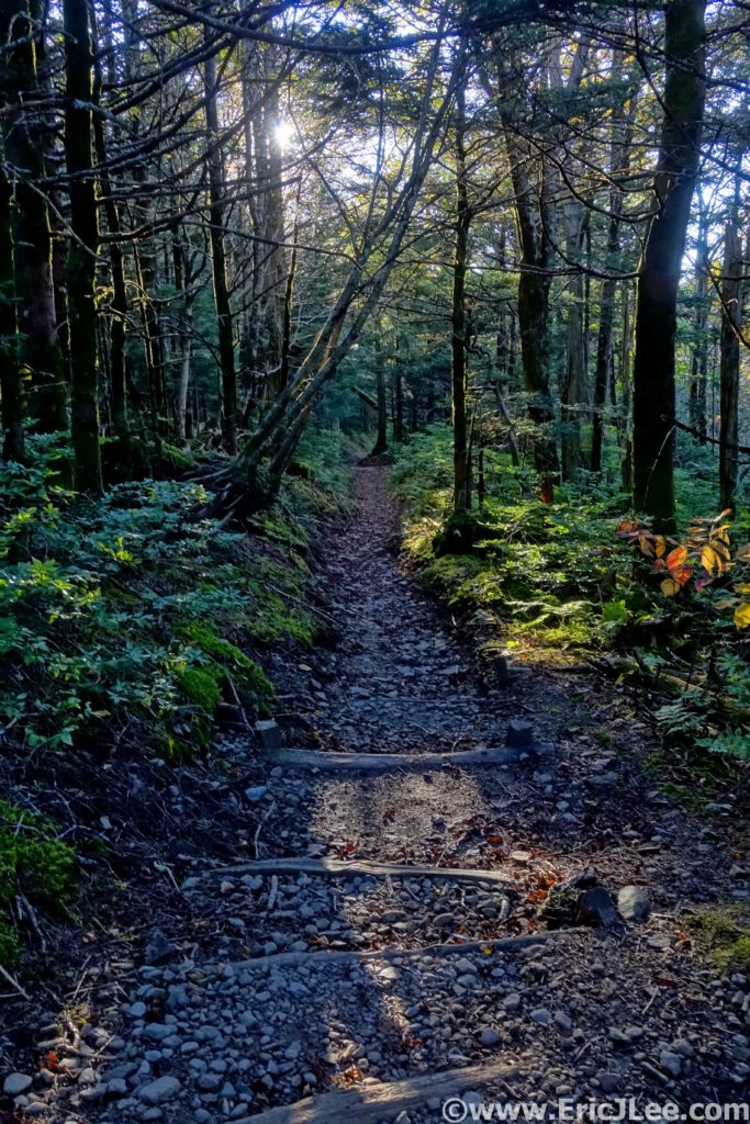
I started my Capitol Reef NP run from the Visitor Center along Sulphur Creek, jogging South along the park road, across the Fremont River and starting up the Cohab Canyon trail. The trail quickly climbs along the cliffside, breaking a gap in the wall the trail enters a high canyon cutting into the heart of the reef. My first destination was Hickman Bridge, a well known natural bridge the trail passes right under. Looping back to Cohab Canyon, I quickly turned off onto Fryingpan Trail, climbing up to the top of the reef. The Fryingpan Trail undulates along the top of the reefs, rims of the slot canyons and across the top of the reef. Eventually dropping down to the iconic Cassidy Arch and into Grand Wash.
Hickman Bridge in Capitol Reef NP.
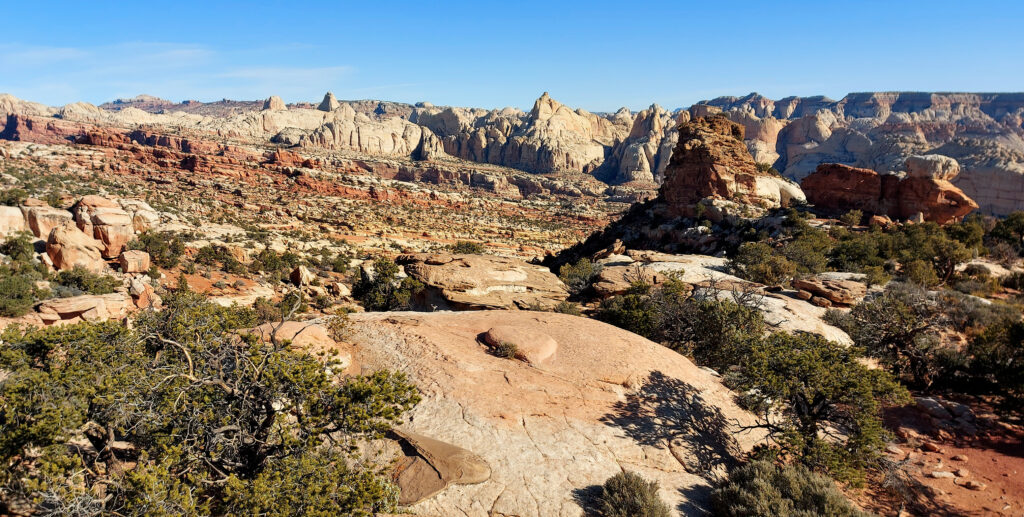
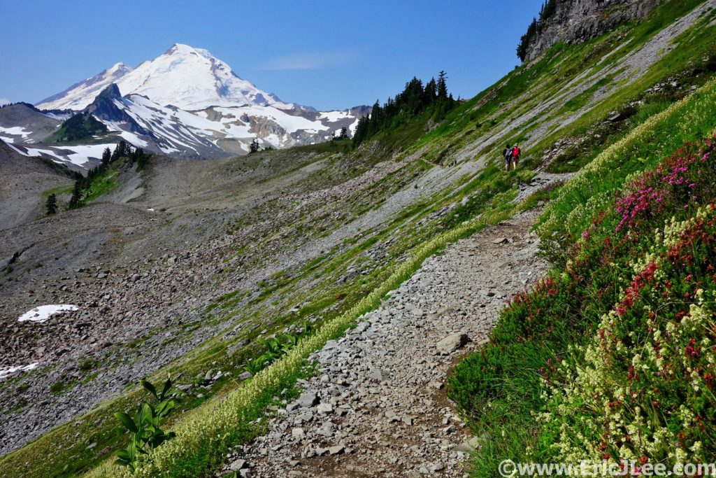
Views along the Frying Pan Trail in Capitol Reef.
Grand Wash’s massive walls rise hundreds of feet above the 20ft wash, terminating at the Fremont River. After a quick water and food resupply at the road crossing, I setup for the first technical obstacle, the ford of the Fremont River into Spring Canyon. The water was very chilly, about thigh deep and moving with some speed. Once across I bushwacked my way into Spring Canyon, and started the slow ascent up the 25mile long Spring Canyon. Trapped deep within the canyon, with no easy exit for 10mi, it’s a very quiet and isolated place in the heart of Capitol Reef, only a few miles from the park road. Soaring white and red sandstone walls, massive spires, narrow slot canyons and lots of hidden nooks. The canyon finally opens up after 10mi near Chimney Rock Canyon, and the trail splits up and over Chimney Rock, which offers fantastic views of the back side of Capitol Reef and towards the Aquarius Plateau.
Grand Wash far below, driveable to the Cassidy Arch TH, then foot traffic only beyond that.
Spring Canyon’s long twisting hallways are seldom visited, but easily accessed from several sides.
The view from Chimney Rock back down towards Spring Canyon.
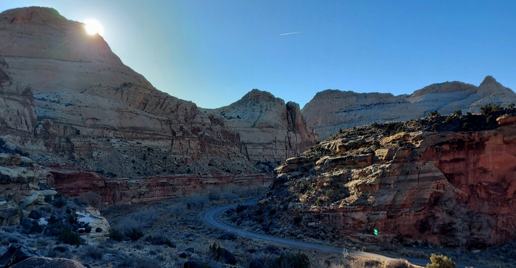
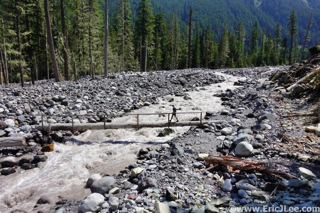
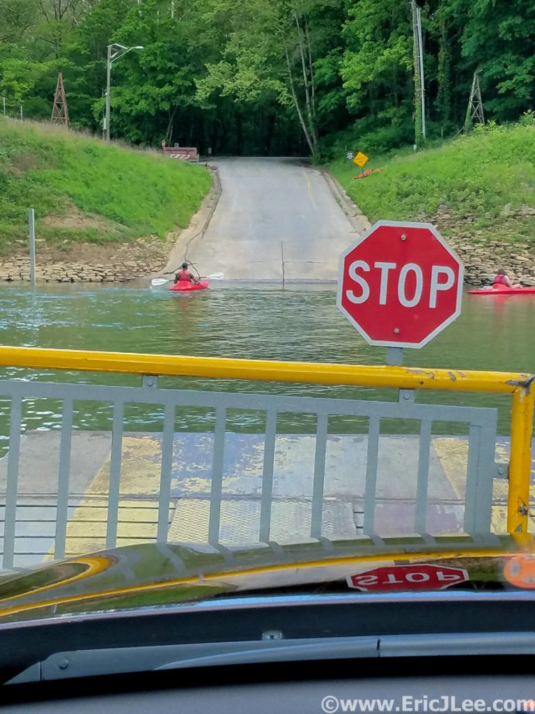
At the Chimney Rock TH my route crossed the highway, and the next section of the Capitol Reef adventure loop began, descending into Sulphur Creek. Sulphur Creek is carved by a cold water natural spring, deep into the eroding mudstone. After passing through the wide portion of the upper canyon, the creek bottom begins to narrow and takes on a more slot like appearance. As the canyon slots up, the options for travel become fewer, and one finds themselves splashing alongside the creek and scrambling on the cliff edges. All of a sudden I rounded a corner and came face to face with the swim, a 8-10ft wide, 50ft long chest deep pool. I undressed, packed all my gear into my drybag and waded into the chilly water. I cruised through and back into the sunshine, redressed and continued down the narrow fluted heart of Sulphur Creek Canyon. After climbing down the final small waterfall the canyon widens back out and terminates back at the Visitor Center.
Entering the narrows of Sulphur Creek. The water starts out avoidable…for a bit.
The final obstacle in Sulphur Creek, a short 4ft downclimb around this waterfall.
30mi and 7h later, I’d completed my ultramarathon loop of the Central Capitol Reef region. A fantastic mix of trail running, adventure, solitude and stunning scenery. With short car shuttles one could easily break the run into three distinct pieces. The Visitor Center to Grand Wash, Grand Wash through Spring Creek to Chimney Rock TH, and Chimney Rock TH through Sulphur Creek. Each section offers a unique, yet stunning view of Capitol Reef’s beauty; the lonely canyons, massive arches/bridges, sculpted walls, and intricate uplift of the reef formation.
After going for a little swim through the narrows of Sulphur Creek. The water is chest deep and chilly.
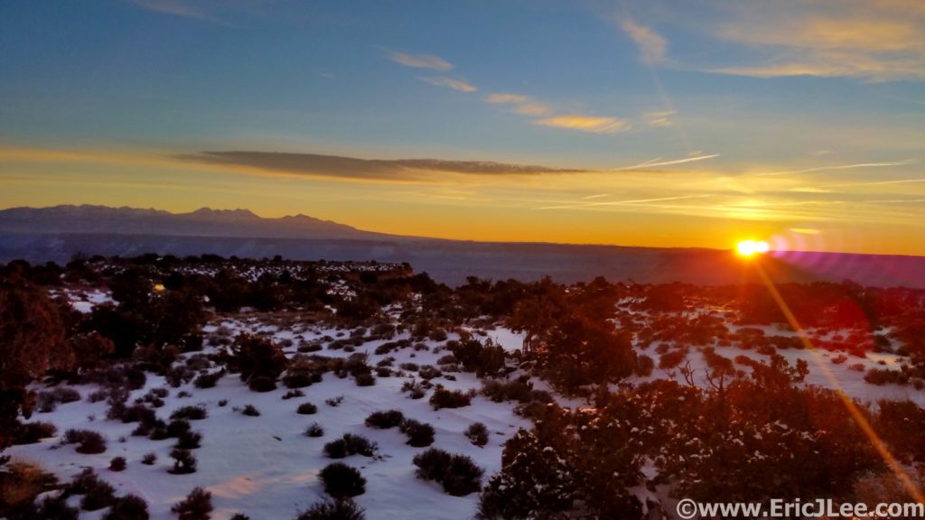
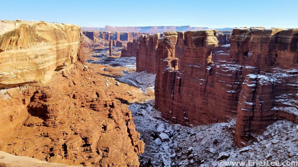
Sunrise from the Island in the Sky in Canyonlands, 1/2/21.
Better late than never? It’s been a whirlwind of a year and 8 months later I’m finally catching up on my early year projects. Winter motivation is often a hard thing to inspire, but the desert has definitely been my oasis in this department. Adler, Owen and I headed to Utah for New Years. After a couple of cold days in Central Utah exploring Capitol Reef (the next blog to come!) we made our way back to Moab for the next installment of the National Park Ultra series, Canyonlands Island in the Sky.
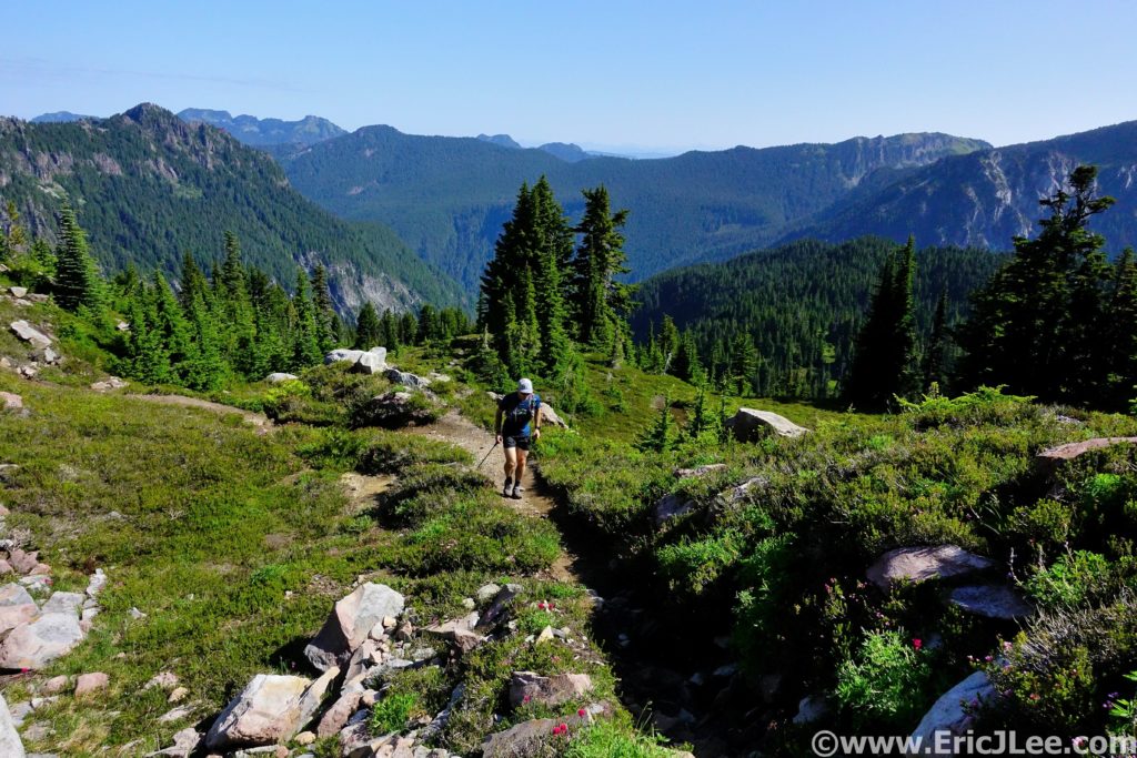
Canyonlands is divided into three distinct districts by the Colorado and Green Rivers; Island in the Sky to the North, Needles to the SE and The Maze to the SW. When I started my project to run an ultra in every National Park I decided that some parks just require more than one run, because one really can’t experience each unique landscape without dividing them up, and Canyonlands is a prime example. The Needles consists of a desertscape chopped up by giant rock fins and slickrock canyons, The Maze is just that, a maze of narrow slots and deep chasms that carve up the landscape while The Island in the Sky consists of a high plateau guarded on all sides by imposing walls, dropping thousands of feet down to the rivers below. All three can seem impenetrable at first glance, but improbable breaks in the canyons allow one to move across the complex landscape.
Adler cruising around the White Rim Rd in Canyonlands, 1/2/21.
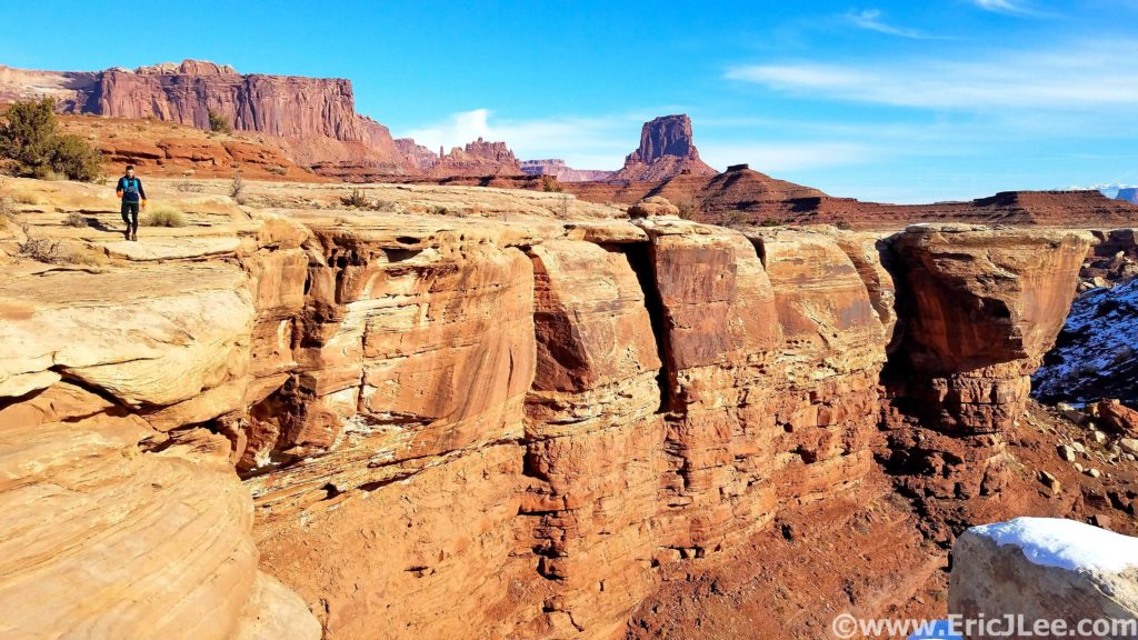
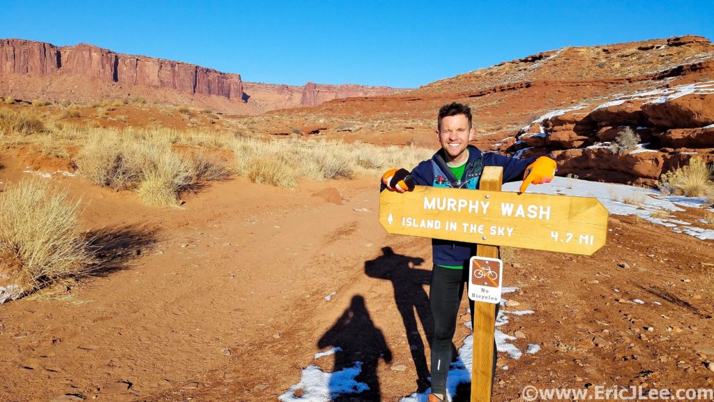
The most well known feature of the Island in the Sky district is the White Rim Road, this 71mile road follows the White Rim sandstone formation as it circles the Island in the Sky, 1500ft below the plateau and 1000ft above the Green and Colorado Rivers. I started my morning at the Murphy Hogback trailhead at sunrise jogging the paved road North as it traversed it’s way through the park. I passed the jam packed Mesa Arch TH and onward to the Lathrop TH where I met Adler and Owen (7mi in).
Descending down the Lathrop Trail into the depths of Canyonlands.
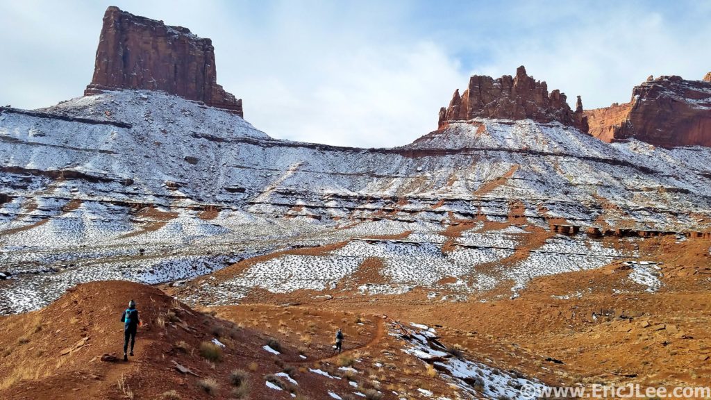
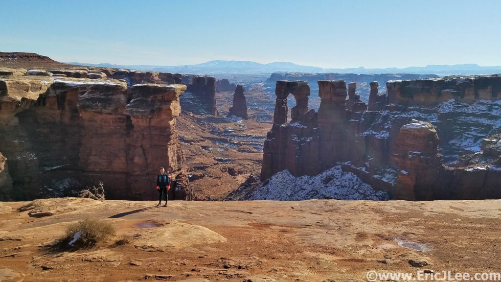
From there we began our descent down one of the improbable trails that switchbacked down the cliff bands into the depths of Canyonlands, 1500ft below. Across this ledge, down this seam, over this talus rock fall and finally down the rim of a small slot to the White Rim. The cool winter air was delightful to run in and we had this region of the park all to ourselves. We hit the White Rim Rd (mm13), bid Owen farewell (as he headed back up to the car), and took off CW on our journey. The White Rim is mostly very cruisy jeep road, trapped between the towering Chinle/Wingate/Navajo sandstone walls above and the Cedar Mesa sandstone below. When you run/ride/drive the road you truly get a sense of the immensity that is Canyonlands, and the isolation that one can find in it’s depths. We continued on the road past the Airport Tower, Washer Woman tower and several immense canyons to our left that dropped to the Colorado River, still miles away. At mm24 we intersected the Gooseberry trail, our only easy bail exit (ie trail) from the canyon. We were still feeling great so forged onward with the long looping traverse around Grand View Point at the head of the Island in the Sky.
A dusting of snow coats Canyonlands, Adler and Owen lead the way.Monument Basin Canyonlands.
A few snack breaks, one floss break above Monument Basin and lots of photo-ops later we finally turned the corner and began to head back North towards Murphy Wash (mm35). The miles were starting to wear on both Adler and I, so we settled into a mixture of fast hiking and jogging, finally reaching our turn back up to the Rim. This run is what I describe as a ‘Pay Later’ run, as with only 5miles to go we had a long sandy wash and 1400ft to climb back to our finish line. The sand felt like cement to our tired legs, but when we finally reached the steep cliff-bands that marked our final ascent back to the rim the hiking actually felt really good after all the flat runnable miles. As we climbed our way up through the different layers of sandstone the views started to expand and the late afternoon light lit up the walls with a reddish/orange glow. We hit the top of the climb right as the sun started it’s descent below the horizon, what a way to end an amazing day in the canyons.
Looking down from the White Rim towards the Colorado River far far below.25mi of White Rim Rd done, back up the Murphy Trail we go!
After a quick high five we booked it back to town to eat every single thing we could get our hands on (9h12min and 43.69mi of running makes one hungry!). On the surface the desert may not have the diversity or grandeur of the mountains, but look a little closer and she just might reveal her secrets to you. The Island in the Sky district is a wonderful example of the diversity of Canyonlands; juniper forest on the high plateau, massive sandstone cliffs, arid slicrkrock and two rivers that create an impassable oasis far below. So many sections of this park are nearly inaccessible to all but the most dedicated, and that’s what makes it so special, you earn what you get, and nothing is easily given up. Huge thanks to Adler and Owen for sharing this adventure with me, Vfuel for powering me through yet another 9h unsupported adventure and to being healthy enough to challenge the body in such spectacular ways. Strava Track.
Hiking the way up the Murphy Trail back to the top!
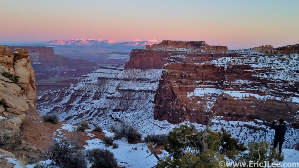
Sunset from Island in the Sky looking towards the Lasals. Winter in the desert is beautiful.
We threw up our hoods, put our heads down and leaned into
the wind as we left the Alpine Visitor Center. The wind ripped across the
Continental Divide and we ran, partly to make good time, partly to stay warm.
An already challenging route promised to be extra challenging on this day.
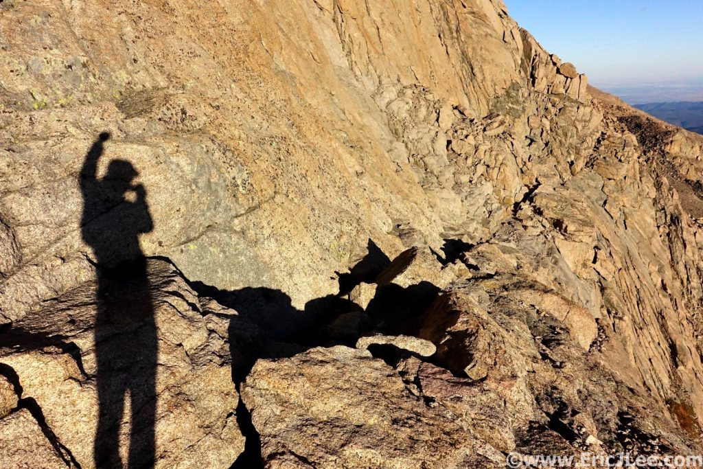
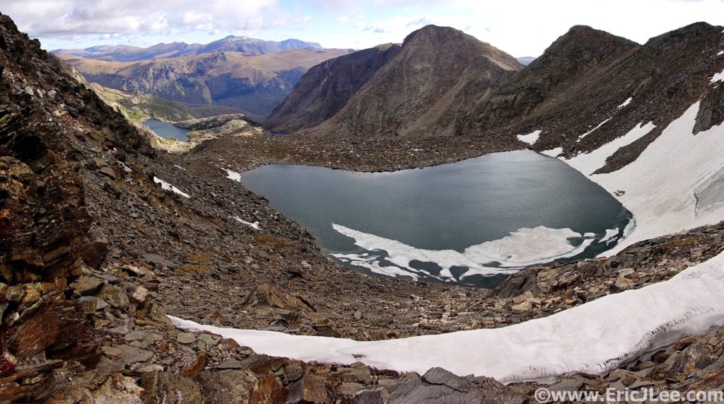
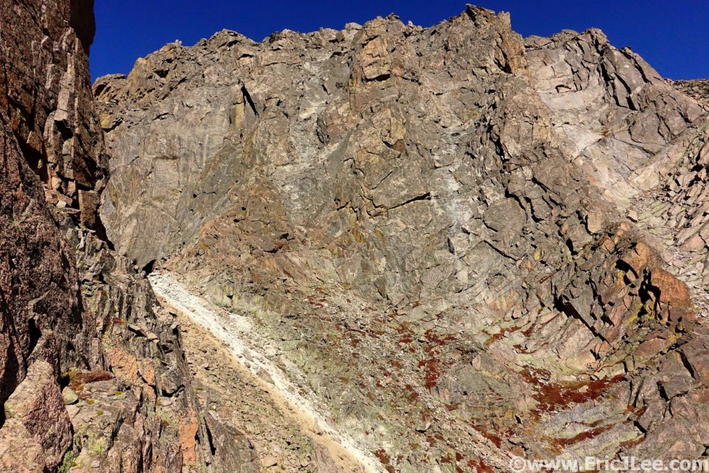
11hours in and I’d made it to the Narrows on Longs Peak!
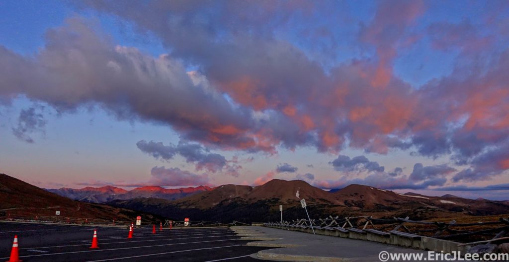
Twelve years after running my first National Park ultramarathon in the Grand Canyon I still hadn’t completed my Rocky Mountain National Park (RMNP) ultra, despite it being my home park. I’d spent a lot of time debating the best route, settling on a ridge traverse through the park’s interior. The difficulty of the route was that almost the entire route was above treeline, holding snow late into the summer and being exposed to thunderstorms for most of the summer. My friend Ben and I picked a nice clear crisp September day (9/22/19), the one factor we didn’t count on was the wind. As we traversed the Ute trail along the Continental Divide a bone chilling wind howled from the NW.
Sunrise from the Alpine Visitor Center with the Continental Divide stretched out in front of us.
Following a section of the Ute trail early in the run. Most of the ridgeline was trailless.
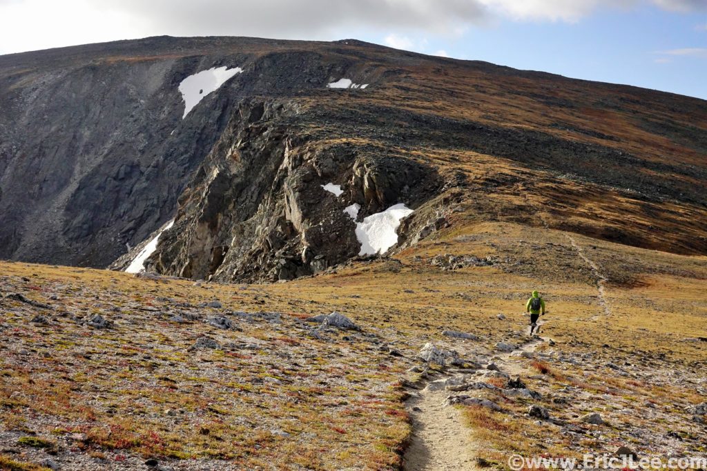
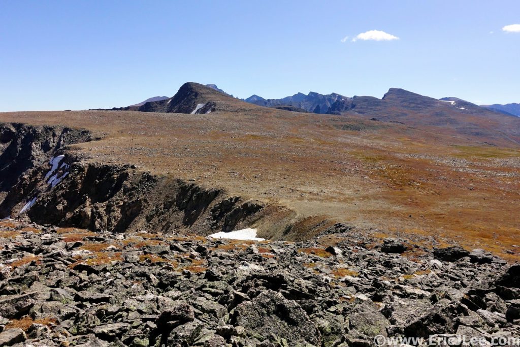
We soon bailed off the trail and onto the ridge proper, where we’d stay for most of the day. As we made our way to Mt Ida, the first summit of the day, we had to duck onto the East side of the ridge to warm our hands and put on all our layers. The wind chill was brutal, and we could barely feel our hands and face. We trudged our way up and over Mt Ida to Chief Cheley (2:11, 7.3mi). Lake Azura and Highest lake were still crusted in ice and the views of the park were phenomenal. This section of the park is one of the most remote and seldom visited, miles from any trailhead and the nearest trail. We put our heads down and continued our trudge into the wind.
Proper Rocky Mountain ridge running near Mt Ida.
Highest Lake near the base of Chief Cheley, with Forest Canyon far below.
Tundra running near Sprague Mountain. Longs Peak still looks really far away (square top)
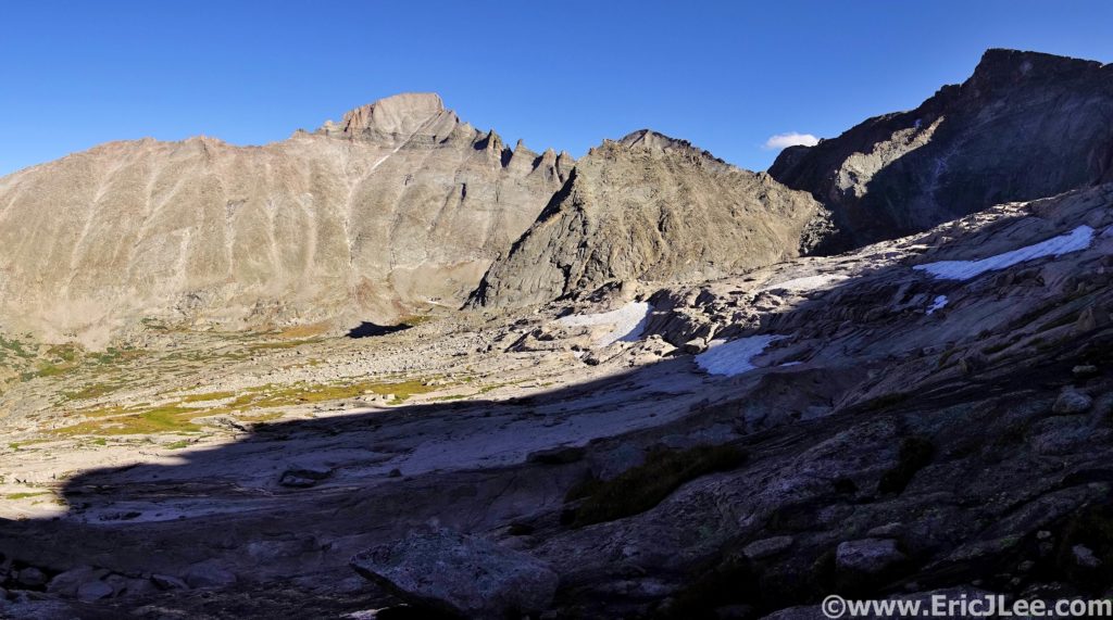
I tagged Sprague Mountain, Gabletop and Knobtop before finally reconnecting with the Flattop mountain trail (5:35, 15.6mi). Ben opted to bail off Flattop back to the car, as the wind was getting worse and there was uncertainty whether the route would go under the conditions. Solo, I crawled my way up Hallett and Otis, barely able to stand without being blown over. As I huddled in the wind block atop Otis peak, I debated my options….. Push on to the technical part of the route (the Class 5 McHenrys Notch), bail down the long East ridge of Otis Peak or return back the way I’d come to the Flattop mountain trail. Being over halfway across the traverse I opted to push on and try my luck.
Flattop Mountain with Hallet and Oatis in the background.
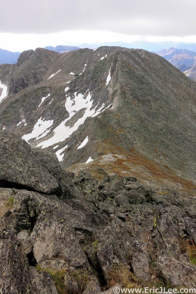
View from Taylor Peak towards Powell with Longs looming behind.
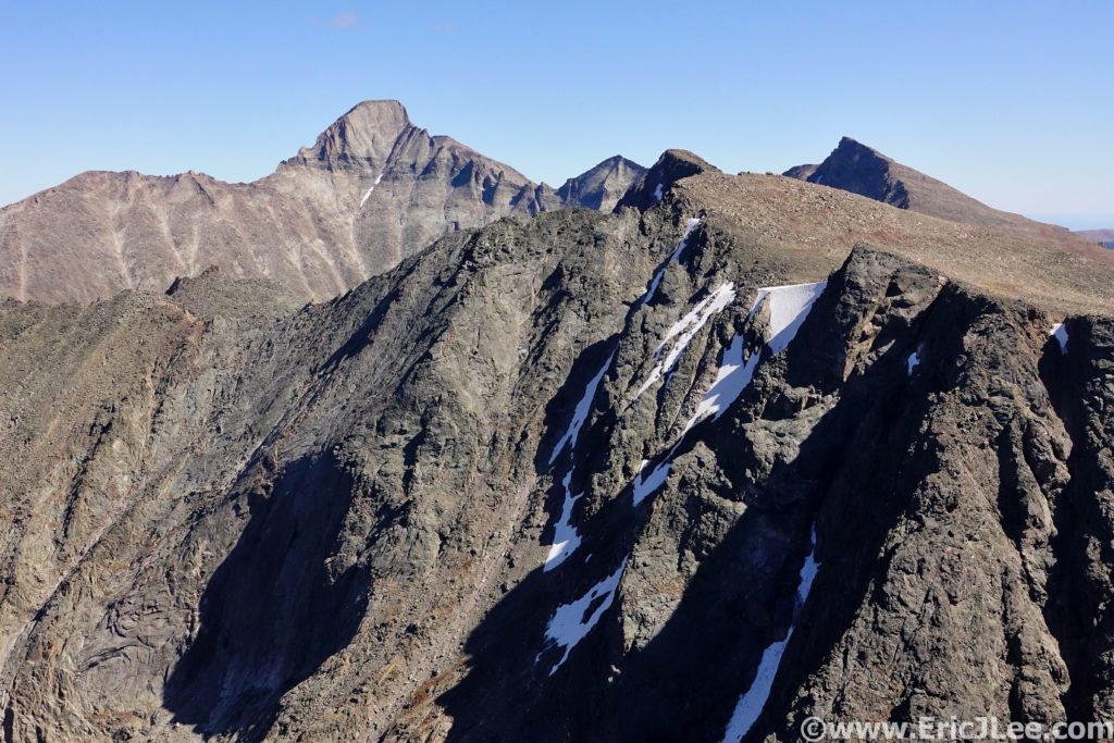
On the long slog up Taylor Peak (the first 13er of the day) my legs were starting to feel heavy, but the wind was actually lessening. From atop Taylor Peak (7:21, 19.1mi) I peered down on Skypond far below, and for the first time all day it looked as though the traverse would actually go! The traverse over to Powell Peak went slowly, but soon I found myself on the summit staring down the SE couloir, ready for the fun to begin. I descended a little over 200ft and located the grassy ledge system to skier’s left that would allow easy passage to McHenrys Notch. From McHenrys Notch the route is obvious, but far from easy. Directly across the Notch are two vertical Class 5 gulleys that lead to the NW ridge of McHenrys Peak.
Looking into McHenry’s Notch. The two gulleys in the middle are your class 5 options to reach the ridgeline above.
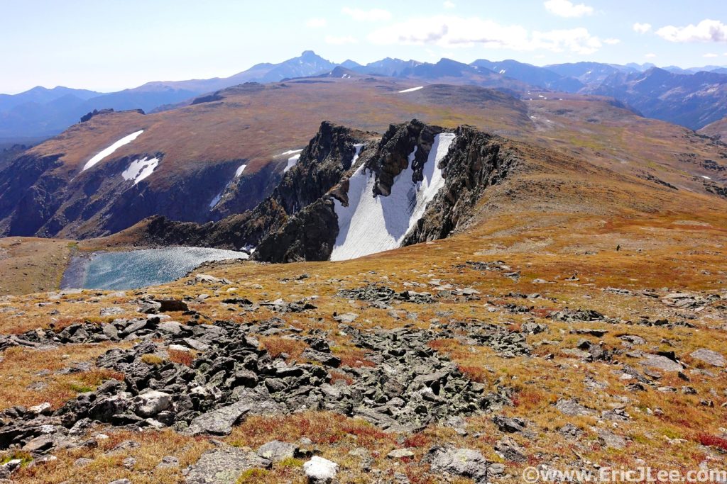
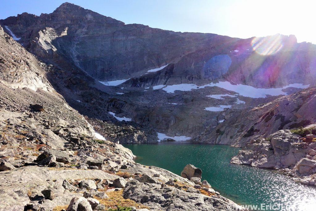
I scrambled my way up the lefthand ledge system to the broad ledge on the South side of the peak, and finished the easy traverse over to the summit of McHenrys Peak (8:39, 21.3mi). It felt great to have surmounted the crux, until I looked across Glacier Gorge at Longs Peak, oy vey, I still had a long way to go. I picked my way down through the talus field to Stoneman Pass (not the low point, but the first notch) and descended into Glacier Gorge. This would be the only time I descended into the valley. Glacier Gorge (especially the upper section) is an absolutely magical gem and one of the most iconic hiking destinations in all of Rocky Mountain National Park. Sheer granite faces surround one on all sides, Arrowhead and Spearhead jut abruptly out of the middle of the valley and numerous alpine lakes have carved out depressions amongst the barren white landscape.
Looking across Glacier Gorge from Stoneman Pass. The Trough is the obvious gulley that ascends just right of the Longs Peak summit block.
Frozen Lake tucked in the shadows of Chief’s Head Peak.
I refilled my water in one of the side streams, crossed over the head of Frozen Lake and made my way to the base of the Trough, a 2500ft gulley that swoops its way from Glacier Gorge up to the West face of Longs Peak. I felt like death as I crawled my way up through the talus and slabs just climbers right of the gulley. Time seemed to be passing in slow motion, 100 vertical feet at a time. At last I pulled myself through the windy notch at the top of the Trough and out onto the Narrows. For as many times as I’ve climbed Longs (30?), this was the first time I’d been on the Keyhole route in non-winter conditions alone. I pulled myself up the Homestretch and onto the summit block (11:16, 24.4mi), collapsing with exhaustion, but also with a smile on my face. It was 6:15pm, I was the only person on the summit, the wind had stopped, and long shadows draped themselves across the park.
Feeling like death as I slog my way up the Trough towards Longs.
The shadows of Longs Peak stretching East into the foothills.
After taking a few long breaths in, I knew I had to get moving, sunset was only an hour away, and I wanted to be below the Loft before it got dark, so back down I went, dropping down Keplinger’s couloir, ascending up past Clark’s Arrow and into the Loft between Longs Peak and Mt Meeker. I summitted Mt Meeker just as the final rays of warm sunlight disappeared over the shoulder of Pagoda Peak (12:04, 25.6mi), bathing the talus in a soft orange glow. I took off at a fairly rapid pace down through the talus, in search of the climbers ledge that would lead below the cliffs. As the light began to fade, I started to panic a little bit as I hadn’t reached the climbers trail yet, but luckily, as the last bit of daylight turned to darkness I spotted the trail just below me. Once on the ledge I knew I would be able to navigate myself back down to trail, and in the end the Longs Peak Trailhead.
The Pallisades guarding easy entry to the Loft, down and around I go.
Sun flare over the shoulder of Pagoda Peak with the Longs Peak summit block on the right. What a day.
Progress was slow as I picked my way down the Class 3 slabs and into the talus below. Once I reached the trail in Chasm meadow I was finally able to jog again….it had been over 13miles since I’d last been on trail, so being able to slowly jog felt wonderful. Tired, beat down and totally satisfied I took my time jogging down the Longs Peak trail back to the trailhead. At 8:45pm, 13:46 after leaving the Alpine Visitor center early that morning I stumbled my way onto the pavement, sat on the bench and hung my head in exhaustion. I had only covered 30.6mi and 12000ft of vertical gain, but it had taken 13h46min and I was worked.
At first glance Rocky Mountain National Park may look just
like the rest of the Colorado Rockies, but for those with the time and energy
to delve a little deeper into it’s depths, the rewards are some of the most stunning
scenery anywhere. From the 2000ft high Diamond of Longs Peak to the glacial
carved valleys of Glacier Gorge, Sky Pond and Dream Lake to the deep forests
teaming with wildlife of the North Boundary; RMNP has it all. I chose my route
because it showcased some of the most remote sections of the park, the high
alpine terrain, the crystal blue lakes, the glacial carved valleys and of course
Longs Peak in all her majesty. There are countless number of adventures within
the park, but for me this route offered a taste of all the best. For those looking
for something less committing I highly recommend the hike to Glacier Gorge and
Mills Lake, Dream Lake and Emerald Lake and for those with summit fever and some
scrambling skills Longs Peak.
This route, being a point to point was not possible without the help of a couple of good friends. So a special thanks to Michael Hodges from McGregor Mtn Lodge for helping with the car shuttle and to my friend Ben for the company on the first half of the loop and for waiting patiently at the end for me to slog my way home. And as always a special thanks to Vfuel for keeping me trudging along through such crazy adventures. My RMNP traverse was National Park Ultra #20, and I completed #21 only 3 weeks later in the Great Smokey Mountains. Even after all the time, suffering and misery I can say I’m super excited to see where this project continues to take me.
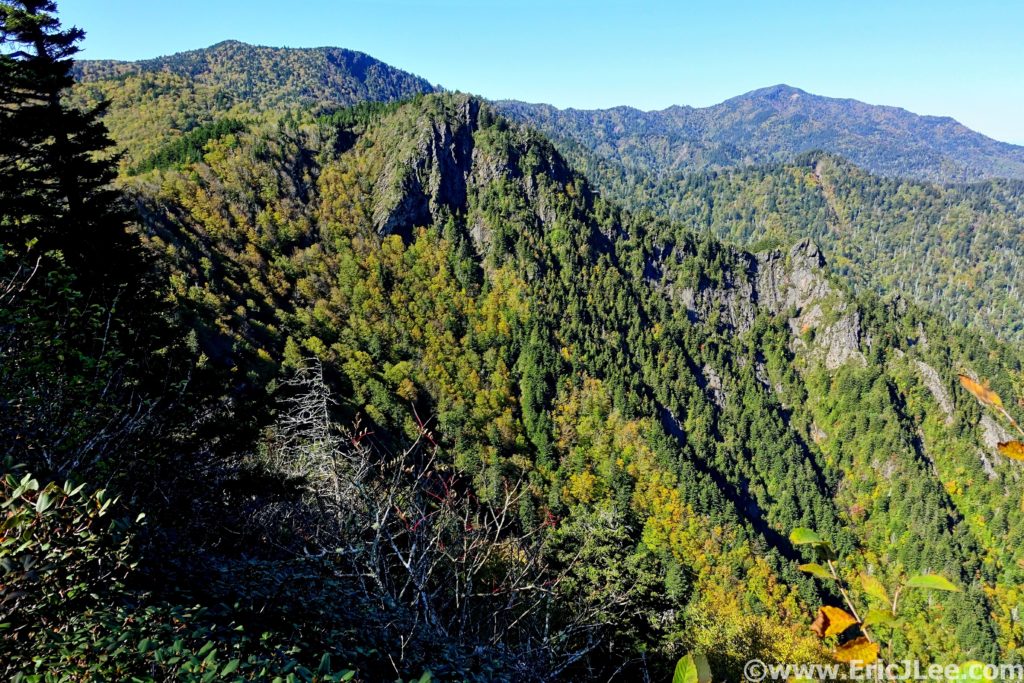
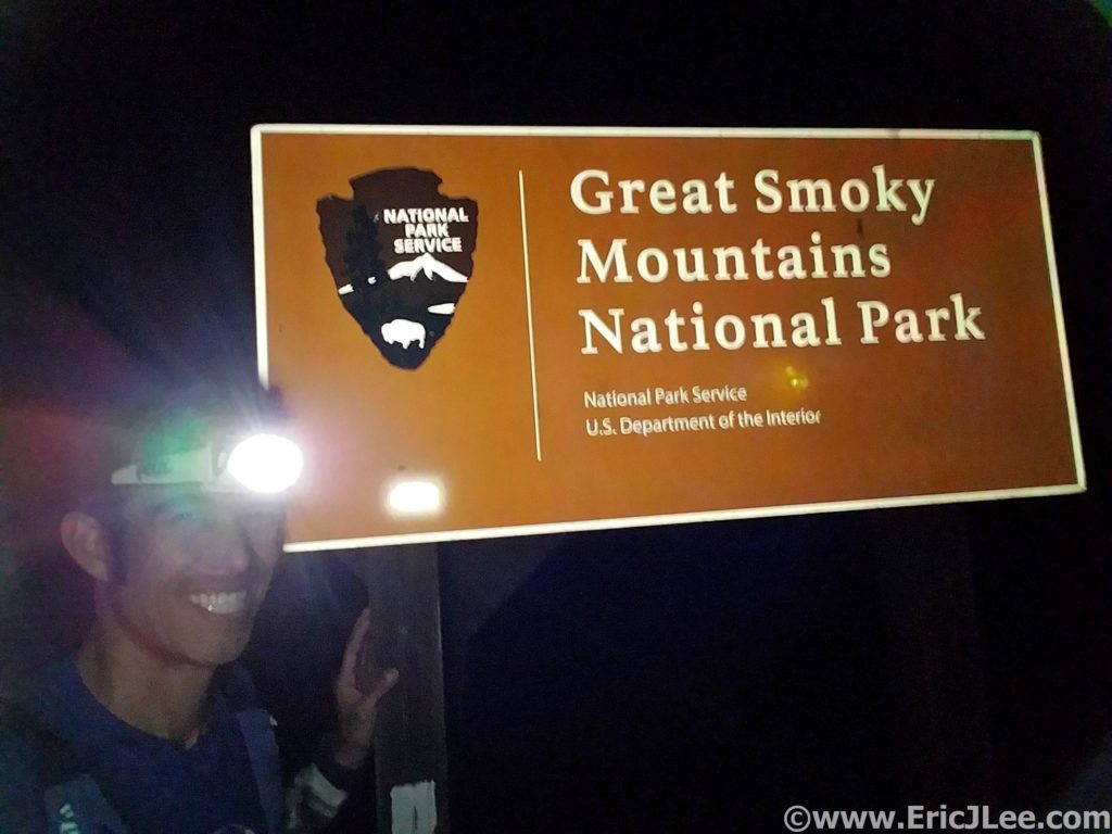
Well here goes nothing…. At 5am I set off into the darkness, slowly climbing my way up from Davenport Gap into the silence of the hardwood forest. It was Oct 14th, just over a month after my disappointing race at Ultra Trail Monte Rosa, a very unfulfilling would be end to a big year of training, so I immediately went searching for the next big challenge. Naturally my National Parks project came to the forefront, and at the very top of that list was the “Smokies Challenge Adventure Run” (SCAR). If you’re not from the East Coast I totally get your confusion at the name of the route, I was equally surprised when I first came across it in blogs in early 2019.
Pre-scouting Davenport Gap the day before the big dance. Oh boy, oh boy!
In short, the SCAR is a 72mile traverse of Great Smokies National Park from Davenport Gap to Fontana Dam (or the other way) along the Appalachian Trail, it was a logical, aesthetic and seriously challenging line (72mi, approx. 18000ft, current FKT 14h28min). My goal was to simply survive it, experience it, and take a lot of photos (it would be my first time in the Smokies). So as I power hiked and jogged up the hill from Davenport Gap, my head was swirling with doubts… was I trained enough, did I pack enough food/supplies, would the natural springs be flowing, would the weather hold? The only thing I was certain of was that I was in for one hell of an adventure.
First light hitting hitting the Appalachian Mountains in Great Smoky National Park.
A little splash of fall colors along the AT.
The initial climb went by fairly quickly, and as I crested
the ridgeline near Mt Cammerer the first glow of sunrise was showing in the
East (5.2mm, 2:45). Now atop the ridgeline I settled into my goal pace for the
day, hike up each knob/peak, then jog the descents and flats. The trail was a
mix of deep hardwood forest with fleeting views from the various lookouts and
knobs along the trail. Finally, I crested Mt Guyot and jogged my way down to
the Tricorner Knob shelter (15.7mm, 4:10), my first reliable water source. 2019
was a dry year in the Smokies, as such many of the springs had dried up, and
even the ever reliable Tricorner Knob was reduced to a piped trickle, though
just enough to treat a bottle before moving on.
Early morning light filtering through the deep forest.
Tricorner Knob shelter, the trickle of water is on the right.
The route stuck pretty close to the ridge for the next
section, with several beautiful narrow sections of ridgeline where one could
look down both the North and South sides of the ridge. Over Mt Sequoyah, Eagle
Rock, Laurel Top, Porter’s Gap and The Sawteeth. The foliage was several weeks
behind, but the hillsides were dotted with yellows, oranges and reds, just
enough to break up the endless sea of green. As I passed Charlie’s Bunion I
began to encounter a steady stream of hikers. By the time I reached Ice Water
Spring and Mt Kephart there was an almost endless line of hikers strung out
along the trail. Thankfully most people were aware enough to allow me to cruise
on by, and I soon popped out of the woods into the madness that was Newfound
Gap (30.3mm, 7:15).
Splashes of yellow adorn the Great Smoky Mountains.
A little fun rocky single track along the AT.
I knew Great Smoky NP was the most visited National Park in
the US, but I was definitely not ready for crowds. Cars were backed up for a
mile on either side of the pass as many more endlessly circled the parking lot.
By a stroke of luck I was actually able to find my mom, who had offered to meet
me at the trailhead for a food and water resupply. I reloaded my S-lab 12 and
jogged out of the parking lot, quickly leaving the masses behind. I hike/jogged
along the rolling forested AT up towards Clingmans Dome, the high point of Tennessee
and the day. As I neared Clingmans Dome I had my first low point of the day, I
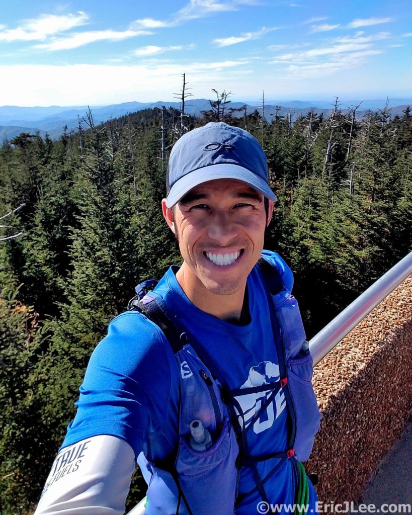
bonked hard, slowly slogging my way up the Clingman Dome fire tower (39.6mm, 10:05).
Selfie atop the lookout at Clingmans Dome, back from the dead….for now.
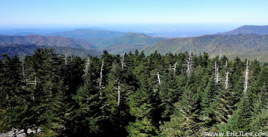
View from Clingmans Dome into Tennessee.
The soft afternoon light makes the forest glow.
The views were 360 degree panoramic and the air was
unusually clear, allowing one to see a long way into both Tennessee and North
Carolina. After taking in the views I again disappeared back into the dense
hardwood forest, losing all the crowds instantly. It was all downhill from
here, literally and figuratively. The trail slowly became rockier, and my legs
were definitely not getting any spunkier. Down, then up, then down again, then
up…. I didn’t seem to be losing any elevation, even though I’d passed the high
point? I finally reached the Derrick Knob shelter (49.3mm, 12:45) for a water
resupply, the pipe was again trickling, just enough.
Derrick Knob shelter, water refill station and new friends.
A little solo silent single track running soothes the soul.
I paused for a moment to chat with the group staying at
Derrick Knob, and the inevitable question came up…”So where are you coming
from”….”Davenport”….”How many days did it take you”……”I started this
morning”……”WHAT?!?!?”. I don’t know why I bother trying to explain, but they
were nice enough to point me in the right direction, so off I went. The light
was slowly fading away, and the end didn’t seem to be getting any closer. The
short steep climbs up Thunder Mountain and Mt Squires were soul crushing, the
last just as the sunset faded away in the West, it was going to be a long dark
road (54.4mm, 15:15).
Sunset from Mt Squire on a long day, with many miles to go.
The miles seemed to drag on, over Mollies Ridge and down to Ekaneetlee Pass. I had been dreading the climb to Doe Knob, though knew it was my last significant uphill before what I hoped would be a cruiser downhill to the Fontana Dam. The power in my legs had disappeared on Thunder Mountain and it took all my concentration just to stay upright and on my feet. The dense forest seemed to wrap the darkness tight around me, and it felt as though there was nothing but me and the trail. Finally, I reached the turn where the AT leaves the ridgeline of the Great Smoky Mts and heads due South (64mm, 17:18). I started to jog down the overgrown track, only to find my legs were jello, and I was struggling to not stumble off the trail with every single step. I finally gave up and settled into a soul crushing 16min/mile stumble down the trail, frustrated I couldn’t run, usually my strength.
Just after midnight at the Fontana Dam, happy to be done, and completely worked.
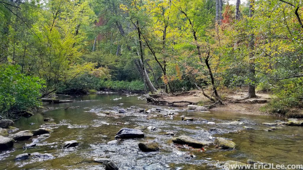
Spending the day after the SCAR quietly recovering along one of the many gentle rivers in Great Smoky National Park.
The miles seemed to pass be excruciatingly slow in the darkness, but at last I popped out of the dense woods at the trailhead, only 0.5mi of road left to the dam! Now back on smooth ground I was able to slow jog down to Fontana Dam and the sign marking the boundary of Great Smoky Mts National Park. 72miles (+/-), 18000ft (+/-) and 19h and 25min after leaving Davenport Gap I’d completed the SCAR. I had received a thorough ass whooping on some beautiful but challenging East Coast trail and my first introduction to the Great Smoky Mts had been one hell of a ride. I definitely underestimated the run, but was grateful to have had the opportunity to experience such a classic AT route. Special thanks to my Mom for helping me out with logistics and making the run possible, and to Vfuel for keeping my energy up throughout most of the run. 21 National Park ultramarathons down….only 35 more to go!
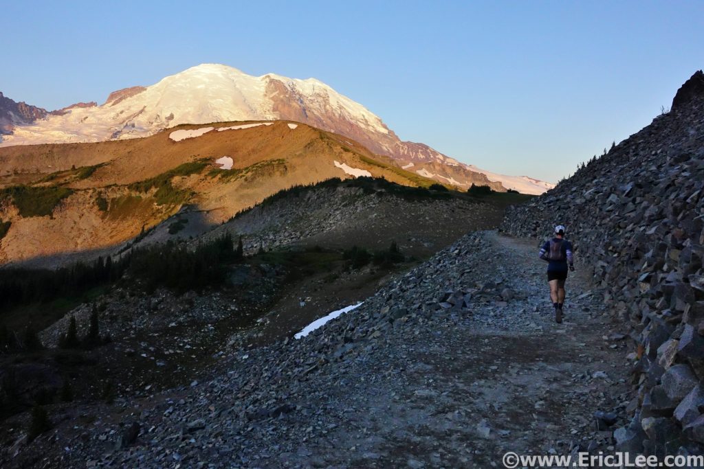
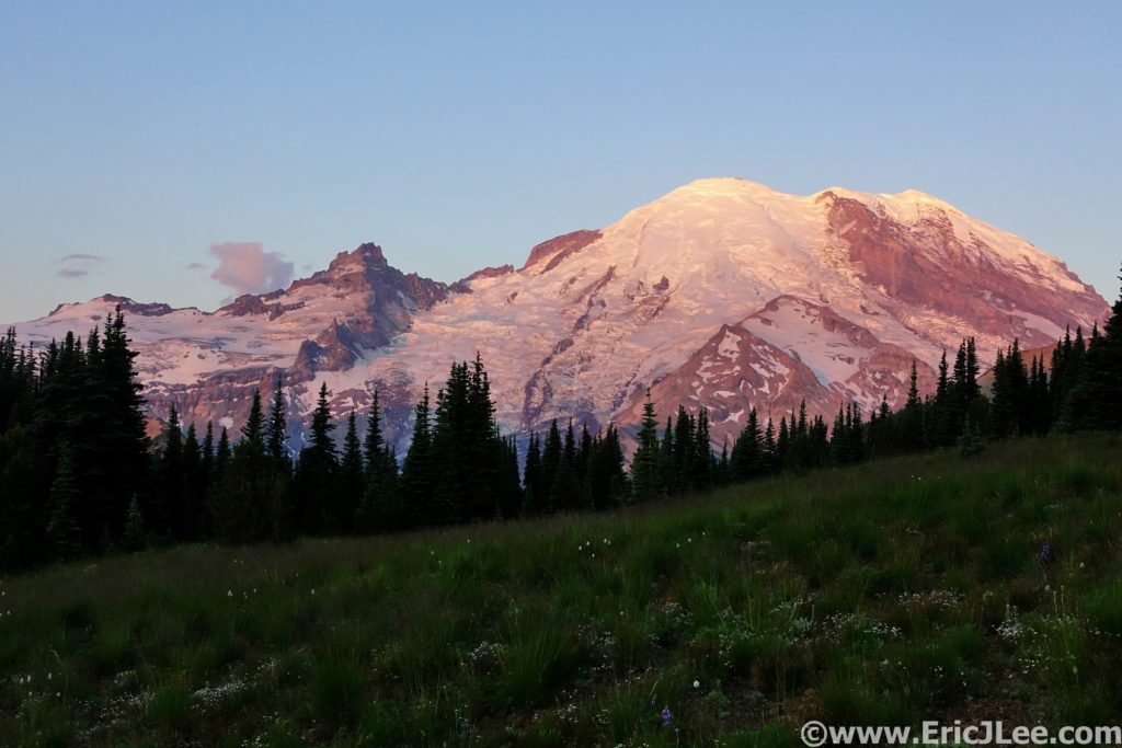
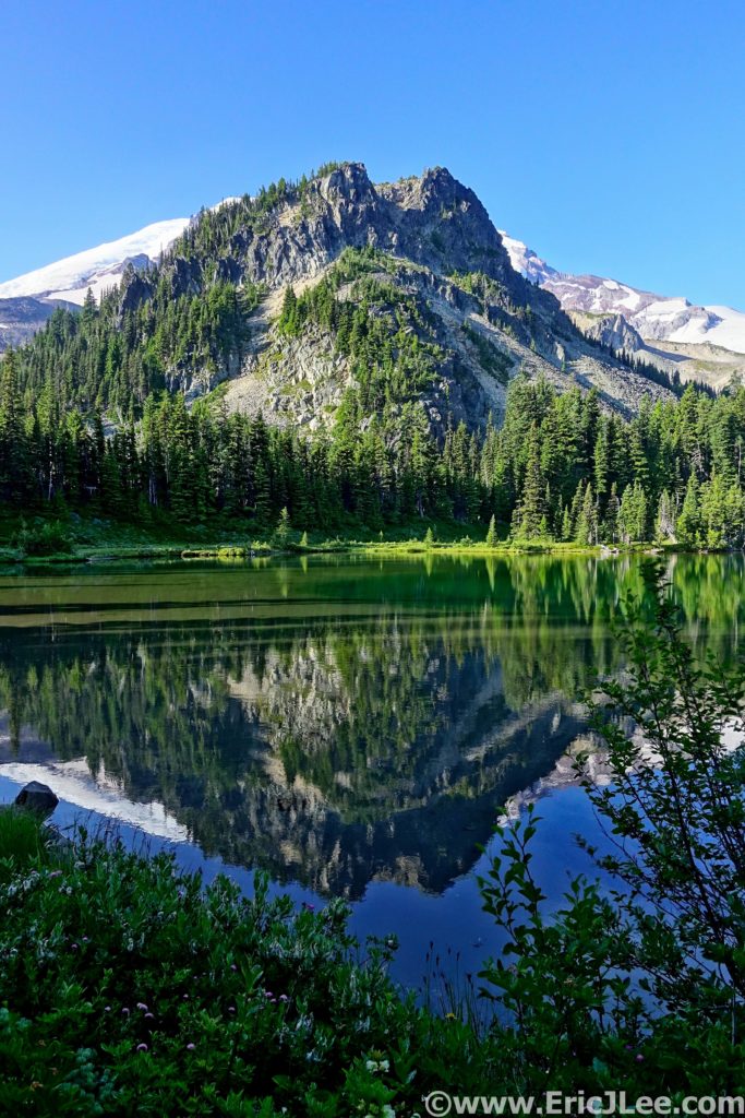
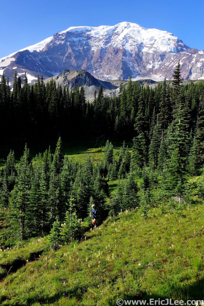
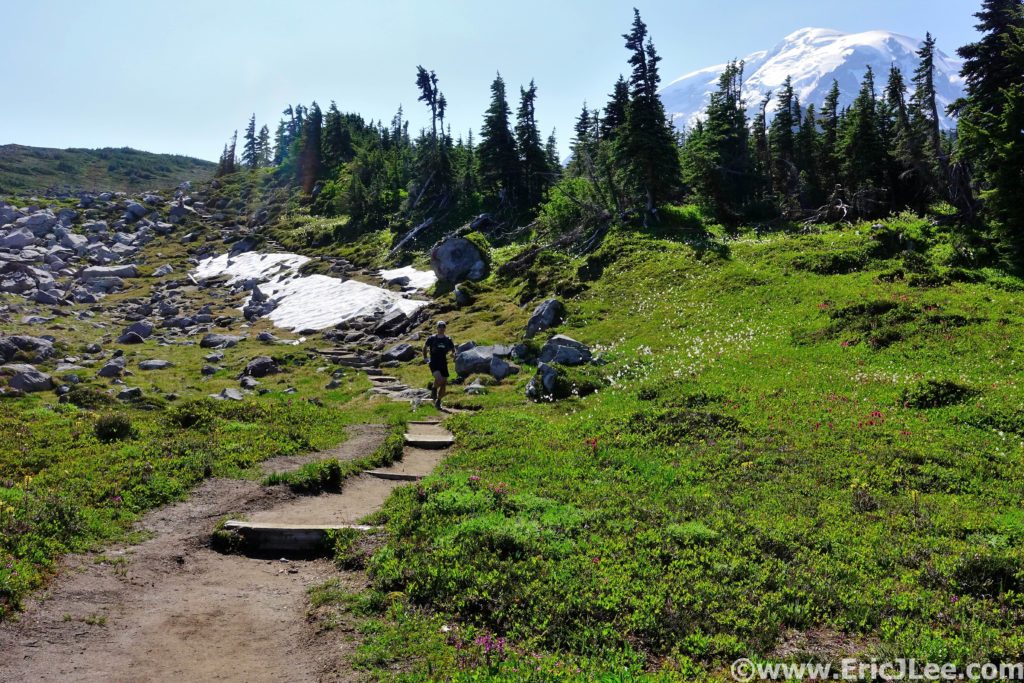
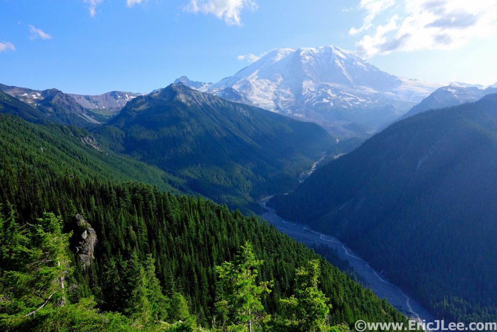
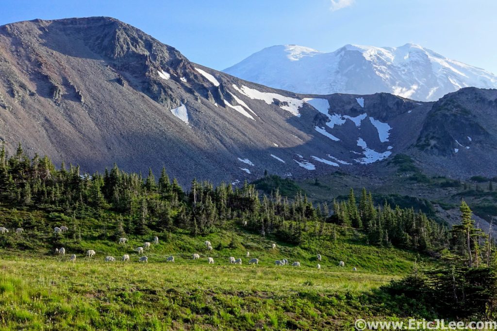
Wow…I just….wtf???? The scene in front of us was beyond words and comprehension, the glaciated massif of Mt Rainier glowed in the early morning light, fields of wildflowers surrounded us on all sides, and not a soul was in sight, this is what we had come for.
Running across the Sourdough Ridge Trail at sunrise, what a start to an epic run.
Mt Rainier National Park was created in 1899, America’s 5th National Park, to protect the glaciers, alpine meadows, roaring waterways and lush forests of the mountain known to the natives at Tahoma (or Tacoma). The last time I had visited Mt Rainier National Park had been in 2004, and on that trip I’d barely scratched the surface of what the park has to offer. This trip was to be a bit different, a whirlwind tour of the North side of the peak, somewhere in the range of 50miles on already tired legs, game on. I’d convinced my friend Ely Gerbin to join me for this epic adventure of stupidity, and what a day we were in for.
Mt Rainier as seen from the aptly named Sunrise parking lot.
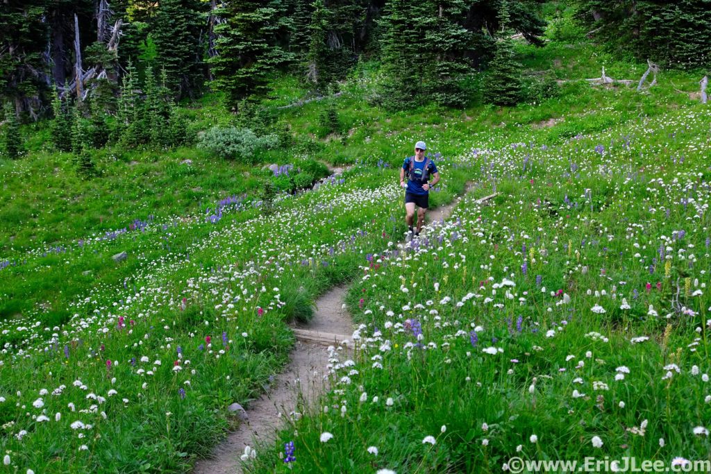
We left the Sunrise parking lot at the crack of dawn, just as the pink alpenglow lit up the hulking massive in front of us. As we jogged our way across the Sourdough Ridge trail the views were nothing short of spectacular, and we were only a mile in! Our route consisted of combining two loops; the Northern Loop with the Spray Park Loop. We opted to start by traversing the Southern portion of the loop first along the Wonderland trail, finishing with the Northern section along the Northern trail. As we rolled along the Wonderland trail through fields filled with wildflowers, the mountain loomed above in the sunlight. The trails were buttery smooth, the morning air was cool and the views were ever changing and stunning. Past the toe of the Winthrop Glacier, the clear reflection of Mystic Lake and on to the bridge over the Carbon River and the looming Carbon Glacier (mm13.4, 3:05). As we started the long climb up from the Carbon River the sun began to bake and the flowers were again popping. The creeks in Spray Park were our own private oasis, and we filled our bottles, drank our fill and dunked out heads (mm17.3, 4:37). Even during our brief stop the mosquitoes swarmed, so we couldn’t stop to smell the flowers for too long.
Reflection in Mystic Lake along the Wonderland Trail.
Ely running through fields of flowers with Mt Rainier looming behind us.
Ely cruising up the single track above the Carbon River.
The views were spectacular as we rolled through the high
alpine meadows, then began the slow descent back into the forest and Mowich
Lake. Ely and I rolled past the masses at Mowich Lake (mm22, 5:50) and onward
to Ipsut Pass (mm23.2, 6:06), the halfway point of our big loop. From the top
of Ipsut Pass we stared straight down 2500ft to the Carbon River far below,
time to get those quads working. We cruised down down down, through lush green
forest, along cascading creeks and past towering evergreens, finally crossing
the raging glacial grey Carbon River (mm28.7, 7:21). We took a few minutes to
refill our water and to cool off in a small tributary before the long climb up to
Windy Gap.
Trudging our way up into Spray Park, the flowers were poppin.
More fields of alpine flowers, all is good.
The alpine gardens of Mt Rainier NP, totally worth it.
Looking down from Ipsut Pass toward the Carbon River.
Ely taking pausing for a moment of serene splendor.
We plodded on up through the trees on what seemed like
endless switchbacks, finally breaking out into alpine terrain near the
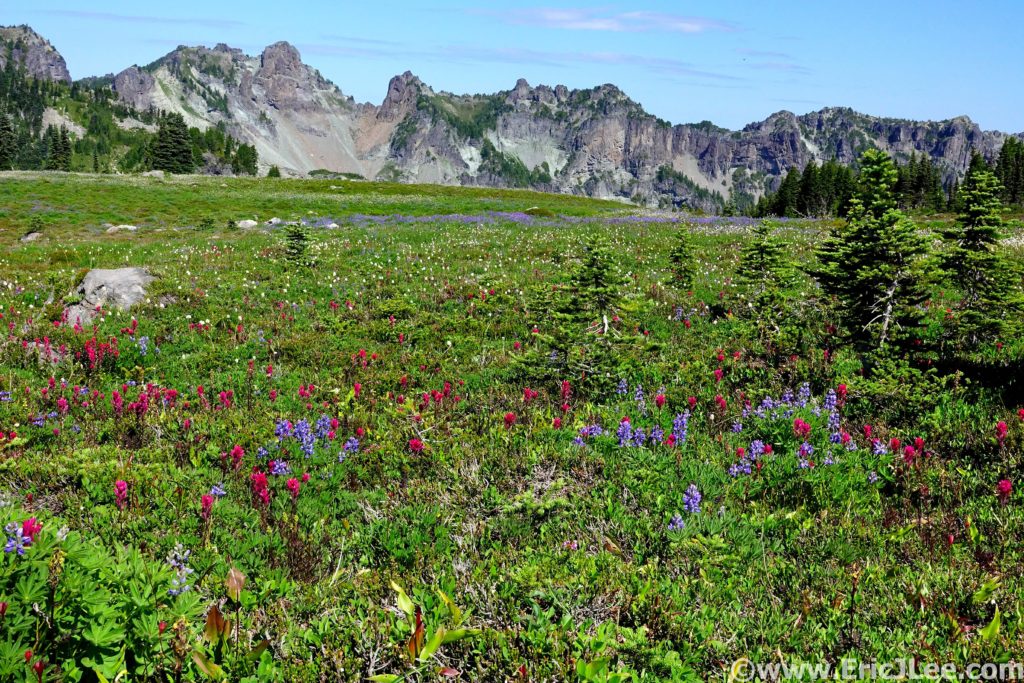
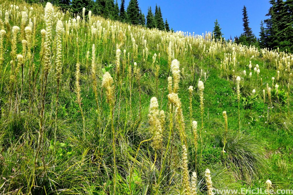
Yellowstone Cliffs into a massive field of bear grass. It was a spectacular site,
cruising through the green meadow dotted with white puff balls as far as the
eye could see. We continued our trudge up to Windy Gap (mm33, 9:11) and down
the other side on some beautiful single track to Lake James. After a little off
trail wandering we hit the long and steep switchback descent back to the West
Fork of the White River (mm36.7, 10:17). After another water refill we started
our final climb of the day up the Northern Loop Trail. The long miles of the
weekend hit me like a sledgehammer, and the death march was on. Ely was very
patient with me as I slowly trudged up the trail, deep in the pain cave, but
the scenery was too spectacular to be too grumpy (but maybe a little).
Ely crossing the Carbon River on the inbound part of our journey.
Ahhhhh, fields of Bear Grass!!!!
View of Mt Rainier from the final climb up above the West Fork of the White River. My grumpiness faded away pretty quickly.
After what seemed like an eternity, we crested the climb to a spectacular view point of Mt Rainier looming high above the White River (mm39.8, 11:32), glowing in the afternoon light….a perfect moment to remind me of why I was enduring all the fatigue, all the suffering, all the soreness in my legs. I finally gained a little of my strength back as we rolled through the flat open plateau and down to Lodi creek. One last final little climb would take us back to Sunrise, and while it seemed to drag on, ambling along the creek through fields of wildflowers was a pretty spectacular way to end the day. As we neared Frozen Lake I was very ready to be done, and just at that moment Ely and I rounded a corner to a herd of mountain goats lazily grazing with the looming mass of Mt Rainier as the backdrop. The day wasn’t over, and the constant reminders of how spectacular the mountain and it’s surrounding environment was kept slapping us in the face. The final traverse back across the Sourdough Ridge trail was a fitting finish to an unbelievable day. Spectacular views and amazing trails start to finish, we’d been thoroughly brutalized (me more so than Ely) and had come out the other side, beaten but with our souls fully filled with an amazing appreciation for all that Mt Rainier National Park has to offer.
The amazing just didn’t stop, running our way up Lodi Creek to the finish of the loop.
Yeah that happened. A herd of mountain goats casually grazing along the Wonderland Trail in the shadow of Mt Rainier.
In the end our route totaled 46.5mi and 13,500ft, taking us a little over 13:30 (because of my slow death march finish). Without a doubt, my first real adventure in Mt Rainier National Park was a resounding success, and the route had been more than I’d ever have hoped for. For anyone who hasn’t had the pleasure of experiencing Mt Rainier National Park either half of our super loop would be spectacular, or any portion of the Wonderland Trail well worth the effort. I’m incredibly grateful for experiences like this, and for the fact that places like this have been protected for me to enjoy, hopefully for many years to come. Run fast, run healthy, but most importantly run happy.
One of the many amazing views along the Copper Ridge Loop.
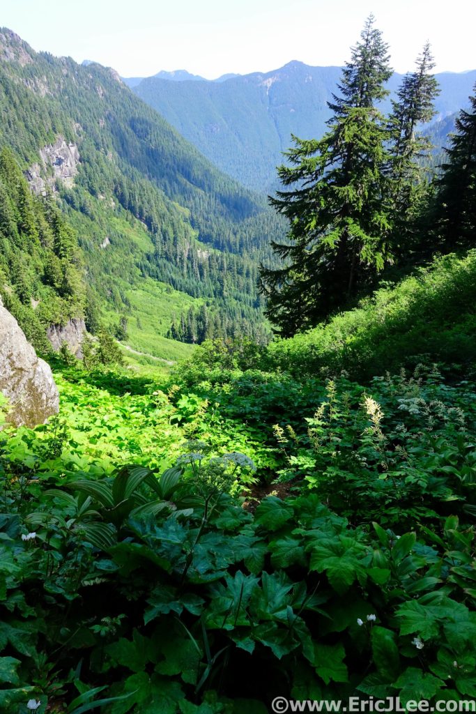
The North Cascades are a massive wilderness full of jagged peaks, alpine lakes, towering glaciers and some of the last true wilderness in the lower 48 states. The National Park portion of the North Cascades Complex (which also includes Lake Ross and Lake Chelan National Recreation areas) encompasses a 500,000 acre nearly roadless wilderness. One that can not be experienced from roadways and lookouts, but must be explored on foot (or boat). It seemed only natural to ultra run the park, but the question is what set of trails best represented everything that makes the North Cascades amazing?
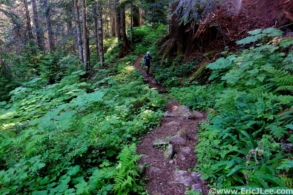
After doing some of my own homework and asking several locals with more knowledge than I, one recommendation kept hitting the top of the list…the Copper Ridge Loop. Well, if everyone (even locals) think it’s that amazing, it must be the proper North Cascades experience? So planning was set in motion for an epic weekend in the Washington mountains (also see Mt Rainier Northern Loop). The first weekend in August (8/2/2019) I flew into SeaTac (2h delays), met my friend Jason and we started our drive North towards the Mt Baker Highway and the Nooksack River. After crashing in a rest stop for several hours, we awoke the next morning to light rain, but a forecast that promised clearing skies, so off we went for the trailhead. Jason and I spent the entire drive catching up, as he is still to this day one of the people with whom I’ve logged the most trail time (cumulative in the months!). He was very nervous though, as this was to be his longest run (by almost double) since badly breaking his leg several years ago, but he welcomed the challenged.
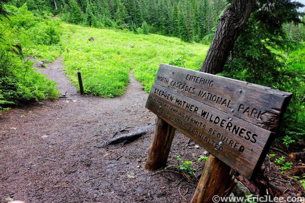
Officially entering North Cascades National Park.
When we rolled into the Hannegan Pass trailhead we were greeted by a road closed sign, marking a huge washout that had undermined the last 200ft of the road. So we parked and packed up our gear, in no rush as the drizzle continued to fall. We cruised out of the trailhead at 9:30am, slowly jogging our way up through the forest towards Hannegan Pass. The low clouds and light drizzled continued to swirl around us, but every once and a while we’d get a glimpse of the mountains looming overhead. From the pass (4.3mi) we opted to do the loop CCW, dropping down to the Chilliwack River first, before climbing to the ridge on the return. As we descended to the river we passed through sections of overgrown trail and sections of open forest, and soon we were soaked from the rain drenched leaves.
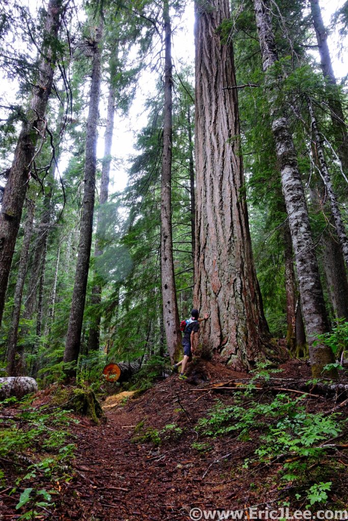
Jason getting in touch with his inner tree hugger. Colorado just doesn’t have big trees like this <3
Buttery smooth forest single track in the North Cascades is so serene.
The weather was starting to clear, and we could see glimpses of blue sky overhead, we’d momentarily dry out, just to be drenched by another set of wet dense brush. The river trail was mostly smooth running (where we could see our feet) and we soon found ourselves at the first Chilliwack river crossing, the cable car (11mi)!! But I was a bit dismayed to discover the cable car was down for repairs, so we’d be fording the river instead, sad face. So Jason and I linked arms, and slowly shuffled our way across the knee deep rapidly flowing stream, thankfully making it across without incident. We continued our hike/jog on the undulating descent to the second ford (16.2mi), thankfully the water here was far more docile, making for an easy crossing. This was our first moment of full sun all day, so we basked in the warm glow along the rocky shore for a few minutes, treating water and savoring the moment.
Crossing one of the side creeks along the Copper Ridge loop, somewhere deep in the Chilliwack valley.
Basking in some of that elusive PNW sunshine after our second crossing of the Chilliwack river.
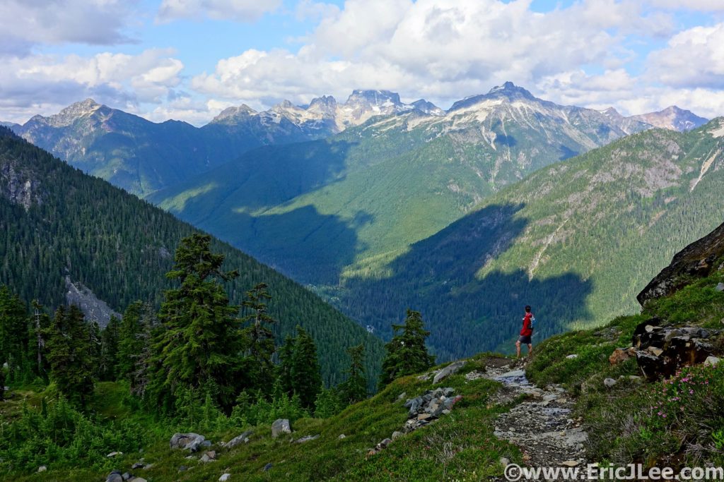
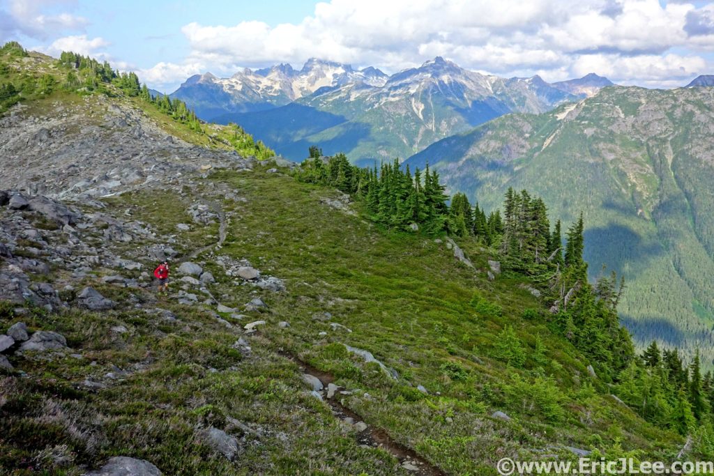
We knew that what came next would be our physical test of the day, a 4000ft climb straight up to the ridgeline. We settled in for the long haul, switchback after switchback up through the forest, the sun percolating through the slowly thinning trees. As we neared the final switchback below the ridgeline, the trees began to open and the views began to explode behind us. The clouds had finally lifted and the jagged glacier capped peaks of the Cascades loomed across the valley. When we finally reached the top of Copper Ridge the weather was beautiful mostly blue sky, and we were completely awe struck by both the verticality and the depth of the mountains surrounding us on all sides (19.2mi).
Mountain views and wildflowers, welcome to the North Cascades!
So amazing and so runnable we couldn’t help ourselves.
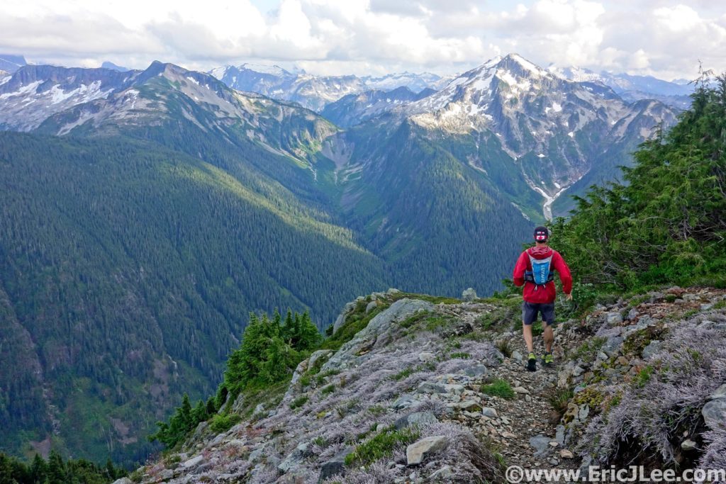
The single track along the ridge was a mix of beautiful flowing dirt and rocky steep climbs/descents. This was the wow factor part of the loop without a doubt. We finally reached Copper Lake, set in a steep walled cirque, it’s blue waters glittering in the sun. Jason’s legs were definitely feeling beat up (this being his longest run in 3 years!), but we put our heads down and trudged our way up to the Copper Ridge lookout tower (24.3mi), the high point of the day. We met up with several groups of backpackers, all of whom were soaking in the expansive vistas, oogling the craggy summits, marveling at the hanging glaciers. In the soft evening light it was truly a spectacular site, the only sounds of civilization being the chatter of our neighbors. Unfortunately we couldn’t linger long as we still had 10miles to go and darkness would soon be descending upon us, so we began the long jog back towards Hannegan Pass.
Some rocky trail running near the Lookout, oh and the views were pretty ok.
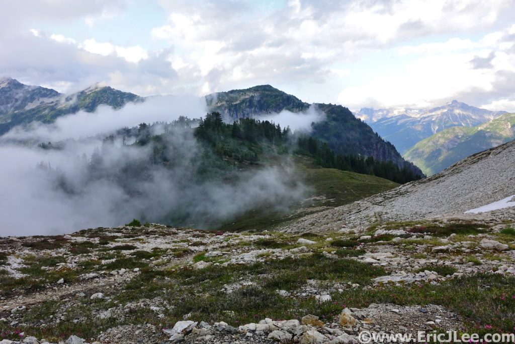
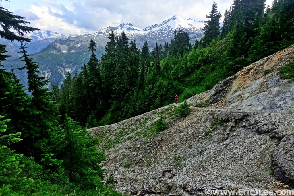
As we descended the ridge the clouds began to roll back in, completely enveloping the ridge, then bursting apart to reveal the mountains around (finally including Shuksan, but not Baker). It was truly a surreal experience and some of the most beautiful trail running I’ve ever done (right there with Four Pass loop). After dozens of photos stops we finally made it back to the base of Hannegan Pass, all we had to do was conquer this final 500ft climb and it was a short few miles of downhill back to the car. Thankfully the final uphill was littered with fields of lupine, lilies, columbine and wildflowers of every color, a welcome distraction for the tired minds. After a quick snack atop Hannegan Pass (30.3mi) and one last moment taking in the Chilliwack valley that stretched out below, we scooted our way back down towards the car. I ran ahead a little bit, rounded a bend and stopped dead in my tracks…. A noise off to my right had perked my ears up, and when I paused to assess I was astounded to see two baby black bears clambering up trees not 50ft away. Where babies play, mamma isn’t far away, so I slowly backed off, signaling to Jason to stop and do the same. Mamma came sauntering through the woods, finally coaxing the two babies down and they went crashing off through the brush when she finally caught our scent. Wow, did that really just happen????
Moody weather along the ridgeline, watching the clouds roll back and forth.
Almost back to Hannegan Pass, this place is a trail runner’s paradise!
We rolled back into the parking lot just as the last bit of sunlight was fading out of the sky, tired but our hearts so full from the amazing experiences of the day that instead of worrying about camp or cleaning up, we sat next to the car eating ‘dinner’ and just recapping all the memories of the day. The Copper Ridge loop (or lollipop) had lived up to its reputation; beautiful forest single track, meadows full of wildflowers, crystal blue glacial rivers, and stunning mountain vistas. While the North Cascades have far more to offer, if you only have one day, this loop definitely encompasses what makes the North Cascades so special. I was very fortunate to be able to share this experience with such a good friend, on such an imperfectly perfect day. We may not have gotten the clear blue skies (and thus no views of Mt Baker), but the mist and drizzle giving way to a mix of low clouds and blue sky made for such proper PNW experience. This loop has easily jumped into my top 10 for National Park Ultras (it was my 18th completed NP Ultra) and should be on every ultra runner’s to do list. 34.5miles, 8950ft gain/loss, 10h35min.
Bonus shot of Mt Baker from the Mt Baker Hwy the day after our Copper Ridge run. Sometimes being a tourist is pretty A-Ok.
Mt Shuksan reflected in a small tarn along the Mt Baker Hwy. Just touristing around the day after our Copper Ridge run.
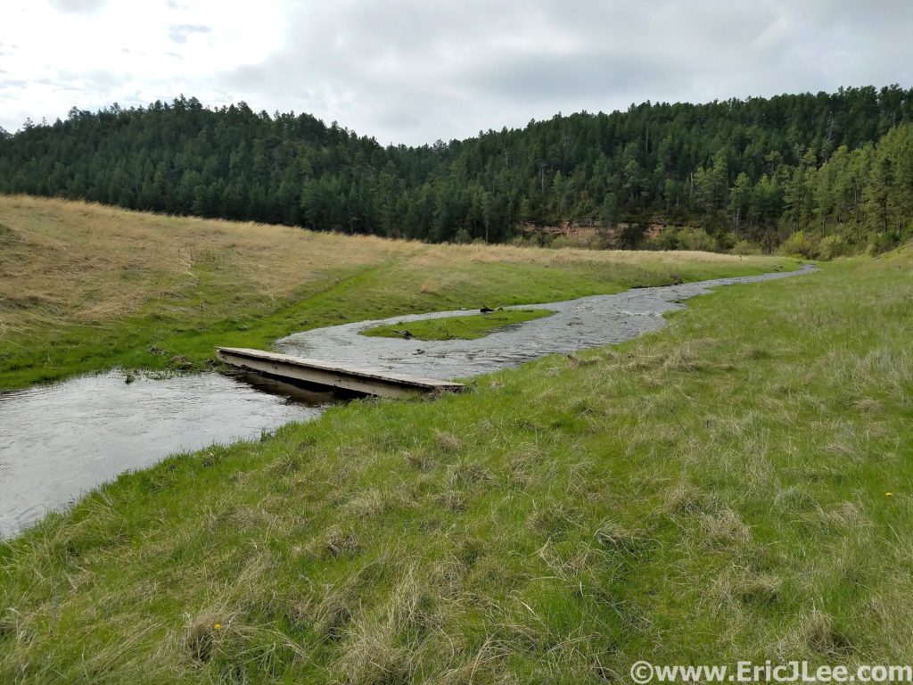
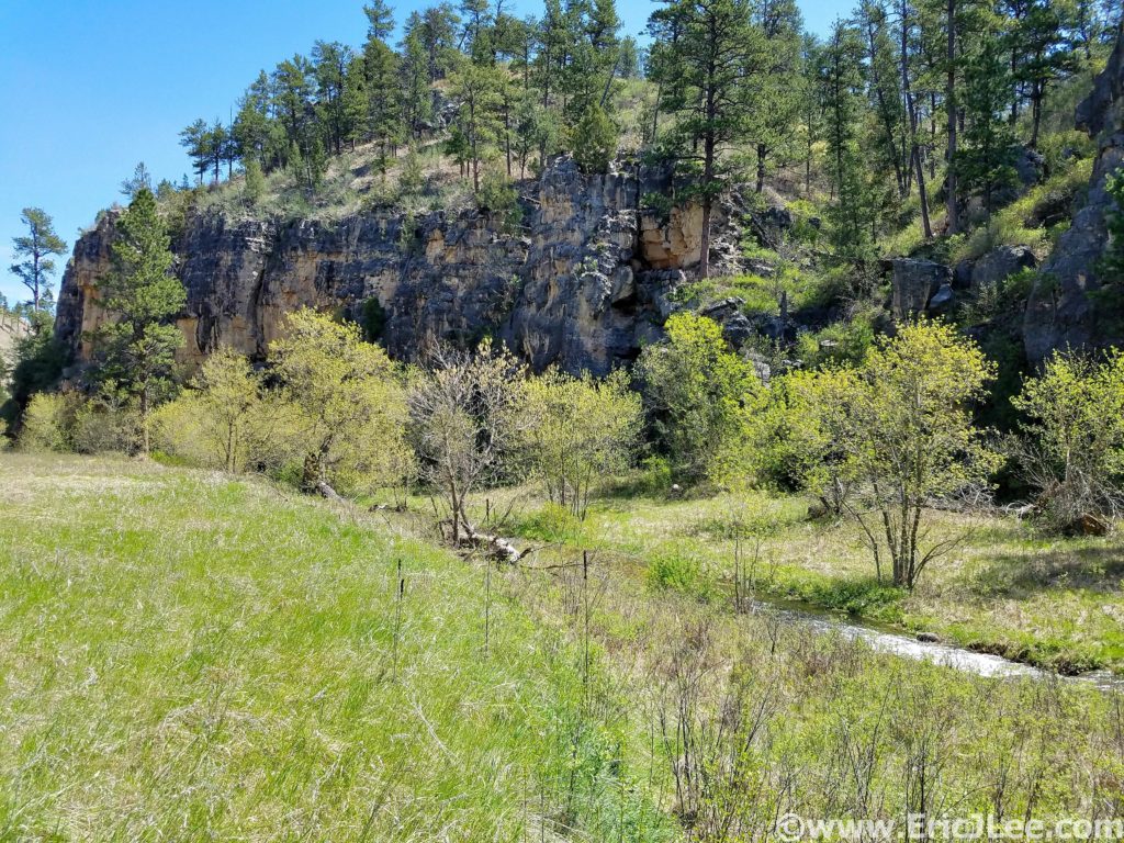
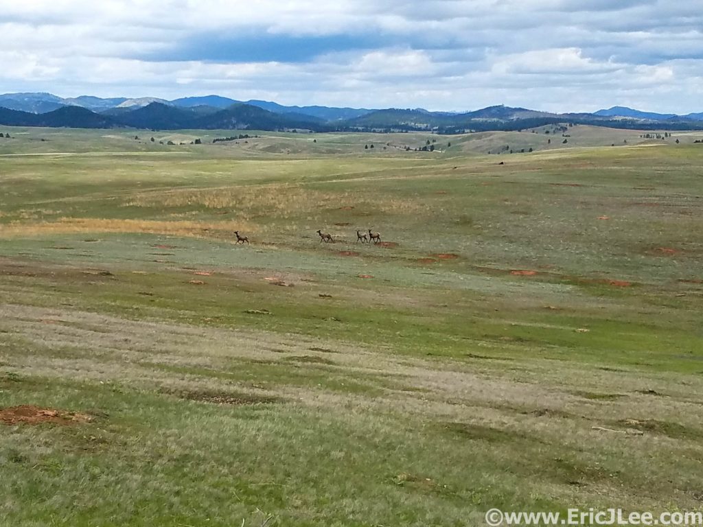
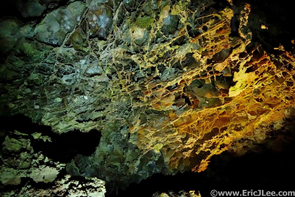
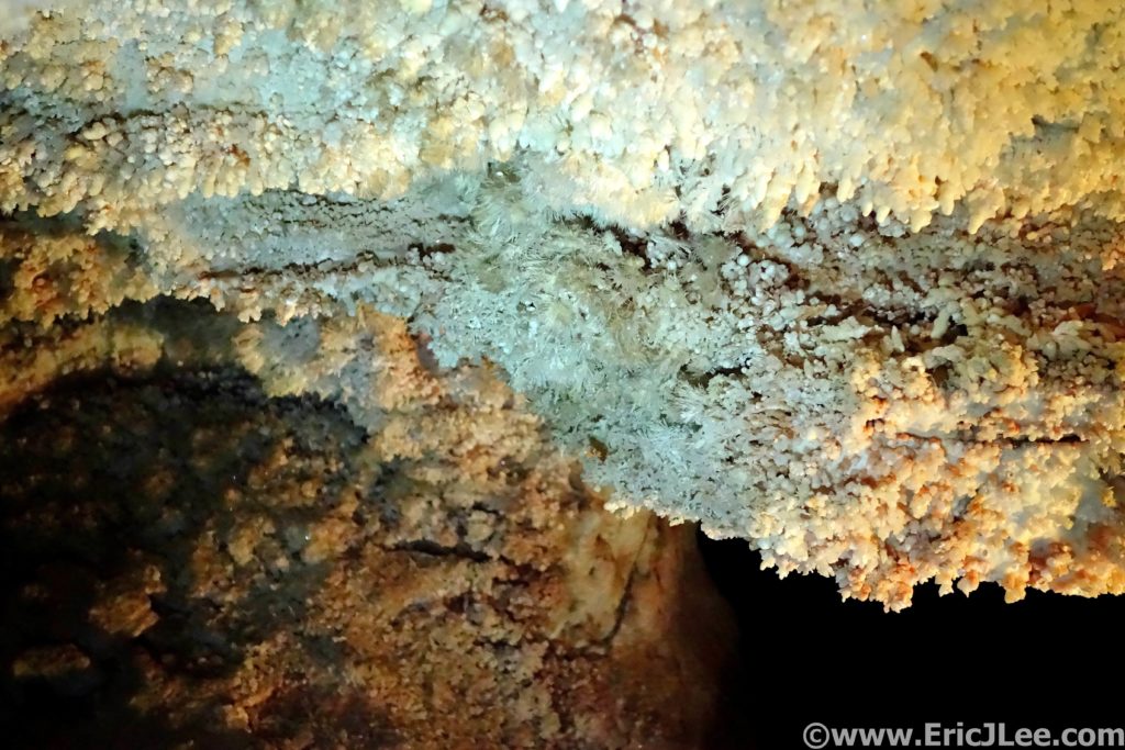
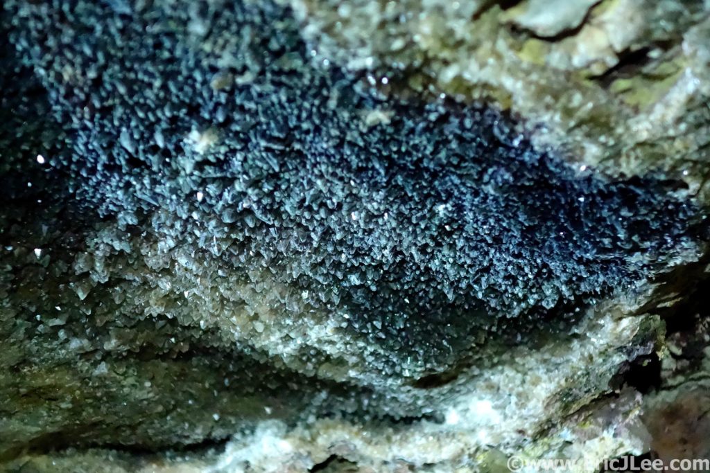
Wind Cave National Park was founded in 1903, the seventh National Park within the system. Even though it was one of the first National Parks, it ranks far down the list of visitations (<700,000), and many have never heard of Wind Cave. Tucked away on the edge of the Black Hills in South Dakota, Wind Cave is the 7th longest cave system in the world (over 150 miles) and new cave is still being discovered every year. Though what makes Wind Cave National Park so special is the intricate boxwork that adorns the cave (found almost no where else in the world) and the wildlife that roams the above ground portions of the park.
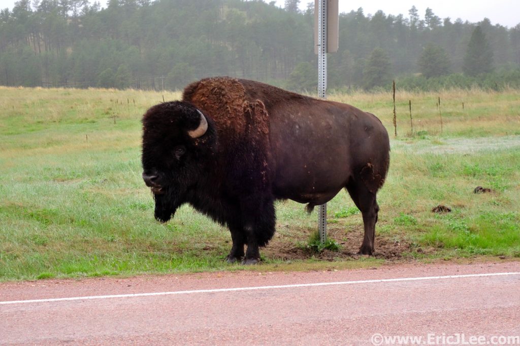
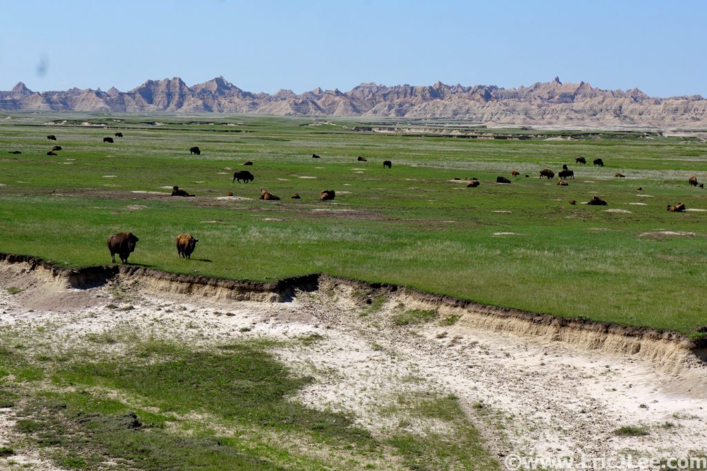
Bison are quite large and intimidating animals, keep your distance.
Fresh off my 6h sloppy mud run in Badlands National Park, and with bad weather looming the following day, I opted for a nice back to back National Park ultra combo. I had tickets for a 3pm cave tour along side my friends Ben, Amanda and Kedar, so at first light on 5/26/19 I hit the Wind Cave Canyon trail, jogging along the gravel road into the plains of Wind Cave NP. I soon turned north onto the Highland Creek Trail (3.5mi), traversing across the high plains, past endless herds of bison, several groups of elk and even a few pronghorn. Large sections of the trail were little more than a faint path cairned through the grasslands, and quite a few times I found myself glancing around looking for the path, but overall it was pretty smooth running.
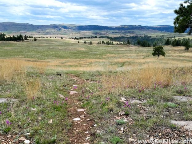
Cruising through plains and along the rivers of Wind Cave National Park.
Smooth cruiser open plains single track in Wind Cave National Park.
Things were going smoothly and I soon found myself at County Road 5 (10.7mi), my lone 1.5mi stretch of road running for the day (dirt). I hit the Centennial trailhead , turned South and headed back into the park. The running continued to be smooth, as I rolled across the never ending plains, finally dropping into Beaver Creek canyon (16.5mi). I cruised up the creek through the narrow but shallow canyon alongside the creek, a nice change of pace to the expansive plains. I hadn’t passed a single person (or car) the entire morning, though I finally started to pass a steady trickle of people as I neared the Lookout Pt trailhead. I exited the canyon, passed through the trailhead and onto the Lookout Pt trail, headed back across the plains again.
Cruising along Beaver Creek in Wind Cave National Park.
Some elk scampering across the plains of Wind Cave National Park.
As I connected back onto the Highland Creek Trail I could feel the fatigue building in my legs from the past two days of running. When I got back onto the Wind Cave trail, I made a quick turn south onto the final leg of my run, an out and back of the East Bison Flats trail (23.3mi). As I slowly climbed my way back up to the high plateau the sun began to beat down on me, and I quickly realized I was running out of water. Onward I slogged, steeply back down into the river canyon, only to immediately climb right back up to Gobbler Pass (26.6mi). I was definitely feeling beat up now, but as I turned around with just under 4miles to go I had really no other choice than to finish up the run. The fatigue and dehydration were taking their toll, so the final miles seemed to drag on in a blur. At last I descended back to Wind Cave Canyon and slowly shuffled my way to the car. I still managed to finish the 30.4mi lollipop in under 6h, not too shabby for a back to back weekend, and in time for the 3pm cave tour!
Boxwork in Wind Cave.
Frost work crystals in Wind Cave.
After chugging a cold soda, tasted so good, I dragged myself over to the Wind Cave visitor center to meet my friends and to catch the 3pm cave tour. I felt a little pathetic, slowly hobbling my way at the back of the tour group (legs were getting stiff), but it gave me an extra chance to photograph some of the cave formations and to take in the smaller intricacies of the cave. Wind Cave is most famous for it’s boxwork formations, a lattice of spiderweb like crosshatching that is found almost no where else in the world. We admired some frostwork (tiny white crystals), spar and a few stalagmites and stalactites. While Wind Cave may not be the most ornately decorated cave, it’s combination of unique features and above ground wildlife make it a special place to visit. For the runners out there the trails are beautifully runnable and very unpopulated (other than the herds of wildlife). So next time you’re in the area (Custer, SD), stop on in to Wind Cave NP and it’s sister Jewel Cave NM right next door, for a little tour of the above and below ground wonders.
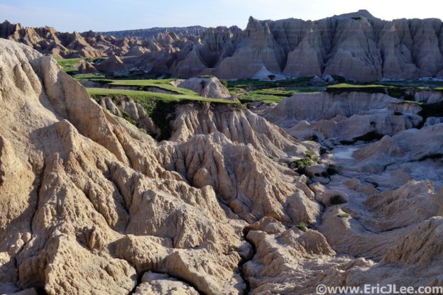
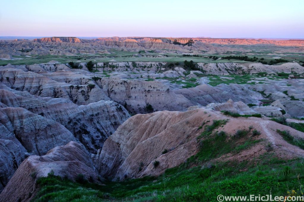
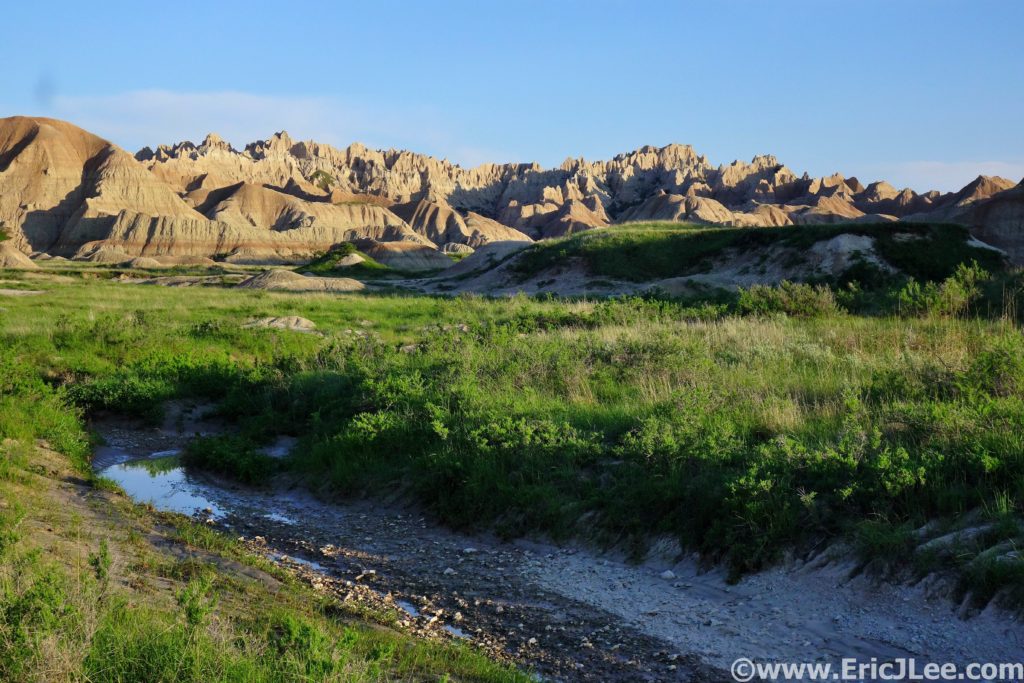
It rained 5” last week, oh boy…not what I wanted to hear the
day before I was supposed to run a big loop around Badlands National Park, a
place everyone told me not to go when it rained. As I drove through the park
along the Rim road the early May sunlight began to illuminate the buttes, so I
stopped at the first view point to take in the views of Sage Creek far below. I
was greeted by a couple of grazing bighorn sheep, and a herd of bison. My first
trip to Badlands was off to a pretty good start.
Sunrise over the Sage Creek area of Badlands National Park.
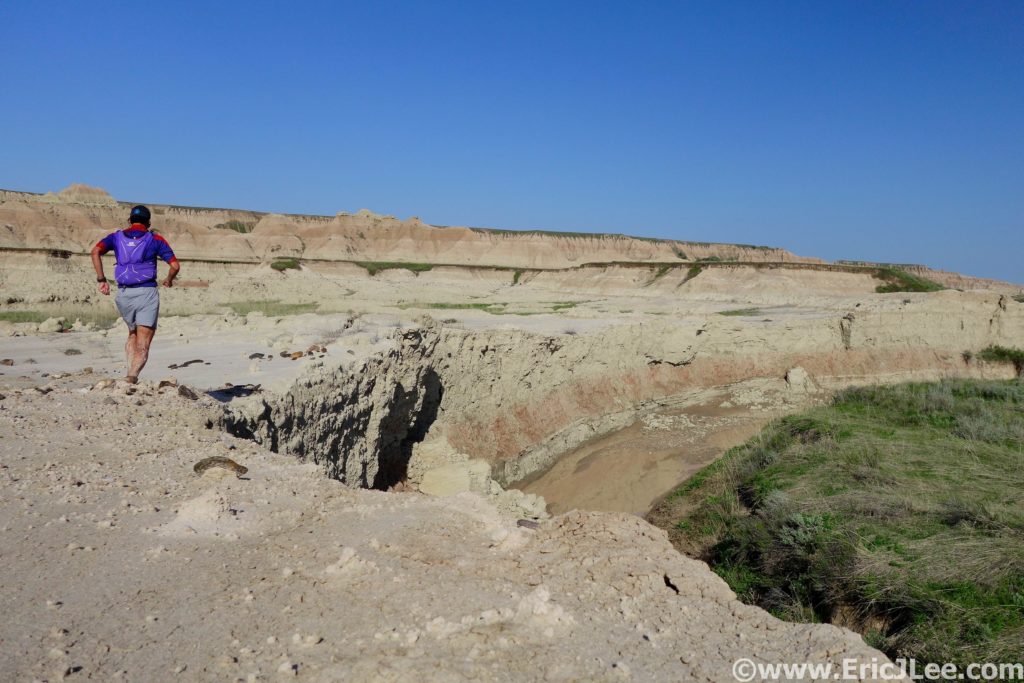
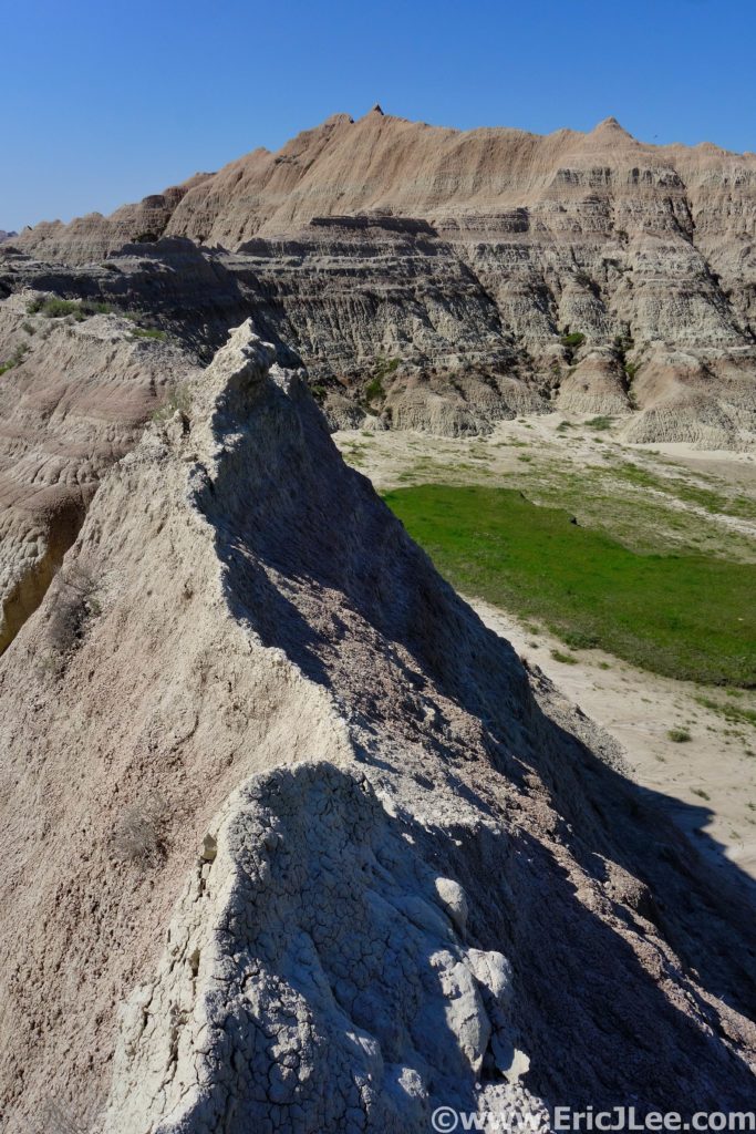
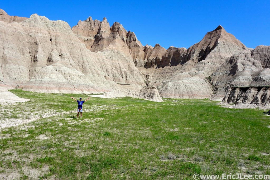
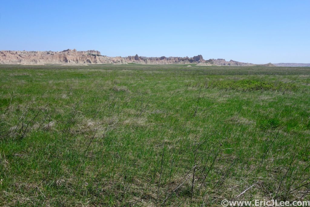
Badlands National Park has very few official trails, so to create a long distance route I pulled from a 22mile off trail backpacking loop with some planned detours and exploration, because that’s what Badlands is really about, a chance to explore, unencumbered. I rolled into the Conata Picnic area just after sunrise on 5/25/19, geared up and strolled off into the meadows. It was immediately apparent I was in for a bit of adversity as the packed dirt meadow turned damp and then into full on swamp. Well, dry feet weren’t going to be an option today. I slopped my way across the valley for 1.5mi, then turned sharply right (North) for the Deer Haven saddle.
Headed up towards Deer Haven, just to the right up the valley.
Looking down the upper reaches of the Sage Creek wash.
As I climbed away from the low grasslands up onto the butte,
I passed through dense stands of juniper, eventually weaving my way up the
steep hillside, around the cliff bands, and onto the summit of the Deer Haven
plateau. Now for the long winding downhill along the North Fork of Sage Creek.
The route started out pretty pleasant, running through the tall grass, occasionally
hopping the creek, but the footing was pretty good. After a short side trip up
one of the canyons draining The Pinnacles, I continued my descent, things
slowly got muddier and muddier and the creek got deeper and deeper. By the time
I hit the confluence of the North and Middle forks of Sage Creek the muddy misery
had escalated.
Running the plateaus along the North Fork of Sage Creek.
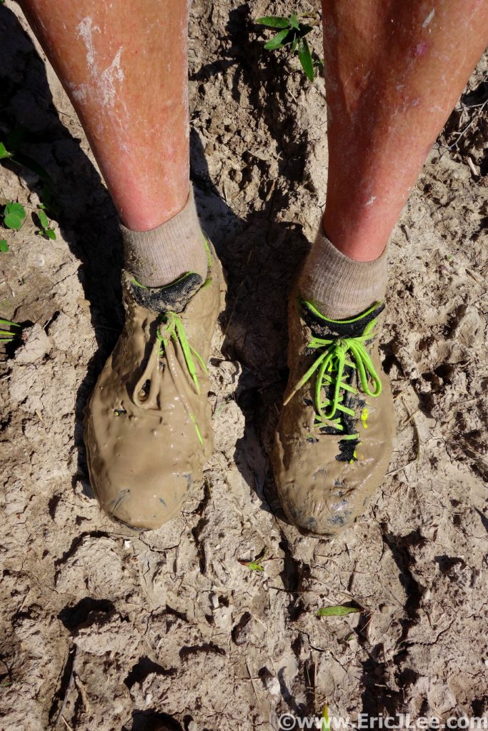
It was like running in peanut butter, yuck.
I cut over the high plateau above the creeks hoping that the
mud would dissipate, but no luck. As I rounded the bluff I dropped onto the
high plateau above the Middle Fork of Sage Creek, a small herd of bison dotted
the plains. Their muddy hoof prints had torn up the grasslands, and it was a
total mud pit. Despite the slipping and sliding, the terrain was fairly easy
and it was really nice to be jogging through the open grasslands and jagged mud
buttes with no one else around. I slow jogged and fast hiked my way up the
Middle Fork, headed towards Sage Creek Pass. As I made my way into the upper
basin the herd of bison had grown into the hundreds, dotting the plains as far
as the eye could see.
Just before reaching Sage Creek Pass I took a detour
slightly NE into some really interesting buttes, hoping to climb one. I
scrambled up the hard mud slope, onto the crumbling ridgeline. As I neared the
summit the slope pitched up to near vertical and the mud stone showed no signs
of solidifying, well that wasn’t going to happen. From my vantage on the
ridgeline I could see down into several of the nearby canyons, watched the
bison trotting around the grasslands and very much enjoyed my isolation deep in
the backcountry of Badlands. I spent anther half hour scrambling around the
canyons of the butte, finding coyote tracks, bighorn droppings and lots of bison
paths. Each canyon was a new adventure, would it be passable, where did it go?
I finally popped out back on the South side of the butte not far from Sage
Creek Pass.
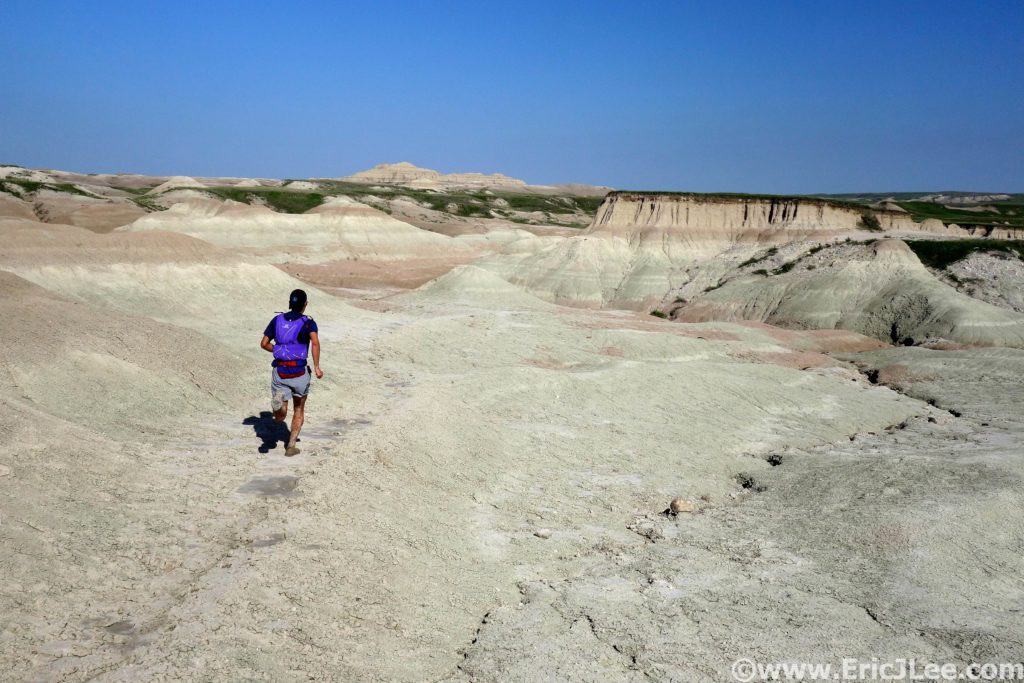
Finding some semi-packed mud to run on!
Bison dotting the Badlands.
Trying to climb some of the mudstone ridges and buttes, not so solid.
The route down from the pass was an enjoyable jog down the
water course right alongside one of the mud stone buttes, alternating between
lovely packed dirt and greasy wet mud. At last I hit the park boundary fence,
hung a left and headed back towards the car across the flat plains that abutted
the mud stone buttes of Badlands. The grasslands seemed to stretch as far as
the eye could see, and as I soon discovered, were completely flooded with an
inch of muddy water. I tried to jog sections, but soon gave in and was relegated
to hiking. After what seemed like an endless slog I got back on the trail near
Deer Haven and jogged back to the car. Tired, covered in mud, and excited to be
back on hard pavement.
Playing in the canyons and plains.
The wide open plains surrounding the Badlands mud buttes and canyons. Endless grasslands (filled with mud this day).
My first trip to the Badlands had been an overall success. Despite the crazy mud and insanely wet conditions, I got to wander through the backcountry all my by lonesome, explore the maze of mudstone buttes and towers, watch the massive herds of bison take over the planes and just be out in an undeveloped part of one of America’s more obscure National Parks. Badlands may not look as dramatic as some of the mountainous national parks, but once you’re lost wandering the backcountry you get to better understand what the park is all about. I look forward to returning to Badlands again, when it’s less muddy and I get more time to just explore all the random canyons (but beware of the rattlesnakes!).
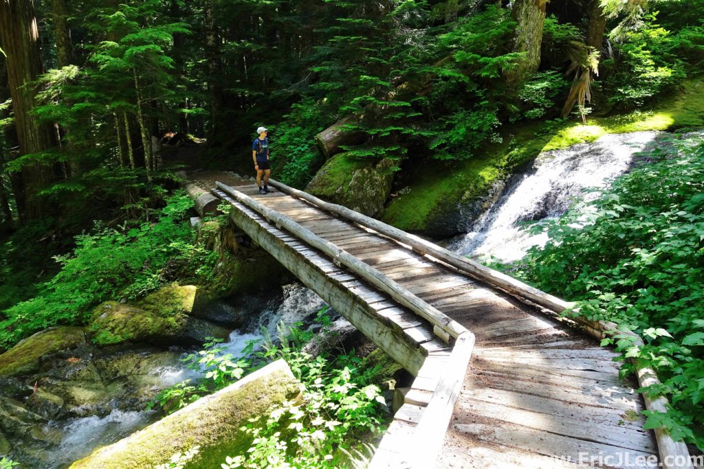
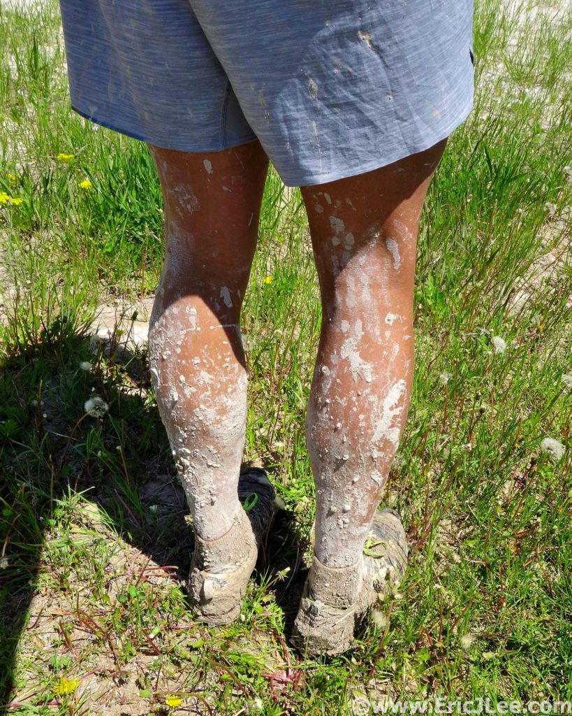
Squish, splash, splosh….what had started out as such a beautifully promising trail had quickly descended into a horse trodden mud bog….would the whole run be this way? The Maple Springs Trail had started out as beautifully cruiser crushed gravel meandering through the lush green forest, but as soon as I turned onto the Mill Branch Trail I found out what the ranger had warned me about, the horse trails were muddy….
Lush green forests and muddy trails of Kentucky along the Mill Branch trail in Mammoth Cave NP.
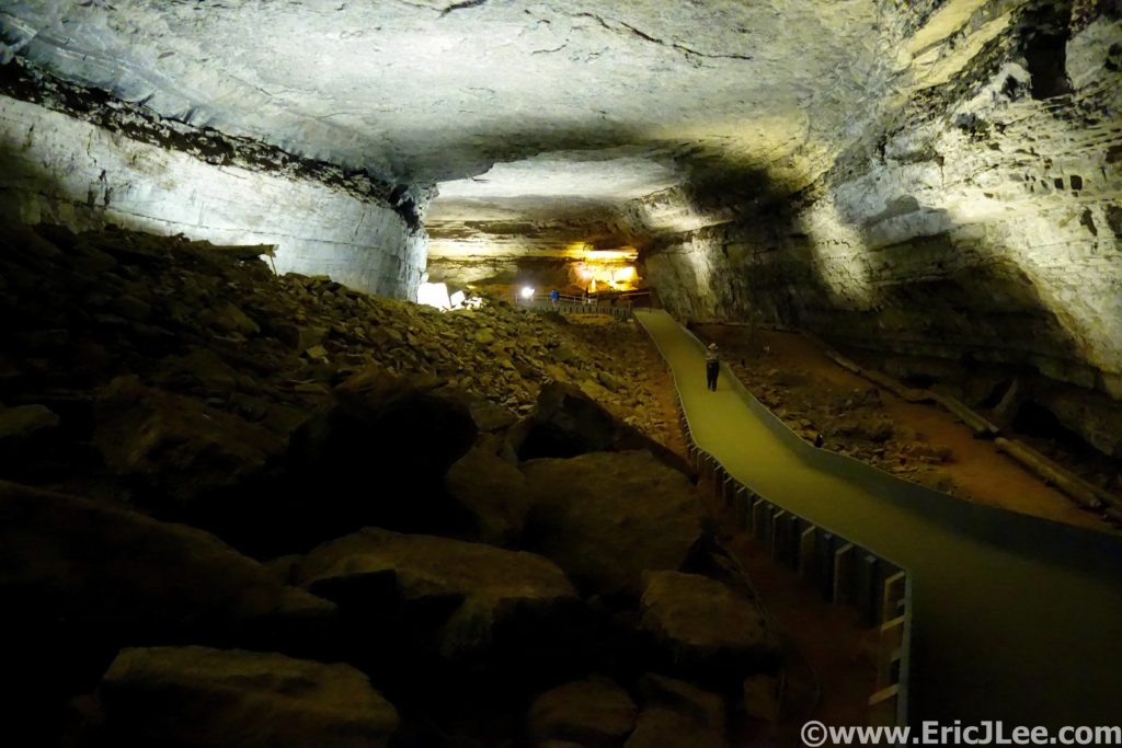
Mammoth Cave National Park is best known because its currently (May 2019) the world’s longest cave system at over 406miles of passageway with more still being discovered. The cave system has a long history of human exploration and exploitation along with a hugely diverse ecosystem inside and out. While the cave itself may be the best known feature of the park, the park also has a beautiful trail system, covering over 70miles, exposing one to the surface geology and weather that makes the formation of the cave possible (more on the caves at the end).
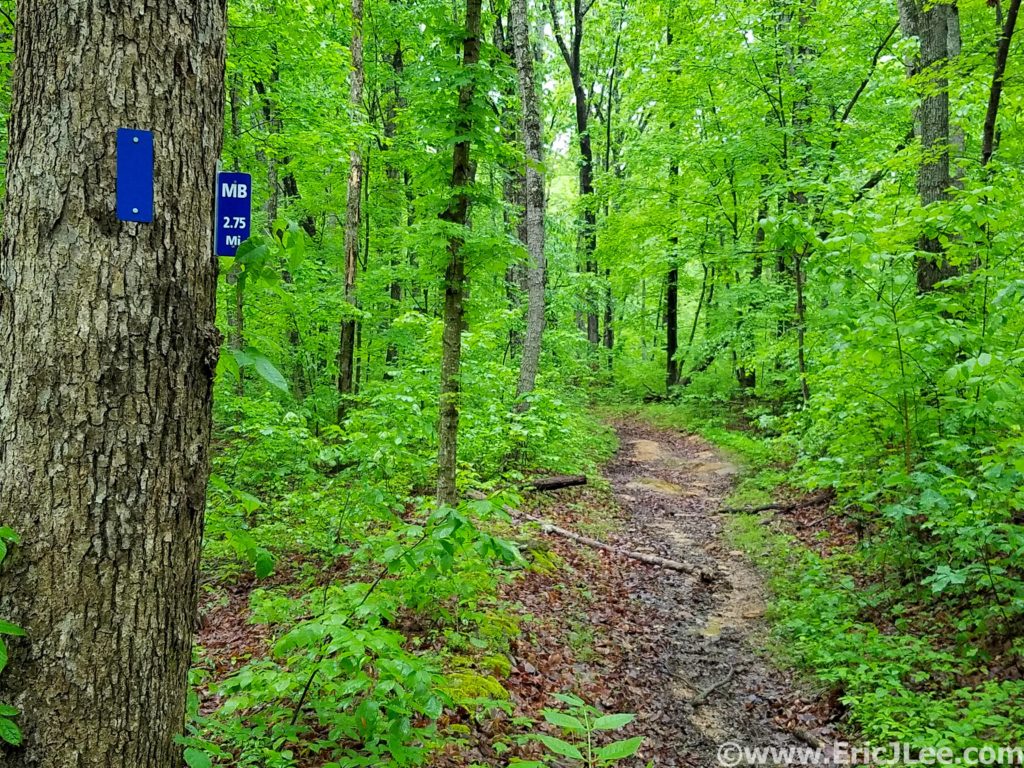
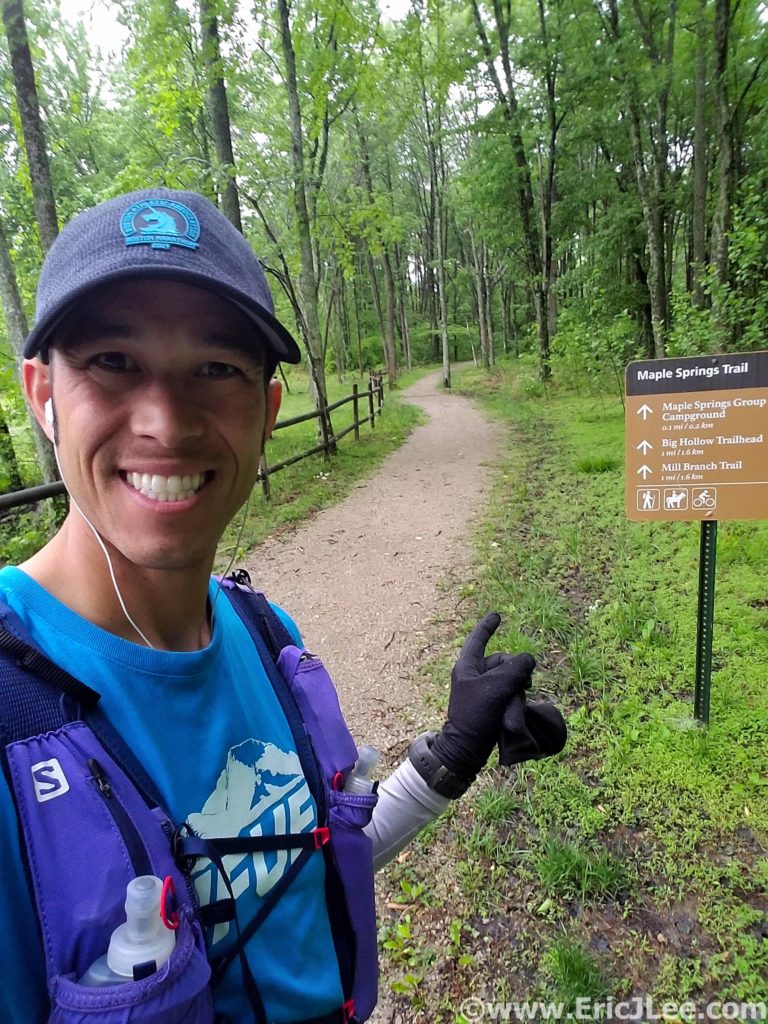
My run set off from the Maple Springs Trailhead cruising the beautiful crushed gravel paths through some of the greenest forest I’ve ever run through. Several days of rain had really brought everything to life…. including the mud. As I transitioned onto the duel use horse trails, the smooth path turned into a chopped up muddy mess. I sloshed my way around the North edge of the park on the Mill Branch and Blair Springs trails, both of which consisted largely of ankle deep mud…bleh. I got a short reprieve as I passed the First Creek TH (7.6mi, 1:30) and climbed the ridgeline high above Second Creek. The foliage briefly transitioned to pines and hemlock, before returning back to the dense hardwood forest.
My starting point at the Maple Springs TH in Mammoth Cave NP.
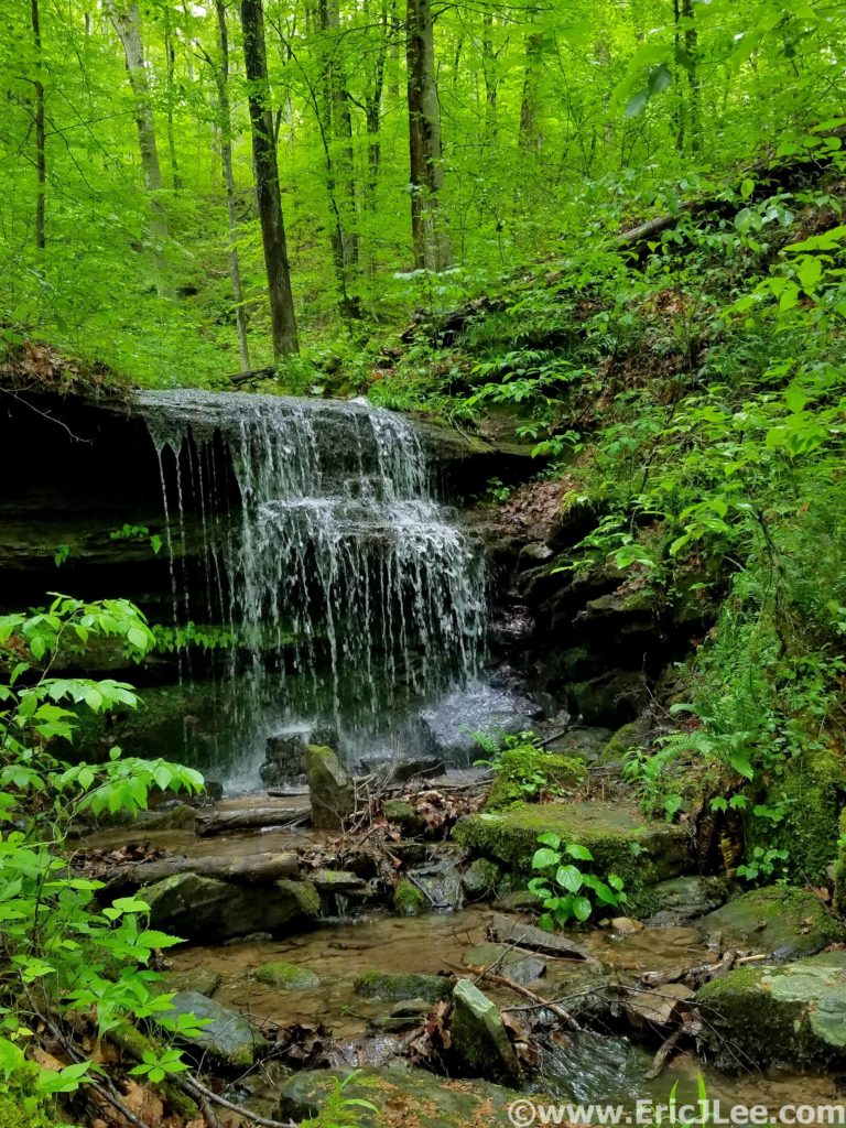
One of many cascades along the trail in Mammoth Cave NP.
When the trails weren’t a mud bog they really were beautiful…rolling
single track, swooping through the neon green forest and limestone rock
formations randomly jutting out of the hillside. As I made a turn to parallel the
Nolin River the trail transitioned back to the horrid mud bog, and I splashed
my way passed First Creek Lake (nice campsites) and then up the steep hill to
Temple Hill (14.3mi, 3:00).
First Creek Lake, several lovely campsites.
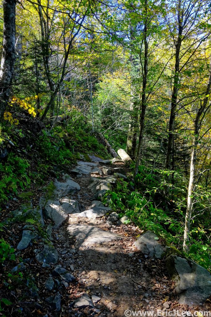
Most of the terrain had been incredibly runnable to this point, so it was nice to have some hiking grade to break up the pace. I passed a few hikers on this stretch, the first people I’d seen all day! After a short but abrupt descent down the McCoy Hollow trail, the grade mellowed and the trail weaved in and out of various river drainages before descending to the Wet Prong of Buffalo Creek (20.4mi, 4:20). Another short steep ascent up to Collie Ridge before the trail plummeted straight down to the Dry Prong of Buffalo Creek. When I finally turned onto the Sal Hollow Trail (24.4mi, 5:25, final trail of the day) I was pretty ecstatic to see find it was a non-horse trail, meaning it was the most beautiful section of trail I’d been on all day.
Limestone formations and lots of greenery await you on the trails of Mammoth Cave NP.
Soaking my legs in Sal Hollow to wash off a little mud and cool the feet.
The damp single track weaved around trees and rocky limestone outcroppings, passing springs flowing out of caves and sink holes where the water was most likely draining into the cave system below. I even took a short break to crawl into one of the cave springs for 20-30ft, opting not to delve too deep on my own though. I splashed through a puddle now and again, but overall the footing was stellar, and my tired legs were glad for the reprieve from the mud bogs of earlier. This was the trail I’d been hoping to find all day, and despite being a tired and a little grumpy I was thoroughly enjoying the cruise through the forest, listen to the birds singing and the water cascading out of every hollow. It was on this stretch that the clouds finally broke and the first rays of sun shown through the foliage, dotting the green underbrush with its yellow glow. If only all of the trail system had been this lovely….After 33.1mi and 7:17 I popped out of the forest and back onto the Maple Springs Rd, what a day it had been. National Park Ultramarathon #15 complete.
One of several cave springs along the trail in Mammoth Cave…where did the water come from?
Riding the Green River vehicle ferry across, and me without my floaties.
This trip had been my first real exploration of Kentucky, and it further confirmed my belief that every single state has something beautiful and unique to offer. The rolling green hardwood forests are so unlike anything we have in the West it was a nice change of pace. While I could have done with a little less mud, I’ve never minded getting a little dirty on the run, sometimes you don’t get the perfect conditions, but that doesn’t mean you can’t have an amazing experience. The forests of Kentucky may not have the altitude or expansive views of some of the Western parks, but the beauty lies in much more subtle things. The millipedes crossing the trail, a heron flying across First Lake, unexpected caves dotting the hillsides or simply the ability to get lost in the forest for hours and only see a handful of people.
Sunlight trickling through the leaves of Mammoth Cave NP.
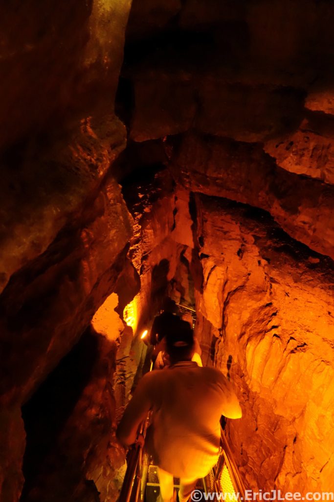
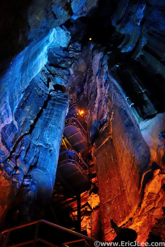
Now on to what brings most people to central Kentucky, the underground labyrinth that is Mammoth Cave….and it sure is mammoth! With a history dating back 1000s of years (to early Native Americans), Mammoth Cave was a known entity long before the Europeans arrived to exploit it. It wasn’t until the mid 1800s that people really began to explore the cave (Stephen Bishop) and cave tourism began to form. Mammoth Cave became a National Park in 1941, and now to visit the caves most people must participate in one of many organized cave tours. While I was not fortunate enough to get on one of the ‘Wild Cave tours’ (reserve early!, includes crawling and scrambling) I did get onto three different tours into very different parts of the cave. In the following paragraph I’ll describe the three tours I took and what I liked/disliked about them. Cave tour reservations can be made here.
The first tour I got on was the ‘Domes and Dripstones tour’ that enters through the New Entrance, which is essentially a dynamite blasted hole into the cave. From this entrance one descends straight into the heart of the cave down a very steep narrow set of stairs. You get a sense of the size of the size of the massive domes where water seeps into the cave and underground rivers. The tour then winds through a variety of passages ending at the Frozen Niagara formation, one of the few formations in this section of the cave. While interesting and beautiful, it was my least favorite tour as it’s a very large group and moves pretty fast, giving one less time to enjoy sections of the cave.
Descending the steep stairs down from the New Entrance deep into Mammoth Cave.
The Frozen Niagara formation in Mammoth Cave.
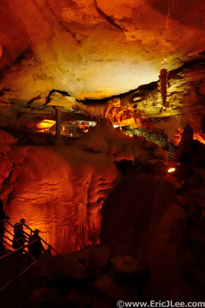
The second cave tour I took was the ‘Historic Tour’, this one enters through the original historic entrance in the center of the park. The initial passageways are massive, quickly letting one understand why people call it ‘Mammoth’. You then learn a good bit about the history of the cave, from early Native Americans to the salt peter mining and tourism of the 1800s. The walking tour then crosses the Bottomless Pit and into Fat Man’s Misery, a narrow section of passageway (all walkable, with a slight crouch). I found the Historic Tour more interesting than the Domes and Dripstones, partially because of the history, but also because you got a much better sense of the size and variety the cave offers.
The main hallway in Mammoth Cave is pretty darn big.
Looking up one of the giant silos in Mammoth Cave.
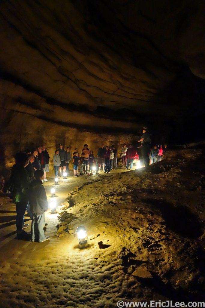
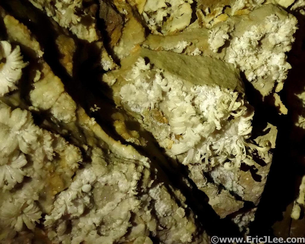
The last tour I took was the ‘Great Onyx Cave’ tour, part of the Flint Ridge cave system that as of this writing does not connect with the rest of Mammoth Cave (but is believed to). As we passed through the damp entrance, careful not to step on the cave salamanders (cool!) we quickly emerged into a room adorned with cave formations (drapes, columns, stalagmites/stalagtites, flow stone). As our small group of 20 slowly made our way deeper into the cave by lantern light the cave slowly dried out and the formation disappeared. Replacing the flow stone formations were delicate gypsum crystals, some of them assembled into the most beautiful gypsum flowers I’ve ever seen. While we didn’t cover as much cave passage on this tour I found that the time allotted allowed us to better appreciate the cave and the formations, as did the smaller group size. This was by far my favorite tour of the day.
Wandering Great Onyx Cave by lantern light.
Delicate gypsum flower formations in Great Onyx Cave.
It may be becoming cliché, but my National Parks project is taking me to areas of the country I otherwise may have never visited and explored. The rolling green hills of Kentucky and the always fascinating underground world of the cave truly exceeded my expectations. The US National Park system is not just a collection of big mountain landscapes or desert canyons, though those get most of the attention. Mammoth Cave is definitely worth exploring, both above ground and below. Because it’s the world above (the rain, the rocks, the ecosystem) that make the caves what they are. As always, special thanks to Vfuel for powering all my crazy ideas and adventures and to our National Park System for preserving such amazing places for all to see and experience in a responsible manner. Next up….Badlands National Park and Wind Cave National Park!
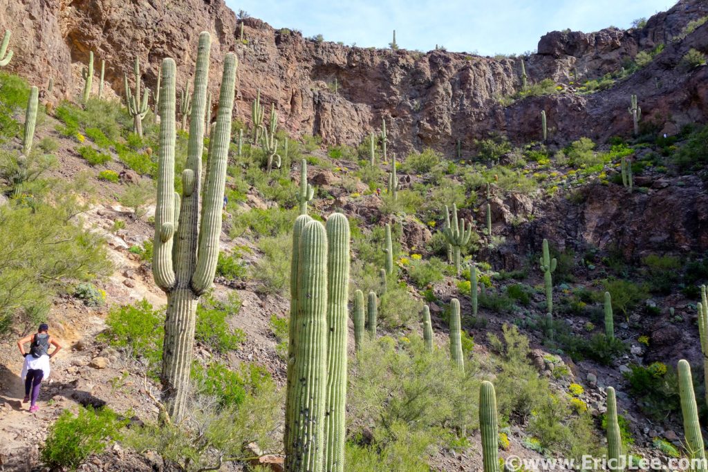
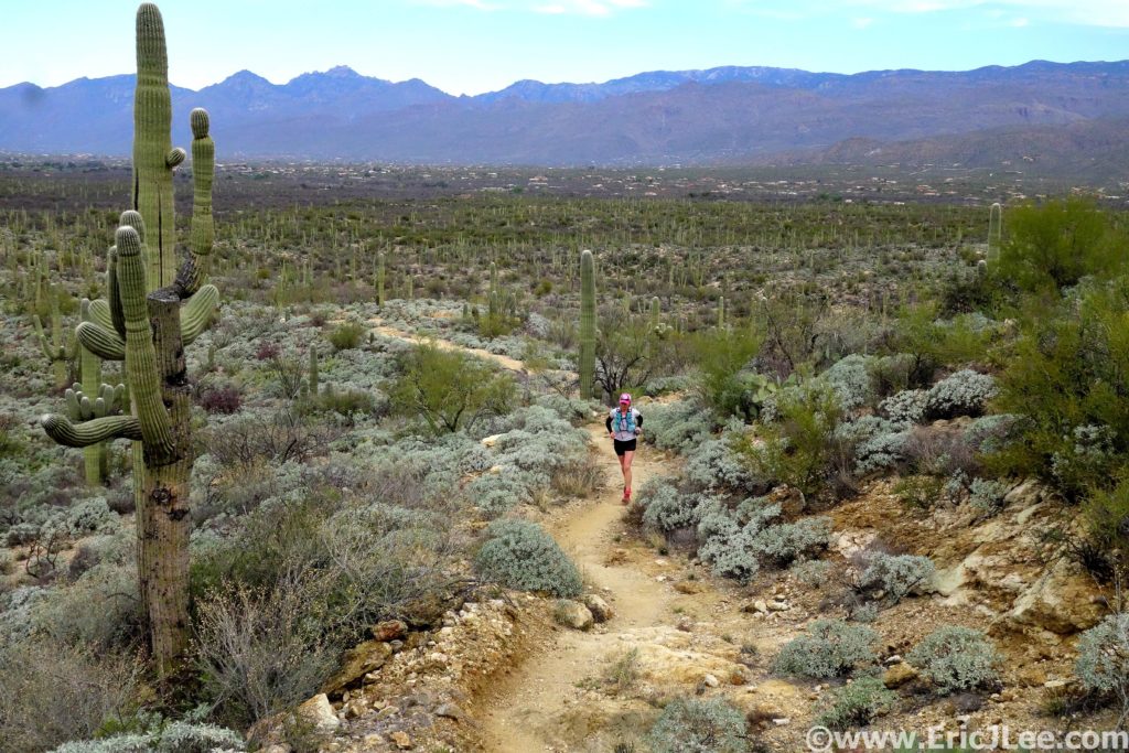
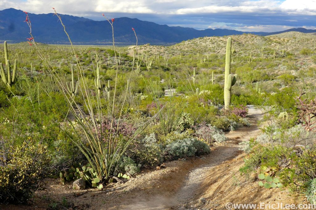
Saguaro cacti, cholla, barrel cacti, prickly pear cacti, ocotillo, catclaw, yucca….there are a long list of things in the desert that are just looking to stab, scratch and tear at you. Our lesson learned, just don’t touch anything and you should be good.
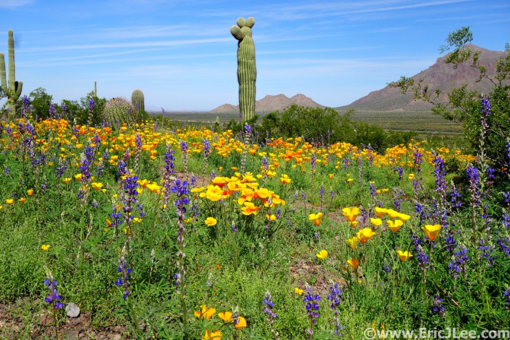
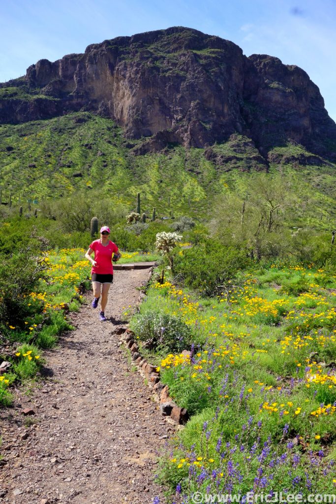
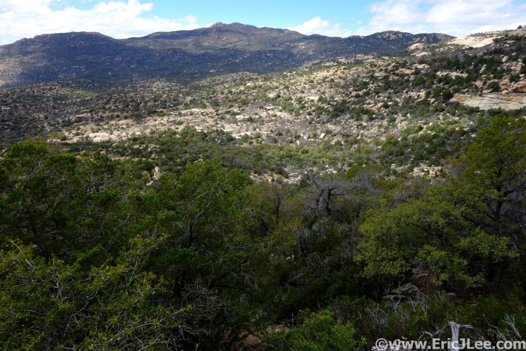
The winter of 2018/2019 has been great for skiing, but it’s also seen most of the trails in my home town of Boulder covered with snow/ice and temperatures just cold enough that things have never quite thawed out (which they normally do). In need of a little desert therapy I booked a quick weekend get away to Phoenix/Tucson. This would also give me a chance to knock out another one of my National Park ultra marathons, Saguaro National Park, which borders right up to the city of Tucson. As I started researching routes in the park I was astounded to realize that the park covered a huge diversity of ecosystems; from the desert lowlands covered in its namesake Saguaro cacti, through pinyon and juniper forests to the summit of 8666ft tall Mica Mountain complete with snow and ponderosa pines. Thanks to a little local insight from trail guru Benedict Dugger and the Tucson Trail Runners group I mapped out what looked to be a spectacular 38mile Figure-8 loop that covered a large portion of Saguaro East. A last minute surprise found me able to convince fellow Colorado runner Helen Cospolich to join me for the adventure.
Hiking our way up Picacho Peak, there are a few cabled scramble sections, but the conditions were phenomenal.
I flew out to Phoenix first thing Saturday morning and hit the ground running…literally. I grabbed Helen from her hotel and we headed straight for Picacho Peak State Park for a little warmup jog. The park was crowded, but we were in for a very special treat, as the winter’s unusually high precipitation had turned the park into a carpet of golden poppies and lavender lupine. We spent almost as much time taking photos as hiking and running. When the desert blooms it’s a truly spectacular sight, as the entirety of the landscape turns a vibrant green and wildflowers mingle with spiny succulents. After our morning tour I couldn’t help but head out for an afternoon run up Wasson Peak in West Saguaro National Park. It felt soooo good to simply run on trails again. The colors in the park weren’t peaking to the same level as Picacho Peak, but beautiful displays of wildflowers and smooth flowing single track made for a wonderful loop. Then it was back to the hotel to plot and scheme for the big adventure the following morning.
Desert bursting with life, lupine and poppies carpeting Picacho Peak State Park, 3/19/19.
Helen cruising around the Nature Trail in Picacho Peak SP, how can you not be giddy with trails like this, 3/9/19.
Trail running along the Sendero Esperanza in Saguaro National Park West, 3/9/19.
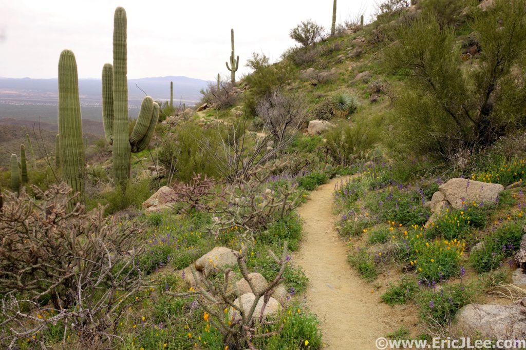
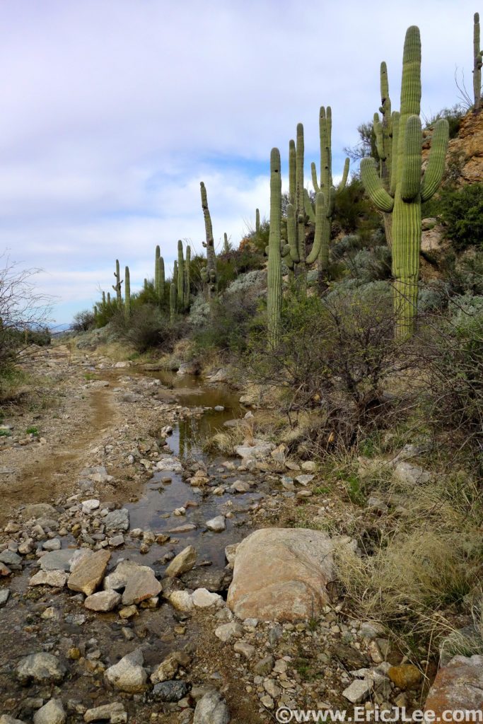
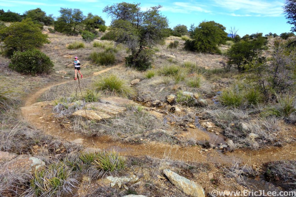
Sunday morning (3/10/19) Helen and I set out from the Broadway trailhead in the NW corner of the park, cruising our way through a network of trails, surrounded by giant Saguaro, crossing flowing washes (water!) and just ambling our way up to the Carillo and Three Tanks trails (3.2mi). Then the climbing started, up into the foothills of Saguaro we went. The trails were beautifully runnable, lined with an assortment of desert succulents and fields of greenery surrounding the babbling creek that was filling the desert with life. As we made our way up the Three Tanks trail and onto Douglas Springs the cacti gave way to rolling grasslands dotted with pinyon and juniper, slowly transitioning to ponderosa pine forest as we passed the Douglas Springs campground (10.2mi +1mi of detours).
Helen running up the Carillo trail in Saguaro National Park, 3/20/19.
Water flowing in the desert making everything super green this year, 3/10/19.
The Douglas Springs trail, out of the Saguaro zone and into the grasslands, juniper and pinyon, 3/10/19.
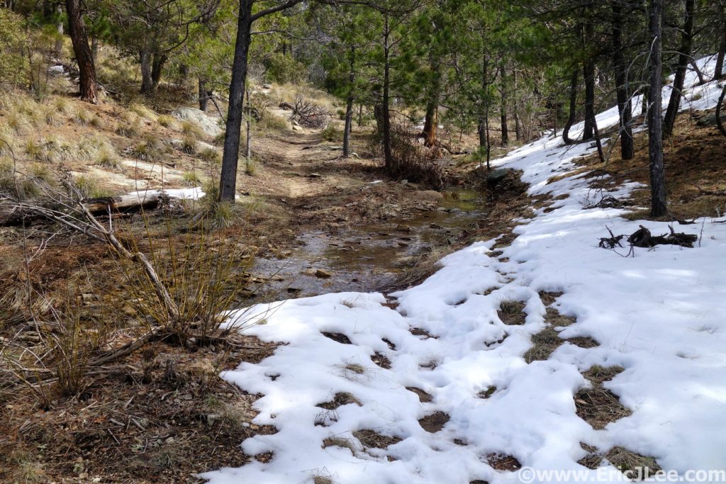
Here’s where the real climb began, 1400ft over the next few miles on a somewhat overgrown trail covered in manzanita and catclaw (ouch!) to the 6100ft Cowhead Saddle. This would be the middle of the Figure-8, and the next section was all business. The trail grinds its way up through ponderosa pine forest, passing jagged rock out croppings, and expansive views of the Sonora desert surrounding the mountains on all sides. The wind was really starting to whip through the trees, and boy was it chilly. Helen, opted to turn back and cut it a bit shorter (the trip was promising to run longer than the mapped 38miles). Around 7500ft the snow began, just a few small patches at first, but as I neared the summit of Mica Mountain I found myself more often on snow than not. Thankfully the tracks were easy to follow and the snow held my weight, soon I found myself atop 8666ft Mica Mountain (17.3mi +1.9mi of detours). There weren’t any views to speak of unfortunately as the summit was densely wooded, so I jogged on down the Mica Mountain trail toward Manning Camp.
Ponderosa forests high on Mica Mt, and a little bit of snow, 3/10/19.
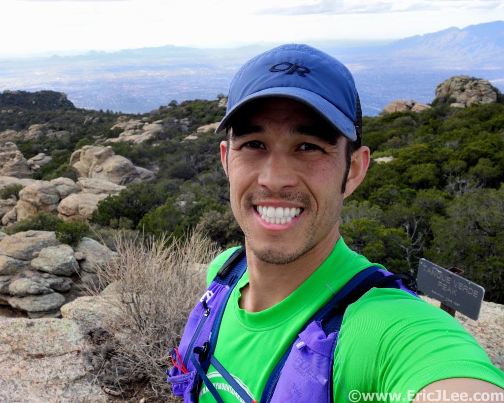
I followed the beautifully clear Chimenea creek down the mountain (refilled water) through now slushy snow to the cabin at Manning Camp, then on down down down the Manning Camp trail to Grass Shack Camp (23.6mi +1.9mi of detours). Trail was fun and technical as it zig zagged its way down the steep hillside back into more arid desert terrain. I washed off in the creek at Grass Shack camp and started the climb back up to Cowhead Saddle and Tanque Verde Peak. The temps were cool and the trail pleasant, but the miles and elevation were starting to take their toll, my poor road legs definitely weren’t in shape for this. The first stage of the climb to Cowhead Saddle went by quickly, but the rolling climb up to the summit of the Tanque Verde ridge was a grind. I felt like I was moving in slow motion but, finally I hit Tanque Verde peak (28.1mi +1.9mi of detours), a bit exhausted, but excited that I was done with most of the uphill, downhill running has always been my thing.
Looking over at Tanque Verde Peak from the Manning trail, oy that’s far away, 3/10/19.
Summit of Tanque Verde Peak, happy to finally be going downhill, 3/10/19.
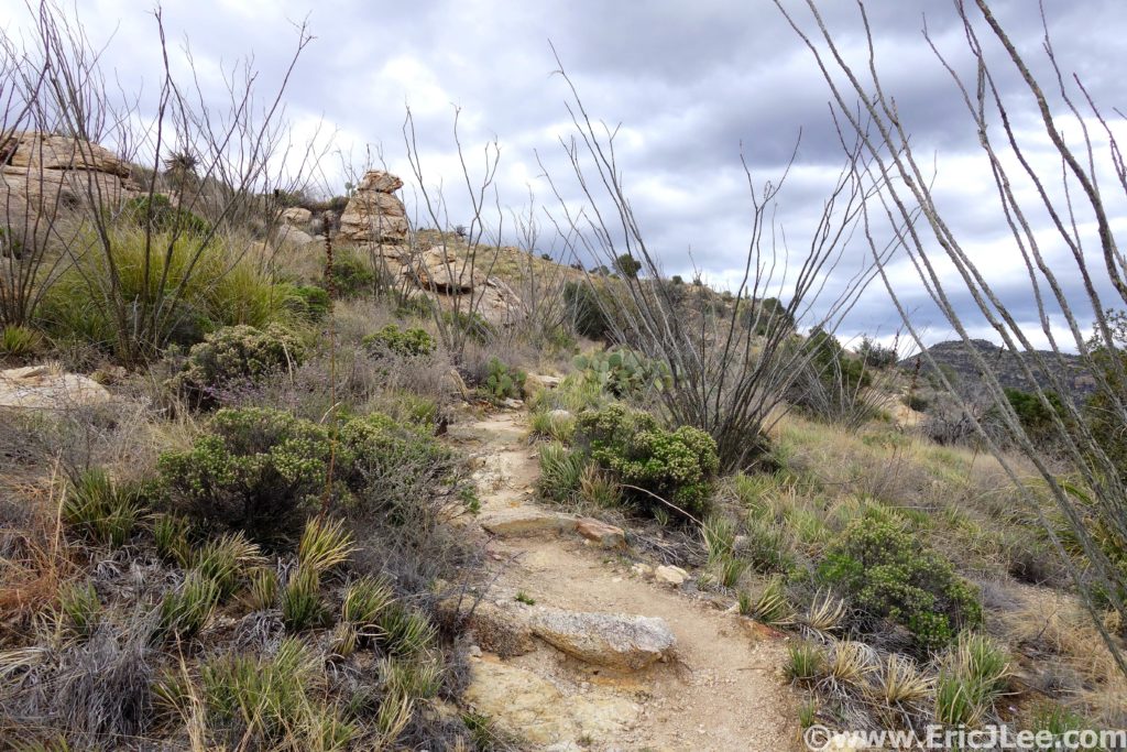
The descent down Tanque Verde peak was long and far more technical than I’d expected, rocky enough to slow the pace, many sharp turns that took one out of any rhythm, and the ever present sharp pointy desert flora threatening to impale one if you happened to stray from the trail even just a little bit. The miles were starting to drag on, but Tucson was slowly getting closer. Past Juniper Camp, and back into the desert, which was bursting with greenery and life, at last I saw the parking lot marking the 5mile to go point of the run (36.7mi +1.9mi of detours). Back down in the desert the afternoon sunlight cast beautiful shadows across the landscape, ocotillo were blooming and the massive Saguaro towered all around. I set out to run every step of that final 5miles across the Cactus Forest trail. Even though I was moving pretty well, the miles seemed to move by sooo slowly. When I finally hit the 2mi to go road crossing I pushed my legs a bit, crushing some 8:30 miles (ha!), and collapsing back at the trailhead 10h59min after we’d set out that morning. Total stats were 43.75mi (1.9m of detours), 9300ft of elevation gain, high point 8666ft, low point 2713ft, lots of cacti seen and my 14th National Park Ultramarathon completed.
The gauntlet of sharp pointy things on the way down the Tanque Verde ridge, 3/10/19.
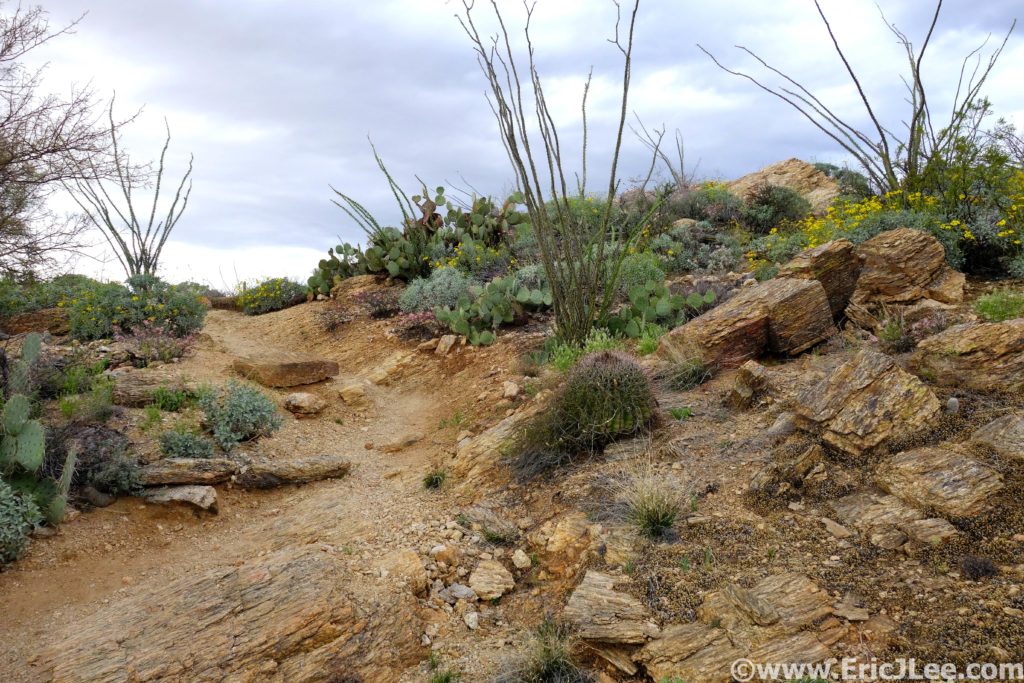
The desert was bursting with life this spring after some heavier than normal winter rains, 3/10/19.
Back in the Sonoran desert, blooming ocotillo and Saguaro cacti everywhere, 3/10/19.
My run through Saguaro National park perfectly encapsulates why I started my National Park Ultra Project. It was a park I knew very little about other than it had giant Saguaro cacti and was a desert. I never expected to be climbing to the summit of a snow capped mountain, crossing numerous streams and rivers, get startled by white tale deer crashing through the brush, or taking photos of blooming poppies, lupine, prairie clover, evening primrose and globemallow. Our National Park system as a whole covers a huge array of beautiful places with unique ecosystems, but within a single park there is often so much more than its name sake implies for those willing to take their adventure beyond the visitor centers and paved nature trails. I can’t believe it’s taken me this long to explore the trails of Tucson and Phoenix, but I will definitely be back. It’s a perfect escape for those of us living in snowy winter climates, because who doesn’t need a little desert therapy once and a while (and good Mexican food!). Special thanks to Helen Cospolich for enduring my slightly longer than advertised run and keeping me company for many miles, Benedict and the Tucson Trail Runners for all the advice. To Vfuel for keeping me energized through all these long unsupported adventures, Adam Engel at Waldron’s Peak for helping fix my arm (still a work in progress) and Myriam Desrosiers massage for taking care of my aching muscles. Next up the Boston Marathon in April and Mammoth Caves National Park in early May! The adventure continues….
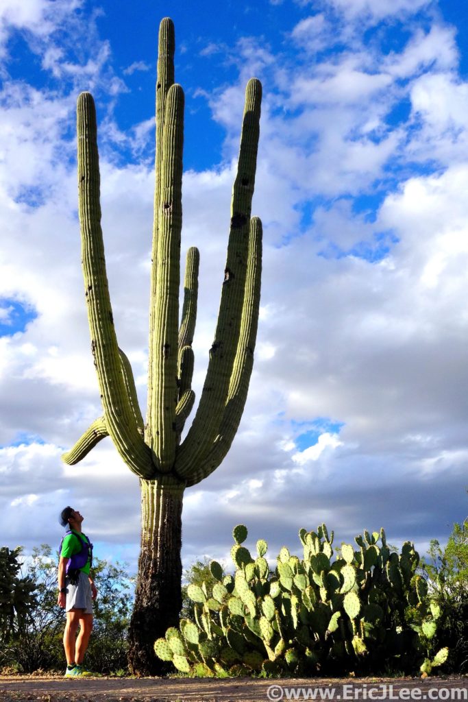
The Saguaro are very big, and I am very small. Approx 100year old cacti.