Author Archives: Eric

About Eric

Immunologist and Infectious Diseases Research Scientist by day, ultra runner and mountain adventurer in my spare time. Blogging about whatever comes up in life.

Leadville to Europe!

For all you ladies out there, Hind clothing is running a promotional give away, two lucky people will get outfit with some wonderful clothes. Just fill out a few lines on the linked form, who knows, maybe we could be twins šŸ™‚

Last day of work and only seven, yes seven days until the start of UTMB. Iā€™m just a little excited to be catching a flight to Switzerland Sunday to begin my 3 weeks of travel with family and friends.

Nick crushing Hope Pass, we were shortly in 8th place until a hip injury ended the race early.

Nick crushing Hope Pass, we were shortly in 8th place until a hip injury ended Nick’s Leadville 100 race early.

Quick recap of last weekend; I headed to Leadville to pace/crew Nick Pedatella at the Leadville 100, the third race in his attempt to complete the Grand Slam of ultrarunning (Western States, Vermont, Leadville, Wasatch). He started off really strong, and I picked up him at the Winfield turnaround in 10th place. We hammered it up Hope Pass, but as we cruised down the backside I could tell something wasn’t quite right as he began to have a bit of a hitch in his gait. By the time we got to Twin Lakes inbound he was experiencing sharp pains in his hip joint, which would ultimately force him to drop out of Leadville and the Grand Slam. Nickā€™s had a rough year, and I hope he comes back stronger next year, as heā€™s one hell of a runner.

Nick Clark cruising around Turquoise Lake to a 2nd place finish.

Nick Clark cruising around Turquoise Lake to a 2nd place finish at the Leadville 100.

Grand Slammer Dennis Ahern running up the Boulevard at the Leadville 100.

Grand Slammer Dennis Ahern running up the Boulevard at the Leadville 100.

While the organization of Leadville leaves much to be desired (my thoughts on that are well known), the runners and their efforts inspired me and rekindled my enthusiasm for racing. From the amazingly fast finishes by Grand Slam runners Ian Sharman and Nick Clark, to the 29hour finishes of those who had struggled through a long night just to walk down that red carpet for the first time and be called 100mile finishers; the stories of strength, perseverance and triumph abound. The last race I ran was Quadrock back in May, and it was far from a good race for me personally, so Iā€™m definitely looking to redeem myself at UTMB.

Here I stand, a mere week away from participating in the biggest race I’ve even been apart of, feeling rested, healthy and extremely excited just to toe the line and see what happens. While my volume has not been quite as high as I would have liked (780miles and 225,000ft gain since June 1st), I need to trust that the quality of training I’ve put in will pay dividends. The next time I check-in here itā€™ll be from somewhere in Europe! I’ll post a link to the race tracking website later, for now here’s a little video from the 2011Ā UTMB to make you jealous. Happy trails to everyone, run fast, run healthy, but mostly run happy. A special thanks to Hind clothing for supporting my adventures and VFuel Endurance gel for keeping me energized throughout the long days.

An Incomplete End (CO 14ers)

This was not how I pictured these past two weekends going when I set out to try and finish the 14ers back in June. I couldn’t have picked a worse weather window, 50-70% chance of thunderstorms and rain/snow likely in the afternoon, a report that lived up to its billing. Even though I skipped the Little Bear-Blanca traverse last weekend due to unsatisfactory conditions (wet with graupel), I was still able to summit all three peaks in the group. Then on our night hike Brian and I got rained on for almost three hours, but still managed to summit again. This weekendā€™s weather report was equally as horrid, but Steve and I forged ahead, aimed at finishing the Wilson group on Saturday.

Headed toward the Rock of Ages saddle and the Wilson Group.

Headed toward the Rock of Ages saddle and the Wilson Group.

On Saturday we got a little later start than Iā€™d hoped for, and werenā€™t moving quite as strong as I thought we needed to be given the forecast. We made WilsonPeak in 2:50, then Mt Wilson in 5:40, but by that time a huge dark thunderhead was building to our North and appeared to be sweeping our way. As we sat in the Mt Wilson saddle and pondered our future, a bolt of lightning snapped toward the ground near the head of the valley, decision made, down we went, no Mt Wilson-El Diente traverse and no El Deinte today. As we bottomed out in Navajo basin the clouds rolled over, the peaks

Summit of Mt Wilson, #2 of the day, note the storm clouds gathering (11am)

Summit of Mt Wilson, #2 of the day, note the storm clouds gathering (11am)

disappeared, and hail began to fall. As we started up the trail toward the Rock of Ages saddle the hail picked up, and the echo of thunder shook the valley, but no visible lightning yet.

Nasty thunder and a wall of rain coming at Navajo basin.

Nasty thunder and a wall of rain coming at Navajo basin.


We slowly moved up hill, staggered about 100ft apart, when a bolt struck the Wilson-Diente ridge behind us sending us both into a crouch. We proceeded to remain in our crouched position at 12600ft watching lightning strike the surrounding peaks and ridges as the hail steadily pelted us. Finally, after about an hour, the clouds began to lift and the worst of the storm had moved off to the South, so we booked it up and over the Rock of Ages saddle and back down to our car. In total it had been a nine hour day with our hour+ break, and El Diente (an unofficial 14er) was left out there.

Looking up at San Luis Pass from West Willow Creek.

Looking up at San Luis Pass from West Willow Creek.

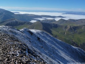
After much thought and debate on what to do I decided that my list would have to be incomplete for this year, no El Diente and also minus two of the four ā€˜classic 14er traversesā€™ (Little Bear-Blanca and Mt Wilson-El Diente). With only one free day left I opted to continue as planned with a nice morning run up San Luis Peak. I was originally thinking of running up Bondholder Meadow, but that approach seemed a little too circuitous, so I opted for the West Willow Creek approach out of Creede. A beautifully runnable trail that partially follows the CT, I hit the snow capped summit of San Luis Peak at 9:06am (2h02min) and plopped down, having summited my 53rd and final official 14er. Saturdayā€™s storms had left all the high peaks with a thin coat of

Snowy summit of San Luis, looked South toward a foggy Creede.

Snowy summit of San Luis Peak, looked South toward a foggy Creede. My 53rd and final Ranked 14er.

snow above 13500ft, and all the rain had left a thick blanket of fog over the valleys below. It would have made for a perfect finish, if things had gone as planned on the two big traverses the past two Saturdays. Unfortunately, it was just another beautiful day at 14000ft.

While I finished the ā€˜officialā€™ 14ers on Sunday with San Luis, it didnā€™t feel like a completion, as my original list and intention was to summit the 58 recognized 14000ft summits AND complete the four classic 14er traverses; CrestoneĀ Needle-Peak, Maroon Bells traverse, Little Bear-Blanca and Mt Wilson-El Diente. Because of the weather and conditions the past two weekends Iā€™d missed out on the last two and had not summited El Diente. While I donā€™t regret the choices I made (definitely was the right decision), Iā€™m still bummed to have to leave my list close, but not quite, finished. The mountains will be there next year and I will definitely return for the two big traverses, hopefully in better conditions than the past two weeks have provided. But with pacing

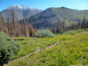
Looking back at a snow capped San Luis from the CT.

Looking back at a snow capped San Luis from the CT.

duties in Leadville next weekend, then a flight to France the following, my next free weekend wonā€™t be until September 21st, most likely too late for such ambitious routes. For now Iā€™ll have to be satisfied with completing the 53 ranked CO 14ers, leaving the celebration for next year. Let the taper begin, as Iā€™m off to France in 13days and UTMB starts in 18days!


Then There Were Four…

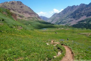
Descending West Maroon Pass on the Aspen Four Pass Loop, 7/20/13.

Descending West Maroon Pass on the Aspen Four Pass Loop, 7/20/13.

Over the past several weeks I’ve had the good fortune to experience a lot of fun mountain adventures, from the Aspen Four Pass loop and Pyramid Peak on 7/20/13 to climbing nine 14ers in 18hours37min on 7/26/13. I started this summer with twelve 14ers (+El Diente) remaining unclimbed on my peak list, and have finally whittled it down to four after this weekend. While the climbs and plans did not go as planned it was a very successful weekend none the less.

Brian at the base of Little Bear's NW Face.

Brian at the base of Little Bear’s NW Face.

After sending out some personal emails I was able to talk my friend Brian into joining me for the weekend of technical peaks and a little bit of adventure. We met in South Denver Friday afternoon, hopped into my Subaru and booked it down to the Sangre de Cristo mountains, bound for Lake Como Rd. We started up the first 1.5 miles of smooth dirt road no problem, though it soon turned to softball sized loose cobbles. We slowly bounced up the road, bypass a few rocky spots without issue until we finally came to the dry wash at 8800ft. Upon inspection I deemed the Forester could high side on the left (driving up toward Como) to bypass a few larger boulders on the right, and got through without issue. Within 100ft the road again pitched up, this time with more large rocks and craters, ones I did not feel driving the Subaru over, so we parked right near the dry wash and the ā€˜black bearā€™ sign to camp for the night. If you have a slightly higher clearance vehicle (larger SUV, Toyota Tacoma, etc) you should be able to make 10000ft with some careful driving as there are only a few problem spots, just too much for a Subaru.

Brian climbing along the ridge to Little Bear at the top of the NW face.

Brian climbing along the ridge to Little Bear at the top of the NW face.

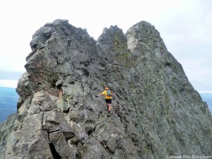
We woke the next morning at the crack of 3:40am, threw together the gear, shouldered the helmets and began hiking up the Lake Como Rd at 4:03am. The road was long, rocky, and tedious, but went by quickly and at 5:50am we passed Lake Como and continued up toward the NW face of Little Bear, our first route. We left the trail around 12100ft and headed toward the black stain at the base of the NW face. The headwall just right of the black stain was our first obstacle, but we were able to surmount it with just some easy class 4 scrambling and soon found ourselves climbing up the ribs and gulleys of the NW face. After a few 100ft we traversed left into a larger bowl and the main gulley on the NW face that takes one to Little Bear. The climbing was mostly solid and very continuous as we ascended a mix of class 3-4 terrain, which was complicated by the fact that heavy rains the previous night had made all the rock and lichen a little damp. As we neared the top we took a leftward ascending route that eventually popped us out on the Little Bear-Blanca traverse ridge, 3 small towers from the summit. There was no easy route up from here, over one tower, then around the crux tower across the class 5 move, which was damp from the previous nightā€™s graupel and rain making it all kinds of sketchy. After tip-toeing around the ledges, we finally topped out on Little Bear at 7:30am.

Descending the Hourglass on Little Bear, very wet.

Descending the Hourglass on Little Bear, very wet.

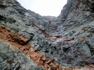
We sat and pondered our fate for a few minutes, finally deciding that the wet rock on the ridge traverse was uncomfortable enough to make it a ā€œNo Goā€ today, so down the Hourglass we went. We carefully hopped down the rubble filled slopes at the top, reaching the Hourglass proper where we scrambled down rocks on climbers left to avoid the strong flow of water coming down the couloir. Weā€™d spoken with a party earlier in the day who said that a new rope had been placed as of 8/2/13, the shiny orange rope was in fact there. We scrambled most of the way down without use of the rope (climbers left) but finally gave in near the bottom where the couloir constricts forcing one into the flowing waterfall. The traverse back to the main road went quickly, and at 8:45am we once again turned up the dirt road, this time bound for Ellingwood and Blanca.

Climbing the SW Ridge of Ellingwood.

Climbing the SW Ridge of Ellingwood.


Looking across to Little Bear and the ridge traverse from Blanca.

Looking across to Little Bear and the ridge traverse from Blanca.

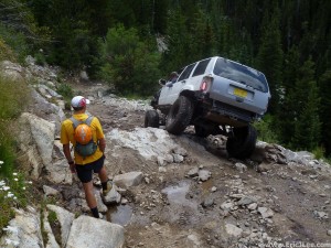
With our change of plans, the SW ridge of Ellingwood became the preferred ascent route, so at 12600ft we left the trail and for a dark band of rock that provided an easy direct line onto the SW ridge.Ā The SW ridge is a very solid and fun route, with moments of exposure, rock scrambling that can be kept at class 3, though a few class 4 moves might be required if you stick to the ridge proper the entire way. We picked our way up the ridge, staying high most of the time and finally scrambled our way to the summit of Ellingwood at 10:30am. Despite the crowds on the trails below and on Blanca, we were alone atop Ellingwood, a pleasant surprise. We descended off Ellingwood via the high route, following the ridge much of the way, until we hit one tower that forced us down the gulley 50-100ft to traverse around before starting our climb back up to the ridge and toward Blanca. We slogged our way up the North face of Blanca, topping out at 11:15am, again with the summit to ourselves.Ā  As we descended the trail back down toward Lake Como low clouds began to roll in, obscuring the summits and pouring over the ridges. The long hike/run out went fairly uneventfully down the road, only interrupted by a short break to watch a highly modified jeep pick its way through Jaws (impressive), though we did beat the jeep back down to the 8800ft mark.

Suped up Jeep on Jaws on Como Rd, one of the hardest 4wd Rds in the state.

Suped up Jeep on Jaws on Como Rd, one of the hardest 4wd Rds in the state.

Back at the car we celebrated our successful day with some food and a cold drink. After a few short naps and a five hour break Brian and I headed out at sunset for one more mountain, summiting at 12:30am and back at our car just after 4am. In total the modified route Saturday AM compiled 18miles and 9200ft while the evening run was an additional 18.5miles and 6200ft, leaving me with just four more peaks until I complete them (Mt Wilson, Wilson Peak, El Diente and San Luis).Ā A special thanks toĀ Hind outerwearĀ for supporting my adventures andĀ VFuel Endurance gelĀ for keeping me energized throughout the long days.

24hours of 14ers, “Do or do not, there is no try”

14ers Summmited: Nine (Evans, Bierstadt, Torreys, Grays, Quandary, Democrat, Lincoln, Bross, Sherman)

Total Time: 18hours 37min (splits below)

Total Distance on Foot: 50.9miles

Total Elevation Gain/Loss: 18500ft

Previous 24h Record: To my knowledge Zachary Dong, nine peaks in 23hours using the 3000ft rule.
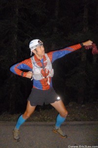
5am on the Mt Evans Rd, its go time!

5am on the Mt Evans Rd, its go time!

It was a dark and stormy night, no really it was. I met my friend Reese in Frisco, CO Thursday evening as the rain pounded the surrounding mountains and lightning and thunder crackled all around us. How was I going to run for 24hours tomorrow, let alone do so all above 11000ft in elevation? I was prepped, somewhat rested, and just had to trust that in the weather report that Friday 7/26/13 was going to be more stable and hopefully less stormy. The idea of trying to climb as many 14ers in 24h had been hatched over a year ago when talking with a former coworker he relayed that he had once climbed nine 14000ft peaks in under 24hours using the 3000ft rule. In searching the internet and asking around I was unable to find any record other than what my coworker had relayed. I felt that someone needed to set out and put down a faster time (or more peaks), why not me?
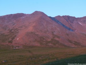
The final summit push to Mt Evans in the early morning light.
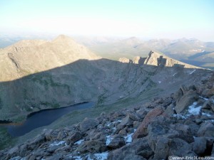
The final summit push to Mt Evans in the early morning light.

Descending toward the Sawtooth and Mt Bierstadt amidst fresh snow.

Descending toward the Sawtooth and Mt Bierstadt amidst fresh snow.

My alarm blared at 4:15am, and Reese and I quickly set to work assembling gear for the day. Then at 5:00am I set out from 11200ft on the Mt Evans Rd to begin my journey to see how many 14ers I could climb in the next 24hours. As the shining moonlight gave way to the warm pink glow of sunrise, I climbed the last 1000ft to the summit of Mt Evans at 6:50am. I was greeted by a thin crust of snow atop Mt Evans and across the Sawtooth over to Mt Bierstadt. After carefully scrambling my way across the Sawtooth and around the patches of snow and ice I topped out on Mt Bierstadt at 7:48am. I snapped a photo, and quickly bombed down the trail toward Guanella Pass, hitting the road and finally finding my crew at 11000ft at 8:32am. I hopped in the car and we sped off toward Georgetown, next destination Stevens Gulch.
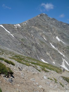
Looking up at Torreys Peak, #3.
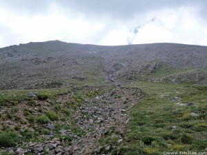
Looking up at Torreys Peak, #3.


Ascending Cristo Couloir toward Quandary Peak.

Ascending Cristo Couloir toward Quandary Peak.

I hit the trail to Torrey’s Peak at 9:17am, headed toward one of my favorite 14ers, with its aesthetic shape and plethora of lines I always seem to enjoy climbing it. I ran into a few friends on the climb up, summiting Torrey’s at 10:37am and Grayā€™s not long after at 10:57am. The run down was just bliss; clear skies, clean air, endless views, good trail, wild flowers blooming and trail crews hard at work (much appreciated). I once again jumped right into the vehicle this time for the long ride to Quandary. I stretched out, rehydrated and refueled as Reese cruised down I-70 toward Frisco. After a quick nap I guided Reese onto Blue Lake Rd where at 11200ft we pulled over, I hopped out and began jogging on up the road toward Cristo Couloir at 12:46pm. Dark clouds loomed overhead as I climbed up Cristo, 2400ft in just over a mile. As I pushed toward the summit the clouds broke, summitting at 2:15pm with blue skies overhead and clouds billowing around on all sides. I scrambled my way back down the couloir reaching the car at 2:55pm, so far so good.
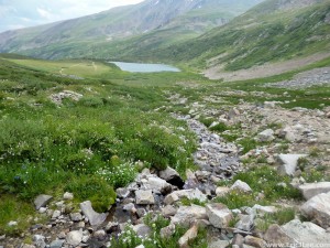
Looking back at Kite Lake enroute to Democrat.
Looking back at Kite Lake enroute to Democrat.


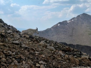
Mt goat hanging out on Mt Democrat.

Mt goat hanging out on Mt Democrat.

Next up Democrat, Lincoln, Cameron (unofficial) and Bross, know as the DeCaLiBron. As I jogged up Kite Lake Rd the afternoon light was softly filtering through the clouds overhead. KiteLake was surrounded by tents, but the trail was quiet as most people were settling in for the afternoon. As I began my hike up toward Democrat I could tell the previous five peaks had taken a toll on my legs and lungs. At 13000ft my pace slowed to a trudge, and I finally summitted Democrat at 5:05pm. I descended back to the saddle where I paused for 15-20min as I watched a dark cloud slowly roll over Mt Cameron,nothing came to pass so on I went to Mt LincolnĀ (6:05pm) and Mt Bross (6:34pm). As I hopped down the rocky slopes of Mt Bross I could tell the fatigue was building and my pace was slowly slipping. I finally reached Kari (crew #2) and the car at 7:19pm, almost an hour later than Iā€™d hoped for.

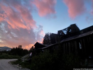
Sunset over the Leavick mining site near Sherman.

Sunset over the Leavick mining site near Sherman.

As we drove toward Fourmile Creek I caught Kari up on the dayā€™s adventure, the good weather, the smooth running and now the labored movement above 13k. At 8:02pm she dropped me off at 11000ft on the Fourmile Creek Rd and off I went, again jogging the flattish uphill this time toward Mt Sherman. As I passed the old Leavick mine site the setting sun illuminated the passing clouds a bright pink color, forcing me to pause for a photo and to absorb the beauty surrounding me. After all, thatā€™s why Iā€™d come out here in the first place instead of just running mountains around Boulder. As I pushed up the ever steepening road into the darkness a cold wind began to blow and my pace again began to suffer because of the altitude. I slowly ascended the rocky ridge toward the top of Mt Sherman, plopping down on the summit at 10:06pm in the silence of the dark night. Since my SPOT had long ago died, I shot out a text to a few friends to let them know I was ok and about to head down into Iowa Gulch.
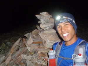
Summit of Mt Sherman, 9th and final 14er for the day.

Summit of Mt Sherman, 9th and final 14er for the day.

The descent was rough and rocky, just how Iā€™d remembered Sherman. I slowly trotted my way back to the saddle, then struggled for a bit trying to find the descent trail into Iowa Gulch, finally giving up and just heading downhill into the basin. Eventually I crossed right onto the trail, which consisted of steep hard pack dirt with a fine layer of gravel on top, yuck. I slowly picked my way over to the Iowa Gulch Rd where my friend Shad was parked to make sure I was ok. It felt soooo nice to be on the dirt road and to let the legs just turn over and run downhill, but the 3miles of dirt road seemed to take forever. During the descent my mind had moved on to whether or not Iā€™d continue for another peak, time was running short and with the UTMB 100mile looming 5weeks away I was worried about a major setback. I reached Kari and the 11000ft point on the Iowa Gulch Rd at 10:37pm at which point I sadly informed them that was it for me.

I wasn’t injured, I wasn’t sick, I wasn’t too tired to continue, Iā€™d just had enough and decided it was time to live to fight another day. While I had not completed the 11-12 14ers Iā€™d initially hoped to, Iā€™d finished nine in 18hours 37min and had felt pretty strong (other than altitude issues) all day. The weather had cooperated after the torrential downpour on Thursday night; my crew had been phenomenal in getting me where I needed to go, keeping me fueled up and being great company. So the current number of 14ers in 24hours still stands at nine, but now with a time of 18hours 37min. Definitely a soft number that can be bested by one of the faster elite mountain runners or someone a little more rested and a little better acclimated than I was on Friday 7/26, either by climbing more peaks in 24hours (>10) or running nine peaks faster than I did. I invite some of you out there to test yourself and see what you can accomplish. Because until you push yourself beyond the perceived limits, you may never know what your ultimate potential might be. Next up for me is to finish the CO 14ers in the coming weeks, to pace my friend Nick at Leadville (yes there will be a costume), and on August 30th the Ultra Trail du Mont Blanc in Chamonix, France. A special thanks to Hind outerwear for supporting my adventures and VFuel Endurance gel for keeping me energized throughout the long days. Full Photo album here.


Point of Interest

Actual Leg Time

Actual Total Time

11200ft Mt Evans Rd

Ā 

Ā 

Mt Evans Summit

1:50:23

1:50:23

Sawtooth to Bierstadt Summit

0:57:50

2:48:12

Guanella Pass Rd 11000ft

0:44:04

3:32:16

Drive to Stevens Gulch TH

0:44:47

4:17:03

Torreys Summit

1:20:23

5:37:27

Grays Summit

0:19:53

5:57:20

Stevens Gulch TH

0:39:25

6:36:45

Drive to Blue Lake Rd 11200ft

1:09:08

7:45:54

Cristo Col to Quandary Summit

1:28:46

9:14:41

Cristo Col to Blue Lake Rd

0:40:19

9:55:00

Drive to Kite Lake Rd 11100ft

0:32:38

10:27:38

Kite Lake to Democrat

1:37:10

12:04:48

Lincoln via Cameron

1:00:34

13:05:22

Bross Summit

0:29:03

13:34:24

To 11100ft on Kite Lake Rd

0:45:08

14:19:32

Drive to Four Mile Crk Rd 11000ft

0:43:01

15:02:33

Mt Sherman Summit

2:03:28

17:06:02

Iowa Gulch Rd 11000ft

1:31:30

18:37:42


Taking Control and Moving On

Well, for the past several months the big question has been, will I get in to Hardrock? As of yesterday 7/4/13 I finally put that to rest with a definitive “No”. With only 8days until the race start I sat in the precarious spot of being 1st on the newbies waitlist, next in line, but still no guarantee of getting in. After much stress and racking my brain, I’ve decided to let Hardrock go and head out east to share in the once in a lifetime moment and be there to see my friends Ben and Amanda get married.

I think I made this decision about two weeks ago, but its been hard for me to let go of Hardrock after Ā 6 years of failed entries (after this year). But, ultimately, Hardrock will be there next year, and I’ll have 64 tickets being a 6 time loser. What this means is I can get back to running around in the mountains, working on my 14ers projects and preparing myself to have a kickass time at UTMB in August. I’m excited and looking forward to all the great things the summer still holds for me. Best of luck to all those participating, crewing, pacing the 2013 Hardrock 100 and don’t have too much fun without me.

Jessie cruising down the North Longs Pk trail on the Granite Pass-Storm Pass loop. The official end to my taper.

Jessie cruising down the North Longs Pk trail on the Granite Pass-Storm Pass loop in RMNP with Longs Peak in the background. The official end to my taper.

Colorado’s 14ers

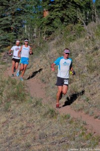
Lead pack at the San Juan Solstice 50 mi. Dakota would take the win in course record time (7:35)

Lead pack at the San Juan Solstice 50 mi. Dakota would take the win in course record time (7:35).

If you follow my blog or you know me personally you know how much I enjoy climbing mountains. Itā€™s not only the physical and mental challenge, but the feeling of having a definitive goal, that when you reach it, provides expansive views, often complete solitude and a reminder of how many new adventures and experiences surround us on all sides. A few weeks ago a friend asked me how many Colorado 14ers I had yet to climb, to which I responded ā€œI donā€™t know?ā€. Upon looking this up I realized I only had 12 left, all of which could probably be done in 6 separate day trips, not bad. For many years I’ve said Iā€™m in no rush to climb all the Colorado 14ers, while nothing has changed, I think its nice to have goals to keep oneself motivated. So with Hardrock quickly becoming a ā€˜maybeā€™ on the summer event list, I’ve decided to keep myself motivated by enjoying all the other fun things that my training has made me capable of doing.


The nasty NW ridge of Redcloud, not recommended.

The nasty NW ridge of Redcloud, not recommended.

Looking over at Sunshine from the summit of Redcloud.

Looking over at Sunshine from the summit of Redcloud.

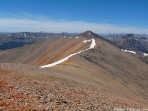
Now the Colorado 14ers are not always the most interesting of peaks, but each one does have its own character. This weekendā€™s summits were great examples of the variety one gets when climbing Coloradoā€™s highest peaks. On Saturday, while many friends were off running the San Juan Solstice, I headed out from LakeCity to run Redcloud and Sunshine. The trail up Silver Creek started out nice and smooth, runnable in fact, but once I took off up the peak proper I ran into 1000s of feet of gravel and talus, until finally reaching the reddish orange non-descriptĀ summit of Redcloud, Sunshine was much of the same. The redeeming factor is the 360 degree panoramic views of craggy peaks and lush green valleys that surround one on all sides and the thin clear air at 14000ft. While the routes were nothing too exciting, the reward on top was worth the trek, 3h31min round trip for 8.9miles, 4700ft of gain, two 14ers, and one 13er (Sundog).

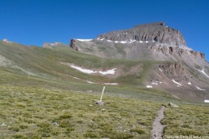
Sunday found me again up early, this time headed for Matterhorn Creek and Uncompahgre and Wetterhorn, twoĀ of Coloradoā€™s most aesthetic 14ers. The Matterhorn Creek trail was another beautifully smooth path, allowing me to slow jog my way uphill, before the long traverse over to Uncompahgre. Both Uncompahgre and Wetterhorn rise strikingly from the high plateau, their summits guarded by several sets of ominous cliffs, but making for a very picturesque scene. I was amazed at how smooth the trail up Uncompahgre was, more like some nice forest single track than high alpine 14er running. I topped out on Uncompahgre 2h27min into my day, and took in the clear skies and the rare occasion of having one of Coloradoā€™s finest peaks completely to myself. I was able to blast down the smooth single track trail, making my way back over to the base of Wetterhorn in an hour.

The trail leading up to Uncompahgre

The trail leading up to Uncompahgre

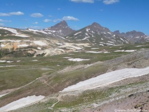
Looking over at Matterhorn and Wetterhorn from the Nellie Creek Jct.

Looking over at Matterhorn and Wetterhorn from the Nellie Creek Jct.

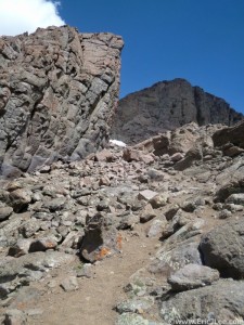
Wetterhorn is a much different peak, where Uncompahgreā€™s cliffs are broken by a little rock hopping and a smooth trail, Wetterhorn requires the intrepid mountaineer to pick oneā€™s way through the cliff bands, scramble over a few rocky ribs and finally to ascend a steep exposed staircase of rock to the summit. The class 3 scrambling on Wetterhorn was incredibly solid and very enjoyable, a nice break from the talus and scree of the day before. Before I knew it I was standing atop Wetterhorn, admiring the open meadows of Matterhorn Creek on one side and the rocky knife edge ridge leading over to Matterhorn Peak on the other. I quickly scrambled my way back down to the trail and cruised backĀ to my car, making the descent in just under an hour. Todayā€™s mountain run was one of the strongest Iā€™ve had in a long time; 18miles, 6700ft elevation gain and two 14ers in 5h32min46sec, a time that might be an FKT (Fastest Known Time) as I canā€™t find any records online of anything faster.

The Prow and the final push to Wetterhorn's summit.

The Prow and the final push to Wetterhorn’s summit.

Then there were 8; Mt Wilson, Wilson Peak, San Luis, Culebra, Pyramid, Little Bear, Blanca and Ellingwood. Unfortunately all except Pyramid require a lengthy drive from Boulder, so when I squeeze them in depends on Hardrock. I’ve also got another 14er project in the works for later this summer and maybe another big one next summer, stay tuned. Special thanks to my sponsorsĀ Hind clothingĀ andĀ VFuelĀ for keeping me on track for all these 14ers.Ā Run fast, run healthy, but mostly run happy.

Why I’m NOT a Runner

My intended traverse route on 6/16 Champion to Oklahoma.

My intended traverse route on 6/16 Champion to Oklahoma.

For several years now I’ve argued that Iā€™m not ā€œa runnerā€, yes I run, but the #1 thing that defines me is NOT running. As with most athletic kids I was forced to run for soccer and volleyball (my two primary sports) and did dabble on the Cross Country team in high school. Though I missed half the Cross Country meets for volleyball matches and always considered Cross Country more of a workout to prepare myself for all day volleyball tournaments. It wasn’t until 2006 that I actually started to run on a regular basis and train for races (La Jolla Half Marathon and Bishop High Sierra 50mi). While this makes me relatively new to running, I’ve been camping, hiking and scrambling around in the outdoors as long as I can remember.

Fun class 2/3 ridge scrambling ahead over Pt13476. 6/16/13.

Fun class 2/3 ridge scrambling ahead over Pt13476. I made it to the base of Deer (far left) before getting stormed off the ridge, 6/16/13.

Not much has changed since my youth playing in the Sierras and around Lake Tahoe, the only difference is, I can do it a lot faster and further than I used to. If I have my choice on the weekends Iā€™m off to the mountains to climb a peak, scramble an exposed ridgeline or to find some obscure lake in the middle of nowhere. My average pace usually a pedestrian 2.5-5mph, barely a jog if at all. I carry items foreign to most runners; a map, emergency blanket, emergency light, whistle, garbage bag (a what?), small 1st aid kit and sometimes an ice axe/crampons. But these arenā€™t the reasons I donā€™t call myself a runner, itā€™s how I approach these weekend adventures. I go out for the freedom of the hills, the thin air, the high altitude peaks, the route finding, the scrambling, the adventure of the unknown but most often NOT to run. Sure I end up running on many of my trips because Iā€™ve trained my body to do so, its quicker and allows me to cover more ground in a day, but if it came down to it and I was incapable of running during one of my mountain outings Iā€™d be perfectly content.

Looking back at the ridge and Deer Mt (right), running away from the rain and snow coming my way. 6/16/13.

Looking back at the ridge and Deer Mt (right), running away from the rain and snow coming my way. 6/16/13.

Even in town, my training consists of endless laps up and down Bear Peak, Green Mt and Mt Sanitas, routes that find me walking and hiking almost as much as running. This is not to say I donā€™t enjoy running, but I enjoy many activities; volleyball, dance, rock climbing, skiing and many more. All of these items contribute to who I am, but like running, they are not what defines my primary love/ambition in the outdoors.


Me climbing some class 3/4 slab on Giraud Peak in the Sierras, circa 2006.

Me climbing some class 3/4 slab on Giraud Peak in the Sierras, circa 2006.

Hello, my name is Eric Lee and I am a peak bagger, one whoā€™s climbed more than 400 mountains in over a dozen states and several countries in Europe. I run because I enjoy it and it allows me more flexibility to climb many peaks in one go (I once did 14), but what really makes me tick is the adventure of finding oneā€™s way up an obscure rarely visited craggy peak with panoramic views and nothing but silence in the thin still air. Everyone has the right to pick their own labels and to define themselves how they wish, just donā€™t label me a runner šŸ™‚

Panorama of the North Halfmoon Crk drainage with; Deer, Oklahoma, Massive, K49.

Panorama of the North Halfmoon Crk drainage with; Deer, Oklahoma, Massive, K49 in view from left to right. Storm brewing behind the ridge to the left.

A quick note on my training, as I guess Iā€™m tapering now, what for, Iā€™m not really sure. I have not moved on the Hardrock waitlist (still #2), and Iā€™d be lying if I said I wasn’t getting nervous that I wonā€™t be running yet again this year (6th year in a row). But itā€™s out of my control and I feel as though I’ve done everything necessary to get myself ready, I just need Dale Garlandā€™s Golden Ticket. After going big last week I took it back a notch this week, logging a solid 72miles and 21000ft of elevation gain, capping off a four week training stint of 280miles and 97000ft of elevation gain. After suffering some major dehydration on Saturday (6/15) running the Boulder peaks, I took myself up high to attempt four rarely visited 13ers near Mt Massive; Mt Champion, Pt13736, Deer Mt, Mt Oklahoma. Unfortunately the weather did not cooperate, so I was only able to complete half the traverse before a blast of snow and rain hit me just after 10am. The mountains will still be there next week, better to play it smart and live to climb another day. Next weekend Iā€™m hoping to make my way down to the San Juans to start my summer project of finishing off the Colorado 14ers, 12 remaining.

LCW and Longs Peak

Running around the shoulder of McCurdy Peak.

Running around the shoulder of McCurdy Peak.

With only five weeks left until the Hardrock 100, I still sit in the precarious position of being 2nd on the first timer wait list, so close, but no certainty of getting in. The only thing I can control is to keep training, and with five weeks to go I had an ambitious training plan for the week, 90miles and 30k ft of gain. The week started off well, with runs of Green Mt, Flagstaff Mt, Bear Pk and Mt Sanitas, 38miles and 11k ft of gain. Saturdayā€™s plan was to hit the Lost Creek Wilderness for a big loop of approximately 36miles and 9-10k ft of gain. I left the Ute TH at 5:45am headed straight up to the flanks of Bison Peak. As I settled in for the 3k ft climb, I could tell my legs had some lingering fatigue from training, but they still moved well. I hit the high point of my route on the flanks of Bison Peak after only 1:31. I contoured my way around Bison and McCurdy, a high elevation playground adorn with old tree skeletons and towering hunks of granite. I was above 11k for most of the first few miles before dropping down to the McCurdy Park junction. My legs were still feeling good so I made good time to the Lake Park junction, where I kicked back into hiking mode.

Descending through the trees and greenery in Hankins Gulch.

Descending through the trees and greenery in Hankins Gulch.

The Lake Park trail was one of the many locations in Colorado that was struck by the Microburst event in November 2011. For 1/2mile every tree larger than 18ā€ in diameter was torn up from the roots, and just like last year I had to pick my way around the blow down, which had not been cleared from the trail. I cruised on down through Lake Park to Hankins Pass and down Hankins Gulch to the junction with Goose Creek. The Goose Creek trail slowly climbs upriver, mostly high above the water and very exposed to the sun. I made steady progress, finally peaking out at the saddle above Refrigerator Gulch. This year I turned up the McCurdy Park trail rather than continuing on the Goose Creek trail to Wigwam and Lost Creek.

In Upper Goose Creek making my way over to Refrigerator Gulch and McCurdy Park

In Upper Goose Creek making my way over to Refrigerator Gulch and McCurdy Park

The McCurdy Park trail started out with a series of undulations, down 300ft, up 200ft, down 400ft, up 400ft, finally dumping me out at the cave along Lost Creek. Having never been through this section, it appeared as though the trail crossed the river and headed up the opposite bank. So I began to for through the knee deep water. About 2/3 of the way across I stepped on a moss covered rock and down I went, soaking myself to theĀ navelĀ  oh well, its just water. As I sloshed out the opposite side I realized my camera and ipod were both in my back pocket!!! I hurriedly pulled them out wiped them off and set them on a rock to dry. I found a dry spot in my pack and stowed them away, hoping I hadn’t done irreparable damage. As I followed the trail out the other side of the creek it passed through a campsite then turned sharply down stream, something wasn’t right. A quick glance at the map proved such, I was supposed to stay on the North side of the river. So back I went, fording through at a much shallower easier spot, quickly locating the actual trail and heading back uphill as the cold river water dripped down my legs and slowly evaporated.

The Cave on Lost Creek, the scene of my camera's demise.

The Cave on Lost Creek, the scene of my camera’s demise.

As I slowly made my way up the undulating McCurdy Park trail my energy waned and my slow jog because a hiking slog. When I finally reached McCurdy Park I was extremely fatigued and did all I could just to keep climbing back to the Bison Peak saddle, where the final big downhill greeted me, 3200ft back to the car. No matter how tired I feel I always seem to be able to let my legs roll downhill, today was no exception. The miles passed quickly and at 10h42min after leaving my car I crossed Taryall Creek and collapsed on the tailgate of my Subaru. The day had been more than anticipated; 5400kcal burned, 1800kcal consumed, 38.5miles, 11700ft of gain in 10h 42min. My bonk the last several hours was the result of improper food planning (ran out of VFuel with 4h to go) and insufficient calories, but overall my legs felt decent considering the mileage and elevation. Lesson learned, no matter how strong you think you are and how experienced one may be, the mountains and trails have their own agenda.

Making our way  through the Boulderfield toward the Keyhole.

Making our way through the Boulderfield toward the Keyhole.

Sunday was to be a ā€˜easyā€™ day of sorts. Meaning not a whole lot of running, but a steady hike to get in some additional elevation and miles. At the ungodly hour of 4:10am we left Boulder headed for the Longs Peak TH. It was already warming when we hit the trail at 5:49a bound for the standard Keyhole route. My legs were a bit sluggish as we started uphill, but I finally managed to shake off some of that fatigue and move at a steady clip. We reached the Keyhole around 8:30am, strapped on our crampons, unsheathed our axes and set off across the Keyhole Traverse to the Trough on solid snow. The steps were good and we made steady progress into the Trough where a 1500ft climb lay ahead. A cool breeze blew up from behind and chilled us in the shade of the Trough, and the sun at the head of the Narrows was a welcome sight.

Crossing the Narrows on the Keyhole route.

Crossing the Narrows on the Keyhole route.

The Narrows were fully packed with snow, so we took our time slowly setting our crampons into the nice steps that had been laid and were soon across at the base of the Homestretch. With the sun beating down we decided to push for the summit and not linger long. It was a beautiful day on the summit; warm, light breeze, and not a soul in sight. We snapped a few pictures, exchanged a few high fives and took in the views before heading back down. The Homestretch, Narrows and Trough were softening, but the snow was still well consolidated, making for good plunge stepping. Once back at the Boulderfield we plopped down for a snack break and to soak in the warm sun. We took our time strolling back to the trailhead, with much of the trail now a river from the melting snow. We returned to the Longs Peak TH just over 9hours after taking off, by no means a speed ascent, but a pleasant day out.

Celebrating another successful summit back at Chasm Junction

Celebrating another successful summit back at Chasm Junction

This brought my weekly total to 87.7miles and 27600ft of elevation gain, my biggest week of the year. And while I was a bit tired come Sundayā€™sĀ jauntĀ up Longs I was still feeling alright considering the pounding my body has taken over the past 3 weeks. Still hoping for that email from Dale asking if I want to join the 2013 Hardrock 100, only time will tell if all my training can be put to some good use. Special thanks to my sponsors Hind clothing and VFuel for keeping me going through the tough days. Run fast, run healthy, but mostly run happy.

Rooftop of Colorado; Mt Elbert

With Hardrock looming less than 6 weeks away (still wait listed), I’ve been determined to put in some solid miles and elevation gain despite the recent fracture of my clavicle. I’ve had to readjust training and get very specific, with my limited ability to run/jog I’ve been focusing on getting in as many steep hike-able miles as possible. As my clavicle has been stabilizing I’ve been jogging on the easy terrain and tip-toeing down the steeps and stairs, mostly out of fear that I might fully fracture the clavicle with one wrong step.

Beautiful day on the Mt Sanitas trail, somewhere in the middle of a 6 lap adventure, 5/25/13.

Beautiful day on the Mt Sanitas trail, somewhere in the middle of a 6 lap adventure, 5/25/13.

The week of May 20th-26th started off well, but that Tuesday was the fall and subsequent road rash and hairline fracture to the clavicle. Despite my initial frustration I was able to readjust my plans for Memorial Day weekend; no camping, no high altitude training and no running. I limped my way through the end of the week, but come Saturday I hit it hard, knocking out 6 laps of Mt Sanitas in under 6h (all hiking), 18mi/8100ft gain. Sunday I stepped it up one more notch and did 5 laps of Green Mt, 23mi/1190ft gain. So even though I could barely jog because of my fall I’d still amassed 61miles/24800ft gain for the week, a few less miles than I’d hoped for, but still a solid Hardrock training week.

Looking up at the false summit of Mt Elbert, from around 13k, 6/23/13.

Looking up at the false summit of Mt Elbert, from around 13k, 6/23/13.

The week of May 27th-June 2nd found me doing much of the same; a lap of Green via Green-Bear Monday, rest Tuesday, another lap of Green Wed, Bear Peak Thur, and another lap of Green on Friday. Saturday I snuck in two quick laps of Green Mt before heading to work at the Golden Gate Dirty 30, dishing out beer most of the afternoon. Then finally it was off to Leadville to crash with a few friends before heading up Mt Elbert in the AM. The morning was chilly in Leadville, but with a forecast high ofĀ 65F in town the warmup was coming. We still all over dressed for the day, eventually ending up in tshirts/shorts. I summitted Mt Elbert via the NE Ridge trail in 2:33, not bad considering it was my first time over 11k this year and the effort wasn’t excruciating. I then jogged back down to find Dana, and re-summitted with her, Basit, Amanda and Lexi. While this was my 1st 14er of the summer, it was to be Amanda’s last CO 14er before moving to Seattle, one last summit.

Me on the summit of Mt Elbert 14433ft, calm and sunny day, 6/2/13. Photo by Basit Mustafa.

Me on the summit of Mt Elbert 14433ft, calm and sunny day, 6/2/13. Photo by Basit Mustafa.

It was a beautiful day, 40s with only a light breeze on the summit and a mostly dry trail (melting fast). On the way down I did two ladders, running ahead a few miles, then turning around and hiking back up 600-900ft of vertical. By the time we all cruised back into the parking lot I’d netted 12mi/6800ft gain, all above 10k. Definitely the high altitude training I’ve been lacking to date, though I have a lot of acclimating to go before I feel even remotely comfortable above 12k. Amanda and I tacked on an afternoon jaunt up Mt Royal in Frisco before heading back to Boulder. Bringing this week’s numbers to 60mi/23800ft gain, very similar to last week, now I need to step up the mileage a few notches. The most surprising thing has been how good my legs have felt throughout the past two weeks, I expected a lot more fatigue after putting in 49000ft of gain, but we’ll see what this week brings. I’ve also been fortunate to have procured the Hypoxico altitude tent I borrowed last year for Nolans14, so I can start sleeping ‘high’ at home. Run fast, run healthy, but mostly run happy.

Snowy Sawatch Mts, looking south from the summit of Mt Elbert, 6/2/13.

Snowy Sawatch Mts, looking south from the summit of Mt Elbert, 6/2/13.

Special thanks to Hind clothing and Vfuel for supporting my habits and powering me through all the weeks of training.

The Dirty Truth; Bacteria at Home

It seems the NY Times has been on a microbiome binge the last several weeks. Two articles on the topic is more than I’ve seen in the public forum in several years, but it’s a good thing. This past weekend I wrote about the human microbiome and commented on the role our internal biodiversity Ā plays in a host of things; from digestion, to overall immune health, to how we tolerate different foods. See “Guts and Bugs” for more on that. On May 27th the NY Times post an article about the house hold microbiome. Not just the bacteria that colonize your internal personal compartments, but those that colonize all the surfaces and every little nook and cranny around your house, “Getting to Know Our Microbial Roommates”.

Another interesting topic for those germaphobes out there, and the sciencey folk. I found this article to be a much simpler and less comprehensive discussion than the previous article I mentioned, but none the less a good topic for discussion. It’s fairly common knowledge that within our homes reside hundreds of different microscopic species (bacteria, fungi, virus, phages…) that we interact with on a day to day basis. A common misconception is that all of these are evil and need to be bleached to high heaven. I think what the article relays and what the early results coming out show (data from another CU Boulder lab!) is that most of these household microbes are what is commonly found on our skin, in our noses, in the soil and within the inhabitants of the household. Basically, most of them are nothing to be scared of and a little bacteria never hurt anyone (well most of us).

Of course there are the exceptions, don’t eat that raw chicken (and clean up after) or lick that mold growing on the old cantaloupe in your fridge, but for the most part we can relax a little bit. The one thing that scares me a lot more than the home is the hospital. The author briefly touches on this, a topic that is becoming increasing problematic in the healthcare industry and is most prominently seen in the rise of MRSA infections (Methicillin-resistant Staphylococcus aureus). These places are breeding grounds for microorganisms, and with the constant flow of sick patients in and out, combined with the use of anti-microbial agents and antibiotics, we’re selecting for only the strongest of all these bugs. I’m not saying don’t go to a hospital if you’re injured or sick, but I am saying that its a real rising danger that everyone should be aware of. The health care industry is doing its best to understand the issue and how to deal with it long term, but its still a work in progress. Fresh air, sunshine and a strong immune system are always the best ways to circumvent this possible danger.