
Run Stats
| Route | Yosemite Valley Rim Circumnavigation |
| Time on Feet | 17h 55min |
| Distance | 64.5mi |
| Elevation | 15,750ft Gain/Loss ea |
| Calories Consumed | 3400 kcal; 12 Vfuel, 3 Clif Bars, 2 chewy bars, 6oz trail mix, 1 Justin’s Almond Butter, 2oz M&Ms, 2 fruit snacks, 1oz turkey jerky. |
| Water Consumed | 13-15 20oz bottles (9L) |
| Salt Consumed | 19 capsules/9000mg, approx 400-500mg ea |
| Calories Burned | Approx 8,000 kcal |
| TemperatureRange | 65-85°F |
Gear: UD UltraVest, 2x 20oz bottles, BD Z-poles, Tikka XP headlamp, Fenix ED10 light, Foretrex 301 GPS, Canon S110 camera, SPOT locator, inhaler, First-aid kit, Emergency blanket, Aqua Mira.
Clothing: iNov8 X-talon 212, Smartwool PhD crew socks, Champion synthetic boxer briefs, TNF Better-than-naked shorts, RMR Patagonia shirt, Moeben sleeves, $1 Walmart gloves, Drymax hat, bandana, OR Helium 2 Jacket.
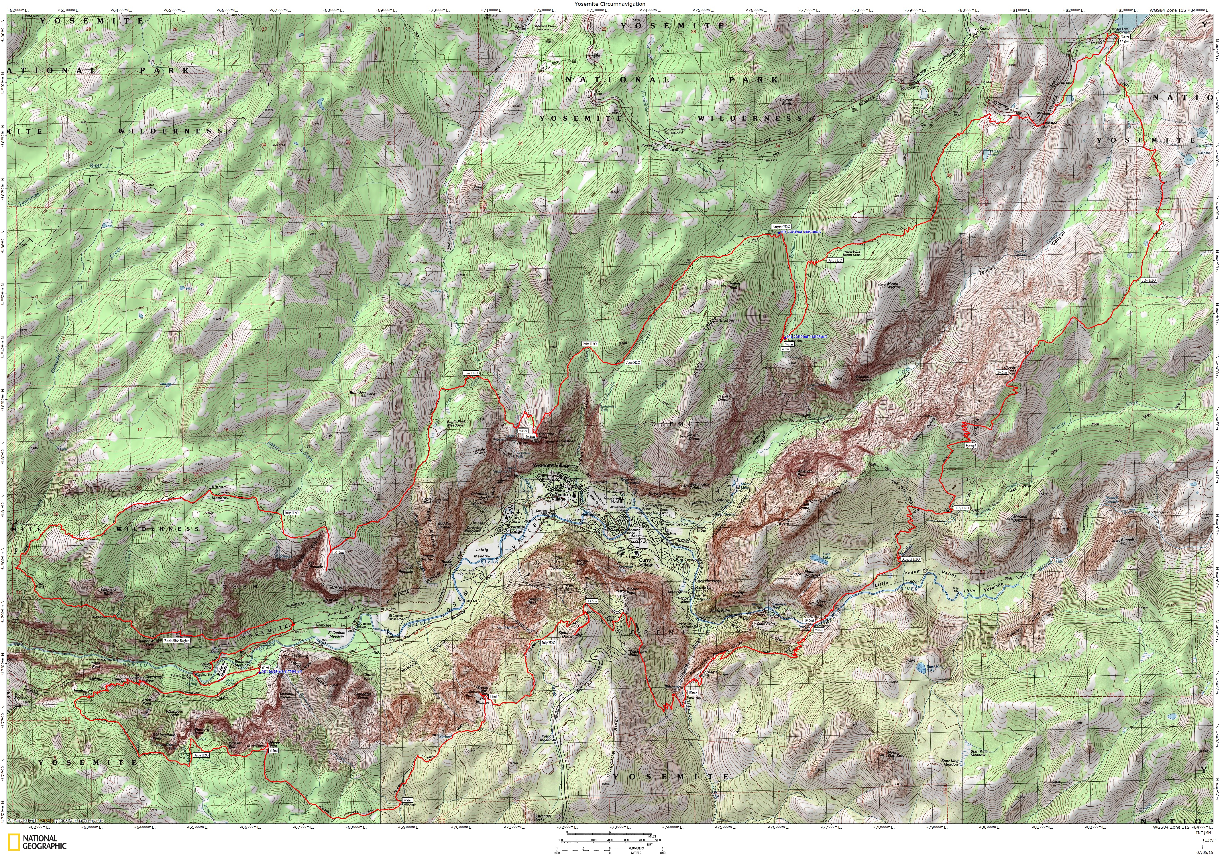
The actual GPS track from my loop around the Yosemite Valley.
Motivation comes in many forms, and all too often I hear people say, “I need to sign up for a race to keep me motivated in training”. I’d argue you don’t need a race, just a goal to work towards. In recent years I’ve come to realize that racing and competition don’t really excite me like it does other, there’s no adventure, there’s no mystery, and the unknown/uncertainty is minimized by the structure. So when I decided to postpone my original big project earlier this year I went searching in California for something fun to do. This is when I noticed a series of trails that seemed to loop around the rim of the Yosemite Valley. I began searching for additional information about the trails, distances and routes, and found very little, and nothing on people completing the full loop. Really? Could it be that no one has completed (and recorded publicly) hiking or running the loop? The closest I’ve found are runs/hikes of the North Rim and Leor Pantilat’s Tenaya Canyon Loop.
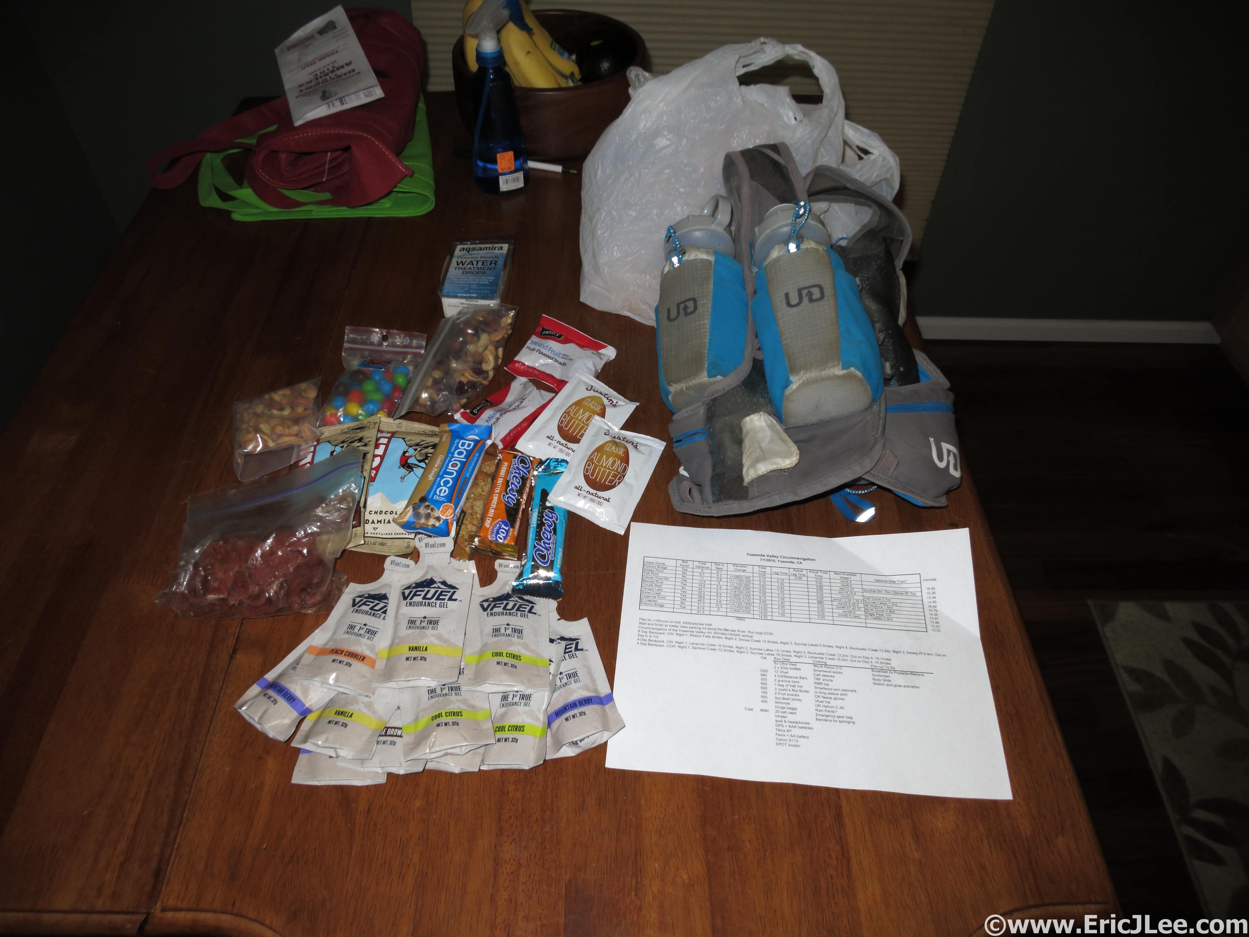
4500kcal is a lot to carry around. Prerun packing.
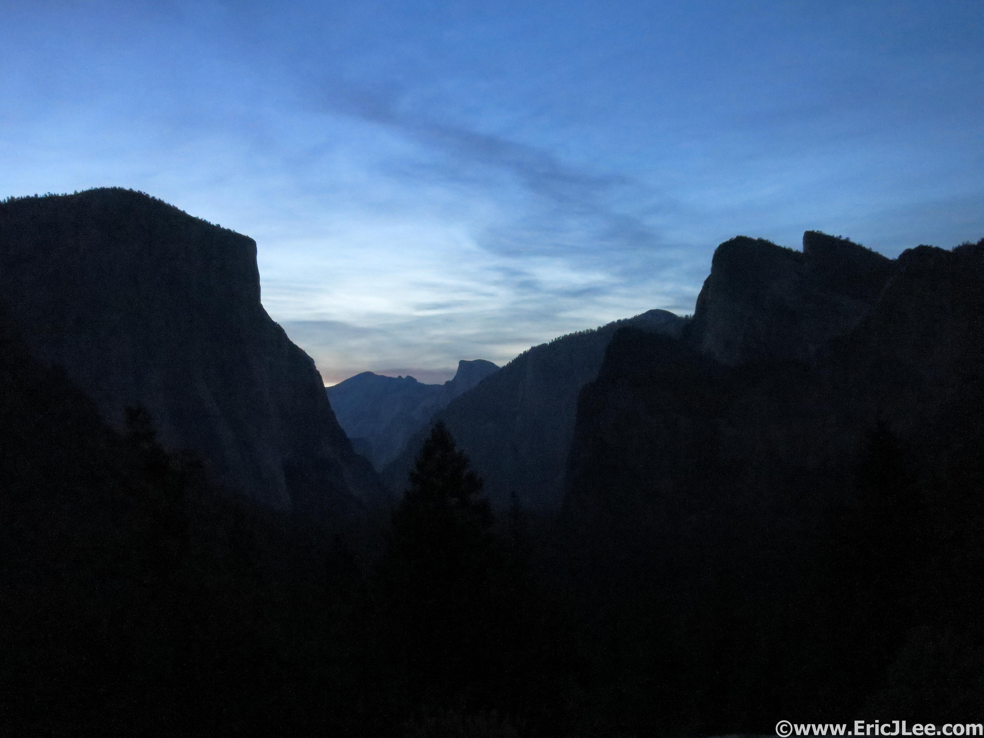
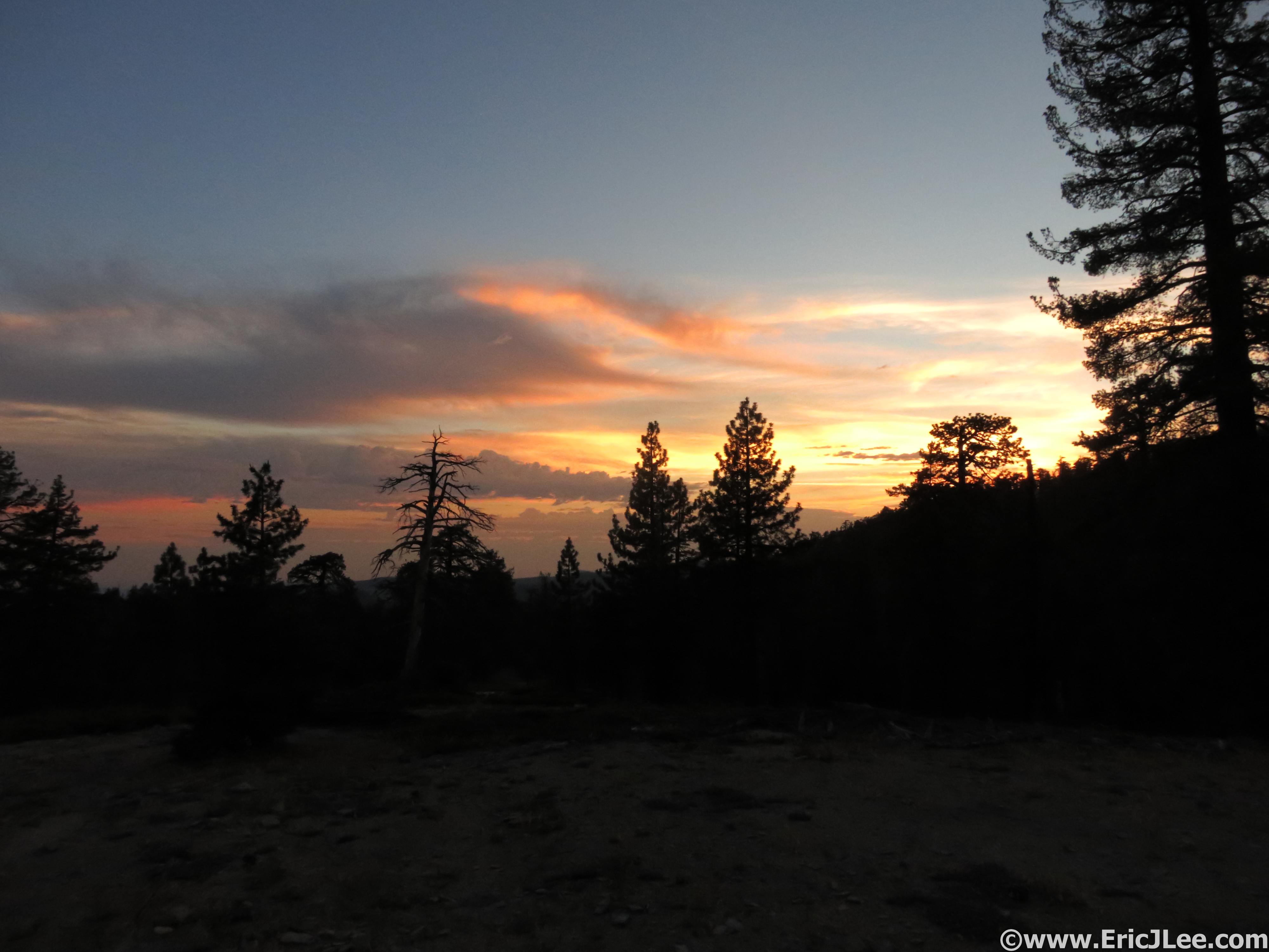
Early morning light at the Tunnel View overlook, here goes nothing.
Tuesday 6/30 I flew back into CA, picked up a car, and drove to the boundary of Yosemite to catch a few hours of rest before an early AM wake up. On Wednesday AM as I descended into the Yosemite Valley before dawn the temperatures were already in the 70s, as the forecast predicted it was going to be a hot one (90s in the Valley). I packed up my gear, threw 4500calories in my backpack, 40oz of water, and slathered on some sun screen. At 4:53am I started up the Glacier Point Rd, opting for this easier start than trying to find the connector trail in the dark. I quickly reached Tunnel View and struck on up the trail toward Inspiration Point. As I ascended toward the valley rim the temperature finally began to cool and the views began to open up. I quickly passed by Inspiration Point and found myself at Dewey Point (6:37am, mm6.5). The Yosemite Valley sprawled out below me, with El Capitan’s massive face dominating the Valley wall directly across from me. It was going to be a LONG way until I stood atop El Capitan probably less than 2miles as the crow flies from where I stood.
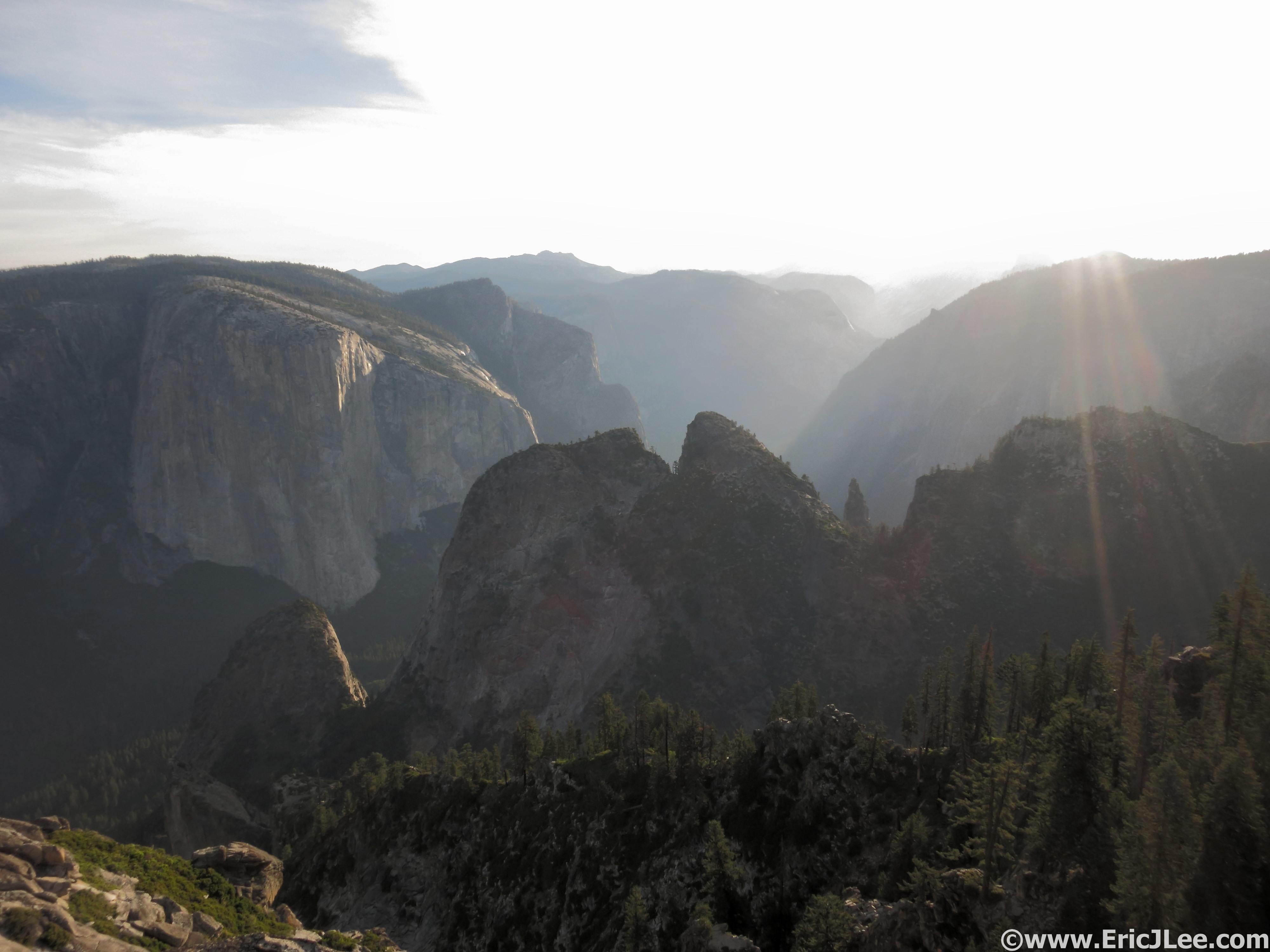
Sun shining on the Yosemite Valley from Dewey Point, this place is awesome.
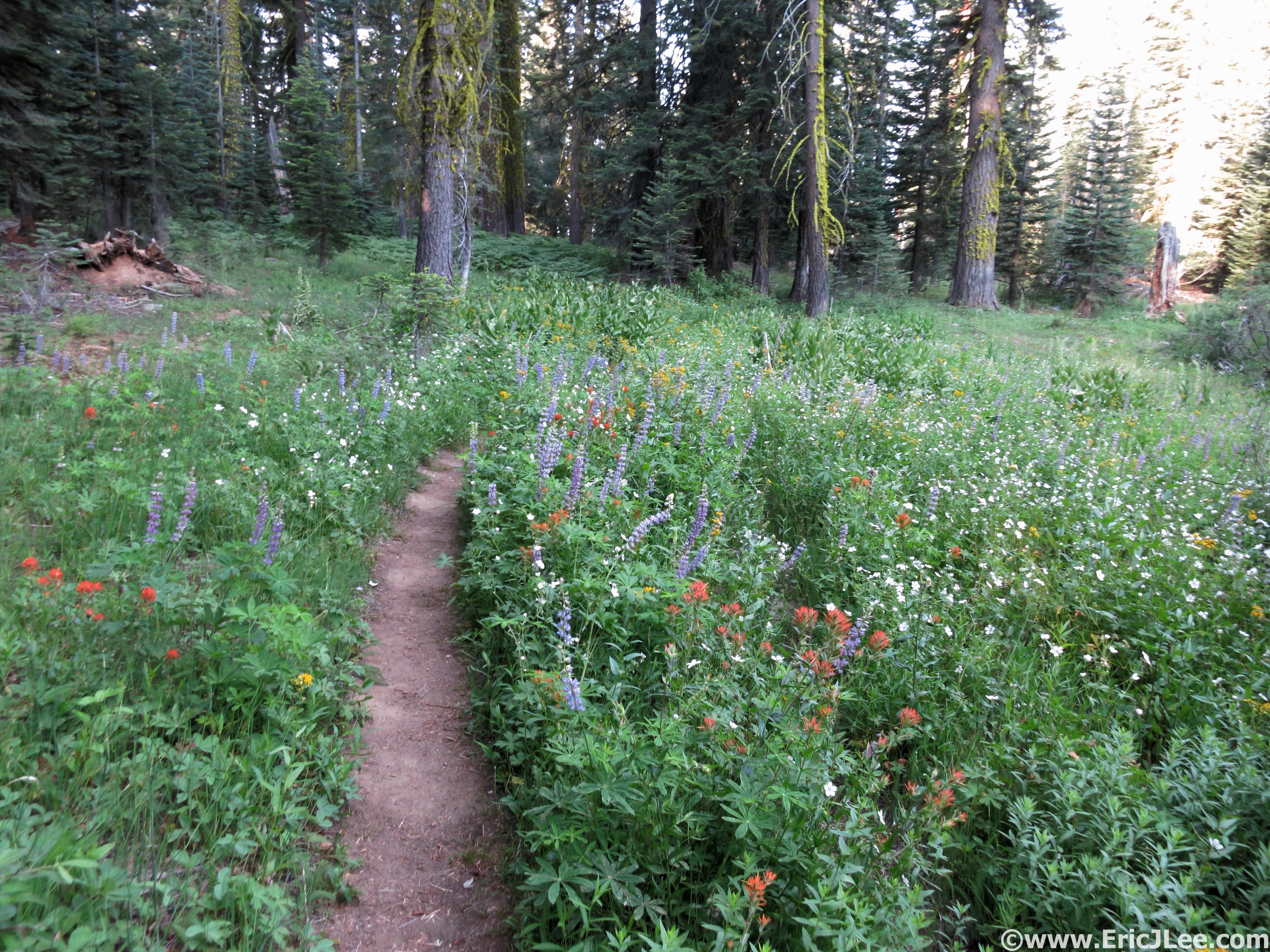
Between the view points the trails weren’t so bad. Even in a drought year the flowers bloom.
I snapped a few photos and jogged off along the South Rim’s rolling forest and meadow laden trails. A quick stop at Taft Point (7:39am, mm11) to take in a few more views up Valley and off to Glacier Point and Sentinel Dome I went. A light cloud cover kept things from heating up too much, but also led to some hazy views from the top of Sentinel Dome (8:15am, mm13.9). Sentinel Dome is a highly underrated short hike, with views of the Yosemite Valley, Half Dome and into the Yosemite High Country as well, all achieved in under a mile each way from the Glacier Point Rd. I blew past the Glacier Point Rd and opened up the pace a bit as I headed down the smooth switchbacks toward Illouette Falls. Illouette Falls is one of the hidden gems of the Yosemite Valley, dropping 370ft sideways into a narrow rocky valley after starting as a narrow band before being broken into a nice fan. It can only be seen from several view points just below Glacier Point or by hiking up the valley to its base.
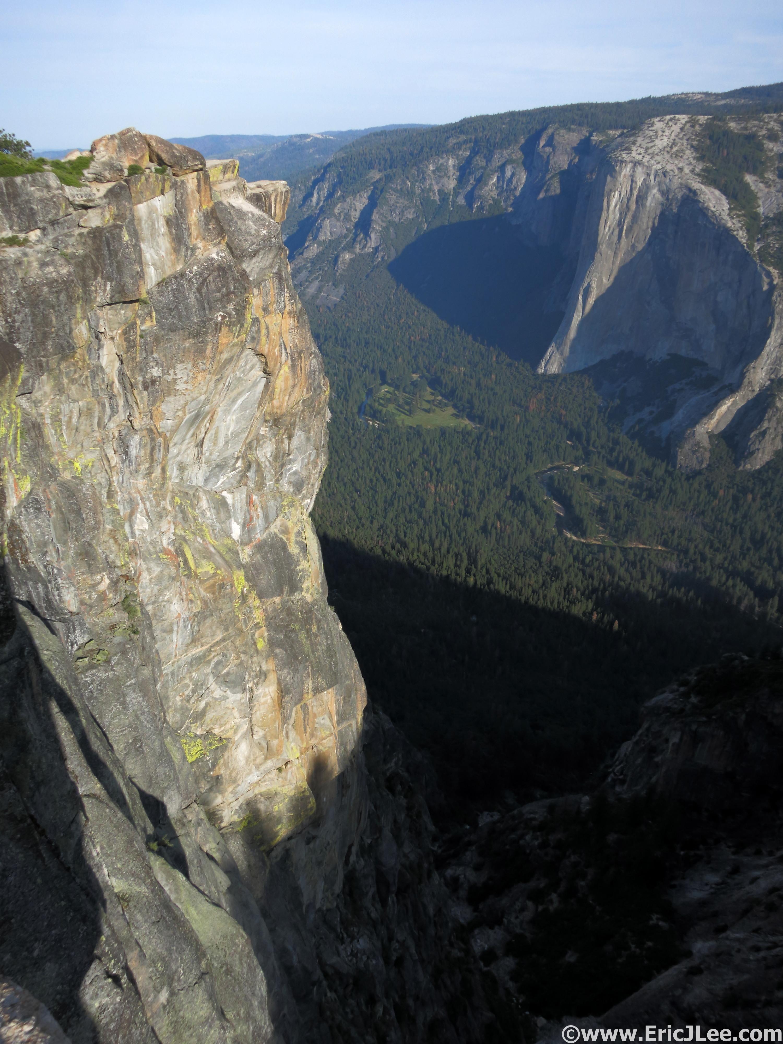
Looking down into the Valley and at the Nose of El Cap from Taft Point.

View from the top of Sentinel Dome toward Half Dome, Cloudsrest and Tenaya Canyon.
On the trail to Illouette Falls just below Glacier Point. Half Dome, Vernal Falls and Nevada Falls.
Often overlooked Illouette Falls.
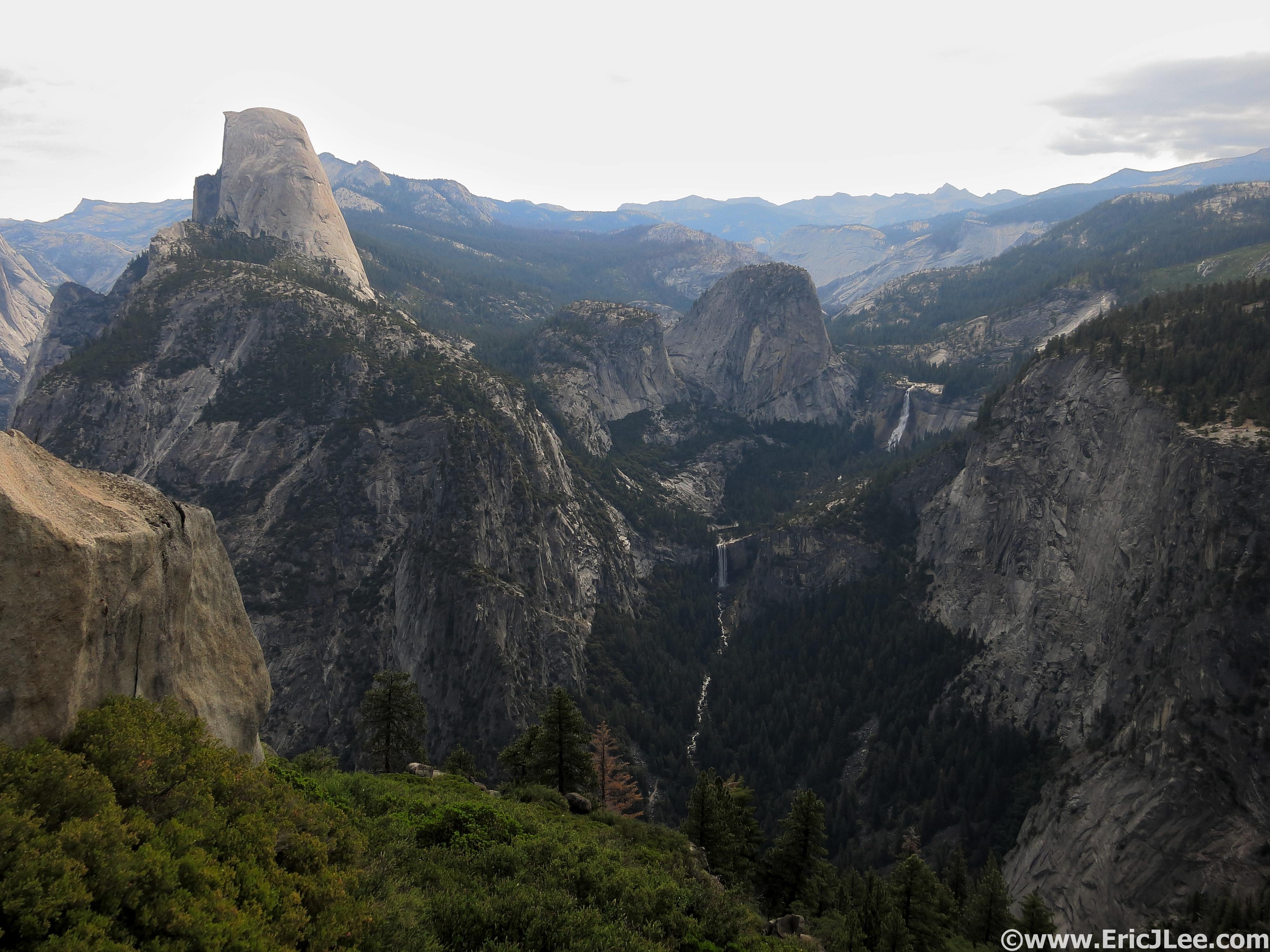
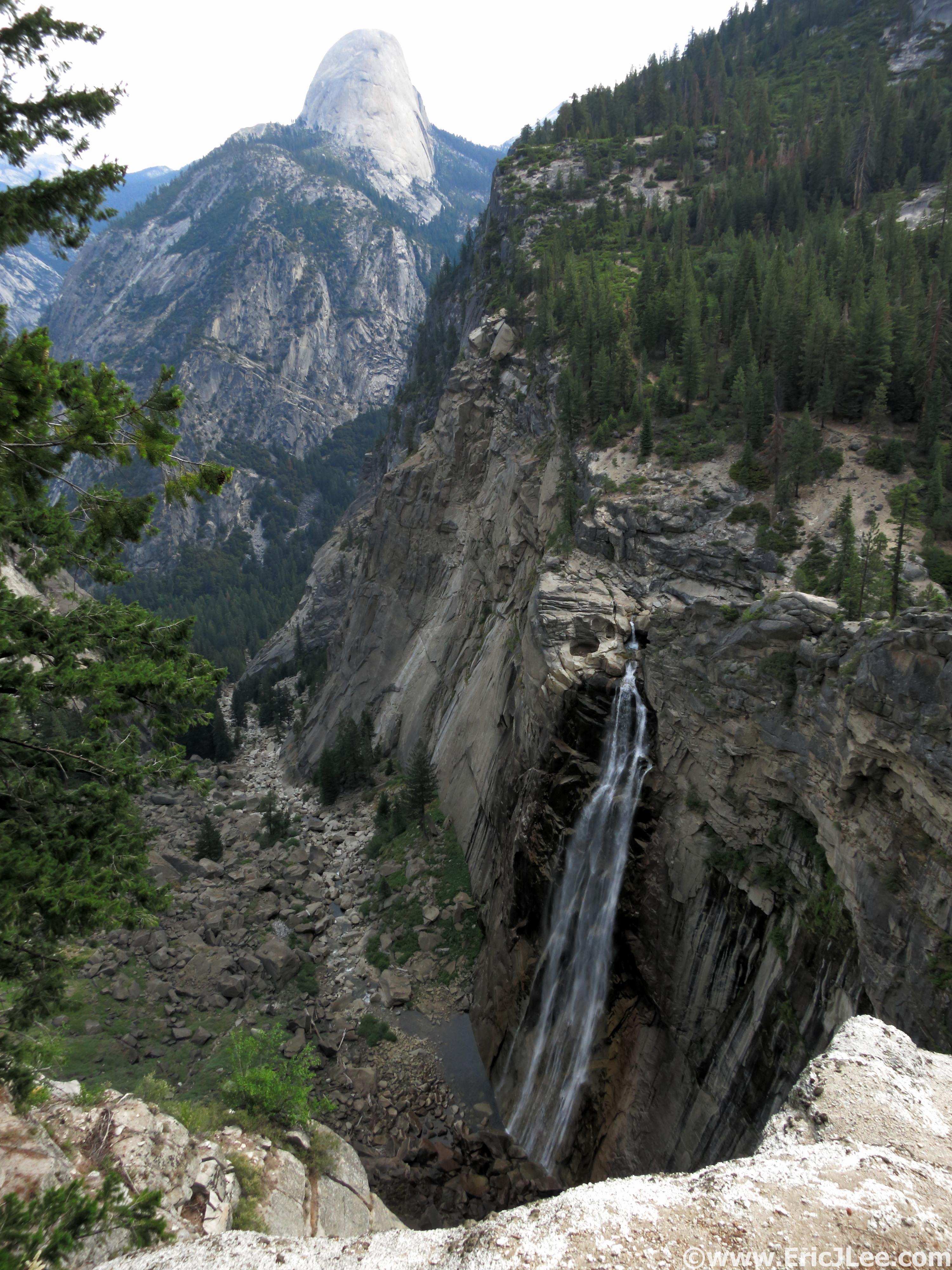
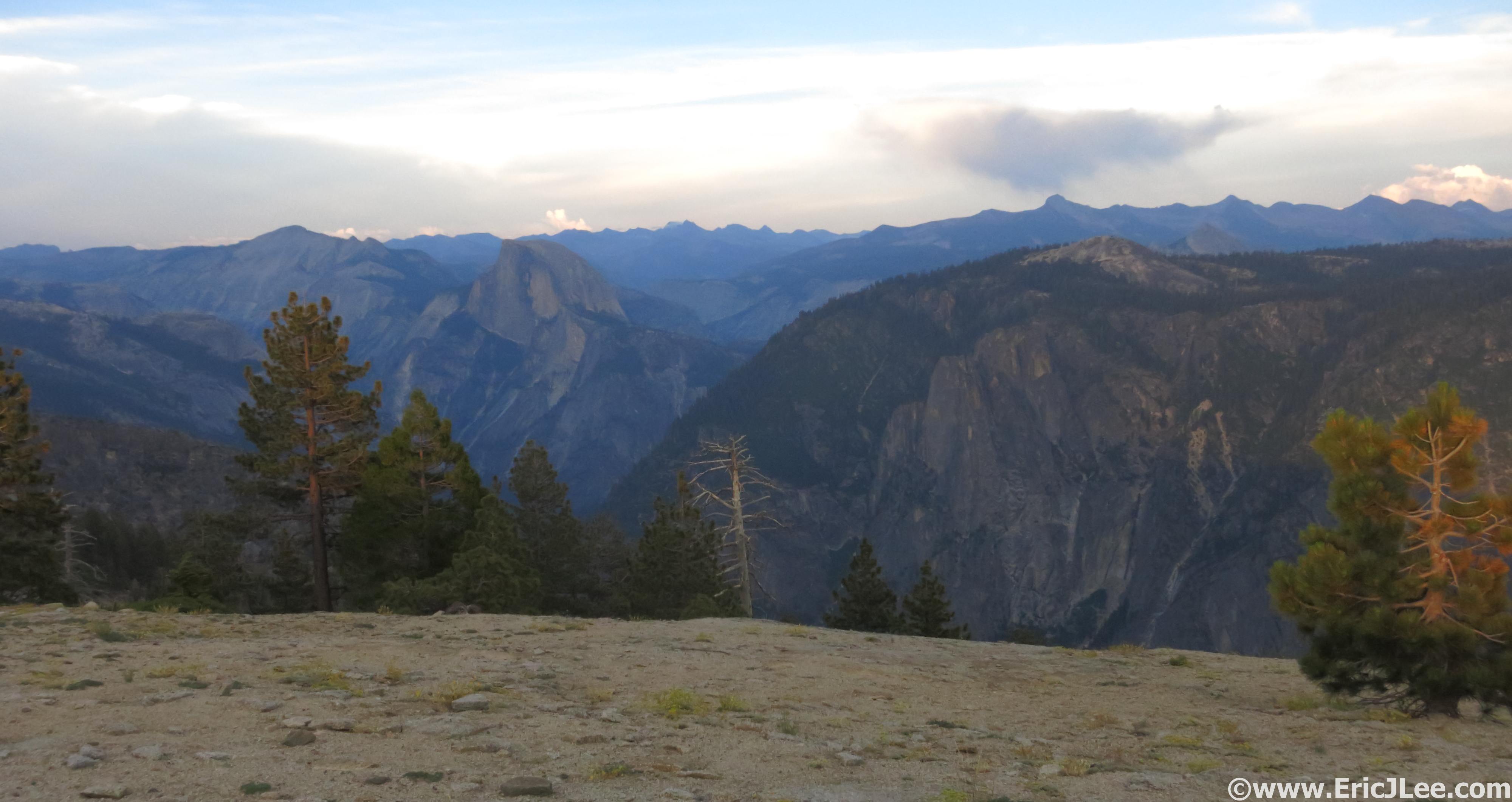
Another quick water refill and I hiked my way over the Panorama Cliffs and soon rejoined the crowds, briefly, for the run from Nevada Falls to the Half Dome cutoff. As I cruised past the roaring Nevada Falls (9:48am, mm20.9) and up the Merced the constant stream of people reminded me I was still so close to the Yosemite Valley. I again refilled water, soaked my bandana, and sponged off near the bottom of Sunrise Creek then began the long hot, dry ascent up Cloudsrest. The sun was out in full force and the cumulative effects of the warm dry air were starting to take their toll, but when you’re running around unsupported you just have to deal with it and keep moving. I chugged water as I slowly climbed, but desperately needed too cool off. As luck would have it I found a trickling spring popping out of the hillside at 8200ft, what a little miracle that was amongst the barren dry slopes of Cloudsrest. My pace had still slowed quite a bit in the heat of the day, but I kept plodding along up up up. I reached the summit of Cloudsrest at 12:32pm (mm27.6), fairly tired/fatigued from the heat, but my legs felt alright. I ate some jerky and M&Ms and took a short nap as the cool breeze blew across the summit, waking 10min later feeling fairly refreshed. The panoramic view from Cloudsrest’s rocky summit includes a close-up profile of Half Dome, the giant granite lined bowl that is Tenaya Canyon, and a glimpse of the granitic peaks and spires that make up the Yosemite High Country.
Nearing the rocky summit of Cloudsrest, its hot.
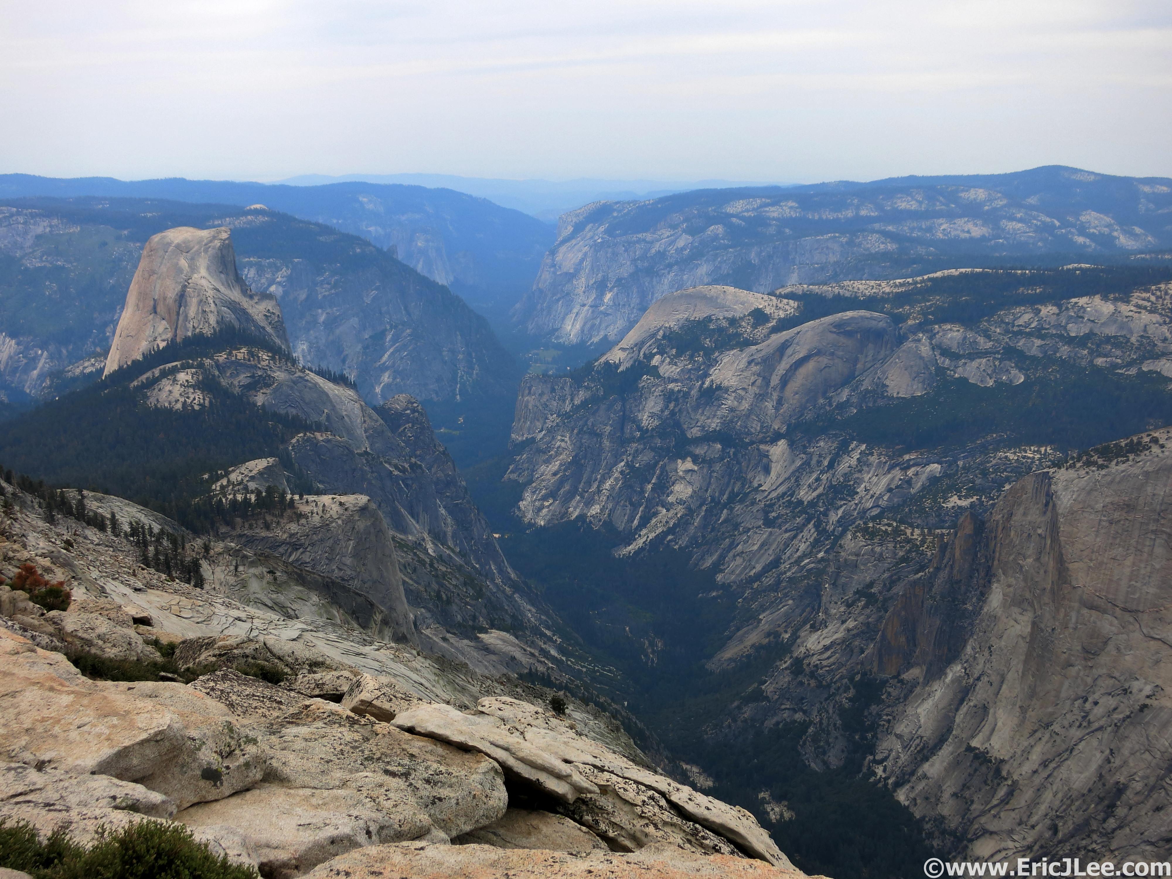
View down the Yosemite Valley from Cloudsrest.
I trotted off down the North side of Cloudsrest toward Tenaya Lake and the long haul around Tenaya Canyon. As I descended the incredibly rocky trail towards Tenaya Lake the all too familiar boom of thunder echoed high overhead in the clouds. As the rain began I was glad I was back below treeline, far from the exposed summit of Cloudsrest. The rain felt wonderfully soothing, and was a welcome change from the relentless heat and sun of the rest of the day, but would be short lived. I settled into a nice jog/hike mixture on the rolling terrain past Tenaya Lake (2:08pm, mm33.6) and around past the tourist crowded Olmstead Point toward Snow Creek. My mind began to become a bit foggy and I was worried the general fatigue was going to shut me down. Another thunderstorm rolled overhead as I crossed an exposed section of trail high above Tenaya Canyon, unfortunately the sun was soon back out heating things back up. My legs still had some decent pep as I cruised down the soft single track toward the Snow Creek crossing.
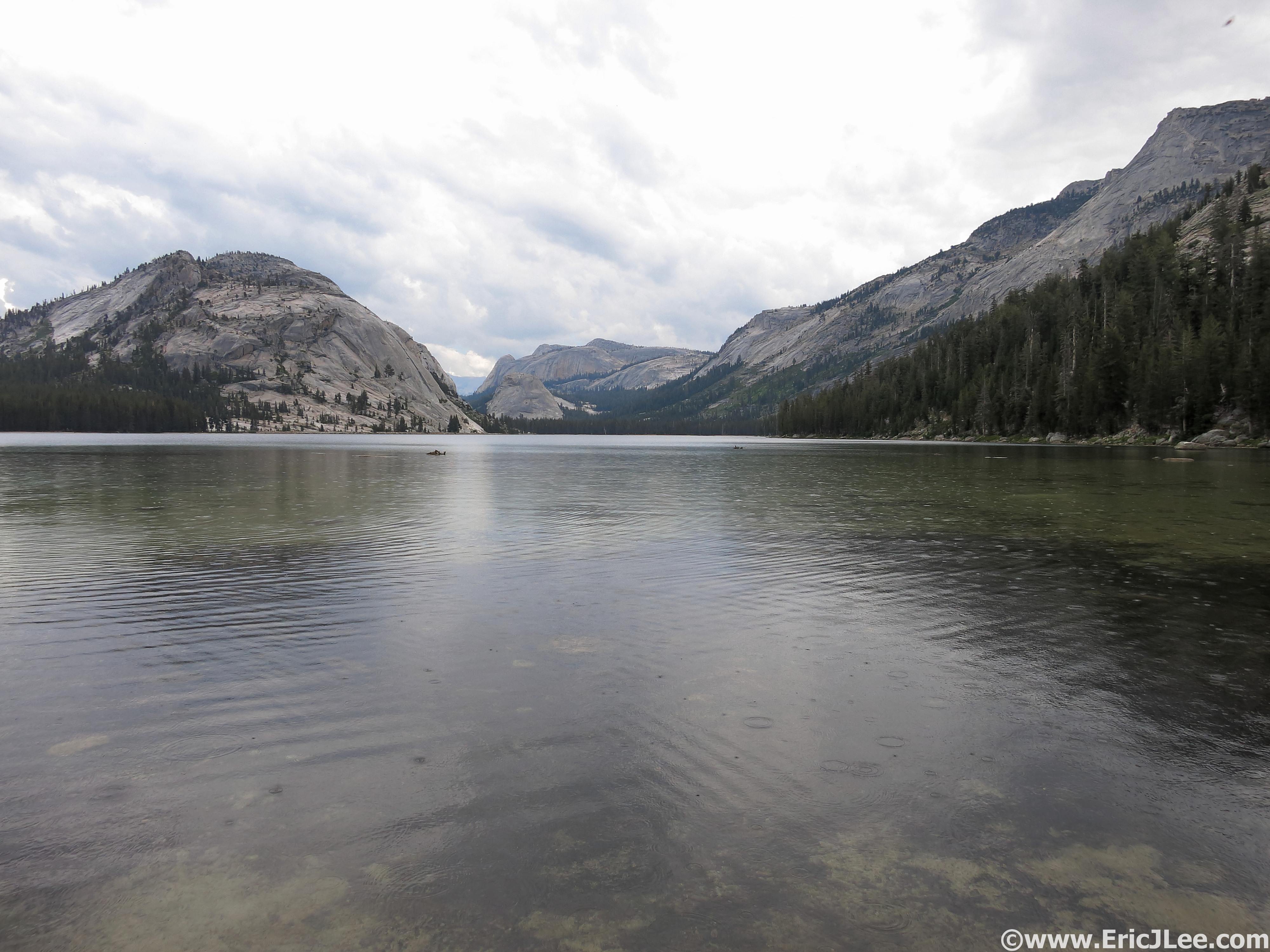
A quick peak into the Yosemite High Country at Tenaya Lake, halfway home.
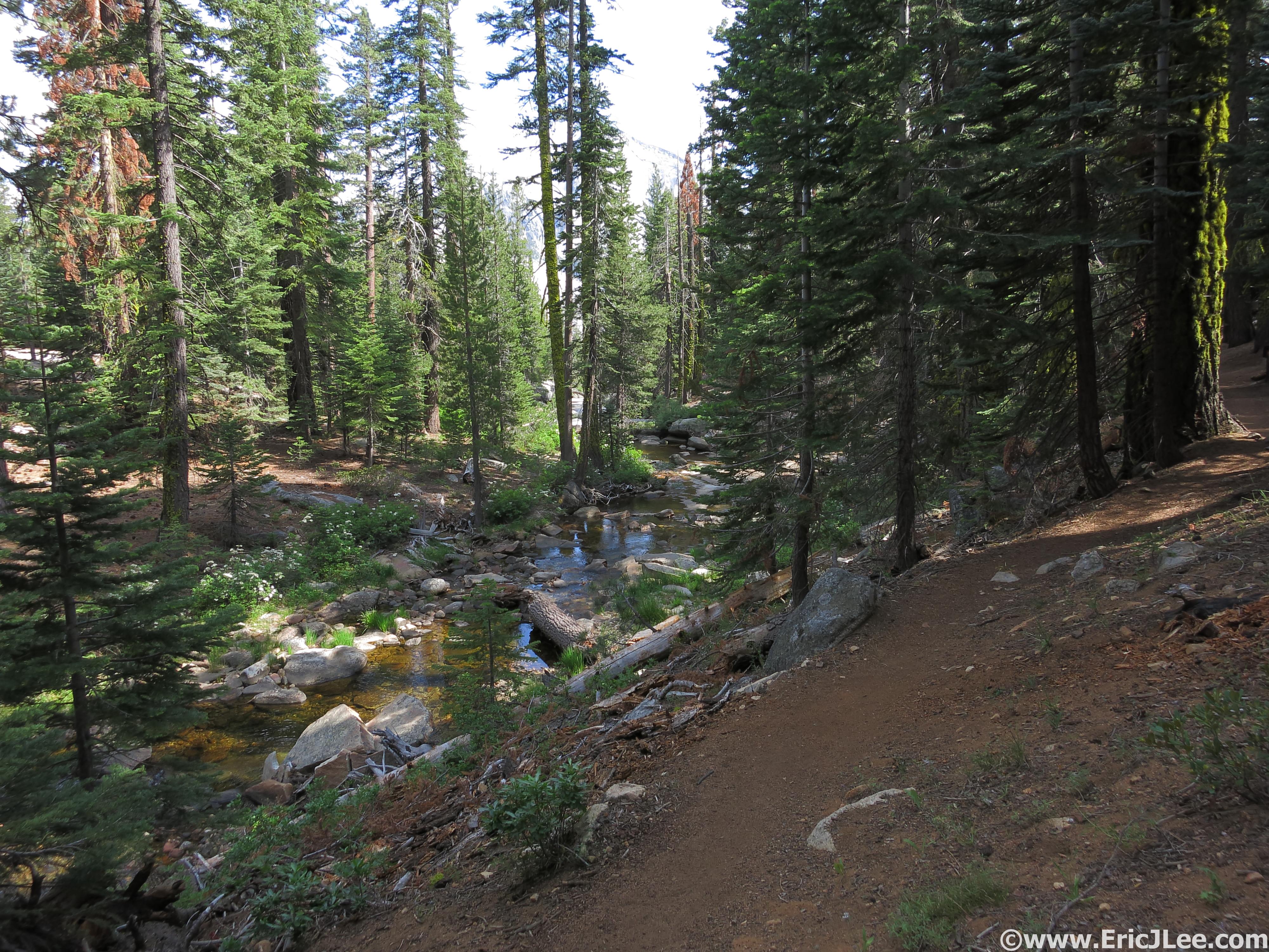
Romping through the forest along Snow Creek.
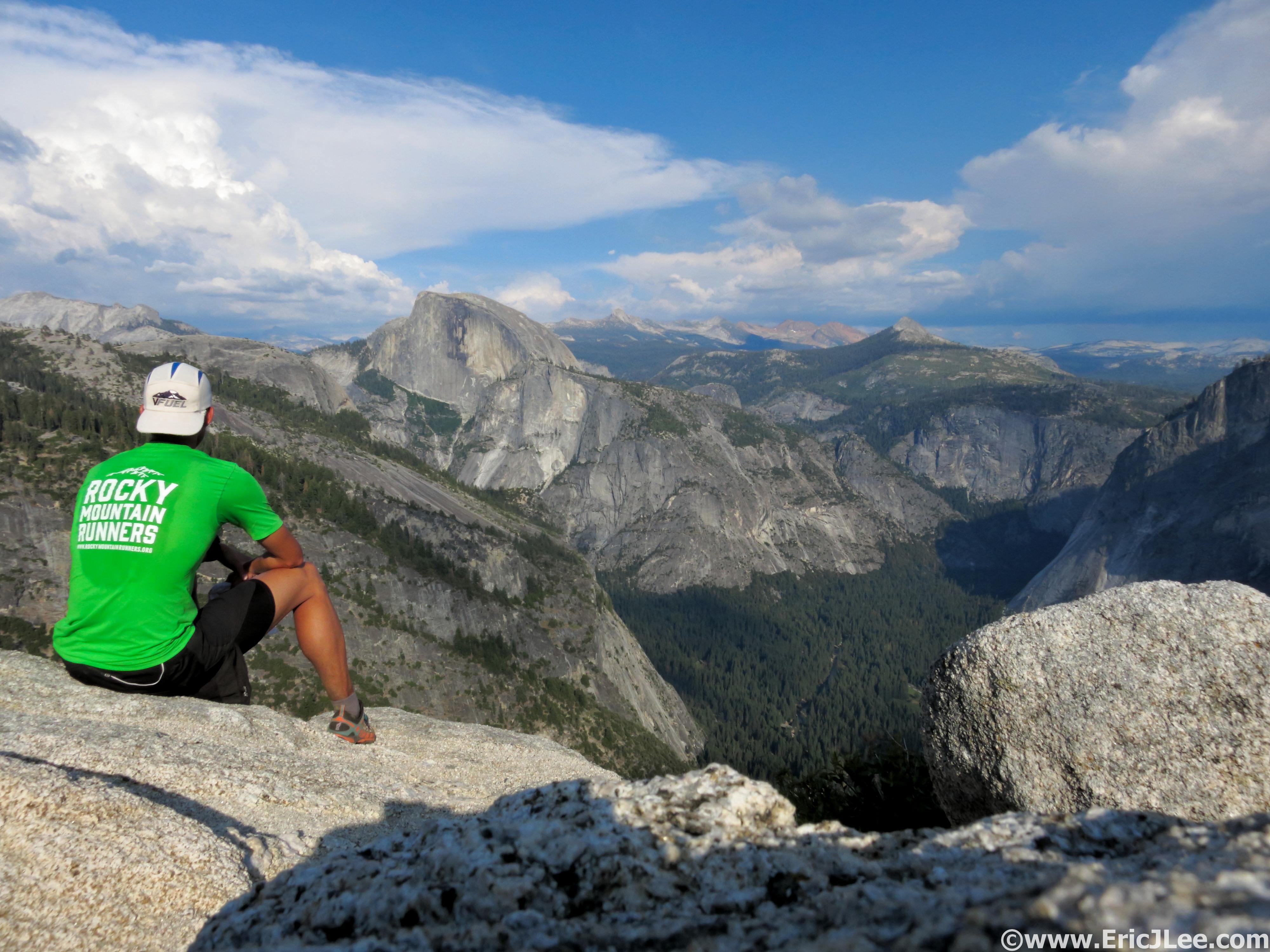
I plopped on down next to Snow Creek, wet my bandana and munched on my trail mix, staring blankly at the map trying to decide my next move. I was moving slower, but my legs still felt alright, so I pushed onward, deciding to forgo the spur to North Dome, opting for the more direct line down Lehamite Creek instead. I put on some music, put my head down and chugged my way up the climb to the Indian Ridge saddle. As the sun dropped lower in the sky, the trees began to filter out a lot of the sunlight, cooling things down a bit and softening the light. Before I knew it I popped out at Yosemite Point (6:00pm, mm47.3); the Valley floor was 3000ft below my feet while Half Dome loomed large with the Clark Range dominating the skyline. As I sat enjoying the view I realized this moment was why I’d decided do to this insanely long linkup in the first place. To experience the awesome immenseness of Yosemite in a fashion and at times of day that few others would ever experience.
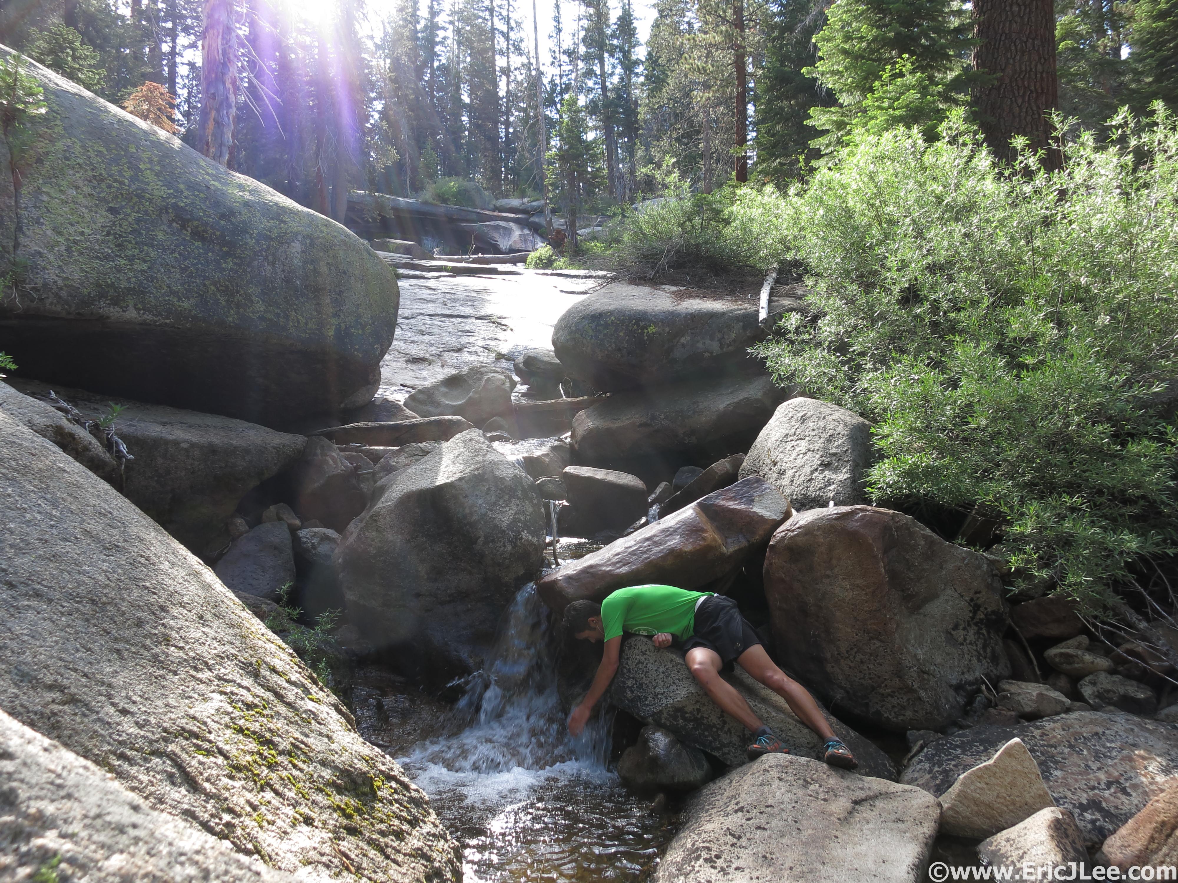
Cooling off in the upper reaches of Snow Creek, a regular occurrence, and a necessity.
This place is alright. Relaxing and taking it all in at Yosemite Point.
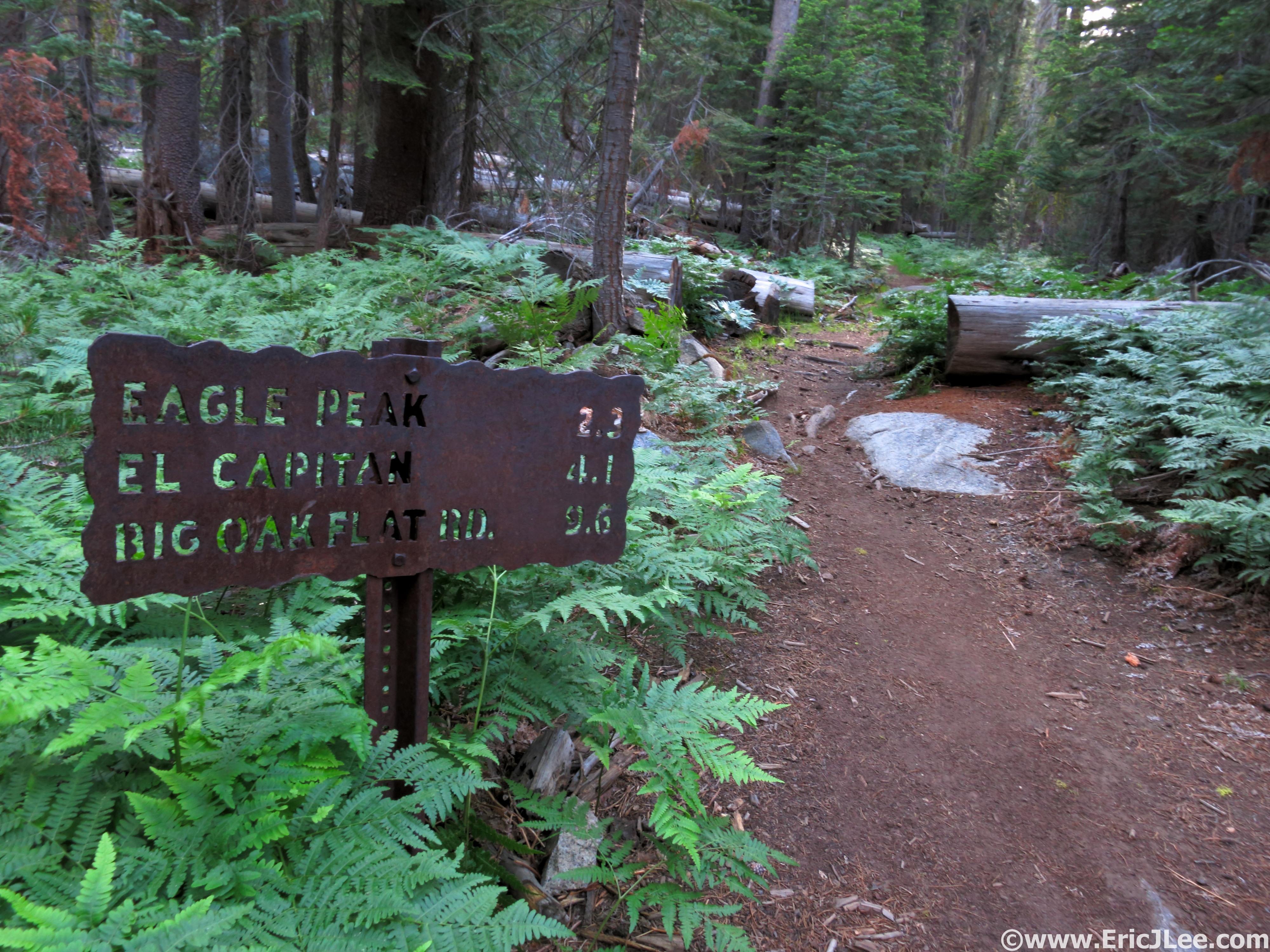
As I made my way through Eagle Peak Meadow I did some calculations and realized I’d be coming back into the Valley after dark, not something I’d wanted to do on the overgrown and unmaintained Old Big Oakflat Rd, but not completely unanticipated either. I pushed my legs a little on the flats and downhills, but the ups were a labor, as the fatigue from the long day was really taking its toll. I finally strolled my way across the top of El Capitan’s broad summit and sat down on a rock pile atop the immense hunk of granite (7:38pm, mm52.5). The sun was hidden behind some clouds bathing the Valley in a soft glow. El Capitan may not have the best view of the Valley and surroundings, but it’s a cool feeling to sit atop the monolith, something surprisingly few people do.
On the homestretch, 15 long miles to go.
Sunset on top of El Capitan.
The sun fades away to the West and back into darkness I go.
Then began the long trudge back to the car. From the top of El Capitan it was roughly 11.8miles of rolling downhill forested single track and unmaintained access road (dirt) back to my car at Bridal Veil. No more views, just closing out the loop…in the dark. As I crested the final small hill near Ribbon Meadow the last remnants of the sun lit the sky up in an array of yellows, oranges, reds and pinks, then into the darkness I descended. My legs were very happy on the somewhat rough downhill single track, and soon I found myself at the unsigned turn off for the Old Big Oakflat Rd, an unmaintained access road that the park service had ‘let go’ of and is now know as the ‘Rock slide’ trail for good reason. As I started jogging down the old road grade I found out what 50years without maintenance can do, hundreds of downed trees, tree branches growing right into the track, manzanita narrowing the path to 1-2ft wide, and finally the rock slides. Just after an old view point known as Rainbow View (it was dark, no views) the old road had been ravaged by dozens of large rocks slides, some that have completely wiped out the old road grade. Ever tried navigating sideways through a large talus field in the dark? It’s not easy, and was very frustrating. In all the descent down the Old Big Oakflat Rd was mentally the most painful and frustrating part of the day, because my legs felt good and wanted to run, but I could never get a rhythm going because of the overgrowth and rock slides. Finally after much rock hoping and thrashing I popped out on the maintained service road at the bottom and hopped on the Valley trail that would take me back to the Pohono bridge and the Bridal Veil parking area. I jogged my way across the valley, finally reaching the Bridal Veil parking lot at 10:48pm (mm64.5), completing the whole loop in 17h55min, not blazing fast by any means, but I’d gotten it done.
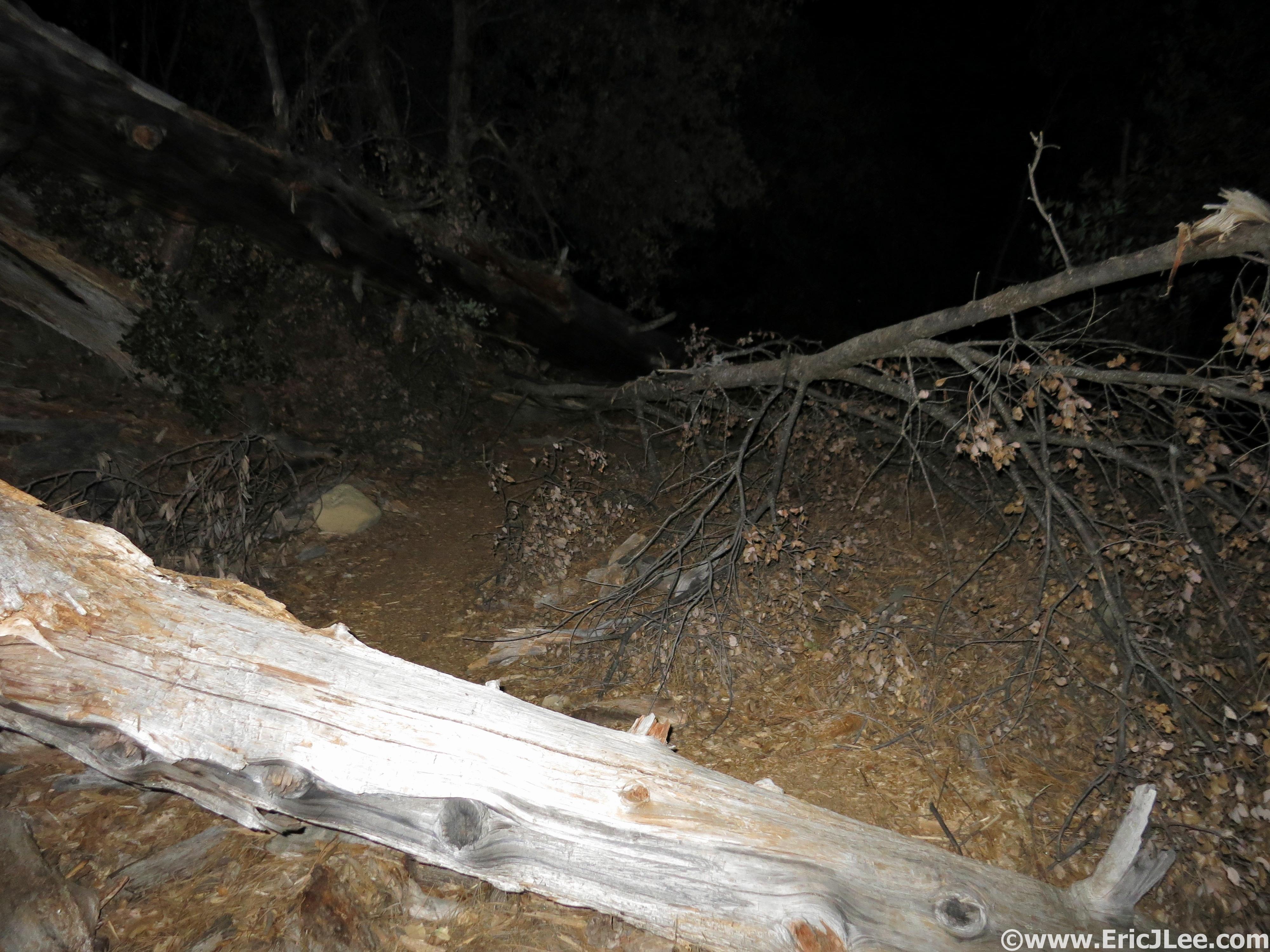
And there were hundreds of these on the Old Big Oakflat Rd, ick.
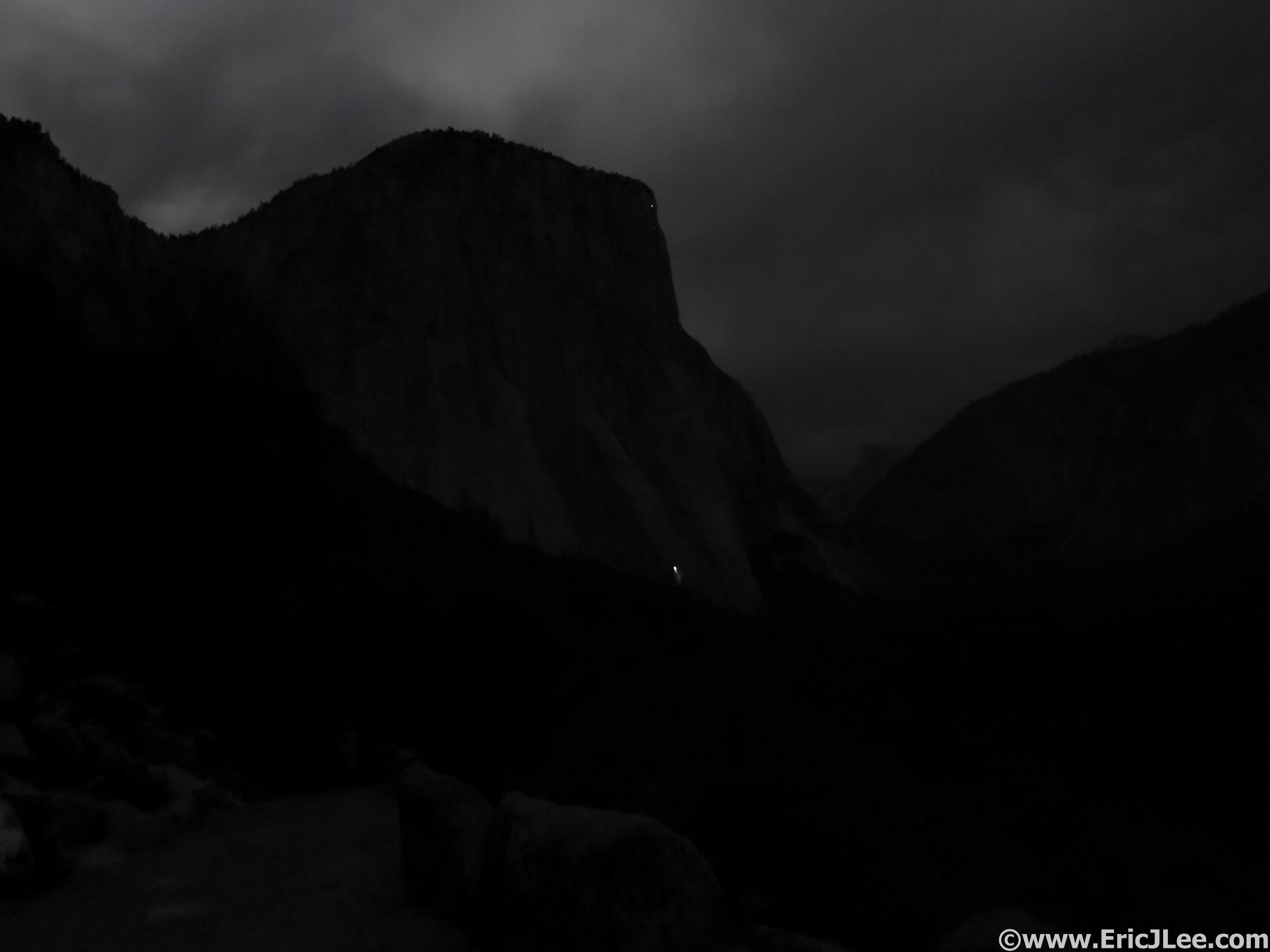
El Cap in the moonlight with a solitary headlamp bivied on the wall.
I was exhausted, but very happy with the long day. After a quick rinse off in the Merced River (I was filthy) I threw all my gear into the back of the car and drove just outside the park boundaries to a logging road I’d found the previous night and was out within minutes, the rest of the drive to meet my family at the Lair of the Bear where we’d be camping until Saturday would have to wait until morning.
Closing Thoughts:
When I first conceived of the idea of running a loop around the entire rim of the Yosemite Valley, the main intention was to experience as many of the iconic view points as possible, while never returning to the hustle and bustle of the Valley. Except for my one detour off the North Dome loop it was a success, the views were amazing and varied all day long, I saw surprisingly few people, even at major junctions like Glacier Point, Nevada Falls and Yosemite Falls. What I hadn’t expected were all the wildflower laden meadows (even in a drought year), the beautifully soft forest single track and the immense fur and pine forests that encompassed all the sections in between the labeled view points. I’d gotten a little unlucky with the weather; being an abnormally low snow year leading to rivers drying up early and a hotter than usual day, which baked me pretty good from 11a-5p. The only part that I really did not enjoy was the final descent down the Old Big Oakflat Rd in the dark, some of that may have been due to fatigue, but I was definitely frustrated by the rough and unrunnable nature of the ‘trail’.
I would love to do the run again someday, but I think the CW direction would be better for several reasons, and placing some self-supported drops at the Tenaya Lake and Glacier Point bear boxes would be a great help. I also think that during a normal snowpack year the flowers could be 10x better than what I saw and water much more plentiful (trail could be muddy in places though). This route would also make a fantastic 3-5day backpacking trip for those less inclined to run, or it could be split into two segments for runners using the free shuttle bus service to/from Tenaya Lake. There are unlimited possibilities for loops of varying distances and difficulties depending what you want to see, many of which have been done before, but putting the whole thing together in one day was an awesome experience, and truly a unique way to get to know the Yosemite Valley Rim.
Special thanks to Vfuel for keeping my energized during this crazy adventures, Cindy Stonesmith at Ultrarunner Training for keeping me in line (physically), Adam Engel at Waldron’s Peak PT for helping fix me earlier this year and all my running/climbing/scrambling/skiing partners for being equally crazy and adventurous. Run fast, run healthy, but mostly run happy.
Here is a link to my Strava GPX from the day.
Here is a link to the video/slideshow of the entire run (approx 10min)
Sounds like an excellent trip! Your title reminded me of the motorcycle trip Long Way Round. So now that you’ve done this, what’s next?
Just more mountain play time of course. Knocked off Capitol-Snowmass-Bells traverse on 7/25, maybe 4pass this coming weekend and UTMB in late August! Yeah Alps.
Pingback: Summer of Fun Recap, Next up UTMB! | MtnRunner_ELee
You are not the first. The ‘Big Loop’ that I remember from the early 80’s started at Wawona tunnel and ended at Foresta for a full circumnavigation of the valley rim. The distance is about 75 miles… It is rarely done these days. It’s a nice 2 day backpack trip or a 24 hour run. This was a popular trek in the 1940’s.
Thanks so much for the info Karl. I Figured it had been done at some point, but couldn’t find anything online about it despite exhaustive searches. Either way is a heck of a day.
Hi Eric! I’m so happy to have found this post — I’m midway through planning this same run! Would you mind if I emailed you some questions?
Tristan,
Not at all! Feel free to shoot me a direct email, thebeave7 at hotmail dot com
Happy to share any additional insight or thoughts on the run. I hear the waterfalls are BOOMING this year, should be an amazing wildflower year once the snow finally melts away.
Eric
This looks like a great route, I’m considering running it in a couple weeks. I am a bit curious about why you think it might be better run clockwise? I would have thought your CCW run would have been ideal from the standpoint of seeing great views at sunrise and sunset. Leor chose CW and starting at Tenaya. . . I’m sure either way would have stunning views, maybe you have logistic reasons?
Zak, I do agree with the views and scenery being more stunning running CCW. I think it’s faster to run it CW because the descent down the old big oak flat road is hard to run, and even harder to run in the dark. So I guess it depends what your intention is, views, scenery, photography, definitely CCW would be better. Faster time, I still think CW would go faster, but either way it’s an awesome adventure and I hear the waterfalls are raging this year! Best of luck and enjoy!
Eric