Author Archives: Eric

About Eric

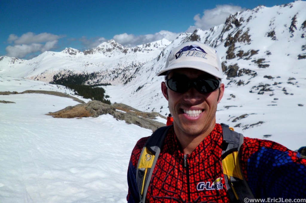
Immunologist and Infectious Diseases Research Scientist by day, ultra runner and mountain adventurer in my spare time. Blogging about whatever comes up in life.

You Are What You Eat?

…so I guess I must be a giant sugar cube. I’ve never been one for New Years resolutions, rather opting to try to improve myself on a daily basis. While I usually try to eat somewhat healthy, I know I’ve got room for improvement in that field. Recently I was reading through ingredients on several packaged foods and kept noticing one theme pop up way too often….sugar. If you know me, you know I have a pretty bad sweet tooth; gummy bears, Reese’s PB cups, otter pops, ice cream…., but was somewhat surprised how many other things I could add to this list. Items like bread, many salad dressings, granola bars, frozen sweet potato fries, peanut butter (non-natural varieties), 75% dark chocolate, chai tea mix, many almond/soy milks (except unsweetened variety), pasta sauce, and on and on.

Though usually I succeed on consuming these only in moderation, lots of moderation can lead to excess. So I’ve decided to perform a little experiment on myself and take two weeks where I don’t consume anything with added sugar or sweeteners (cane sugar, corn syrup, agave…its all sugar). Before anyone out there launches into a diatribe about eating vegan, or gluten free, or raw, or paleo or whatever else diet you think is best…..that’s not the point of this exercise. It’s simply to become more aware of what I eat and put into my body, and to see how difficult it is (for me) to eliminate such things from my diet and how it makes me feel.

I’m not a dietitian and far from an expert, but simply an observant human being (and scientist) who loves to experiment. I know a lot of this can be remedied by simply cooking for myself more often, but as someone who spends 11hours/day associated with work and likes to recreate/socialize every once and a while, that doesn’t leave an over abundance of time for 3 complex meals a day. Yes yes, excuses excuses, but that’s the goal of this little exercise, to break old habits and negate the excuses for long term change. So let’s see how this goes. Note, I don’t plan on giving up sugar/sweets forever, what fun would that be 🙂

I’ll update on how this little test went in two weeks…..

2015 Year in Review

I’ve been somewhat slacking of late in my writing, too much work, too much wandering, and just too much scatter brained-ness going on. While I try not to live in the past, its always good to take a moment to reflect, remember and relish all the wonderful things one has done. 2015 was an amazing year, some amazing highs, some tough spots, but overall full of friends, fun and adventure. First a quick synopsis of a few stats, because I’m geeky like that, then some photographic highlights from the year.

Miles

Vertical Gain

Time on Feet (h)

Vertical/Mile

Running/Climbing/BC Skiing stats

2686.5mi

678,700ft gained (New PR)

749.73hours of time on feet

252.6 ft/mi gained

Since my last post about UTMB way back in September I’ve been to the Eastern Sierras for some fall running, scrambled a number of flatirons, spent a week in Zion canyoneering, snagged several days of back country skiing, had a feature article published in the inaugural ‘Boulder Running Journal’, and spent the holidays in California. Life has not been short on action and fun, and when 2015 is all said and done I’ll have spent 17 days traveling on airplanes, visited five different countries, seven different states and summited Green/Bear/Sanitas a cumulative 96 times. Here’s to a great 2015 and hopefully and even better 2016.

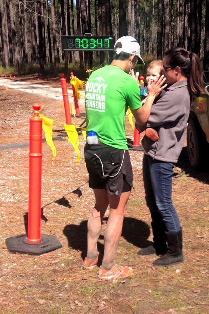
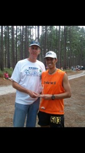
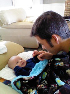
Celebrating the win with my sister and nephew, best High-fiver ever. Mississippi 50, 3/8/15.

Celebrating the win with my sister and nephew, best High-fiver ever. Mississippi 50, 3/8/15.

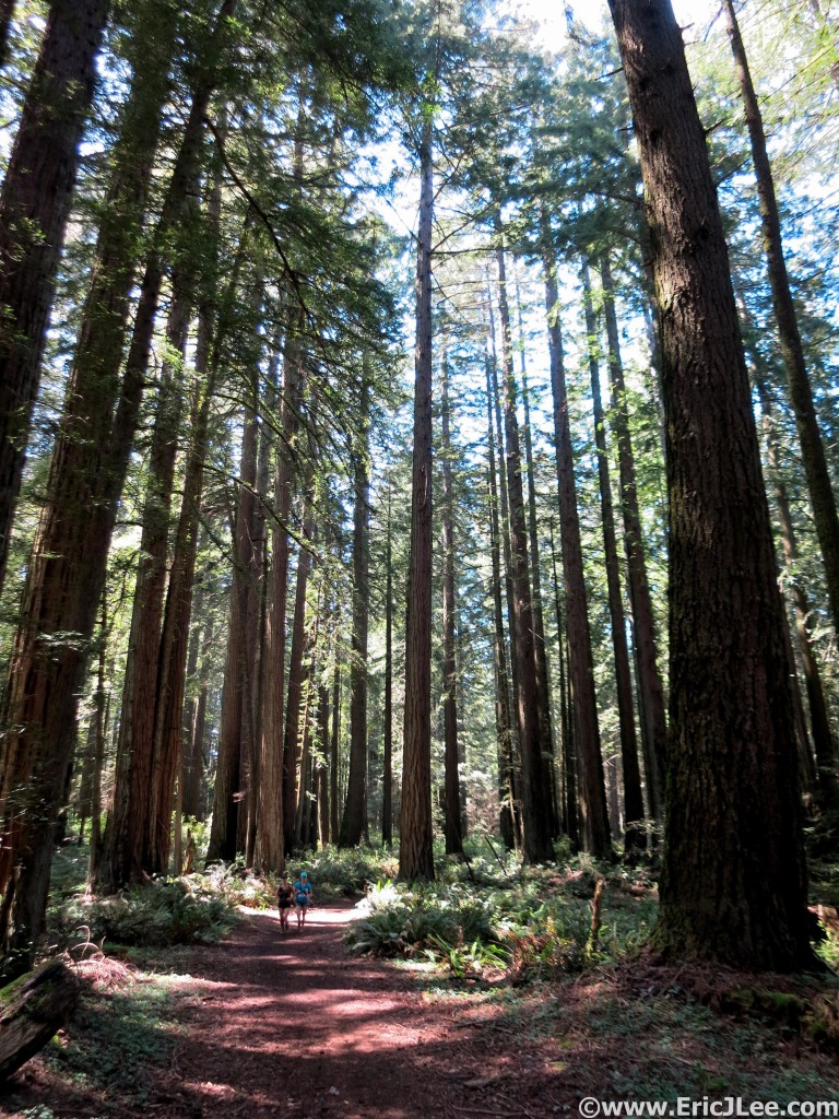
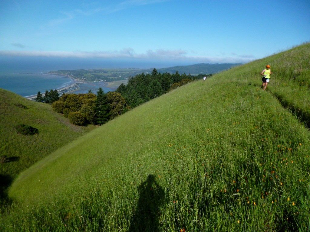
Running through the redwoods on a beautifully sunny California day, Miwok 100k 5/2/15.

Running through the redwoods on a beautifully sunny California day, Miwok 100k 5/2/15.

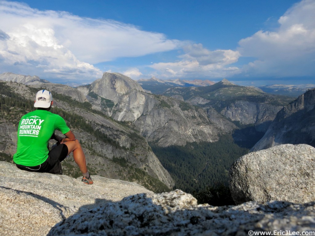
This place is alright. Relaxing and taking it all in at Yosemite Point. 7/1/15.

This place is alright. Relaxing and taking it all in at Yosemite Point. 7/1/15.

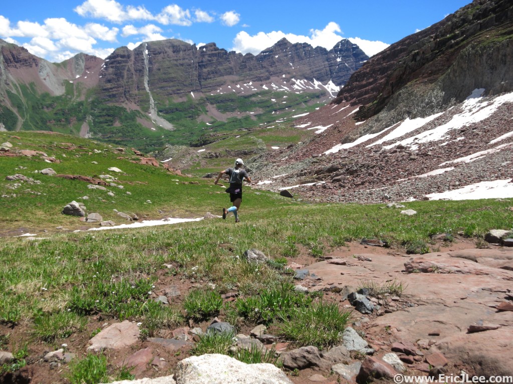
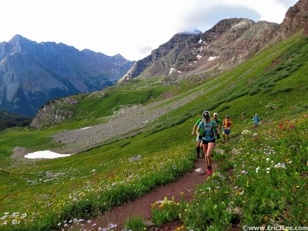
Headed toward the Maroon Bells on the shortcut from Snowmass, 7/25/15.
Headed toward the Maroon Bells on the shortcut from Snowmass.
I've never been good at tapering. Pre-race play time in Iceland, 8/21/15.

I’ve never been good at tapering. Pre-race play time in Iceland, 8/21/15.

Finally atop the Grand Col Ferret, rough climb, but now I get to go downhill.

Finally atop the Grand Col Ferret, rough climb, but now I get to go downhill.

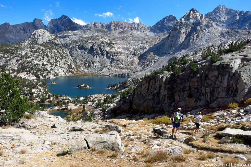
First time back in the Eastern Sierras in a long time, 9/26/15.

First time back in the Eastern Sierras in a long time, 9/26/15.

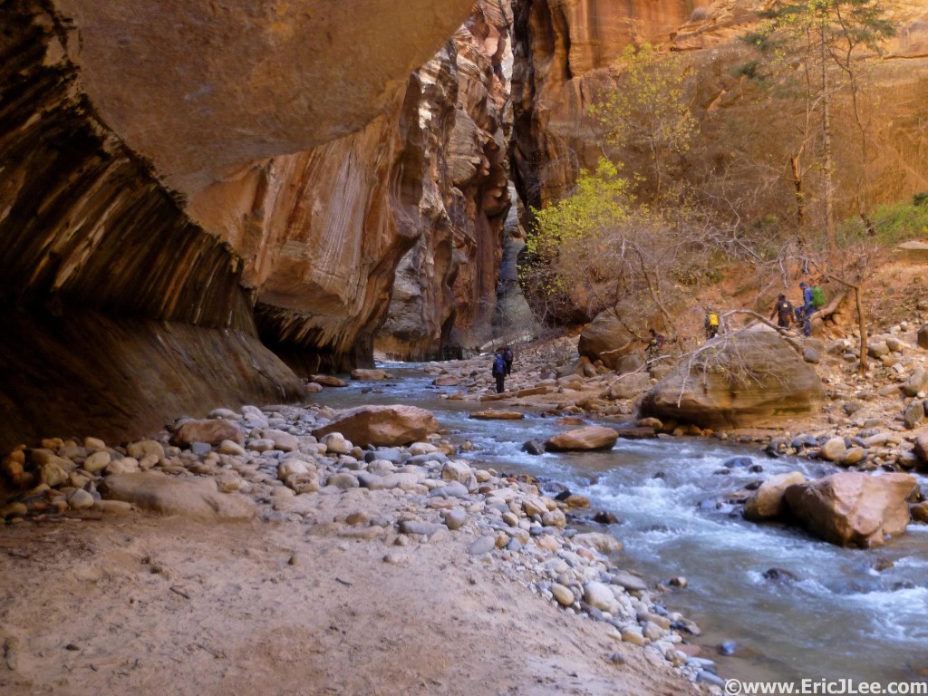
Zion Narrows for Thanksgiving, 11/28/15.

Zion Narrows for Thanksgiving, 11/28/15.

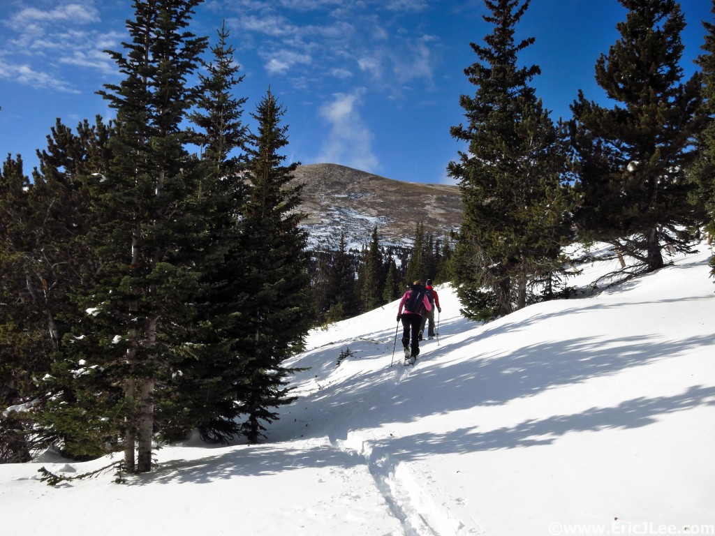
Early season touring in the Indian Peaks, 12/20/15.

Early season touring in the Indian Peaks, 12/20/15.


Redemption at the 2015 UTMB

As I descended into Courmayeur just before sunrise, doubt began to creep into my mind, what if my legs failed again, what if something happens…again? I deliberately slowed my pace down the steep dusty switchbacks, even though I felt pretty good, but also understanding that I had almost 60miles of mountains left. The DNF demons of 2013 still chased me, even on race day, but sometimes out of our greatest failures, come our biggest successes. So hang with me, as this is going to be a long one. If you’re curious about my ‘training’ for the 2015 UTMB see my previous blog.

Prerace

On August 19th after a summer of playing in the mountains, admittedly with a much more relaxed attitude toward training than I’ve had in previous years, I hopped on an Iceland Air flight bound for Iceland, my first stopover enroute to the 2015 UTMB race. But this story actually starts in 2013, when I made my first trip to France to attempt the UTMB. The scene was the more energetic and stimulating than anything I’d ever been a part of (dwarfing Western States), the mountains were more dramatic than anything on the Hardrock course, and the field was by far the largest I’d ever run in (2400 runners). Admittedly my first trip to UTMB was overwhelming, I got caught up in a lot of the hype, and in the end I was handed my first ever DNF (at La Fouly, 110km) due to mechanical issues that ended up severely inflaming my left knee to the point I couldn’t bend it. That day has haunted me ever since, but in 2015 I was given a chance at redemption.
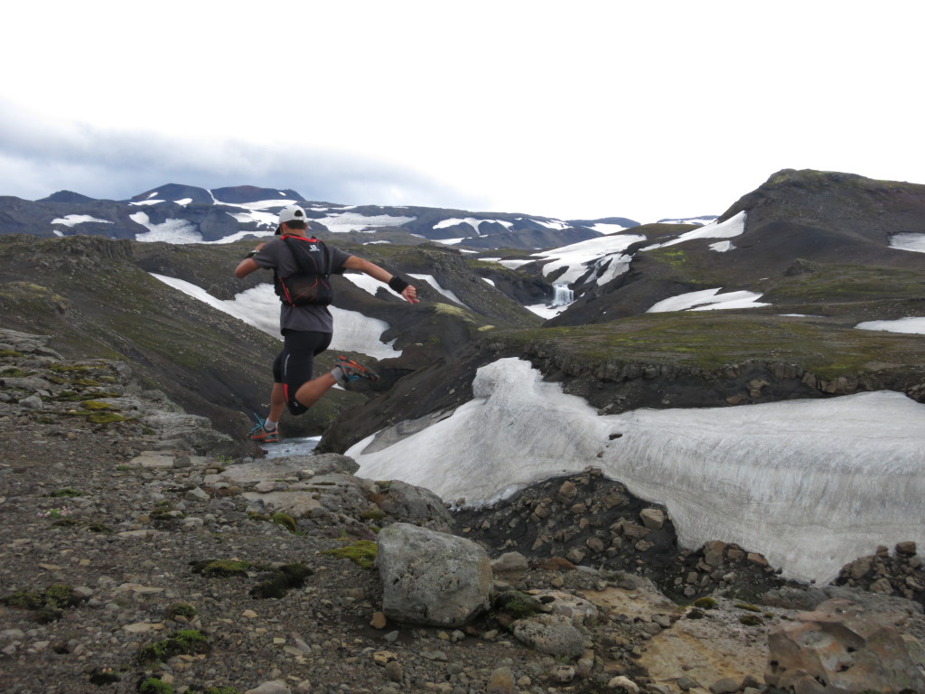
I've never been good at tapering. Pre-race play time in Iceland.

I’ve never been good at tapering. Pre-race play time in Iceland.

Pre-race I spent several rainy days running around the volcanoes and glaciers of Iceland, probably not the most physically restful thing I could have done, but traveling alone allows me to mentally recuperate and relax. It’s a beautifully diverse country, with great people and amazing scenery, I highly recommend a stopover if you get the chance. On Tuesday August 25th I caught a flight to Geneva, Switzerland and made my way to Chamonix, because even though my race wouldn’t start until Friday, I wanted to see my good friend Chris off as he started his journey on the TDS course (120km sister race to UTMB). Wednesday morning I caught the bus over to Courmayeur with several friends, watched the TDS runners sprint off into the early morning light, then spent the rest of the morning eating croissants and enjoying Courmayeur, this was the only time I’d get a chance to enjoy the town in the daylight as both in 2013 and again in 2015 I’d roll through just before sunrise.
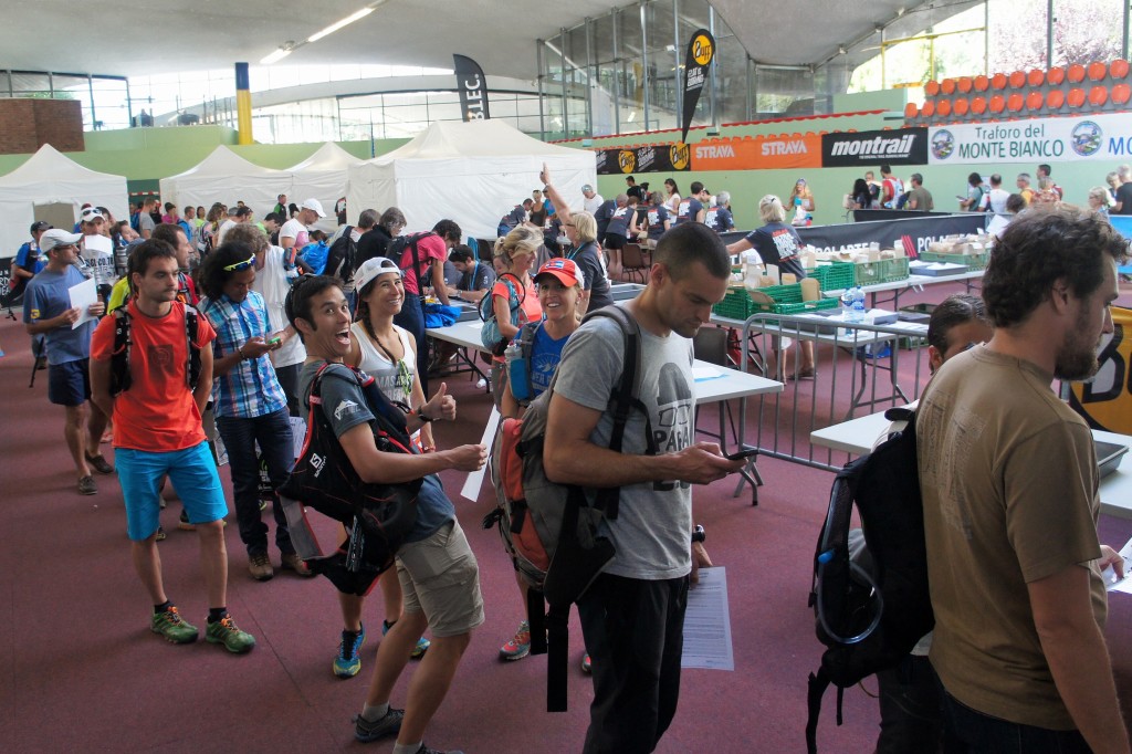
At race check-in along with our 2300+ closest friends.

At race check-in along with our 2300+ closest friends.

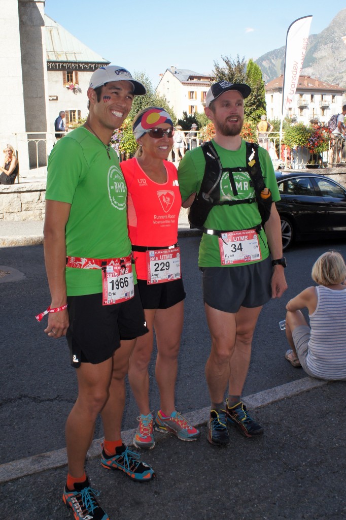
Back in Chamonix the town was electric, most of the 5000+ runners (between OCC, CCC, TDS, UTMB) had arrived and many were milling about the downtown, the vendor expo and check-in. In some ways its complete chaos, but it’s also the most excitement and energy you’ll find at any Ultramaraton event, part of what makes it so special. I finally met up with my parents and several friends from Colorado and settled into our condo on the outskirts of town, just far enough from the madness. This year since I knew what to expect, my goal was to avoid much of the chaos downtown and to simply relax in the days before the race. Note, this is the first time I’ve EVER started a 100mile race more than once, every other race I’ve started and finished exactly once. Wednesday and Thursday went by fairly uneventfully, as Ryan, Amy and the entire household simply kicked back and relaxed. Finally Friday arrived, and after an early breakfast, some last minute gear organization, I laid down for a nap as UTMB doesn’t start until 6pm Chamonix time.
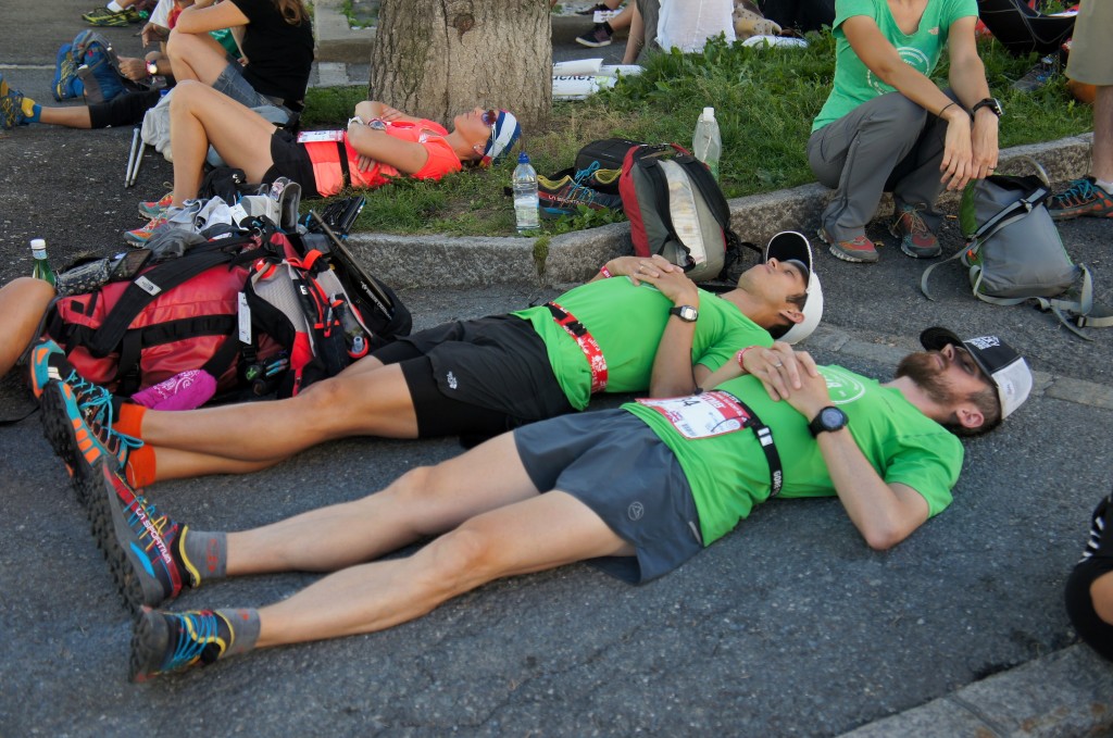
 

Team Colorado taking a little siesta before the afternoon start of UTMB. Photo by Kerwin Lee
Team Colorado taking a little siesta before the afternoon start of UTMB. Photo by Kerwin Lee

All smiles, til we meet again back at in this same spot, hopefully as finishers. Photo by Kerwin Lee

All smiles, til we meet again back at in this same spot, hopefully as finishers. Photo by Kerwin Lee

The Start: Chaos, Excitement and Patients

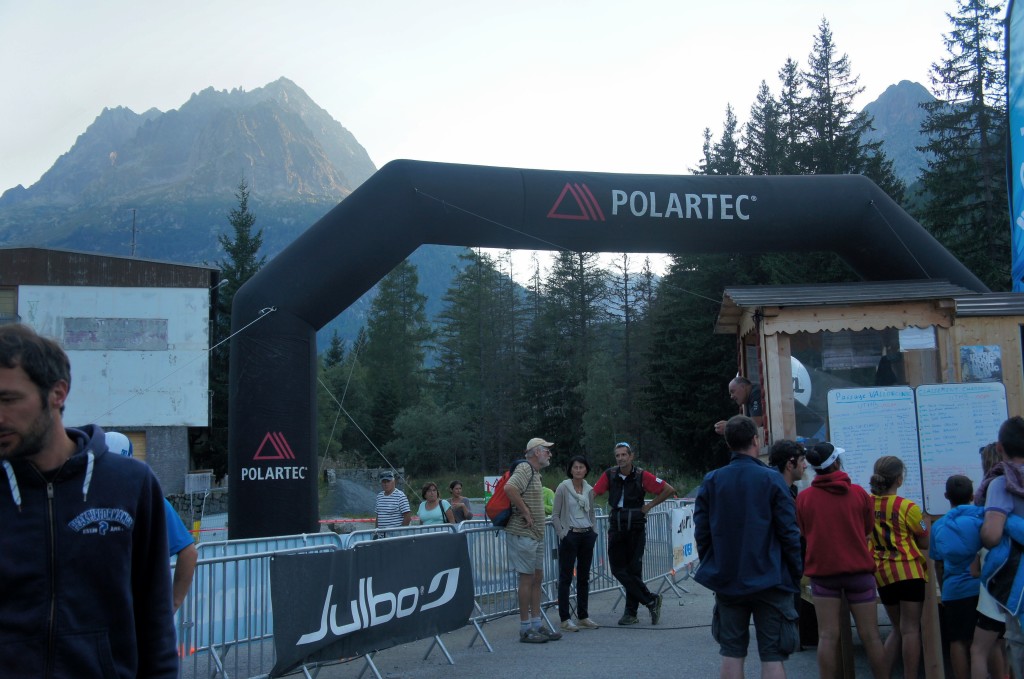
Around 4:30pm we all rolled down to the start line where people were already lining up and a massive crowd was gathering. Ryan, Amy and I stood to the side in an effort to stay out of the sun (race forecast was for hot and sunny conditions throughout) and keep ourselves relaxed. Finally the 30 minute call went out, Ryan headed up to the elite runners bin at the front, while Amy and I began to squeeze our way into the massive crowd that was lining up behind the start line. Two years ago I’d started nearly 1200 people back, which made for a slow and frustrating first 8km, this year I’d resolved to push my way into the top 500 or so. The announcers roared over the PA, something in French, the crowd began to clap, and the gun went off sending all 2400 of us on our way. I slowly jogged through town, past the thousands of on lookers, eventually finding my way to the outskirts of Chamonix where I was able to open up the stride to a comfortable run on the gentle crush gravel downhill. 43min later I rolled into Les Houches (8km), quick but it felt pretty easy and comfortable, now I was in a good spot in the field (top 400). Two years ago the incredible energy of the start and early aid stations had me so amped up I blasted through the first 30km, this year I was resolved to just run my race, enjoy the scene, and to not worry what the other runners (most of whom went out too hard) were doing.
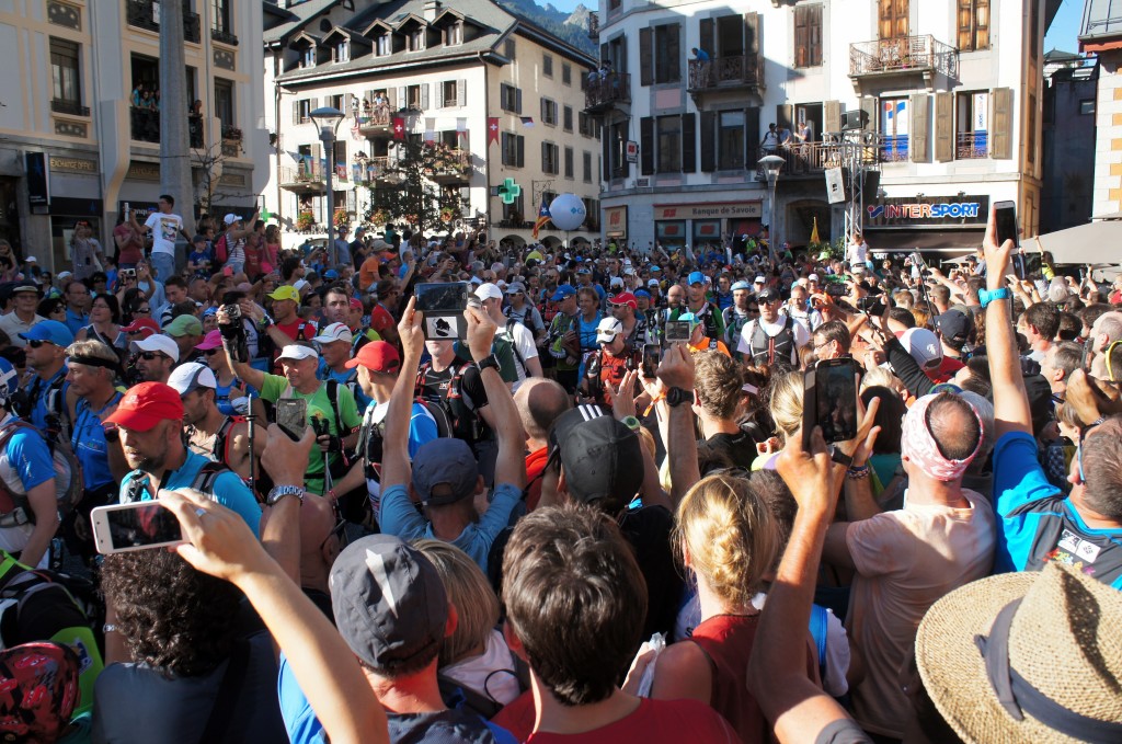
Start of the 2015 UTMB, runners streaming out of Chamonix. Photo by Kerwin Lee.
Start of the 2015 UTMB, runners streaming out of Chamonix. Photo by Kerwin Lee.

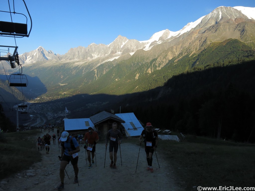
Sun setting as we climb the first hill to Le Delevret
Sun setting as we climb the first hill to Le Delevret

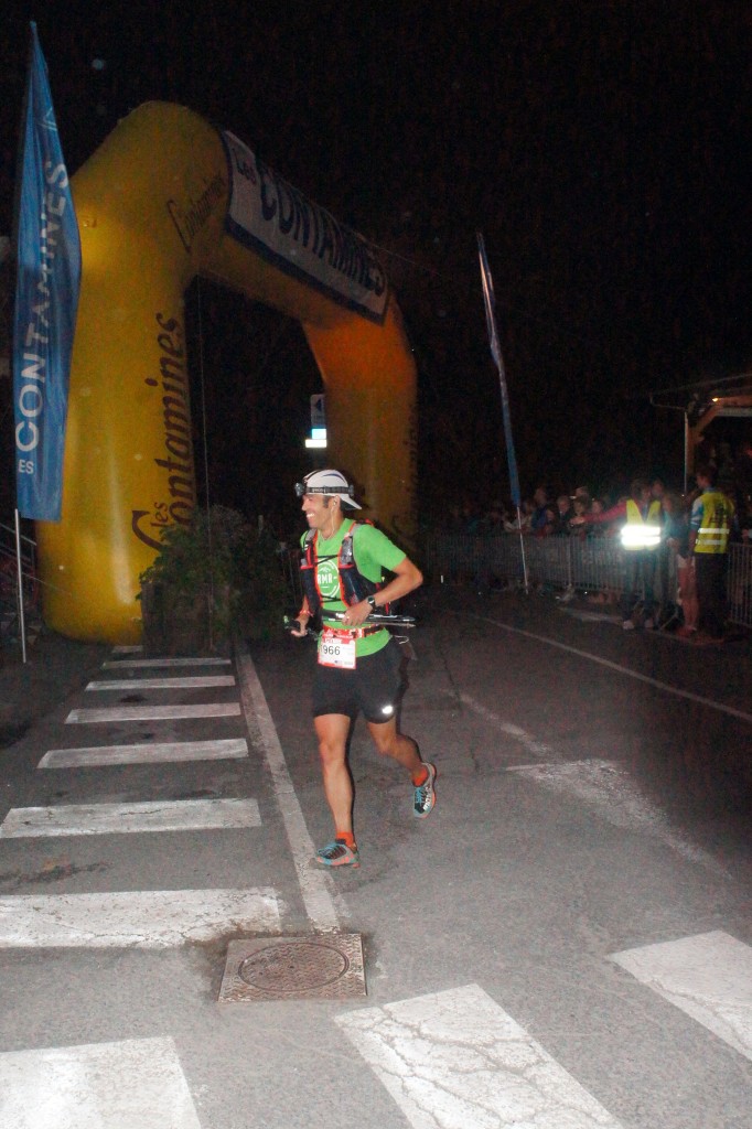
Me arriving at Les Contamines, all systems go and plenty of smiles. Photo by Kerwin Lee

Me arriving at Les Contamines, all systems go and plenty of smiles. Photo by Kerwin Lee

I popped out my poles and settled into a strong uphill hike toward Le Delevret, our first climb of the day. The climb went very smoothly, I stopped to take a few pictures of the sunset on the surrounding mountains, chatted with my new friend Kris from the UK, finally cresting the ski resort and hitting the steep grassy downhill into Saint-Gervais. Kris took off down the steep but runnable slope, I was somewhat hesitant, as the DNF of 2013 lingered in the back of my mind. Still I made it into Saint-Gervais about 28min ahead of schedule (2:27, 21km, 403rd). I briefly greeted my mom, grabbed some water and a snack and jogged off through town, high fiving dozens of kids along the way, because how could you not! As I jogged the rolling single track and gravel road up the valley toward Les Contamines, the final bit of daylight faded away, I kept my headlamp off as much as possible on the easy terrain, reaching Les Contamines feeling strong and energized (3:49, 30.7km, 319th). I walked into the crowded aid station, filled my water, grabbed a snack, all the while trying to find my parents in amongst the chaos. Finally my mom came sprinting through one of the gates, the aid workers had refused to let her in for some odd reason. We sat down at a picnic table as I refilled my Vfuel and trail mix stash and chatted about what I expected for the long night ahead, the next crew point would be Courmayeur in 47km! I gave my mom a sweaty hug, a quick pep talk to my friend Louis who was having a rough patch, and jogged off into the darkness.
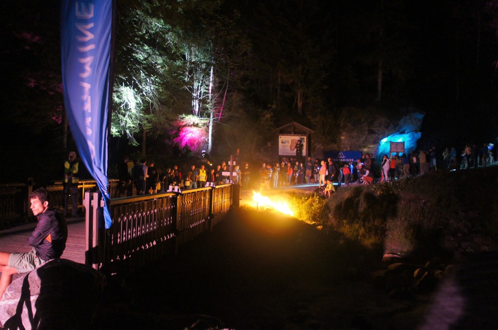
Notre Dame de la Gorge may only be a check-point and a church, but they put on one heck of a party. Photo by Kerwin Lee

Notre Dame de la Gorge may only be a check-point and a church, but they put on one heck of a party. Photo by Kerwin Lee

The Long Dark Road

I jogged my way up the valley, past the checkpoint at Notre Dame de la Gorge (really more like a party) and up into the black abyss. This would be our last major sign of civilization until Courmayeur, 8hours later. Again I snapped out the poles and settled into my fast hike. As I climbed toward La Balme the full moon rose from behind the mountains, illuminating the alpine terrain, so I switched off my headlamp choosing to move solely by moon light. I still hold that night running is an acquired skill, come join me for a BTR night run sometime and I’ll tell you all about it (Wed at 8:30p). As I neared the Col du Bonhomme I glanced back at the trail of headlamps winding up the valley and the aid stations far below, what a night. I soon reached the Refuge du Bonhomme, reracked my poles and began a moonlit descent (yes still no headlamp). I cruised into Les Chapieux (6:58, 49.4km, 222nd) having passed almost 100 runners in 20km, many of them with my headlamp off (to their surprise).
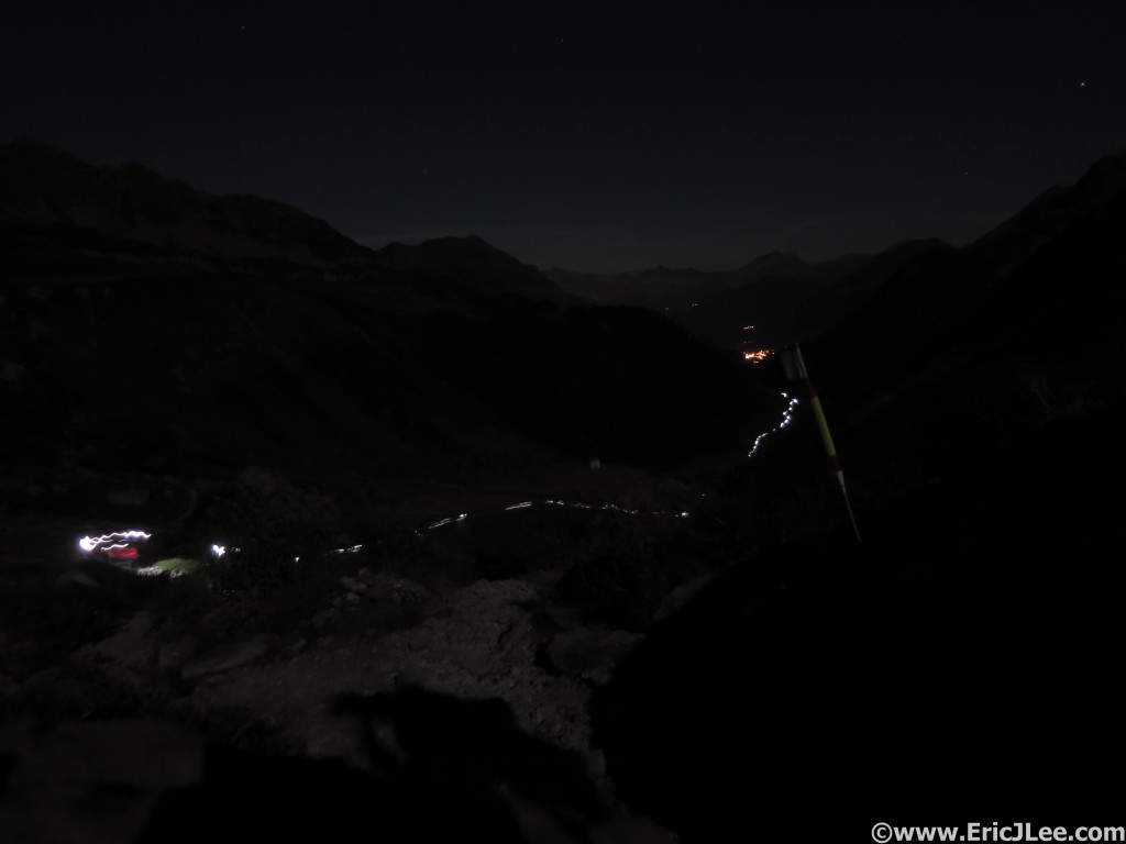
View of the line of headlamps between Notre Dame and La Balme from just below the Col du Bonhomme.

View of the line of headlamps between Notre Dame and La Balme from just below the Col du Bonhomme.

The energy of the race had faded a little, but I was still feeling strong; so after downing some soup and a glass of coke I set out on the long haul to Lac Combal. As I climbed toward Col de la Seigne I again switched off my headlamp, enjoying some moonlit trail silence, soon finding myself cruising down toward Lac Combal. As I jogged down the hill I glanced to my left and noticed a line of headlamps leading toward a Col several hundred meters above me, and became very puzzled as I could see Lac Combal below, but it became apparent the route was taking us a different direction? I was starting to get sleepy, so figured the reason I didn’t remember this section was because I had done it at night. The climb to the Col des Pyramides Calcaires was a mix of muddy wet grass and loose talus, not very runnable, and the case of the sleepies that was setting in made it even more difficult. As we finally approached Lac Combal (10:00, 65.8km, 161st) I was a little mentally beat, the section had taken me 30min longer than expected, I needed a recharge.

As I reloaded my water and browsed the aid station food I heard someone speaking English behind me, I turned around to see Jamil Coury walking into the aid station, he also looked a bit haggard. We briefly chatted as I stuffed my face with soup, coke and the most delicious cake I’d ever eaten (well it was at the time). As we set off along the dirt road toward the Arete du Mont-Favre a cold fog settled over us, blurring our headlamps into a dull white haze. On the climb out of the valley the fog broke and the beautiful starry night reintroduced herself, I was feeling a little sluggish, but still moving alright. As the steep climb finally gave way to another quad pounding descent, a small bit of doubt began to creep into my mind, as the 1300m descent into Courmayeur was my undoing 2years ago. As I descended the steep switchbacked trail into Courmayeur I definitely held back, knowing I was moving well enough, I figured I’d rather lose 5min than risk blowing up my legs again. I finally popped out of the trees and onto the cobblestone backstreets of Courmayeur just before dawn. I was very relieved to have the long crewless night behind me, as the sun always seems to bring me energy.
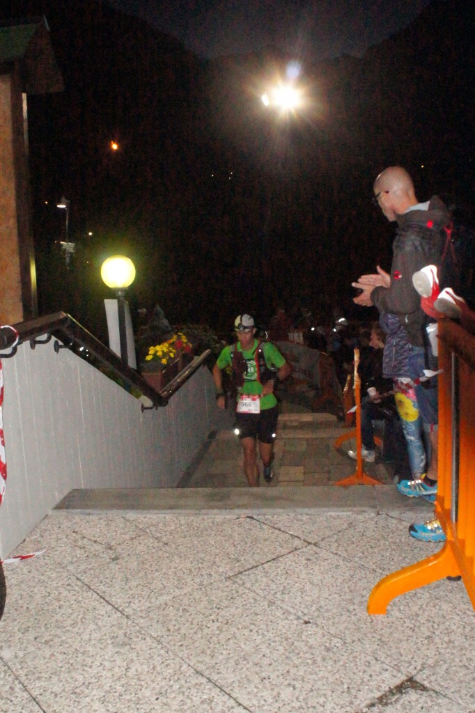
Arriving in Courmayeur after a long night in the mountains, still moving up the ranks. Photo by Kerwin Lee

Arriving in Courmayeur after a long night in the mountains, still moving up the ranks. Photo by Kerwin Lee

The Heat is On

My parents (and Abby) were waiting at the Courmayeur Aid Station (12:09, 78.8km, 149th), I restocked all my Vfuel and food, shed any unnecessary warm clothing and took fifteen minutes to eat and regroup. I could feel a little fatigue creeping into my muscles, but overall they felt exponentially better than two years ago, and much stronger. I again bid my parents farewell, as it would be another 40km until I’d see them again, and off up the hill toward Rifugio Bertone I went. I made quick work of the climb and was surprised to be greeted by Sage at the Aid Station, apparently he’d taken a bad fall, tried to limp on, but couldn’t do it so was waiting for a helicopter ride out. The section of trail from Bertone to Bonatti is one of my favorites on the course, a high alpine traverse with panoramic views of the Mt Blanc massive directly across the valley, what a way to start the morning. I cruised through Bonatti and Arnuva and again set out on another long climb toward the Grand Col Ferret, at 2537m our highest point along the course.
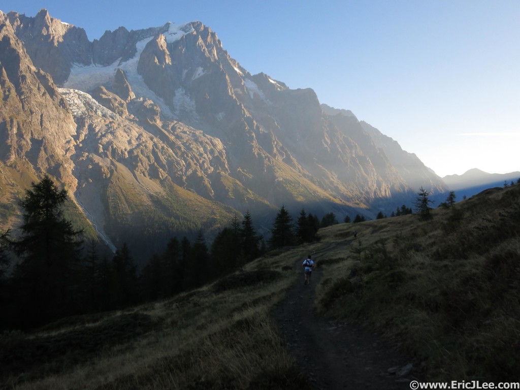
Early morning light near Rifugio Bertone, why I love this section.
Early morning light near Rifugio Bertone, why I love this section.

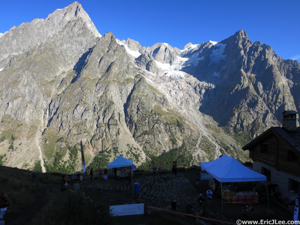
View from Rifugio Bonatti, too bad I can't stay a bit longer.

View from Rifugio Bonatti, too bad I can’t stay a bit longer.
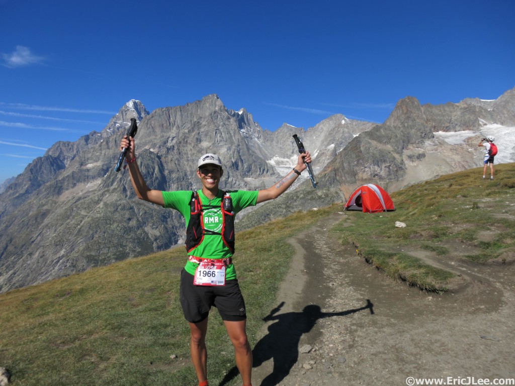
Finally atop the Grand Col Ferret, rough climb, but now I get to go downhill.

Finally atop the Grand Col Ferret, rough climb, but now I get to go downhill.

As I climbed into the warm morning sun my breathing became a bit labored, not in the bronchial constriction way, but more general pulmonary inflammation, or lung butter as we in the ultra world often call it. I slogged on up the hill, but could tell the climbs were going to be especially difficult the remainder of the race. When I finally reached the summit of the Grand Col Ferret I sat down for a moment to take stock of things, my legs felt pretty darn good (all things considered), but I was definitely having trouble taking a deeper breath on the uphills. Thankfully I knew that ahead lay nearly 20km of very runnable downhill so I decided to just let the legs roll and before I knew it I was at La Fouly (17:46, 110.1km, 100th), in great spirits no less. My parents were originally hoping to check-in with me at La Fouly (not a crewable AS), but because of the bus timing and the pace I was running didn’t make it. So I refilled my water, soaked my head under the tap and pushed onward. It was now midday and the sun was baking us with its full force, not my ideal race conditions. As I wound my way down the valley and through several small hamlets I was ever so excited to see that each of them had a public spring fed fountain, so I continually topped off my water and drenched my head in an effort to keep cool, so far so good.
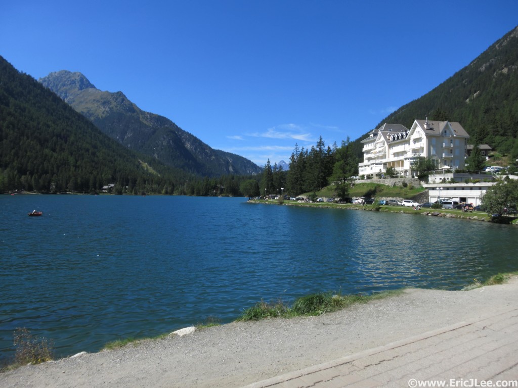
I oh so badly wanted to stop and go for a swim here, but ran on instead.

I oh so badly wanted to stop and go for a swim here, but ran on instead.

At last I reached the short steep climb up to Champex Lac, and my new running mate Alister (Canadian) and I forged ahead up the hot dusty switchbacks. About 2/3 of the way up we came across another spring fed fountain, which was key in refreshing me for the final leg of the long climb. As I neared the crowds waiting at Champex Lac I heard someone call my name, it was my friends Chris and Kate who had come out to cheer me on for the rest of the day, friends and family were just the lift I needed at that stage. In Champex Lac (19:56, 124.1km, 83rd) I quickly changed my shoes, drank a bowl of cold salty soup broth and sponged off again. From the triage that lay around me in the Aid Station I could tell I was handling the heat better than most. After some quick advice from Chris on the last three climbs I bid my parents farewell, it would only be 10-20km between aid stops from now on and barring some major meltdown I had very high hopes of finishing, and finishing strong.
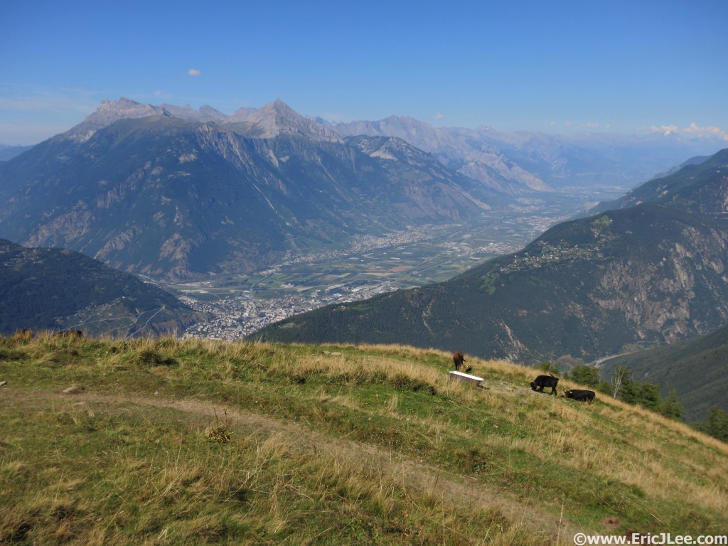
Finally at the top of the climb to La Giete, looking down into the Martigny Valley.

Finally at the top of the climb to La Giete, looking down into the Martigny Valley.

The climb to La Giete (formerly Bovine) was steep, rooty, rocky and dusty; and it sucked the life out of me. My breathing had worsened and I was slowed to what felt like an excruciatingly slow crawl. I hated watching people pass me by, not because I was losing places, but because it meant I was no longer moving as strongly as I knew my legs were capable of. All I could do was trudge on, finally cresting the top of the climb, we traverse through the herd of cattle and dropped into La Giete, were I was able to top off my water before the short but very steep descent to Trient. As I rolled out of the check point my breathing eased on the downhill and my legs had a surprising amount of quickness, so I pushed them a bit, making quick work of the incredibly steep descent and arriving in Trient right on schedule (23:22, 140.6km, 81st). In the warm afternoon sun the crowds had returned and I fed off the energy. The aid stops had fallen into a routine now; restock Vfuel, refill water, sponge off, drink some cold soup, pound a glass of coke and jog on out of the AS.
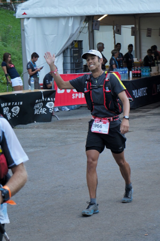
Leaving Trient in pretty good spirits, two more climbs to go. Photo by Kerwin Lee
Leaving Trient in pretty good spirits, two more climbs to go. Photo by Kerwin Lee

Crews waiting at the Vallorcine AS, Photo by Kerwin Lee

Crews waiting at the Vallorcine AS, Photo by Kerwin Lee

The penultimate climb up toward Catogne was short and steep, and while my pace suffered up the steep section I was able to muster an easy jog across the flat traverse at the top before again bombing my way down into Vallorcine. The sun was finally dropping low in the sky, temperatures were cooling off, and since I knew I was well hydrated I popped a couple of ibuprofen in hopes it would help alleviate some of my lung inflammation and congestion. The descent into Vallorcine was quite enjoyable, my legs felt ok and most importantly I knew there was only one more hill to climb before descending back to Chamonix, I could do this. As I rolled through the small town, the aid station was buzzing with crews and spectators (25:56, 150.9km, 87th). I located my parents and instructed them that all I wanted was water, coke and a half dozen Vfuel, then I’d be off. I gave them one last hug good bye and started to walk out of the Aid Station when my friend Chris held up his glass of beer to cheers me and wish me good luck….oooo that looks really good. I made a B-line for him, asked if I could have a swig and after he obliged took a large gulp of the smooth and slightly chilled ale, just what I needed.
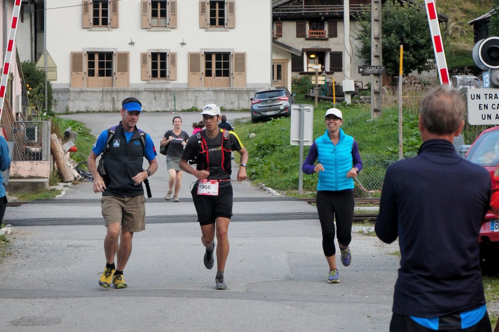
Chris and Kate running me into Vallorcine, its time to get this thing done. Photo by Kerwin Lee
Chris and Kate running me into Vallorcine, its time to get this thing done. Photo by Kerwin Lee

The sun fades away as I enter night #2 on the trail, one climb to go.

The sun fades away as I enter night #2 on the trail, one climb to go.

I then promptly jogged off up the gentle climb toward the Col des Montets. Dominic Grossman and I leap frogged back and forth up to the base of the Col, where darkness set in, we crossed the road and shit got real, 600m of extremely rocky vertical in just a few kilometers. As we pounded our way up into the darkness I noticed my lungs were feeling a bit better, whether it was the ibuprofen or the cooling temperatures who knows, but I was able to keep pace. When we finally crested the top of the steep section my Canadian friend Alister pointed out a light far off in the distance, that was La Flegere, the final aid station, and boy did it look a lot further than 4km away. We jogged/hiked our way through the undulating traverse on some of the most technical terrain of the entire course, the legs and mind were tired, but Chamonix was near. At last only a short section of dirt road separated us from La Flegere and we both breathed a sigh of relief as we strolled into the last checkpoint of the race (28:41, 161.6km, 89th). I filled one of my water bottles with water and the other with coke, it was time to get this done, so both Alister and I hammered out of the ski lodge down the dirt road toward Chamonix. The final descent is a mix of gravel jeep road, rooty and rocky single track and finally a little bit of pavement. We pushed a good pace through the technical sections and before I knew it the trees parted and we were at the ski lift on the edge of town. A huge smile cracked across my face, as all that was left was a few kilometers of pavement across town and I’d have my redemption. We wound our way through the streets, past a handful of on lookers who cheer us home (it was almost midnight after all), finally making a left turn onto the final ‘straight-away’. Neither of us slowed, but simply ran side by side past several hundred cheering spectators, finally spotting our crews waiting for us near the finish line. My Mom and Alistair’s friend joined us for the final 100ft through the finish chute and I made an emphatic leap across the finish line, it was done, the two year wait was over, I was a UTMB finisher.
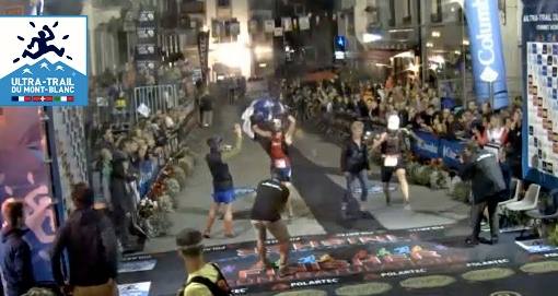
Alister and I crossing the finish line at the 2015 UTMB. 86th overall in 29:37:38 I'll upload a better photo once I get one.

Alister and I crossing the finish line at the 2015 UTMB. 86th overall in 29:37:38
I’ll upload a better photo once I get one.
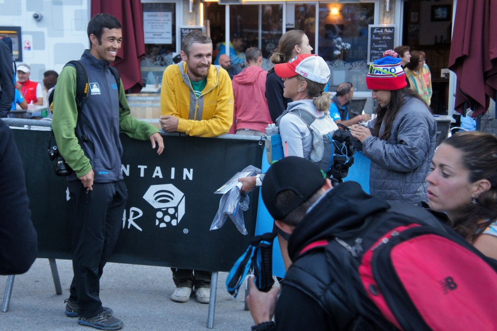
The Colorado household goes 3 for 3, Ryan (9th), Me (86th), Amy (575th). Photo by Kerwin Lee

The Colorado household goes 3 for 3, Ryan (9th), Me (86th), Amy (575th). Photo by Kerwin Lee

A few shared high fives, a hug and some photos were snapped. My mind didn’t care that it was nearly midnight, that my body had been awake for nearly 40hours, that I’d been running for 30hours, or that my legs were tired, stiff and sore, no, all it cared about was that I’d finished and the massive smile on my face made that evident to all. I chatted with all the friends who had come out to see me finish, even Ryan had limped his way down to the finish line to congratulate me (he’d finish many hours earlier in 9th overall!). It was amazing to share that moment with everyone; family and crew, training partners, friends, supporters and the other several hundred brave souls who were still awake in the middle of the night awaiting the arrival of more runners. While the words in this report describe my experience, I still can’t fully put into words everything that the 2015 UTMB was for me; redemption, elation, sacrifice, perseverance and satisfaction. We don’t do 100mile races because they are easy; we do them because they push our limits, they test our strengths, they break us down and expose our weaknesses, but most of all they provide a rich diversity of experiences. A mere three days later I was back to running and hiking, my legs had never felt so good after a 100miler, cheers to a quick recovery and more adventure to come.
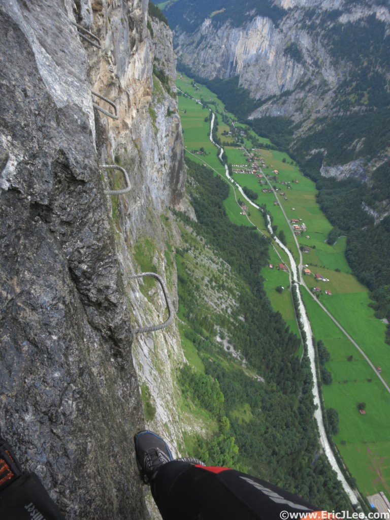
Post-race play time, Murren to Gimmelwald klettersteig, at least I wasn't running.

Post-race play time, Murren to Gimmelwald klettersteig, at least I wasn’t running.
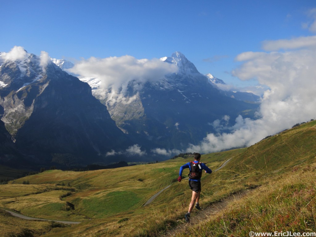
Six days after finishing UTMB my legs felt way too good not to get out and enjoy Gindelwald and views of the Eiger.

Six days after finishing UTMB my legs felt way too good not to get out and enjoy Gindelwald and views of the Eiger.

A special thanks to my parents for crewing me into two nights and a full day, all my training partners for slogging out mountain miles with me (including the Rocky Mountain Runners), Adam Engel of Waldron’s Peak PT for helping fix the weaknesses that derailed my 2013 UTMB, Cindy Stonesmith for the training advice, and Vfuel for supporting my crazy ideas and keeping me consistently fueled. Video of my entire race experience is in the works, stay tuned

Summer of Fun Recap, Next up UTMB!

It’s been a while since I’ve written anything, not for lack of content, but for lack of time. The Ultra Trail du Mont Blanc is rapidly approaching, only 9 days away, so I thought I’d throw a little fun recap out of my ‘training’ for the race, more like playing. Mostly its just a small collection of pretty pictures, hope you enjoy it 🙂

My DNF of 2013 at UTMB still haunts me to this day and I would say it’s been a driving force in keeping myself healthy and strong. Before this year’s UTMB race I’ve taken a little different approach to training, and it hasn’t really been ‘training’. After Miwok I was really struggling to find any sort of fire when it came to races, so decided that this year would not be about training and races, it’d be about adventure and fun. July 1st I ran an unsupported 100km loop around the Yosemite Valley, first known time as far as I can find.

This place is alright. Relaxing and taking it all in at Yosemite Point.

This place is alright. Relaxing and taking it all in at Yosemite Point.

The following week I was fortunate enough to join Andrew Hamilton for Longs Peak as he broke the Colorado 14ers FKT. I then paced a good friend Jason Oliver for 40miles at the Hardrock 100 enroute to his first finish, always an amazing time in the San Juans.

Sunrise near Virginius while pacing Jason Oliver at the 2015 Hardrock 100

Sunrise near Virginius while pacing Jason Oliver at the 2015 Hardrock 100


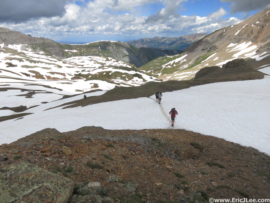
Trudging our way through the snow up to Oscars Pass

Trudging our way through the snow up to Oscars Pass

I finished off July with the Pawnee-Buchanan Loop and a successful connection of Capitol Peak, Snowmass Mt and the Maroon Bells in just over 15hours.

Descending off Buchanan Pass on the Pawnee-Buchanan Loop.

Descending off Buchanan Pass on the Pawnee-Buchanan Loop.

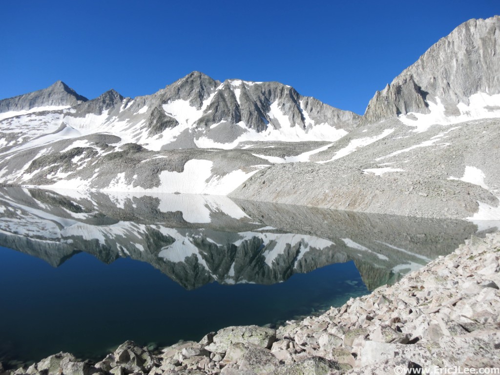
Traversing Pierre Lakes basin between Capitol and Snowmass during the Capitol-Snowmass-Bells linkup.

Traversing Pierre Lakes basin between Capitol and Snowmass during the Capitol-Snowmass-Bells linkup.
Headed toward the Maroon Bells on the shortcut from Snowmass.

Headed toward the Maroon Bells on the shortcut from Snowmass.

This linkup was something I’ve been eyeing for a while and was the last piece of the 14ers puzzle left to connect. I started at 345am at the Capitol Ditch TH and made steady progress up the standard route to Capitol Peak. I then backtracked over K2 and descended the Wandering Dutchman couloir into PierreLakes basin. The key to an efficient linkup is the class 3-4 ascent of the low point of the Capitol-Snowmass ridge, an otherwise foreboding knife-edge ridge guarded by sheer cliffs, pinnacles and nasty scree chutes. Once over the Capitol-Snowmass ridge I scampered up the backside of Snowmass Mt along the West Ridge, descended the standard route and took a high traverse to the trail just below Trail Rider Pass. Once I hit the trail I immediately crossed over and headed up the valley toward the ridge that separates Snowmass Lake from the Bells, taking a direct line across the high tundra toward the back side of the Gunsight Couloir. The climb up North Maroon’s NW ridge went slow and steady, then I did an out and back over to Maroon Peak across the Bells traverse and descended the NE ridge of North Maroon back to the TH. I had originally intended to go for Pyramid as well, but due to poor planning I was running out of food and didn’t have much warm clothing so left that for another day.

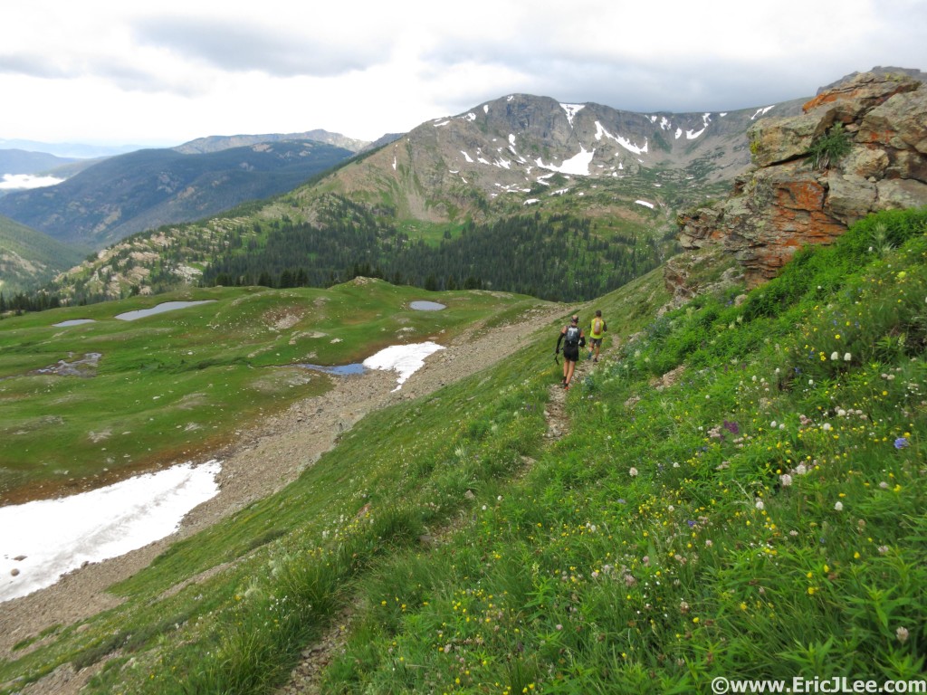
Headed toward Jasper during an extended High Lonesome Loop

Headed toward Jasper during an extended High Lonesome Loop

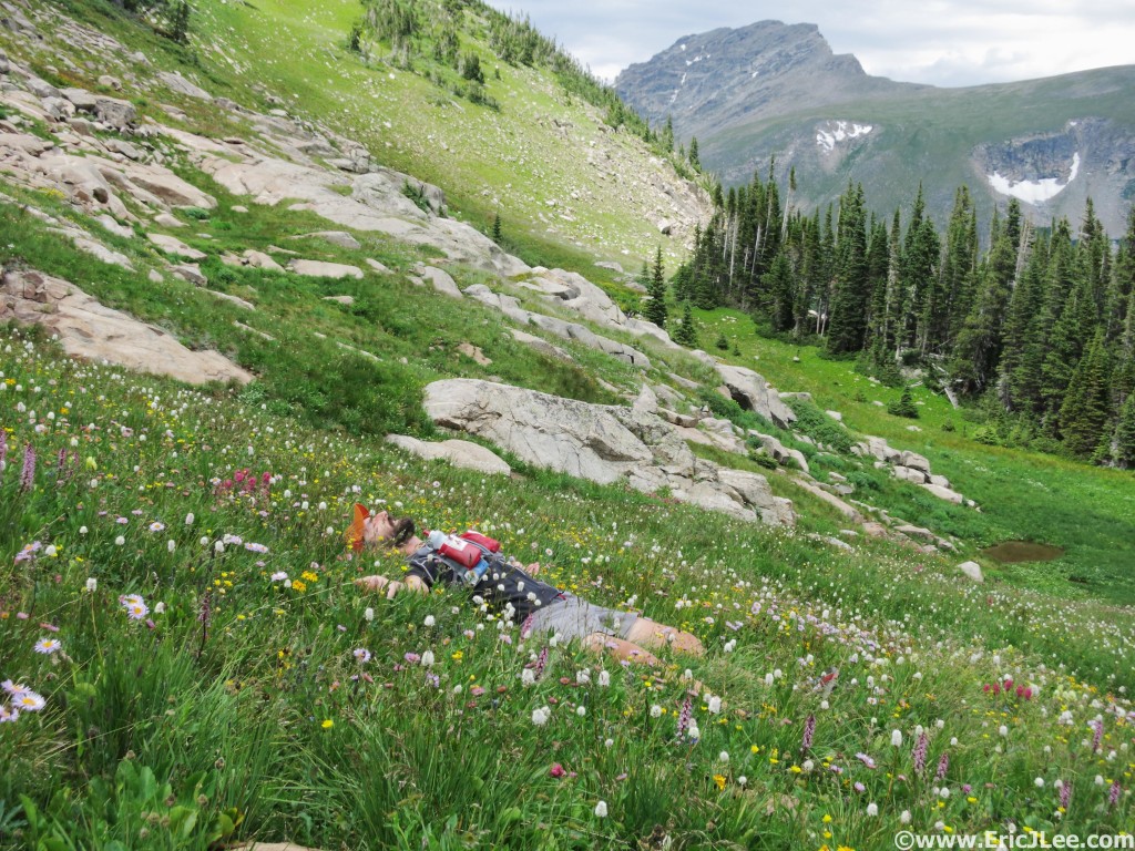
Jon laying in a field of flowers near Diamond Lake in the Indian Peaks.

Jon laying in a field of flowers near Diamond Lake in the Indian Peaks.

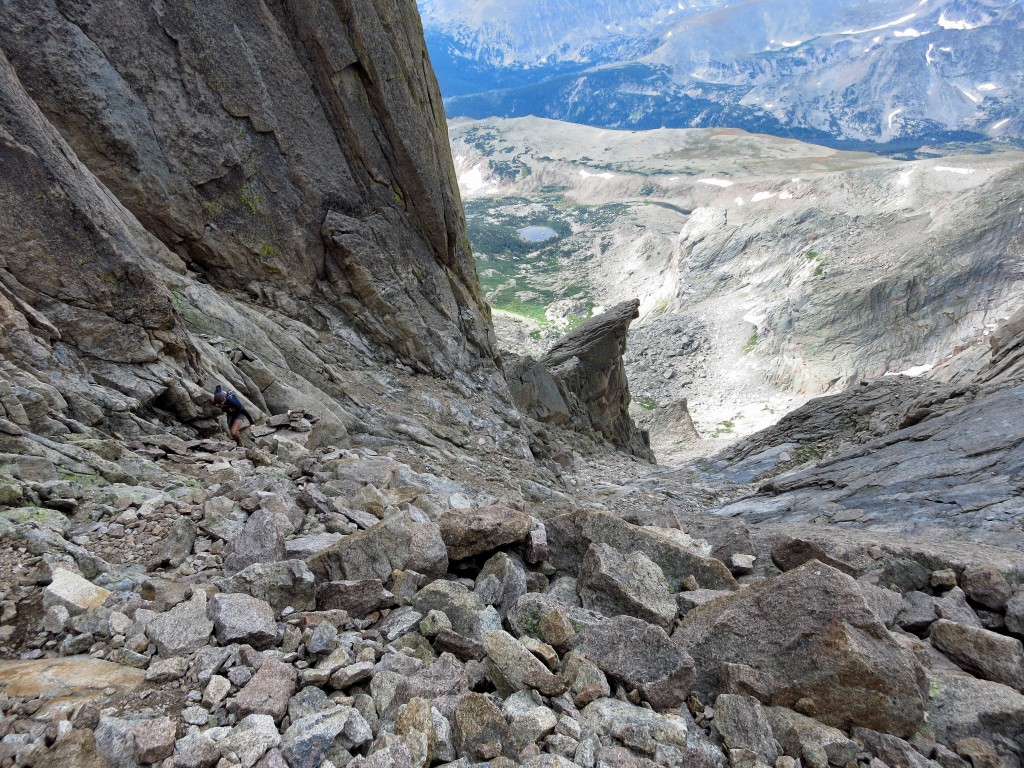
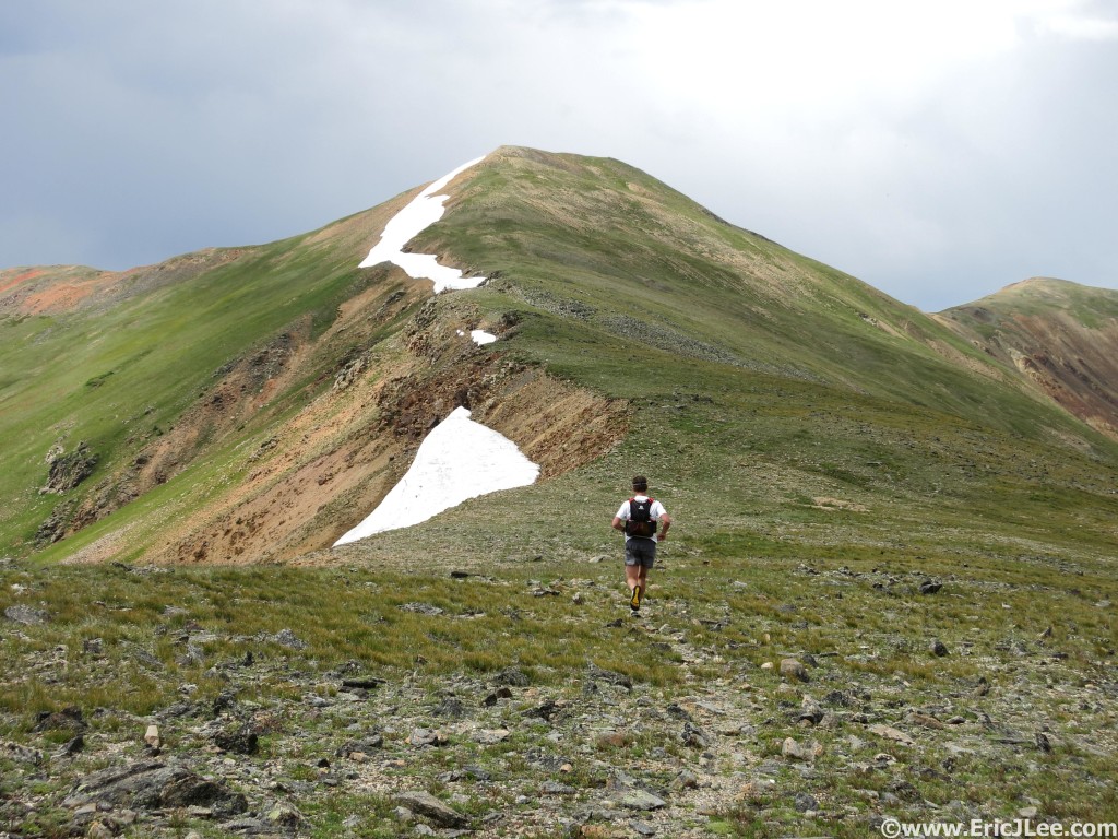
August saw more mountain play time including; an extended High Lonesome Loop including Jasper Peak and Mt Neva, a ridge run from Guanella Pass, the Maroon Bells Four Pass Loop and a scramble up Meeker and Longs.

High altitude ridge running near Guanella Pass.

High altitude ridge running near Guanella Pass.

The Maroon Bells Four Pass Loop rarely disappoints

The Maroon Bells Four Pass Loop rarely disappoints

Making our way up Keplingers after climbing the Loft and Mt Meeker enroute to Longs Peak.

Making our way up Keplingers after climbing the Loft and Mt Meeker enroute to Longs Peak.

My training volume never peaked over 75miles, I never broke 20,000ft of vertical gain (in the past I’ve hit as much as 30,000ft), but I feel very strong and fit after spending lots of quality mountain time outside and mixing in some solid weight sessions a few times a week. Whether this has adequately prepared me for UTMB remains to be seen, but I can say that it’s been quite a few years since I had this much fun simply playing outdoors; having rediscovered what brought me to the outdoors in the first place, a love of mountains, scrambling and off-trail adventure. With only 10 days until UTMB I’m trying to behave myself and keep the energy expenditure down, but with five days in Iceland coming up we’ll see how that goes. I’m excited and ready for some more mountain play time on the volcanoes of Iceland and in the mountains of the Alps. Thanks to Vfuel for keeping me energized throughout all these crazy fun mountain adventures, Adam Engel at Waldron’s Peak for helping me fix my ailments and get me stronger, and all my adventure buddies who have made this summer so wonderful….off to Europe!

The Long Way Around: Yosemite Valley Circumnavigation

Run Stats

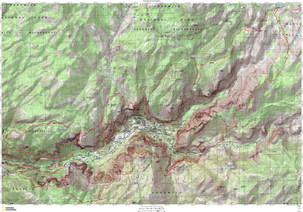
Route Yosemite Valley Rim Circumnavigation
Time on Feet 17h 55min
Distance 64.5mi
Elevation 15,750ft Gain/Loss ea
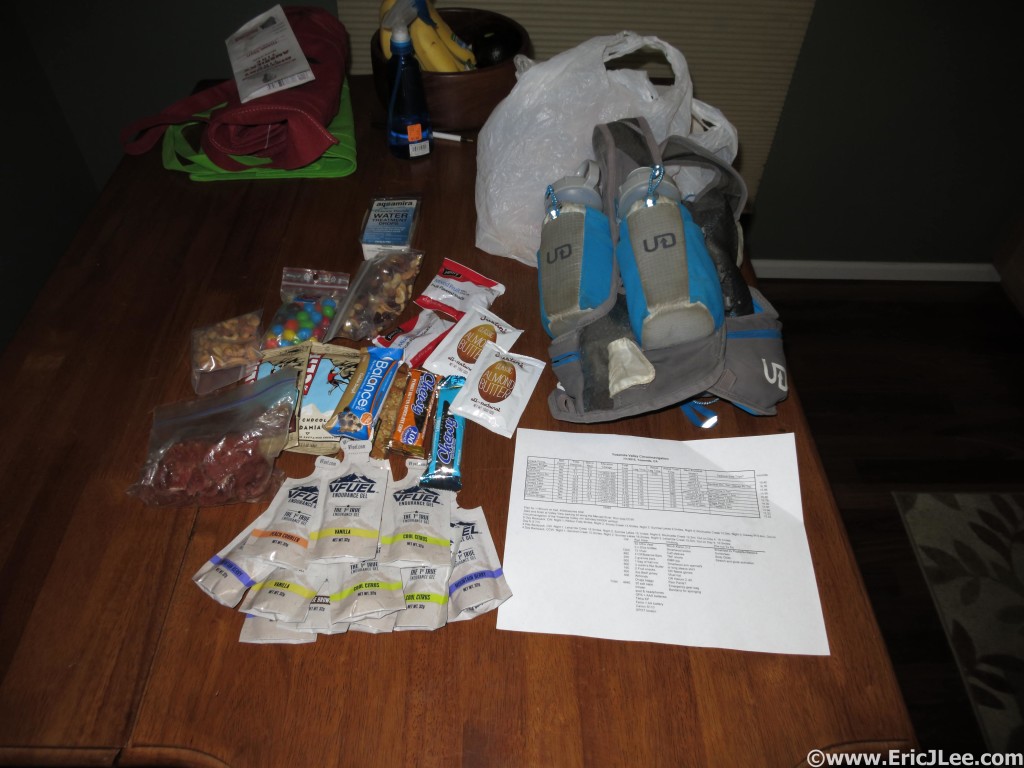
Calories Consumed 3400 kcal; 12 Vfuel, 3 Clif Bars, 2 chewy bars, 6oz trail mix, 1 Justin’s Almond Butter, 2oz M&Ms, 2 fruit snacks, 1oz turkey jerky.
Water Consumed 13-15 20oz bottles (9L)
Salt Consumed 19 capsules/9000mg, approx 400-500mg ea
Calories Burned Approx 8,000 kcal
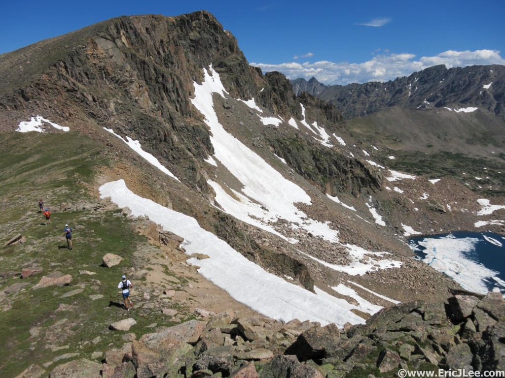
TemperatureRange 65-85°F


Gear: UD UltraVest, 2x 20oz bottles, BD Z-poles, Tikka XP headlamp, Fenix ED10 light, Foretrex 301 GPS, Canon S110 camera, SPOT locator, inhaler, First-aid kit, Emergency blanket, Aqua Mira.

Clothing: iNov8 X-talon 212, Smartwool PhD crew socks, Champion synthetic boxer briefs, TNF Better-than-naked shorts, RMR Patagonia shirt, Moeben sleeves, $1 Walmart gloves, Drymax hat, bandana, OR Helium 2 Jacket.
The actual GPS track from my loop around the Yosemite Valley.
The actual GPS track from my loop around the Yosemite Valley.

Motivation comes in many forms, and all too often I hear people say, “I need to sign up for a race to keep me motivated in training”. I’d argue you don’t need a race, just a goal to work towards. In recent years I’ve come to realize that racing and competition don’t really excite me like it does other, there’s no adventure, there’s no mystery, and the unknown/uncertainty is minimized by the structure. So when I decided to postpone my original big project earlier this year I went searching in California for something fun to do. This is when I noticed a series of trails that seemed to loop around the rim of the Yosemite Valley. I began searching for additional information about the trails, distances and routes, and found very little, and nothing on people completing the full loop. Really? Could it be that no one has completed (and recorded publicly) hiking or running the loop? The closest I’ve found are runs/hikes of the North Rim and Leor Pantilat’s Tenaya Canyon Loop.

4500kcal is a lot to carry around. Prerun packing.

4500kcal is a lot to carry around. Prerun packing.

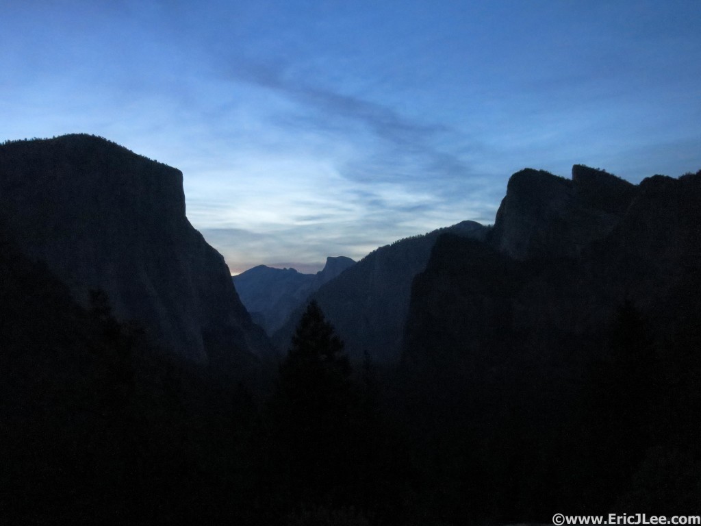
Early morning light at the Tunnel View overlook, here goes nothing.

Early morning light at the Tunnel View overlook, here goes nothing.

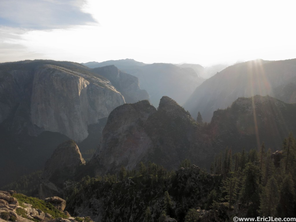
Tuesday 6/30 I flew back into CA, picked up a car, and drove to the boundary of Yosemite to catch a few hours of rest before an early AM wake up. On Wednesday AM as I descended into the Yosemite Valley before dawn the temperatures were already in the 70s, as the forecast predicted it was going to be a hot one (90s in the Valley). I packed up my gear, threw 4500calories in my backpack, 40oz of water, and slathered on some sun screen. At 4:53am I started up the Glacier Point Rd, opting for this easier start than trying to find the connector trail in the dark. I quickly reached Tunnel View and struck on up the trail toward Inspiration Point. As I ascended toward the valley rim the temperature finally began to cool and the views began to open up. I quickly passed by Inspiration Point and found myself at Dewey Point (6:37am, mm6.5). The Yosemite Valley sprawled out below me, with El Capitan’s massive face dominating the Valley wall directly across from me. It was going to be a LONG way until I stood atop El Capitan probably less than 2miles as the crow flies from where I stood.

Sun shining on the Yosemite Valley from Dewey Point, this place is awesome.

Sun shining on the Yosemite Valley from Dewey Point, this place is awesome.

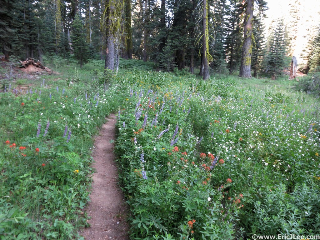
Between the view points the trails weren't so bad. Even in a drought year the flowers bloom.

Between the view points the trails weren’t so bad. Even in a drought year the flowers bloom.

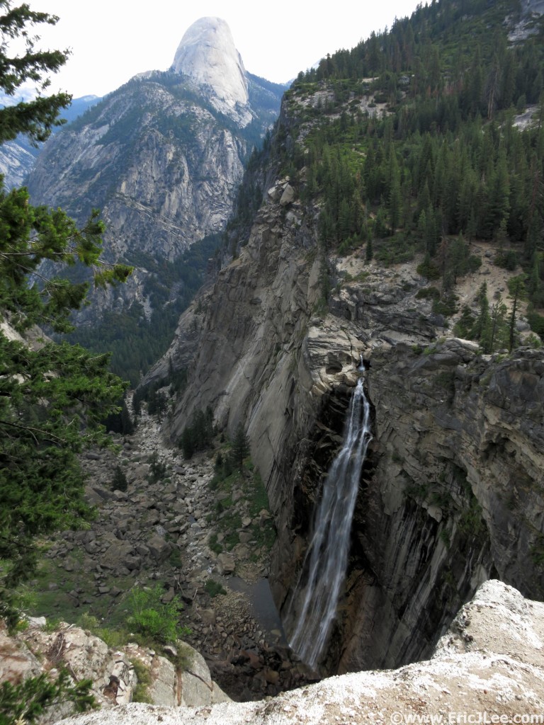
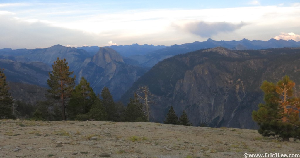
I snapped a few photos and jogged off along the South Rim’s rolling forest and meadow laden trails. A quick stop at Taft Point (7:39am, mm11) to take in a few more views up Valley and off to Glacier Point and Sentinel Dome I went. A light cloud cover kept things from heating up too much, but also led to some hazy views from the top of Sentinel Dome (8:15am, mm13.9). Sentinel Dome is a highly underrated short hike, with views of the Yosemite Valley, Half Dome and into the Yosemite High Country as well, all achieved in under a mile each way from the Glacier Point Rd. I blew past the Glacier Point Rd and opened up the pace a bit as I headed down the smooth switchbacks toward Illouette Falls. Illouette Falls is one of the hidden gems of the Yosemite Valley, dropping 370ft sideways into a narrow rocky valley after starting as a narrow band before being broken into a nice fan. It can only be seen from several view points just below Glacier Point or by hiking up the valley to its base.
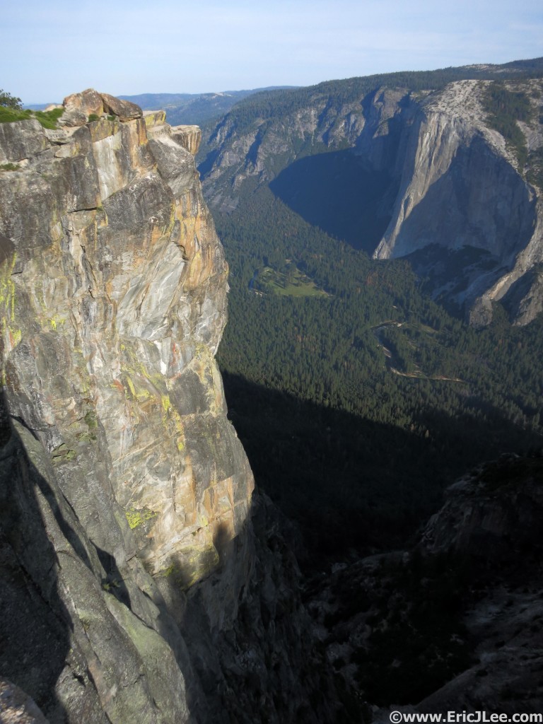
Looking down into the Valley and at the Nose of El Cap from Taft Point.

Looking down into the Valley and at the Nose of El Cap from Taft Point.

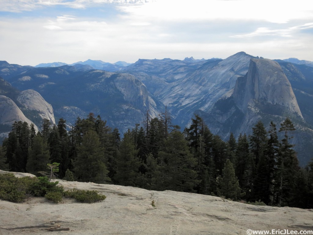
View from the top of Sentinel Dome toward Half Dome, Cloudsrest and Tenaya Canyon.

View from the top of Sentinel Dome toward Half Dome, Cloudsrest and Tenaya Canyon.

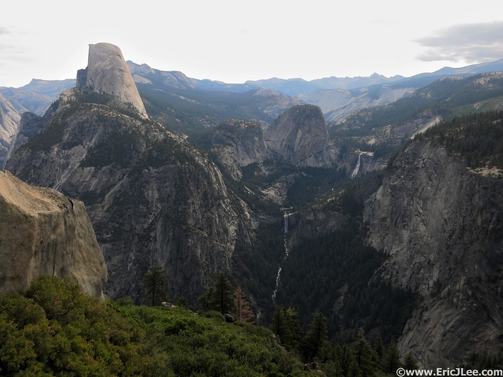
On the trail to Illouette Falls just below Glacier Point. Half Dome, Vernal Falls and Nevada Falls.

On the trail to Illouette Falls just below Glacier Point. Half Dome, Vernal Falls and Nevada Falls.

Often overlooked Illouette Falls.

Often overlooked Illouette Falls.

Another quick water refill and I hiked my way over the Panorama Cliffs and soon rejoined the crowds, briefly, for the run from Nevada Falls to the Half Dome cutoff. As I cruised past the roaring Nevada Falls (9:48am, mm20.9) and up the Merced the constant stream of people reminded me I was still so close to the Yosemite Valley.  I again refilled water, soaked my bandana, and sponged off near the bottom of Sunrise Creek then began the long hot, dry ascent up Cloudsrest. The sun was out in full force and the cumulative effects of the warm dry air were starting to take their toll, but when you’re running around unsupported you just have to deal with it and keep moving. I chugged water as I slowly climbed, but desperately needed too cool off. As luck would have it I found a trickling spring popping out of the hillside at 8200ft, what a little miracle that was amongst the barren dry slopes of Cloudsrest. My pace had still slowed quite a bit in the heat of the day, but I kept plodding along up up up. I reached the summit of Cloudsrest at 12:32pm (mm27.6), fairly tired/fatigued from the heat, but my legs felt alright. I ate some jerky and M&Ms and took a short nap as the cool breeze blew across the summit, waking 10min later feeling fairly refreshed. The panoramic view from Cloudsrest’s rocky summit includes a close-up profile of Half Dome, the giant granite lined bowl that is Tenaya Canyon, and a glimpse of the granitic peaks and spires that make up the Yosemite High Country.

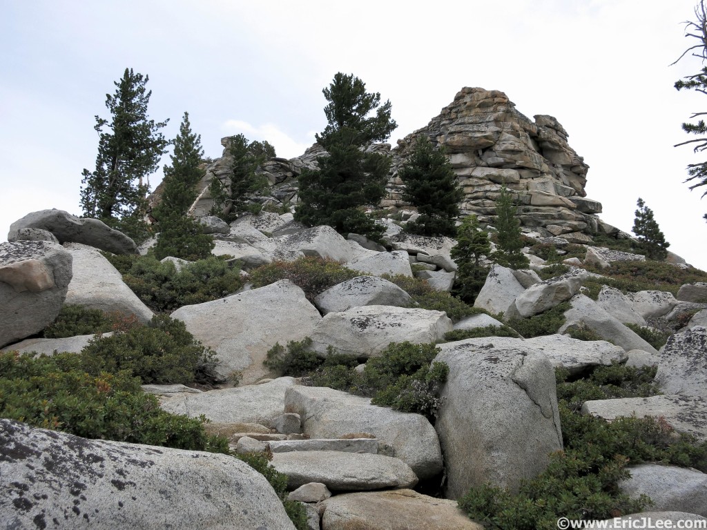
Nearing the rocky summit of Cloudsrest, its hot.

Nearing the rocky summit of Cloudsrest, its hot.

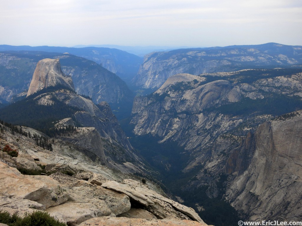
View down the Yosemite Valley from Cloudsrest.

View down the Yosemite Valley from Cloudsrest.

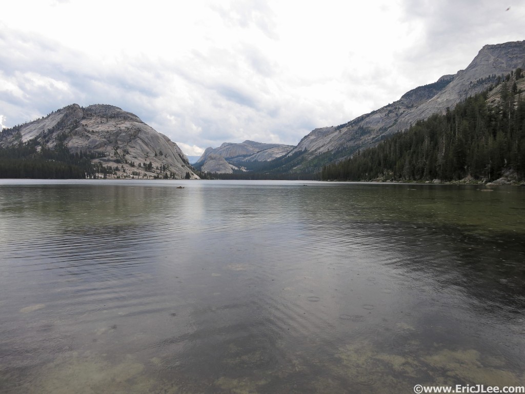
I trotted off down the North side of Cloudsrest toward Tenaya Lake and the long haul around Tenaya Canyon. As I descended the incredibly rocky trail towards Tenaya Lake the all too familiar boom of thunder echoed high overhead in the clouds. As the rain began I was glad I was back below treeline, far from the exposed summit of Cloudsrest. The rain felt wonderfully soothing, and was a welcome change from the relentless heat and sun of the rest of the day, but would be short lived. I settled into a nice jog/hike mixture on the rolling terrain past Tenaya Lake (2:08pm, mm33.6) and around past the tourist crowded Olmstead Point toward Snow Creek. My mind began to become a bit foggy and I was worried the general fatigue was going to shut me down. Another thunderstorm rolled overhead as I crossed an exposed section of trail high above Tenaya Canyon, unfortunately the sun was soon back out heating things back up. My legs still had some decent pep as I cruised down the soft single track toward the Snow Creek crossing.

A quick peak into the Yosemite High Country at Tenaya Lake, halfway home.

A quick peak into the Yosemite High Country at Tenaya Lake, halfway home.

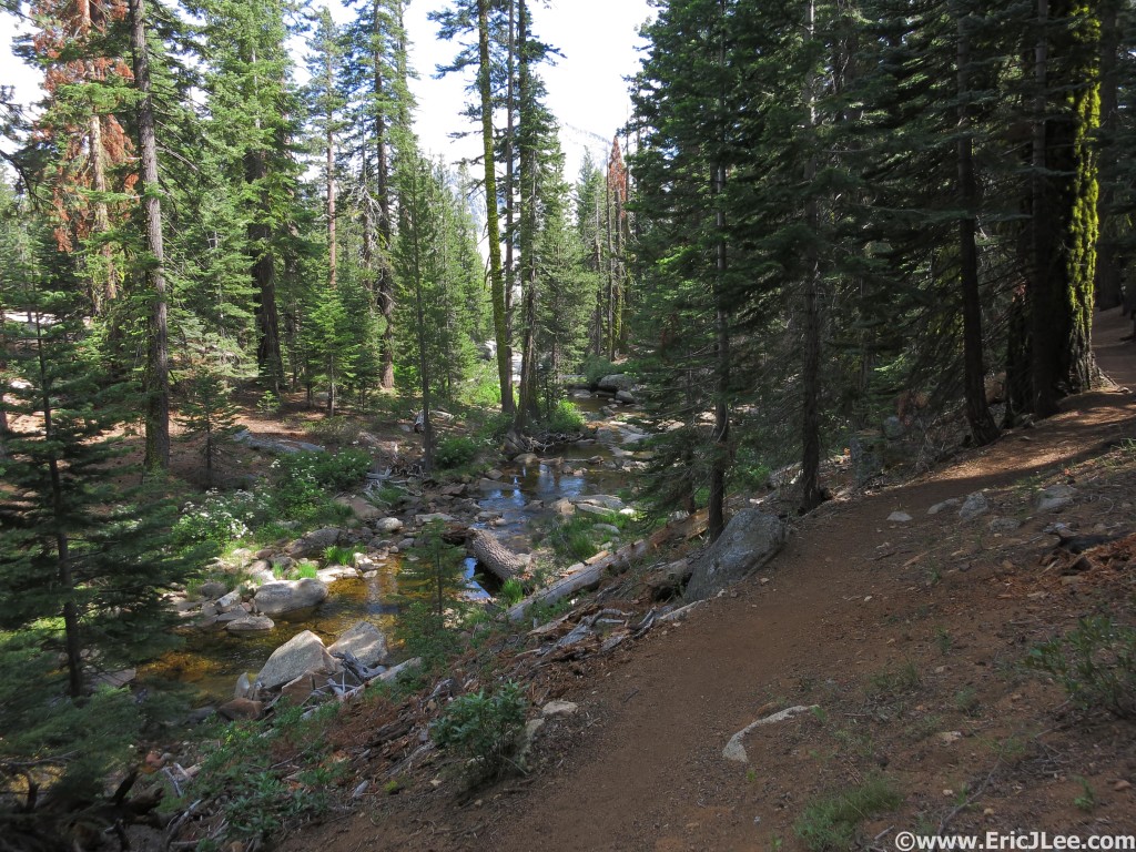
Romping through the forest along Snow Creek.

Romping through the forest along Snow Creek.

I plopped on down next to Snow Creek, wet my bandana and munched on my trail mix, staring blankly at the map trying to decide my next move. I was moving slower, but my legs still felt alright, so I pushed onward, deciding to forgo the spur to North Dome, opting for the more direct line down Lehamite Creek instead. I put on some music, put my head down and chugged my way up the climb to the Indian Ridge saddle. As the sun dropped lower in the sky, the trees began to filter out a lot of the sunlight, cooling things down a bit and softening the light. Before I knew it I popped out at Yosemite Point (6:00pm, mm47.3); the Valley floor was 3000ft below my feet while Half Dome loomed large with the Clark Range dominating the skyline. As I sat enjoying the view I realized this moment was why I’d decided do to this insanely long linkup in the first place. To experience the awesome immenseness of Yosemite in a fashion and at times of day that few others would ever experience.

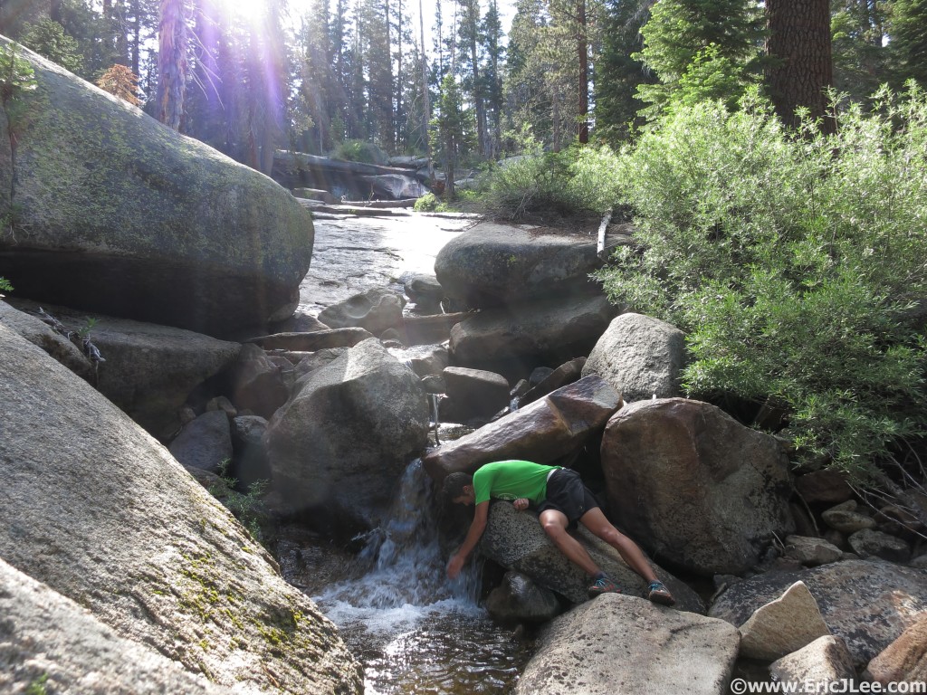
Cooling off in the upper reaches of Snow Creek, a regular occurrence, and a necessity.

Cooling off in the upper reaches of Snow Creek, a regular occurrence, and a necessity.

This place is alright. Relaxing and taking it all in at Yosemite Point.

This place is alright. Relaxing and taking it all in at Yosemite Point.

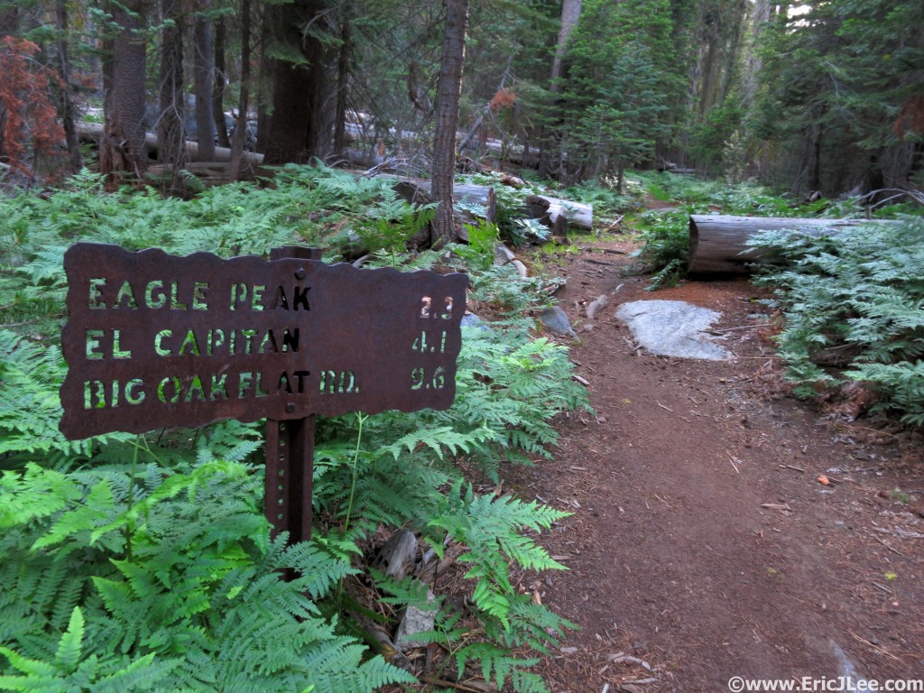
As I made my way through Eagle Peak Meadow I did some calculations and realized I’d be coming back into the Valley after dark, not something I’d wanted to do on the overgrown and unmaintained Old Big Oakflat Rd, but not completely unanticipated either. I pushed my legs a little on the flats and downhills, but the ups were a labor, as the fatigue from the long day was really taking its toll. I finally strolled my way across the top of El Capitan’s broad summit and sat down on a rock pile atop the immense hunk of granite (7:38pm, mm52.5). The sun was hidden behind some clouds bathing the Valley in a soft glow. El Capitan may not have the best view of the Valley and surroundings, but it’s a cool feeling to sit atop the monolith, something surprisingly few people do.

On the homestretch, 15 long miles to go.

On the homestretch, 15 long miles to go.

Sunset on top of El Capitan.

Sunset on top of El Capitan.

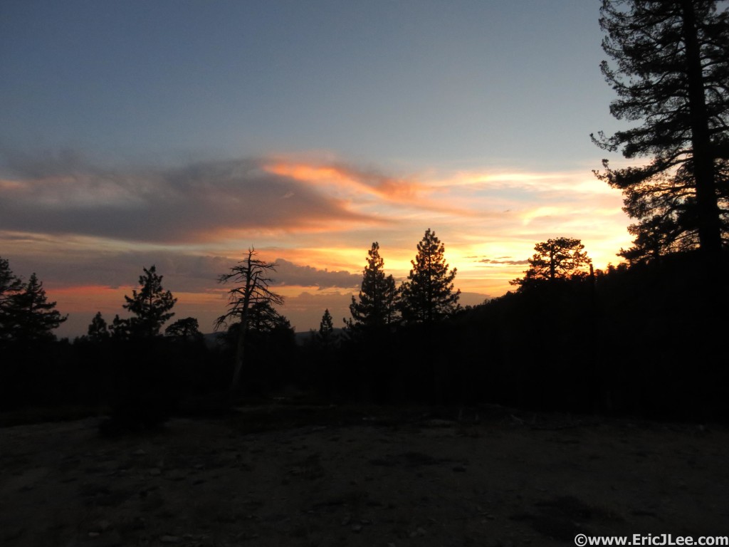
The sun fades away to the West and back into darkness I go.

The sun fades away to the West and back into darkness I go.

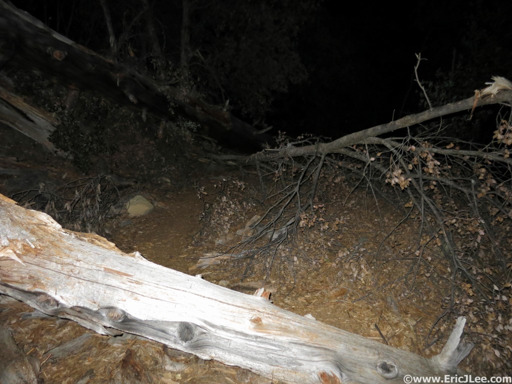
Then began the long trudge back to the car. From the top of El Capitan it was roughly 11.8miles of rolling downhill forested single track and unmaintained access road (dirt) back to my car at Bridal Veil. No more views, just closing out the loop…in the dark. As I crested the final small hill near Ribbon Meadow the last remnants of the sun lit the sky up in an array of yellows, oranges, reds and pinks, then into the darkness I descended. My legs were very happy on the somewhat rough downhill single track, and soon I found myself at the unsigned turn off for the Old Big Oakflat Rd, an unmaintained access road that the park service had ‘let go’ of and is now know as the ‘Rock slide’ trail for good reason. As I started jogging down the old road grade I found out what 50years without maintenance can do, hundreds of downed trees, tree branches growing right into the track, manzanita narrowing the path to 1-2ft wide, and finally the rock slides. Just after an old view point known as Rainbow View (it was dark, no views) the old road had been ravaged by dozens of large rocks slides, some that have completely wiped out the old road grade. Ever tried navigating sideways through a large talus field in the dark? It’s not easy, and was very frustrating. In all the descent down the Old Big Oakflat Rd was mentally the most painful and frustrating part of the day, because my legs felt good and wanted to run, but I could never get a rhythm going because of the overgrowth and rock slides. Finally after much rock hoping and thrashing I popped out on the maintained service road at the bottom and hopped on the Valley trail that would take me back to the Pohono bridge and the Bridal Veil parking area. I jogged my way across the valley, finally reaching the Bridal Veil parking lot at 10:48pm (mm64.5), completing the whole loop in 17h55min, not blazing fast by any means, but I’d gotten it done.

And there were hundreds of these on the Old Big Oakflat Rd, ick.

And there were hundreds of these on the Old Big Oakflat Rd, ick.

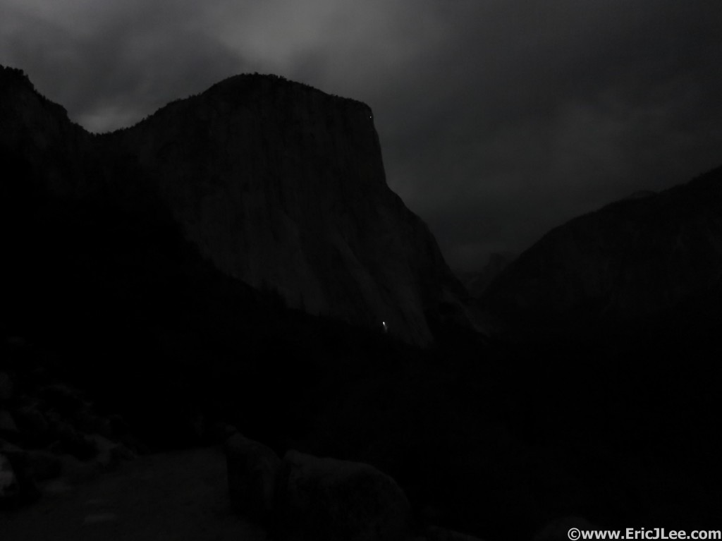
El Cap in the moonlight with a solitary headlamp bivied on the wall.

El Cap in the moonlight with a solitary headlamp bivied on the wall.

I was exhausted, but very happy with the long day. After a quick rinse off in the Merced River (I was filthy) I threw all my gear into the back of the car and drove just outside the park boundaries to a logging road I’d found the previous night and was out within minutes, the rest of the drive to meet my family at the Lair of the Bear where we’d be camping until Saturday would have to wait until morning.

Closing Thoughts:

When I first conceived of the idea of running a loop around the entire rim of the Yosemite Valley, the main intention was to experience as many of the iconic view points as possible, while never returning to the hustle and bustle of the Valley. Except for my one detour off the North Dome loop it was a success, the views were amazing and varied all day long, I saw surprisingly few people, even at major junctions like Glacier Point, Nevada Falls and Yosemite Falls. What I hadn’t expected were all the wildflower laden meadows (even in a drought year), the beautifully soft forest single track and the immense fur and pine forests that encompassed all the sections in between the labeled view points. I’d gotten a little unlucky with the weather; being an abnormally low snow year leading to rivers drying up early and a hotter than usual day, which baked me pretty good from 11a-5p. The only part that I really did not enjoy was the final descent down the Old Big Oakflat Rd in the dark, some of that may have been due to fatigue, but I was definitely frustrated by the rough and unrunnable nature of the ‘trail’.

I would love to do the run again someday, but I think the CW direction would be better for several reasons, and placing some self-supported drops at the Tenaya Lake and Glacier Point bear boxes would be a great help. I also think that during a normal snowpack year the flowers could be 10x better than what I saw and water much more plentiful (trail could be muddy in places though). This route would also make a fantastic 3-5day backpacking trip for those less inclined to run, or it could be split into two segments for runners using the free shuttle bus service to/from Tenaya Lake. There are unlimited possibilities for loops of varying distances and difficulties depending what you want to see, many of which have been done before, but putting the whole thing together in one day was an awesome experience, and truly a unique way to get to know the Yosemite Valley Rim.

Special thanks to Vfuel for keeping my energized during this crazy adventures, Cindy Stonesmith at Ultrarunner Training for keeping me in line (physically), Adam Engel at Waldron’s Peak PT for helping fix me earlier this year and all my running/climbing/scrambling/skiing partners for being equally crazy and adventurous. Run fast, run healthy, but mostly run happy.

Here is a link to my Strava GPX from the day.

Here is a link to the video/slideshow of the entire run (approx 10min)

Finding One’s Happy Place at the Miwok 100k

Endurance sports have always been rife with stories of physical and mental burnout, and because of the nature of the energy and time commitment it’s not something that is going to change. For many, the sport of ultramarathon running is about pushing your limits and challenging yourself, but how far is too far?

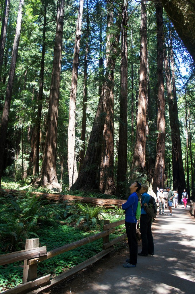
Taking a stroll through Muir Woods the day before the Miwok 100km.

These trees are really big…..Taking a stroll through Muir Woods the day before the Miwok 100km.

Over the years I’m no different than others in that I’ve dealt with injuries of all sorts, mostly minor nags, some more major; sprained ankles, plantar fascitis, Achilles tendinitis, pulled muscles, 2x broken clavicles, weak glutes and knee issues. So far I’ve been methodical enough to work through these issues and mostly correct the underlying causes….except those darn glutes. It was quite a surprise to me that when my knee started to bug me after my last race (Mississippi50) my PT said it was because my glutes weren’t strong enough and my quadriceps and hips were too tight. But wait, hadn’t I been doing all these squats, deadlifts, and exercises to prevent this? So with the Miwok 100km only 7weeks away I was back to square one; limited running, pain management, lots of stretching/foam rolling and an hour of PT each day to retrain my muscles to fire properly, uggg. As I was spending an hour a day on the treadmill running at 10% (uphills didn’t bother my quad/knee), I began to wonder why am I actually doing all this? Do I ‘have to run’ or do I ‘want to run’?

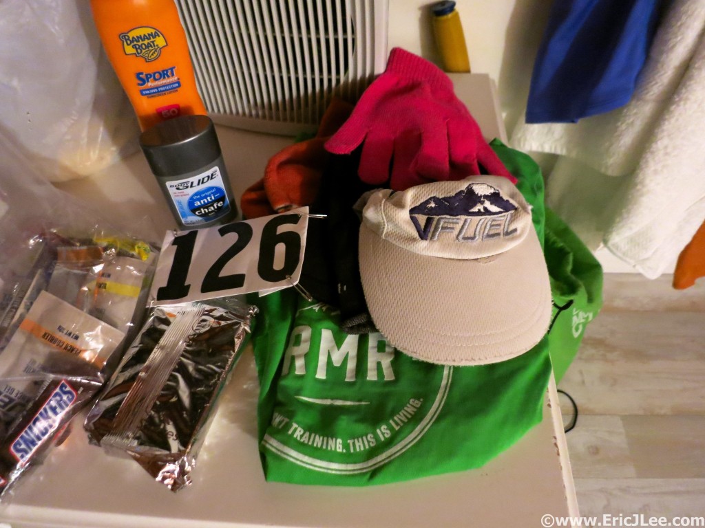
It's go time for the Miwok 100km, 5/2/15.

Mmm poptarts and snickers, it’s go time for the Miwok 100km, 5/2/15.

Two weeks before Miwok I finally had a break through in my rehab thanks to Adam Engel at Waldron’s Peak and Ginna Ellis at Boulder Acusport, the pain in my quad/knee had been reduced to a dull ache when I ran and hiked and almost non-existent at other times. So after several weeks of so so training, including a lot hiking I was heading to California to run 100km and had no clue if my body would even hold up for that distance. Race day came and I felt pretty good that I would be able to finish, but how fast would be the question, given my sub-par training (45-50mi/week) and my balky quad. The race started in the foggy dark pre-dawn hours with a nice steep climb up the Dipsea trail to the Deer Creek fire road, the sound of bag pipes filling the early morning fog with an eerie song. I settled into a pretty casual pace for the first 10miles, leap frogging with a friend and just letting my body ease into the miles. After a quick stop through Muir Beach then Tennessee Valley I finally opened up the pace as we circled the Rodeo Valley, even running all the climbs and zipping by dozens of runners. While a little tight, my quad felt alright for the first 20miles, but I could tell that my fitness might catch-up with me at some point.

Arriving at Tennessee Valley the first time, 5/2/15.

Arriving at Tennessee Valley the first time, 5/2/15.

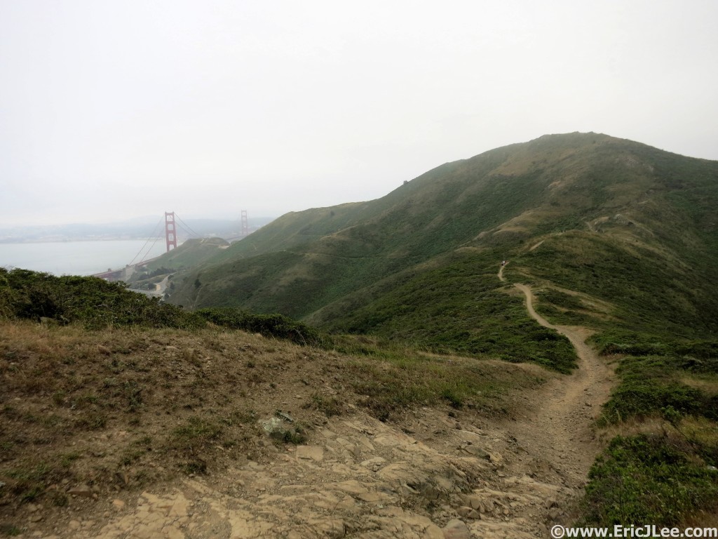
Running the trail with views of the Golden Gate Bridge through the fog.

Running the trail with views of the Golden Gate Bridge through the fog.

I hit Muir Beach #2 still feeling good, and in the 22miles since Muir Beach #1 having passed 52 other runners, there was hope for my race yet. Finally I hit the climb up to Cardiac, a 1500ft grind that was a sight for sore legs because it meant I got to power hike instead of run. The climb up toward Cardiac was going well, I picked up another five spots, but then the sun came out and I realized I’d left my second water bottle with my parents, and that was going to be a problem. After Cardiac I started to get a little hot, but the bigger issue was my stomach, around mm38 it turned sour, I felt bloated and nauseous, but I couldn’t throw up to empty it. So I hiked and slow shuffled along the sunny Coastal Trail all the way to the Bolinas AS where I was finally starting to feel a bit better. I drank some more water, had a glass of coke (bad idea) and some pretzels and took off along the runnable Bolinas ridge only to have my stomach turn again, reducing me to a fast walk. Soon my friend Katie caught up to me from behind and her brother Jon (in 6th) was heading inbound from the out and back. It was good to see friends and lifted my spirits, but not my stomach.

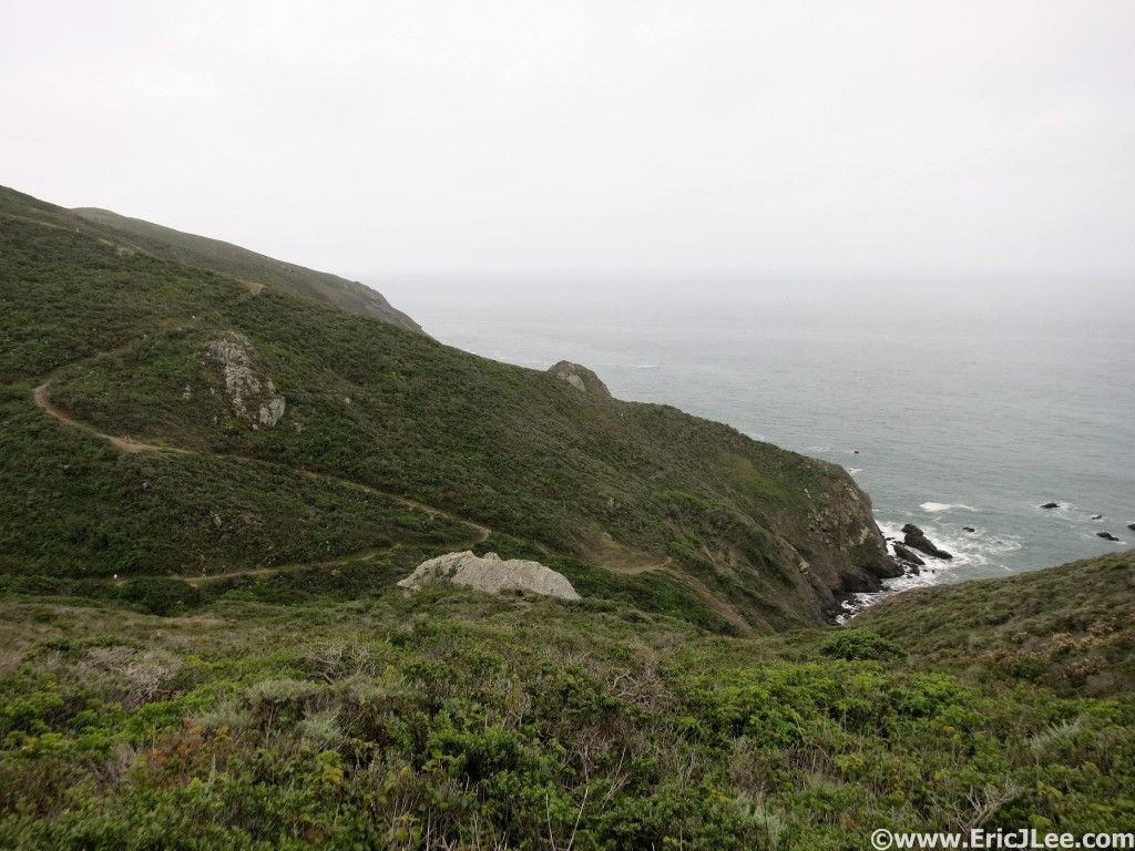
Running the Pirates Cove trail in the fog around mile 26.

Running the Pirates Cove trail in the fog around mile 26.

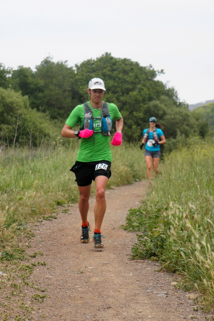
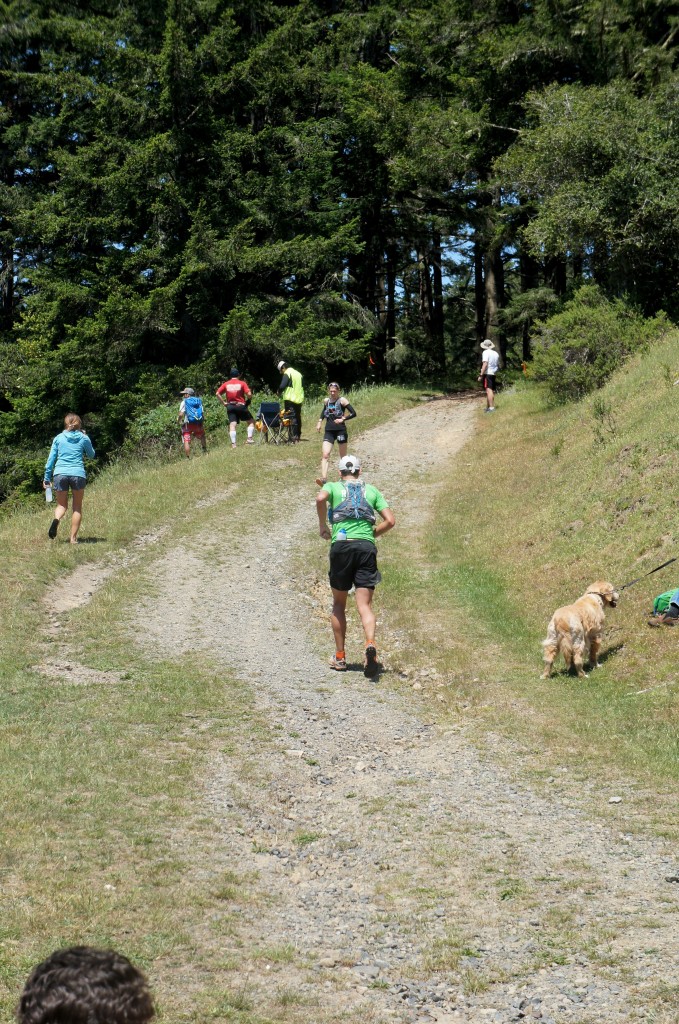
Running through the redwoods on a beautifully sunny California day.

Tiny people. Running through the redwoods on a beautifully sunny California day.

My stomach finally started to settle right before the long descent to the Randall AS turn around, so I turned the legs over and pushed the pace a little. After a quick refuel and restock I went charging up the hill, running the 5-10% grade for the first 1/4mile, but finally relented back to a power hike. My mind began to wander to the trees, the flowers, and why I was in this location at all. I realized that I really didn’t want to hammer the last 12miles, that I didn’t care about my time (I would finish) and I didn’t care about my place. I just wanted to stroll along and enjoy the rest of the afternoon, even if my legs were capable of running faster. I danced my way through the redwoods, took pictures of the iris, lupine and poppies, and ate pizza at the Bolinas AS. I ran a little, walked a little, stopped a few times. Those last 12miles were the most enjoyable of the entire race. Next time you are feeling down during a race, take a moment to contemplate your surroundings, your purpose and the experience and rather than DNF, slow it down and enjoy your amazing surroundings and an accomplishment that few others are capable of, even if it’s slower than you’d hoped for.

Stomach back intact, running the hill out of the Randall AS.

Stomach back intact, running the hill out of the Randall AS.

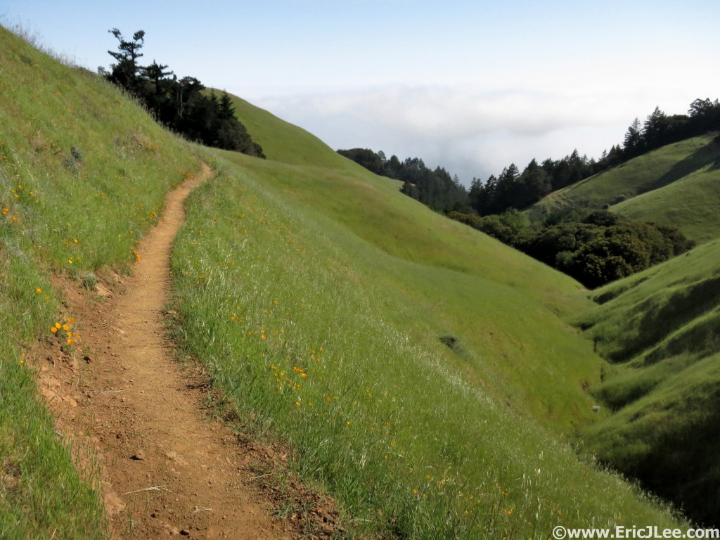
Rolling hillsides, poppies and sunshine along the Coastal trail. A great place to take it easy and just cruise along.

Rolling hillsides, poppies and sunshine along the Coastal trail. A great place to take it easy and just cruise along.

I ran the final 2-3miles down the Matt Davis trail to the finish line, crossing in 12hours16min, slower than last year, slower than I was capable of, but what my mind and body wanted and needed on that day. My fire to race and compete seems to have disappeared, but not my love of long distance trail running and ultra distance adventures. The 2015 Miwok 100km was a beautiful and very enjoyable run, even if it wasn’t a good ‘race’ for me, and I highly recommend it to all ultra runners. But the question still remains, why am I out there running and hiking? I had originally gotten into the sport as a way to allow me to mountaineer and peak bag at a whole new level, much faster and much further. Lately I’ve been caught up in the whole competitive racing scene, and while fun every once and a while, I’m realizing it’s not what I crave. Some people thrive off running competition and hammering themselves and their peers on a daily basis. Me, I’d rather amble around the mountains for 20-60 miles taking pictures, exploring new places and just having a grand ole time. Most of the time my goal isn’t a time, isn’t a particular pace, it’s just to go out and to explore, adventure and expose myself to new experiences.

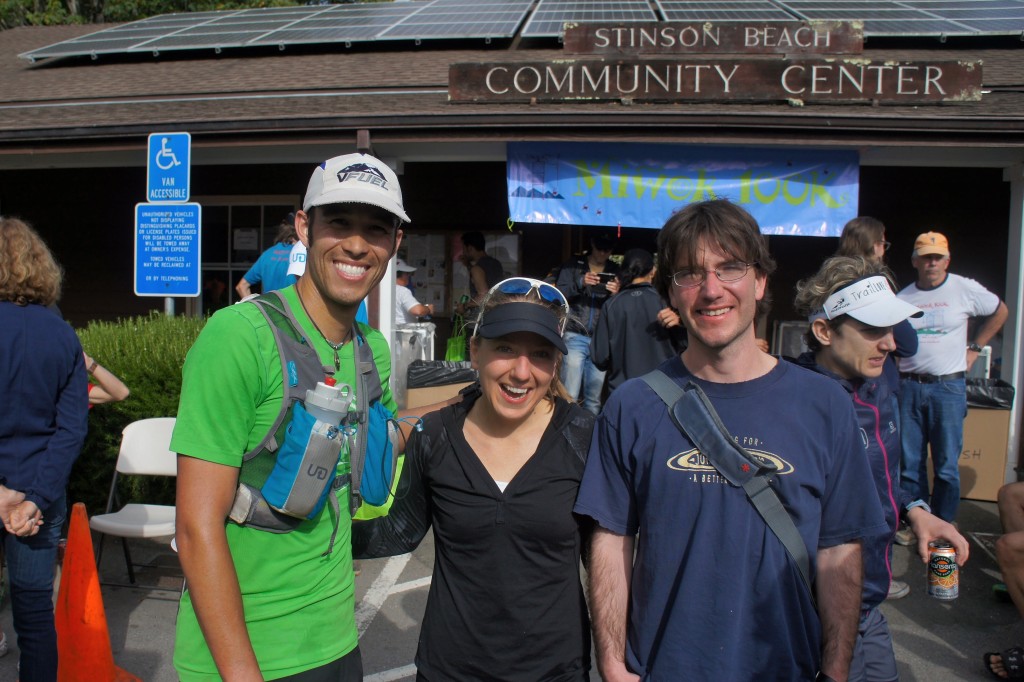
Myself, Katie (5th female) and Jon (6th overall) at the finish of the Miwok 100km.

Myself, Katie (5th female) and Jon (6th overall) at the finish of the Miwok 100km.

I’ve decided to postpone some very ambitious plans I had schedule for June 2015, and instead am looking forward to getting outside to wander and explore some new things, sometimes fast, sometimes slow, but hopefully always with a smile on my face. I hope that you too can find what you need each time you head out the door, whether its for a walk around the neighborhood, a jog on trails or up a mountain, or for a climb. So whatever you do just remember it’s not just about the pain and suffering, it’s supposed to be fun. Special thanks to all those who have helped me through this ongoing process of figuring out what ails me; Adam Engel at Waldron’s Peak PT, Ginna Ellis at Boulder Acusport, Meggan Oliver, Cindy Stonesmith at Ultrarunner Training, Vfuel for keeping me energized and my parents and friends Katie and Jon for the fun time playing on the California coast.

Here’s an album with a whole bunch more of my photos from the 2015 Miwok 100k.

Squats, Deadlifts, Schedule Mix-ups and the Mississippi 50mile

For the past three years, I’ve planned a trip down to the gulf coast of Mississippi to visit family and run the annual Mississippi50 race in Laurel (inland). Training for the 2015 race was going well, lots of hard trail miles on the abnormally warm and dry January Boulder trails mixed with twice a week weight training sessions, focused on strengthening glutes, hips, core and overall balance, had me feeling good about my prospects for a PR and another shot at a win, until…..

A little over a week out from the race I went to the race’s website to check the schedule and directions only to see the date “March 7th” stamped in red lettering at the top. Wait a second, I thought it was on February 28th, because that’s when I’d scheduled my flight and hotel, %$#@^%. I went into a panic, searching the facebook page, my race confirmation email, everything I could find said March 7th. So I immediately started to look into rescheduling my trip, but the flight change on United (they suck) was going to run an additional $500-600, and my sister couldn’t change her vacation around, so I gave in that I was going out the weekend before to see family, and might just have to skip the race, despite all the training. 🙁

About half of the snow we received in late February 2015, it was the snowiest February on record in Boulder (>50")

About half of the snow we received in late February 2015, it was the snowiest February on record in Boulder (>50″)

I continued to search every nearby city, finally I found a Frontier flight for $300 direct from Denver to New Orleans (2h drive) that would allow me to work a full day Friday, fly out, get a full nights sleep and run the race; now to procure a few rides and this just might happen. With only 10days until the race I found a friend willing to pick me up at the airport and give me a ride to the race, and my sister would pick me up after the race, then drive me back to the New Orleans airport Sunday, it was going to work out! Back to focusing on training, tapering and just enjoying time with the family.

A little dry trail running in Mississippi the weekend before the race.

A little dry trail running in Mississippi the weekend before the race.

As luck would have it, Boulder got completely snowed under in late February, so my pre-race trip to Mississippi actually allowed me to get in some nice long trail runs on dirt (no snow/ice) the week before the race. I also got to spend lots of time with my sister, brother-in-law and nephew; the most important thing. So on 3/1 I caught a late night flight from Gulfport back to Colorado, finally getting home at 2am after numerous delays and a dead car, ready for a whirlwind week of work before flying back down South only five days later.

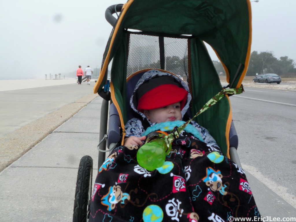
Taking the little guy out for an ocean side jog on the beach walkway.

Taking the little guy out for an ocean side jog on the beach walkway.

On 3/6, less than five days after I’d left the South, I was back on another plane, this time bound for New Orleans. All went smoothly on Friday, and Jerry (my savior in New Orleans) and I were sound asleep by 10pm. The alarm blared at the all too early hour of 4:15am, so I went about with my standard pre-race rituals, ate my two poptarts, then Jerry and I hopped in his car to head for the Desoto NF. Temperatures were a brisk 28F at the start, nothing abnormal for Colorado, but definitely chilly for Mississippi. After quickly catching up with the RDs Dennis and Renee, along with fellow Rocky Mountain Runner Jack and his dad Ed, it was almost go time. I really enjoy these small local races, there’s no big hoopla at the start, just a handful of family, friends and volunteers standing around in the cold morning air. As the ‘gun’ went off, three of us (Jack, Arthur, and myself) took off out front running a very comfortable 8min/mile, allowing our legs to settle in for the long haul. We chatted as we swapped leads, splashing through the many creek crossings, stomping in a few mud puddles, coming through the start/finish in 1:39:46 for the first 12mile lap, a little faster than I was planning, but comfortable none the less.

The three of us continued to leap frog back and forth during lap #2, returning back to the start/finish in 1:42:27, I quickly grabbed a few gels and blasted out of the aid area ahead of the other two. Jack caught me part way into lap #3 and we ran together until around mm32, where he pushed ahead. I was feeling a little off so I let him go, deciding to instead focus on holding steady and preparing for a strong finish through the last 13miles of the race. I came out of the third big loop in 1:48:17, having lost a little time, but still moving alright, now a few minutes behind Jack, but securely in 2nd as we’d lost the rest of the pack after lap #2.

As I started into the first of two short 6.5mi loops, my energy dropped, my pace slipped to 9:30-10ish, and I knew I needed a little pick-me-up at the next aid station. I got in to the aid, slammed half a glass of coke, ate two snickers and chugged off down the trail. The temperature was still quite pleasant (high 50s) and this loop only had a half-dozen or so water crossings, so I continued to push onward. Finally around mm42 the caffeine and sugar kicked in, and my legs suddenly had a good bit of pop, back down to 8:30-9min pace and off I went. I hit the start/finish after a 58:17 loop, not bad considering the low I’d had, but found out I still had some work to do, I needed to run a 52min last loop (for <7hours) and to pick up 3min to catch Jack who was in the lead.

Celebrating the win with my sister and nephew, best High-fiver ever. Photo courtesy of Jamie Dubeck.

Celebrating the win with my sister and nephew, best High-fiver ever. Photo courtesy of Jamie Dubeck.

I flew out of start/finish a man on a mission, both for time and place. A mile down the trail another runner told me I was only 30seconds back! Holy hell, I was catching up fast, that really energized me, so I just put my head down and ran. I caught Jack just before the last aid station, he was looking pretty beat. I tried to give him some words of encouragement, but knew that if I wanted to hit 7hours I had to keep pushing. I put my head back down, embraced the pain and just kept moving my legs as fast as they would go. With 2miles left it became apparent that I wasn’t going to make sub-7hours (needed to run two 7min/miles), so I took it down a small notch, all the while glancing over my shoulder waiting for Jack to sneak back up on me. I finally made the last turn down the straight away with 1/4 mile to go, no one in sight, and knew the race was mine and even though I wouldn’t break 7hours, I’d PR by a massive margin.

I crossed the finish line in 7hours03min38sec (26min PR), having run a 54:49 final lap, very happy, very tired, and a little sore. Hugs from my family, who’d come for lap #3, high-fives from my 1yo nephew, and finally I could stop running. Jack came in at 7hours16min, for a very strong 50mile debut and 2nd overall, giving the Rocky Mountain Runners from Boulder a 1-2 sweep on the men’s side. After three years of flat, muddy, wet running in the Mississippi forest, I’d finally had the race I’d hoped for. An even paced run, with a strong finish, where I felt like I gave the course everything I’d had on that day. The sun was shining and it was in the 60s, so I was happy to hang out with family and a few friends, enjoying the laid back atmosphere and the Southern hospitality. I’ve always been a big proponent of the homegrown low key races, put on by people who give so much of their time and energy simply because they love the sport and all the people in it. While I definitely pushed myself and competed on this day, Jack and I spent most of the miles in friendly conversation, and not until the last 15miles did we actually start racing and challenging one another. Ultrarunning is about pushing your physical and mental boundaries, but doing so in an environment where ALL runners support one another, regardless of pace, experience, or age, this is what makes it a truly special sport.

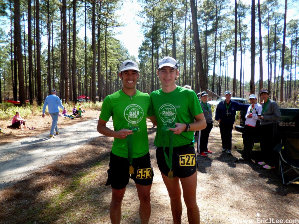
Jack and I after the run, Rocky Mountain Runners go 1-2 at the Mississippi50.

Jack and I after the run, Rocky Mountain Runners go 1-2 at the Mississippi50.

Last year I feel as though I had logged more fast hard training miles, but this year I trained smarter. Mixing in hard slow mountain miles with some faster paced tempo runs and my twice a week weight training sessions. As with many runners I suffer from Noassatall, it’s a terrible disease where you butt doesn’t do any work, letting your quads and hamstrings overwork, not a very efficient way to run. So a smart race plan, listening to my body during the race and a little weight lifting in training are what I felt made the difference for me this year compared to the last two years. So whatever your goal, train smarter, not just harder. Special thanks to Vfuel for supporting my craziness and powering my race (9 Vfuel and half a dozen snickers were all I ate). Run fast, run healthy, but mostly run happy.

Noassatall is a real disease, affecting real people, my friend Ginna at Boulder AcuSport has a nice write-up on the topic. Friends don’t let friends have a lazy ass.

One last shot of my nephew, I think I wore him out pretty good this weekend. He fell asleep PB&J in hand.

One last shot of my nephew, I think I wore him out pretty good this weekend. He fell asleep PB&J in hand.

Traveling New Zealand

It’s been quite a while since my last writing and I figured the first order of business would be to write up some thoughts and share some photos from my one month trip down under (New Zealand and Australia). Rather than give a step by step outline of my journey, I’ll just mention some highlights, share a few photos/videos and make some comments about traveling down under. If you have specific questions about places to see, lodging, or logistics feel free to shoot me a message/email.

The view from Avalanche Peak near Arthur's Pass.

The view from Avalanche Peak near Arthur’s Pass. This is New Zealand.

Highlights

  • Waitomo Glowworm Cave tubing (North Island)
  • Ruakuri Bush Walk at Night, Glowworms (NorthIsland)
  • Abel Tasman Great Walk in a Day (South Island -North)
  • Arthur’s Pass/Avalanche Peak (South Island -West)
  • Motukeikei Beach (South Island -West)
  • Rob Roy Glacial Valley (South Island – Lakes Region)
  • Routeburn Great Walk (South Island – Lakes Region)
  • Kepler Track Great Walk in a Day (South Island – Fiordlands)
  • Doubtful Sound Cruise (South Island – Fiordlands)
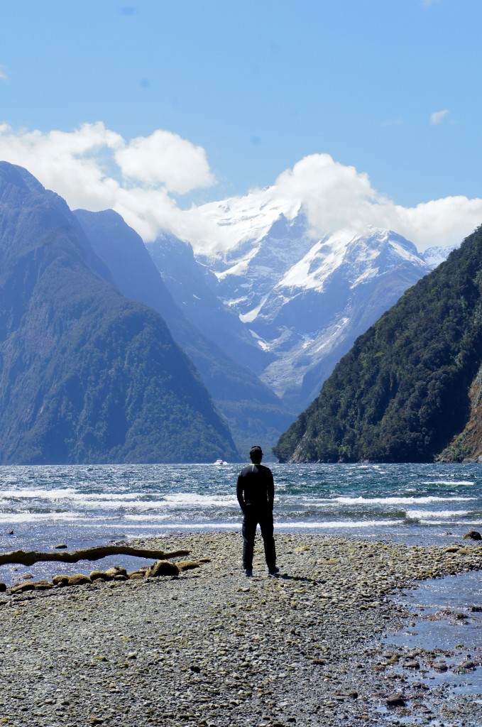
  • Milford Sound Drive (South Island – Fiordlands)
  • Little Blue and Yellow Eyed Penguins (YEPs) (South Island – East Coast)

Things I Missed Out On

  • Auckland City Tour (North Island)
  • Tongariro Northern Circuit (NorthIsland)
  • Nelson Lakes/Roberts Ridge (South Island – Central)
  • Dart and Reese Rivers (South Island – Lakes Region)
  • Milford Track (South Island – Fiorlands)
  • Stewart Island (South of the South Island)
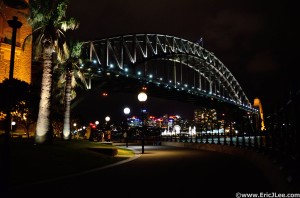
Night time view of the Sydney Harbour Bridge.

Night time view of the Sydney Harbour Bridge.

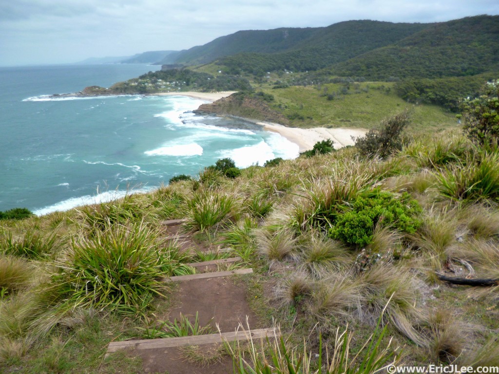
On November 7th, 2015 I decided to give myself a little 1/3 life crisis birthday present, a one month trip to New Zealand and Australia. I first stopped over in LA to visit my cousin, before flying off to Sydney for a few days to meet up with my parents and visit my Uncle Jim who lives a few hours south of the city. I flew down through Fiji on an all night flight, finally reaching Sydney in the morning. Sydney is a beautiful and very clean city, with a vibrant downtown, classic views like the Opera House, Harbour Bridge, and botanical gardens. The jacaranda trees were in full bloom, dotting the city skyline with their bright purple flowers. It is definitely an expensive city, but worth your time to soak in some of the culture and sample the cuisine. My uncle lives on the coast just South of Sydney, amongst several small townships; a much quieter scene, with a handful of shops, farmers markets, and some of the most amazing fish markets I’ve see (oh do I miss good seafood). Amongst the family time I got out for a few exploratory runs along Seven Mile Beach and in Royal National Park (w Ryan Stuart). This quick 3 day sample has convinced me I eventually need to come back to Australia for the full tour of the outback, the reefs, and some of the other cities.

Royal National Park near Sydney, 33km of beautiful coastline with Ryan.

Royal National Park near Sydney, 33km of beautiful coastline with Ryan.

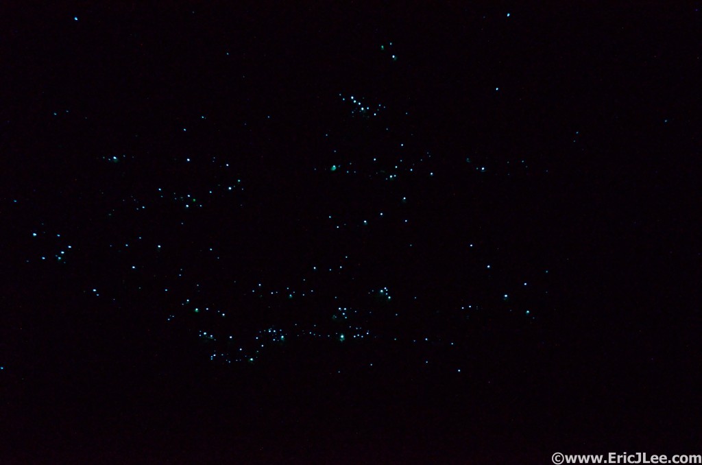
We hopped a evening flight to Auckland, then promptly took off the following morning headed South, so we did not get to explore the big city of New Zealand, but that’s how I had planned it, too much to do, not enough time. Driving through the North Island lives up to its reputation, lots of rolling green grass, a fair bit of rain, and tons of sheep. The Waitomo glowworm caves, while touristy, are well worth the visit as its not something you can find anywhere else in the world. The best way to get up close and personal is actually the free Ruakuri bush walk, at night. At night this fairly typical walk through the jungle becomes a glowworm studded private tour, just check every overhang, every creek side, and every little cave you find. Unfortunately due to a stint of bad weather we missed out on the Tongariro crossing/Northern Circuit. In windy Wellington we met up with my old friend Shelley who escorted us around town. There is a wonderfully vibrant culinary scene in the city and I could have easily spent a few more days in there, but too many places to go and not enough time.

Hundreds of tiny glowworms dot the cliff sides along the Ruakuri Track.

Hundreds of tiny glowworms dot the cliff sides along the Ruakuri Track.


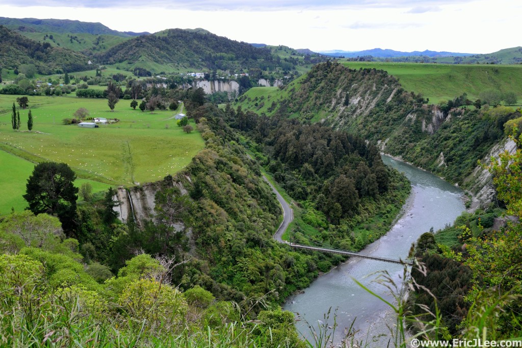
Green hills, rivers, waterfalls and sheep, that's New Zealand.

Green hills, rivers, waterfalls and sheep, that’s New Zealand.

One of the many beautiful beaches along the Abel Tasman Track.

One of the many beautiful beaches along the Abel Tasman Track.

Next stop was Abel Tasman National Park along the North coast of the South Island. I ran the 55km Great Walk in a day with help from my parents (car shuttle pickup). It’s a beautiful track that meanders along high coastal cliffs, across beautiful stretches of beach and through some jungle as well. Easy water access at the huts, but make sure to time the tides carefully or you’ll be swimming through the Awaroa Inlet. Beware the sandflies though, they can be ravenous. We next headed to Nelson Lakes NP, but again got completely stormed off our intended route up Roberts Ridge. So we bolted for the West Coast, where the drizzle and clouds broke just long enough for us to spend a spectacular day at Arthur’s Pass (Avalanche Peak is a must) and an early morning tidal walk along Motukeikei Beach. I was a bit underwhelmed by the Fox and Franz Glaciers, but it’s such a quick stop that it’s worth seeing, the Fox more so.

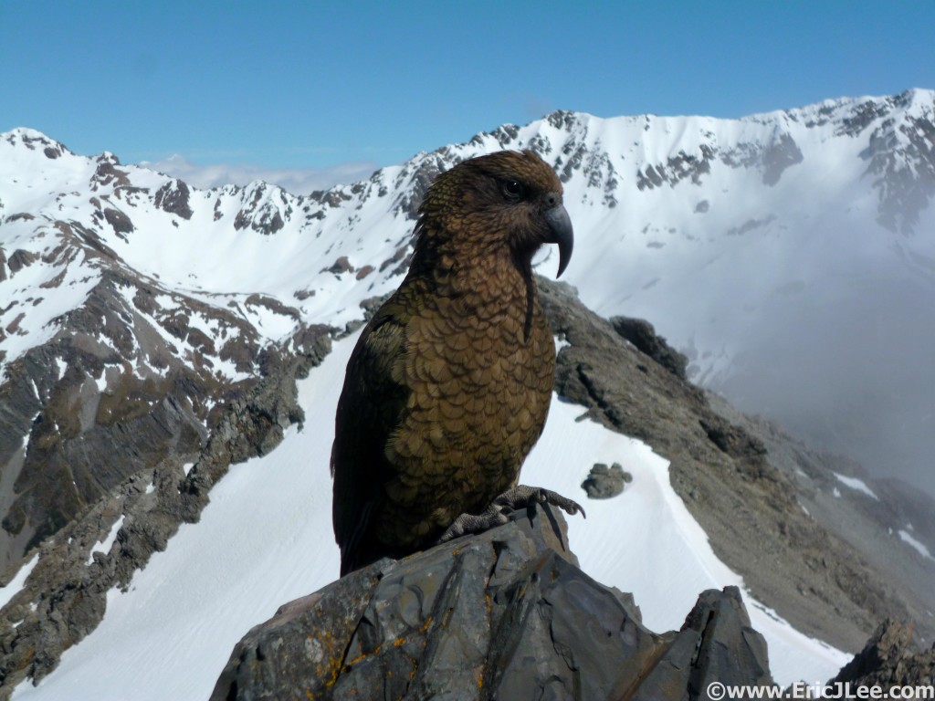
Infamous Kea bird on Avalanche Peak

Infamous Kea bird on Avalanche Peak

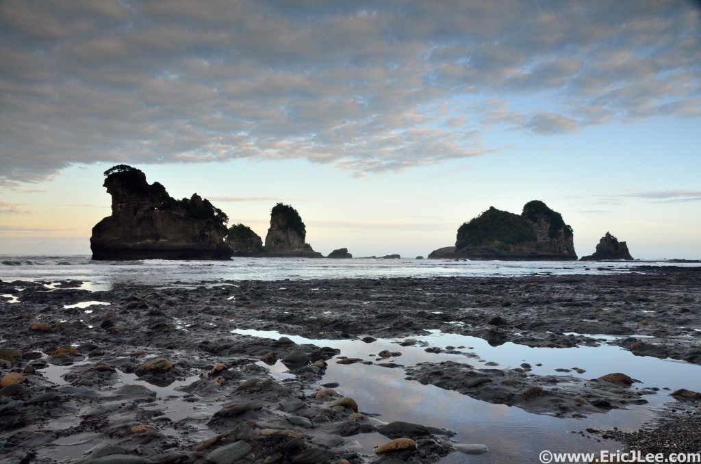
Low-tide walk on Motukeikei Beach, our own private tidal shelf and sea stacks.

Low-tide walk on Motukeikei Beach, our own private tidal shelf and sea stacks.

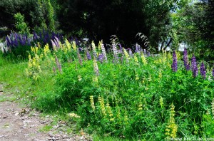
Beautifully diverse array of lupine near Wanaka.

Beautifully diverse array of lupine near Wanaka.

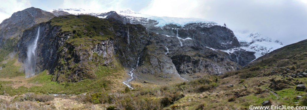
Our journey then took us up and over the rainy Haast Pass to the Lakes region of the South Island, specifically Wanaka and Wakatipu (Queenstown). This area has earned its reputation as an adventurer’s basecamp, with milder weather, but easy access to some fantastic trails and the mountains. I personally enjoyed Wanaka more, its much more laid back and quaint than the glitz, glamour and more touristy Queenstown. The highlights of our exploration were definitely the Rob Roy Glacial Valley and the Routeburn Great Walk. If heading for the Rob Roy Valley in early season, make sure your car can handle the several 6”-18” deep creek crossings, otherwise be prepared for a bit of extra walking. The Routeburn is a tricky one, as it’s a point to point with a 5 hour car shuttle. I opted to run 2/3 of the track to the Lake MacKenzie overlook, then turn around and head back, definitely doable as a day run in this manner, approx 34km.

Rob Roy Glacier Valley, massive cliffs, 1000ft waterfalls, hanging glaciers, wow.

Rob Roy Glacier Valley, massive cliffs, 1000ft waterfalls, hanging glaciers, wow.


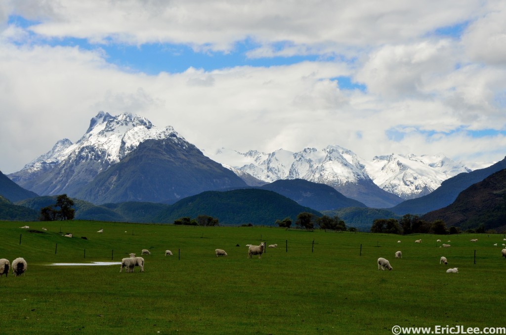
Dart/Rees valleys, sheep and mountains, this is New Zealand.

Dart/Rees valleys, sheep and mountains, this is New Zealand.


Harris Lake, near the saddle on the Routeburn Track.

Harris Lake, near the saddle on the Routeburn Track.

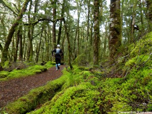
Running through the lush green down low on the Kepler Track. The high alpine was all snow this day.

Running through the lush green down low on the Kepler Track. The high alpine was all snow this day.

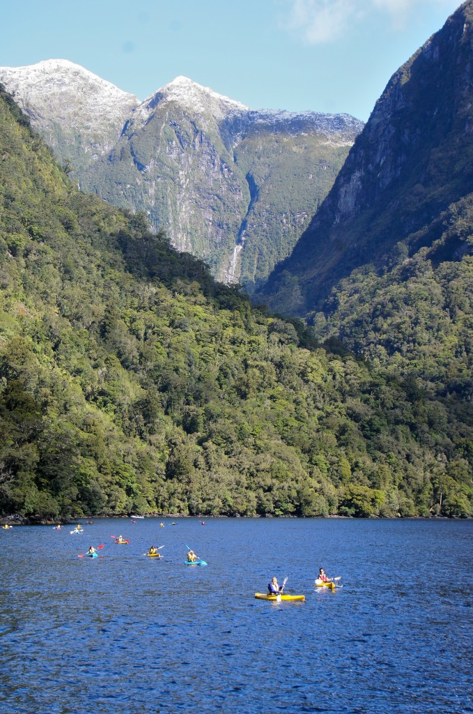
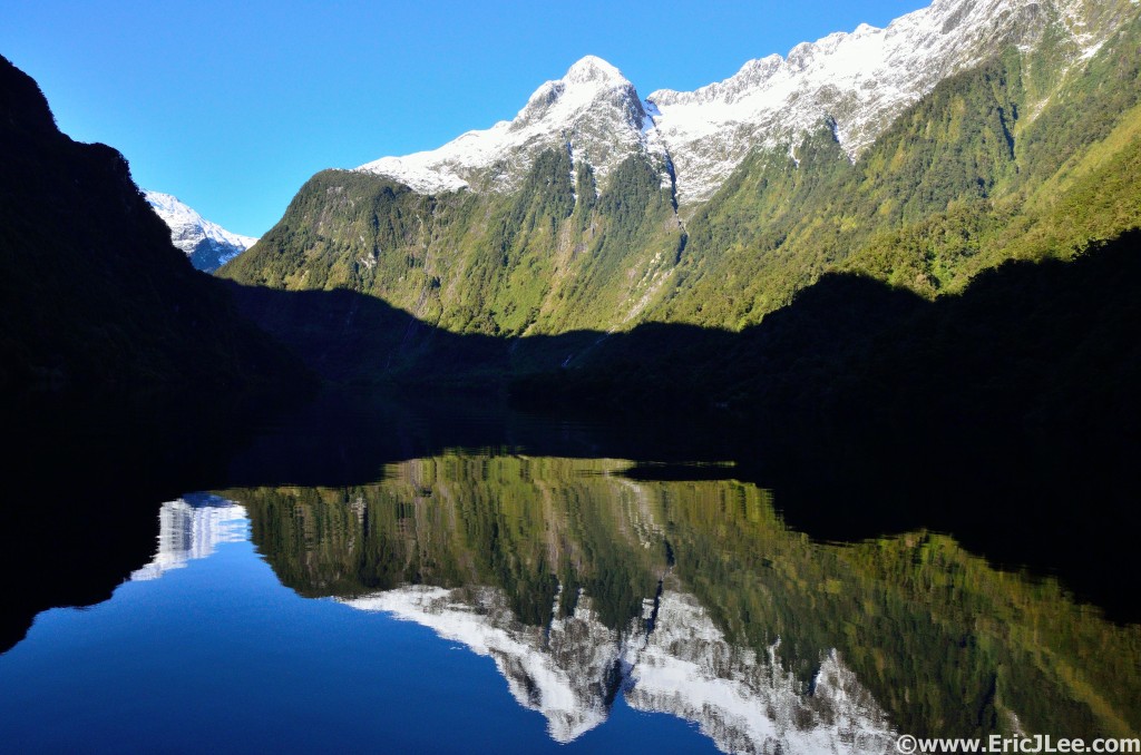
I could easily have spent weeks in the Queenstown/Wanaka regions, but as it was we were soon off to Te Anau and Fiorlands where more adventure awaited. First up was a day run of the relatively new Kepler Track Great Walk, a line that traverses sandy beaches, deep green jungle, steep narrow valleys, then endless high ridgeline. I missed out on much of the views because of the snow storm up high (6-10” of new stuff). But the stark contrast of the route was still an amazing thing to experience. With a perfect sunny weather window dropping into Fiorlands we took a ferry ride across Lake Manupouri then hopped the Fiordland Navigator for an overnight cruise on Doubtful Sound. If you catch this area under decent weather its well worth the price of admission, and much quieter than its busier cousin Milford Sound. Towering seaside mountains, waterfalls in all directions, kayaking, fur seals, penguins, bottlenose dolphins and more. This was by far the highlight of my trip to New Zealand.

Kayaking in Doubtful Sound, makes one feel small.

Kayaking in Doubtful Sound, makes one feel small.


Calm water reflections in Doubtful Sound, what a morning.

Calm water reflections in Doubtful Sound, what a morning.


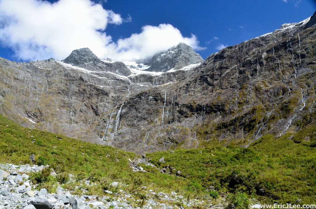
Waterfalls streaming down the cliffs above the Homer Tunnel, how many do you see?

Waterfalls streaming down the cliffs above the Homer Tunnel, how many do you see?

My parents and I pre-Doubtful Sound cruise, sunshine in Fiordlands.

My parents and I pre-Doubtful Sound cruise, sunshine in Fiordlands.

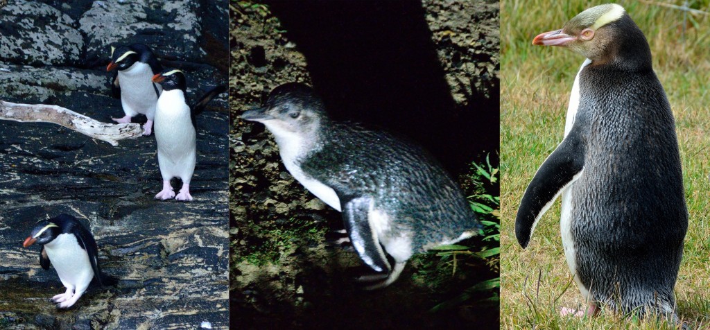
We spent the final few days of our trip winding down along the East Coast of the South Island, stopping in Dunedin to see hundreds of the Little Blue Penguins at the albatross sanctuary ($25), Katiki Lighthouse to see Yellow Eyed Penguins (YEPs), and just enjoying the coastline. Our final night was in Christchurch, a city very much in transition. The earthquakes of 2010-2011 ravaged the downtown, leveling most of its high rise buildings and damaging the historical structures. There is really no night life to speak of downtown, and very little to do, so it was a bit of  a downer, and I until it revives itself I wouldn’t recommend spending too much time there. So ended my one month tour down under, on a somber note.

Fiordlands Crested Penguins, Little Blue Penguins and Yellow Eyed Penguins

Fiordlands Crested Penguins, Little Blue Penguins and Yellow Eyed Penguins

Final Thoughts

We (3) opted not to get a camper van, instead we rented a smaller Nissan Wingroad hatchback and ended up staying mostly in hostels and cabins with the occasional night of tent camping. Personally I think this worked out better, as the driving was much easier in the smaller vehicle, we could dry out wet gear at night, and it ended up costing about the same (camper van vs hatchback + hostels). We didn’t reserve any of our lodging, but we were early enough in the season that the only place we had any issues were Queenstown and Christchurch. Most hostels, holiday parks, and developed campgrounds have pots, pans and utensils for one to use. If you plan to stay in more DOC campgrounds then you’ll need your own gear, but they still have cooking shelters and sometimes also gas stoves.

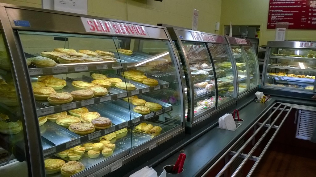
New Zealand pie shops, lamb, beef, chicken, and all the savory one could want. Standard fair.

New Zealand pie shops, lamb, beef, chicken, and all the savory one could want. Standard fair.

We went during their early summer (Nov), it was a bit colder, a bit rainier, but the crowds were much smaller. January and February tend to be warmer, but you’ll need to plan a head a bit more than we did. In regards to the itinerary, I’d highly recommend staying flexible and allowing yourself as much time in a priority location as you can. We found out quickly that the weather is very unpredictable, so look at the forecasts and pick your weather windows, otherwise you’ll end up in a downpour or gale force winds, not so fun. But when it’s nice, OH IS IT NICE! If you’re an outdoors adventurer, the South Island is where you want to be; mountains, jungle, glaciers, beaches, trails, climbing, swimming, etc.

What you'll find yourself doing a lot, staring at the Awesomeness that is New Zealand.

What you’ll find yourself doing a lot, staring at the Awesomeness that is New Zealand.

For planning we didn’t have much of a set itinerary, but did use a combination of Lonely Planet and New Zealand Frenzy. I think some of the most fun things we did came out of the off-the-beaten-path New Zealand Frenzy guide, well worth the $10 price tag. Lastly, for those who have traveled the US, you won’t find many things in New Zealand that you can’t see somewhere else; we have big mountains, we have subtropical rainforest, we have glaciers…., its more that New Zealand has all this and more within a days (or less) drive, creating a beautiful contrast of scenery. This doesn’t mean the sights aren’t worth seeing, rather to just enjoy New Zealand for what it is, and the Kiwi way about it. While there are several items noted above I missed out on, I’d have to say I’m not sure if I’ll ever return to New Zealand. Not that I wouldn’t love to, but more that there are so many other places I’ve never visited and explored it’d be hard to set aside the time again, but maybe…..


Here are my compilation videos from the month’s adventures.

2014 in Review

It’s been quite some time since I wrote a blog, and with the end of 2014 nearing its probably a good time to sit back and reflect on all the awesome experiences, all the tough moments, and everything in between. I also will be writing up a recap of November’s trip to New Zealand, but there is so much to tell that will need it own space and time.

Hanging with a few friends this past weekend in the North Cascades, 1/21/14. Photo by Ben S.

Hanging with a few friends this past weekend in the North Cascades, 1/21/14. Photo by Ben S.

Unlike 2013, 2014 started off healthy, and with the exciting news that I’d be running the Hardrock 100 for the first time ever! Training started off in full, snow be damned, and included a little trip to Seattle to visit Ben and Amanda with a chance to explore the Cascades.

For the first time in many years I did not race the Moab Red Hot, opting instead to explore some of the other trails in the surrounding areas and to do a little scrambling with Buzz and Tressa on some super secret routes…shhhh. In March I headed back to Mississippi 50 to try and defend my title, falling just short on a hot and humid day, taking 2nd overall, oh well, you win some and you lose some. But most importantly I got to meet my nephew for the first time (born January 2014), I like the sounds of Uncle Eric 🙂

Accepting my 2nd place award at the 2014 Mississippi 50.

Accepting my 2nd place award at the 2014 Mississippi 50.

Playing with my new little nephew Ryan.

Playing with my new little nephew Ryan.


Tressa and Buzz scrambling along a secret route in Canyonlands.

Tressa and Buzz scrambling along a secret route in Canyonlands.

After Mississippi my life became focused on one main goal, Hardrock, and getting my legs and lungs are ready for the challenge as I possibly could. Trail miles with tons of vertical, backcountry skiing at high elevations, and a whole host of shenanigans from Boulder to the mountains to deserts of Fruita.

First summit of 11 on the day of Mt Sanitas, training with the RMR.

First summit of 11 on the day of Mt Sanitas, training with the RMR.

Downhill skiing with Jason and Kate, Photo by Kate Fisher.

Downhill skiing with Jason and Kate, Photo by Kate Fisher.

On May 1st I hopped a plane back to CA bound for the Marin Headlands and the starting line of the Miwok 100k. A beautiful race that winds through the redwoods, across open grassy hillsides, and above steep ocean side cliffs. Despite a rough patch around mm50 I hung in there for a 34th place finish in 11h28min. Definitely a must do for those ultrarunners looking for some hard but incredibly scenic and varied trail miles. I continued my racing by entering the Dirty Thirty 50k in Golden for the first time since its inaugural running in 2008, treating it as more of a training run for Hardrock.

Running the Bolinas Ridge around mm17 of the Miwok 100k.

Running the Bolinas Ridge around mm17 of the Miwok 100k.

Skiing touring near Independence Pass, a little early summer high country fun.

Skiing touring near Independence Pass, a little early summer high country fun.

As summer began to settle in to the high country I found my way to higher and higher elevations, exploring new trails and hitting up some old favorites in the process. As July rolled around and Hardrock neared I had one other piece of unfinished business, the summit of my 58th and final 14er, El Diente, had eluded me last year. On July 4th I met Ben, Bruce and Tressa and summited my 58th and final 14er, closing up one chapter of my journey through the mountains, just as the next was opening up. The Hardrock 100 is arguably the US’s most difficult 100mile foot race, traversing the rugged San Juan Mts, crossing a dozen high passes, requiring off trail travel, sleep deprivation, and one to put up with inclement weather it proved a worthy test. After many high and lows, aided by my parents (crewing) and good friends Andy and Stephanie (pacers) I kissed the Hardrock for the first time, 34h38min after starting. It’s such an amazing event, one that can not be fully understood or felt until you toe the line along side 150 others, all unified under the goal of kissing the rock. One of these days (lottery gods willing) I’ll return.

On the summit of El Diente, my 58th and final CO 14er with Ben and Bruce. 7/4/14.

On the summit of El Diente, my 58th and final CO 14er with Ben and Bruce. 7/4/14.

Welcoming committee of Rocky Mountain Runners atop Grand Swamp Pass. Photo by Ryan Smith.

Welcoming committee of Rocky Mountain Runners atop Grand Swamp Pass. Photo by Ryan Smith.

What lovely scenery....When does this climb end? Dives Basin, Photo by Stephanie Lynn.

What lovely scenery….When does this climb end? Hardrock 100 Dives Basin, Photo by Stephanie Lynn.

After Hardrock things did not slow down, and the mountain adventures just kept on coming, I couldn’t say no. Aspen Four Pass Loop, Maroon Bells Traverse, Niwot Ridge, Ten Mile Range Traverse, East Ridge of Pacific Peak, a snowy through hike across the ElkRange, winning the inaugural Kite Lake Triple-Triple, the Little Bear Blanca traverse, pacing the Bear 100 in a downpour and finally capping off the season at the Bluesky Marathon. October brought a month of rest and recovery, something I like to give my body every year so that it can heal all the damage.

Boulder Banditos atop West Maroon Pass at the end of the Four Pass Loop.

Boulder Banditos atop West Maroon Pass at the end of the Four Pass Loop.

Scott and Jason cruising across the mellow part of the Ten Mile Range

Scott and Jason cruising across the mellow part of the Ten Mile Range


Looking across the Little Bear-Blanca traverse, fun day of scrambling.

Looking across the Little Bear-Blanca traverse, fun day of scrambling.


First rain storm of the night around midnight, all geared up and having fun.

First rain storm of the night around midnight, all geared up and having fun at the Bear 100 with Jason.

Early in 2014 I’d decided to give myself a birthday present, so on November 7th I hopped on the first of several flights that would eventually land me in Australia/New Zealand. After a short visit with my Uncle, who lives just outside Sydney, it was off to New Zealand for 3+ weeks of adventuring with my parents. We saw glowworms, beaches, mountains, rain forest, glaciers, waterfalls, dolphins, penguins, our share of rainy days and more on our whirlwind tour of New Zealand. The more indepth story will come later, with photos and videos. In short it’s a beautifully varied country where you can find a multitude of ecosystems all within a days drive. While no one thing alone sticks out as unique in the world, the sum total of all its beauty (different and varied) is what makes it so amazing.

My parents and I before our amazing overnight boat cruise on Doubtful Sound in the Fiordlands region of New Zealand.

My parents and I before our amazing overnight boat cruise on Doubtful Sound in the Fiordlands region of New Zealand.

In total I’d have to say this year was a pretty awesome year, full of new experiences, great friends and tons of adventure. 2015 looks like another fantastic year with a return to the Mississippi 50 and Miwok 100k already planned, some big mountain projects during the summer and possibly a return to UTMB for redemption (lottery gods willing). Hope everyone has a happy and safe new year and a fantastic 2015! Run fast, run healthy, but mostly run happy.

Special thanks to Vfuel Endurance for powering my year of adventure and to Hind Performance clothing for keeping me warm and comfortable during the journeys.

2015 Stats

2,842

miles run/climbed/skied (new Best year)

656,000

feet of elevation climbed (2nd Best year)

42,900

minutes spent on my feet (715 hours or 29.8days)

32, 31, 17

Summits of Mt Sanitas, Green Mt, Bear Peak respectively

58

# of Colorado 14ers climbed (list completed)

6

Races run and completed in 2014 (marathon to 100mi)

6

US States visited

2

Countries visited

Ebola; Zombie Apocalypse or Just Another Infection?

Just in case know the rules of Zombieland...

Just in case know the rules of Zombieland…

In the past several weeks the world has seen the horrible images of what the Ebolavirus can do to a human thrust into the public eye. Understandably there has been a lot of discussion, fear and misunderstanding in regards to Ebola. I’m hoping to lay out some information about the disease, assuage some fears, correct some of the misunderstanding and give the non-scientific public (or at least people I know) a glimpse into what is known about the disease.

First off, I have a Masters in Cell Biology/Immunology with a special emphasis in Infectious Disease Research. I currently do mucosal HIV research, looking at the dynamics of how HIV and the gut microbiome interact and how these interactions affect disease progression and pathogenesis. My Masters Thesis focused on the recognition of Mycobacterium tuberculosis by Dendritic Cells (a key piece of our immune system) and how the bacteria are able to corrupt our own host responses in order to avoid recognition and survive. So, in short, I have a fairly strong background in working with various infectious diseases, including Level 3 pathogens, though I am by no means an expert on Ebolavirus specifically. The thoughts below are merely my interpretations of the literature which I have read, the discussions I’ve had with others in the field, and observations on how our hospital (University of Colorado Anschutz) is preparing for this threat.

Images of Ebolavirus (top) with a schematic of its structure below.

Images of Ebolavirus (top) with a schematic of its structure below.

What is Ebola?

The Ebolavirus is part of the Filoviridae family, a group of single-stranded negative sense RNA viruses. What the hell does that mean, basically it’s a virus. They are tiny structures of RNA with an envelope wrapped around the outside, they have a very basic genome, are able to form multi-virion strands (up to 6), but require the full intact structure to replicate (the RNA itself is non-infectious). There are 5 different subtypes of Ebola, each one slightly different in how virulent (infectious and deadly) it is, the current outbreak in Guinea, Sierra Leone and Liberia is caused by a variant of Zaire Ebolavirus. In most people the virus causes what’s know as hemorrhagic fever, a not so fun complex process by which the immune system is hyperactivated to such an extent that the virus literally destroys you from the inside, causing massive blood vessel leakage and organ damage. This is not a new disease, first officially discovered in 1976 in the Democratic Republic of the Congo (Zaire strain), and it has flared up numerous times in the past 40years, though the previous flare ups have all burned themselves out in more rural areas. The current outbreak has spread to the urban areas in West Africa and continues to spread uncontrolled as of this moment (10/21/14). Below I will discuss the general pathology (what happens with disease), the current state of Ebolavirus research, and what all of this means for both the US and the World (in my opinion). (Ansari AA et al 2014, Feldman H et al 2011)

A map showing the location of the 2014 Ebolavirus outbreak. As of Oct 21st there have been over 9000 cases and 4500 confirmed deaths. Making this the largest Ebola outbreak in history.

A map showing the location of the 2014 Ebolavirus outbreak. As of Oct 21st there have been over 9000 cases and 4500 confirmed deaths. Making this the largest Ebola outbreak in history.

Infection and Symptoms

The Ebolavirus, like other filoviruses, survives in and is transmitted through contact with bodily fluids such as; blood, vomit, stool, saliva, semen, urine, puss, etc. The current research and epidemiology show no evidence for generalized aersole transmission (unlike flu or cold viruses), though Ebolavirus has been shown to survive in body fluids outside of the host for several hours on surfaces, making it much easier to contract than a virus like HIV. Infection occurs when infectious materials/fluids come into contact with the mucus membranes or open wounds of a new individual (eyes, mouth, throat, nose, cuts/scrapes, etc). After infection there is what is known as an incubation period (average 4-10days), in which the virus is replicating in the individual but they don’t show any obvious signs of being sick, during this stage the new individual is not known to be infectious. During this latter part of this incubation period the initial symptoms are very general and include; fever, chills, malaise and myalgia. During the later stages of disease (typically 6-16 days) the disease takes on its more severe form in which excessive immune activation leads to coagulation disorders, blood vessel leakage, multiorgan failure and shock, often leading to death. The current Ebolavirus strain (Zaire) has a 60-90% fatality rate, though some do recover from the disease back to (apparently) full health. We still do not know exactly what leads to Ebolavirus immunity, but high levels of specific neutralizing antibodies seem to be one of the leading candidates. (Ansari AA et al 2014, Feldman H et al 2011, Hoenen T et al 2012)

Treatment Options

There are not currently any officially FDA approved vaccines or treatment options available to the general public, though there are many strong candidates in the works. Several different vaccine candidates are in development, but none have gone beyond animal trials as of this writing (Oct 2014). Several have shown very strong abilities to protect Non-Human Primates (monkeys) from infection and thus may also work in humans, TBD. Post exposure treatments are in a similar state, with several treatments having shown to be effective in animal models, but none have been extensively tested in humans. The two most common experimental treatments are the use of serum from previously immune (recovered patients) and a synthetic antibody cocktail known as ZMAPP. Both are based on the premise that specific antibodies against Ebolavirus can help the patient neutralize the infection and thus recover. All of these treatments are experimental and have NOT been extensively tested for safety and efficacy in humans, but due to the high mortality rate of Ebolavirus infection they are being used in a life saving experimental fashion. NOTE: The makers of ZMAPP are now working with Amgen to see if it would be possible to scale up its production in order to have larger quantities of this therapeutic on hand in case its needed. (Ansari AA et al 2014, Feldman H et al 2011, Hoenen T et al 2012)

Why All the Confusion?

Ebolavirus research lags behind many other disease for several reasons. One, there is not as much funding for Ebolavirus as there is for HIV, TB, and many other more prominent diseases. Two, since Ebolavirus is a Biosafety Level 4 pathogen there are only a dozen or so research laboratories that have the facilities to properly and safely study this virus. Even though the Ebolavirus research is in its infancy, it is much further along than HIV research was when the initial HIV outbreak happened in the 80s and 90s, thus there is much more promise for containing its spread.

A lot of the current fear instilled in populations of the developed world revolves around several health care workers becoming infected, and thus the concern that the virus may easily spread throughout the world. Note that just as in Africa, those becoming infected are people who have direct contact with highly infectious patients, and not simple casual bystanders. What these secondary infections in health care workers do highlight is the need for a more coordinated plan on how to deal with isolated patients in order to properly protect the care givers from the infectious virus. Many hospitals (Emory and Nebraska are two exceptions) don’t have the proper containment wards setup and Personal Protective Equipment (PPE) protocols in place to deal with an Ebolavirus infected patient if they were to walk into their facilities today. This is very disconcerting for healthcare workers who would be at high risk for transmission as they treat the patient. After the transmissions in Dallas many hospitals have implemented procedures and specific protocols on how to identify and deal with a potentially infected patient (UC Denver Anschtuz is working on this now). This is where I feel the CDC has dropped the ball the most, in not implementing an extremely detailed Nation wide protocol for hospitals on how to identify and deal with a potential Ebola case, their hospital guidelines were initially very general and in my opinion not adequate for something that is so deadly.

Evolution of the CDC recommended Personal Protective Equipment (PPE) for those treating Ebola patients. http://www.nytimes.com/interactive/2014/10/15/us/changes-to-ebola-protection-worn-by-us-hospital-workers.html

Evolution of the CDC recommended Personal Protective Equipment (PPE) for those treating Ebola patients. http://www.nytimes.com/interactive/2014/10/15/us/changes-to-ebola-protection-worn-by-us-hospital-workers.html

What Does This Mean For Me?

For most of us (me included) this outbreak in West Africa, while tragic, does not pose a direct threat to us individually. It is definitely something worth watching to see how well the CDC and WHO are able to help control the spread of the disease in the impoverished countries, but spread in the developed world has been halted by simple containment protocols and proper handling. I wouldn’t go traveling to West Africa any time soon though. If you are a healthcare worker, specifically one who works in a hospital, ER or ICU I would be more concerned until I knew my facility had the proper protocols, PPE and containment facilities in place to handle a patient potentially infected with Ebolavirus. These are the people who are at high risk because they are asked to care for the highly infectious and to put themselves directly in harms way. For now, unless you are a healthcare worker there are many more things to worry about, Ebola being quite a ways down the list. Information on the current status of the West African Outbreak, where the disease has been treated outside West Africa, and the state of the current coordinated effort on the CDCs website.

If all else fails, just remember the rules of Zombieland

References

CDC website, http://www.cdc.gov/vhf/ebola/outbreaks/2014-west-africa/index.html

Ansari AA, Clinical features and pathobiology of Ebolavirus infection, Journal of Autoimmunity (2014), http://dx.doi.org/10.1016/j.jaut.2014.09.001

Feldman H et al, Ebola haemorrhagic fever, Lancet. 2011 March 5; 377(9768): 849–862.

Hoenen T, Current Ebola vaccines, Expert Opin Biol Ther. 2012 July; 12(7): 859–872.

Gatherer D, The 2014 Ebola virus disease outbreak in West Africa, Journal of General Virology (2014), 95, 1619–1624.