Over the past several years I've been slowly learning the routes (many off trail), preparing my body for long adventures and gaining a better appreciation for the incredible difficulty that entails attempting and hopefully completing Nolans14. In 2009 I started at Blank Gulch, making my way North collecting; Mt Shavano, Mt Tabeguache, Mt Antero, Mt Princeton and Mt Yale. For all my efforts I'd only netted 5 peaks in 23hours, a small fraction of what it would take to complete Nolans14. After a 1 year hiatus I returned to the route in 2011, this time starting at Mt Massive, the Northern terminus. I made my way south summiting; Mt Massive, Mt Elbert, La Plata Peak, Mt Huron, Missouri Mt, Mt Belford, Mt Oxford, Mt Harvard and Mt Columbia finishing at the N Cottonwood TH in 34hours. Between these two long scouting runs I'd done the whole route, but in two pieces it had taken me 57hours, meaning I'd need to be a lot stronger if I wanted to attack the whole thing in 2012.
2012 found me training harder than I ever had before, focused on one goal, completing Nolans14. Between January 1st and August 5th I ran/hiked 1,800miles covering 500,000ft of elevation gain (that's an average of 270ft of gain PER MILE!). So through August I tapered and rested, hoping that the insane pounding I'd laid upon my legs would be enough to get me through 100mi/45,000ft gain that was Nolans14. I laid out my detailed pace charts and spread sheets, lined up my crew, and decided to hit the trail on August 31st at 6am, with a full moon ready to rise that night and light my way.
I quickly packed away my trekking poles and took off at a brisk pace down the SW slope of Mt Massive. I whipped through the switchbacks, cruising fairly effortlessly down the hill. Before I knew it I was 3,000ft down in just over 30minutes! Oops, way too fast, so I eased back on the pace for the final easier bits of the descent down the trail, past the trailhead, and on down the road to where the South fork of Halfmoon Creek turned off. There I met Chris and Kari at 9:12am, well ahead of schedule. I swapped out packs and hopped off across the river up toward the West ridge of Mt Elbert.
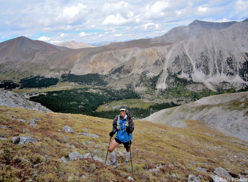
I took it easy up the road, hit the turnoff at 11400ft, and charged on up the mellow tundra to the base of the main ridge. In front of me lay nearly 3000ft of steep climbing over the course of 1.5miles straight to the summit of Colorado's hishest point. I settled in to a comfortable pace and trudged on up the ridge. I kept my effort and breathing in check, not wanting to overexert myself so early in the journey. Even with that I topped on out Mt Elbert at 11:25am, 15min ahead of schedule, but most importantly, I'd felt really good for the entire climb.
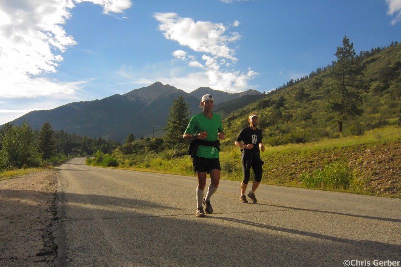
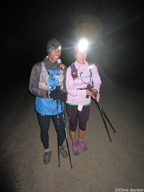
I snapped a photo and jogged off down the South ridge toward Bull Hill. First the trail, then the runnable tundra felt really good under my legs, and I was descending quite well. I made quick work of the 13200ft contour around Bull Hill, then scree skied my way past the Golden Fleece and Last Chance Mines and down to the smooth Echo Canyon trail. Less than 10min down the Echo Canyon trail I rolled my ankle, I grumbled at my stupidity (smooth single track) as I hobbled along for a few minutes until the pain subsided and I was able to run again. When I hit Hwy82 I turned over a quick power hike on the gentle uphills and slow jogged the flat sections, giving my legs a break from the downhill pounding they had just taken. I hit the La Plata/Lake Creek parking lot at 12:57pm, excited to see my crew, but this time they had picked up Chris F who would keep me company for the next few peaks!
|
|
|
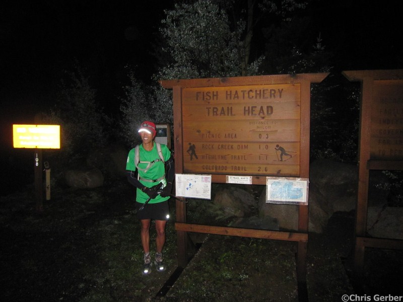
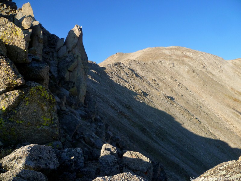
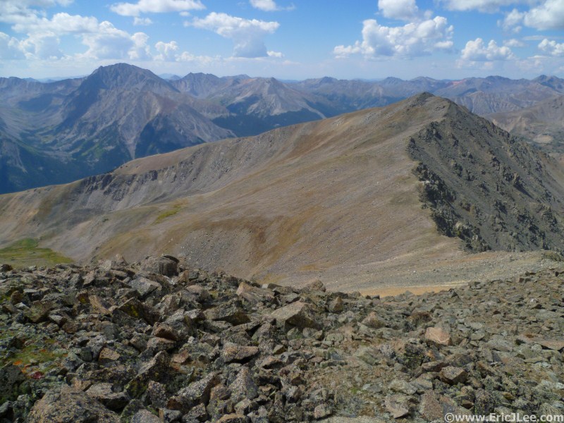
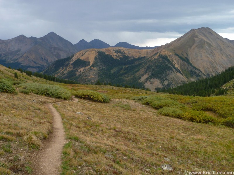
| Leadville Fish Hatchery Party of 1 | Mt Massive NE slope route | Bull Hill & La Plata |
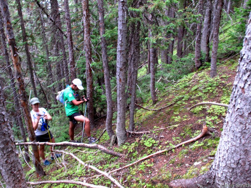
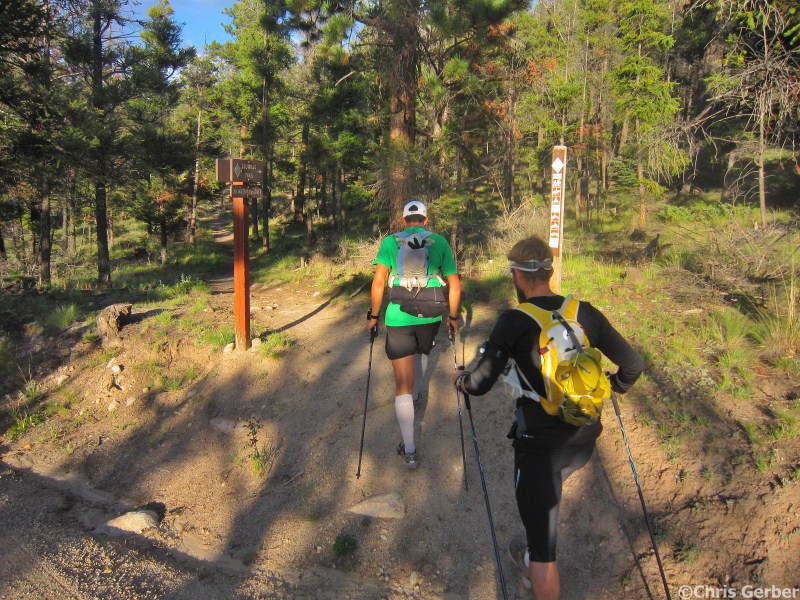
I devoured a turkey wrap (I would later regret this), refilled my pack, and fiddled with my water bladder hose (the liner had slipped in the tube and bunched up, slowing water flow). Chris and I soon took off down the road to La Plata. The first bit of trail/road is rolling and flat, making it runnable, and run we did. Soon we got to a steep set of stairs, where the trail begins to climb more steeply. We settled into a steady hike and began our long climb to peak #3. As we climbed into the upper basin I began to fatigue and my pace slowed. My stomach wasn't digesting the calories and water very quickly, stupid heavy turkey wrap, and my energy was suffering as a consequence. I made slow, but steady progress up the switchbacks toward the ridgeline, finally sitting down to MacGyver my stupid camelback hose and to down a large helping of Vi Fuel. Finally around 13400ft my stomach began to empty, my energy returned, and Chris and I went charging up the hill toward the summit of La Plata Peak.
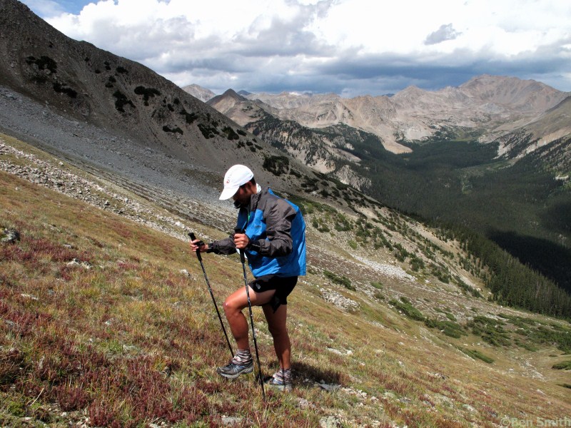
When we hit the summit at 3:58pm I was feeling like a new man, so we quickly hopped off down the SW ridge. We picked our way through the boulders on the upper slope down to the smooth trail through the tundra and ultimately the pass. On fairly fresh legs we hopped and scree skied our way down into the valley, soon hitting some of the most beautiful single track on the entire course. The trail through La Plata's North basin winds its way through the willows, with the massive hulks of Winfield Peak, Virginia Peak and Mt Huron all looming large in the afternoon sunlight. We chatted about how lucky we'd been with the weather, and how spectacular the route had been so far, but also about how far I still had to go. We made our way down the road and into South Winfield, where I had a full entourage awaiting me!
 |
 |
 |
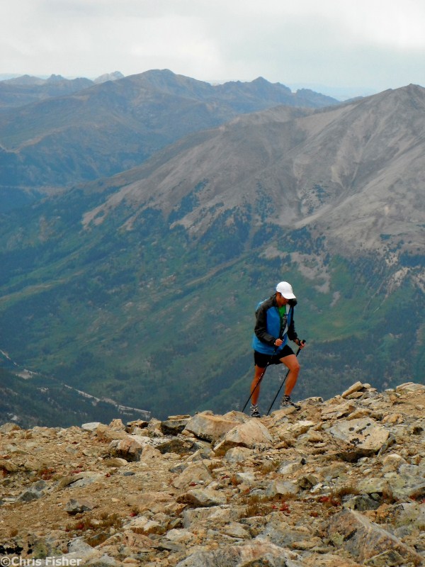
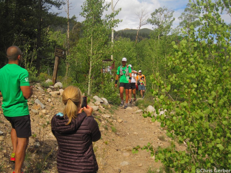
| Ascending La Plata Peak | Descent toward Winfield | Arriving at Winfield |
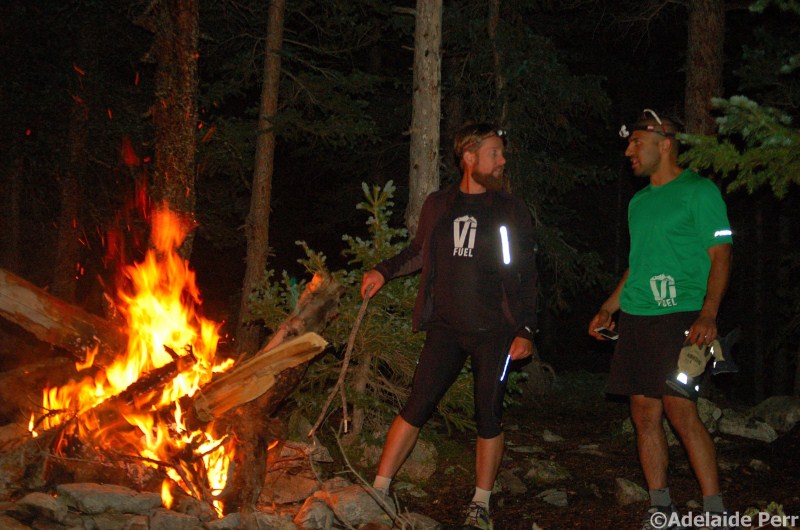
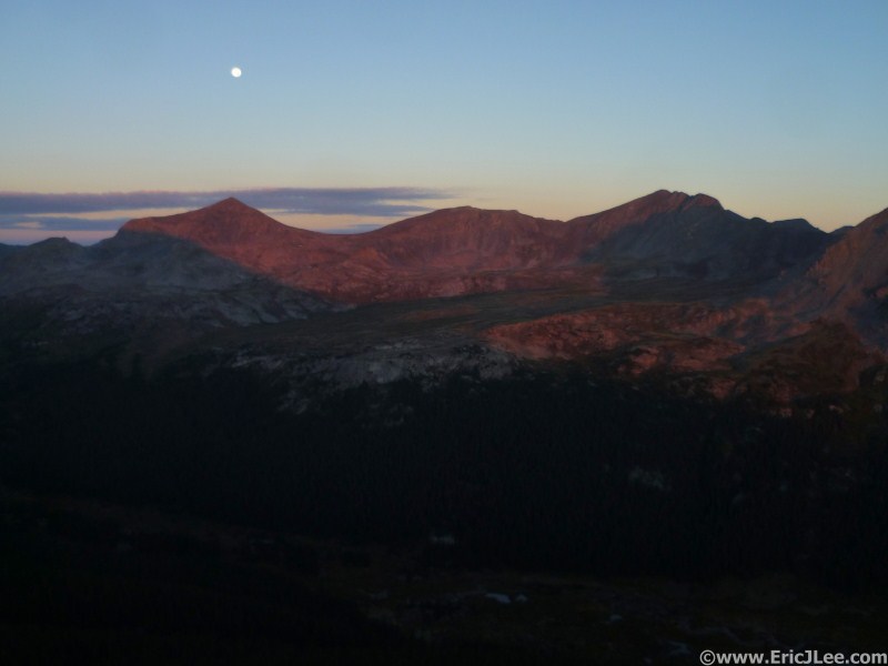
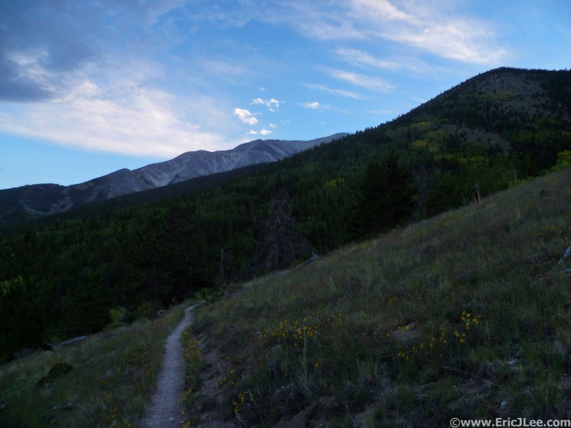
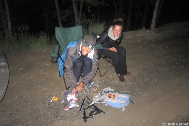
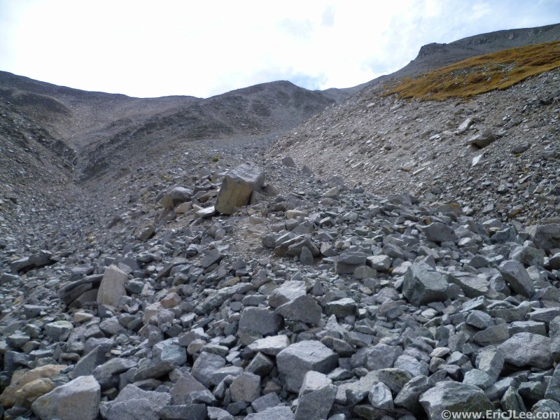
We summited Huron at 8:18pm as the skies began to clear showing the full moon rising to our East. We trotted off down the trail back to the saddle below Huron's summit where we bid Amanda and Preston farewell and while the three of us made our way down the scree gulley on the East side of Huron. We carefully made our way down the steep scree to avoid kicking rocks on each other, finally reaching the large talus field below. Aided by the full moon we cut slightly left across the talus to one of the grassy ridges where we picked up a cairned path leading down into a grassy gulley that would take us to Lake Lois. We jogged our way down to the Lake and followed the trail along side the stream heading down to Clohesy Lake. After a mix of boulder hopping and bushwacking through the dense forest we hit the fisherman's trail around the North side of Clohesy Lake and were greeted by a roaring campfire across the lake where the crew was partying it up at 9:55pm.
 |
 |
 |
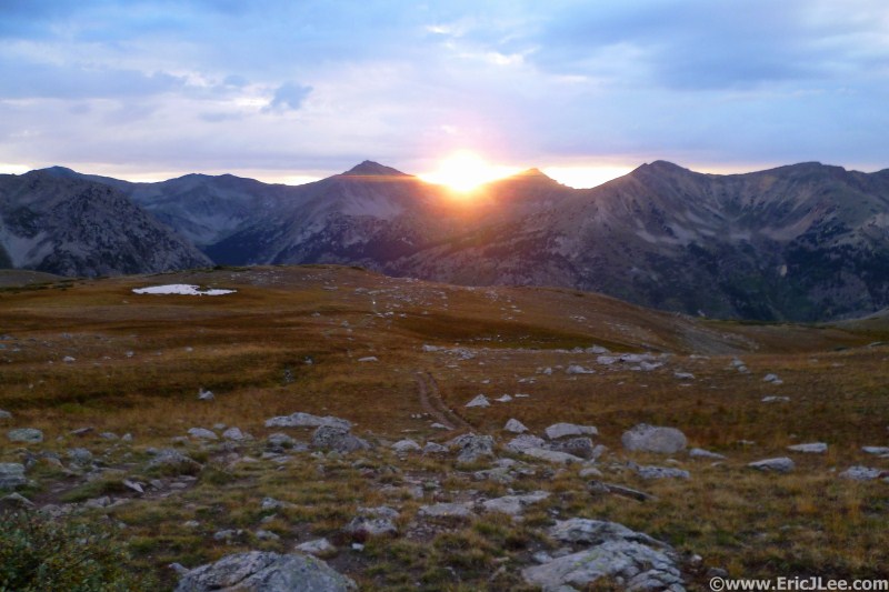
| Sunset from just below Huron | Bonfire at Clohesy Lake | Night shot of Missouri Mt |
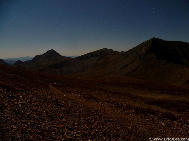
I chowed down on tater tots, reloaded my food and water, and swapped out company. Chris and Ben would be leaving me here, and I would pick up Pete for the next stretch from Clohesy to Pine Creek. We took off at a quick hike up the NW side of Missouri making our way into the upper basin where the trail slowly disappeared into ever steepening tundra. Above treeline we switched off our headlamps and continued our uphill progress by the light of the full moon. It was a very pleasant night up on the ridge and we hit the summit 12:15am on Saturday. The summit was a bit chilly so we cruised off down the South ridge toward the Iowa/Missouri saddle. We cut down early on some steep scree making our way into the upper reaches of Pine Creek. We traversed our way down to the Elkhead Pass trail at 12600ft and began our short climb back to the pass.
We met up with Cindy and Barry, who had backpacked in to Elkhead Pass, and had hot soup waiting along with our food and water resupply. After a short break we continued our grind up to Mt Belford, once again moving sans headlamps by moonlight. We made good time to Belford, summiting at 2:23am under clear, but cold and windy skies. We quickly turned and headed back the way we'd come, off to Mt Oxford, and hopefully some wind free terrain. As we dropped down toward the saddle between Belford and Oxford the wind abated and we powered our way across to Mt Oxford, reaching the top at 3:15am. Now I began to really regret not grabbing my GPS at Winfield before I had left (I was supposed to grab that and new batteries for my SPOT, but forgot).
We dropped straight off the summit of Oxford down the SW slope. The tundra was covered in frost making for a slippery descent down the steep tundra and scree. As we hit treeline we passed a cliff band by heading west toward the river, then traversed back east into the trees working our way down to Pine Creek at 4:53am. Once on the Pine Creek trail, Pete and I exchanged a little info about the route and some crew updates and I bid him farewell, making my way up canyon to 11350ft. Now the decision, to take off into the trees toward Mt Harvard's North slope in the dark without a GPS, hopelessly bushwacking through dense trees, or to take a nap and wait for daylight?
 |
 |
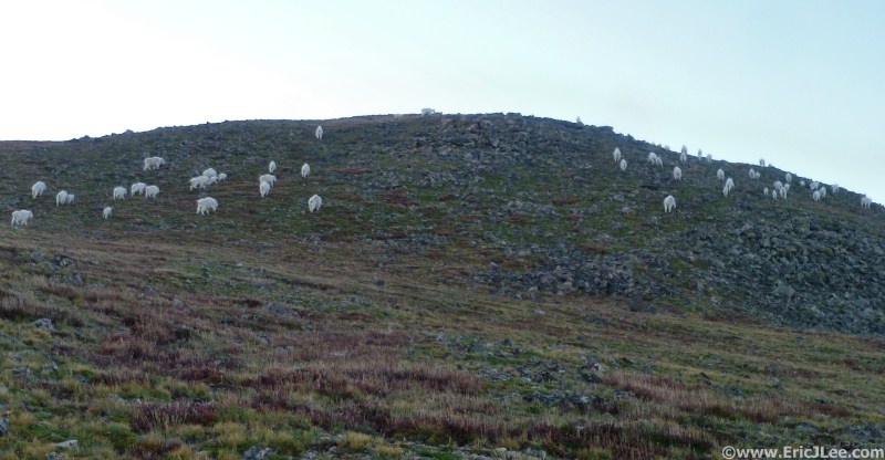 |
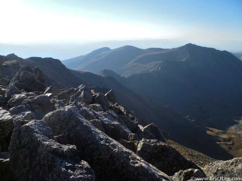
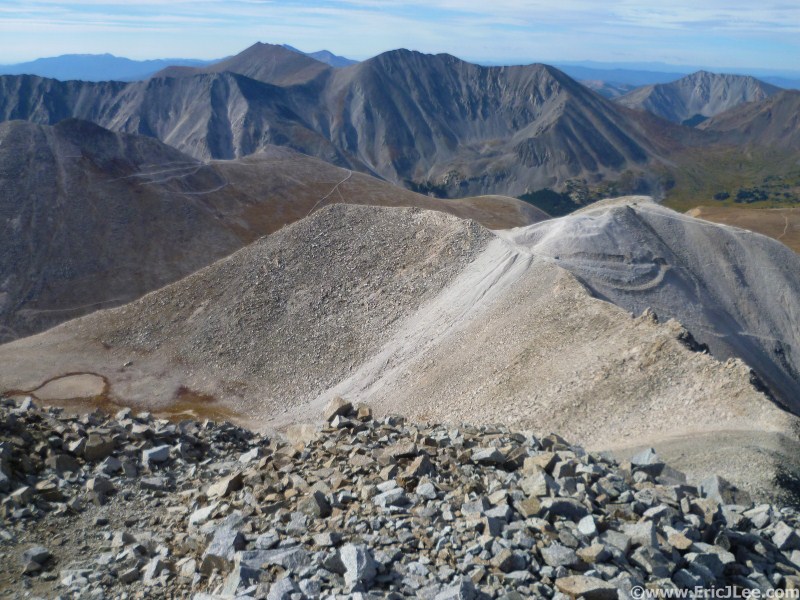
| Summit of Mt Belford | Sunrise from Harvard's North ridge | Mountain goats on Mt Harvard's North ridge |
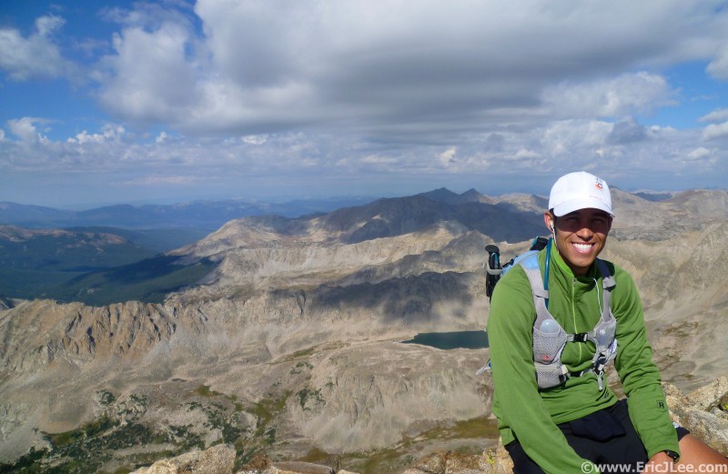
I took several deep breaths and a long look over at Mt Columbia, the scene of last year's unraveling. I scrambled my way across the ridge then jogged my way across the tundra down into the Frenchman Creek drainage. I descended into the rocky basin at 12600ft and began my slow scramble up Columbia. As I slowly made my way up Columbia my lungs began to feel constricted, no matter how deeply I breathed in I couldn't get a full breath. I crawled my way up the North ridge of Mt Columbia finally settling down on the summit at 9:38am. I looked up to see a friendly face, Justin had hiked/run up Columbia that morning to meet me and keep me company for the descent. Despite how slow the ascent had felt I had made good time across the traverse, and the friendly face was just the mental boost I needed to get myself down to N Cottonwood Creek.
With my downhill legs still feeling good I opted for the trail, slip sliding my way down the steep rocky trail into Horn Fork Basin. Every time I've been on this trail is seems to drag on forever, and this time was no different. As we jogged and hiked downhill time seemed to move at half speed. When we finally reached the bridge over North Cottonwood creek at 10:50am my heart sunk, there was no one there, no crew, no support, no one…. Justin said he'd jog back toward the trailhead and try and find the crew, while I laid down for a short nap. About 10min later up the trail came Chris, Pete, Ben, Amanda and Justin. I sprawled out all my resupply gear in my grassy bed and repacked my bag for the long haul up and over Mt Yale. Unfortunately, still no batteries for my ailing SPOT.
 |
 |
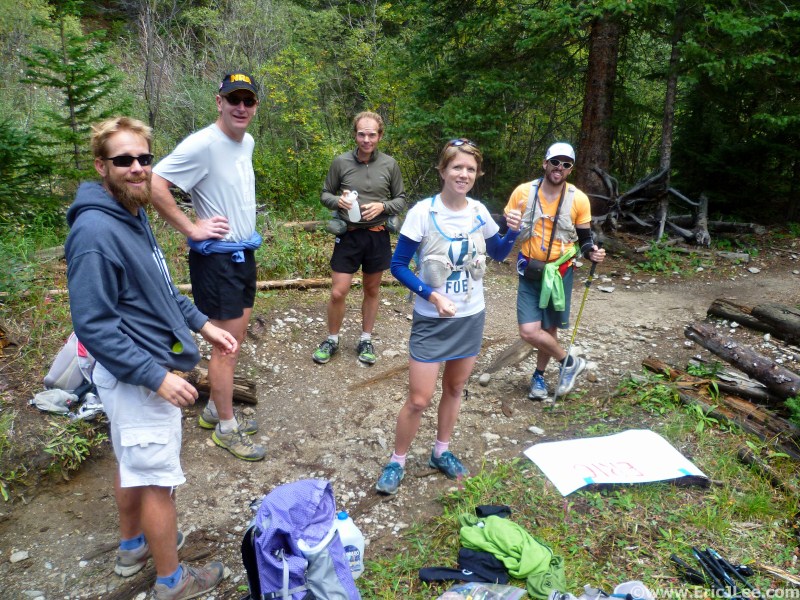 |
| Looking toward Columbia from Harvard | Me on the summit of Mt Columbia | Me and crew at North Cottonwood Creek |
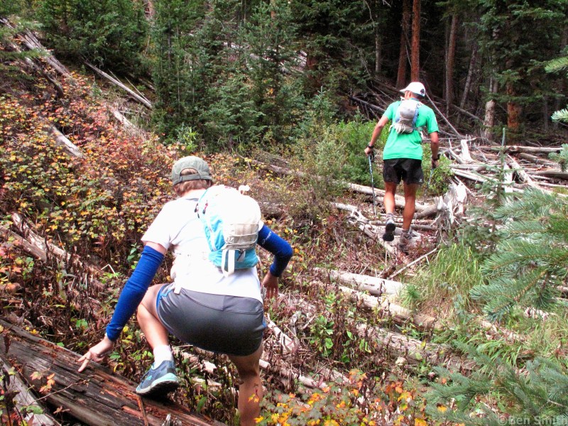
I was very excited to have the company of Ben and Amanda again for the long haul up Mt Yale, and I promised them a fun, unique and crazy route. We took off on a short bushwack west from the North Cottonwood Creek bridge, soon making our way into open forest terrain heading up the North side of Mt Yale. I had picked a direct line up the North ridge of Pt12619, at one point gaining 800ft in a quarter of a mile! Some of the steepest hikeable forest dirt I've ever been on, we all laughed at the ridiculousness of the terrain, unsure how the dirt was still holding onto the slope. At treeline we made our way into the avalanche gulley and onto the open tundra of the North ridge of Mt Yale. After skirting around Pt13105 we hit the North slope of Mt Yale, and so began the slow trudge. The vice grips around my lungs had begun to tighten again, and my pace suffered above 12500ft. The death march was on, and I did all I could to simply move forward at a slow pace. The summit couldn't come soon enough and we finally crested the ridge and hit the summit of Mt Yale at 2:35pm.
 |
 |
 |
| Bushwacking toward Mt Yale | Steep slopes on the North side of Mt Yale | Me on the slow grind up Mt Yale |
I was beginning to feel fatigued, between that and the breathing issues my initial downhill pace was not as strong as I'd been holding. We made our way down the East ridge of Mt Yale, picking our way through the rocks, down down down, reaching the Avalanche Gulch trail about an hour after leaving the summit. While I had not reached full zombie mode, I was definitely in need of a nap. We hiked/jogged our way down the smooth Avalanche Gulch trail. As we neared the trailhead I couldn't help but smile at the stream of glittery party parrots and the hooting and hollering echoing up the hill. Despite how tired I felt, the greeting party at the trailhead lifted my spirits, 4:45pm. I downed a bowl of potato leak soup with bacon and quickly put myself to sleep. Apparently I was snoring within minutes, out cold. Chris and Kari woke me 45min later, a little groggy, but definitely refreshed. I scarfed down two more bowls of soup with bacon, changed shoes, grabbed my repacked bag, functional SPOT and Pete, who would be joining me yet again for the long night ahead.
 |
 |
 |
| Descending Mt Yale's East ridge | Tired arrival at Avalanche Gulch TH | Passed out cold, nap time |
 |
 |
 |
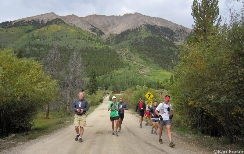
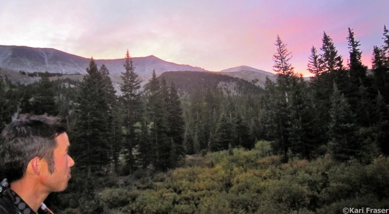
| Running along Cottonwood Pass Rd | Hitting the CT to Mt Princeton | Sunset over Mt Princeton's NE ridge |
As we ascended the wind began to pick up and my breath became very labored again. The temperature dipped into the 30s, and the wind chill numbed both Pete and I from head to toe. The long high altitude ridge combined with my labored movement, made for extremely slow progress. Despite earlier reports, we did not get lost on the ascent, all I could muster was two steps then 4 shallow breaths, rinse and repeat. As we literally crawled our way toward Mt Princeton the hours ticked away, at last we scrambled up the final pitch to the summit of Mt Princeton at 12:35am. It had taken over 6.5 hours to summit, far longer than I'd hoped.
Both of us had numb fingers so we immediately tip toed down the West ridge to Pt13971. I was still feeling weak, so our progress along the rocky ridge was slow. As we descended South from Pt13971 the ridge became increasing rocky until we were forced to scramble down some steep class 3 to a rocky notch at 13500ft above a giant scree field. In my daze I did not recognize the scramble along the ridge ahead, but had written down that we needed to follow the ridge down to 13000ft. I opted to descend the known quantity down the nasty scree into the upper reaches of Grouse Gulch. We slowly hopped our way down the lose scree and talus finally reaching the flats far below, but way off route.
I took a quick GPS bearing and realized we had definitely descended too early, and were about a mile too far up the valley. I could see the treeline below and the grassy ridge that would mark the dry creek bed where the use trail we should have hit lay. We took a descending traverse down valley eventually reaching the lower section of the use trail and then the main river. We had lost 45-60min picking our way across the tundra and talus, but were now back on track. With my navigation failing us, we opted to stick to the old trail along the East side of Grouse Gulch, finally descending to the road about two miles from the Alpine Reservoir, a longer, but technically easier route. We jogged/walked down the road in the dark, it seemed as though the bridge to Chalk Creek Rd would never come. When we finally hit the bridge, in my semi-delerious state I had us turn left (East) down Chalk Creek Rd, only half a mile later did I realize we were going the wrong way. It just wasn't my night, and Pete was understandably frustrated by the many mistakes I'd made. Finally we reached Chris, Kari and Dana who were awaiting our arrival at the bottom of the Baldwin Gulch jeep road at 4:50am. They were relieved that everything was ok, as I was over 4hours overdue.
 |
 |
 |
| Early Sunday morning at Baldwin Gulch | Kari and I ready for Antero | Sunrise over Mt Antero |
When we hit treeline and started up the switchbacks my lungs began to constrict and my pace again began to slow. Kari and I made a quick crew stop along the 4wd road, then it was off up the direct shortcut to Mt Antero, cutting off the road at 12900ft. We scrambled and rock hopped up to the saddle below Mt Antero, then slowly up the trail reaching the summit at 9:25am. While I was still moving slowly above 12500ft, I was feeling better than the night before on Princeton. We picked our way down the rocky trail back to the saddle then it was off to the Antero-Mt White saddle and the shortcut gulley to Browns Creek. As we descended to Browns Creek we were greeted by a curious herd of bighorns, just as interested in us, as we were of them.
 |
 |
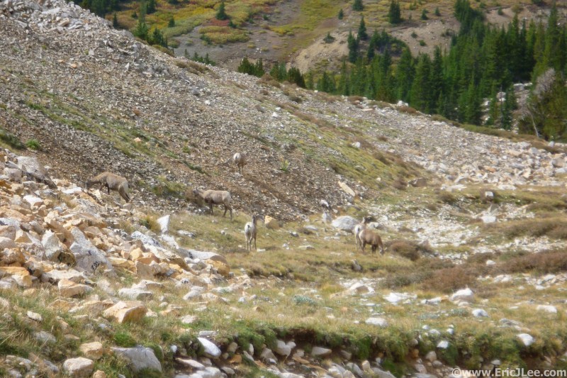 |
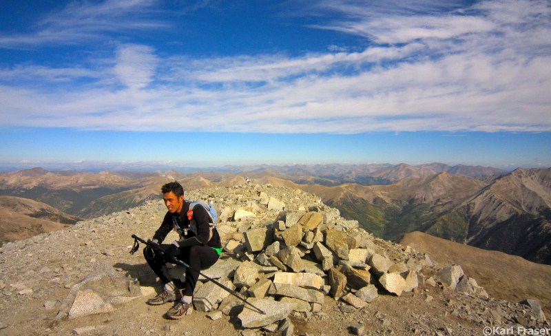
| Me sitting at Mt Antero | Tabeguache and Shavano from Antero | Bighorns hanging out near Browns Creek |
We tiptoed across a beaver damn over Browns Creek then followed my route skirting the marsh before making our way up the main gulley toward the Tabeguache/Antero saddle. We picked up a use trail in the gulley and followed it onto the grassy rib in the middle of the gulley taking us toward Tabeguache. We trudged away up the hill, finally finding one of the use trails to the summit of Tabeguache at 1:20pm. While sitting on Tabeguache, Kari called in via HAM radio of our progress and it finally hit me that I was actually going to finish this!
 |
 |
 |
| Ascent to Tabeguache | Trudging up Tabeguache | Almost to Tabeguache, #13 |
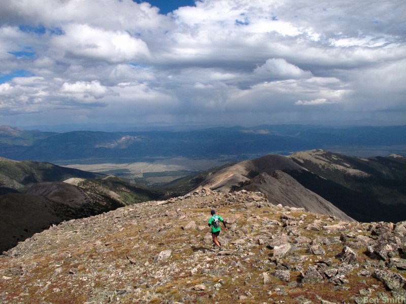
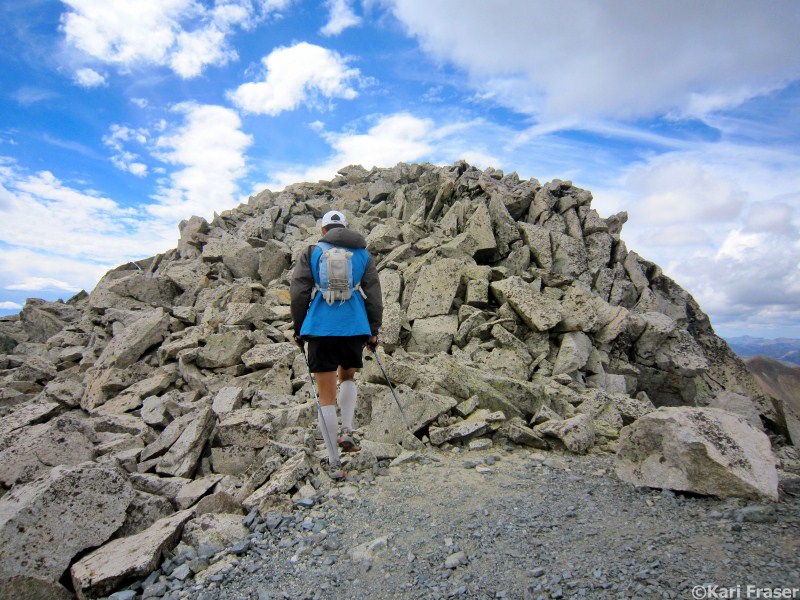
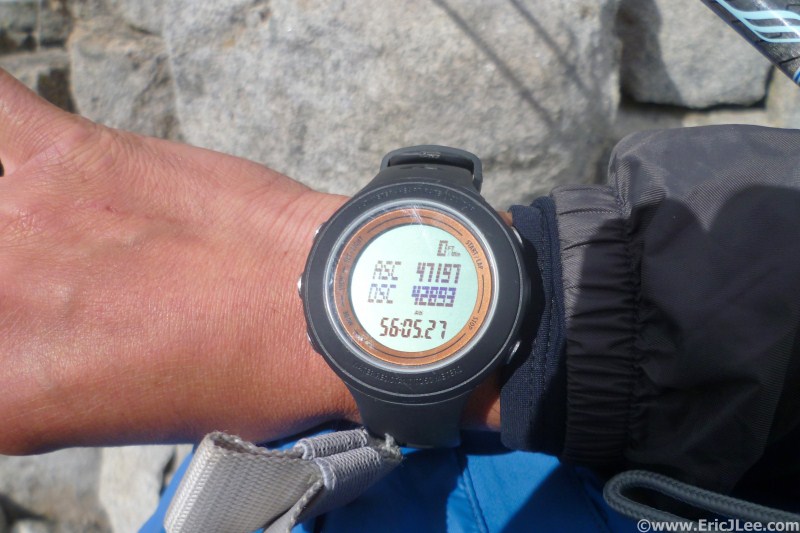
We picked our way back down to the saddle, then I pushed myself up over all the false summits on Shavano to the rocky out cropping that marked the fourteenth and final summit of my 56hour05min05sec journey, 2:05pm. After snapping a picture of my watch and the obligatory summit photo, Kari radioed down to the crew and friends at the trailhead that we were coming home! My legs were still working amazingly well downhill so we jogged almost the entire way to the trailhead, taking only a few walking breaks. As we neared the trailhead my body finally began to realize the cumulative fatigue of only sleeping 45min in two and a half days, and the raw adrenaline that I'd been surviving off for the past several hours was wearing off.
 |
 |
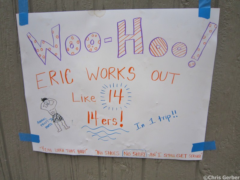 |
| 56h05min27sec atop Mt Shavano! | Self Portrait atop Mt Shavano | Motivational sign on the run down |
 |
 |
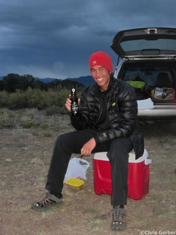 |
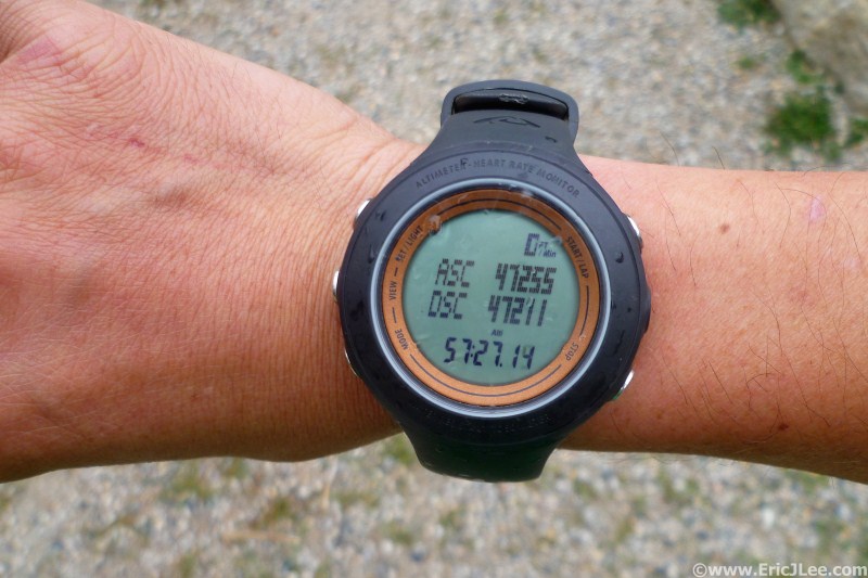
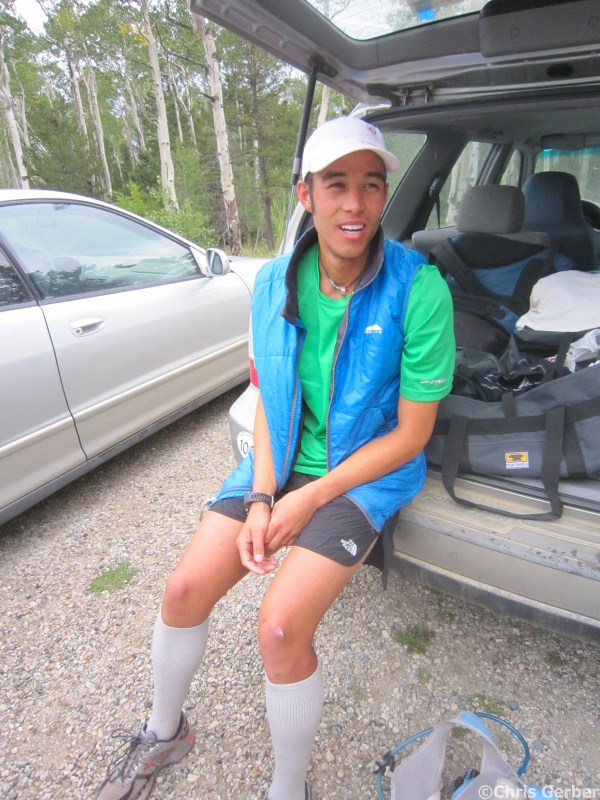
| 57h27min14sec, 47,000ft and I'm Done! | Tired, overwhelmed, and done | Enjoying a well deserved beer |
I pushed myself through the last several miles where at 3:27pm, 57hours27min14sec after leaving the Leadville Fish Hatchery I finally stopped my watch and sat down. I had seen three sunrises, two sunsets, the summit of fourteen of Colorado's highest peaks and endless miles of rarely traveled high mountain terrain. The whole journey is still a bit of a blur even a week later, and feels surreal; the fact that after 5 years of scouting, planning and training I'd become the 7th person EVER to finish Nolans14. People have asked if I will return to make another attempt at the FKT, my response has been, maybe someday, but for now there are more mountains to climb, different challenges to pursue. I think the hardest part about attempting to set an FKT on Nolans14 is that 50+ hours at high altitude is such a long time, that something will go wrong. The weather won't cooperate, you can get lost, your stomach can fail you, your lungs can fail you, your muscles can fail you…. To beat the FKT would take someone with extraordinary strength and a little bit of luck to avoid most of those factors listed above. Someday the FKT will be broken, but for now, I'm incredibly happy to call myself a Nolans14 finisher.
A special thanks to Vi Fuel for fueling both my 2011 and 2012 Nolans14 attempts. Also to Cindy Stonesmith of Ultrarunner Training for all the training advice. Most importantly a huge thank you to my crew; Chris G, Kari, Pete, Chris F, Ben, Amanda, Basit, Adelaide, Cindy, Barry, Justin, Dana and everyone else who supported me at some point during my training or during my long hike over Labor Day 2012.
Photo Album from my Nolans14 adventure
| Location | Time of Day | Total Time-Split Time | Fish Hatchery TH | 6:00am Fri | 0h0min | Mt Massive Summit | 8:22am Fri | 2h22min | South Halfmoon TH | 9:12am Fri | 3h12min-0h50min | Mt Elbert Summit | 11:25am Fri | 5h25min-2h13min | La Plata TH | 12:57pm Fri | 6h57min-1h32min | La Plata Peak Summit | 3:58pm Fri | 9h58min-3h01min | South Winfield TH | 5:27pm Fri | 11h27min-1h29min | Mt Huron Summit | 8:18pm Fri | 14h18min-2h51min | Clohesy Lake | 9:55pm Fri | 15h55min-1h37min | Missouri Mt Summit | 12:15am Sat | 18h15min-2h20min | Elkhead Pass | 1:35am Sat | 19h35min-1h20min | Mt Belford Summit | 2:23am Sat | 20h23min-1h12min | Mt Oxford Summit | 3:15am Sat | 21h15min-52min | Pine Creek Crossing | 4:53am Sat | 22h53min-1h38min | Mt Harvard Summit | 7:26am Sat | 25h26min-2h33min | Mt Columbia Summit | 9:38am Sat | 27h38min-2h12min | North Cottonwood Creek Bridge | 10:50am Sat | 28h50min-1h12min | Mt Yale Summit | 2:35pm Sat | 32h35min-3h45min | Avalanche Gulch TH | 4:45pm Sat | 34h45min-2h10min | Mt Princeton Summit | 12:35am Sun | 42h35min-7h50min | Baldwin Gulch TH | 4:50am Sun | 46h50min-4h15min | Mt Antero Summit | 9:25am Sun | 51h25min-4h35min | Tabeguache Peak Summit | 1:20pm Sun | 55h20min-3h55min | Mt Shavano Summit | 2:05pm Sun | 56h05hmin-45min | Blank Gulch TH | 3:27pm Sun | 57h27min-1h23min |