
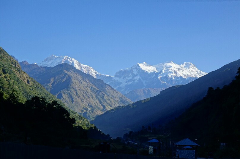
November 6th Day 1; Besi Sahar to Tal
After catching a bus from Pokhara to Besi Sahar (550 rupees) on November 5th I’d intended to catch another bus to Nagdi, but when the driver told me 300 rupees for the 14km ride I said no thanks, checked in with the ACAP and stubbornly walked off. The road went by quickly and I soon found myself in Bhulbule and then Ngadi. These first 14km were pretty uninteresting and can easily be skipped, though I enjoyed the quiet morning stroll. Then began the climbing up through the terraced hillsides of Bahundande, Badalbisuanaa, Lili Bhir and Ghermu (which would be a lovely place to stay). At Syange I rejoined the road for the dusty climb up to a short bit a trail into Chamje. Here I missed the bridge so hoofed it along the road all the way to Tal as the valley was bathed in deep shadow. It had been a long 35km, 8.5h day, but the low elevation sections were behind me and into the mountains I went. 37km, 1400m+, 8:26.
Mountain views near Ngadi.
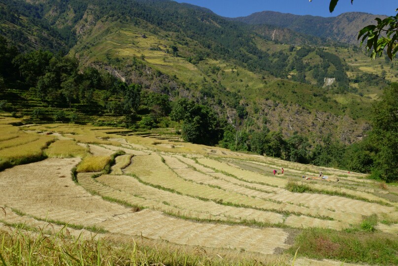
Terraced hillsides of Bahundande.
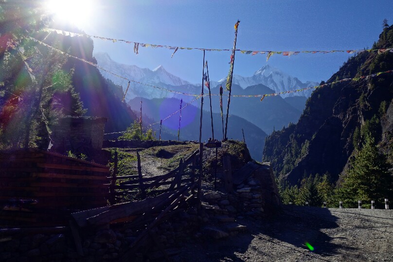
Looking down on the village of Tal from the road.
Day 2; Tal to Chame
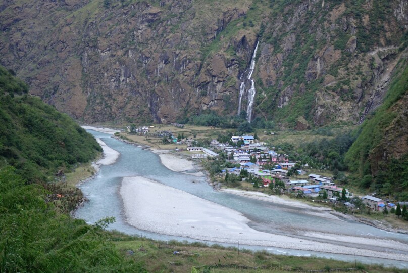
A more causal morning start had me following the single track out of Tal past several waterfalls through the deep gorge all the way to Dharapani. The lush green trail was sunk deep in the river gorge, and I lost it several times as it was not very well marked. Finally I reached Danakyu and began the steep 600m climb up to Timang, where we were teased with views of Manaslu the whole time. After this exhausting steep climb I settled in for lunch on a roof top in Timang with superb views of manaslu. After lunch it was back on the dusty dirt road through Thanchowk, Koto and finally into the bustling town of Chame. I set up shop at the Tilicho GH for the night, a friendly and quaint lodge. Being my birthday I treated myself to fresh apple pie as I chatted with the other travelers. 23km, 1200m+, 7:15.
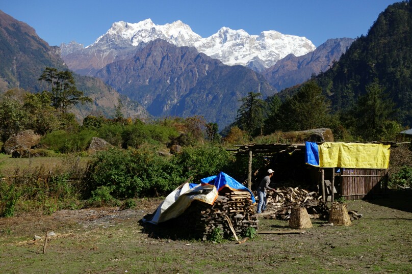
Views of Manaslu from Timang.
The Annapurna range finally reveals herself.
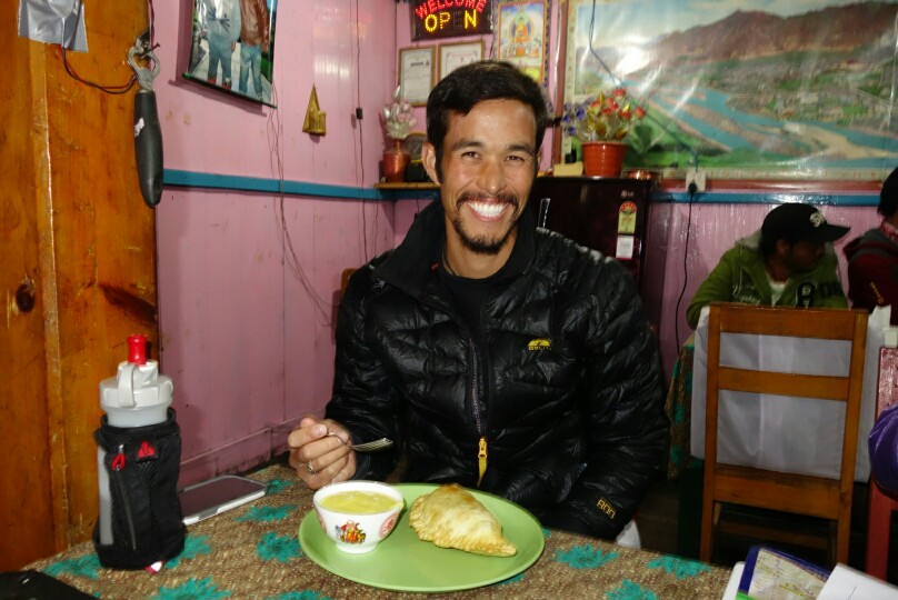
Birthday apple pie and custard.
Day 3; Chame to Gyaru
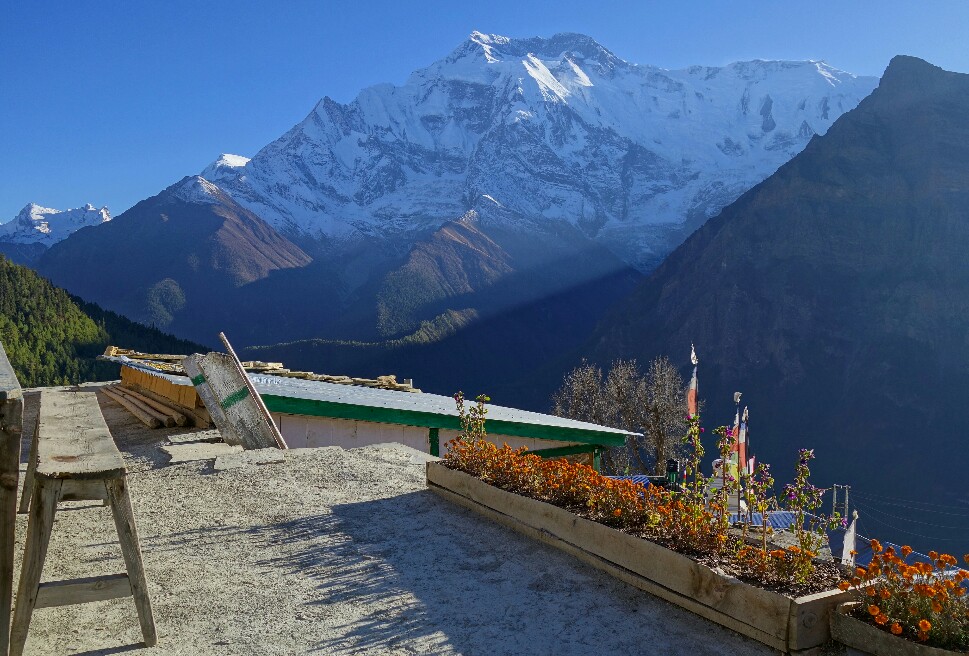
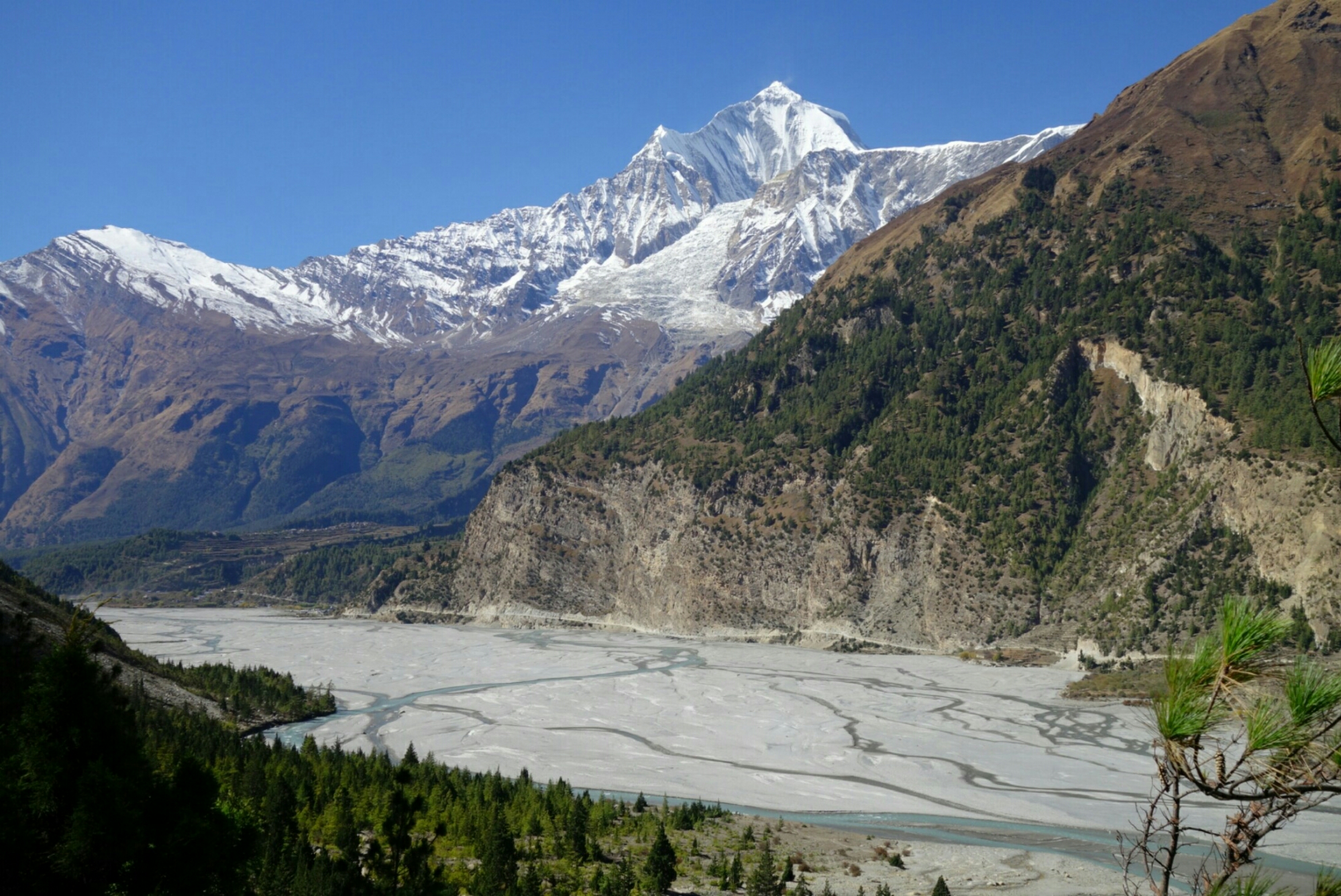
Another casual start in the chilly shade of the valley at 8:25, cruising up the dusty road. When I reached the lovely apple orchards of Bhratang I was overwhelmed by the 50-70 people lining the road in front of me. Apparently I’d found all the other trekkers I hadn’t seen the previous two days. I quickly passed them all by, arriving in Dhikur Pokhari around 11am. Here the massive sweeping face of the Swargadwari Danda dominated the skyline. The terrain soon turned very arid as I passed into the rainshadow of the Annapurna massif. As I neared Upper Pisang fantastic views of Annapurna II and IV appeared. I paused on the outskirts of Upper Pisang for lunch and to gawk at the views. Till now the trail had been climbing pretty gently, then just 1km from Gyaru it jumped up in cruel fashion, gaining 300m in a series of relentless switchbacks. I grunted up the slope reaching Gyaru just before 2pm. I settled into the Annapurna hotel, basic accommodations but a million dollar view. Special thanks to Jessie Wilburn for the suggestion, as sunrise (and starry skies) from this village is a must see, best views around. 19km, 1100m+, 5:10.
Swargadwari Danda looming over the river.
View on Annapurna from near Upper Pisang.
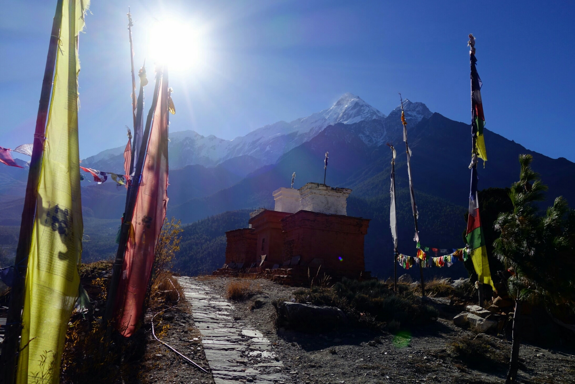
Roof top view from Ghyaru
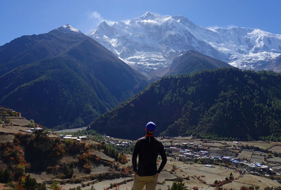
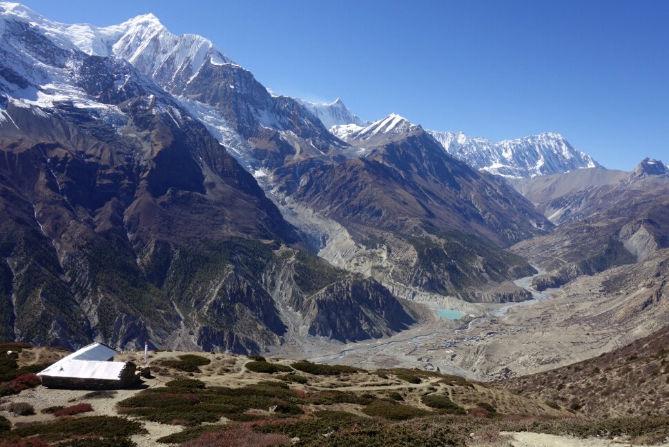
Day 4; Gyaru to Manang
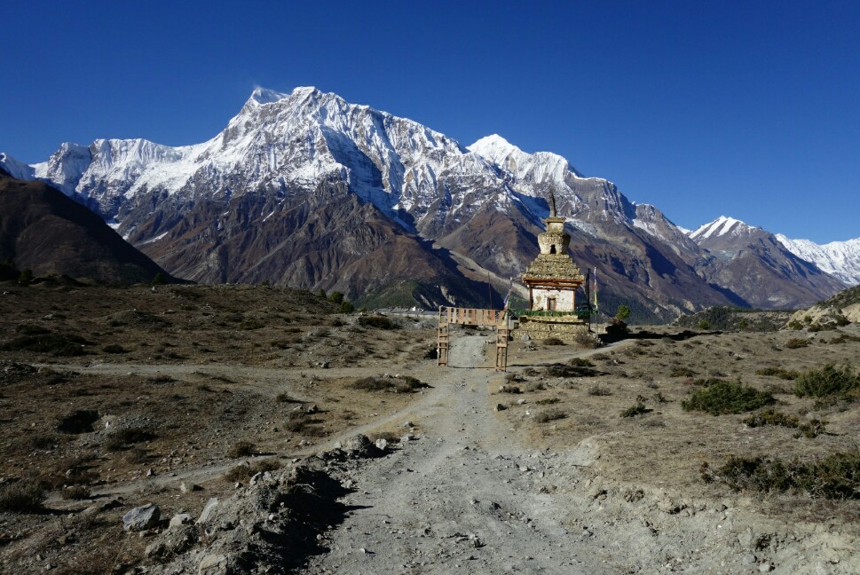
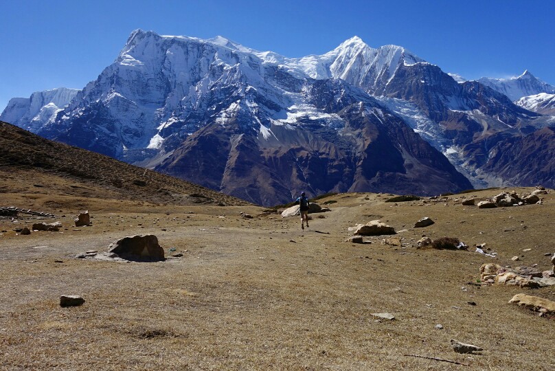
This was to be my easiest day with the big pack on, but I also intended to throw in a side trip to Kicho Tal (Ice Lake), so it wouldn’t be much of a rest day. After watching a beautiful sunrise over the Annapurna range from my hotel rooftop I set off early across the rolling traverse towards Braka. The views across the valley and to the villages far below were quite spectacular. The terrain was pretty easy going until I hit a broad valley near Julu and stared across at the steep 300m decent and climb that awaited me, well damn. I flew down the hill as usual, then came the grind straight back up, ugh. I made decent time and was deposited in a high hanging valley on a gently descending trail, one of the most pleasant sections of trail I’d been on, fantastic views to boot. I cruised on over to the junction with the Ice Lake trail, dumped my main pack in some bushes and with only a running vest set off up the 900m climb to Ice Lake.
I was huffing and puffing pretty good but made great time to the lake (1:30), and had it all to myself for 20min. The still lake waters reflected the Annapurna massif as some bighorn sheep bounded up the hill behind me. What a place to spend a morning. Then, abruptly the wind picked (11:20) up and my scene was gone. I jogged back down the hill (0:45) picked up my pack and mosied on over to Manang. I settled in for the night at the Yeti hotel, a decent but over priced large complex and just wandered town the rest of the afternoon. Manang is a nice place to grab a pastry and stock up on supplies as its the last cheap hub east of Thorung La. Then it was early to bed again. 25km, 1500m+, 6:25.
Sunrise from Ghyaru.
Cruising the trail between Ghyaru and Braka.
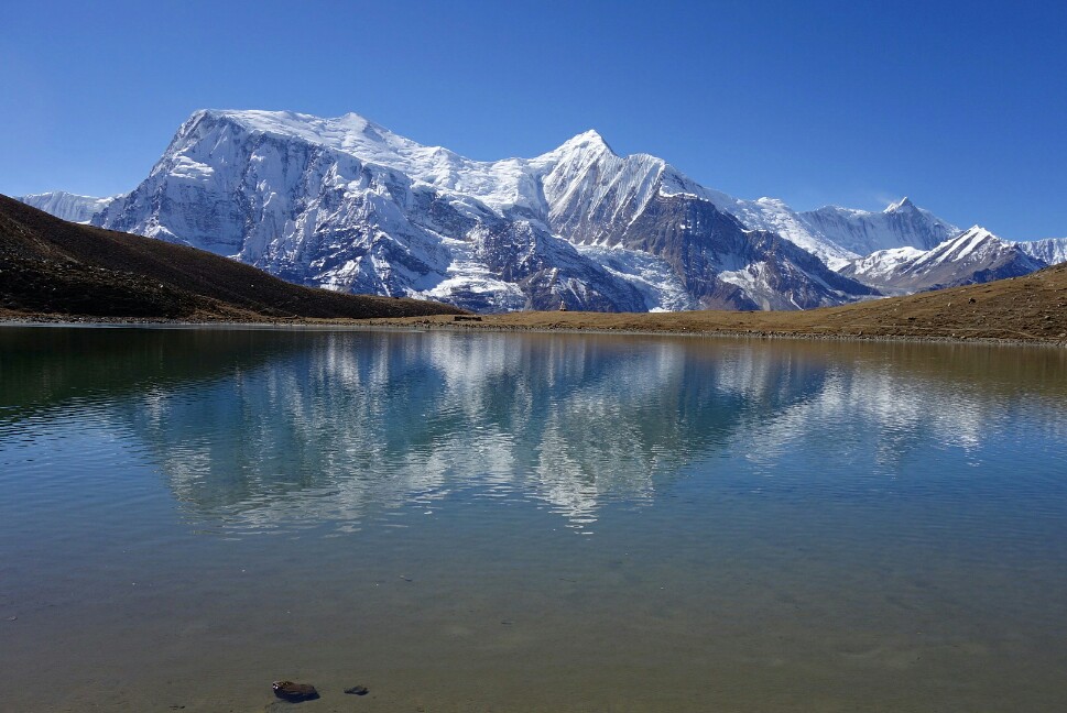
Reflection of the Annapurna massif in Ice Lake.
Descending from Ice Lake, there is a tea house half way with some lovely views.
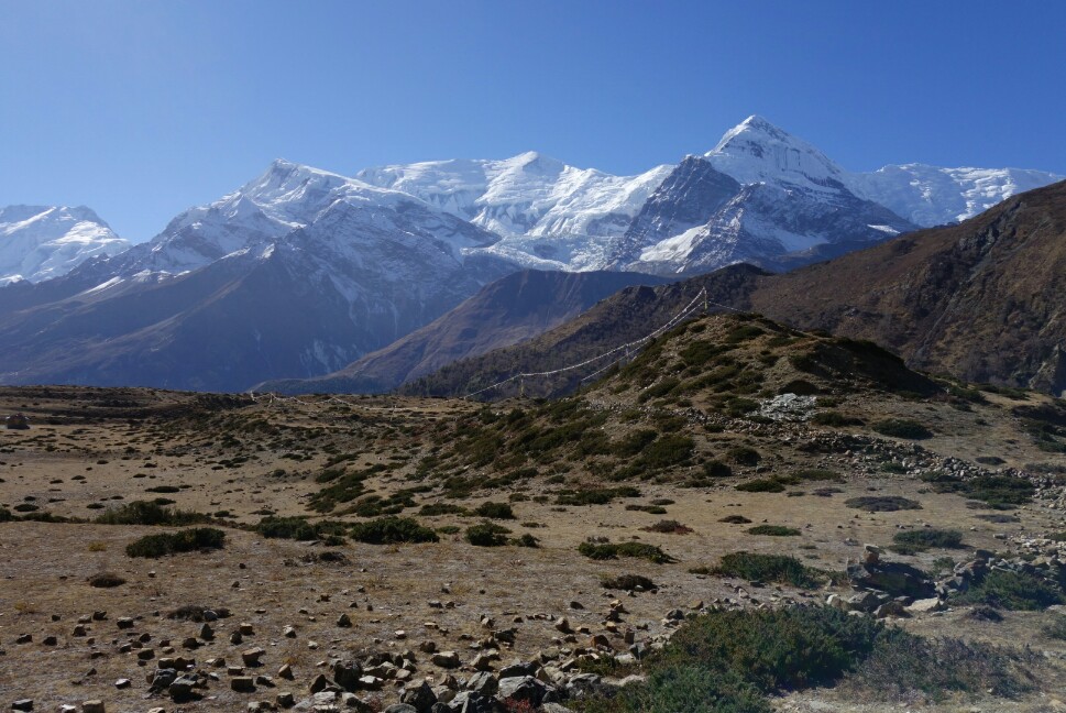
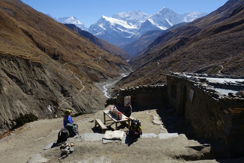
November 10th, Day 5; Manang to Thorung Phedi
I took a slow and steady pace leaving Manang, climbing from 3600m up the valley. There were nice views of Annapurna and Gangapurna behind me, but I was slowly leaving them behind. I took a break for soup lunch in Yak Karkha (4000m), then continued my trudge up valley. The altitude was slowing me down but I kept slogging forward, crossing the Kone Khola and taking one last tea break before the final push to Thorung Phedi. There are three guesthouses at 4500m set in a high arid valley. Not much views of the mountains here, but a spectacular valley none the less. It was a chilly and restless night as I didn’t sleep well at the altitude which made me nervous for the following days climb to Thorung La. 15km, 1100m+, 5:06. Resting HR 64.
Views back at Annapurna from near Yak Karkha.
Tea house break just before Thorung Phedi. Nice views and thin air.
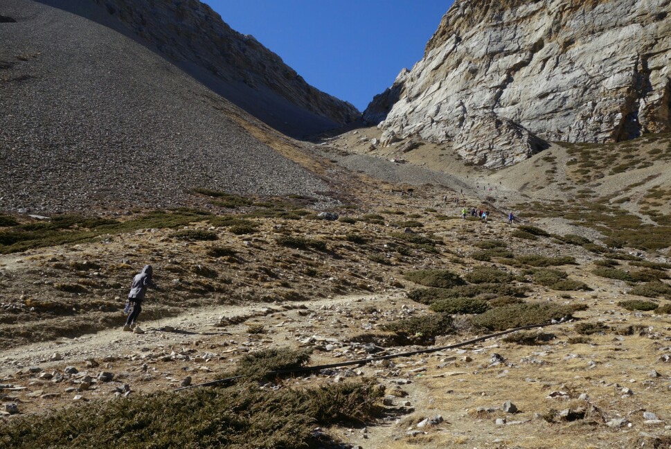
Looking up the endless switchbacks from Thorung Phedi to Thorung high camp. How many people can you spot out for an acclimatization hike?
Day 6; Thorung La Pass to Muktinath.
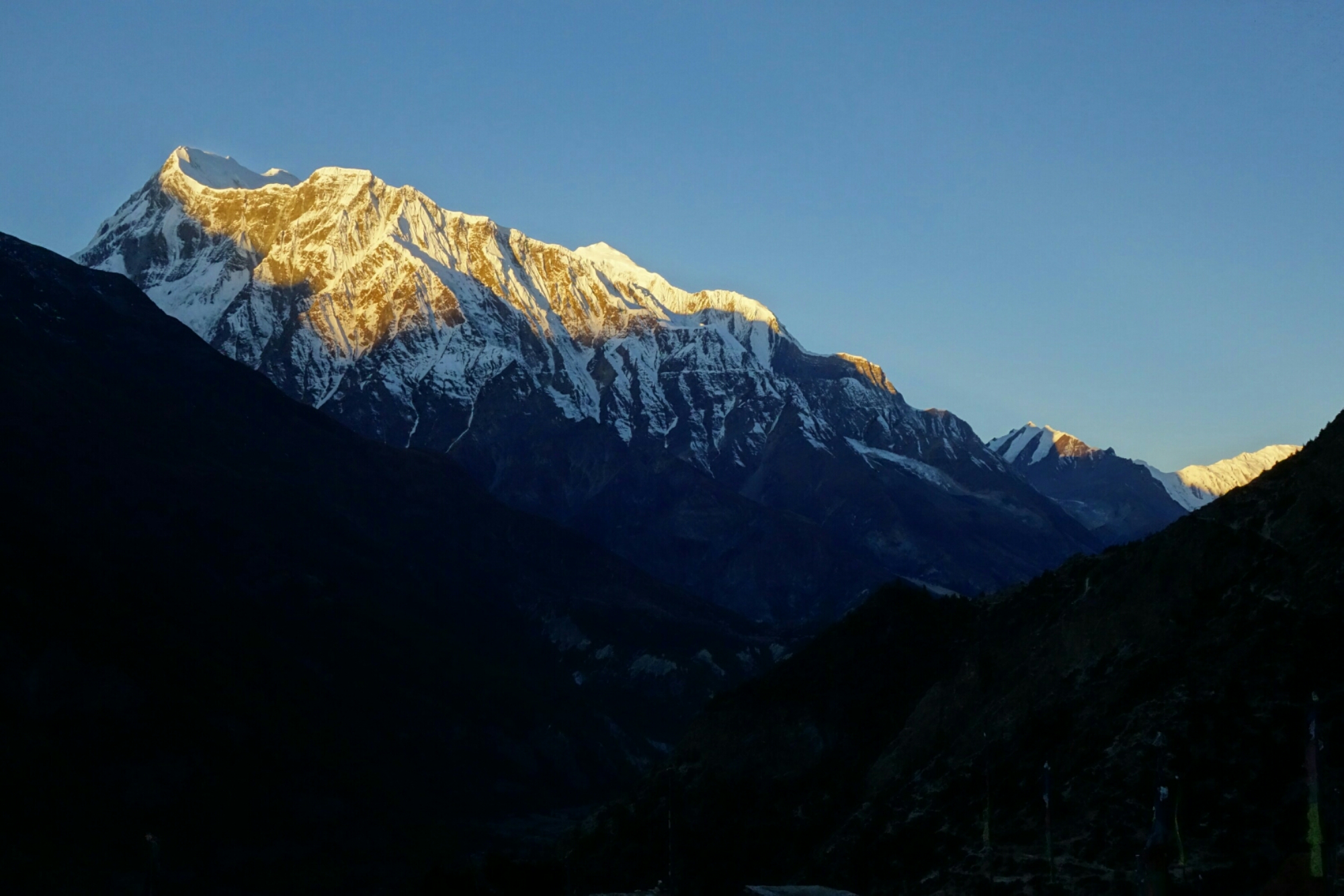
Worried about the altitude I awoke early and hit the trail at first light (6:15am), wrapped in my down jacket. The first part of the climb out of Thorung Phedi consisted of 400m of steep switchbacks up to Thorung high camp. As I slowly climbed upwards I felt OK, winded but moving steadily. The sun began to illuminate the valley behind me and Annapurna III glowed pink in the morning light. Surprisingly after only 45min I crested the hill arriving at Thorung high camp (4900m), feeling fairly spry. The sun was slowly creeping down from the pass toward me, and soon I found myself bathed in its wonderful morning warmth. The rolling uphill to Thorung La seemed to drag on, but finally I saw the thousands of prayer flags that adorn the pass, pushed the pace a bit, and at last plopped down at 5416m atop the pass (2:15).
The pass is set between two sizeable mountains so the only views are backward and forward down the trail, still expansive. I put on all my clothing and proceeded to hang out on top for 1.5h, enjoying the scenery and people watching, in no rush to descend as the thin air felt good. After quite a few photos I decided it was time to go and bounced off down the steep trail toward Muktinath. The steep and dusty descent past Chambarbu and to Muktinath went by quickly and can definitely be a quad killer (1600m-). I strolled into the bustling voyage at Muktinath and took a room at the Hotel Caravan among a sea of local Nepali. I joined the locals and explored the sacred sights of Muktinath, I still feel strange wandering around holy sights of which I don’t have a particular affiliation, but the culture was intriguing and beautiful none the less. 17km, 900m+/1600m-, 4:30 moving.
Morning light creeping toward Thorung High Camp.
The final portion of the climb toward Thorung La pass. Don’t forget to turn around and enjoy the scenery.
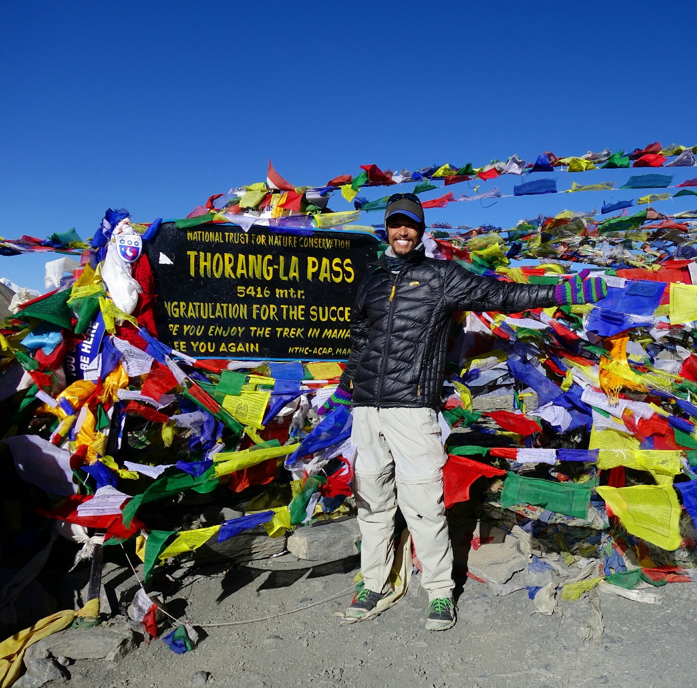
Atop Thorung La pass amongst the prayers flags at 5416m.
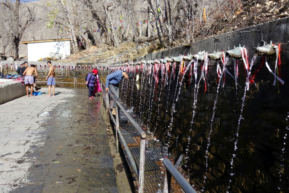
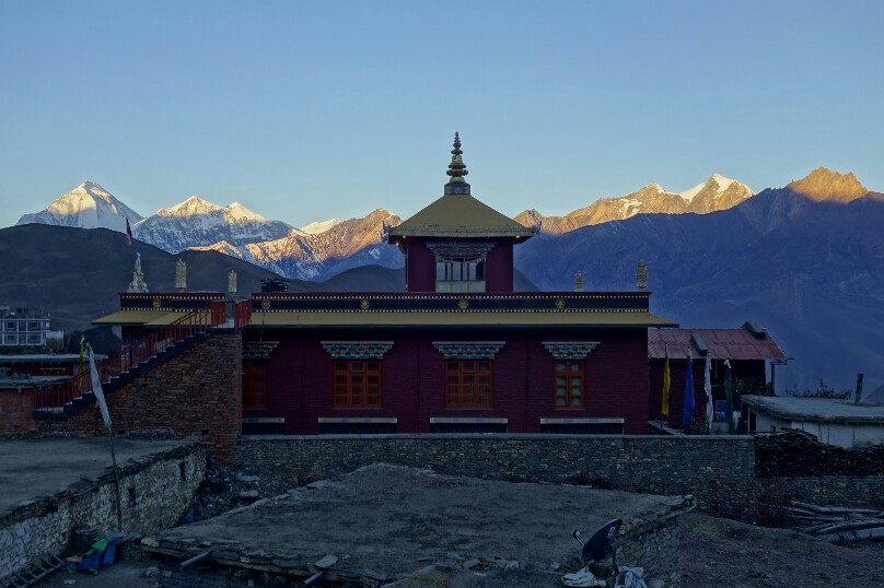
Nepali pilgrims bathing in the sacred fountains at Muktinath.
November 12th, Day 7; Muktinath, Upper Mustang, Jomsom.
I set out on the trail toward the villages of Jhong and Putak to explore these traditional Mustang villages. As I climbed away from Muktinath following a well beaten path and a series of red arrows (not the red or blue flags) I had the suspicion that my route was taking me a little deeper into Mustang than I’d initially anticipated. Soon I was 500m above the valley, looking back at the expansive views, and forward into a deep valley surrounded by rock towers and massive desert mountains. A couple of Nepali confirmed that if I went down and turned left at Chhuksang I’d reach Kagbeni….I was totally about to descend into the Forbidden Kingdom of Upper Mustang.
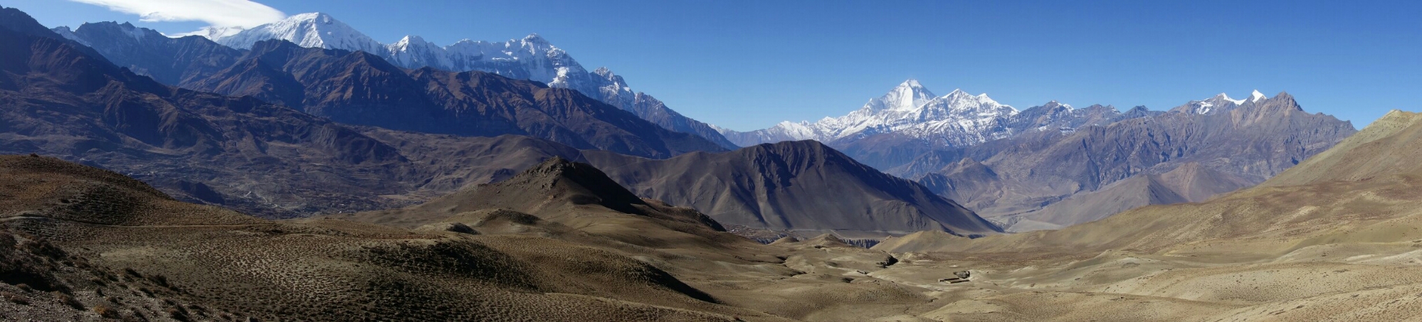
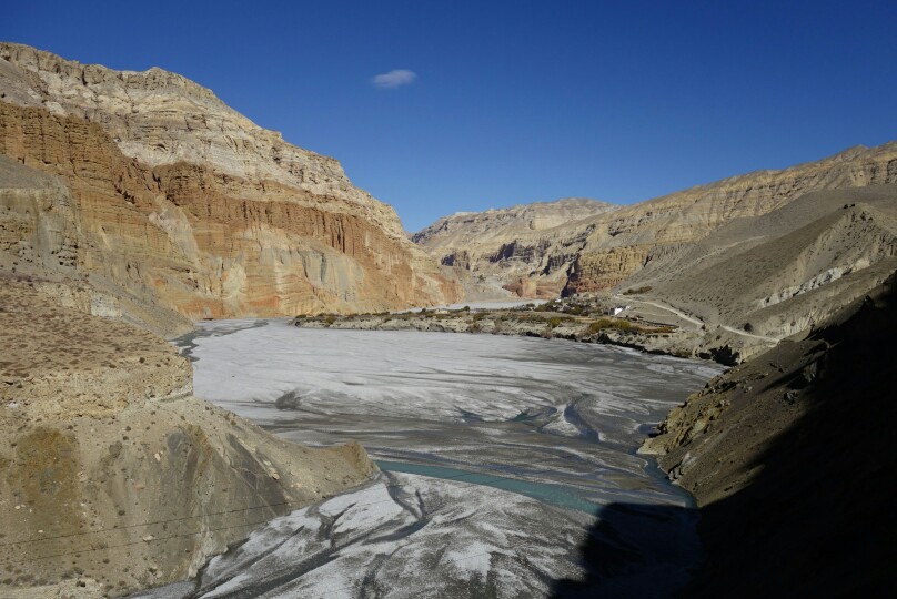
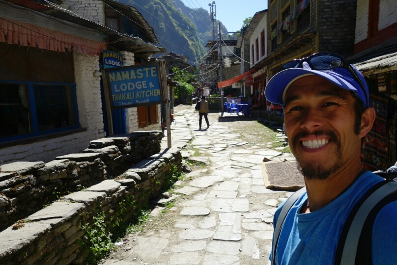
I descended the steep trail past several small groups, finally reaching the small village of Tetang with its terraced hillsides, mud huts, gompas and isolated silence. After another 45min I reached Chhuksang and the headwaters of the Kali Gandaki river. I turned left onto the road and began the long (2h) walk to Kagbeni. The surroundings were surprisingly arid and reminded me of the Native American reservations of the SW. Mudstone towers lined the road, deep canyons reached back from the river and views stretched for many miles. Finally after almost 15km I reached Kagbeni, exhausted. The forray into Upper Mustang had been a wonderful glimpse into a life style long forgotten. Kagbeni was interesting, but after Mustang didn’t have the same intrigue, so I quickly set off for Jomsom along the wind blasted dusty road. This was by far the most miserable section of hiking. 6km of dust storms in the wide open valley, so i was very excited to pull into old Jomsom and find a place for the night after my long day. Jomsom is the bustling hub of the circuit compete with airport, markets (in new Jomsom) and the bus stand. I was just glad to relax and take a load off, enjoying my first yak burger of the trip. 35km, 800m+, 7:00.
Sunrise from Muktinath over a temple with Dhaulgiri in the background.
Looking back from the high pass to Mustang toward Muktinath.
Descending into the Mustang village of Tetang, born of a different Era.
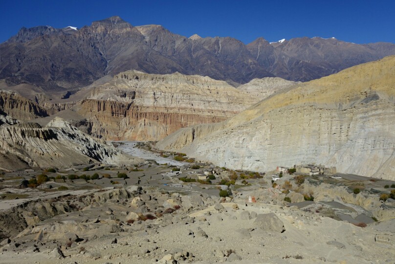
Looking back at the village of Chhuksang along the Kali Gandaki.
November 13th, Day 8; Jomsom to Kalopani.After some debating I decided to close the loop and walk the western section of the loop to Tatopani. From old Jomsom I headed up the hill following the trail on the east side of the valley. I made a short side trip to Hutsapternga Gompa(1:00), perched high on a hill with superb views of the valley. I stayed on the trail, bypassing Marpha, couldn’t handle more road, eventually reaching the Tibetan settlement at Chhairo (2:00). I paused briefly to listen to the school children reciting the morning prayer and talked with a few locals at the school.
The trail continued to climb and descend along the east side of the valley, avoiding the dust bowl and visiting numerous small settlements. The people all seemed much friendlier and more open, maybe because the new road has left them to a quieter and less tourist riddled life? Views of Dhaulgiri are phenomenal on this part of the circuit, and I mostly had the trail to myself. After many ups and downs I finally rolled into Kalopani/Lete and the See You Lodge. This town has one of the better all around views on the circuit, Dhaulgiri behind and Nilgiri and Annapurna I across the valley. It’s a shame so many people skip the Western portion of the circuit. 27km, 600m+, 5:57.
Hutsapternga Gompa shining in the morning sunlight.
Dhaulgiri towering above the Kali Gandaki river.
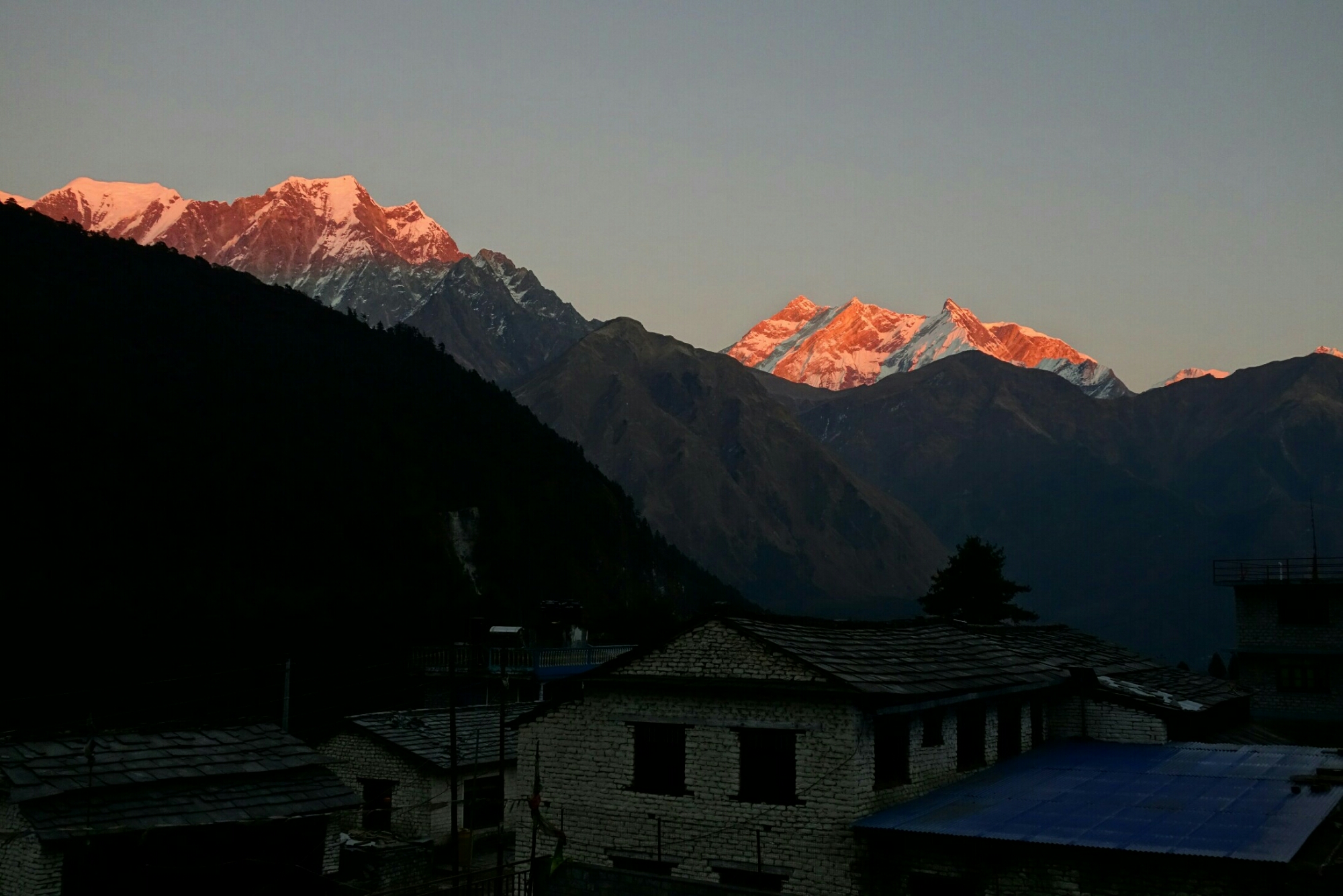
Sunset on Nilgiri and Annapurna from Kalopani.
Day 9; Kalopani to Tatopani, the end.
My last day on the trail, up and our early to avoid traffic on the first section of road to Ghasa. I then rejoined the trail East of the river for the rest of the day, avoiding the road again. Walking through the now lush forest was very pleasant as I passed countless small villages, a few waterfalls and lots of view points. I paused in Gharpad to enjoy some fresh oranges and guavas with some locals before descending into Tatopani. Tatopani was a small village with plenty of small markets, a nice hot spring and an interesting mix of Western and Nepali travelers passing through. It was a nice place to relax after my long days in the circuit, but not much more than a way station with fresh fruit.
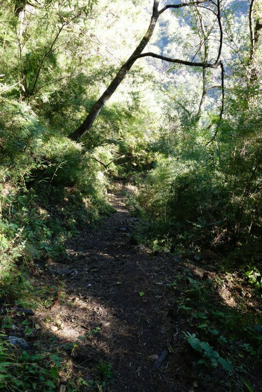
Lush forest enroute to Tatopani.
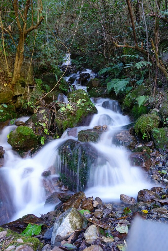
Nice little trail side cascade.
After 8.5 days of hiking I’ve reached Tatopani and the end of the Annapurna circuit. Up next a trip to Basecamp.
So ended my 9 days whirlwind tour on the Annapurna circuit. Full of amazing scenery, wonderful people, and some eye opening experiences. I’ll leave you with some final thoughts and notes before signing off.
NOTES;
Trekking on the Annapurna circuit is not a wilderness experience, you’ll see tons of other travelers, jeeps and motorbikes. In every village you can find both hot food and snacks to carry away. So technically you could probably carry almost no food and be fine (though you pay for it). It’s easy to simply fall in with the travelers and not meet the locals, so take the time to branch out.
I did the entire 190km loop in 9 days, definitely not recommended for most people. I’m extremely fit and I spent time elsewhere in Nepal acclimating. Climbing over 5400m Thorung La is no joke and should be treated with respect. My short time also only allowed me a few side trips, something many people would prefer to take more advantage of. Though I did walk the western part of the loop from Jomsom to Tatopani, something I highly enjoyed and recommend not skipping by using the bus. Lastly, always remember to look around and keep an open mind. You never know what each day and experience will bring, so try to soak in as much of it as possible. It’s a fantastic journey that has not been ruined by the roads, the experience has just changed a bit over the years, but in the end it is what you make of it. Stay tuned for the next blog detailing my quick adventure up to Annapurna Basecamp.
Running the trail down from Ice Lake with. Annapurna in the background.