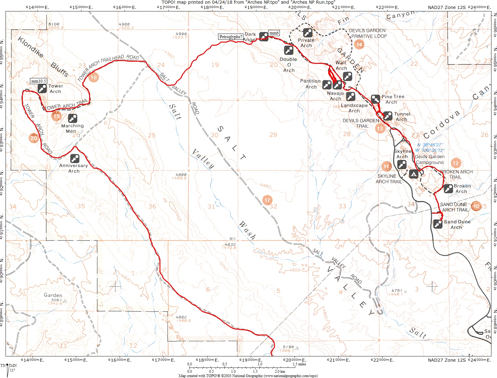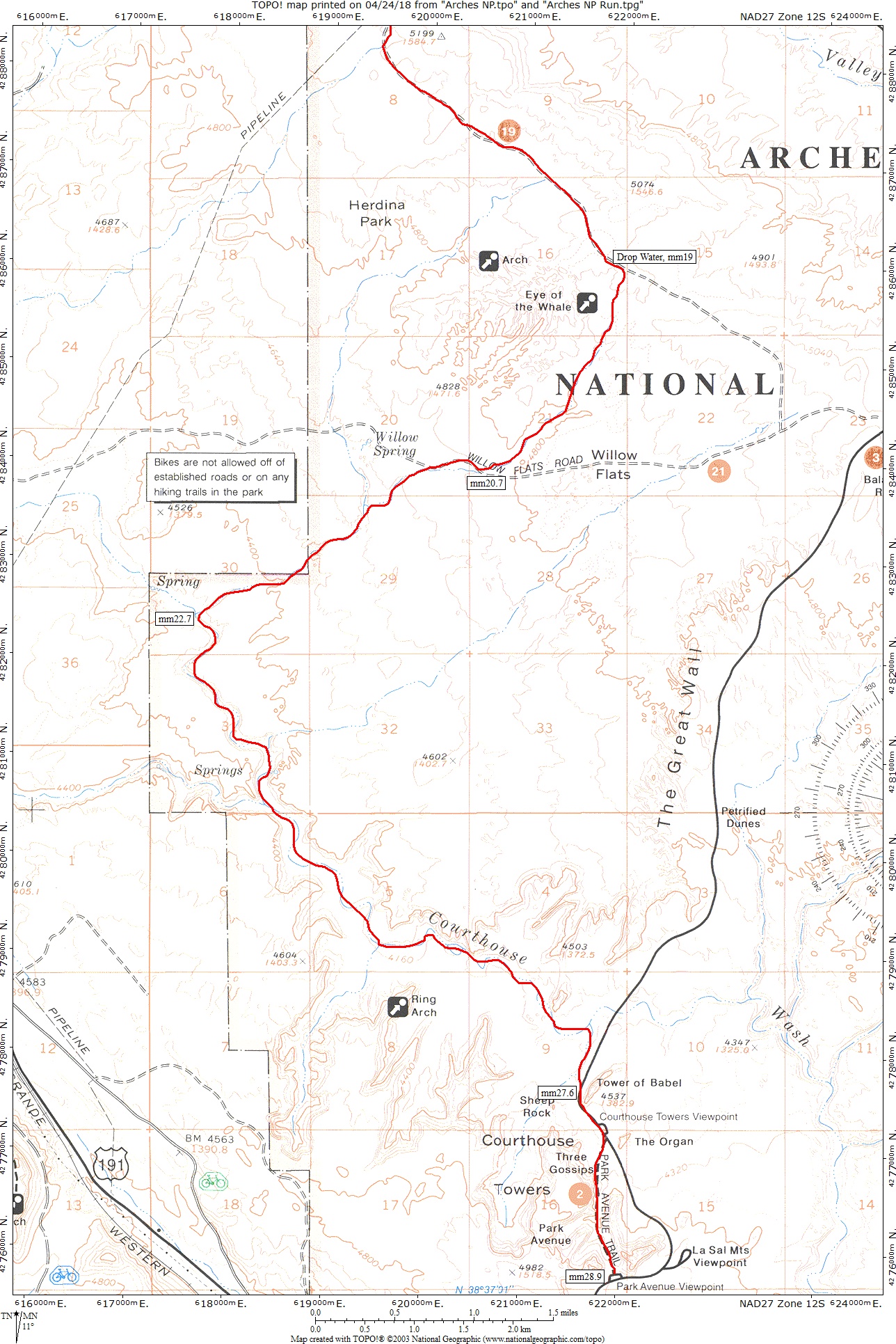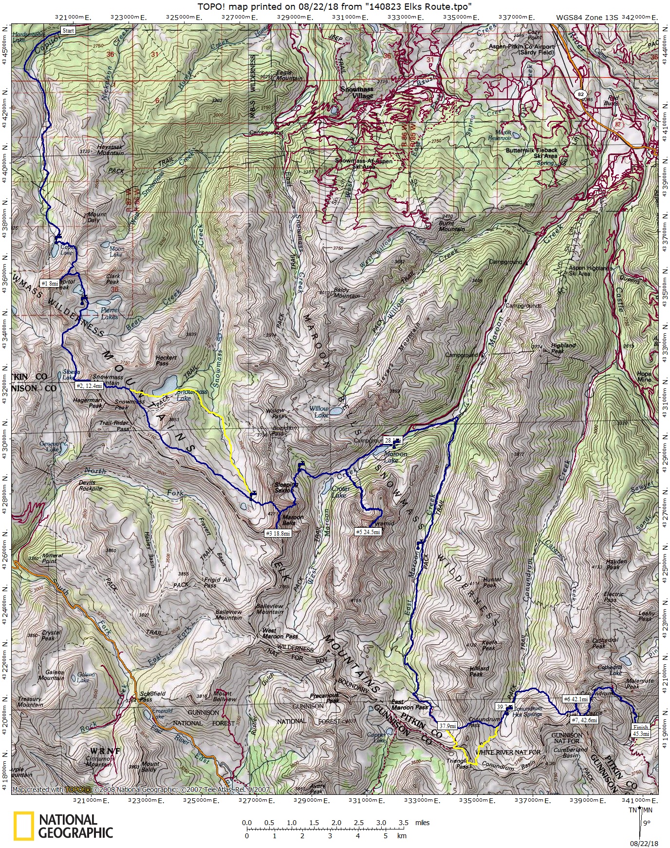
Map of my route through the Elks, with a few deviations.
“We do not conquer mountains, nor tame the elements. The true conquest lies in penetrating those barriers of self-imposed limitations within our minds.” – Sharon Wood (1st North American woman to climb Everest)
Oh great fresh snow on the scree, my favorite…as I stared up at the back side of Castle and Conundrum peak, rolling my eyes at the continued absurdity of the route commonly known as the Elks Traverse. I’d been awake and on my feet for almost 28hours at this time and what an adventure it had been… but let’s take it back a few years to where this stupidity all began.
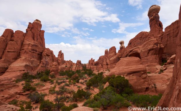
I’ve always loved climbing mountains, gasping for breath in the thin crisp air, panoramic views, the technical challenges of route finding and scrambling. All of these things draw me to the mountains, but mostly it’s the adventure of delving into the unknown, into a landscape where you are the guest and not in charge, where you can go for hours without seeing another soul because no one else in their right mind would come this way. The mountains are a place I go to both escape and to find myself. The Elk Mountains near Aspen are no exception, a rugged group of crumbling peaks, containing seven of Colorado’s vaunted 14ers. The difficulties of these peaks is what initially drew me to them; from the Knife edge on Capitol to the ‘Deadly’ Bells traverse, and the crumbling ledges of Pyramid peak… the 14ers of the Elk Mountains are among the most difficult in the state.So naturally it wasn’t enough to just climb them, but could I link them all together in a single push?
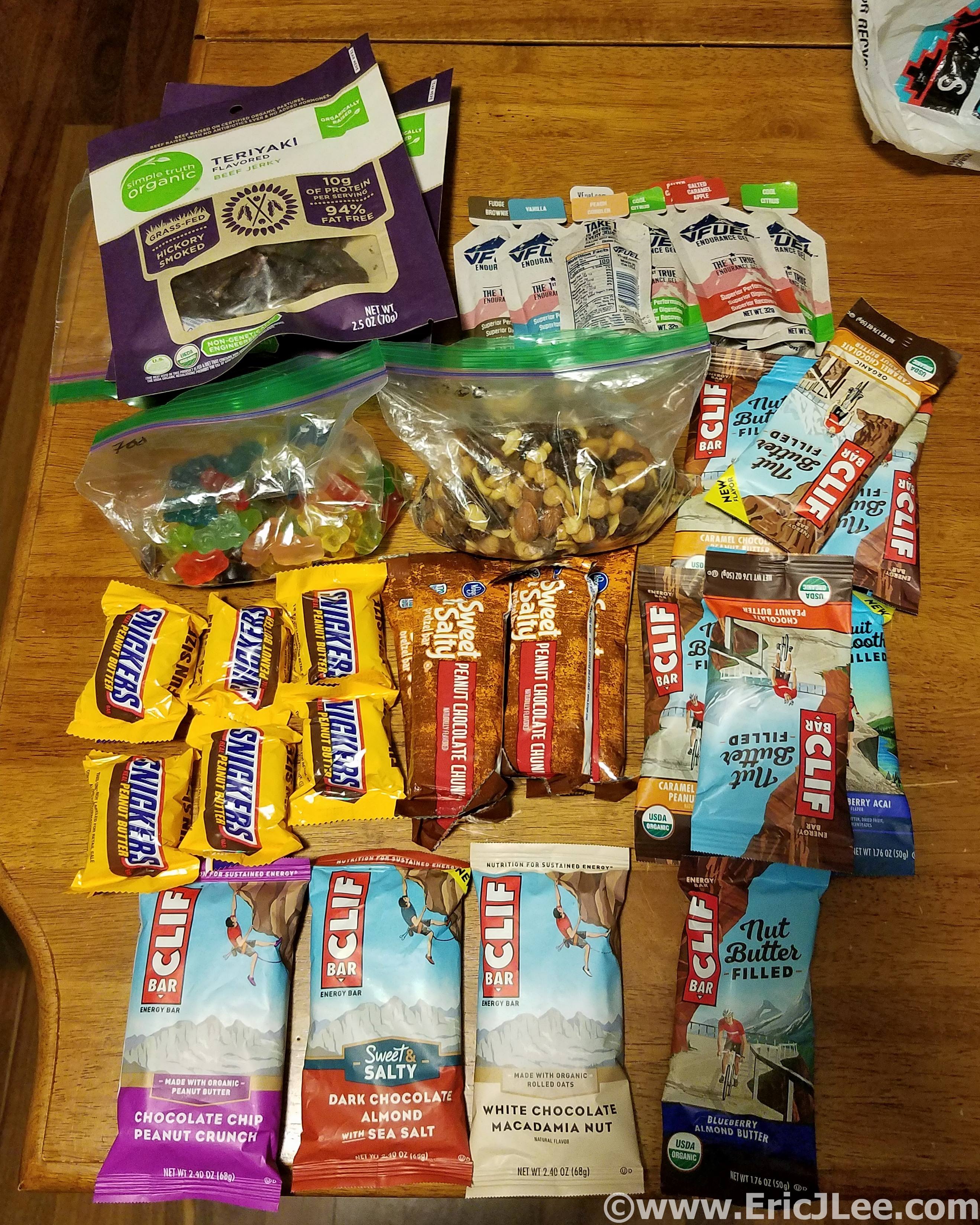
This is what 7000calories looks like.
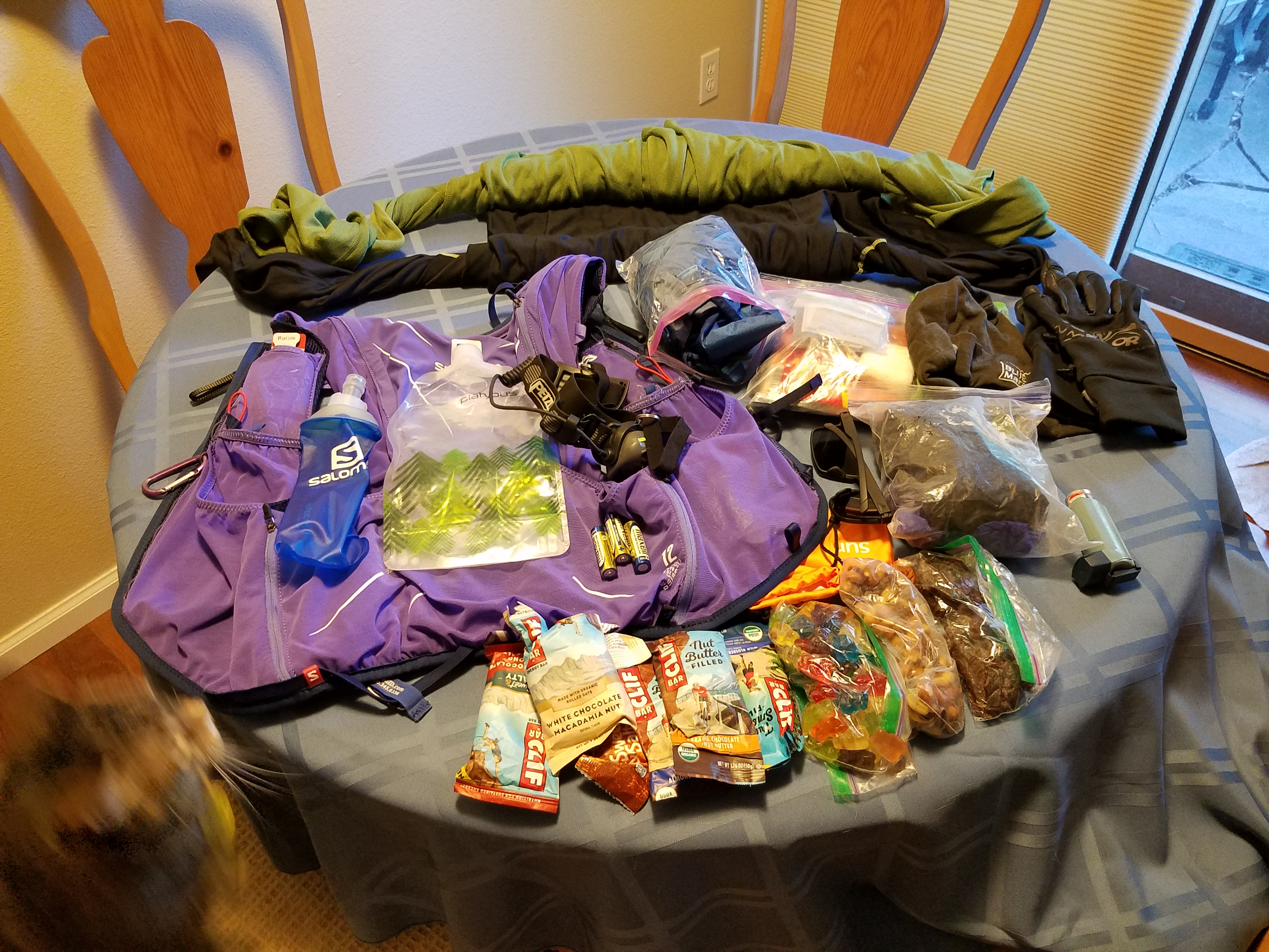
All my gear for the Elks traverse.
Over the past several years I’ve scouted various connections; running the sections, wandering through some scary and sketchy no-go routes, but eventually finding reasonably passable lines between all the peaks.In 2015 I made a horribly misguided attempt to link Pyramid to Capitol (it snowed and rained all day so I bailed), then in 2016 I linked Capitol through the Bells in a solid 15hour push, so linking them all together started to seem feasible. Fast forward to 2018, with no distinct summer plans other than to play in the mountains I was keeping a keen eye on weekend weather windows in hopes of finding a time to make an attempt at the linkup. Finally on the weekend of Sept 8th-9th the weather looked good enough, so I called up a friend Jeason to join for the first section and help with the car shuttle and we were set to start at 4am on Saturday…oh boy, here goes nothing.
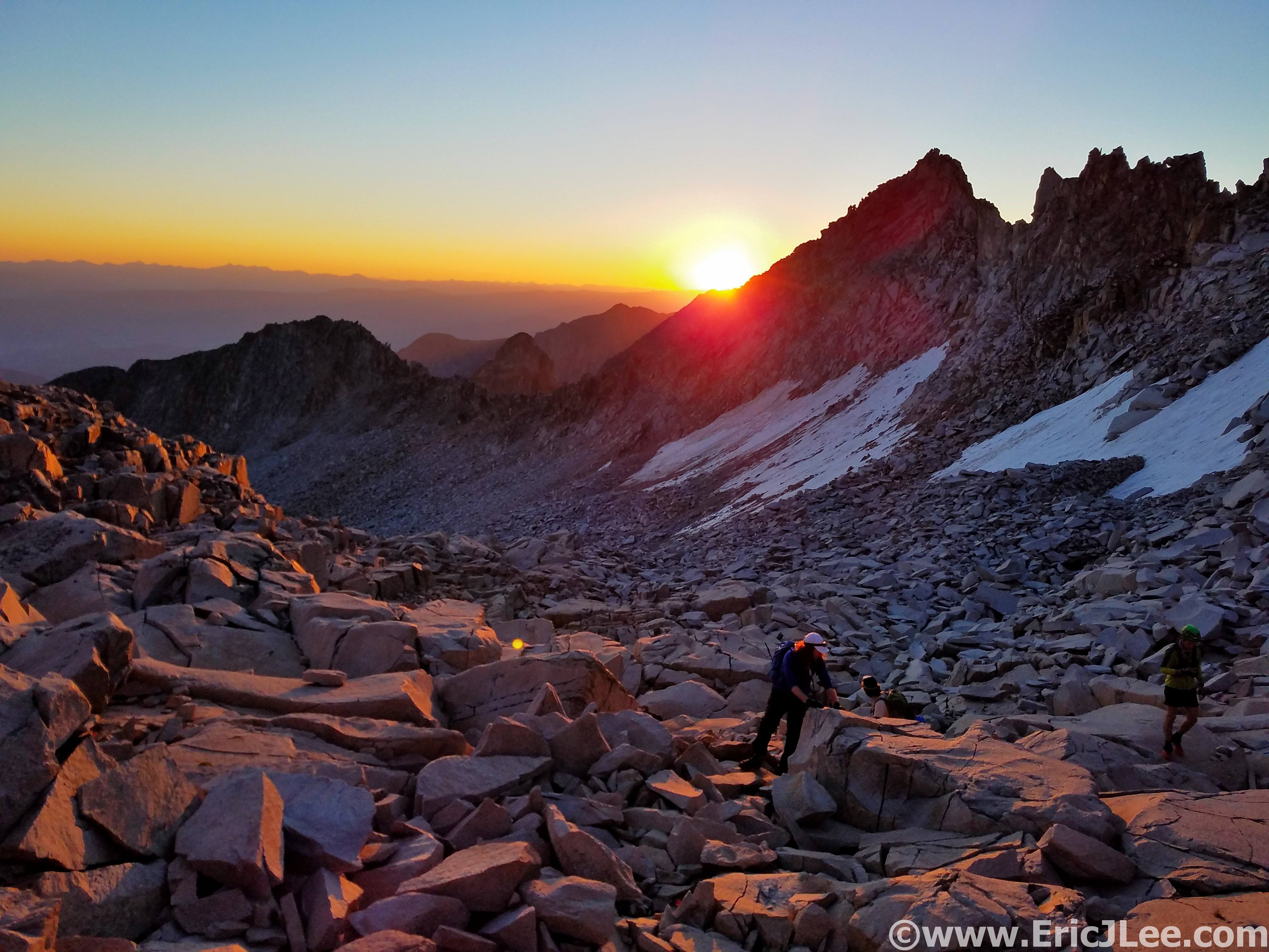
Sunrise on our way up Capitol Peak.

Capitol Peaks knife edge and final ridge straight ahead.
We set off in the chilly morning air (410a) from the Capitol Creek TH just rolling along, jogging and chatting as we moved through the dark. As we ascended the switchbacks above Capitol Lake, the first hint of morning cast dark shadows across the tundra, and the horizon began to glow orange. The sky was completely clear and as we made our way up toward K2 the talus was finally bathed in warm sunlight, perfect. We scampered past a few groups, across the Knife edge, and up the direct ridgeline to Capitol’s summit (my preferred route, #1, 3:20). We had the top all to ourselves, and as I looked across the range it struck me that I could see all the peaks of the traverse…%#$ Castle was far away. Well, no time to waste, from here on out the route is mostly off trail until reaching Maroon Lake.
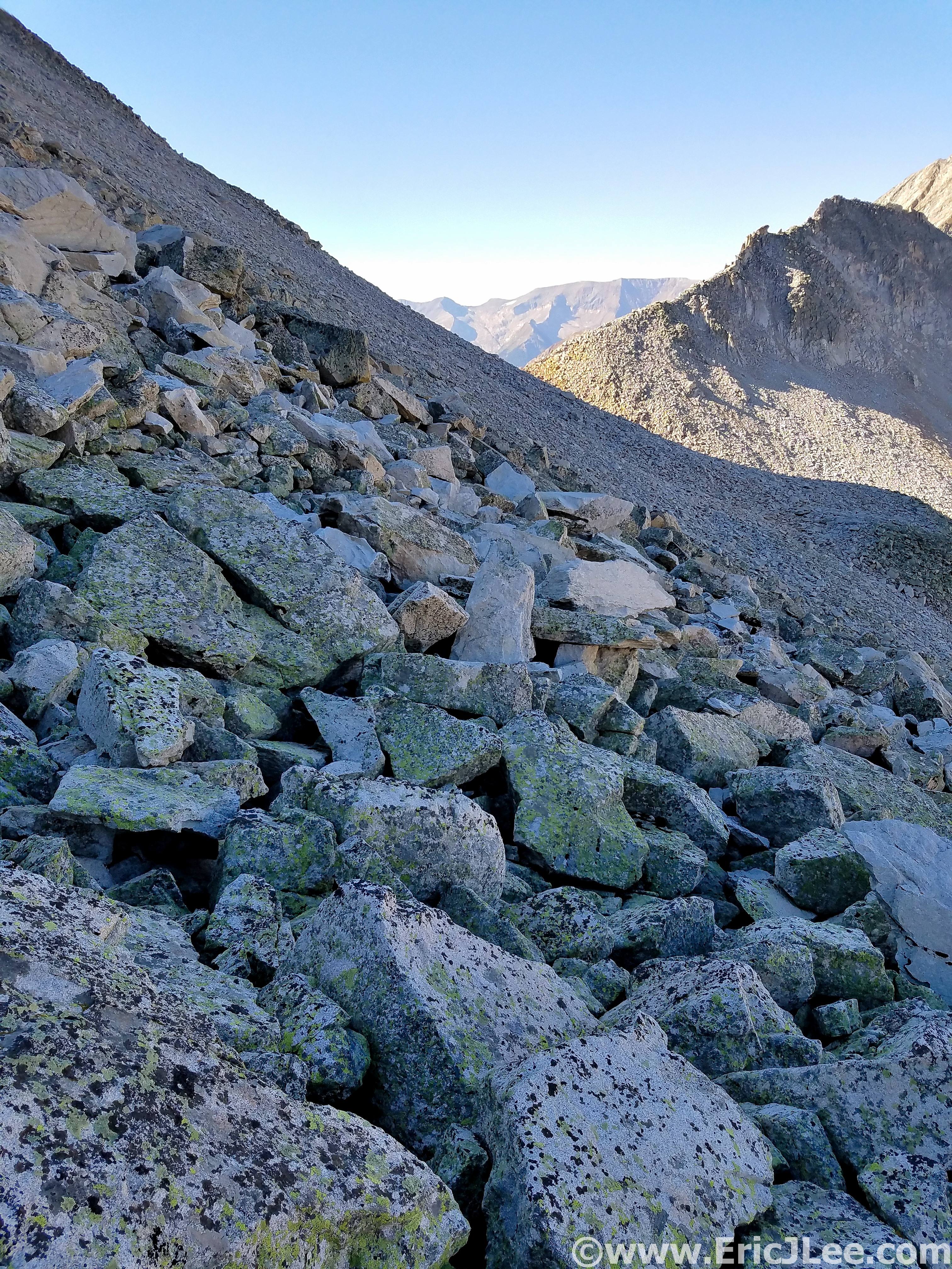
Looking down across Pierre Lakes basin, miles of talus.
Back across the Knife edge, down the scree, we banked a hard right dropping into the scree chute that is the Wandering Dutchman couloir. After slip sliding our way down the class 2-3 gulley we were faced with crossing Pierre Lakes basin, several miles of rarely traveled scree and talus that separates Snowmass from Capitol Peak, bounded by the heinous cliffs of the Snow-Cap Ridge. Thankfully I have the route across the basin pretty dialed so Jeason and I made quick work of it (filling our water along the way), soon arriving at the base of the most hideous part of the route. The class 3-4 shit slope that leads to the Snow-Cap saddle and allows passage to the West face of Snowmass, a necessary evil.
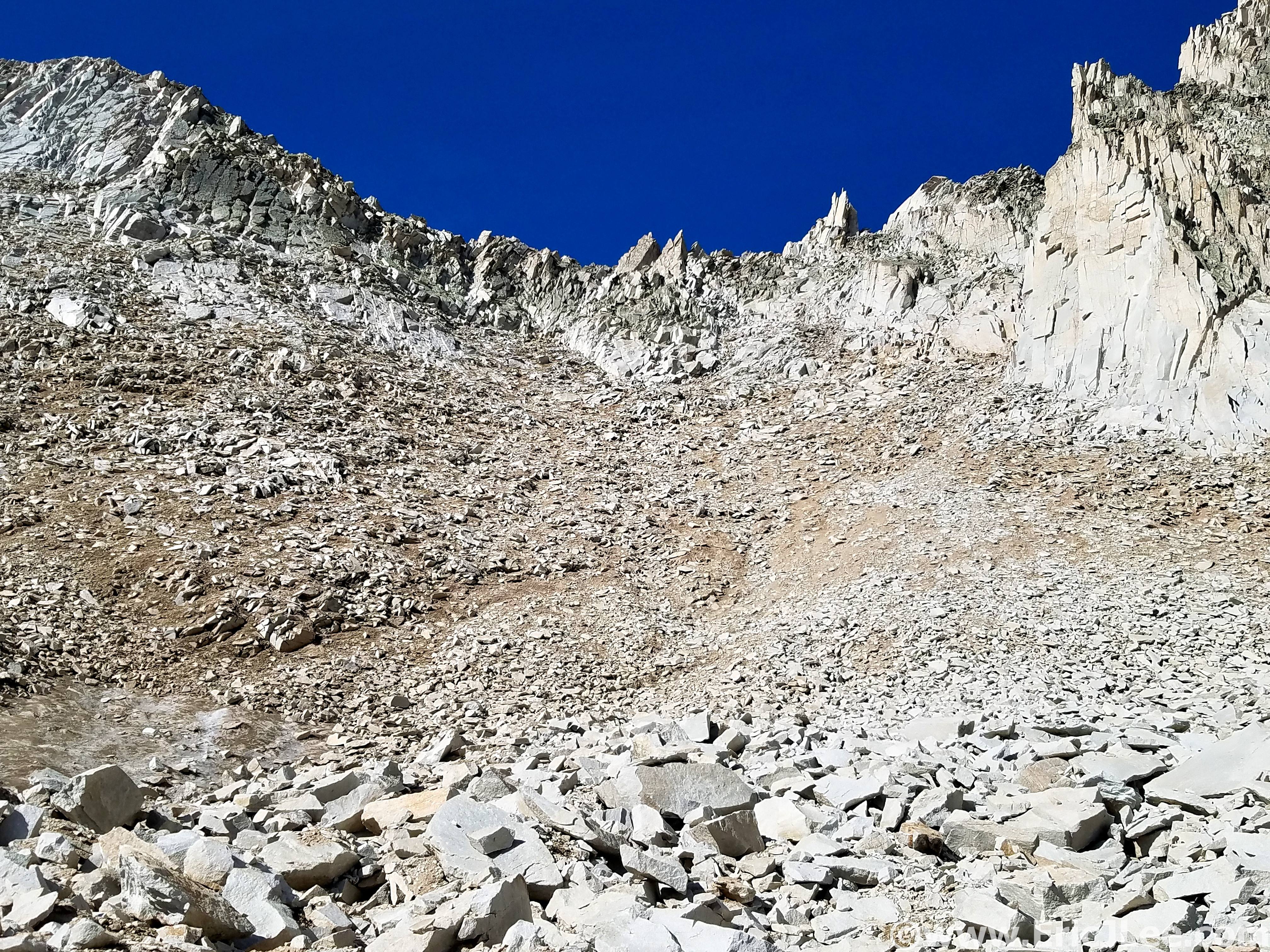
Looking up at the Snow-Cap saddle, all the choss.
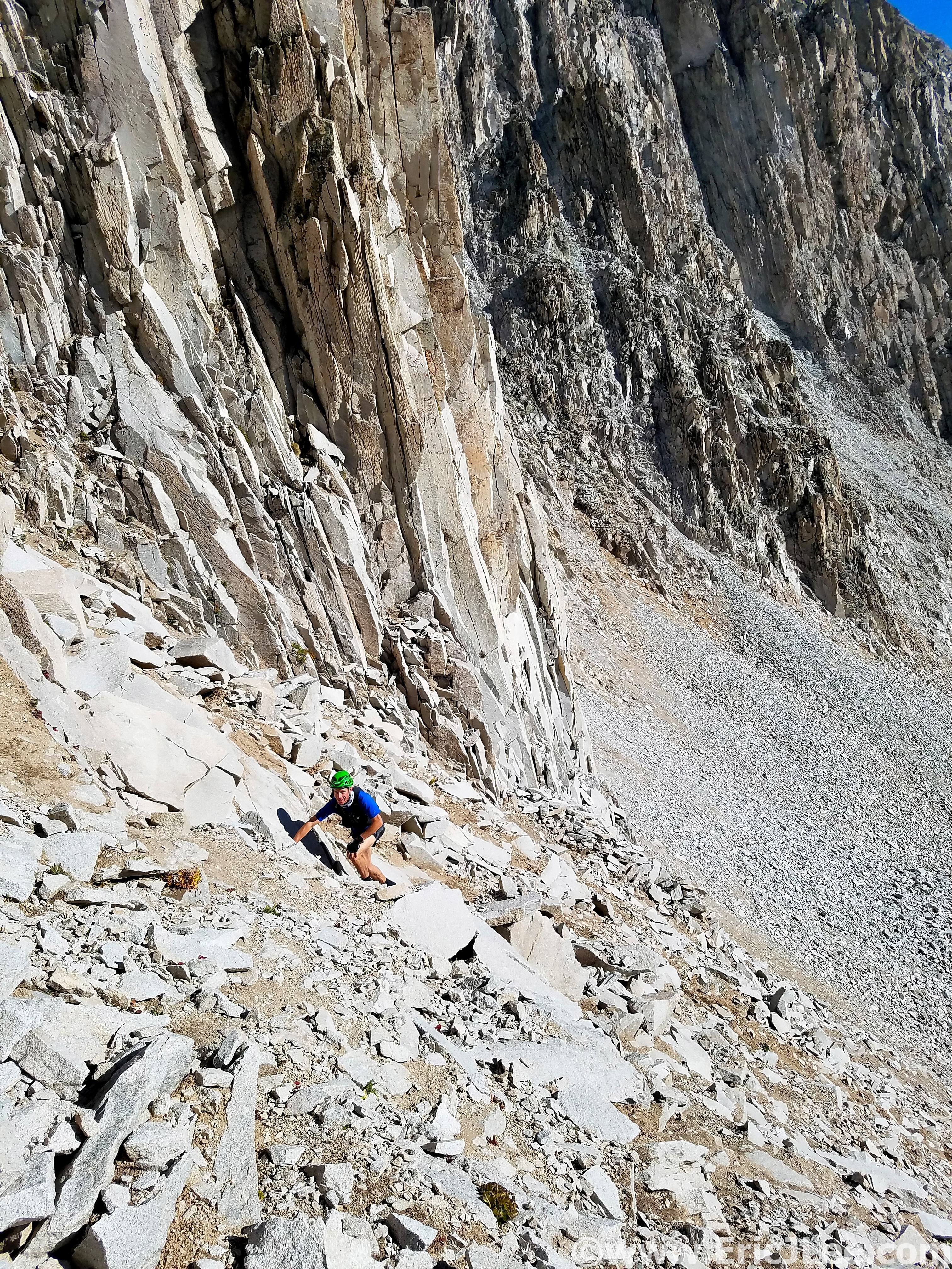
Crawling up to the Snow-Cap saddle, its that shitty.
We staggered ourselves and crawled (literally) our way up and over the saddle then rock hopped around to the West ridge of Snowmass Mountain. I felt like I was moving in slow motion up the ridge, but we hit the summit in 7:00 (#2), not bad considering the effort and terrain. The weather was still spectacular, so we quickly jogged off down the ridge, and descended the open scree and slab face formerly known as the ‘snowmass’. I made a last minute change that rather than take the high route over the subridge that I’d descend to Snowmass Lake, grab water then use the trail to traverse around to the back side of the Bells, approaching from below. This would allow for a water refill and also more oxygen, as I wasn’t feeling very strong above 12k.
The talus traverse around to the West Ridge of Snowmass.
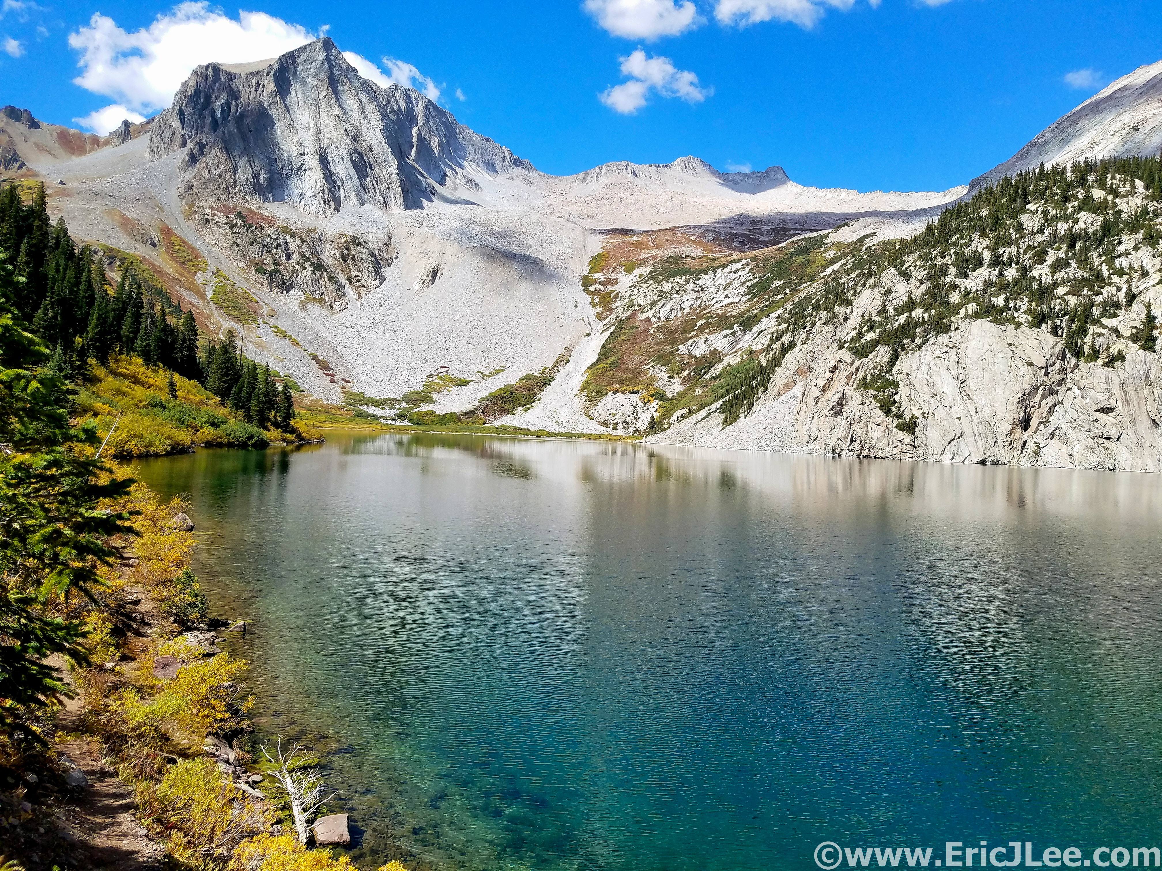
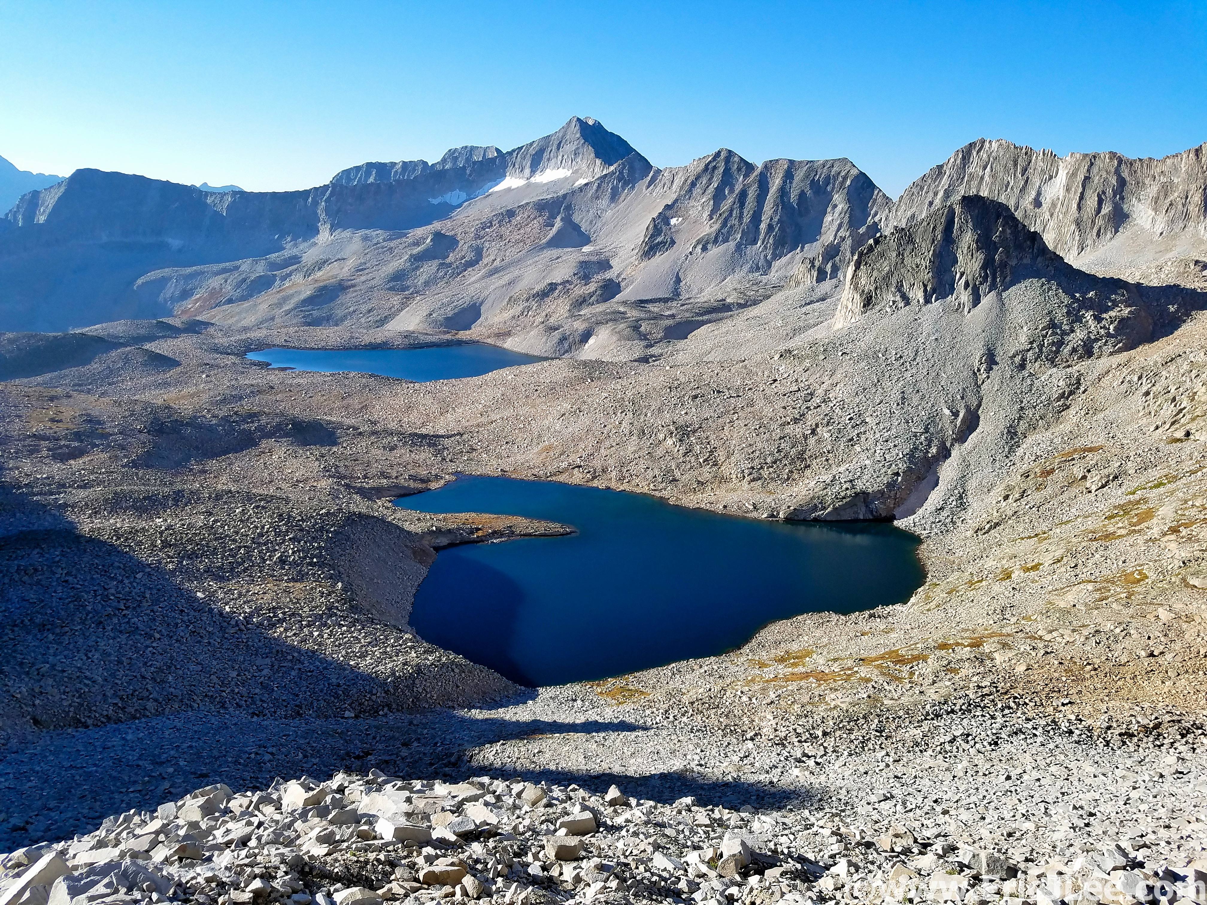
View from Snowmass Lake back toward Snowmass.
The trail section over to the base of Buckskin felt really good, but before I knew it I was bushwacking my way up social trails towards the backside of the Maroon Bells. At first the travel was easy going on game trails (as I’d remembered), but soon I found myself traversing a bit too high above the valley and bushwacking through willows, ug. At last I arrived at the base of the Gunsight couloir and North Maroon, though with a slightly different plan this time. I took off at an ascending traverse around North Maroon, popping out right at the start of the Bells traverse, perfect! I’ve always enjoyed the traverse, as the climbing on the most technical sections is solid, but definitely in the low 5th class range. As I neared Maroon Peak I realized that the lingering snow was definitely going to be an issue, forcing me to tiptoe very carefully up the slick ledges to the summit (#3, 11:10).
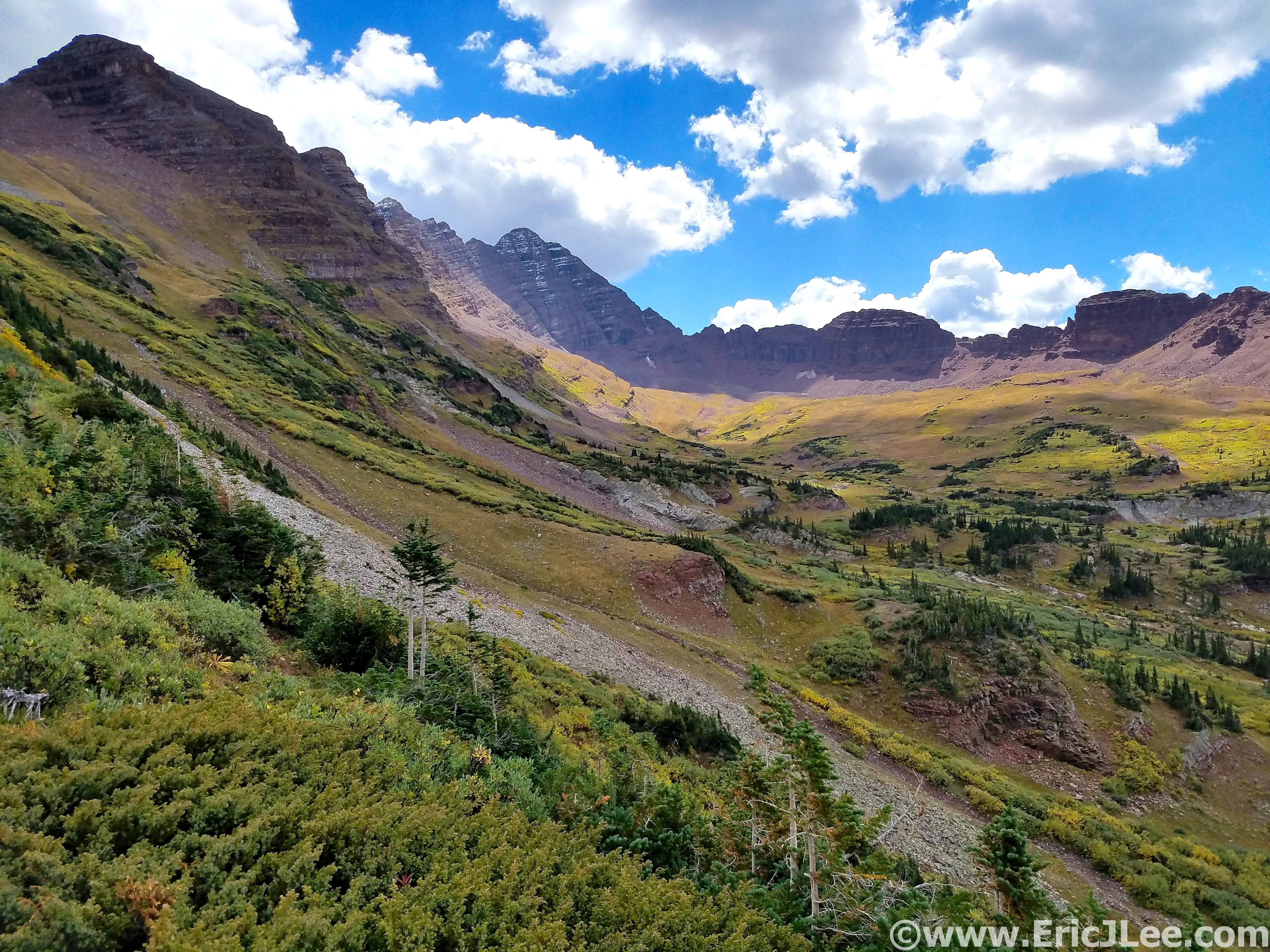
Looking up the valley toward the backside of the Maroon Bells.
Looking up at the Gunsight (left) and North Maroon (middle).
Then, as per my plan, I set back out across the traverse again, this time getting to upclimb all the technical sections, making it back to the summit of North Maroon in just 46min (#4, 12:00). It was a quiet afternoon on the mountain as I began my descent of the standard route on North Maroon Peak, hopping around a few wet and snowy sections, losing the trail a few times but finally reaching the Buckskin Pass trail and the Crater lake junction. I’d be lying if I said that the ascent of Pyramid Peak didn’t scare me, but looking at my watch I knew I had about 2hours to get as much of the ascent done before things got dark…no time to waste.
View of South Maroon from the traverse, a little snowy.
Looking down the valley I climbed up to connect from Snowmass.
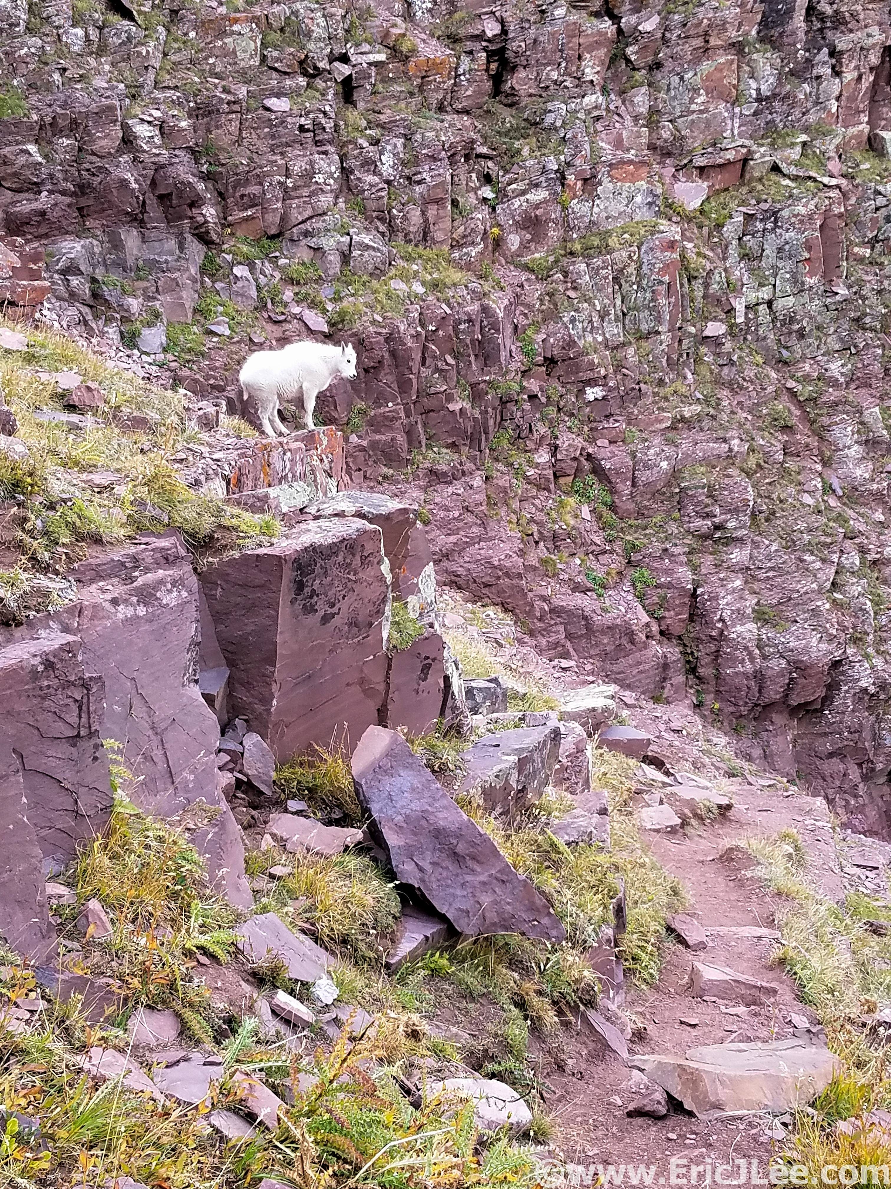
Making friends on the descent of North Maroon Peak.
I settled into a power hike up the very good climbers trail into Pyramid’s upper basin, feeling sluggish, but making good time. As I began to crawl my way up the dirty gravel slope to the saddle at 13000ft the evening light began to wane (15:20). I glanced up at the maze like upper slopes of Pyramid, well, here we go. As I began to scramble across the ledges the final light of the setting sun faded away and I was left with just my narrow headlamp beam, the occasional cairn and my memory of the route. To my surprise I soon found myself on the summit of Pyramid Peak (#5, 16:10). The descent went surprisingly well, and though the talus and scree was slow I made my way back down to the climbers trail without incident, very excited to be back on a trail again and able to jog a bit.
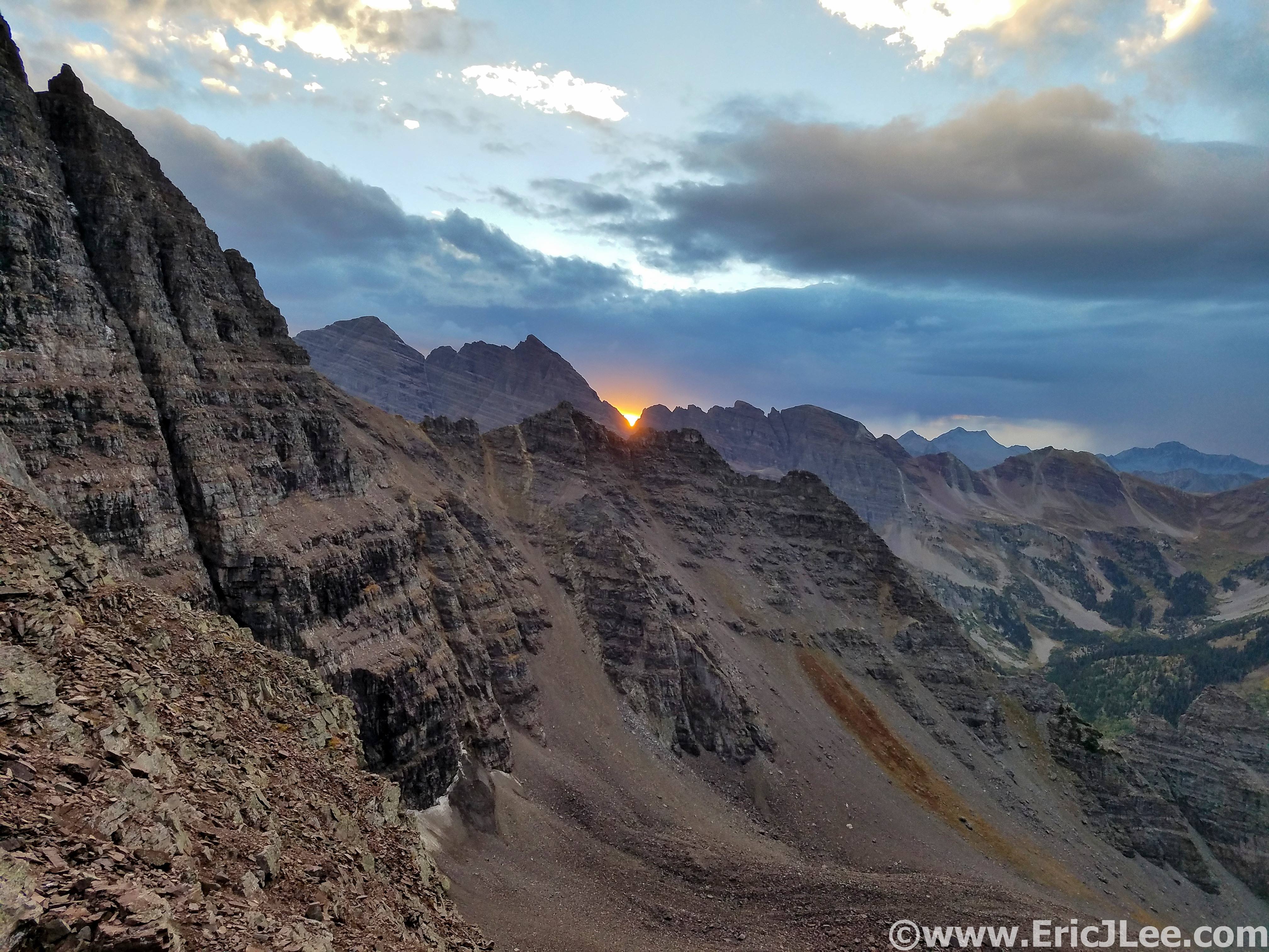
Sunset over the Bells from the shoulder of Pyramid Peak.
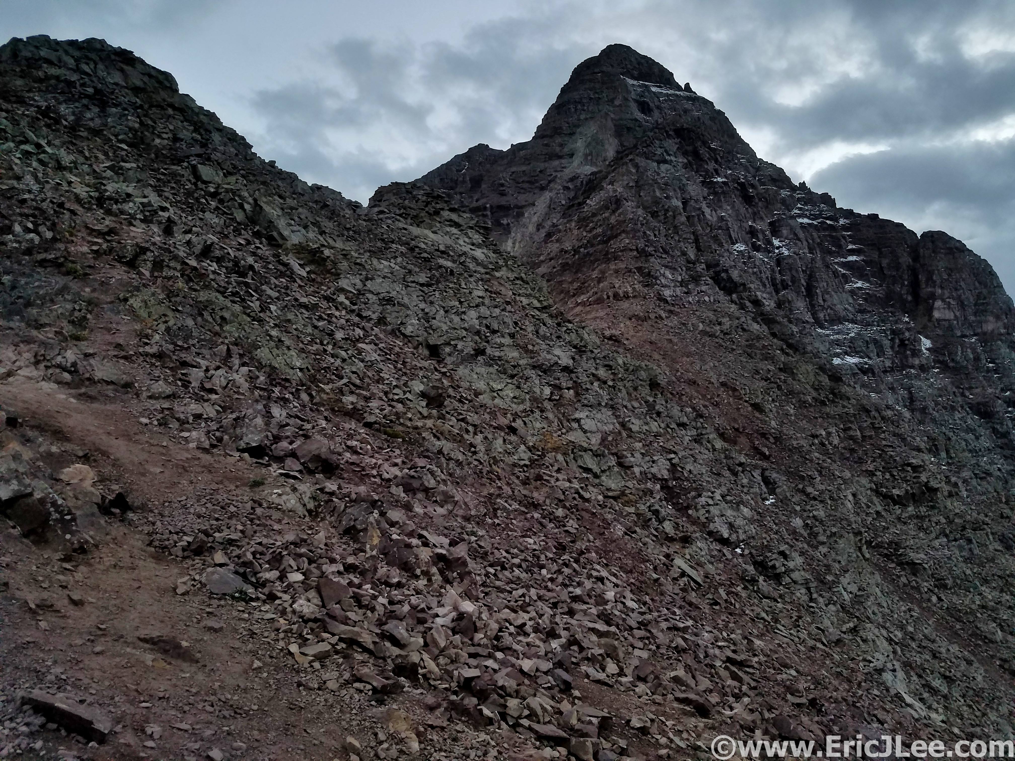
Last light as I climb my way up toward Pyramid Peak.
After a quick stop at the oh so quiet Maroon Lake TH to fill water and use the bathroom (19:00), I jogged off into the lonely darkness. I power hiked and yogged my way slowly up East Maroon creek, occasionally catching a few sprinkles, enjoying being able to move without too much thought to each foot step for the first time all day. As I ascended toward treeline a soft rain began to fall….then it picked up to a steady rain. I threw on my rain gear hoping for a passing storm, but no such luck this night. Above treeline the driving rain muted my headlamp and I lost the trail several times in alpine meadows, but I finally got myself up to Copper pass, as a cold sleet pelted my jacket, which was struggling (but thankfully succeeding) to keep me dry. As I traversed the ridge to Triangle Pass the rain finally began to let up and out of the darkness came a sign marking the top of the pass, a welcome sight (25:05).
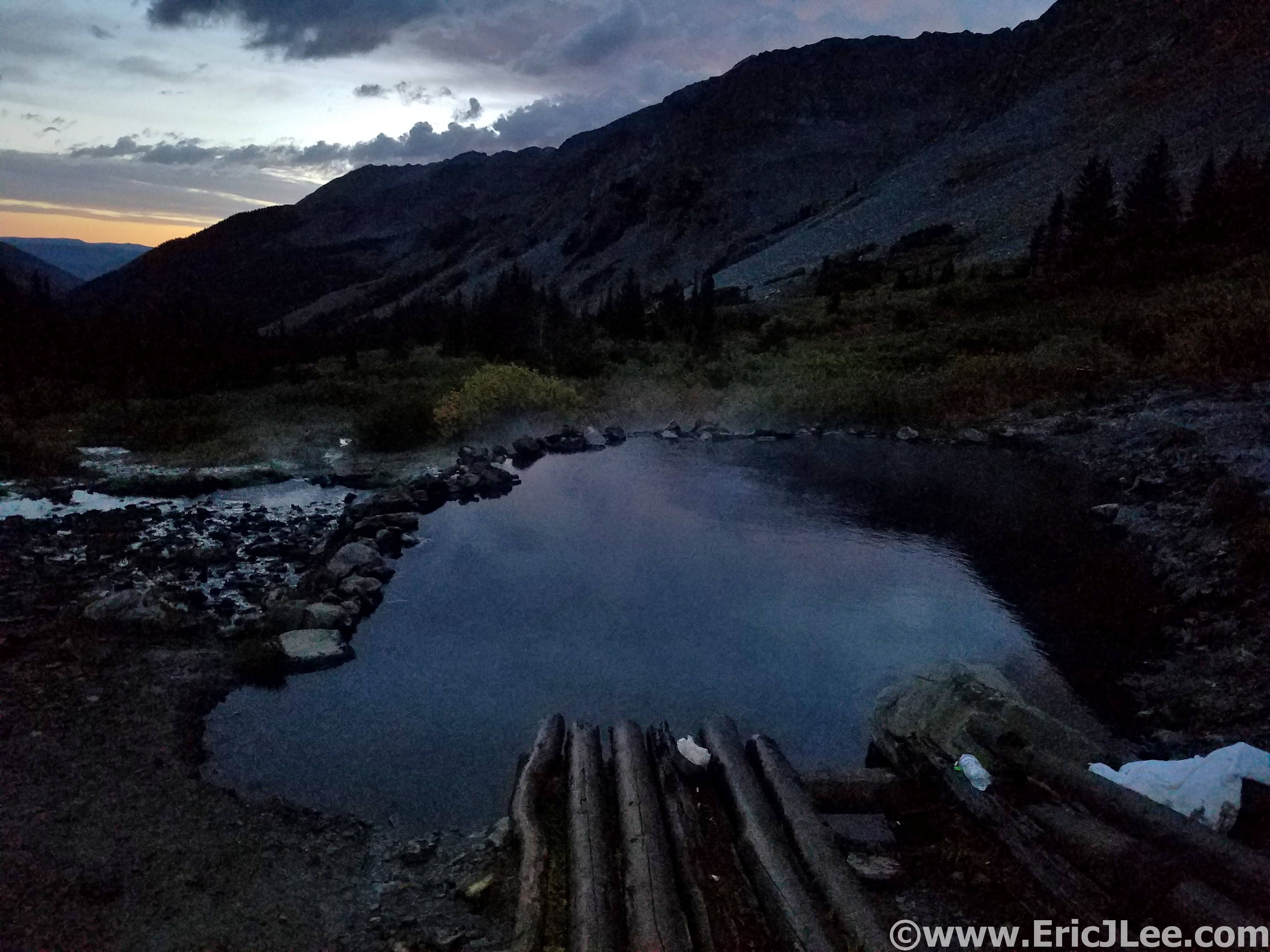
Morning hot springs action at Conundrum hot springs. It was a long night.
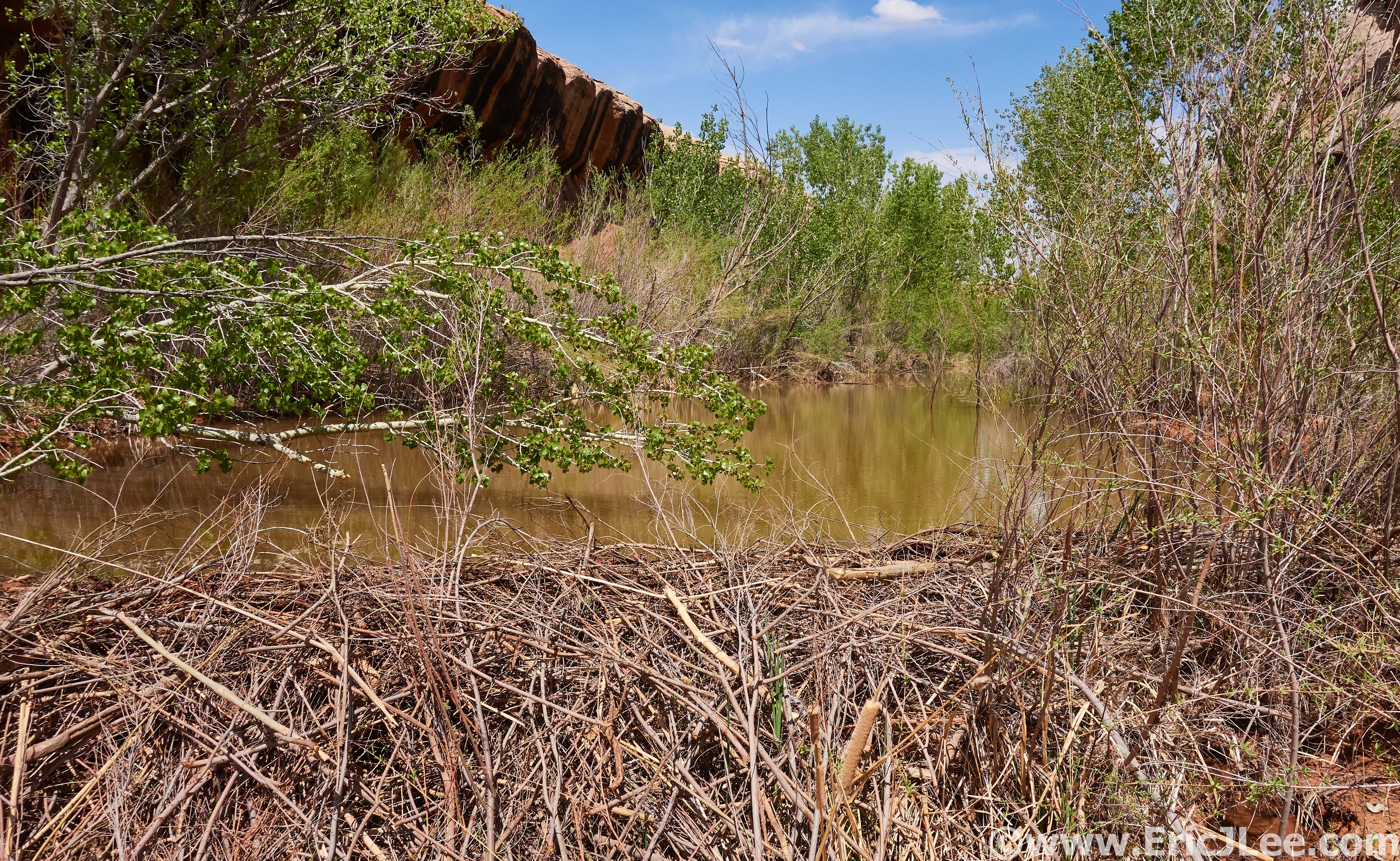
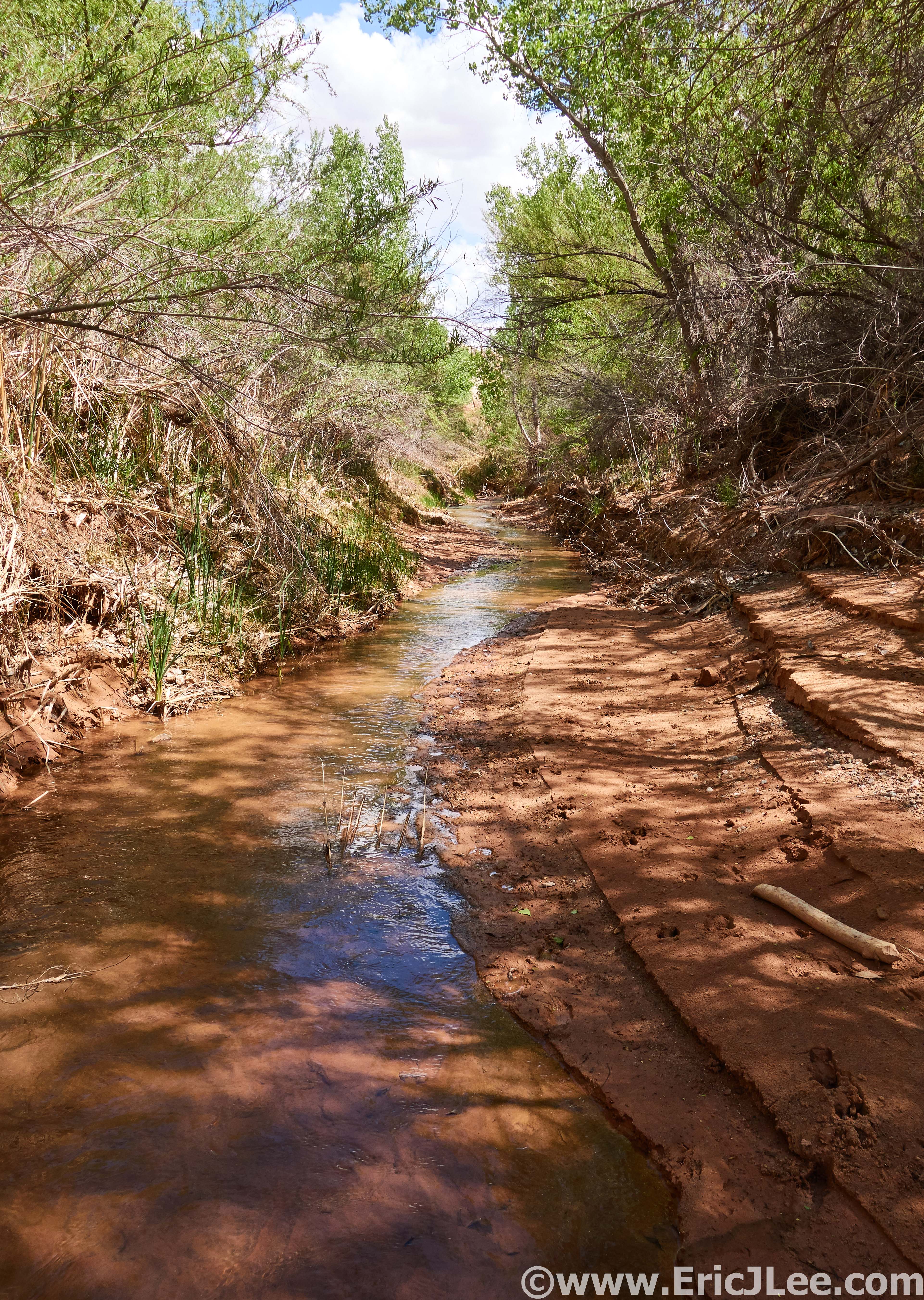
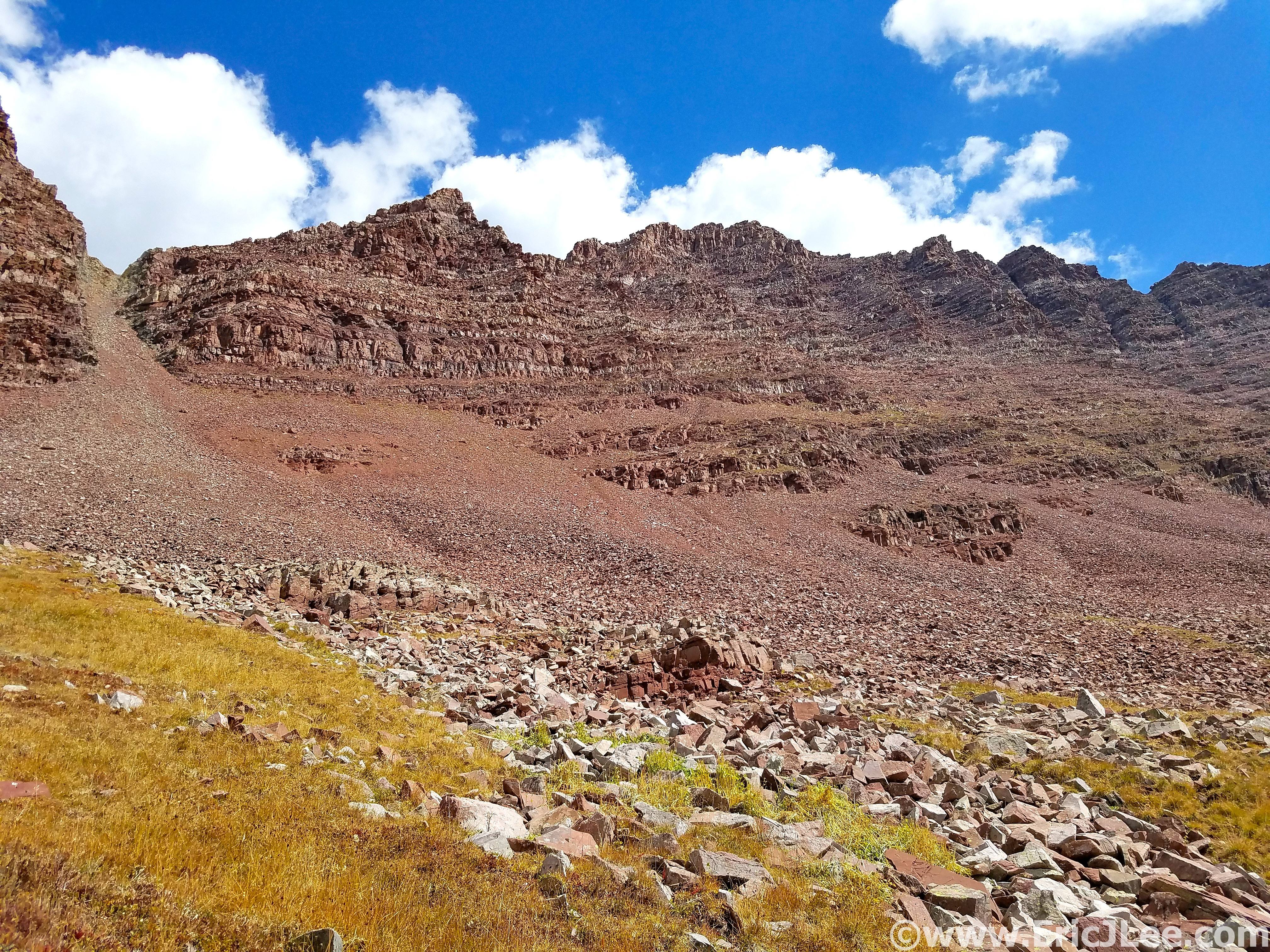
I jogged down the steep trail into the valley below, just as the first light of morning began to illuminate the horizon. I’d survived the night, it had been a slow and damp slog, but I was nearing the final two summits, I was actually going to finish this thing. My feet and legs were soaked from the night’s rain and all the willows, so I walked straight into Conundrum hot spring (shoes on) to warm up my feet (26:10), and damn did it feel good. As I ascended up the valley on the backside of Conundrum it became apparent that the adventure of the Elks Traverse wasn’t over just yet. The last 600ft of talus to the saddle was covered in a delightful glaze of fresh snow, YEAH, because miserable talus wasn’t enough fun, now there was a glaze of snow and ice on top.
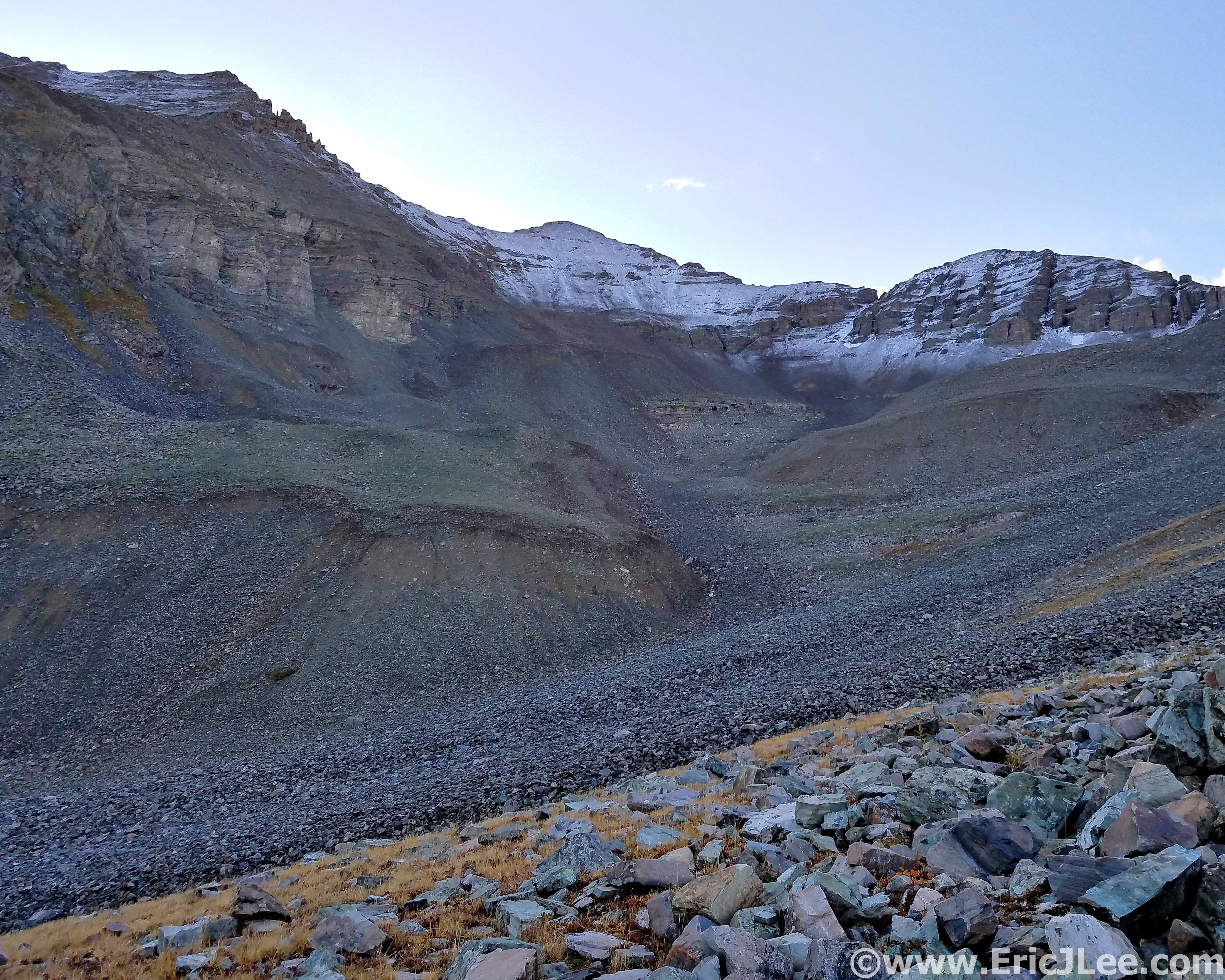
Climbing up more talus on the way to Castle and Conundrum, note the snowy talus ahead.
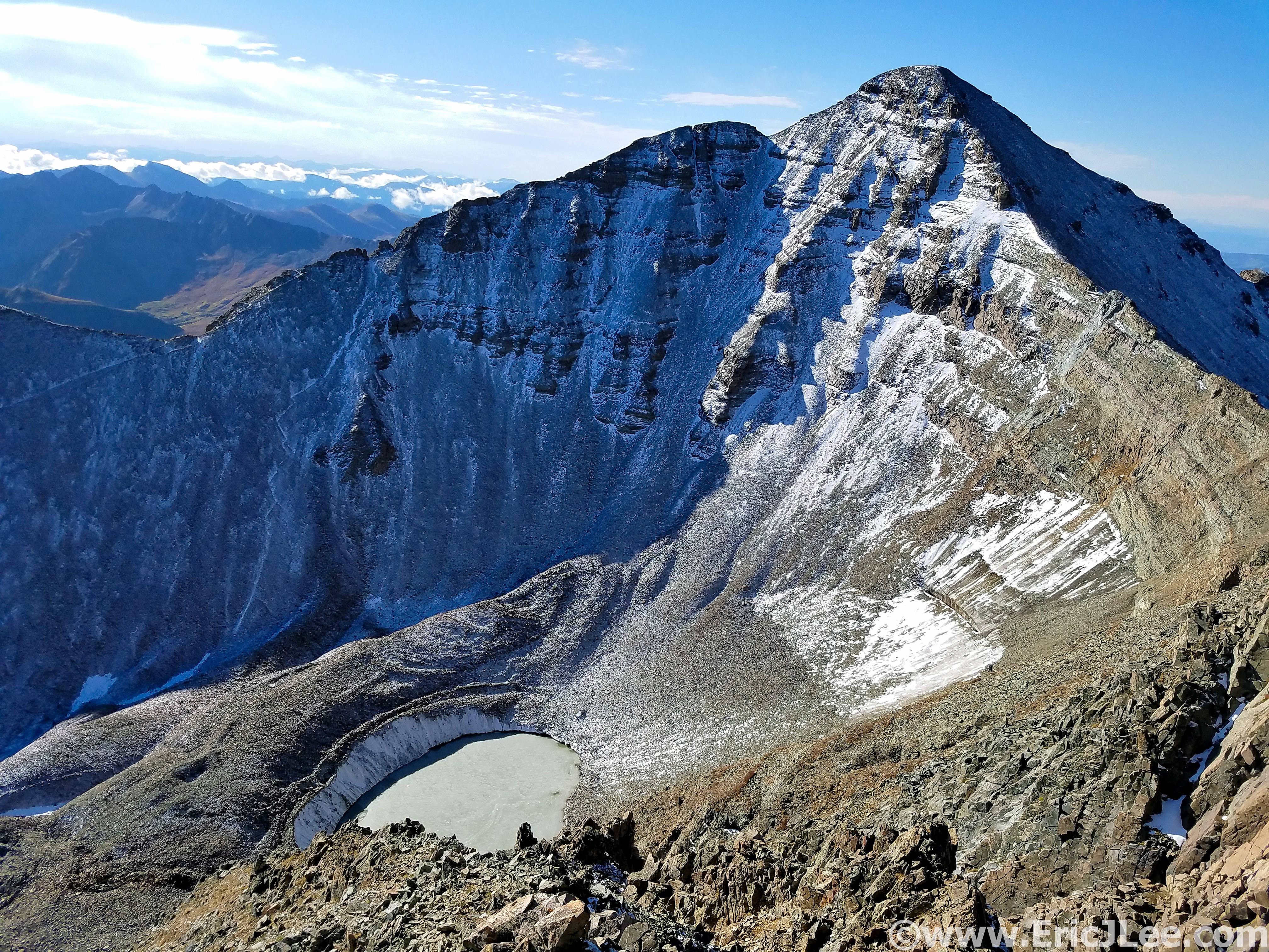
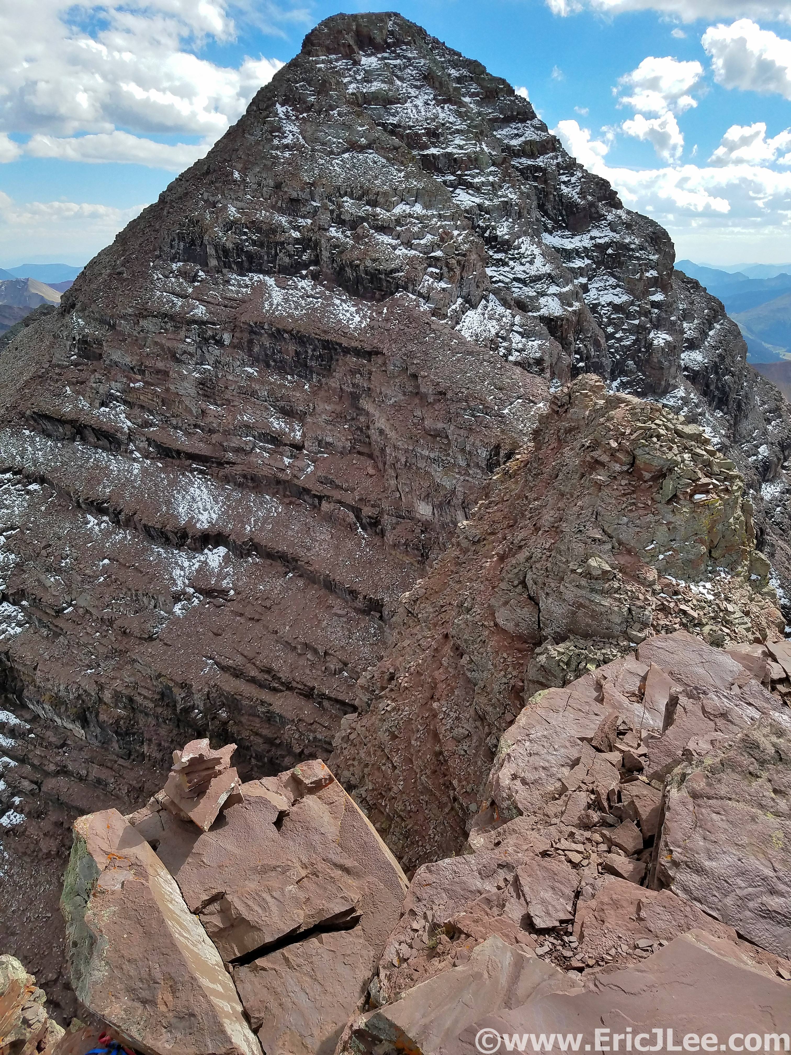
Staring at Castle Peak, my final summit, from the top of Conundrum.
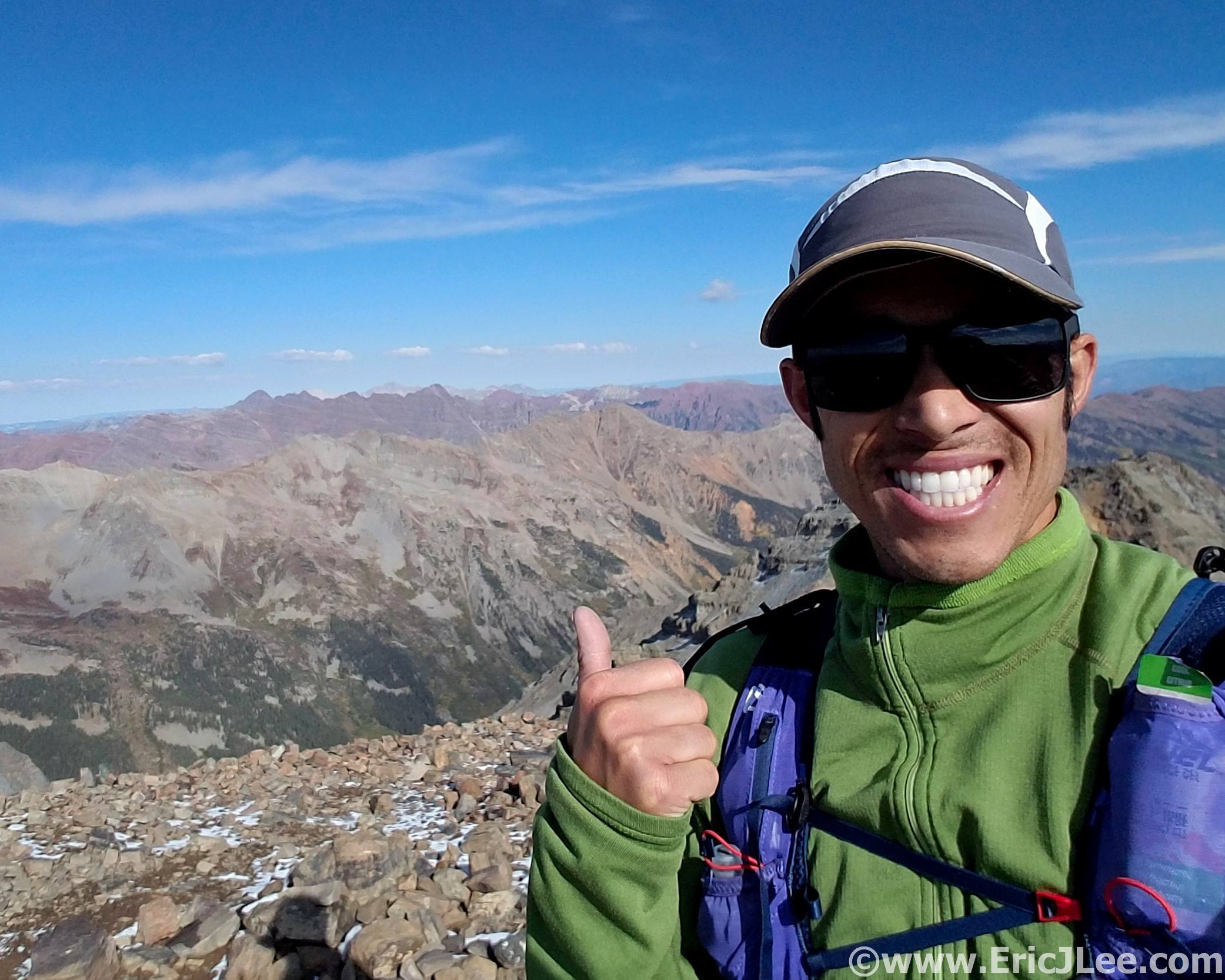
On the summit of Castle Peak, with the rest of the Elks over my shoulder, it was a long journey.
I slowly crawled my way up the final talus slope, one step up, slide 6” back down. When I finally reached the sunlight streaming through the saddle a wave of relief came over me, all the adversities were behind me, and all I had to do was follow the standard routes to Conundrum and Castle. I quickly tagged Conundrum (#6, 29:00) then cruised over to Castle Peak’s summit, topping out on the beautifully clear fall day, all by my lonesome on the summit. It was only fitting that after spending over 29hours in the mountains (mostly alone) that I’d have the final summit (#7, 29:30) all to myself. I hiked and jogged my way down the Castle Creek Rd and back to the 2wd trailhead, finishing my journey in 31:34:52, the second fastest time on the route and the fastest known unsupported time.
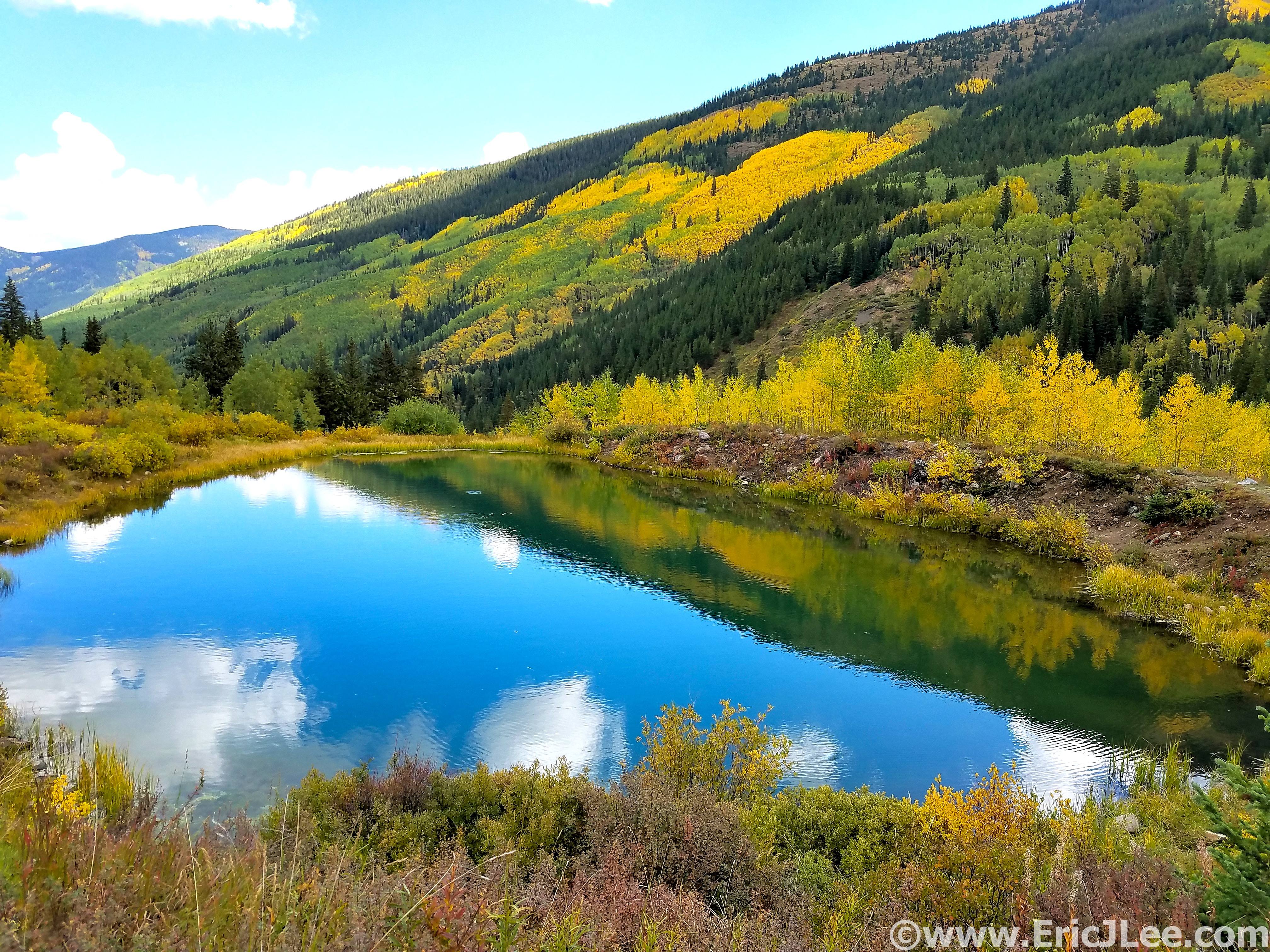
Quick stop along Castle Creek Rd to take in some fall colors.
Now over a week after finishing I’ve finally been able to absorb a little of what the journey meant. It was the culmination of many years of scouting and planning. A line that when done unsupported requires one’s full physical and mental attention to deal with the constant off trail navigation, endless miles of talus and scree, numerous class 4-5 climbing sections plus the rest of the adversity that comes with moving through the high mountains for 30hours+. The scenery had been stunning, I’d traveled through areas very few others have seen, experienced two sunrises and a sunset without sleeping, but most importantly I’d proven to myself that such a daunting line was not impossible (for me). While I have no desire to go back and attempt this line again any time soon, the experiences of the journey will forever be etched into my memory, an adventure I will not soon forget.
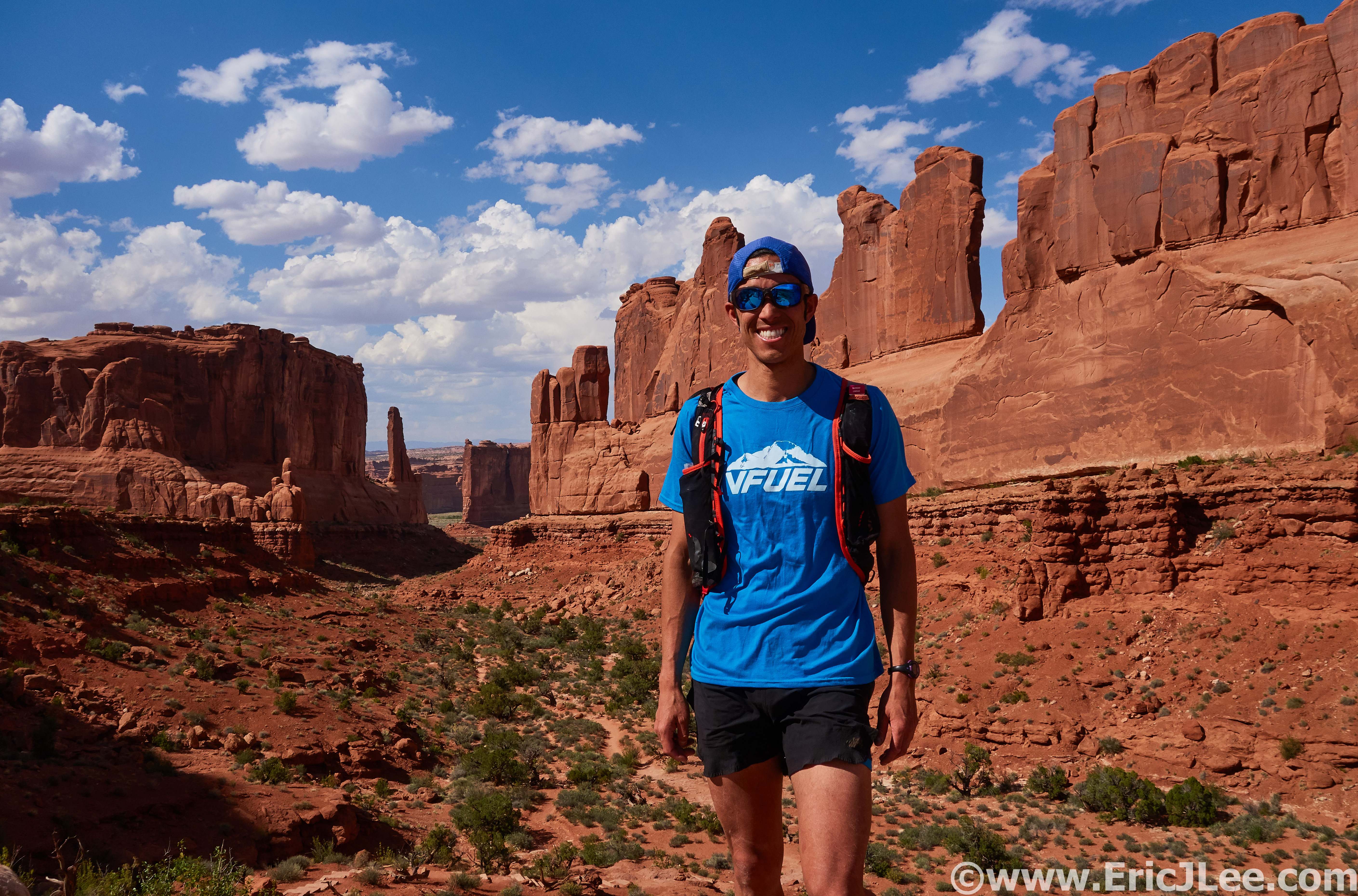
Special thanks to Jeason Murphy for keeping me company for the first two peaks and for helping with the logistics of the car shuttle. To Vfuel for keeping me powered through such crazy endeavours, Salomon for providing me with the perfect tools for adventure (Advanced Skin 12 pack), to Myriam Desrosiers and Ginna Ellis at Boulderacusport for making sure my legs are able to keep up with such madness, and all my friends and training partners for always challenging me to be stronger and faster. I’ve included a handful of photos with this report, but am also working on a little video slide show of the journey.
Gear List for Unsupported Elks FKT, 9/9/18
- Salomon Advanced Skin 12 pack
- Patagonia R.5 long sleeve
- Hind Drylete long sleeve
- Tech shirt
- Patagonia strider shorts
- Ski socks
- OR Fleece gloves
- Smartwool beanie
- OR Swift cap
- Adidas Terrex sunglasses
- Ski socks
- Inov8 X-talon 212
- OR Helium II jacket
- Luke’s Ultralite silnylon pants
- SPOT locator
- Garmin Spartan Ultra watch
- Samsung Galaxy Phone (also camera)
- Emergency Kit: space blanket, bandages, alcohol wipes, gauze, lighter, 1.5″ pocket knife, ibuprofen, chlorine dioxide tablets, garbage bag, three 1q ziplock bags, hand warmers, albuterol inhaler.
- 1.5L of water capacity
- Myo XP headlamp + extra 3 AAs
- Fenix E12 flashlight + extra AA
- 7000 calories of food (see photo)
- 1:35000 paper TOPO maps for the whole route
Short video compilation of the journey.