The neat thing about my National Park Ultramarathon project is it’s taking me to places that I normally wouldn’t think about visiting. Example, the Guadalupe Mountains of Southern New Mexico/Northwestern Texas. The Guadalupes aren’t your typical towering mountain range with distinct peaks rising above the surroundings; rather they consist of an uplifted inland reef (Capitan Reef) with deep canyons carving down through the ancient sea floor. The area is split into two parks, one being the Guadalupe Mountains National Park (in Texas) the other, and better known, being Carlsbad Caverns National Park. Over 200 million years ago the area that makes up these two parks was a vast inland sea. Then the inlet to this sea (the current mountain range) was cutoff and the sea slowly dried up, in the process covering the area in layer upon layer of mineral deposits. The continued uplift exposed these mineral and fossil layers in what is now the Capitan Reef of Guadalupe Mountains National Park, and the power of slowly percolating water carved out vast caverns underground creating the massive labyrinth that is Carlsbad Caverns.
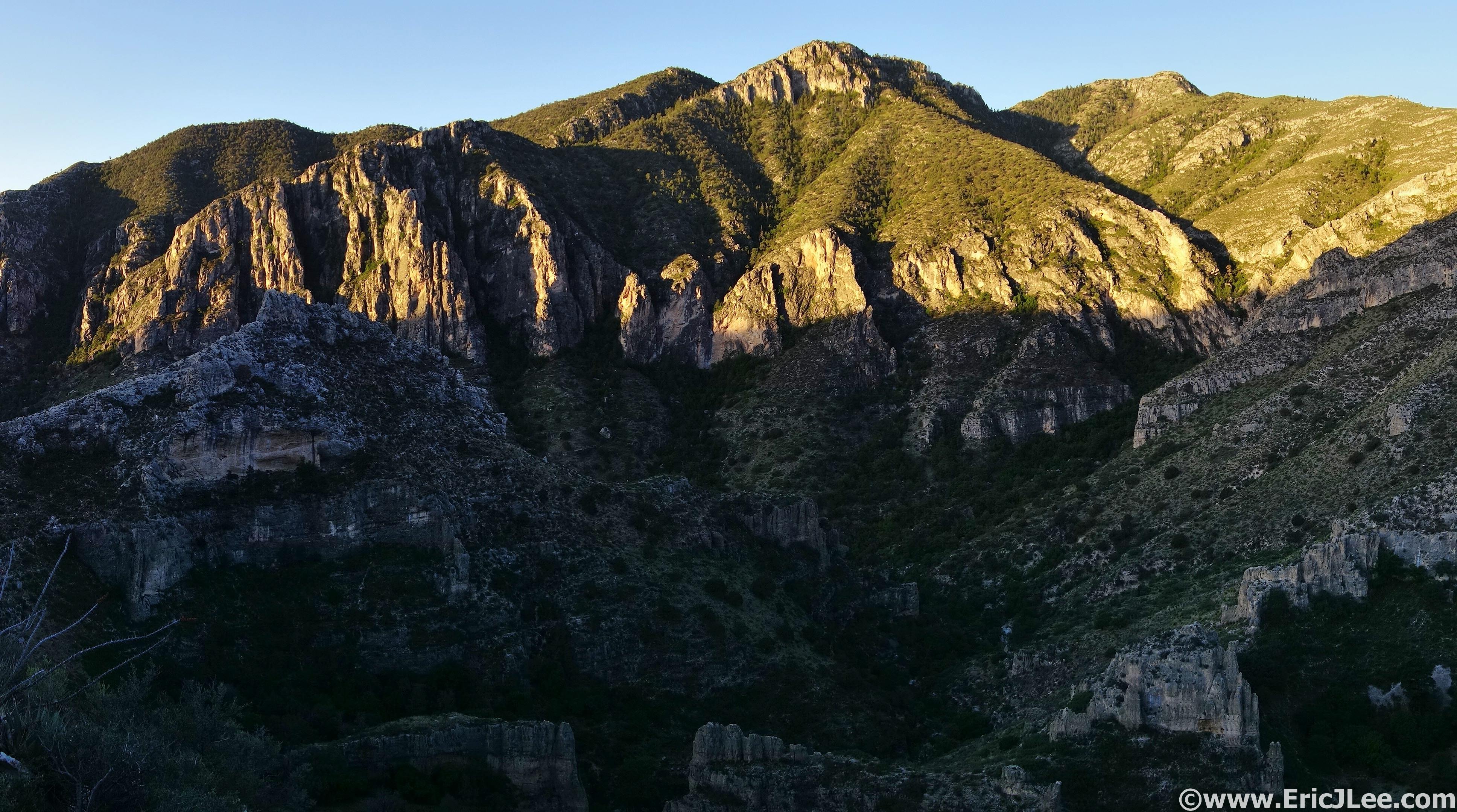
Sunrise on Guadalupe Peak from the Tejas Trail.
Descending the Bush Mt trail toward Dog Canyon. Not much of a trail.
I first set my sights on a 37mile lollipop in Guadalupe Mountains National Park (5/8). One of the local rangers told me “the magnificence of the Chihuahuan desert lies in its subtlties”, and I couldn’t agree more. As I climbed up the Tejas Trail from the Pine Springs trailhead the sun slowly began to illuminate the surrounding walls and the birds began to awake to greet the day. I ascended 2500ft of switchbacks out of the low arid desert and into the high altitude juniper and pine forest (<8000ft). The trail slowly disintegrated from a wide horse trail into an overgrown sparsely used foot path (Bush Trail) as I crested Bush Mountain (the high point of the day 8631ft, mm6.2, 1:45). The trail undulated along the high ridge through the pine and oak forest, before descending steeply down through an old burn zone to the meadows surrounding the old ranch settlement of Cox Tanks. Blooming cacti and an assortment of wildflowers dotted the desert terrain as I cruised down to the Dog Canyon TH, my only water resupply for the day (mm16, 3:50). The TH was completely empty except one couple and their RV. I doused myself at the water spigot, refilled all my water bottles (2.5L) and jogged back up the Tejas Trail toward Lost Peak.
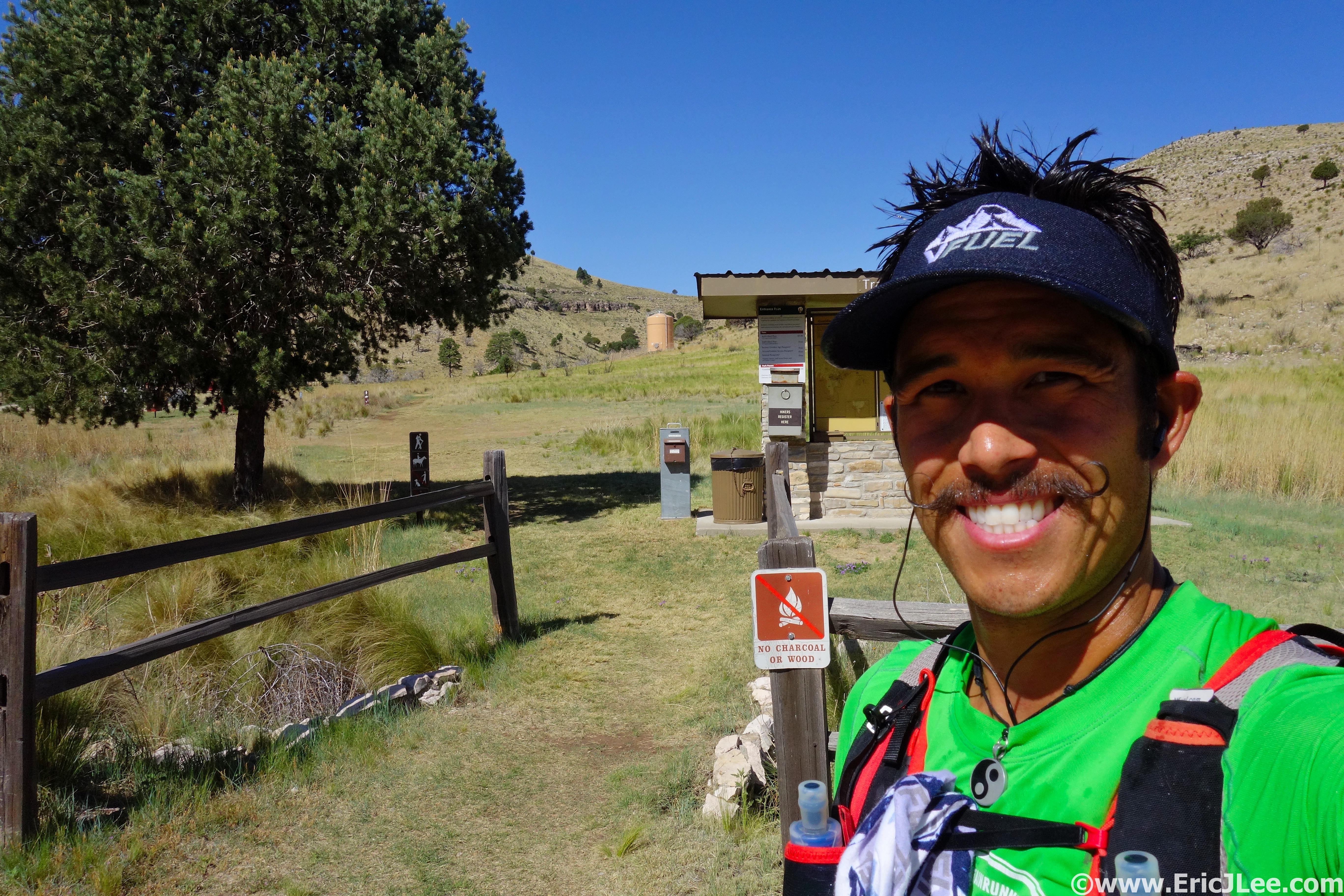
Dog Canyon TH, refreshed and ready to roll another 21miles.
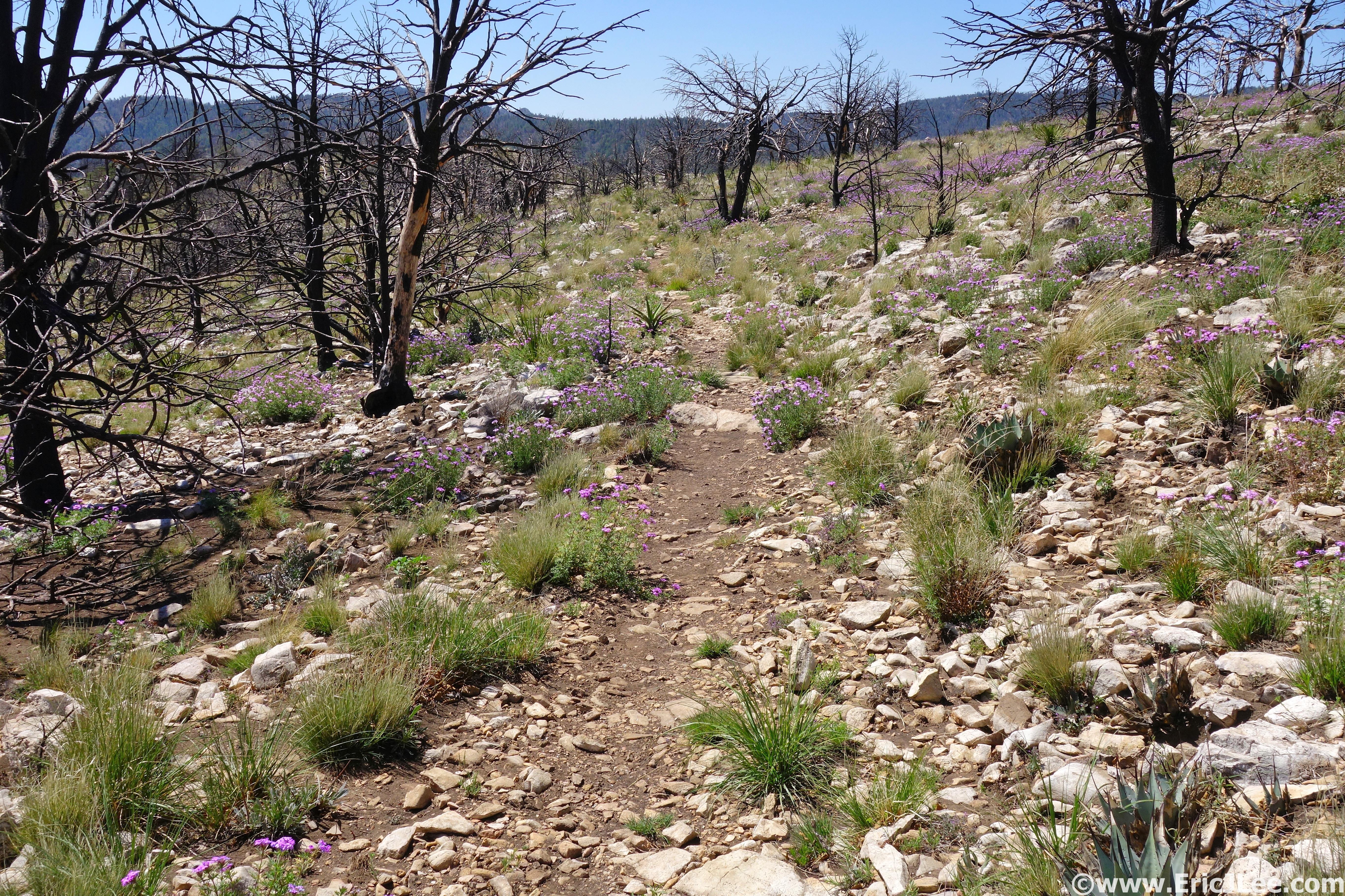
Wildflowers blooming in an old burn zone along the Tejas Trail.
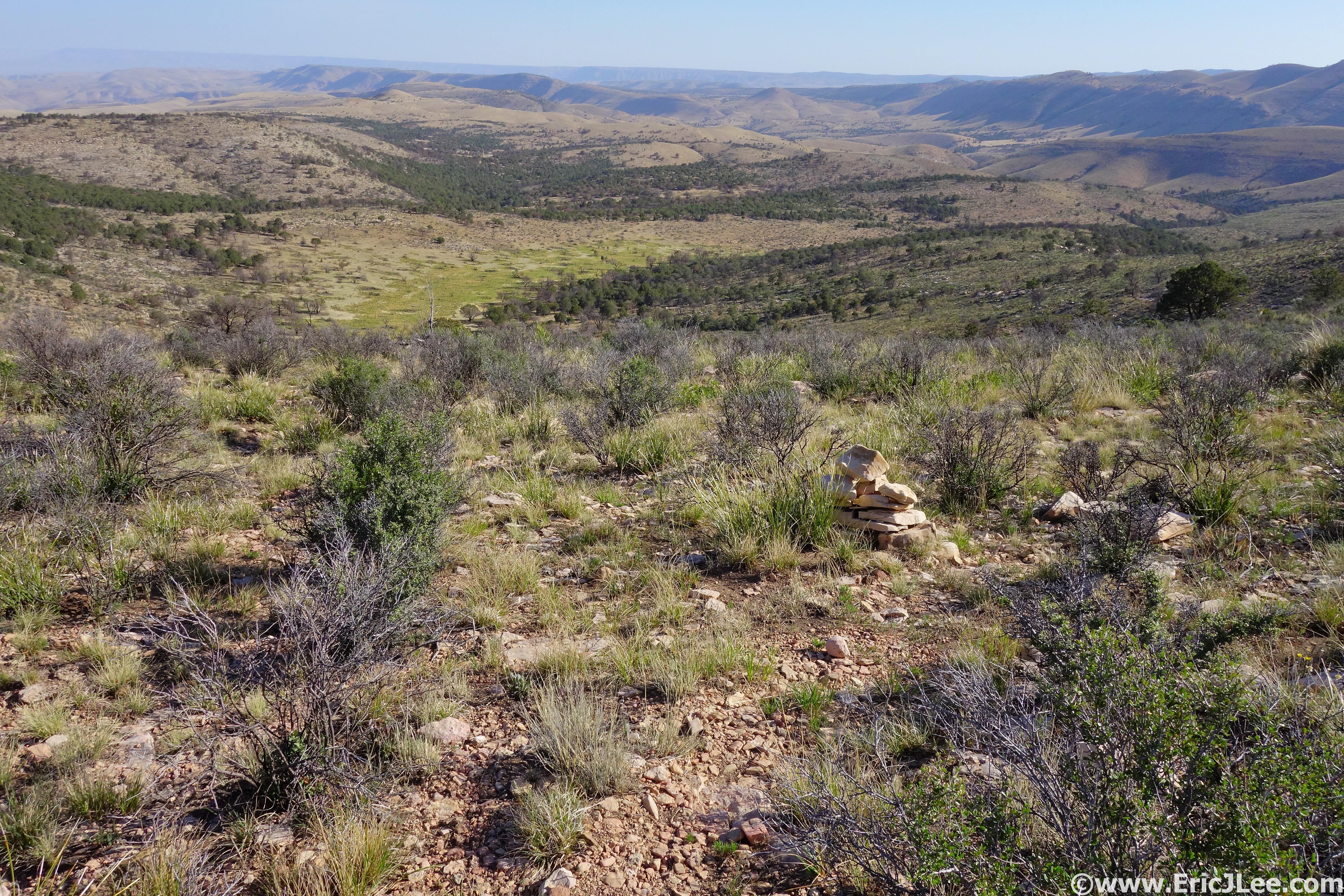
As I jogged up the canyon the midday sun had begun to bake the open grasslands. I ran into a couple of volunteers who were in the process of clearing the trail, cutting back brush and moving rocks. They mentioned I’d run into more overgrown trail about 1.5miles ahead, as the park didn’t have the resources to clear everything just yet, an unfortunate, but all too common issue within the National Park system due to budget cuts. As I neared Lost Peak the trail became a little rougher, but was far better than the Bush Mountain trail I’d run in the morning. From the summit of Lost Peak (4:50) I had a nice view of the surrounding landscape, an endlessly undulating high plateau strewn with pines, junipers, oak trees and cacti. I cruised along the high ridge dotted with Indian Paintbrush and blooming prickly pear cacti until the junction with the Blue Ridge Trail (mm21.8, 5:20) where the trail descended deep into the pine forests. I hadn’t seen anyone else since the Dog Canyon TH, and was enjoying the trail solitude as I turned up onto the Juniper trail and steeply climbed my way up to the old water tanks at the top of Bear Canyon.
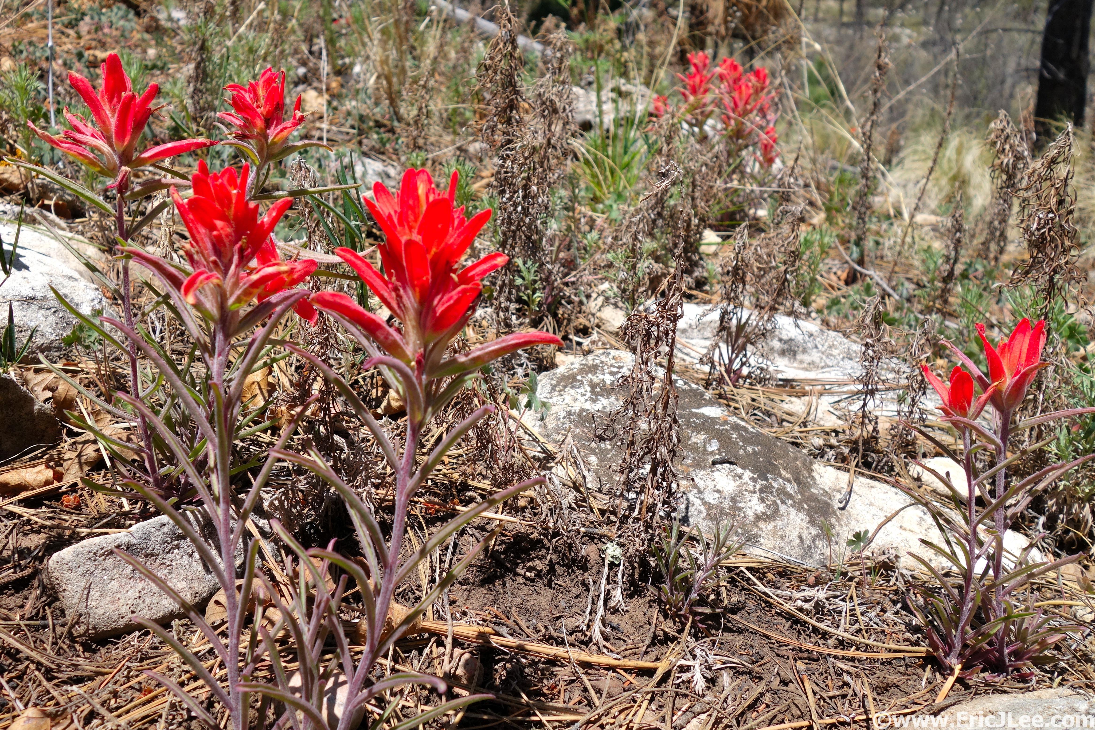
Indian Paintbrush blooming in the desert.
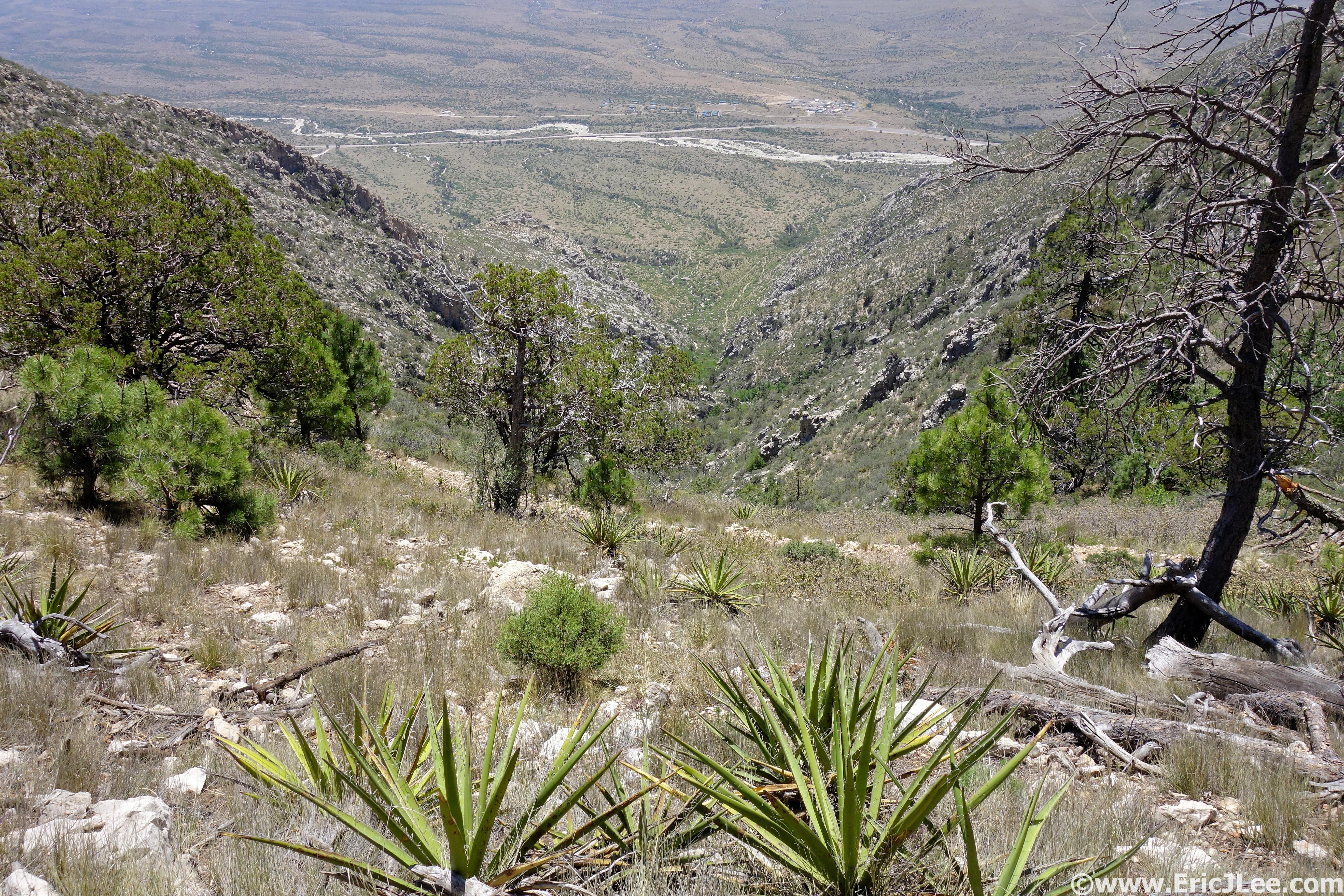
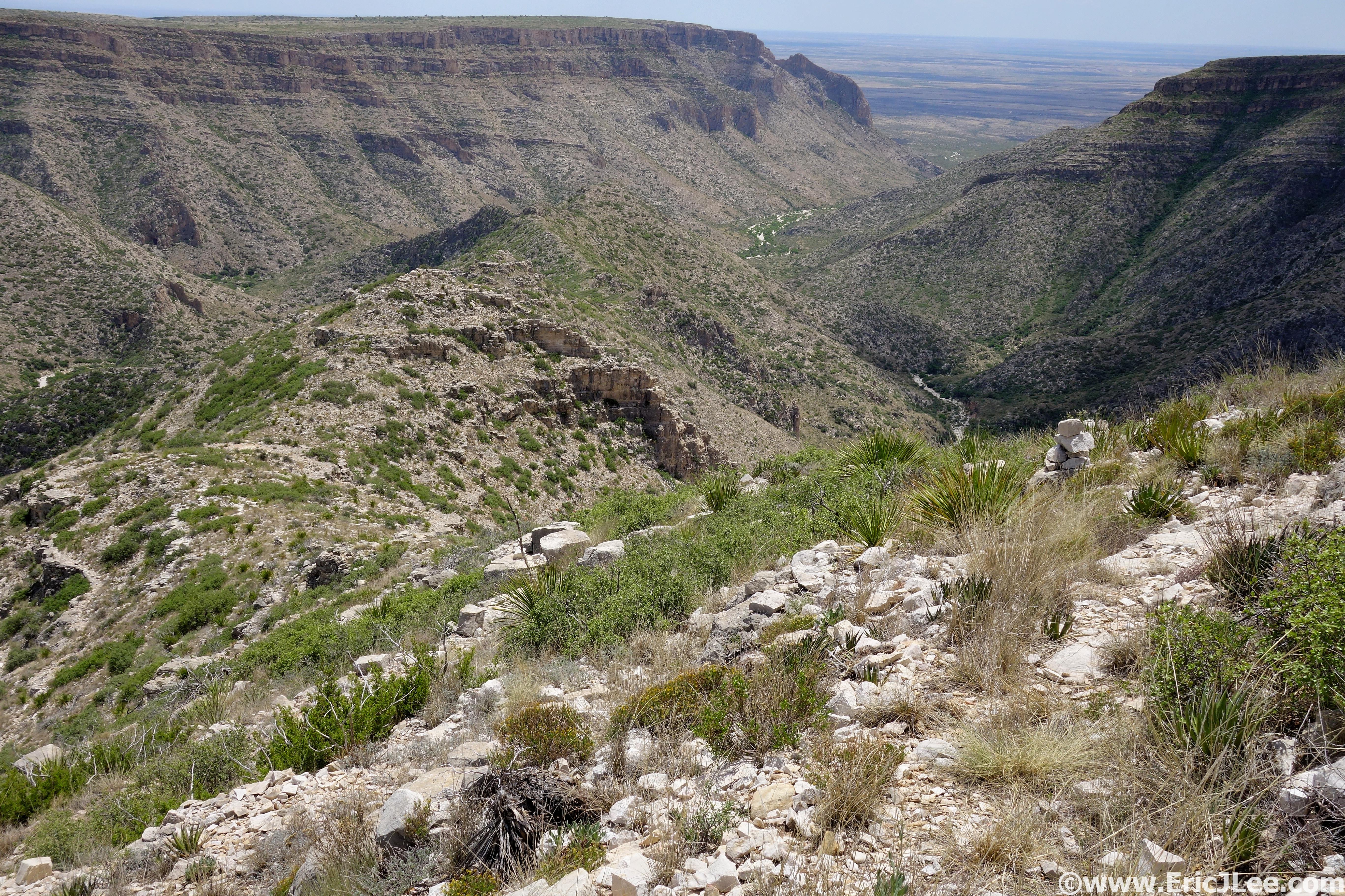
Looking down Bear Canyon at the valley over 2000ft below.

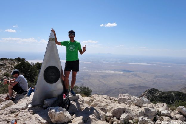
Summit of Guadalupe Peak, high point of Texas.
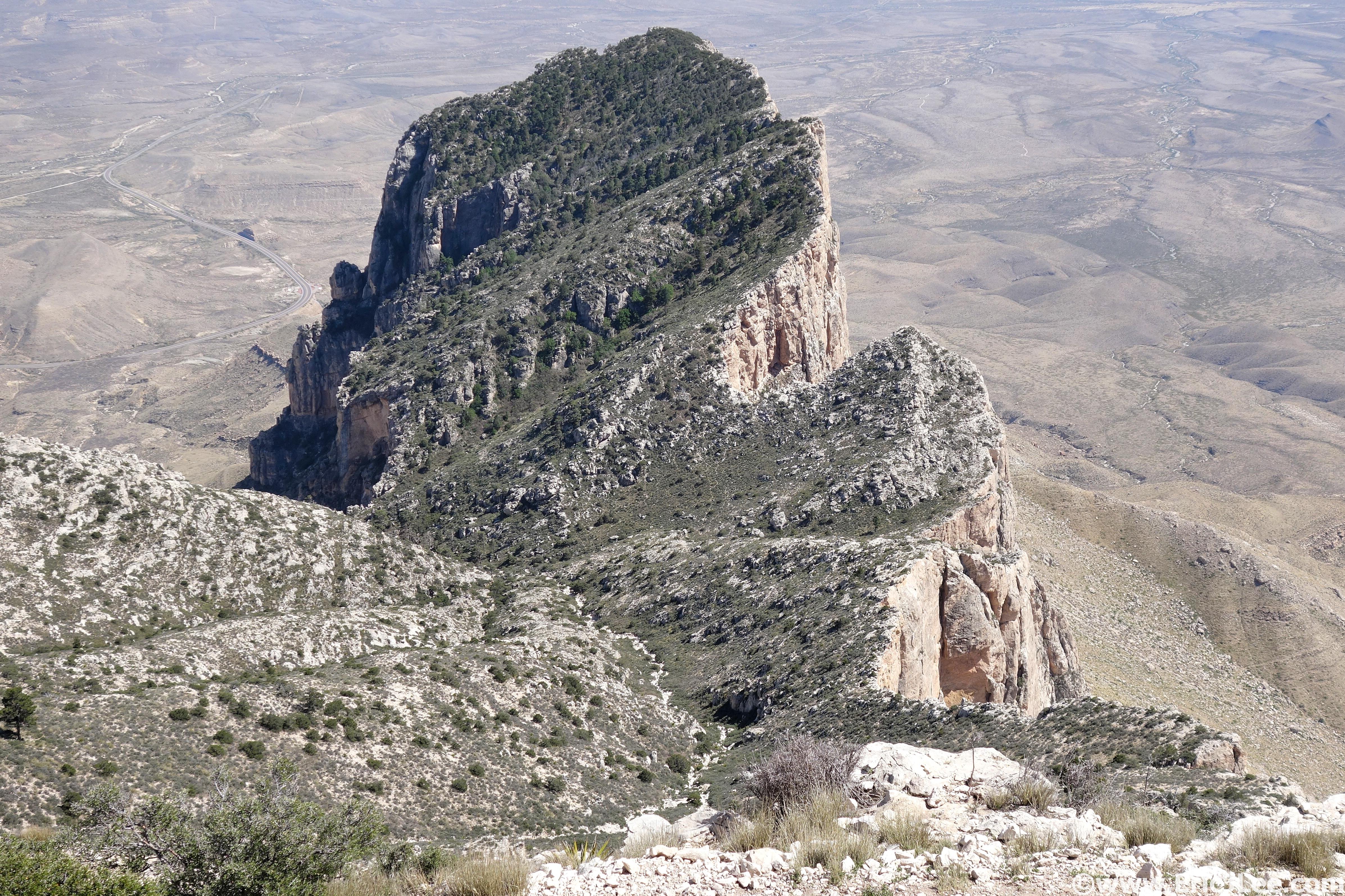
El Capitan of the Guadalupes from above.
The view abruptly opened, and I was staring down on the Frijole trail 2000ft below. The descent was rocky, but runnable the whole way, and the temperature quickly climbed from the comfortable 60s into the low 80s. I reached my car in the Pine Springs parking lot a bit cooked (mm29, 7:20), but after a quick refill I felt like I was ready to tackle the 3000ft climb up to Guadalupe Peak (the Texas high-point). The trail climbed steeply at first then mellowed a bit more as it traversed into the trees. The heat and sun were definitely getting to me, and I had to take several breaks to cool off in the little bits of shade I could find. The final push from the saddle to the summit seemed to drag on forever, but I finally stumbled my way up to the summit pinnacle and plopped down for a breather (mm33mi, 9:20). Views were expansive, the vast Chihuahuan desert to the South and East, the rolling ridgelines of the Guadalupes to the North and the vertical cliffs of El Capitan (Texas, not CA) directly below. The jog down was a bit painful as I was pretty dehydrated and cooked from the day, but I finally reached the trailhead and sprawled out on the ground, 37mi and 10h and 25min after starting.
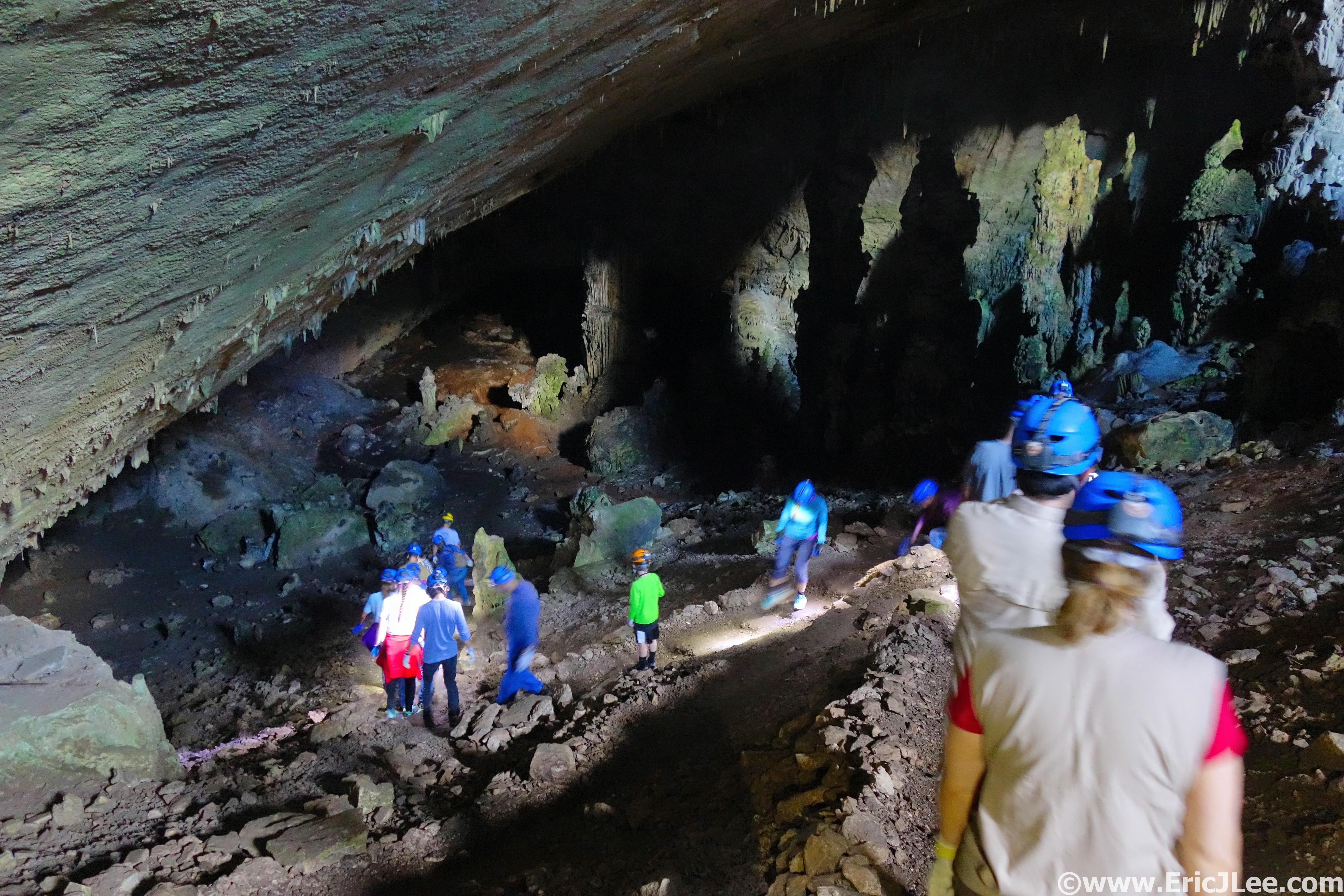
Descending into Slaughter Cave on a Ranger guided tour.
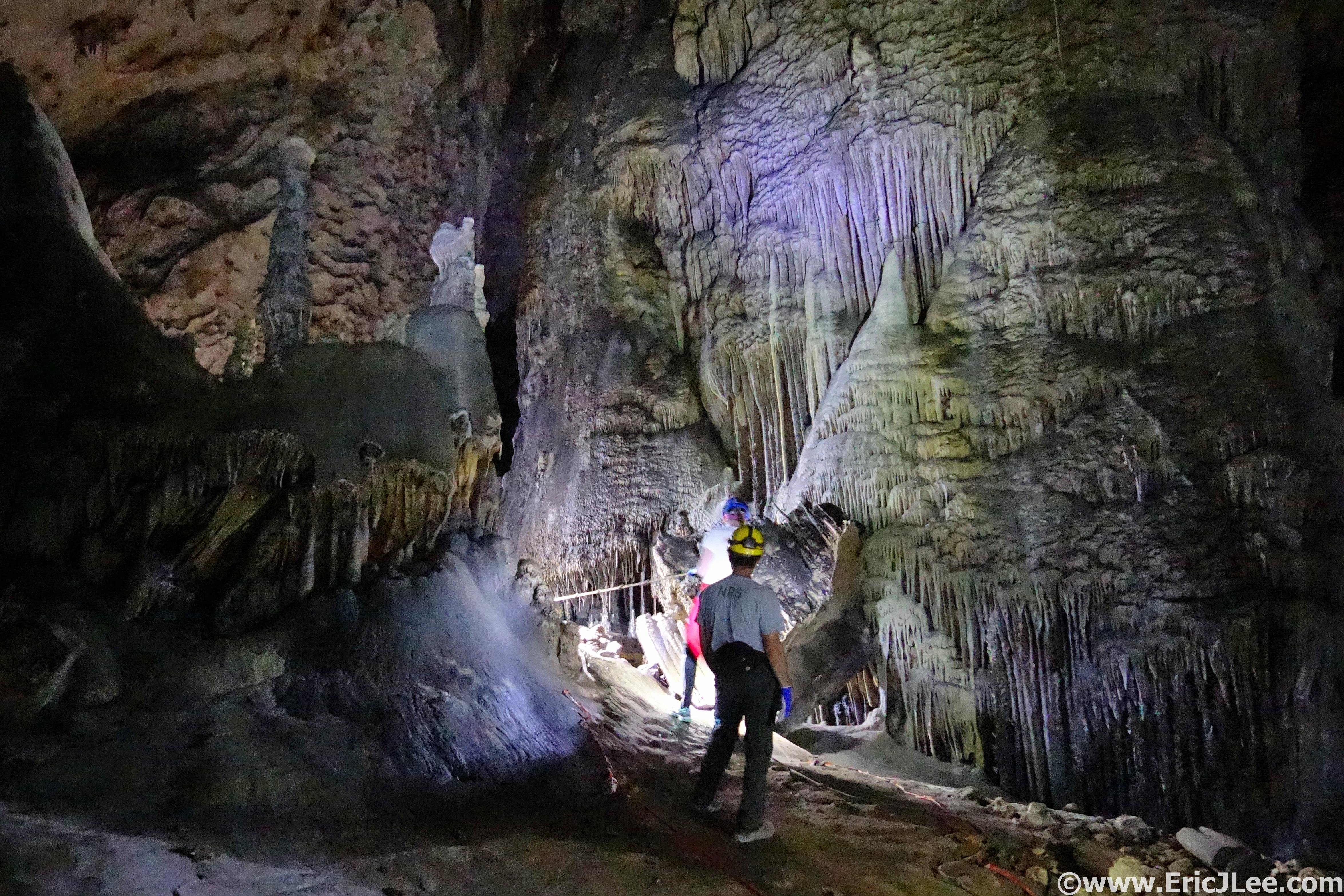
Formations in Slaughter Cave.
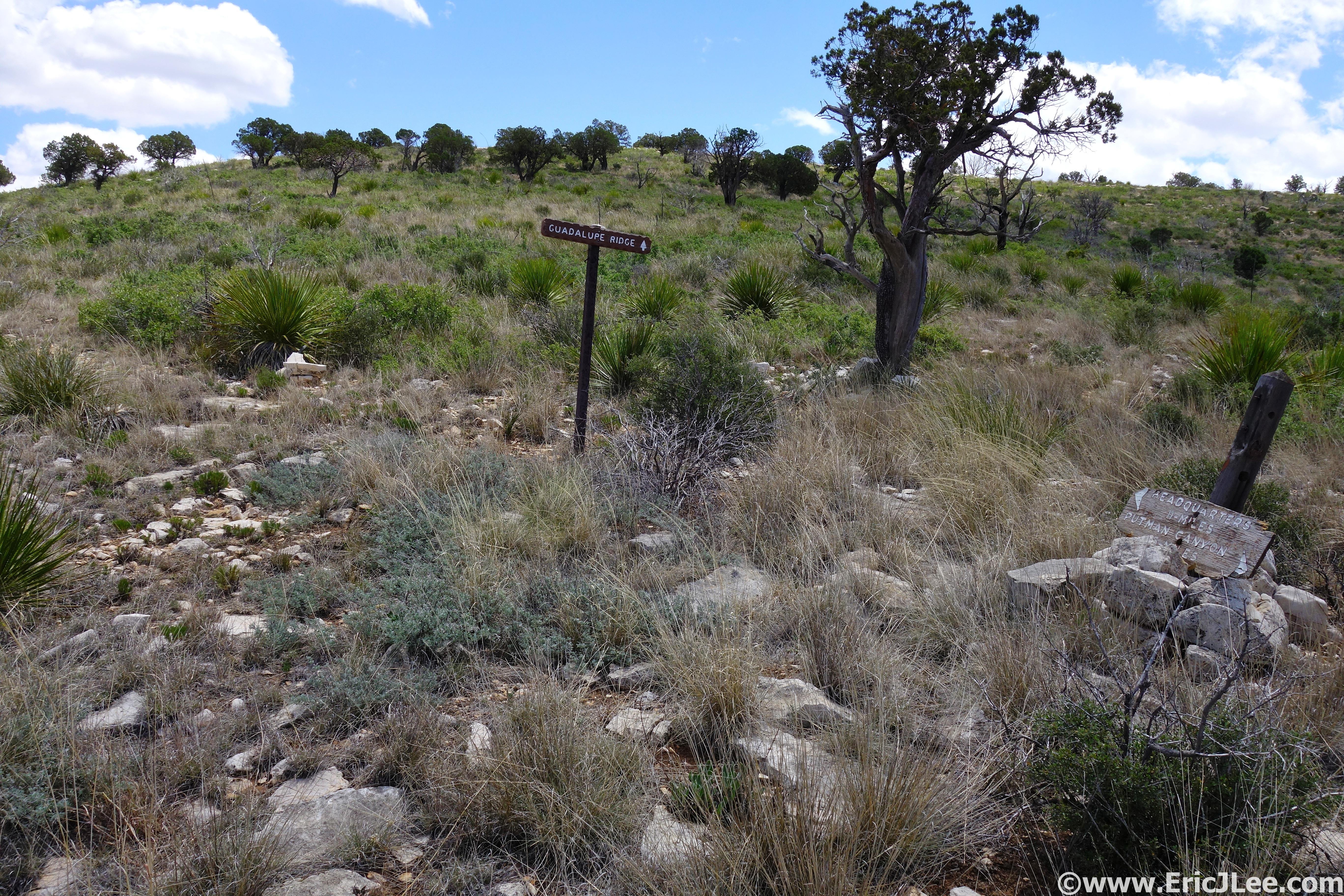
Day two (5/9) in the Guadalupes found me descending deep into Slaughter Cave in Carlsbad Cavern National Park. This 4h, $15 Ranger Guided tour of the cave was a fantastic way to learn about the history, geology and to see some of the phenomenal formations up close. Day three (5/10) I got a little more than I bargained for, my supposed 25-ish mile run of the Yucca trail-Guadalupe Ridge trail-Slaughter Canyon trail reminded me how cruel the desert can be. All are listed as ‘unmaintained trails’ but I figured how bad could they be? As I climbed up Yucca canyon the trail was well established, the ocotillo and cacti were blooming and the temperature was pleasant. But as I crested the high plateau the trail disappeared into the desert scrub, a nasty mixture of yucca, sotol, cats claw, cacti and agave, as I was relegated to navigating cairn to cairn….when I could. After thrashing my way across the high plateau I finally reached what I thought was the junction with the Guadalupe Ridge trail, wrong (mm11, 3:15). After a 1mi detour I reversed course and found the correct road, and was able to jog my way across the Guadalupe Ridge, only to miss two more unmarked turns on my way to the Putnam Cabin (mm15, closer to mm18.5 that day, 4:55). Then it was back to thrashing my way across the ridgeline until I reached a few old trail signs at the junction with the Slaughter Canyon trail, a trail which did not exist outside of a few rock cairns (mm19, mm23 that day, 5:50). I again thrashed my way down the ridge into Slaughter Canyon, legs ripped up from the sotol and cats claw, a few holes in my foot from agave spines that had pierced my shoes. By the time I reached the canyon bottom I no longer cared about dodging the skin ripping plants, and just barreled on through them, finally reaching the trailhead 7h and 17min after starting, and the ‘marathon-ish’ route turned out to be closer to 28.6miles of brutal bushwacking. My legs told the tale as small streams of blood dripped from scratches on my knees and thighs.
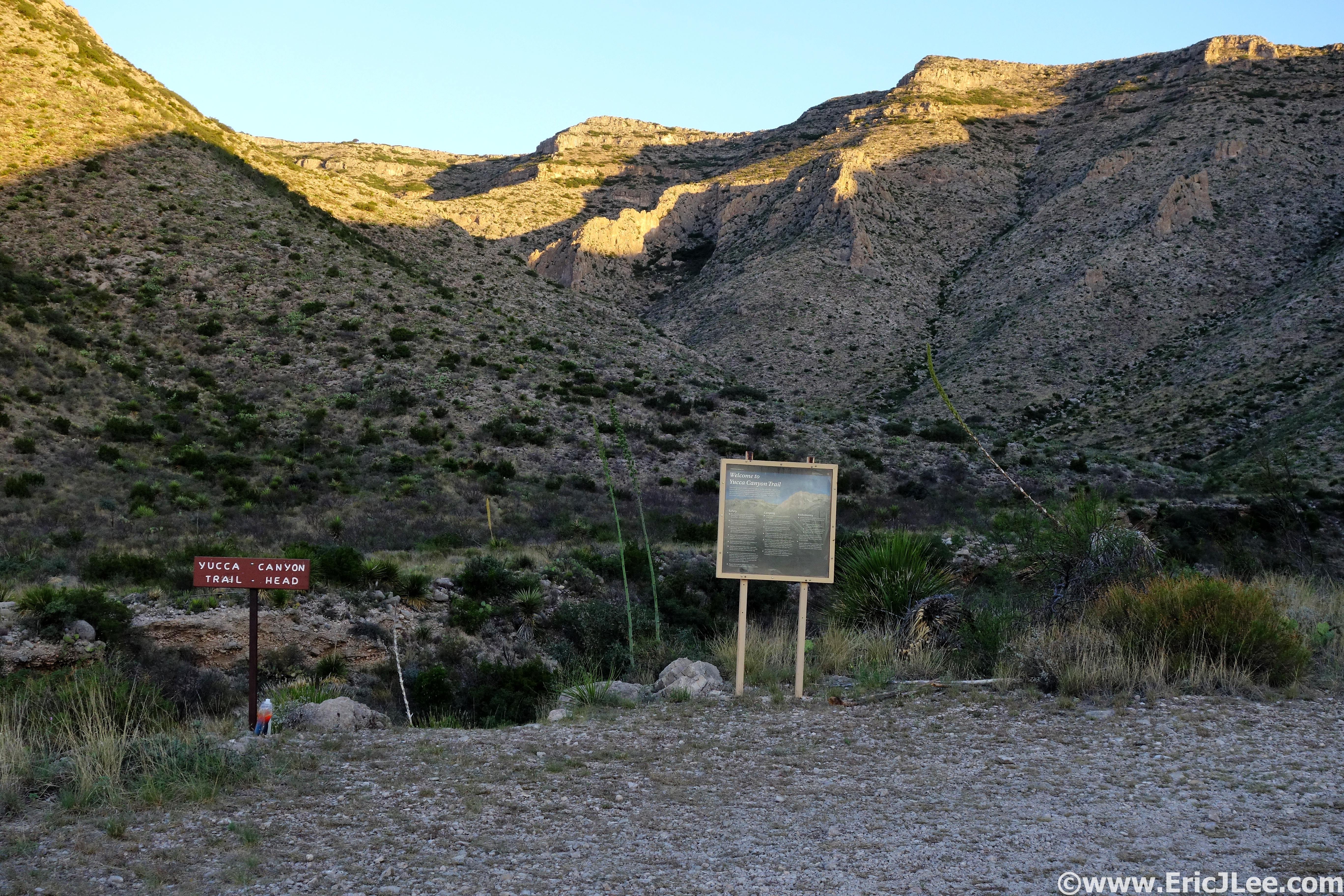
Sunrise on the Yucca Canyon trail.
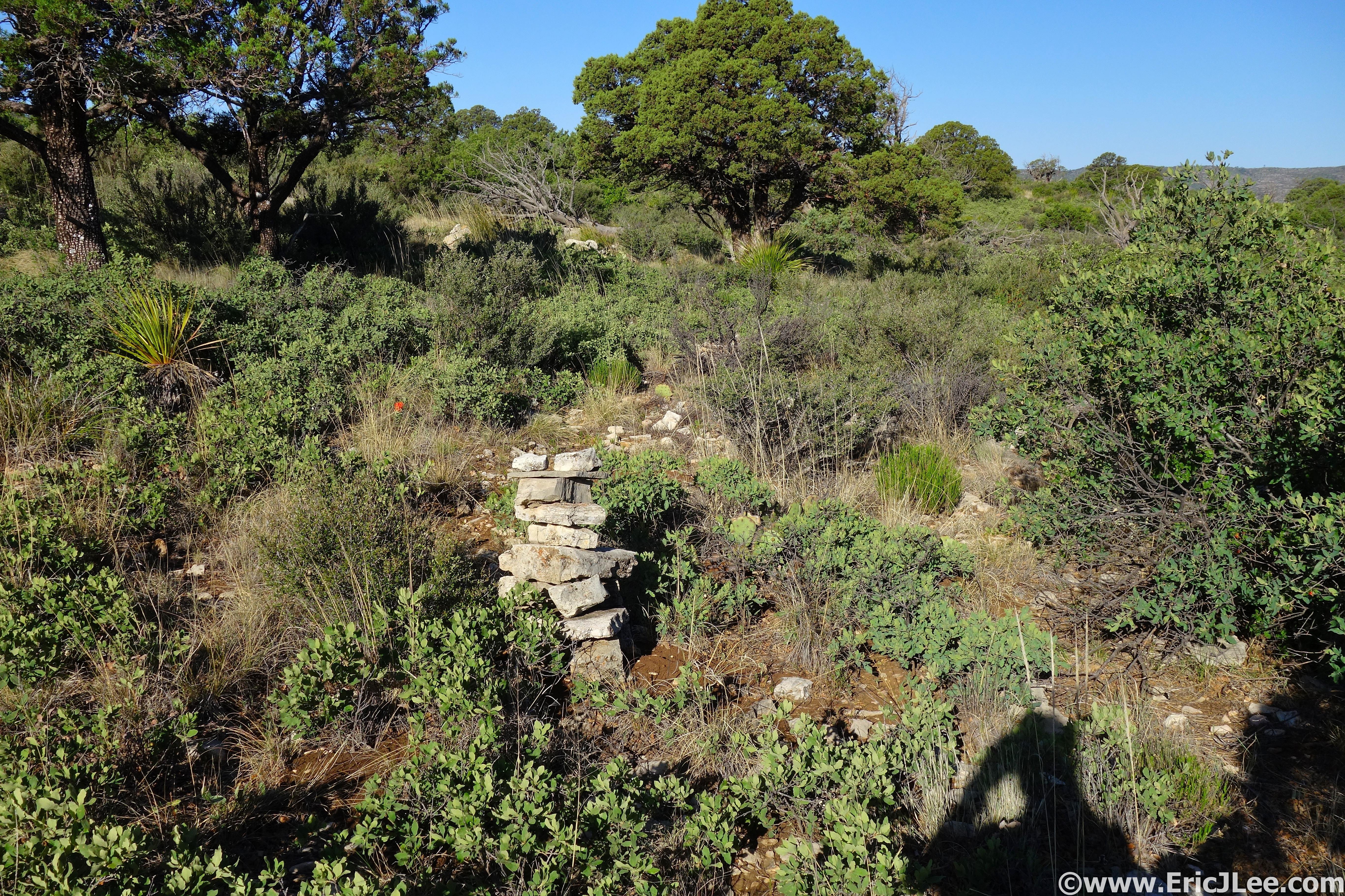
Follow the cairns, because that’s all you got.
Useless signs at the Slaughter Canyon turn.
Descending back into Slaughter Canyon.
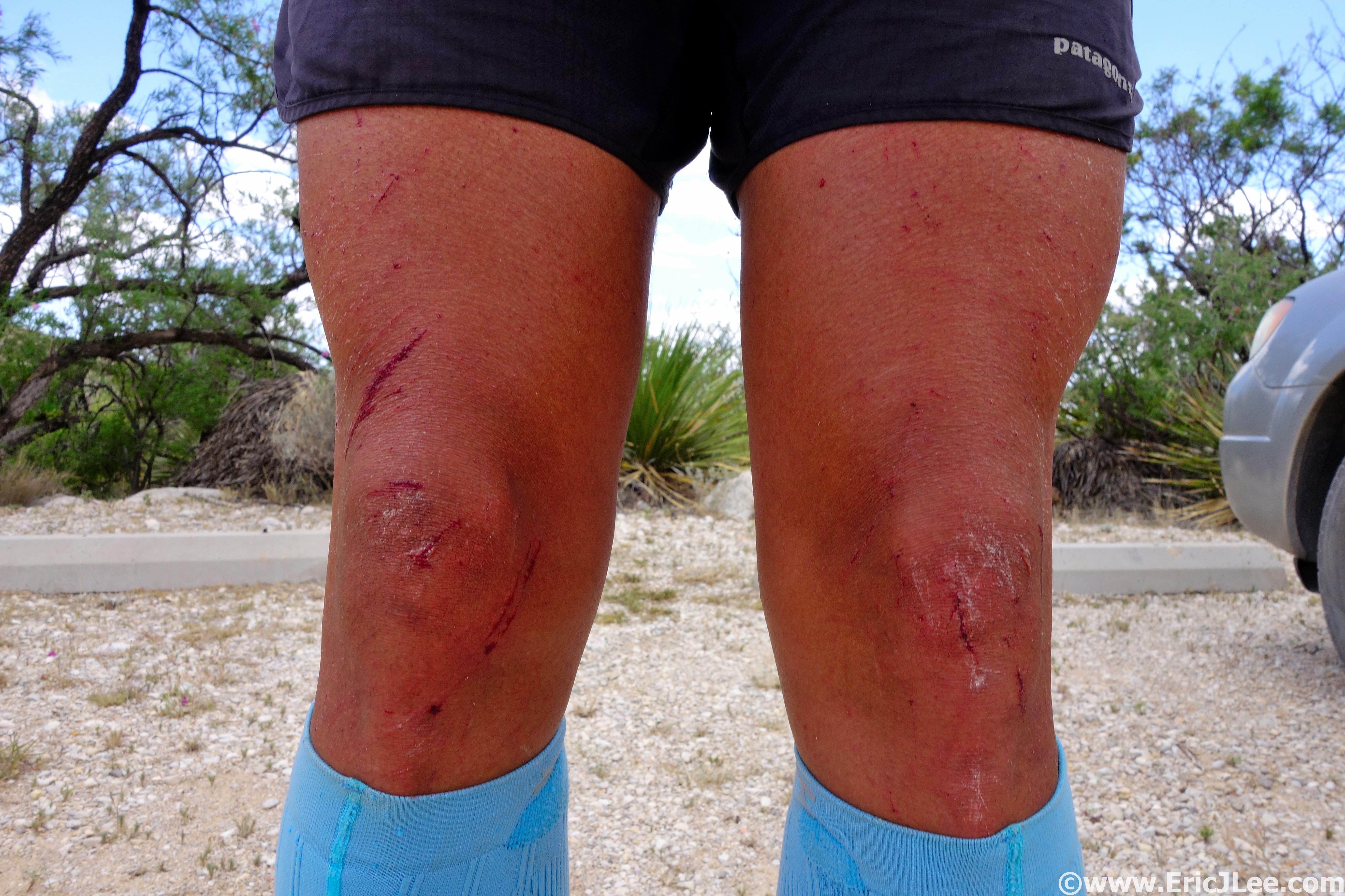
The ravages of yucca and cats claw, bloody legs.
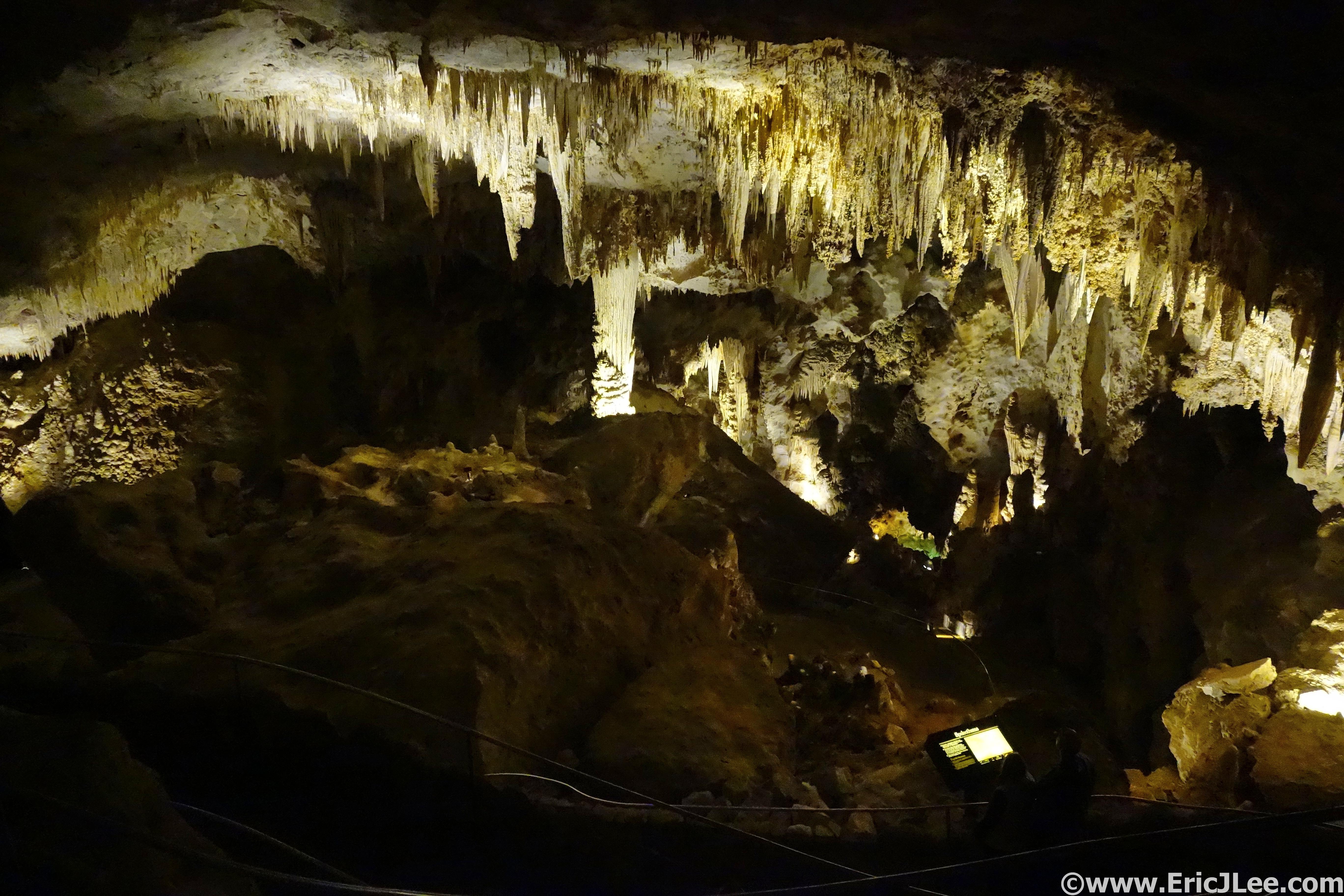
No time to waste though, as I hopped in my car and booked it over to the Carlsbad Cavern main entrance for a self guided walking tour down into the heart of the main cave system. As I descended into the darkness, the air cooled, light faded away and all the noises of the outside world were cut off. The main cave is lit by artificial lights so no headlamps are needed, but one is nice if one would like to inspect some formations in more detail. As the paved walking path entered “The Big Room” the cave opened into a massive cavern, the size of 14 football fields. Thousands of soda straws and stalactites hung from the ceilings, calcite domes up to 30ft tall rose from the floor and crystal clear pools of water flowed deep into the depths of the earth. The standard walking tour of the cave is around 2.5miles from the surface, but there are several other Ranger Guided options to explore deeper into the cave. Wandering this underground labyrinth is truly mind boggling, especially when you consider that miles of cave passages and even new cave systems are being discovered all the time (like Lechuguilla in 1986). If you visit Carlsbad I highly recommend you take a Ranger Guided tour (minimal charge) and if you visit in the summer time stay around to watch the bats fly out of the cave (up to ½ million).
Entering the main Carlsbad Cavern.
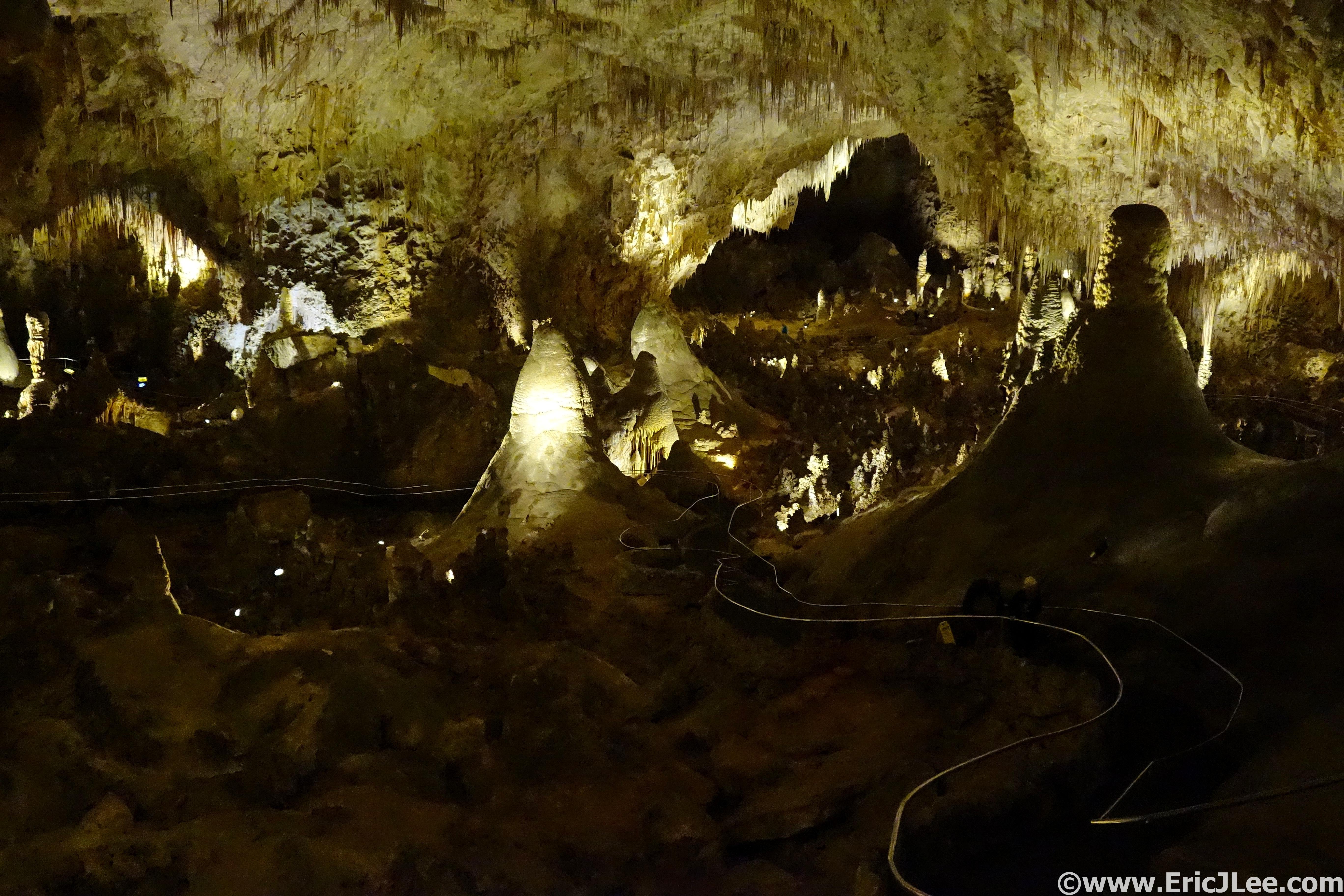
The Big Room at Carlsbad Caverns, the size of 14 football fields.
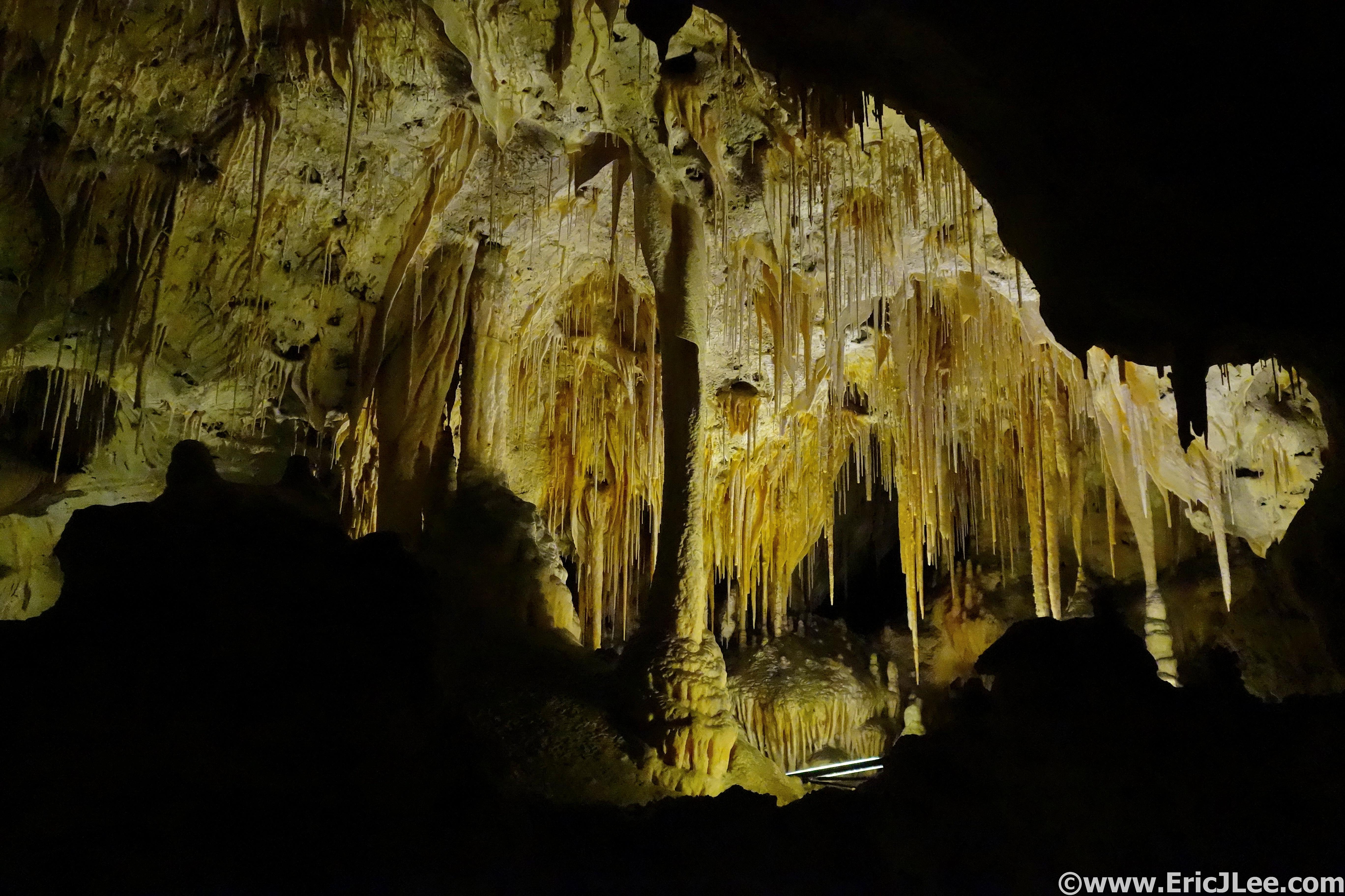
Soda Straws and other formations in Carlsbad.
While the Guadalupe Mountains may not wow you from the outset, hang around a little bit and delve into the subtleties of this seemingly arid desert that is full of life. You’ll see mule deer darting through the scrub, lizards bask in the sun and even a rattlesnake or two letting you know how pissed off he/she is (from a distance of course). Prickly pear cacti blooming in brilliant yellow, the spiny ocotillo and their vibrant red tips and dozens of small wildflowers (including paintbrush) hiding amongst the yucca and scrub. If you stop and look a little closer you’ll be amazed what you find both above ground and below. And while the trail systems of the area won’t rival those of Yosemite, Glacier NP or North Cascades, the solitude you’ll find in the desert will provide you a much different experience than the overcrowded trails elsewhere. My only suggestion, wear full leg coverings and be smarter than I. Special thanks to Vfuel for powering me through crazy adventures like these and to the National Park Service for protecting these amazing lands for all to explore.
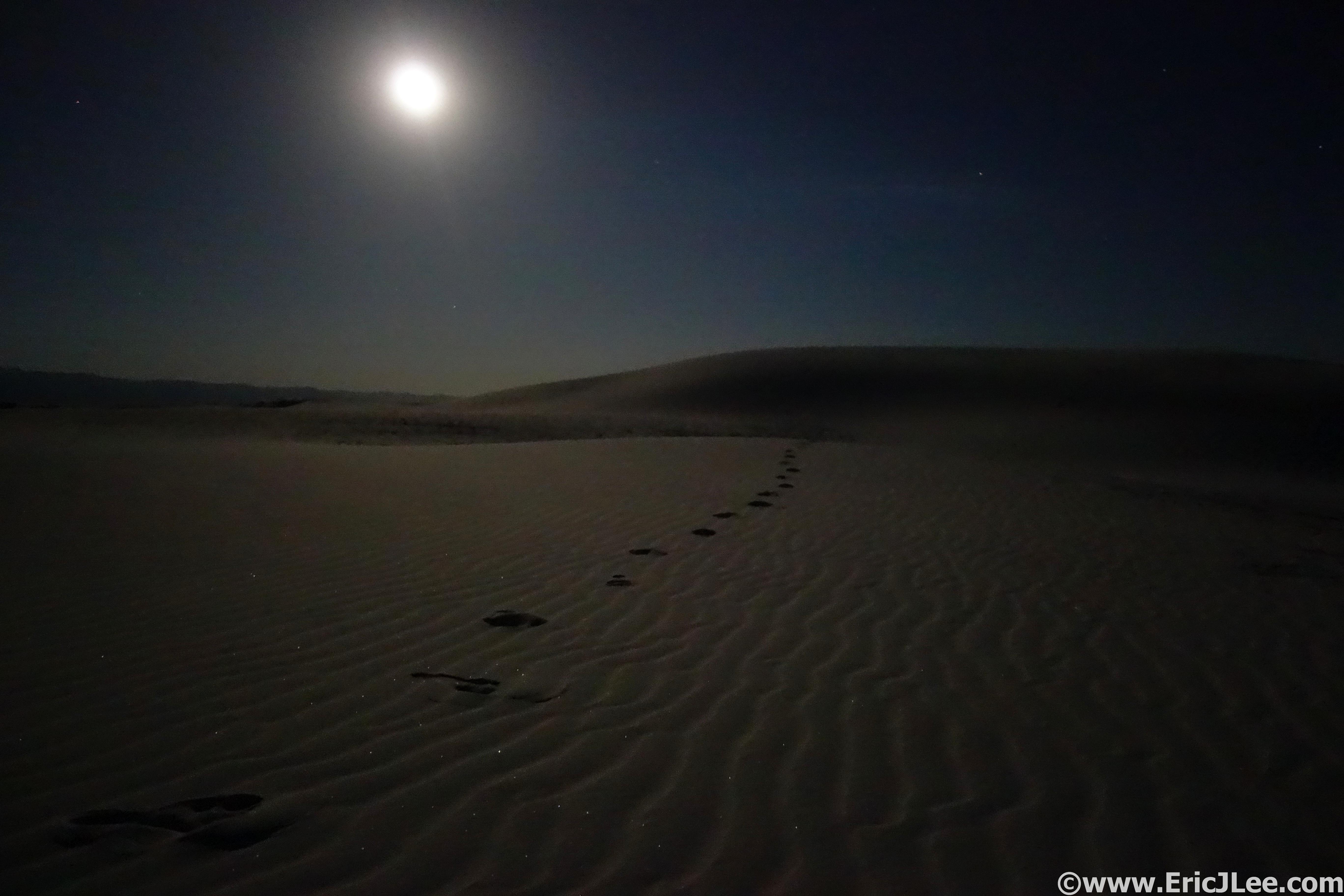
Walking by moonlight at White Sands National Monument.